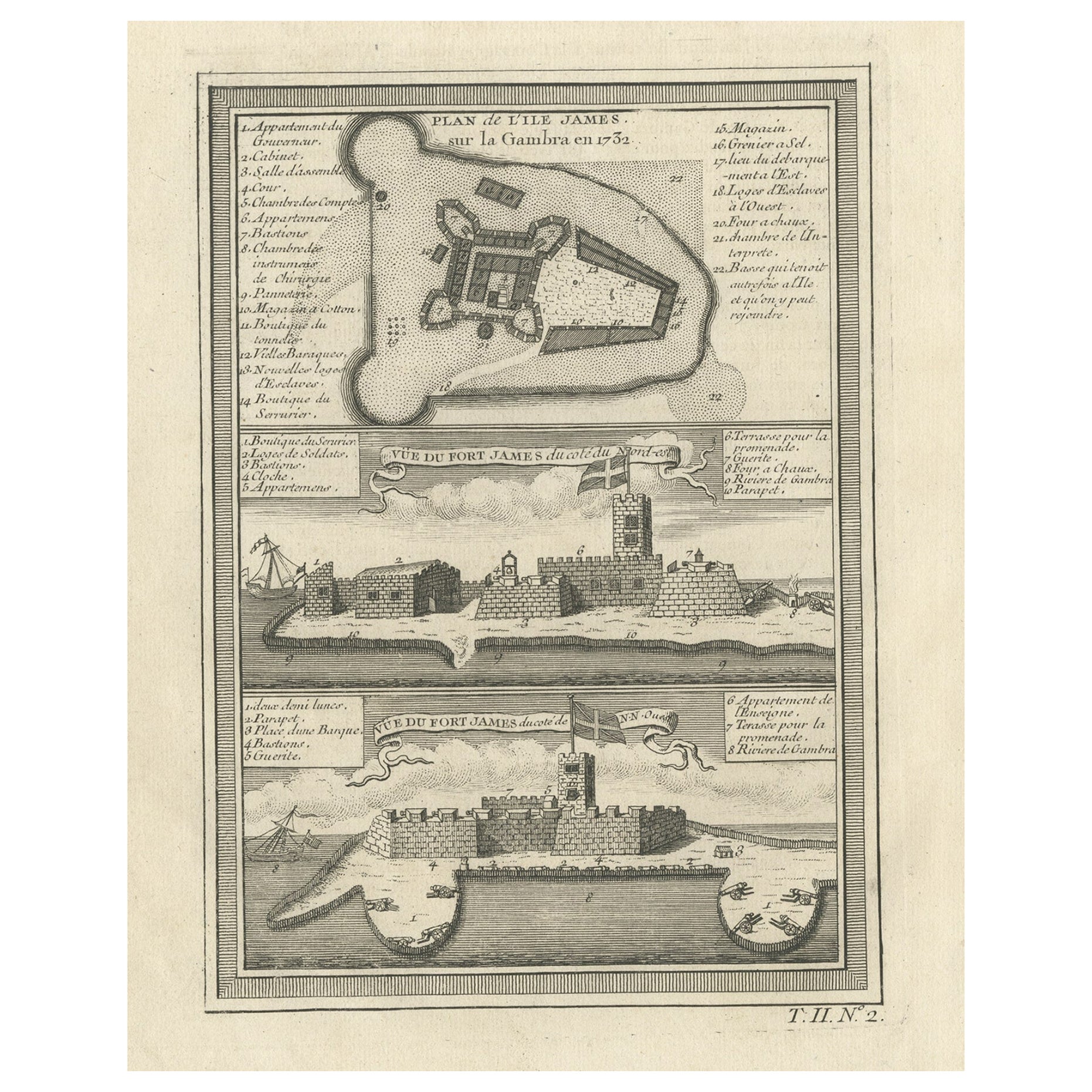
Items Similar to Three Views of Fort James, Van der Schley, c.1760

Want more images or videos?
Request additional images or videos from the seller
1 of 5
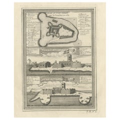
Three Views of Fort James, Van der Schley, c.1760
$76.66
$95.8220% Off
£56.81
£71.0120% Off
€64
€8020% Off
CA$104.65
CA$130.8120% Off
A$116.42
A$145.5220% Off
CHF 61.03
CHF 76.2820% Off
MX$1,422.60
MX$1,778.2520% Off
NOK 777.11
NOK 971.3920% Off
SEK 731.54
SEK 914.4320% Off
DKK 487.29
DKK 609.1120% Off
Shipping
Retrieving quote...The 1stDibs Promise:
Authenticity Guarantee,
Money-Back Guarantee,
24-Hour Cancellation
About the Item
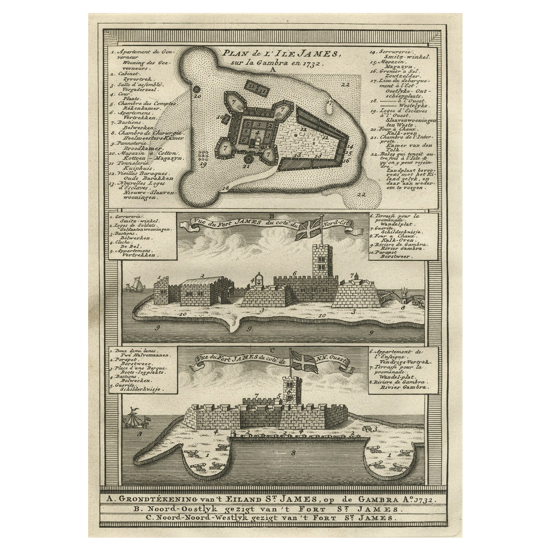
Three views of Fort James. The Dutch subtitles read: a) Grondtekening van ?t eiland St. James, op de Gambra Ao 1732. B) Noord-Oostlyk gezigt van ?t Fort St. James. C) Noord-Noord-Westlyk gezigt van ?t Fort St. James. Artists and Engravers: Made by 'Jakob van Schley' after 'Jacques Nicolas Bellin'. Jakob van der Schley (1715-1779) was a Dutch draughtsman and engraver, who studied under Bernard Picart. Jacques-Nicolas Bellin (1703-1772) was a French hydrographer, geographer and member of The Philosophes. His career, spanning over 50 years, caused an enormous output in maps, particular of maritime interest.
Artist: Made by 'Jakob van Schley' after 'Jacques Nicolas Bellin'. Jakob van der Schley (1715-1779) was a Dutch draughtsman and engraver, who studied under Bernard Picart. Jacques-Nicolas Bellin (1703-1772) was a French hydrographer, geographer and member of The Philosophes. His career, spanning over 50 years, caused an enormous output in maps, particular of maritime interest.
Condition: Good, given age. General age-related toning and/or occasional minor defects from handling. Please study scan carefully.
Date: c.1760
Overall size: 19.8 x 25.4 cm
Image size: 0.001 x 13.9 x 20 cm
Antique prints have long been appreciated for both their aesthetic and investment value. They were the product of engraved, etched or lithographed plates. These plates were handmade out of wood or metal, which required an incredible level of skill, patience and craftsmanship. Whether you have a house with Victorian furniture or more contemporary decor an old engraving can enhance your living space.
- Dimensions:Height: 10.01 in (25.4 cm)Width: 7.8 in (19.8 cm)Depth: 0 in (0.01 mm)
- Materials and Techniques:
- Period:
- Date of Manufacture:circa 1760
- Condition:
- Seller Location:Langweer, NL
- Reference Number:Seller: BL-000701stDibs: LU3054327435402
About the Seller
5.0
Recognized Seller
These prestigious sellers are industry leaders and represent the highest echelon for item quality and design.
Platinum Seller
Premium sellers with a 4.7+ rating and 24-hour response times
Established in 2009
1stDibs seller since 2017
2,494 sales on 1stDibs
Typical response time: 1 hour
- ShippingRetrieving quote...Shipping from: Langweer, Netherlands
- Return Policy
Authenticity Guarantee
In the unlikely event there’s an issue with an item’s authenticity, contact us within 1 year for a full refund. DetailsMoney-Back Guarantee
If your item is not as described, is damaged in transit, or does not arrive, contact us within 7 days for a full refund. Details24-Hour Cancellation
You have a 24-hour grace period in which to reconsider your purchase, with no questions asked.Vetted Professional Sellers
Our world-class sellers must adhere to strict standards for service and quality, maintaining the integrity of our listings.Price-Match Guarantee
If you find that a seller listed the same item for a lower price elsewhere, we’ll match it.Trusted Global Delivery
Our best-in-class carrier network provides specialized shipping options worldwide, including custom delivery.More From This Seller
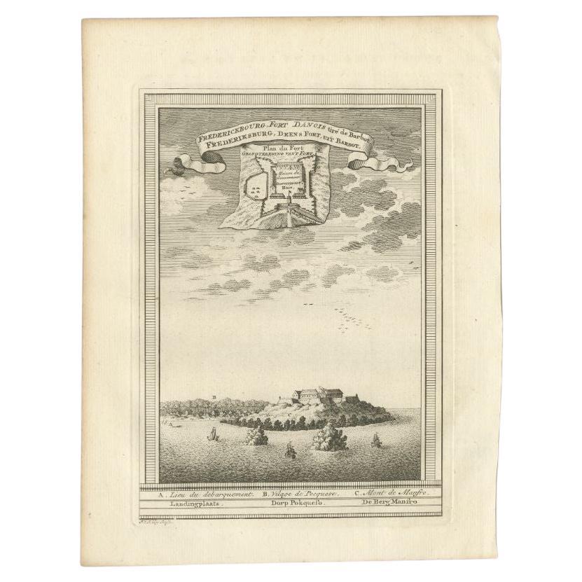
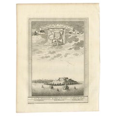
View AllAntique Print of the Danish Fort of Groot Frederiksburg at Pokesoe, circa 1750
By Jakob van der Schley
Located in Langweer, NL
Antique print titled 'Frederiksburg, Deens fort, uit Barbot'. Old print of the fort of Groot Frederiksburg at Pokesoe. Engraved by J. van Schley for a Dutch edition of 'l'Histoire Ge...
Category
Antique 18th Century Prints
Materials
Paper
$220 Sale Price
20% Off
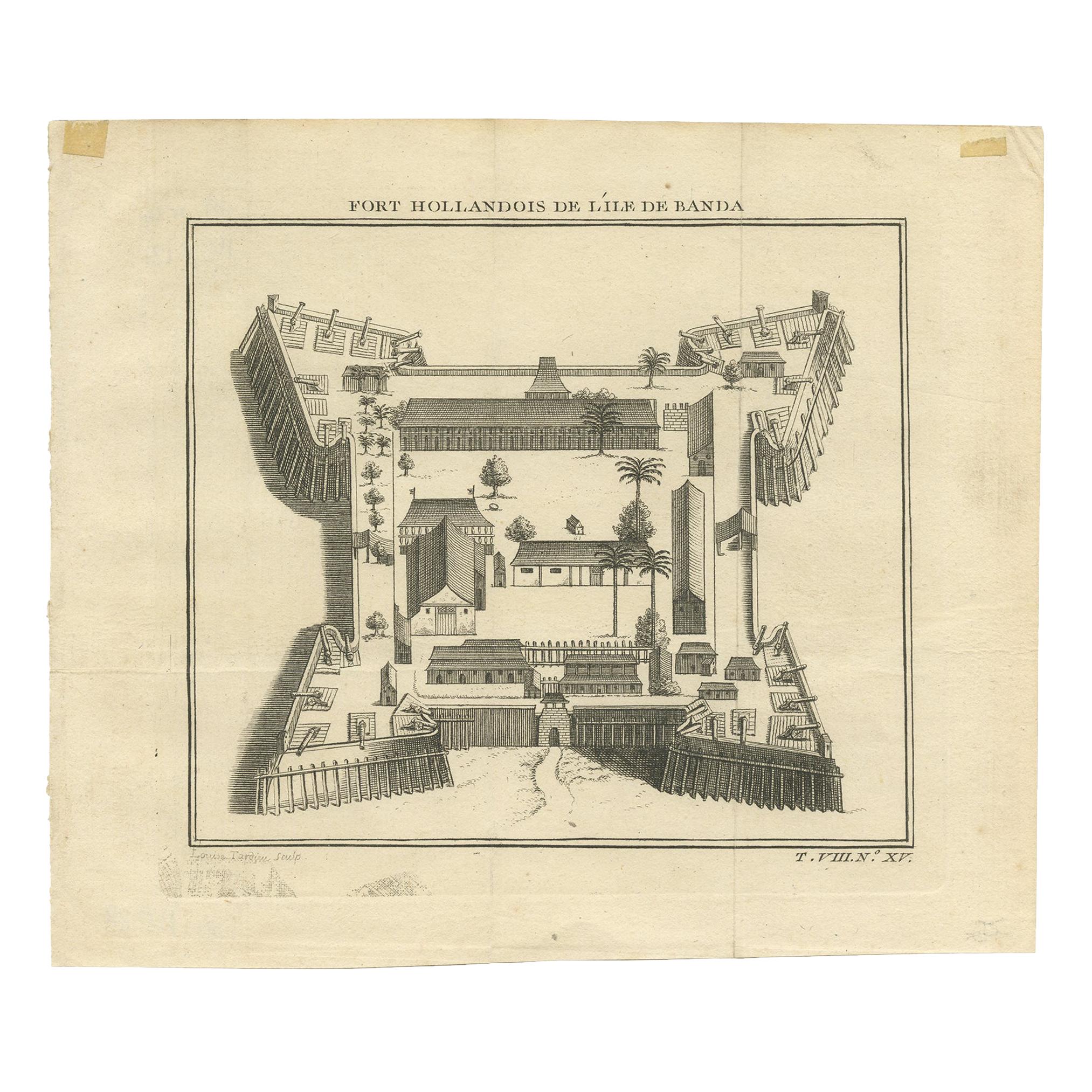
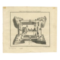
Antique Print of the Dutch Fort on Banda by Tardieu 'circa 1750'
Located in Langweer, NL
Antique print titled 'Fort Hollandois de l'Ile de Banda'. Engraving of the Dutch VOC fortress Nassau, on Banda Neira, Indonesia. This print originates from '...
Category
Antique Mid-18th Century Prints
Materials
Paper
$114 Sale Price
20% Off
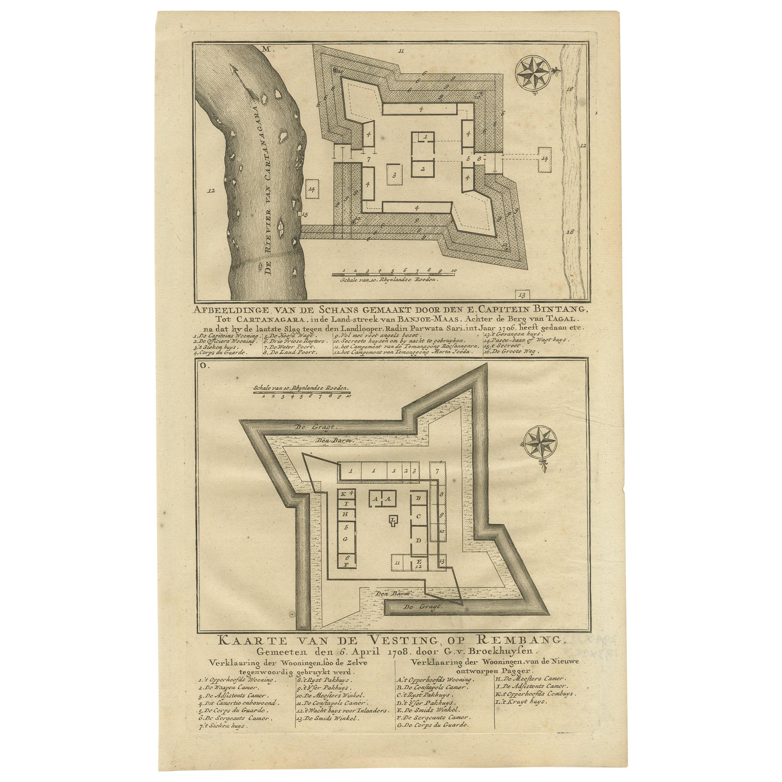
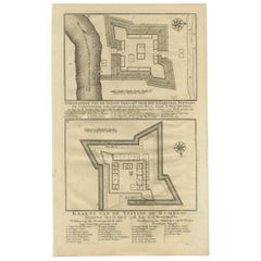
Antique Print of Fortresses in the Banyumas Region by Valentijn, 1726
By F. Valentijn
Located in Langweer, NL
Antique print titled 'Kaarte van de Schans gemaakt door den E. Capitein Bintang. Kaarte van de Vesting op Rembang. ' A plan of the fort constructed by the Captain E. Bintang, in the ...
Category
Antique Mid-18th Century Prints
Materials
Paper
$114 Sale Price
20% Off
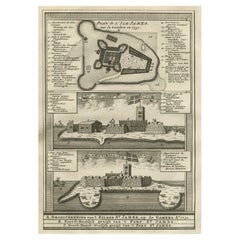
Old Print of Fort James on Kunta Kinteh Island on the Gambia River, Africa, 1746
Located in Langweer, NL
Antique print titled 'Plan de l’lle James sur la Gambra en 1732, Vue de Fort James du côte du Nord-Est, Vue de Fort James du côte de N.N. Ouest'.
Old print of Kunta Kinteh Island on the Gambia...
Category
Antique 1740s Maps
Materials
Paper
$172 Sale Price
20% Off
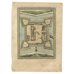
Old Copperplate Engraving of Fort St. James on the Gambra River, Africa, c.1760
Located in Langweer, NL
Plan de l’Isle James sur la Gambra en 1732 (…).
Copperplate engraving/etching on Hand laid (Verge) paper.
Sheet size: 19,7 x 26,7 cm. Image size: 13,8 x 19,8 cm.
From vol. 3 o...
Category
Antique 1760s Maps
Materials
Paper
$153 Sale Price
20% Off
Fort Hollandois De Paliacate Nommé Le Fort De Gueldre, Bellin, 1751
Located in Langweer, NL
Antique print, titled: ?Fort Hollandois de Paliacate nommé le Fort de Gueldre?. Published for Antonine de Prevost d' Exile's Histoire generale des voyages. Artists and Engravers: Jac...
Category
Antique 18th Century Prints
Materials
Paper
$114 Sale Price
20% Off
You May Also Like
17th-18th Century Siege of Graves Mapping Engraving By Willian III
Located in Kingston, NY
RARE French 17th-18th Century Enhanced Siege of Graves Mapping Engraving BY William III, also widely known as William of Orange,
The Siege of Grave in Dutch Brabant started by Monsie...
Category
Antique 17th Century French Prints
Materials
Paper

A page from A Complete Body Of Architecture by Isaac Ware, 1756
By Isaac Ware
Located in Kenilworth, IL
Page 8 from Issac Ware's book "A Complete Body Of Architecture, Adorned With Plans and Elevations, From Original Designs, By Isaac Ware, Esq. Of His Majesty's B...
Category
Antique 1750s British Prints
Materials
Paper
Set of Four 18th Century Prints
Located in Long Island City, NY
Set of four 18th century prints of English Earls.
Category
Antique 18th Century English Prints
Materials
Paper, Wood
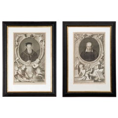
$1,800 / set
3 Antique Italian Views of Venice Drawings 1778
Located in Boca Raton, FL
3 antique 18 th c Italian ink drawings on paper of views of Venice- Dougaba and Santa Maria church, Piazza San Marco with Campanile, Venice fort. framed later. Inscribed and dated.
Category
Antique 1770s Italian Baroque Drawings
Materials
Paper
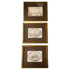
$3,500 / set
18 Century Engraving of the Royal Menagerie at Versailles by Antoine Aveline
By Antoine Aveline
Located in Vancouver, British Columbia
A rare 18 century perspective view engraving of the Salon de la Menagerie at Versailles, attributed to Antoine Aveline retailed in Paris by Nicolas Langlois and executed with the per...
Category
Antique Early 18th Century French Louis XV Drawings
Materials
Paper
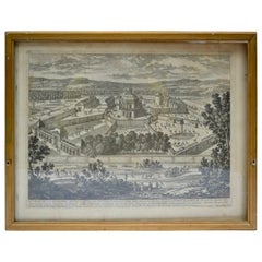
$440 Sale Price
20% Off
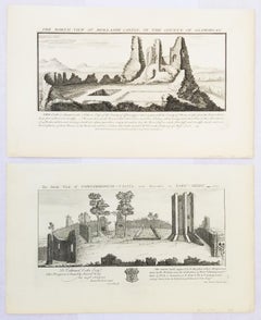
"Conisborough Castle" and "Morlashe Castle" from "Buck's Antiquities" /// UK Art
By Samuel & Nathaniel Buck
Located in Saint Augustine, FL
Artist: Samuel and Nathaniel Buck (English, 1696-1779) and (?-1759/1774)
Title: "Conisborough Castle" (Plate 323) and "Morlashe Castle" (Plat...
Category
1720s Old Masters Landscape Prints
Materials
Laid Paper, Engraving, Intaglio
More Ways To Browse
Brass Blanket Stand
Brass Skeleton Clock
Bronze Cactus
Cabana Vintage
Cadmium Glass
Cartier Catalog
Carved Ancestor Figure
Carved Music Cabinet
Ceramic Elephant Stool
Ceramic Snail
Chamois Carved Wood
Cherry Amber
Chest Of Drawers Black Chinoiserie
Chinese Bronze Lantern
Chinese Butterfly Cabinet
Chinese Fish Plate
Chinese Water Bowl
Chinese Woodblock Print