Items Similar to Venetian Fortress Paleokastro on Crete – Antique Print, Hand-Coloured, 1688


Want more images or videos?
Request additional images or videos from the seller
1 of 10
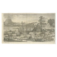
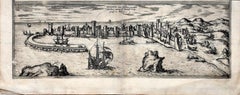
Venetian Fortress Paleokastro on Crete – Antique Print, Hand-Coloured, 1688
$378.29
£282.27
€320
CA$526.35
A$589
CHF 306.40
MX$7,096.95
NOK 3,857.46
SEK 3,644.66
DKK 2,436.40
About the Item
Antique Print of Paleokastro Castle on Crete, Dapper, 1688
This fine hand-coloured engraving depicts the fortress of Paleokastro (Palaiokastro) on the north coast of Crete. The view shows the fortress dramatically positioned on a rocky promontory overlooking the sea, with ships sailing in the foreground and rugged mountains in the background. A small river valley with soldiers, cannon fire, and smoke suggests military activity, emphasizing Crete’s strategic importance during Venetian and Ottoman conflicts.
The accompanying Dutch text provides a detailed description of Paleokastro:
“Kastel of Kasteel Paleokastro, aan de Noordzijde des eilants gelegen. Paleokastro – that is a half-broken Greek and Latin word; in Dutch it means as much as ‘old castle’. It lies on the north side of the island, by the sea, three or about four miles west of the city of Candia, on a high cape or headland, 'punta della Fraschia' as the Venetians call it, or rather on the eastern side of the same headland, and it has the island Standia to the north opposite it. Between this Paleokastro and the city of Candia there are four rivers: Armirro, Gazé, Xeropotamo, and Gioffro, all of which flow northward into the sea. Some miles southwest of Paleokastro lies a high mountain inland, called 'Santo Paulo', the mountain of Saint Paul, with a house or hermitage on the top. Paleokastro is divided into three parts or districts: 'Piazza Alto' (upper square), 'Piazza di Mezzo' (middle square), and 'Piazza da Basso' (lower square).”
The print was published in Olfert Dapper’s 'Naukeurige Beschrijving der Eilanden in de Archipel der Middelantsche Zee' (Accurate Description of the Islands in the Archipelago of the Mediterranean Sea), Amsterdam, 1688. Dapper (c.1635–1689), although he never travelled outside the Netherlands, compiled richly illustrated works on Africa, Asia, and the Mediterranean that remain important historical sources.
This engraving offers not only a striking image of Crete’s Venetian-era fortifications but also a rare 17th-century description of the site. For collectors of antique maps and views, or those with an interest in Venetian-Ottoman history, it represents both artistic and documentary value.
Condition: Good. Strong hand colouring, some age toning, light browning to margins, and faint spotting consistent with age. Plate mark visible. Reverse with uncoloured engraving of Belveder Castle.
Framing tips: A walnut or dark wood frame with a cream mat will highlight the hand-colouring. For a more dramatic display, a gilt frame with a wide mount would suit its 17th-century style.
Technique: Hand-coloured copper engraving
Maker: Olfert Dapper, Amsterdam, 1688
- Dimensions:Height: 11.66 in (29.6 cm)Width: 8.04 in (20.4 cm)Depth: 0.01 in (0.2 mm)
- Materials and Techniques:Paper,Engraved
- Place of Origin:
- Period:Late 17th Century
- Date of Manufacture:1688
- Condition:Condition: Good. Strong hand colouring, some age toning, light browning to margins, and faint spotting consistent with age. Plate mark visible. Reverse with uncoloured engraving of Belveder Castle.
- Seller Location:Langweer, NL
- Reference Number:Seller: PCT-627961stDibs: LU3054346308592
About the Seller
5.0
Recognized Seller
These prestigious sellers are industry leaders and represent the highest echelon for item quality and design.
Platinum Seller
Premium sellers with a 4.7+ rating and 24-hour response times
Established in 2009
1stDibs seller since 2017
2,587 sales on 1stDibs
Typical response time: <1 hour
- ShippingRetrieving quote...Shipping from: Langweer, Netherlands
- Return Policy
Authenticity Guarantee
In the unlikely event there’s an issue with an item’s authenticity, contact us within 1 year for a full refund. DetailsMoney-Back Guarantee
If your item is not as described, is damaged in transit, or does not arrive, contact us within 7 days for a full refund. Details24-Hour Cancellation
You have a 24-hour grace period in which to reconsider your purchase, with no questions asked.Vetted Professional Sellers
Our world-class sellers must adhere to strict standards for service and quality, maintaining the integrity of our listings.Price-Match Guarantee
If you find that a seller listed the same item for a lower price elsewhere, we’ll match it.Trusted Global Delivery
Our best-in-class carrier network provides specialized shipping options worldwide, including custom delivery.More From This Seller
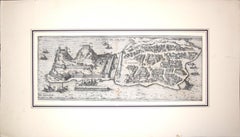
View AllAntique Print of a Greece Island, Most Likely Gavdopoula South of Crete, 1688
Located in Langweer, NL
Description: Untitled print of one of the islands of Greece, most likely Gavdopoula (located south of Crete).
Gavdopoula is an islet located north-west of its larger neighbour, G...
Category
Antique 1680s Maps
Materials
Paper
$334 Sale Price
20% Off
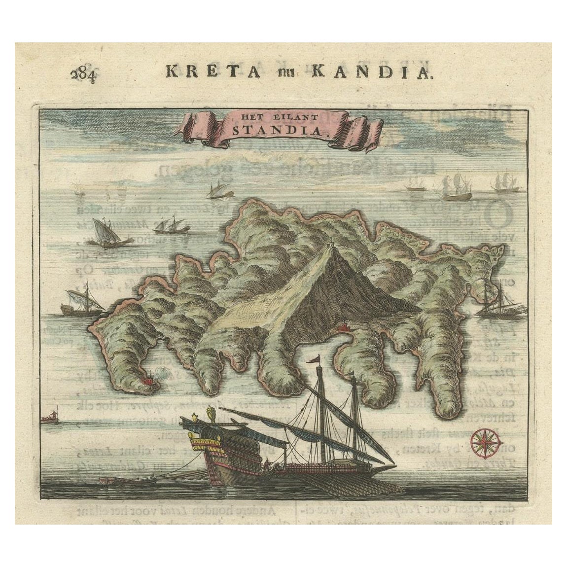
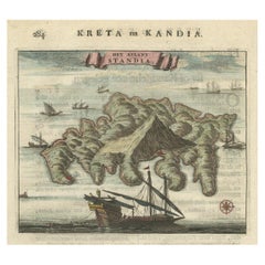
Old Print of Standia, a Greek Island 'Heraklion, Crete, Greece, Balkans', 1688
Located in Langweer, NL
Antique print Greece titled 'Het Eilant Standia'. Old print of the island Standia, near Crete, Greece. This print originates from 'Nauwkeurige Bes...
Category
Antique 17th Century Prints
Materials
Paper
$277 Sale Price
20% Off
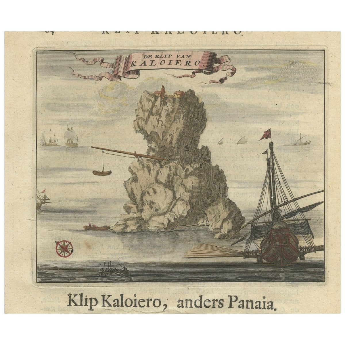
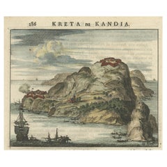
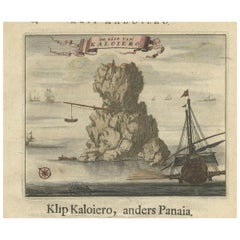
Encoloured Engraving of Cliff Kaloiero or Caloiero Island, Panaia, Greece, 1688
Located in Langweer, NL
Antique print Greece titled 'De Klip van Kaloiero'. Old print of the Island Kaloiero or Panaia, Greece. This print originates from 'Nauwkeurige Be...
Category
Antique 17th Century Prints
Materials
Paper
$277 Sale Price
20% Off
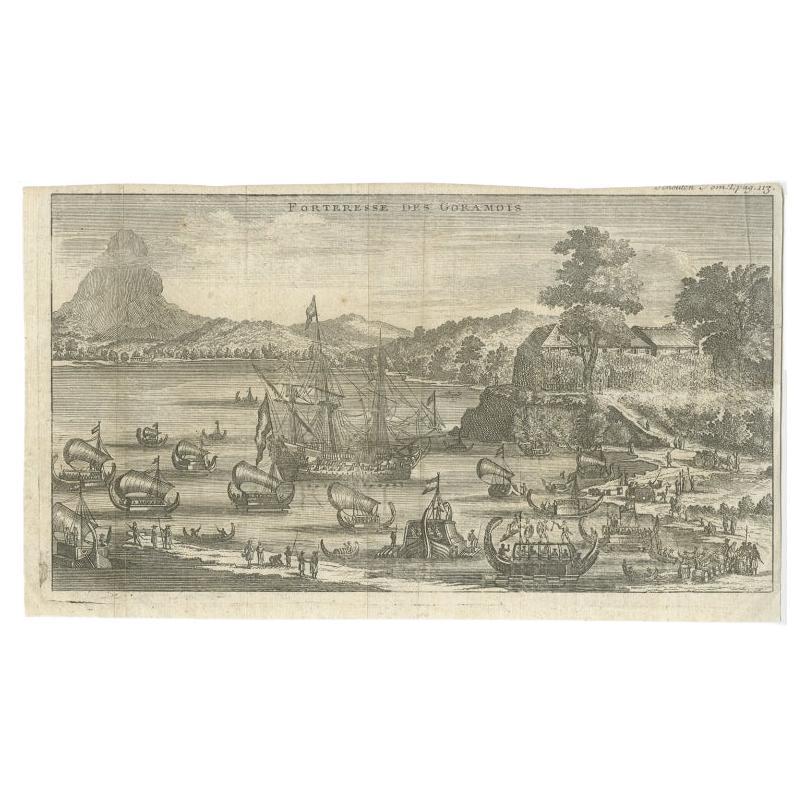
Antique Print of the Fortress of Goram by Schouten, 1725
Located in Langweer, NL
Antique print titled 'Forteresse des Goramois'. View of the fortress of Goram. Originates from 'Voyage de Gautier Schouten aux Indes Orientales (..)'.
...
Category
Antique 18th Century Prints
Materials
Paper
$124 Sale Price
20% Off
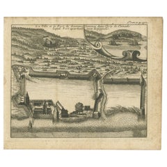
Antique Print of the Town and Fortress of Ternate by Renneville, 1725
Located in Langweer, NL
Antique print Ternate titled 'La Ville et la Fort de Gamma lamma dans l'isle de Ternade lequel Fort apartient aux Espagnols'. Antique print of the town and fortress of the island of Ternate. Originates from 'Recueil des voyages qui ont servi à l’établissement et aux progrès de la compagnie des Indes orientales...
Category
Antique 18th Century Prints
Materials
Paper
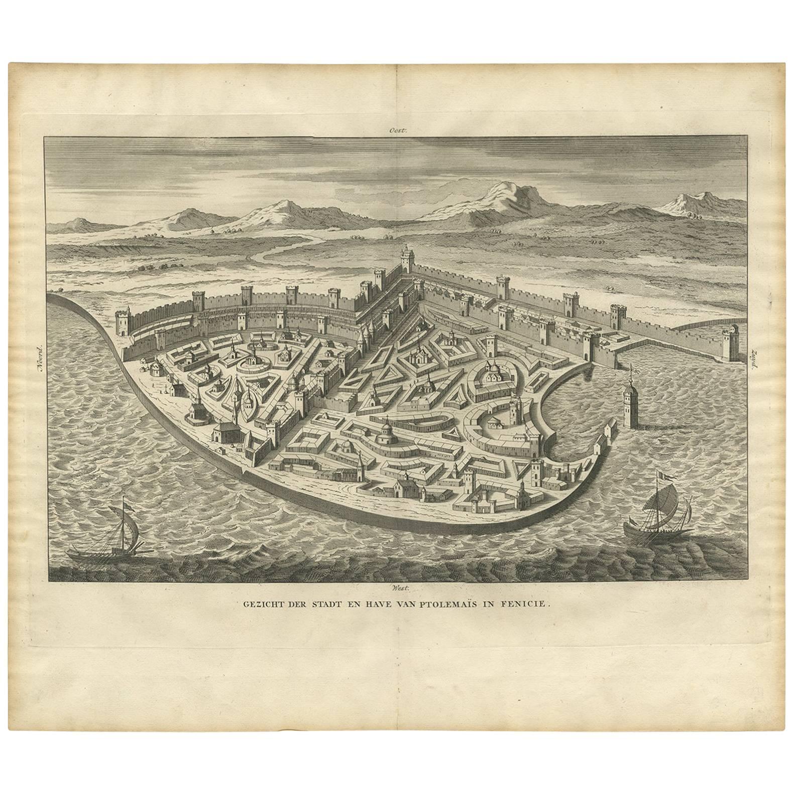
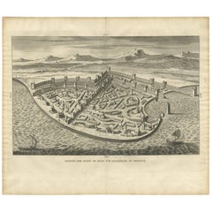
Antique Print of the City and Port of Ptolemais in Phoenicia by A. Calmet, 1725
Located in Langweer, NL
Antique print titled 'Gezicht der stadt en have van Ptoleamais in Fenicie.' Acre is a city in the Western Galilee region of northern Israel at the northern extremity of Haifa Bay. Ac...
Category
Antique Early 18th Century Prints
Materials
Paper
$191 Sale Price
23% Off
You May Also Like
Corfu, Big Antique Map from "Civitates Orbis Terrarum" - 1572-1617
By Franz Hogenberg
Located in Roma, IT
Braun G. and Hogenberg F., Corfu, from the collection Civitates Orbis Terrarum, Cologne, T. Graminaeus, 1572-1617. Image dimensions: cm 19 x 48; dimensions: cm 40 x 70.
Very lovely ...
Category
16th Century Landscape Prints
Materials
Etching
Map of Methoni - Etching by George Braun - Late 16th Century
Located in Roma, IT
This Map of Methoni is an etching realized by George Braun (1541 – 1622)
The state of preservation of the artwork is good but aged and the trace of foxing that doesn't affect the i...
Category
17th Century More Prints
Materials
Etching
Ancient View of La Valetta - Original Lithograph - Early-19th Century
Located in Roma, IT
La Valetta is an original modern artwork realized in Italy in the first half of the 19th Century.
Original Lithograph on Ivory Paper.
Inscripted in capital letters on the lower ma...
Category
1850s Modern Figurative Prints
Materials
Lithograph
Southern Greece: A Large 17th Century Hand-colored Map By Sanson and Jaillot
By Nicholas Sanson d'Abbeville
Located in Alamo, CA
This large original hand-colored copperplate engraved map of southern Greece and the Pelopponese Peninsula entitled "La Moree Et Les Isles De Zante, Cefalonie, Ste. Marie, Cerigo & C...
Category
1690s Landscape Prints
Materials
Engraving

Antique Voc Print Holland Malaysia Old Map Melaka History, 1663
Located in Amsterdam, Noord Holland
From my own collection I offer this impressive Antique print of the city of Malakka
A very interesting piece for collectors . It is an museum piece from the Dutch Institute of Orien...
Category
Antique 17th Century European Paintings
Materials
Paper

$293 Sale Price
20% Off
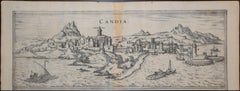
Heraklion, Map from "Civitates Orbis Terrarum" - by F. Hogenberg - 1575
By Franz Hogenberg
Located in Roma, IT
Braun G., Hogenberg F., Candia, (Heraklion, Crete) from the collection Civitates Orbis Terrarum, Cologne, T. Graminaeus, 1572-1617.
Very fine B/W aquatint showing a view of Heraklio...
Category
16th Century Figurative Prints
Materials
Etching, Aquatint