Items Similar to Antique Print of a Greece Island, Most Likely Gavdopoula South of Crete, 1688
Want more images or videos?
Request additional images or videos from the seller
1 of 5
Antique Print of a Greece Island, Most Likely Gavdopoula South of Crete, 1688
About the Item
Description: Untitled print of one of the islands of Greece, most likely Gavdopoula (located south of Crete).
Gavdopoula is an islet located north-west of its larger neighbour, Gavdos, in the Libyan Sea. It is located to the south of Crete, of which it is administratively a part, in the regional unit of Chania. It is part of the municipality of Gavdos, and it was part of the former Selino Province.
This print originates from 'Nauwkeurige Beschrijving der eilanden in de in de Archipel der Middellantsche Zee' by O. Dapper.
Artists and Engravers: Olfert Dapper (c. 1635 - 1689) was a Dutch physician and writer. He wrote books about history and geography, although he never travelled outside Holland.
Condition: Very good, Dutch text on verso. Please study image carefully.
- Dimensions:Height: 12.21 in (31 cm)Width: 7.68 in (19.5 cm)Depth: 0 in (0.02 mm)
- Materials and Techniques:
- Period:1680-1689
- Date of Manufacture:1688
- Condition:
- Seller Location:Langweer, NL
- Reference Number:
About the Seller
5.0
Platinum Seller
These expertly vetted sellers are 1stDibs' most experienced sellers and are rated highest by our customers.
Established in 2009
1stDibs seller since 2017
1,932 sales on 1stDibs
Typical response time: <1 hour
- ShippingRetrieving quote...Ships From: Langweer, Netherlands
- Return PolicyA return for this item may be initiated within 14 days of delivery.
More From This SellerView All
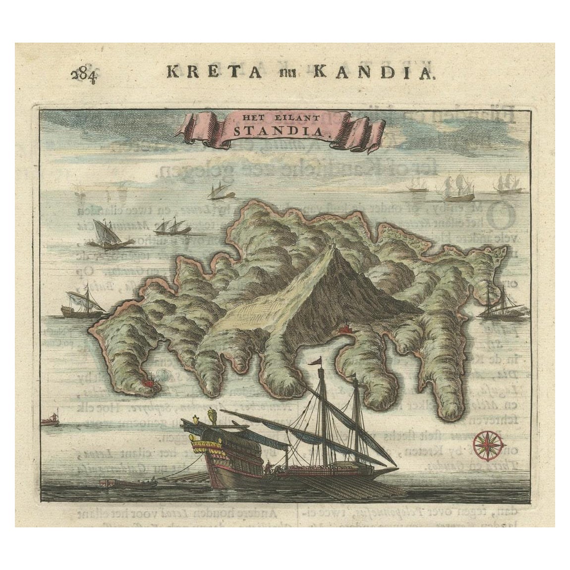
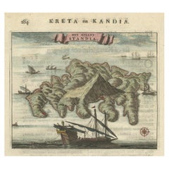
- Old Print of Standia, a Greek Island 'Heraklion, Crete, Greece, Balkans', 1688Located in Langweer, NLAntique print Greece titled 'Het Eilant Standia'. Old print of the island Standia, near Crete, Greece. This print originates from 'Nauwkeurige Bes...Category
Antique 17th Century Prints
MaterialsPaper
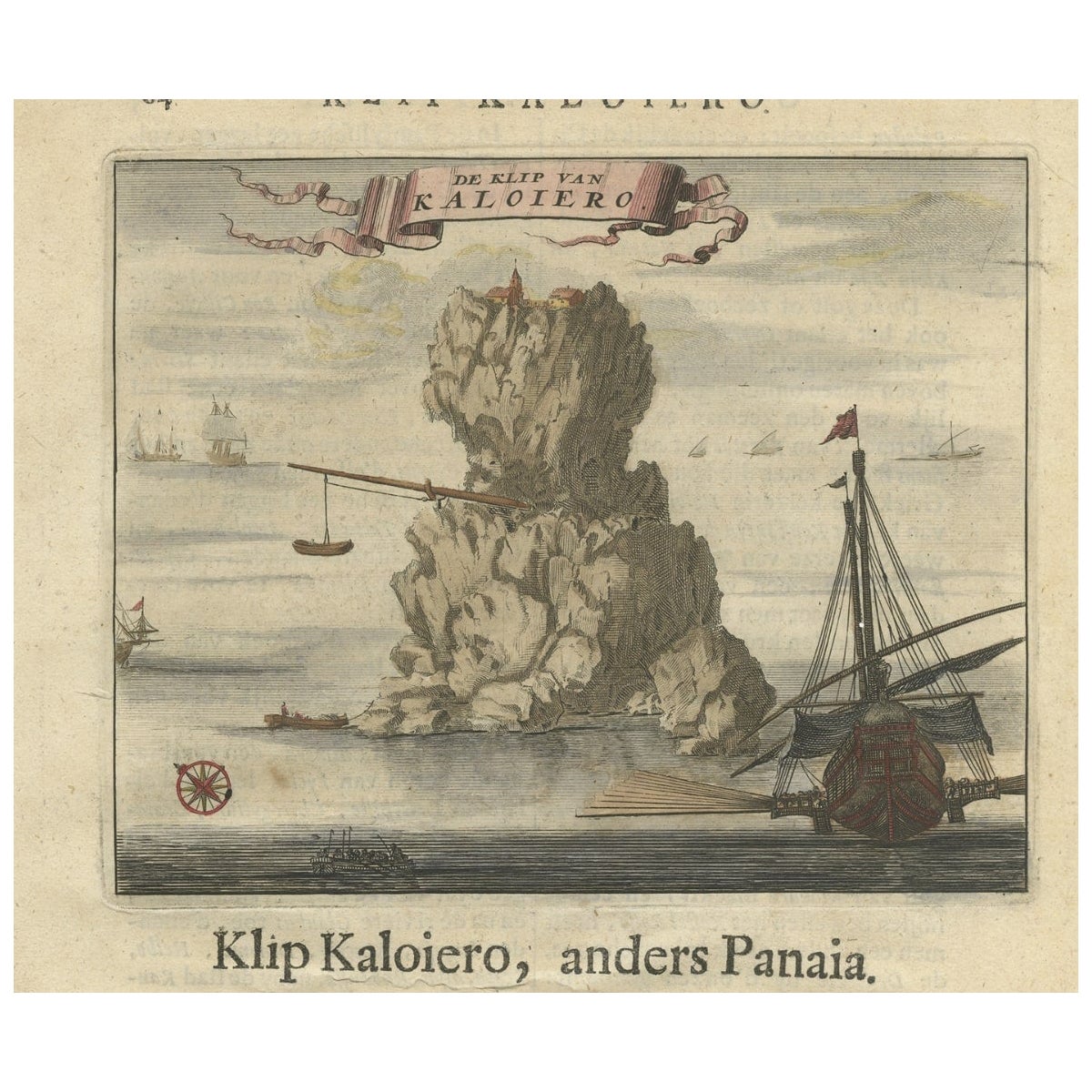
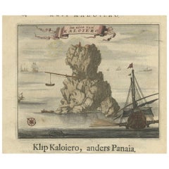
- Encoloured Engraving of Cliff Kaloiero or Caloiero Island, Panaia, Greece, 1688Located in Langweer, NLAntique print Greece titled 'De Klip van Kaloiero'. Old print of the Island Kaloiero or Panaia, Greece. This print originates from 'Nauwkeurige Be...Category
Antique 17th Century Prints
MaterialsPaper
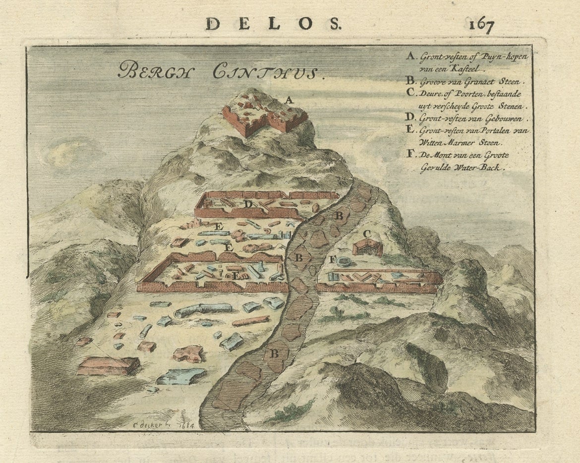
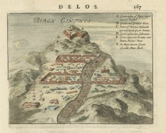
- Original Antique Print of Mount Cinthus on the isle of Delos, Greece, 1688Located in Langweer, NLAntique print Greece titled 'Bergh Cinthus'. Old print of Mount Cinthus (birth place of Apollo), Delos, Greece. This print originates from 'Nauwkeurige Beschrijving der eilanden in de in de Archipel der Middellantsche Zee' by O. Dapper. Mount Cynthus (Kýnthos) is located on the isle of Delos, part of the Greek Cyclades. In Greek mythology, Leto gave birth to Apollo and Artemis...Category
Antique 17th Century Prints
MaterialsPaper
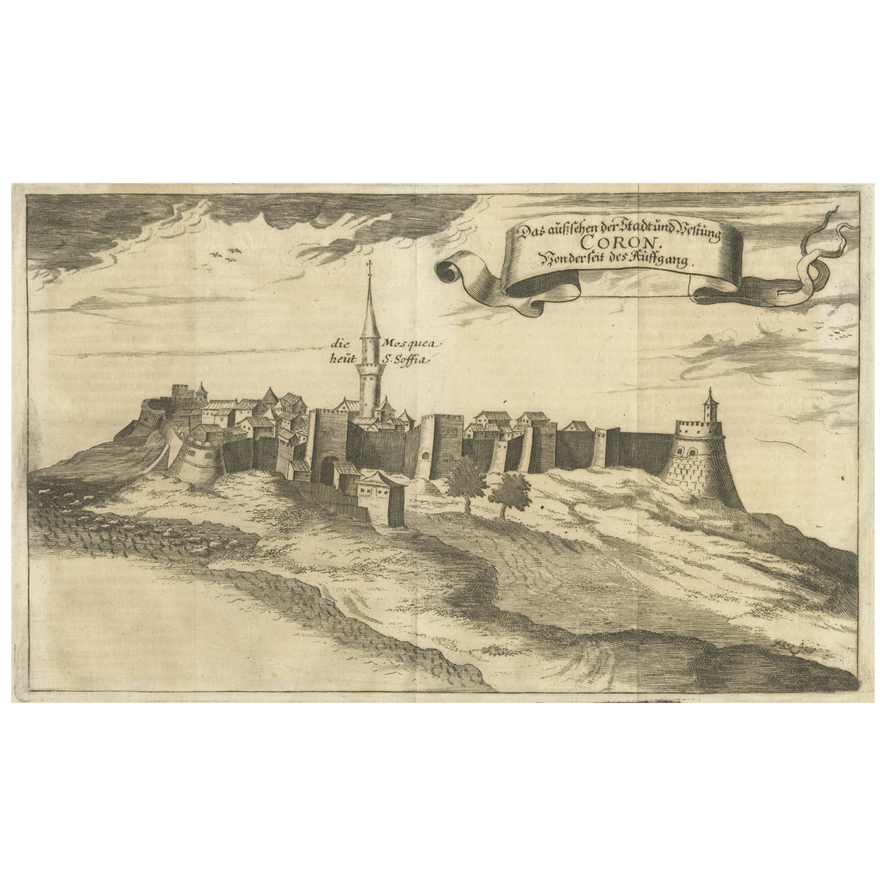
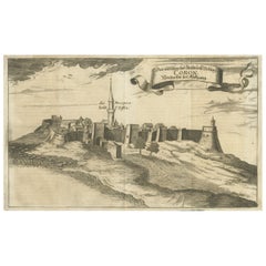
- Original Copper Engraving of Koroni 'or Corone', Greece, 1688Located in Langweer, NLAntique print titled 'Das Aussehen der Stadt und Vestung Coron von der Seit des Auffgang'. Copper engraving of Koroni (or Corone), Greece. This print originates from 'Ruhm-belorb...Category
Antique 1680s Maps
MaterialsPaper
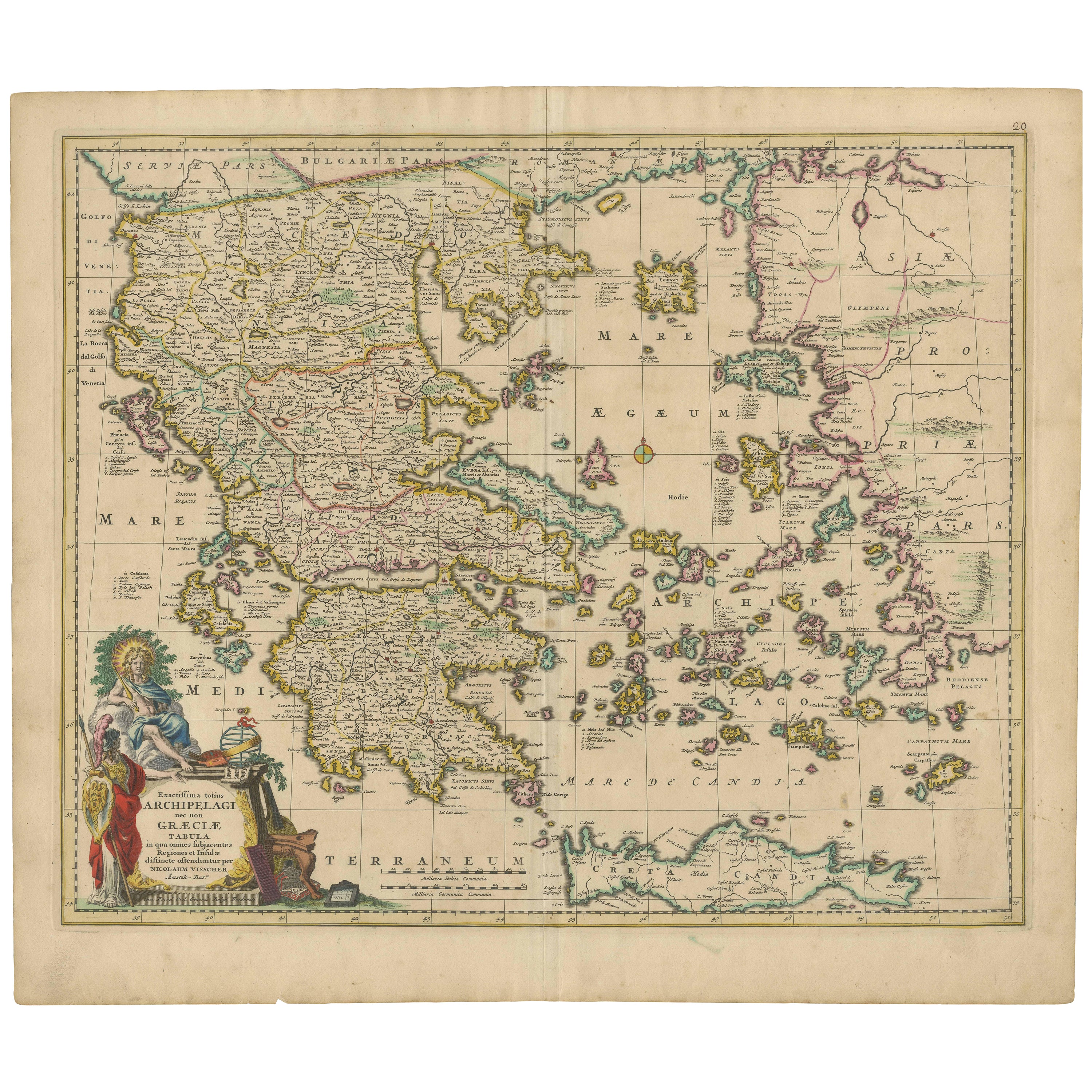
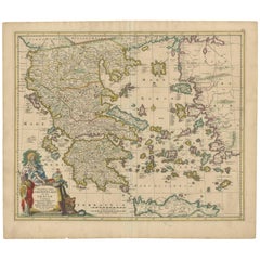
- Scarce Antique Map of Greece, the Aegean, Crete and part of Asia MinorLocated in Langweer, NLOriginal antique map titled 'Exactissima totius Archipelagi nec non Graeciae Tabula'. Visscher's scarce map of the Greek Islands, the Aegean, Crete and part of Asia Minor. Published circa 1680. Among the many great Dutch map publishers active in the seventeenth century were the Visscher family; the firm was begun by Claes Jansz Visscher...Category
Antique Late 17th Century Maps
MaterialsPaper
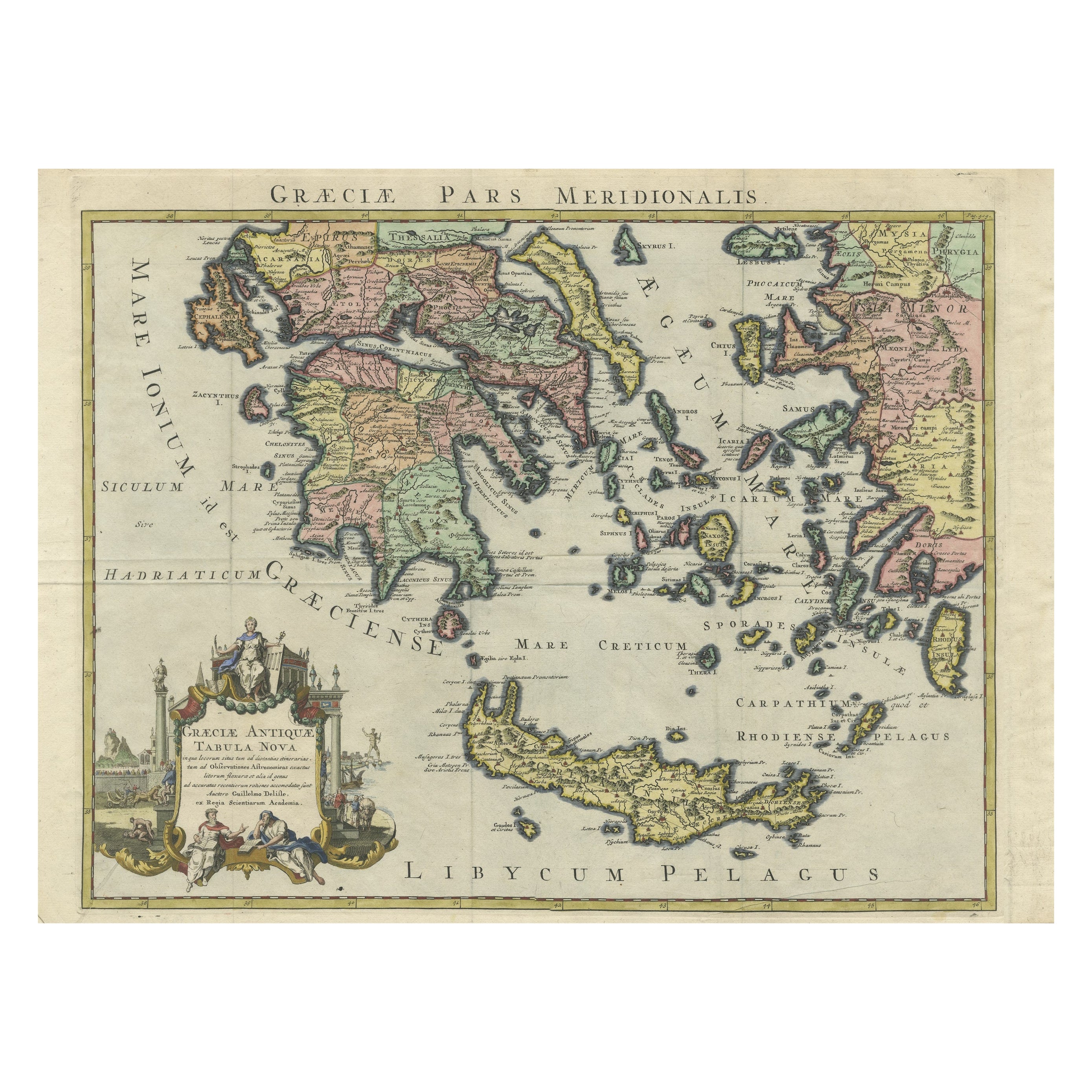
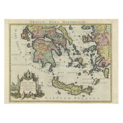
- Antique Map of Greece and Crete, Rhodus and A Part of Asia Minor , ca. 1730Located in Langweer, NLAntique engraved map of Greece. Title: "GRÆCIÆ ANTIQUÆ Tabula Nova". Year: c. 1730. Coloured engraved map by G. Delisle of Greece and Part of the Aegean. Condition is good. Sm...Category
Antique 1720s Maps
MaterialsPaper
You May Also Like
- Original Antique Map of South America. C.1780Located in St Annes, LancashireGreat map of South America Copper-plate engraving Published C.1780 Two small worm holes to left side of map Unframed.Category
Antique Early 1800s English Georgian Maps
MaterialsPaper
- Original Antique Map of South America, circa 1830Located in St Annes, LancashireGreat map of South America Copper plate engraving Published by Butterworth, Livesey & Co., circa 1830 Unframed.Category
Antique Early 1800s English Other Maps
MaterialsPaper
- Original Antique Map of South Africa, Arrowsmith, 1820Located in St Annes, LancashireGreat map of South Africa. Drawn under the direction of Arrowsmith. Copper-plate engraving. Published by Longman, Hurst, Rees, Orme and Br...Category
Antique 1820s English Maps
MaterialsPaper
- Original Antique Map of Ancient Greece- Boeotia, Thebes, 1787Located in St Annes, LancashireGreat map of Ancient Greece. Showing the region of Boeotia, including Thebes Drawn by J.D. Barbie Du Bocage Copper plate engraving by P.F T...Category
Antique 1780s French Other Maps
MaterialsPaper
- Original Antique Map of Ancient Greece, Achaia, Corinth, 1786Located in St Annes, LancashireGreat map of Ancient Greece. Showing the region of Thessaly, including Mount Olympus Drawn by J.D. Barbie Du Bocage Copper plate engraving by P.F Tardieu Original hand color...Category
Antique 1780s French Other Maps
MaterialsPaper
- Original Antique Map of Ancient Greece, Phocis, Gulf of Corinth, 1787Located in St Annes, LancashireGreat map of Ancient Greece. Showing the region of Phocis, including the Gulf of Corinth Drawn by J.D. Barbie Du Bocage Copper plate engraving by P.F Tardieu Original hand c...Category
Antique 1780s French Other Maps
MaterialsPaper


Recently Viewed
View AllMore Ways To Browse
Greek Map
Map Greece
Antique Prints Of Greece
Antique Greek Map
Antique Greece Map
Antique Maps Of Greece
Antique Map Of Greece
Antique Maps Greece
Antique Map Greece
Antique Crete
Greece Map Print
Antique World Globe
Antique World Globes
World Globes Antique
Antique Rollers
Russian Antique Collectables
Framed Map United States
Doctor Office