Items Similar to VOC Fort Nassau at Banda of The Spice Islands, Bird’s-eye View Engraving, c.1740

Want more images or videos?
Request additional images or videos from the seller
1 of 10
VOC Fort Nassau at Banda of The Spice Islands, Bird’s-eye View Engraving, c.1740
$337.91
£254.84
€290
CA$467.18
A$523.32
CHF 274.87
MX$6,363.46
NOK 3,480.74
SEK 3,304.16
DKK 2,207.67
About the Item
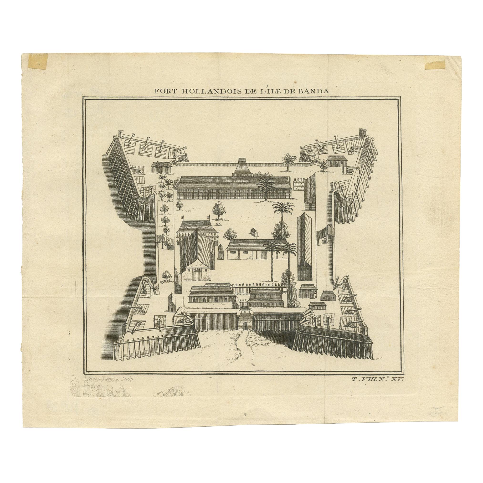
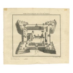
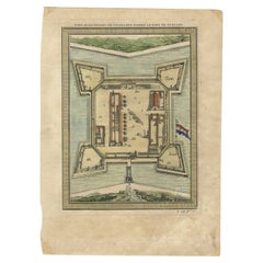
Fort Nassau at Banda, bird’s-eye view engraving by Van der Schley, c. 1735–1747
This finely detailed 18th-century engraving presents a bird’s-eye view of Fort Nassau on Banda Neira, one of the Banda Islands in the Moluccas (present-day Indonesia). The engraving was executed by Jacob van der Schley and published by Pieter de Hondt between 1735 and 1747. It appeared in the influential French travel publication Histoire Générale des Voyages by L’abbé Antoine François Prévost d’Exiles, a key work documenting global exploration and colonial enterprise.
The Banda Islands, known as the Spice Islands, were the world’s only source of nutmeg and mace in the 17th century, making them a focal point of fierce colonial competition. The Dutch East India Company (VOC) established Fort Nassau in 1609 as its first stronghold on Banda Neira. Together with the nearby Fort Belgica, it formed a defensive and administrative hub for controlling the spice trade.
This engraving offers a stylized yet informative overhead perspective of the fort’s interior and ramparts. The square layout is reinforced by four angular bastions at the corners, with heavy palisades and artillery placements. Within the walls, rows of buildings, storage houses, residences, palm trees, and open courtyards are carefully rendered, showing both the defensive and functional aspects of the fort. The symmetry and spatial clarity are typical of Van der Schley’s architectural illustrations, produced in the service of European curiosity about far-flung Dutch colonies.
The French title at the top reads *Fort Hollandois de l'Ile de Banda* and the Dutch caption below as *Hollands Fort op ‘t Eiland Banda*, attesting to the international readership of the publication.
This print is of great interest to collectors of VOC history, Southeast Asian colonial maps, and early architectural engravings. It serves not only as a visual record of Dutch military infrastructure but also as a reflection of the intense global competition for spices during the colonial era.
Condition report:
Very good condition. Clean impression on laid paper. Minor age toning and one vertical fold as issued. No tears or stains. Wide margins and crisp plate lines. A fine example of 18th-century colonial cartography and engraving.
Framing tips:
Frame with dark teak or black wood to complement the historic tone. Use a cream or parchment-colored archival mat. Museum-grade UV glass is recommended to preserve detail and prevent fading over time.
- Dimensions:Height: 8.67 in (22 cm)Width: 9.65 in (24.5 cm)Depth: 0.01 in (0.2 mm)
- Materials and Techniques:Paper,Engraved
- Period:1740-1749
- Date of Manufacture:circa 1740
- Condition:Very good condition. Clean impression on laid paper. Minor age toning and one vertical fold as issued. No tears or stains. Wide margins and crisp plate lines. A fine example of 18th-century colonial cartography and engraving.
- Seller Location:Langweer, NL
- Reference Number:Seller: BG-13484-71stDibs: LU3054345131702
About the Seller
5.0
Recognized Seller
These prestigious sellers are industry leaders and represent the highest echelon for item quality and design.
Platinum Seller
Premium sellers with a 4.7+ rating and 24-hour response times
Established in 2009
1stDibs seller since 2017
2,517 sales on 1stDibs
Typical response time: <1 hour
- ShippingRetrieving quote...Shipping from: Langweer, Netherlands
- Return Policy
Authenticity Guarantee
In the unlikely event there’s an issue with an item’s authenticity, contact us within 1 year for a full refund. DetailsMoney-Back Guarantee
If your item is not as described, is damaged in transit, or does not arrive, contact us within 7 days for a full refund. Details24-Hour Cancellation
You have a 24-hour grace period in which to reconsider your purchase, with no questions asked.Vetted Professional Sellers
Our world-class sellers must adhere to strict standards for service and quality, maintaining the integrity of our listings.Price-Match Guarantee
If you find that a seller listed the same item for a lower price elsewhere, we’ll match it.Trusted Global Delivery
Our best-in-class carrier network provides specialized shipping options worldwide, including custom delivery.More From This Seller
View AllAntique Print of the Dutch Fort on Banda by Tardieu 'circa 1750'
Located in Langweer, NL
Antique print titled 'Fort Hollandois de l'Ile de Banda'. Engraving of the Dutch VOC fortress Nassau, on Banda Neira, Indonesia. This print originates from '...
Category
Antique Mid-18th Century Prints
Materials
Paper
$111 Sale Price
20% Off
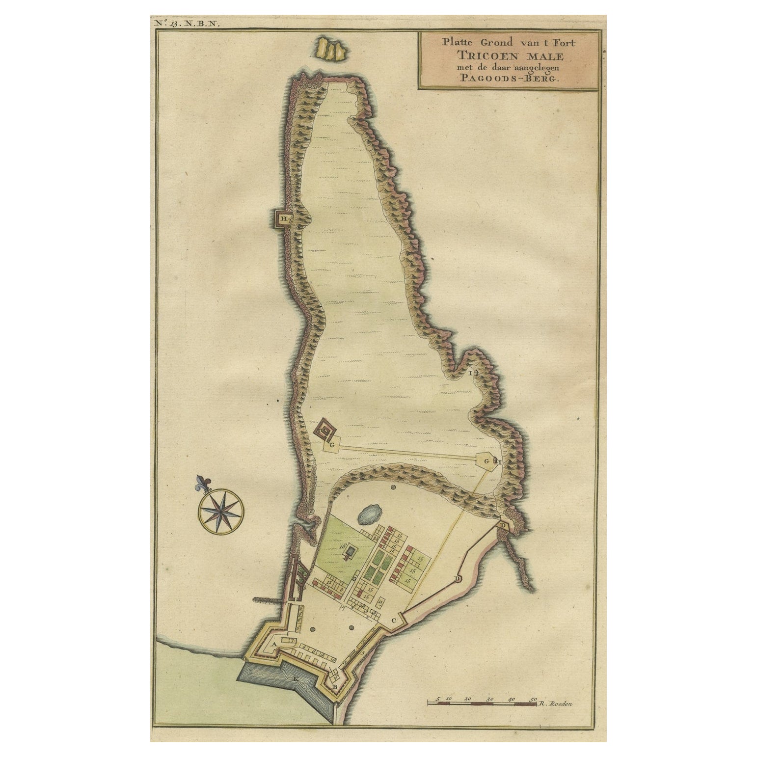
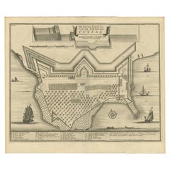
Print of a Dutch VOC Fort on the Peninsula Trincomalee, Ceylon (Sri Lanka), 1726
Located in Langweer, NL
Dutch print with the title: Platte Grond van t'Fort Tricoen male met de daar aangelegen Pagoods-Berg (Trincomalee, Sri Lanka)
The map is taken from: 'Oud en Nieuw Oost-Indiën' van...
Category
Antique 1720s Maps
Materials
Paper
$251 Sale Price
20% Off
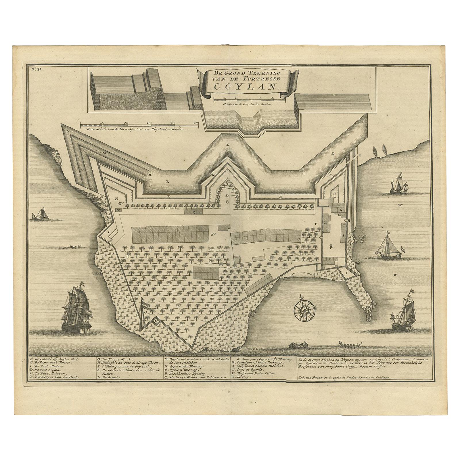
Antique Print of the Fort at Kollam ‘India’ by Valentijn, 1726
By F. Valentijn
Located in Langweer, NL
Antique print titled 'De Grond Tekening van de Fortresse Coylan'. Bird's-eye plan of the fort at Kollam, along the Malabar coast of India. This print ori...
Category
Antique Early 18th Century Dutch Prints
Materials
Paper
$419 Sale Price
20% Off
Fort Hollandois De Paliacate Nommé Le Fort De Gueldre, Bellin, 1751
Located in Langweer, NL
Antique print, titled: ?Fort Hollandois de Paliacate nommé le Fort de Gueldre?. Published for Antonine de Prevost d' Exile's Histoire generale des voyages. Artists and Engravers: Jac...
Category
Antique 18th Century Prints
Materials
Paper
$111 Sale Price
20% Off
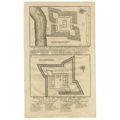
Antique Print of Fortresses in the Banyumas Region by Valentijn, 1726
By F. Valentijn
Located in Langweer, NL
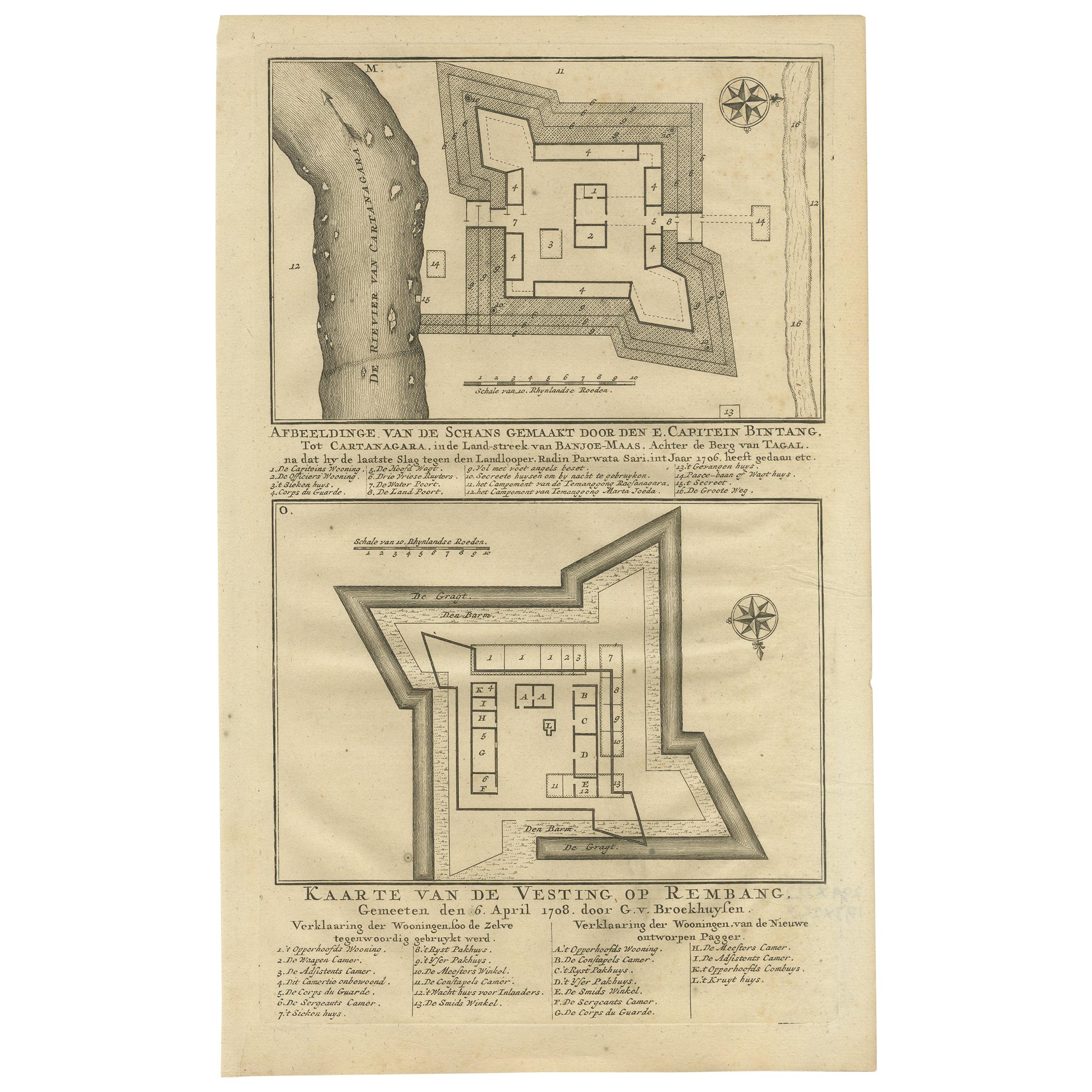
Antique print titled 'Kaarte van de Schans gemaakt door den E. Capitein Bintang. Kaarte van de Vesting op Rembang. ' A plan of the fort constructed by the Captain E. Bintang, in the ...
Category
Antique Mid-18th Century Prints
Materials
Paper
$111 Sale Price
20% Off
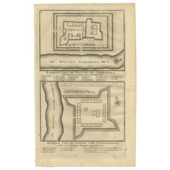
Antique Print of the Fortress on Surabaya and Pasuruan by Valentijn, 1726
Located in Langweer, NL
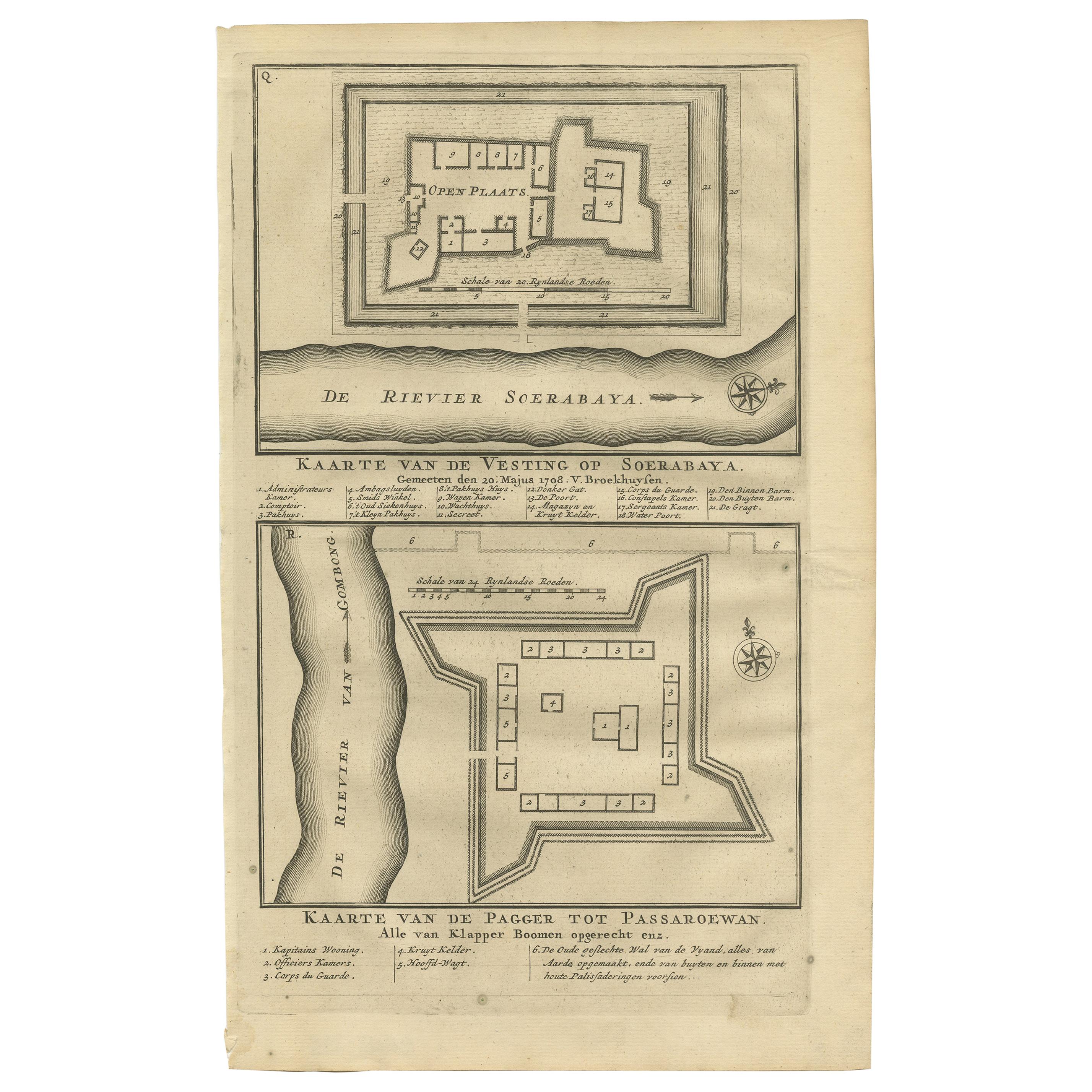
Antique print titled 'Kaarte van de vesting op Soerabaya. Kaarte van de Pagger tot Passaroewan. ' A plan of the fortress on Surabaya, and a plan of the fo...
Category
Antique Mid-18th Century Prints
Materials
Paper
$93 Sale Price
20% Off
You May Also Like
Antique Voc Print Holland Malaysia Old Map Melaka History, 1663
Located in Amsterdam, Noord Holland
From my own collection I offer this impressive Antique print of the city of Malakka
A very interesting piece for collectors . It is an museum piece from the Dutch Institute of Orien...
Category
Antique 17th Century European Paintings
Materials
Paper

$293 Sale Price
20% Off
17th-18th Century Siege of Graves Mapping Engraving By Willian III
Located in Kingston, NY
RARE French 17th-18th Century Enhanced Siege of Graves Mapping Engraving BY William III, also widely known as William of Orange,
The Siege of Grave in Dutch Brabant started by Monsie...
Category
Antique 17th Century French Prints
Materials
Paper

18th Century Map Engraving - Newport, a Strong Sea-Port Town in Flanders
Located in Corsham, GB
A map of Nieuwpoort, anglicised to 'Newport', in northern Belgium. There is a panorama in the upper quarter depicting major landmarks. Below is a plan of the town, including its strong defences and ships at the port in the lower register. Inscribed with the title in plate to the lower edge, 'Newport a Strong Sea-Port Town...
Category
18th Century More Prints
Materials
Engraving

$269 Sale Price
20% Off
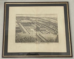
18th Century Engraving "Birdseye View of Grand Country House at Hamstead Marshal
Located in San Francisco, CA
18th Century Engraving "Birdseye View of Grand Country House at Hamstead Marshall" C.1924
Bird's eye view of the grand country house and gardens at Hamstead Marshall in Berkshire, o...
Category
Early 18th Century Landscape Prints
Materials
Etching
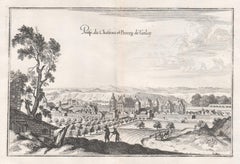
Castle and Town of Tanlay, French architecture, mid 17th century engraving
By Matthaeus Merian
Located in Melbourne, Victoria
'Prosp du Chasteau et Bourg de Tanlay'
Copper-line engraving by Matthaeus Merian.
From 'Topographia Galliae', a fine series of engravings of 17th-century French landscapes, garden...
Category
Mid-18th Century Rococo Landscape Prints
Materials
Engraving
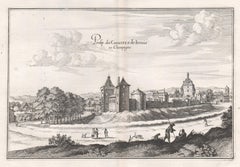
Castle of Irrois in Champagne, French architecture, mid 17th century engraving
By Matthaeus Merian
Located in Melbourne, Victoria
'Prosp. du Chasteau de Irrois en Champagne'
Copper-line engraving by Matthaeus Merian.
From 'Topographia Galliae', a fine series of engravings of 17th-century French landscapes, g...
Category
Mid-18th Century Rococo Landscape Prints
Materials
Engraving