Canada Maps
to
6
7
5,436
241
7
1
1
3
3
1
1
5
1
1
6
2
2
2
1
7
7
7
2
1
1
Item Ships From: Canada
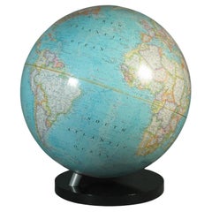
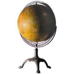
16-Inch Terrestrial Globe 1986 National Geographic
By National Geographic
Located in Ottawa, Ontario
A 16-INCH TERRESTRIAL GLOBE 1986
NATIONAL GEOGRAPHIC
Large terrestrial globe with paper gores
on a stylish black lucite base
scale 1: 31,350,000
18" inches, (45.5cm.) high.
16" in...
Category
Late 20th Century American Modern Canada Maps
Materials
Metal
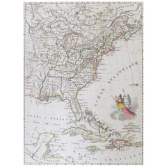
Early 19th Century Hand Colored Map of the United States and Caribbean Islands
Located in Hamilton, Ontario
Hand coloured early 19th century map by Giraldon of France titled "Etats Unis et Grandes Antilles" (United States and Greater Antilles).
Category
Early 19th Century French Antique Canada Maps
Materials
Paper
$595 Sale Price
40% Off
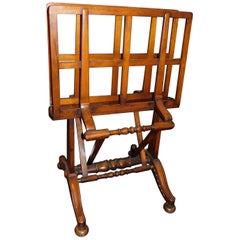
English Mahogany Wooden Folio Stand, Map and Document Holder, circa 1820
Located in Hamilton, Ontario
Regency era mahogany wood folio stand rack, map, poster, document holder used in a library, office or den, circa 1820. Folds out to six positions ...
Category
Early 19th Century English Regency Antique Canada Maps
Materials
Wood
$5,200 Sale Price
20% Off
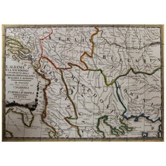
18th Century Map of the Southern Balkans by Giovanni Maria Cassini
By Giovanni Maria Cassini
Located in Hamilton, Ontario
18th century map by Italian engraver Giovanni Maria Cassini (Italy 1745-1824).
Map of the Southern Balkans: Rome. Hand colored and copper engraved print done in the year 1788. It in...
Category
18th Century Italian Antique Canada Maps
Materials
Paper
$795 Sale Price
36% Off
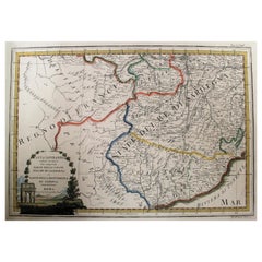
Map of the Kingdom of Sardinia and Part of the Kingdom of Genoa, Rome
By Giovanni Maria Cassini
Located in Hamilton, Ontario
18th century map by Italian engraver Giovanni Maria Cassini (Italy 1745-1824). Map of Part of the Kingdom of Sardinia and Part of the Kingdom of Genoa: Rome. This is a hand colored a...
Category
18th Century Italian Antique Canada Maps
Materials
Paper
$795 Sale Price
36% Off
17th Century Nicolas Visscher Map of Southeastern Europe
Located in Hamilton, Ontario
A beautiful, highly detailed map of southeastern Europe by Nicolas Visscher. Includes regions of Northern Italy (showing the cities Bologna, Padua, and Venice), Bohemia, Austria (sho...
Category
17th Century Dutch Antique Canada Maps
Materials
Paper
$1,350 Sale Price
38% Off
Early 19th Century Hand Coloured Map of North America by Aaron Arrowsmith
By Aaron Arrowsmith
Located in Hamilton, Ontario
Hand coloured map in French by English cartographer Aaron Arrowsmith (1750–1823) titled "Amerique Septentionale" (North America).
Map size: 9.5" x 8"
Mat size: 20.5" x 14.25".
Category
Early 19th Century English Antique Canada Maps
Materials
Paper
$795 Sale Price
36% Off
Related Items
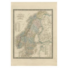
Antique Map of the Kingdoms of Sweden and Norway by Wyld '1845'
Located in Langweer, NL
Antique map titled 'Kingdoms of Sweden and Norway'. Original antique map of the Kingdoms of Sweden and Norway. This map originates from 'An Atlas of the World, Comprehending Separate...
Category
Mid-19th Century Antique Canada Maps
Materials
Paper
$139 Sale Price
40% Off
H 14.18 in W 10.24 in D 0.02 in
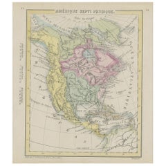
Small Map of the United States
Located in Langweer, NL
Antique map titled 'Amérique septe. Physique'. Small map of the United States. lithographed by C. Callewaert brothers in Brussels circa 1870.
Category
Mid-19th Century Antique Canada Maps
Materials
Paper
Large and Extremely Rare Terrestrial Globe by Newton
By Newton Globes - Planer & Newton
Located in Lymington, Hampshire
A large and extremely rare 24-inch terrestrial globe by Newton
Our most magnificent and rare globes were a pair of 24-inch Newton globes.
These too were updated in 1852 (terre...
Category
Mid-19th Century English Antique Canada Maps
Materials
Mahogany
Antique Hammond's 6-Inch Terrestrial Globe on Stand
By C.S. Hammond & Co.
Located in Philadelphia, PA
Offered here for your consideration is, A fine antique 6-inch terrestrial globe.
Additional Details:
By C.S. Hammond & Co.
The globe likely dates from 1927 to 1930 due to the ...
Category
20th Century Unknown Art Deco Canada Maps
Materials
Wood, Paper
19th Century German Miniature Pocket Terrestrial Globe
By C. Abel-Klinger
Located in Essex, MA
A miniature 19th century 3.5 inch diameter pocket terrestrial globe by C. Abel-Klinger, Nuremberg, Germany, in English for the English speaking markets. Signed with cartouche reading...
Category
1880s German Antique Canada Maps
Materials
Brass
Antique Map of The United States of North America, Pacific States, 1882
Located in Langweer, NL
The map is from the same 1882 Blackie Atlas and focuses on the Pacific States of the United States of America during that period. Here are some details and historical context about t...
Category
1880s Antique Canada Maps
Materials
Paper
$233 Sale Price
20% Off
H 14.97 in W 11.03 in D 0 in
Antique Map of the United States by Titus '1871'
Located in Langweer, NL
Antique map titled 'The United States of America'. Original antique map of the United States. This map originates from 'Atlas of Prebl...
Category
Late 19th Century Antique Canada Maps
Materials
Paper
$745 Sale Price
20% Off
H 16.54 in W 26.78 in D 0.02 in
Antique Leather Spine 6 Volumes National Geographic Magazine 1924 1925 and 1926
By National Geographic
Located in Miami, FL
Set of antique 1924/1925 and 1926 National Geographic Magazines. 6 Well bound leather-spine & corners and dark cloth books, 2 volumes per year, January-June and July-December. A ti...
Category
1920s American International Style Vintage Canada Maps
Materials
Leather, Paper
$585 / set
H 10 in W 7.88 in D 2 in
Bronze Bassin for Holy Water, Spain, 17th Century
Located in Madrid, ES
Holy wall font. Bronze. Spain, 17th Century.
Small font for holy water designed to be placed on a wall, which has a container decorated with moldings and architectural elements and...
Category
17th Century Spanish Baroque Antique Canada Maps
Materials
Bronze, Other
18-inch Globe, Cary's, London, 1840
By Cary’s
Located in Milano, IT
John and William Cary
Updated by George and John Cary
Terrestrial Globe
London, 1840
lb 22 (kg 10)
Slight surface abrasions due to use. A small crack on the horizon circle.
The globe rests in its original Dutch style stand with four supporting turned wood columns.
It measures 26 in in height x 23.6 in in diameter with the diameter of the sphere measuring 18 in; 66 cm in height x 60 cm in diameter with the diameter of the sphere measuring 45.72 cm.
The 18 inch...
Category
1840s English Early Victorian Antique Canada Maps
Materials
Paper, Wood
Map of the Ottoman Empire in Europe, incl. the Balkans, Greece & Turkey, c.1760
Located in Langweer, NL
Antique map Turkey titled 'An Accurate Map of Turky in Europe drawn from the best Authorities'.
Map of the Ottoman Empire in Europe, the Balkans, Greece, and Turkey in Europe. Engr...
Category
1760s Antique Canada Maps
Materials
Paper
$428 Sale Price
20% Off
H 8.67 in W 13.59 in D 0 in
Antique Map of the United States by Balbi '1847'
Located in Langweer, NL
Antique map titled 'Etats-Unis'. Original antique map of the United States. This map originates from 'Abrégé de Géographie (..)' by Ad...
Category
Mid-19th Century Antique Canada Maps
Materials
Paper
$186 Sale Price
20% Off
H 9.06 in W 11.23 in D 0.02 in
Previously Available Items
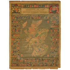
Original Historical Cloth Clan Map of Medieval Scotland of Old
Located in Hamilton, Ontario
The Scotland of Old Clans Map is a unique pictorial map showing the ancient territories of the principal Scottish clans in the 17th century, and features Don Pottinger’s (Islay Heral...
Category
Mid-20th Century Scottish Canada Maps
Materials
Linen, Paper
1930s Weber Costello Globe with Cast Copper Mount
Located in Surrey, BC
Beautiful example of a classic globe from the 1930s and made by Weber Costello. The mounting mechanism is cast from copper.
The roots of what would bec...
Category
1930s American Victorian Vintage Canada Maps
Materials
Copper
1960 Vintage Pull Down Cartography Chalkboard Map of North America
By Denoyer-Geppert
Located in Surrey, BC
Vintage pull down cartograph slated chalkboard map of North America by Denoyer & Geppert Co. in excellent condition.
History
The Denoyer-Geppert ...
Category
1950s American Mid-Century Modern Vintage Canada Maps
Framed New York Central Railway Map Original from 1943 with Railway Label
By Baker, Jones, Hausauer, Inc. 1
Located in Ottawa, Ontario
Framed New York Central Railway Map Original from 1943 With Railway Label, The map is by Baker, Jones, Hausauer, Inc. Buffalo, N.Y. The map covers all line...
Category
1940s American Mid-Century Modern Vintage Canada Maps
Materials
Paper
H 26.5 in W 41 in D 0.75 in
World Map
Located in Surrey, BC
Large world map, mfg by the Rand McNally Co, Chicago showing political areas.
Category
1940s American Vintage Canada Maps
Materials
Paper, Wood
Set of 3 Vintage Riveted Map Holders
Located in Calgary, Alberta
Fabulous and funky! Set of 3 vintage handmade cardboard map holders found in the UK. They each have a metal rim on the top and bottom and are riveted up th...
Category
20th Century British Canada Maps
Materials
Metal
American Map
Located in Surrey, BC
Very unique and rare map depicting government figures and national images and graphics from the gold rush era.
Category
American Canada Maps
Materials
Paper
Recently Viewed
View AllMore Ways To Browse
Vintage Bone Dish
Vintage Bronze Lion Statue
Vintage Chinese Shell Art
Vintage Christmas Bells
Vintage Christmas Figurines
Vintage Folding Hand Fan
Vintage Foundry Tools
Vintage French Provincial Drawer Pulls
Vintage Industrial Bins
Vintage Ivory Tusk
Vintage Liquor Labels
Vintage Utensil Holders
Vintage Wicker Wine Bottles
Vintage Wrought Iron Fire Screen
Viso Porcelain
Vizagapatam Box
Wall Mount Water Fountains
Wedding Cabinets and Armoires
