Connecticut Maps
to
5,466
195
4
1
2
2
4
2
2
1
1
3
1
1
4
4
4
Item Ships From: Connecticut
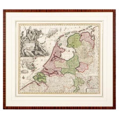
Matthaus Seutter, Framed 1730 Color Engraving Map of "Belgium Fonderatum"
Located in Bridgeport, CT
Label on verso. From Grosser Atlas. The name Belgium comes from the ancient designation "Gallis Belgica". Figural decoration upper left. M. Seutter was a famed German mapmaker in the...
Category
18th Century European Renaissance Antique Connecticut Maps
Materials
Brass
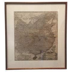
Framed Map of China
Located in Greenwich, CT
Map of China, 19th century. European print map of China
Conservation frame with walnut frame
Overall dimension : 28 1/2" wide 31" high 2" depth with fra...
Category
19th Century European Qing Antique Connecticut Maps
Materials
Paper
$3,800
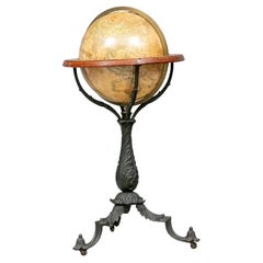
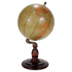
19th C. Terrestrial Globe on Stand for H.B. Nims After Copley
Located in Bridgeport, CT
Manufactured for H.B. Nims & Co., Troy New York, last quarter 19th c. After the original engravings by Charles Copley done in 1852.
Printed paper on wood with brass/ bronze meridian ring and a flat circular printed center horizon ring on wood labeled with the months of the year with notes. Mounted on a fine leafy iron baluster...
Category
Late 19th Century American Victorian Antique Connecticut Maps
Materials
Bronze, Iron
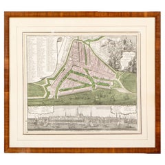
Framed 1731 Color Engraving, Map of Rotterdam by Matthaus Seutter, "Roterodami"
Located in Bridgeport, CT
"Roterodami". Seutter (1678-1757) was an important German 18th century map maker. Bird's eye view of the city above with full details, neoclassi...
Category
18th Century European Renaissance Antique Connecticut Maps
Materials
Glass, Wood, Paper
Related Items
Antique Hammond's 6-Inch Terrestrial Globe on Stand
By C.S. Hammond & Co.
Located in Philadelphia, PA
Offered here for your consideration is, A fine antique 6-inch terrestrial globe.
Additional Details:
By C.S. Hammond & Co.
The globe likely dates from 1927 to 1930 due to the ...
Category
20th Century Unknown Art Deco Connecticut Maps
Materials
Wood, Paper
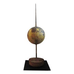
Rare 19th Century Large Original Painted Lightning Rod on Stand
Located in Los Angeles, CA
Fantastic folky oversized 19th century mustard over copper Lightning rod ball on a professional iron stand. The base is a plank of original work that the...
Category
19th Century American Folk Art Antique Connecticut Maps
Materials
Copper
Antique Map of Venezuela by Montanus, 1671
By Arnoldus Montanus
Located in Langweer, NL
Antique map titled 'Venezuela cum parte Australi Novae Andalusiae'. The map extends from Coquibocoa to the Orinoque River, centered on Bariquicemento and Cape de Curiacao. Large cart...
Category
Mid-17th Century English Antique Connecticut Maps
Materials
Paper
Large and Extremely Rare Terrestrial Globe by Newton
By Newton Globes - Planer & Newton
Located in Lymington, Hampshire
A large and extremely rare 24-inch terrestrial globe by Newton
Our most magnificent and rare globes were a pair of 24-inch Newton globes.
These too were updated in 1852 (terre...
Category
Mid-19th Century English Antique Connecticut Maps
Materials
Mahogany
Framed Japanese 19th Century Woodblock Print of Kabuki Actors Toyokuni III
Located in London, GB
Japanese 19th Century Woodblock Print of Kabuki Actors Toyokuni III
Original Woodcut by Toyokuni III (1786 - 1864)
Of the Kabuki actors Bando Hikosab...
Category
19th Century Japanese Antique Connecticut Maps
Materials
Paper
$1,907
H 13.39 in W 9.06 in D 0.79 in
19th Century German Miniature Pocket Terrestrial Globe
By C. Abel-Klinger
Located in Essex, MA
A miniature 19th century 3.5 inch diameter pocket terrestrial globe by C. Abel-Klinger, Nuremberg, Germany, in English for the English speaking markets. Signed with cartouche reading...
Category
1880s German Antique Connecticut Maps
Materials
Brass
Antique Framed Japanese Shunga Woodblock Print of a Man and a Woman Making Love
Located in Yonkers, NY
An antique Japanese Shunga woodblock print in gilt frame depicting a man and a woman making love. Created in Japan, this woodblock print called...
Category
19th Century Japanese Antique Connecticut Maps
Materials
Glass, Wood, Paint
$1,200
H 16.5 in W 13.5 in D 1 in
Antique 1743 Map – Travels of Jesus Christ & Apostles by Seutter
Located in Langweer, NL
Antique 1743 Map – Travels of Jesus Christ & Apostles by Seutter
This is an original antique map titled “Carte des Voyages de Notre Seigneur Jesus-Christ et des Actes des Apotres St...
Category
Mid-18th Century German Antique Connecticut Maps
Materials
Paper
$2,010
H 21.66 in W 26.3 in D 0.01 in
Antique Framed Japanese Shunga Woodblock Print of Two Women Making Love
Located in Yonkers, NY
An antique Japanese Shunga woodblock print in gilt frame depicting two women making love. Created in Japan, this woodblock print called a Shung...
Category
19th Century Japanese Antique Connecticut Maps
Materials
Glass, Wood, Paint
$1,200
H 13 in W 15.5 in D 1 in
Antique Japanese Erotic Shunga Woodblock Print of a Couple in Gilt Frame
Located in Yonkers, NY
An antique Japanese Shunga woodblock print in gilt frame depicting a man and a woman making love. Created in Japan, this woodblock print called...
Category
19th Century Japanese Antique Connecticut Maps
Materials
Glass, Wood
$1,200
H 16.5 in W 13.5 in D 1 in
Antique Framed Japanese Shunga Woodblock Print of a Couple Making Love
Located in Yonkers, NY
An antique Japanese Shunga woodblock print in gilt frame depicting a man and a woman making love. Created in Japan, this woodblock print called...
Category
19th Century Japanese Antique Connecticut Maps
Materials
Glass, Wood
19th Century Terrestrial Globe - by Ikelmer Paris
By Ikelmer
Located in Casteren, Noord-Brabant
A beautiful antique globe, issued by the French maker Ikelmer Paris.
The globe was made around 1880-1890.
The globe is made of paper, the base is made of black lacquered wood.
The gl...
Category
Late 19th Century French Belle Époque Antique Connecticut Maps
Materials
Wood, Paper
Previously Available Items
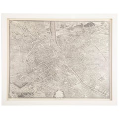
Vintage Map of Paris after the Original Turgot Plan of 1739
Located in Stamford, CT
Vintage map of Paris after the original Turgot Plan of 1739 in white frame.
Category
1950s Vintage Connecticut Maps
Materials
Paper
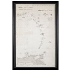
Rare Chart of the Caribbean Islands Published by James Imray & Son, London, 1866
Located in Stamford, CT
Rare chart of the Caribbean Islands published by James Imray & Son, London, 1866.
FW 1370.
Category
Mid-19th Century English Folk Art Antique Connecticut Maps
Materials
Paper
H 44 in W 30 in D 1.5 in
Rare Rand McNally & Co. "New 3" Terrestrial Globe
By Rand McNally & Co.
Located in Bridgeport, CT
Rand McNally & Co. "New 3" terrestrial globe, small spherical supported on crescent metal frame raised on a circular magnifying glass base.
...
Category
20th Century American Art Deco Connecticut Maps
Mid-19th Century Set of Three Charts of the West Coast
Located in Stamford, CT
Set of three mid-19th century maritime charts of the west coast of the United States from the famous U.S. Coast Survey project.
Included are San Die...
Category
1850s American Antique Connecticut Maps
Materials
Paper
Early 19th Century Celestial Globe by Cary
By John & William Cary
Located in Greenwich, CT
Fine Georgian Celestial globe by J. & W. Cary of London, circa 1800, the mahogany Stand with ring turned urn shaft and standing on slipper feet, with co...
Category
1790s English George III Antique Connecticut Maps
Materials
Mahogany, Paper
Vintage Replogle 32 Inch Library Globe
Located in Bridgeport, CT
Chicago, Illinois. Designed and edited by Gustav Bruekmann, cartographer. Paper map over glass with several applied tabs dated 1957. Housed in a well crafted mahogany footed cradle w...
Category
20th Century Grand Tour Connecticut Maps
Materials
Brass
Copper World Map from Sabena Airlines, JFK Airport, New York, 1972
Located in Wilton, CT
Commissioned by Sabena Airlines Belgium. This unique copper repousse world map was the backdrop for Sabena's check in counter at JFK Airport, New York, in ...
Category
1970s Chilean Mid-Century Modern Vintage Connecticut Maps
Materials
Copper
Framed Rare Map of Japan and Korea
Located in Greenwich, CT
A framed rare map of Japan and Korea in 1797. Provenance: JP Morgan, Tokyo, Japan.
Category
18th Century and Earlier Japanese Antique Connecticut Maps
20th Century Reprint of 18th Century Nolli Map of Rome
Located in Norwalk, CT
The famous 12 part map of Rome, The NOLLI PIANTA GRANDE was completed by Giambattista Nolli in 1748. This 20th Century reproduction, as the original is in 12 seperate but contiguous ...
Category
20th Century Connecticut Maps
Turgot's 1739 "Plan de Paris"
By Michel Etienne Turgot
Located in Stamford, CT
A stunning 1950's copy ( 117/1000 ) of Turgot's 1739 "Plan de Paris". This remarkable map shows the whole of 18th century Paris and offers a wonderful pe...
Category
18th Century and Earlier French Antique Connecticut Maps
Materials
Oak, Paper
Extremely Rare French and Indian War Period Powder Horn
Located in Greenwich, CT
Extremely rare Circa 1760 French and Indian War period powderhorn with a map of the water routes of New York depicting New York harbor, the Royal Block House Fort, Fort Stanwix and Fort Hartman, showing the Hudson and Mohawk rivers
Category
18th Century and Earlier American Antique Connecticut Maps
Vintage Globe "Solely for the use of the blind"
Located in Oakville, CT
Copyright dated 1959, this globe was made by "American Printing House” for the blind. It sands just over 4 feet tall and is around 2 1/2 feet wide. The globe offers raised longitud...
Category
1950s American Vintage Connecticut Maps
Materials
Iron
Recently Viewed
View AllMore Ways To Browse
Vintage Industrial Bins
Vintage Ivory Tusk
Vintage Liquor Labels
Vintage Utensil Holders
Vintage Wicker Wine Bottles
Vintage Wrought Iron Fire Screen
Viso Porcelain
Vizagapatam Box
Wall Mount Water Fountains
Wedding Cabinets and Armoires
Wedgwood Green Jasperware
Wedgwood Portrait
West German Pot
White Ceramic Garden Stool
White Ironstone China
White Lacquer Bar Cart
Woman With Water Jug
Wooden Chest 1800
