England Maps
to
10
353
5,466
195
353
65
33
9
6
2
1
1
1
59
198
96
88
2
2
52
1
27
1
310
57
30
11
8
294
277
168
53
53
353
353
353
28
4
1
1
1
Item Ships From: England
Original Antique Map of China, Arrowsmith, 1820
Located in St Annes, Lancashire
Great map of China
Drawn under the direction of Arrowsmith
Copper-plate engraving
Published by Longman, Hurst, Rees, Orme and Brown, 1820
Unfr...
Category
1820s English Antique England Maps
Materials
Paper
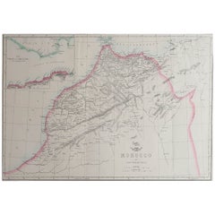
Large Original Antique Map of Morocco. Edward Weller, 1861
Located in St Annes, Lancashire
Great map of Morocco
Lithograph engraving by Edward Weller
Original colour
Published, 1861
Unframed
Good condition.
Category
1860s English Victorian Antique England Maps
Materials
Paper
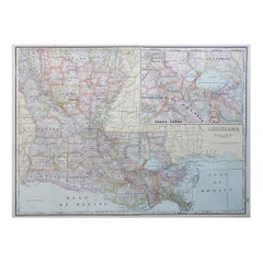
Large Original Antique Map of Louisiana, USA, C.1900
Located in St Annes, Lancashire
Fabulous map of Louisiana.
Original color.
Engraved and printed by the George F. Cram Company, Indianapolis.
Published, c.1900.
Unframed.
Repair ...
Category
1890s American Antique England Maps
Materials
Paper
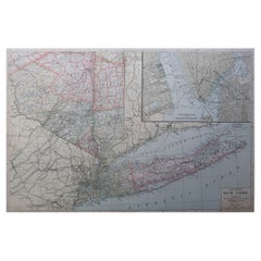
Large Original Antique Map of New York State( Southern ), USA, C.1900
Located in St Annes, Lancashire
Fabulous map of Southern New York . With a vignette of Lower Manhattan
Original color.
Engraved and printed by the George F. Cram Company, Indianapolis.
Published, C.1900.
Unfram...
Category
1890s American Antique England Maps
Materials
Paper
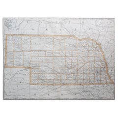
Large Original Antique Map of Nebraska, USA, 1894
By Rand McNally & Co.
Located in St Annes, Lancashire
Fabulous map of Nebraska
Original color
By Rand, McNally & Co.
Published, 1894
Unframed
Some slight restoration to the Gosper / Furnas area. Seen in the last image
Free shipping.
Category
1890s American Antique England Maps
Materials
Paper
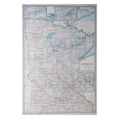
Large Original Antique Map of Minnesota, USA, C.1900
Located in St Annes, Lancashire
Fabulous map of Minnesota
Original color
Engraved and printed by the George F. Cram Company, Indianapolis.
Published, C.1900
Unframed
Repair to a small tear bottom left corner
...
Category
1890s American Antique England Maps
Materials
Paper
Large Original Antique Map of The South of Italy. John Dower, 1861
Located in St Annes, Lancashire
Great map of the South of Italy
Lithograph engraving by John Dower
Original colour
Published, 1861
Unframed
Good condition
Free shipping
Category
1860s English Victorian Antique England Maps
Materials
Paper
Original Antique Map of the American State of Washington, 1889
Located in St Annes, Lancashire
Great map of Washington
Drawn and Engraved by W. & A.K. Johnston
Published By A & C Black, Edinburgh.
Original colour
Unframed.
Category
1880s Scottish Victorian Antique England Maps
Materials
Paper
Large Antique Lithography Map of Kent, English, Cartography, Robert Morden, 1700
Located in Hele, Devon, GB
This is a large antique lithography map of Kent. An English, framed atlas engraving of cartographic interest by Robert Morden, dating to the early 18th century and later.
Superb li...
Category
Early 18th Century British Queen Anne Antique England Maps
Materials
Glass, Wood, Paper
Large Original Antique Map of Nevada, USA, 1894
By Rand McNally & Co.
Located in St Annes, Lancashire
Fabulous map of Nevada
Original color
By Rand, McNally & Co.
Published, 1894
Unframed
Free shipping.
Category
1890s American Antique England Maps
Materials
Paper
Antique County Map, Oxfordshire, English, Framed Cartography Interest, Victorian
Located in Hele, Devon, GB
This is an antique lithography map of Oxfordshire. An English, framed atlas engraving of cartographic interest, dating to the mid 19th century and later.
Superb lithography of Oxfo...
Category
Mid-19th Century British Mid-Century Modern Antique England Maps
Materials
Wood
Large Original Vintage Map of North America, circa 1920
Located in St Annes, Lancashire
Great map of North America
Original color. Good condition
Published by Alexander Gross
Unframed.
Category
1920s English Edwardian Vintage England Maps
Materials
Paper
Original Antique Map of Switzerland, Engraved By Barlow, Dated 1807
Located in St Annes, Lancashire
Great map of Switzerland
Copper-plate engraving by Barlow
Published by Brightly & Kinnersly, Bungay, Suffolk.
Dated 1807
Unframed.
Category
Early 1800s English Antique England Maps
Materials
Paper
Original Antique English County Map, Kent. J & C Walker, 1851
Located in St Annes, Lancashire
Great map of Kent
Original colour
By J & C Walker
Published by Longman, Rees, Orme, Brown & Co. 1851
Unframed.
Category
1850s English Other Antique England Maps
Materials
Paper
Large Original Vintage Map of China, circa 1920
Located in St Annes, Lancashire
Great map of China.
Original color. Good condition.
Published by Alexander Gross
Unframed.
Category
1920s English Edwardian Vintage England Maps
Materials
Paper
Large Original Antique Map of Utah, USA, 1894
By Rand McNally & Co.
Located in St Annes, Lancashire
Fabulous map of Utah
Original color
By Rand, McNally & Co.
Published, 1894
Unframed
Free shipping.
Category
1890s American Antique England Maps
Materials
Paper
Large Original Antique Map of The World, Fullarton, C.1870
Located in St Annes, Lancashire
Great map of the World. Showing both hemispheres
From the celebrated Royal Illustrated Atlas
Lithograph. Original color.
Published by Fullarton, Edinburgh, C.1870
Unframed.
Rep...
Category
1870s Scottish Antique England Maps
Materials
Paper
Antique West Yorkshire Map, English, Framed Lithography, Cartography, Victorian
Located in Hele, Devon, GB
This is an antique lithography map of West Yorkshire. An English, framed atlas engraving of cartographic interest, dating to the mid 19th century and later.
Superb lithography of t...
Category
Mid-19th Century British Victorian Antique England Maps
Materials
Paper
Large Antique Lithography Map, Northamptonshire, Framed Cartography, John Speed
Located in Hele, Devon, GB
This is a large antique lithography map of Northamptonshire. An English, framed atlas engraving of cartographic interest by John Speed, dating to the early 17th century and later.
Superb lithography reproduction of Northamtonshire - place names are written in 17th century English
Displays a desirable aged patina and in very good order
Fascinating Jacobean period cartography, set within a quality, later frame
Reproduced here from its appearance in the 'Theatre of Great Britain' of 1627 published by George Humble
Marked for John Speed as cartographer and George Humbell (sic) as seller
Exceptional detail, as expected from a John Speed map...
Category
Mid-17th Century British Other Antique England Maps
Materials
Glass, Wood, Paper
Antique Town Plan Map, Poole, English, Framed Cartography, Georgian, Circa 1780
Located in Hele, Devon, GB
This is an antique town plan map of Poole in Dorset. An English, framed atlas engraving, dating to the 18th century and later.
Fascinating cartography with annotated streets and pl...
Category
Late 18th Century British George III Antique England Maps
Materials
Glass, Wood, Paper
Original Antique Map of the American State of Oregon, 1889
Located in St Annes, Lancashire
Great map of Oregon
Drawn and Engraved by W. & A.K. Johnston
Published By A & C Black, Edinburgh.
Original colour
Unframed.
Category
1880s Scottish Victorian Antique England Maps
Materials
Paper
Antique County Map, Dorset, English, Framed Engraving, Cartography, Lithography
Located in Hele, Devon, GB
This is an antique lithography map of Dorset. An English, framed atlas engraving of cartographic interest, dating to the mid 19th century and later.
Superb lithography of Dorsetshi...
Category
Mid-19th Century British Victorian Antique England Maps
Materials
Glass, Wood, Paper
Original Antique Map of Hungary, Arrowsmith, 1820
Located in St Annes, Lancashire
Great map of Hungary
Drawn under the direction of Arrowsmith.
Copper-plate engraving.
Published by Longman, Hurst, Rees, Orme and Brown, 1820
Unframed.
Category
1820s English Antique England Maps
Materials
Paper
Original Antique Map of South Africa, Arrowsmith, 1820
Located in St Annes, Lancashire
Great map of South Africa.
Drawn under the direction of Arrowsmith.
Copper-plate engraving.
Published by Longman, Hurst, Rees, Orme and Br...
Category
1820s English Antique England Maps
Materials
Paper
Antique East Yorkshire Map, English, Framed Lithograph, Cartography, Victorian
Located in Hele, Devon, GB
This is an antique lithography map of East Yorkshire. An English, framed atlas engraving of cartographic interest, dating to the mid 19th century and later.
Superb lithography of t...
Category
Mid-19th Century British Victorian Antique England Maps
Materials
Paper
Original Antique Map of the American State of Nevada, 1889
Located in St Annes, Lancashire
Great map of Nevada
Drawn and Engraved by W. & A.K. Johnston
Published By A & C Black, Edinburgh.
Original colour
Unframed.
Category
1880s Scottish Victorian Antique England Maps
Materials
Paper
Original Antique Map of New Brunswick and Nova Scotia, 1889
Located in St Annes, Lancashire
Great map of New Brunswick and Nova Scotia
Drawn and Engraved by W. & A.K. Johnston
Published By A & C Black, Edinburgh.
Original colour
Unfr...
Category
1880s Scottish Victorian Antique England Maps
Materials
Paper
Large Original Antique Map of New Jersey, USA, circa 1900
Located in St Annes, Lancashire
Fabulous map of New Jersey
Original color
Engraved and printed by the George F. Cram Company, Indianapolis.
Published, circa 1900
Unframed
Repairs to minor edge tears
Category
1890s American Antique England Maps
Materials
Paper
Large Original Antique Map of Kansas, USA, 1894
By Rand McNally & Co.
Located in St Annes, Lancashire
Fabulous map of Kansas
Original color
By Rand, McNally & Co.
Published, 1894
Unframed
Free shipping.
Category
1890s American Antique England Maps
Materials
Paper
Large Original Vintage Map of Mexico, circa 1920
Located in St Annes, Lancashire
Great map of Mexico
Original color.
Good condition
Published by Alexander Gross
Unframed.
Category
1920s English Edwardian Vintage England Maps
Materials
Paper
Large Original Antique Map of Maine, USA, C.1900
Located in St Annes, Lancashire
Fabulous map of Maine
Original color
Engraved and printed by the George F. Cram Company, Indianapolis.
Published, C.1900
Unframed
Free shipping.
Category
1890s American Antique England Maps
Materials
Paper
Original Antique Map of Central America / Florida, Arrowsmith, 1820
Located in St Annes, Lancashire
Great map of Central America.
Drawn under the direction of Arrowsmith.
Copper-plate engraving.
Published by Longman, Hurst, Rees, Orme and Brown, 1820
Unframed.
Category
1820s English Antique England Maps
Materials
Paper
Original Antique English County Map, Leicestershire, J & C Walker, 1851
Located in St Annes, Lancashire
Great map of Leicestershire
Original colour
By J & C Walker
Published by Longman, Rees, Orme, Brown & Co. 1851
Unframed.
Category
1850s English Other Antique England Maps
Materials
Paper
Large Original Vintage Map of India, circa 1920
Located in St Annes, Lancashire
Great map of India
Original color.
Good condition / repair to some minor damage just above Sri Lanka. Shown in the last image.
Published by Alexander Gross
Unframed.
Category
1920s English Vintage England Maps
Materials
Paper
Large Original Antique Map of Australia by Sidney Hall, 1847
Located in St Annes, Lancashire
Great map of Australia
Drawn and engraved by Sidney Hall
Steel engraving
Original colour outline
Published by A & C Black. 1847
Unframed
Free shipping.
Category
1840s Scottish Antique England Maps
Materials
Paper
Large Original Vintage Map of Spain, circa 1920
Located in St Annes, Lancashire
Great map of Spain
Original color.
Good condition
Published by Alexander Gross
Unframed.
Category
1920s English Vintage England Maps
Materials
Paper
Large Original Antique Map of Poland by Sidney Hall, 1847
Located in St Annes, Lancashire
Great map of Poland
Drawn and engraved by Sidney Hall
Steel engraving
Original colour outline
Published by A & C Black. 1847
Unframed
...
Category
1840s Scottish Antique England Maps
Materials
Paper
Large Original Antique Map of The Environs of Dublin, Ireland, circa 1880
Located in St Annes, Lancashire
Great map of The Environs of Dublin
Published circa 1880
Unframed
Free shipping.
Category
1880s Scottish Antique England Maps
Materials
Paper
Original Antique Map of Sweden, Engraved by Barlow, 1806
Located in St Annes, Lancashire
Great map of Sweden
Copper-plate engraving by Barlow
Published by Brightly & Kinnersly, Bungay, Suffolk. 1806
Unframed.
Category
Early 1800s English Antique England Maps
Materials
Paper
Small Antique County Map, Northamptonshire, English, Framed, Cartography, C.1850
Located in Hele, Devon, GB
This is a small antique county map of Northamptonshire. An English, framed atlas engraving of cartographic interest, dating to the mid 19th century and later.
Superb lithography of...
Category
Mid-19th Century British Victorian Antique England Maps
Materials
Paper
Original Antique Decorative Map of Iceland & Faroe, Fullarton, C.1870
Located in St Annes, Lancashire
Great map of Iceland and The Faroe Islands
Wonderful figural border
From the celebrated Royal Illustrated Atlas
Lithograph. Original color.
Published by Fullarton, Edinb...
Category
1870s Scottish Antique England Maps
Materials
Paper
Original Antique English County Map, Huntingdonshire, J & C Walker, 1851
Located in St Annes, Lancashire
Great map of Huntingdonshire
Original colour
By J & C Walker
Published by Longman, Rees, Orme, Brown & Co. 1851
Unframed.
Category
1850s English Other Antique England Maps
Materials
Paper
Original Antique English County Map, Nottinghamshire, J & C Walker, 1851
Located in St Annes, Lancashire
Great map of Nottinghamshire
Original colour
By J & C Walker
Published by Longman, Rees, Orme, Brown & Co. 1851
Unframed.
Category
1850s English Other Antique England Maps
Materials
Paper
Antique County Map, Hertfordshire, English, Framed Engraving, Cartography, Litho
Located in Hele, Devon, GB
This is an antique county map of Hertfordshire. An English, framed atlas engraving of cartographic interest, dating to the mid 19th century and later.
Superb lithography of Hertfor...
Category
Mid-19th Century British Victorian Antique England Maps
Materials
Glass, Wood, Paper
Original Antique English County Map, Hertfordshire. J & C Walker, 1851
Located in St Annes, Lancashire
Great map of Hertfordshire
Original colour
By J & C Walker
Published by Longman, Rees, Orme, Brown & Co. 1851
Unframed.
Category
1850s English Other Antique England Maps
Materials
Paper
Antique Nottinghamshire Map, English, Framed, Cartographic Interest, Victorian
Located in Hele, Devon, GB
This is an antique lithography map of Nottinghamshire. An English, framed atlas engraving of cartographic interest, dating to the mid 19th century and later.
Superb lithography of ...
Category
Mid-19th Century British Victorian Antique England Maps
Materials
Wood
Large Original Vintage Map of The North Pole, circa 1920
Located in St Annes, Lancashire
Great maps of The North Pole.
Unframed.
Original color.
By John Bartholomew and Co. Edinburgh Geographical Institute.
Published, circa 1920.
Free shipp...
Category
1920s British Vintage England Maps
Materials
Paper
Original Antique English County Map - Monmouthshire. J & C Walker. 1851
Located in St Annes, Lancashire
Great map of Monmouthshire
Original colour
By J & C Walker
Published by Longman, Rees, Orme, Brown & Co. 1851
Unframed.
Category
1850s English Other Antique England Maps
Materials
Paper
Original Antique English County Map, Herefordshire, J & C Walker, 1851
Located in St Annes, Lancashire
Great map of Herefordshire
Original colour
By J & C Walker
Published by Longman, Rees, Orme, Brown & Co. 1851
Unframed.
Category
1850s English Other Antique England Maps
Materials
Paper
Original Antique English County Map, Staffordshire, J & C Walker, 1851
Located in St Annes, Lancashire
Great map of Staffordshire
Original colour
By J & C Walker
Published by Longman, Rees, Orme, Brown & Co. 1851
Unframed.
Category
1850s English Other Antique England Maps
Materials
Paper
Large Original Vintage Map of Switzerland, circa 1920
Located in St Annes, Lancashire
Great map of Switzerland
Original color.
Good condition
Published by Alexander Gross
Unframed.
Category
1920s English Vintage England Maps
Materials
Paper
Large Original Antique City Plan of Dublin, Ireland, circa 1880
Located in St Annes, Lancashire
Great city plan of Dublin
Published circa 1880
Unframed
Free shipping.
.
Category
1880s Scottish Antique England Maps
Materials
Paper
Large Original Antique Map of Pennsylvania, USA, 1894
By Rand McNally & Co.
Located in St Annes, Lancashire
Fabulous map of Pennsylvania
Original color.
By Rand, McNally & Co.
Published, 1894.
Unframed.
Free shipping.
Category
1890s American Antique England Maps
Materials
Paper
Antique Lithography Map, Durham, English, Framed, Cartography, Early Georgian
Located in Hele, Devon, GB
This is an antique lithography map of Durham. An English, framed engraving of cartographic interest, dating to the early 18th century and later, circa 1720.
Superb lithography of Du...
Category
Early 18th Century British Georgian Antique England Maps
Materials
Wood
Large Original Antique Map of South Italy and Malta by Sidney Hall, 1847
Located in St Annes, Lancashire
Great map of South Italy and Malta
Drawn by Sidney Hall
Steel engraving by G.Aikman
Original color outline
Published by A & C Black. 1847
Un...
Category
1840s Scottish Antique England Maps
Materials
Paper
Antique Lithography Map, Monmouthshire, Framed, Welsh Cartography, Victorian
Located in Hele, Devon, GB
This is an antique lithography map of Monmouthshire. An English, framed atlas engraving of cartographic interest, dating to the mid 19th century and later.
Superb lithography of Mo...
Category
Mid-19th Century British Victorian Antique England Maps
Materials
Glass, Wood, Paper
Large Original Antique Map of Alaska, USA, C.1900
Located in St Annes, Lancashire
Fabulous map of Alaska
Original color
Engraved and printed by the George F. Cram Company, Indianapolis.
Published, C.1900
Unframed
Free shipping.
Category
1890s American Antique England Maps
Materials
Paper
Antique Lithography Map, Gloucestershire, English, Framed Engraving, Cartography
Located in Hele, Devon, GB
This is an antique lithography map of Gloucestershire. An English, framed atlas engraving of cartographic interest, dating to the mid 19th century ...
Category
Mid-19th Century British Victorian Antique England Maps
Materials
Wood
Antique Lithography Map, Cambridgeshire, English, Framed Cartography, Victorian
Located in Hele, Devon, GB
This is an antique lithography map of Cambridgeshire. An English, framed atlas engraving of cartographic interest, dating to the mid 19th century and later.
Superb lithography of C...
Category
Mid-19th Century British Victorian Antique England Maps
Materials
Glass, Wood, Paper
Large Original Vintage Map of British Island Possessions, circa 1920
Located in St Annes, Lancashire
Great map of British Island Possessions
Original color. Good condition
Published by Alexander Gross
Unframed.
Category
1920s English Vintage England Maps
Materials
Paper
Recently Viewed
View AllMore Ways To Browse
17th Century Kano
1930s Secretary Desk
3 Monkeys Sculptures
6 Leg Drop Leaf Table
6 Man Clock
Abes Used Furniture
Alcove Cabinet
Alexandrite Murano
Alhambra Vase
Andre Sornay Cabinet
Antique Atrium
Antique Bagpipes
Antique Bench With Drawer
Antique Betel Nut Box
Antique Black Bathroom Vanity
Antique Bow Front Dresser
Antique Brass Toilet
Antique Breakfront China Cabinet

