London Maps
to
5,433
239
2
2
1
1
1
1
2
1
2
2
2
1
Item Ships From: London
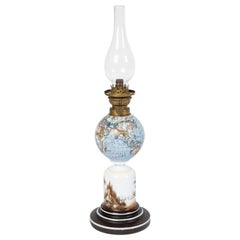
Oil Lamp with an Illuminating Globe Shade, circa 1885
Located in London, GB
A rare late 19th century oil lamp with a globe shade and base decorated with a castle set in a rural scene, circa 1885.
Northern Europe...
Category
Late 19th Century European Antique London Maps
Materials
Glass
Carl Adami 13 inch terrestrial globe, Berlin, dated 1900.
Located in London, GB
Carl Adami 13 inch terrestrial globe, by Dietrich Reimer, Berlin, Germany, 1900.
“C. ADAMI’S ERDGLODUS neu bearbeitet und gezichnet von H. KIEPERT. Dietrich Reimer, Berlin. 1900 (E....
Category
Late 19th Century German Antique London Maps
Materials
Brass
Related Items
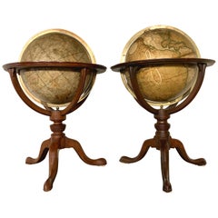
Pair of 19th Century English J & W Cary Celestial/Terrestrial Table Model Globes
By John & William Cary
Located in Milford, NH
A fine assembled pair of 12-inch English table model globes on stands manufactured by J & W. Cary, the left globe with cartouche labeled “The New Celestial Globe, on which are correc...
Category
Early 19th Century English Antique London Maps
Materials
Brass
$18,900 / set
H 25 in Dm 16.5 in
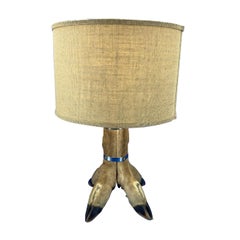
Table Lamp With 4 Tier Deer Hoof With Nickel Bands And Antler Finial
Located in Haddonfield, NJ
Mid-Century table lamp with 4-tier deer hoof with nickel bands and brass fitted antler finial.
Shade is not included.
Category
20th Century American Folk Art London Maps
Materials
Organic Material
Table Lamp with an Antique Porcupinefish Natural Taxidermy Specimen
Located in Auribeau sur Siagne, FR
Beautiful mood light featuring a rare and unusual antique marine natural taxidermy specimen of a porcupine fish. It belongs to the family Diodontidae, order Tetraodontiformes, and is...
Category
20th Century London Maps
Materials
Wood
$614 Sale Price
20% Off
H 7.09 in W 9.45 in D 7.88 in
Mid-Century World Map Globe Table Light or Lamp
Located in Miami, FL
Good quality world map globe lamp.
If you are looking for stylish and beautiful quality item to upgrade your interior (whether at home or in your office) then this Parisian globe...
Category
Mid-20th Century French Mid-Century Modern London Maps
Materials
Chrome
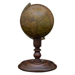
Antique Hammond's 6-Inch Terrestrial Globe on Stand
By C.S. Hammond & Co.
Located in Philadelphia, PA
Offered here for your consideration is, A fine antique 6-inch terrestrial globe.
Additional Details:
By C.S. Hammond & Co.
The globe likely dates from 1927 to 1930 due to the ...
Category
20th Century Unknown Art Deco London Maps
Materials
Wood, Paper
New York 'World's Fair' Bamboo Lamp with Parasol Shade by Christopher Tennant
By Tennant New York
Located in Brooklyn, NY
The World’s Fair Collection is a family of fixtures handmade from sustainably sourced materials and upcycled antique paper parasols given to visitors at ...
Category
2010s American Mid-Century Modern London Maps
Materials
Cement, Brass
19th Century German Miniature Pocket Terrestrial Globe
By C. Abel-Klinger
Located in Essex, MA
A miniature 19th century 3.5 inch diameter pocket terrestrial globe by C. Abel-Klinger, Nuremberg, Germany, in English for the English speaking markets. Signed with cartouche reading...
Category
1880s German Antique London Maps
Materials
Brass
Late Century Japanese Cast Aluminium Industrial Flameproof Table Lamp, Edison
By Kokosha, Industrial Production
Located in Leicester, Leicestershire
Reclaimed Kokosha aluminium flame proof ceiling light circa 1998, made by Kokosha of Osaka, Japan
Originating form super tankers and cargo ships this lamp has been expertly stripp...
Category
1990s Japanese Industrial London Maps
Materials
Aluminum
$442 / item
H 9.06 in Dm 9.06 in
French 19th Century Brass Altar Candlestick Lamp and Shade
Located in Baton Rouge, LA
An antique brass altar candlestick from 19th century France, that has been converted into an electrified lamp. This gorgeous fixture i...
Category
19th Century French Gothic Antique London Maps
Materials
Brass
One of a Kind Italian Pair Deco Modern Art Lamps with Cast Brass Carnival Masks
Located in New York, NY
1980s vintage Italian pair of very rare lamps, entirely handmade in cast polished brass, uniquely decorated with carnival masks in different sizes, each different from the other, rai...
Category
1980s Italian Folk Art Vintage London Maps
Materials
Brass, Metal
$5,200 / set
H 32.75 in Dm 16 in
Large and Extremely Rare Terrestrial Globe by Newton
By Newton Globes - Planer & Newton
Located in Lymington, Hampshire
A large and extremely rare 24-inch terrestrial globe by Newton
Our most magnificent and rare globes were a pair of 24-inch Newton globes.
These too were updated in 1852 (terre...
Category
Mid-19th Century English Antique London Maps
Materials
Mahogany
Circa 1880 Pair of Great Hand Carved Wood Winged Caryatids-Griffins Now as Lamps
Located in Lambertville, NJ
Circa 1880 pair of hand carved wood winged caryatids-griffins, now as table lamps
Architectural carvings from the Victorian age that have been electrified.
Great for those that are ...
Category
Late 19th Century English Antique London Maps
Materials
Oak
$4,800 / set
H 31 in W 9 in D 13 in
Previously Available Items
Desk Globe by Smith and Son, circa 1860
By Charles Smith & Son
Located in London, GB
A handsome Smith's terrestrial globe, circa 1835. Mounted on a brass semi-meridian that sits on a turned wooden upright and circular base. Printed in several colours, the globe compr...
Category
1860s British Antique London Maps
Materials
Brass
Pair of Philip & Son Globes, circa 1946
By George Philip & Son
Located in London, GB
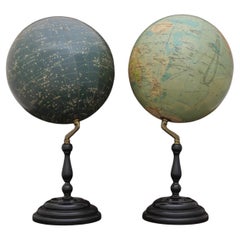
A wonderful set of Terrestrial and Celestial 12 inch globes by George Philip and Son. Presented on brass inclined plain mounts attached to original turned ebonized wooden bases and uprights with axes secured at the top by brass acorn finials. Unusually, the terrestrial globe has a copyright date shown under the cartouche, 1946.
The celestial globe is printed in beige against a dark blue background and shows the constellations and many named stars. Solid lines connect the stars within constellations rather than illustrating them as mythological and other figures.? A cartouche is present that includes the title and maker's address.
When looking at the stars from Earth the viewpoint is effectively inside a celestial sphere. The surface of a celestial globe shows the star field as a projection viewed from the outside and is therefore reversed, with the constellations appearing as their mirror images.
The terrestrial globe is printed in several colours and comprises of twelve coated lithographic paper gores with polar calottes over a twelve inch card sphere. The age of the globe has been confirmed by the political borders and named cities displayed. The globe is nicely detailed and has a grid network of parallels and meridians. It shows all the continents and countries as they were at the time it was printed and also indicates all the principal steamship routes with distances in nautical miles. The globe also has a printed Analemma - a diagram showing the declination of the Sun for every day in the year and the equation of time. The Analemma therefore shows the position of the Sun in the sky as seen from a fixed location on Earth at the same mean solar time, as the sun's position varies over the course of a year. A cartouche is present that includes the title and maker's address.
Dimensions of each globe: 30.5 cm/12 inches (diameter) x 59 cm/23 1/4 inches (max height).
George Philip, (1800–1882) was a cartographer and map publisher. He founded George Philip & Sons in 1834 in Liverpool primarily as a bookseller and stationer, but rapidly expanding to become a publisher of primarily maps, atlases and educational works. He had one son, also George (1823–1902), who was admitted to the business in 1848.
George senior was born in Huntly, Aberdeenshire and by 1819 he had become assistant to the Liverpool bookseller, William Grapel before going on to start his own business. He used cartographers (such as John Bartholomew the elder, August Petermann, and William Hughes) to produce maps on copper plates. Philip then had these printed and hand-coloured by his women tinters. The business expanded rapidly and by the time he produced his county maps of 1862 he was using machine...
Category
1940s British Vintage London Maps
Materials
Brass
Geographia 10 Inch Globe, circa 1955
By Geographia, Ltd.
Located in London, GB
A fine 10 inch terrestrial globe by Geographia of Fleet Street London. With chromed semi-meridian on a turned wooden upright and circular base that has an ebon...
Category
1950s British Vintage London Maps
Materials
Chrome
Philips' Terrestrial Globe, circa 1925
By George Philip & Son
Located in London, GB
An attractive terrestrial globe by George Philip and Son; circa 1925. Printed in several colours and mounted on a brass semi-meridian attached to original turned ebonized wooden base...
Category
1920s British Vintage London Maps
Materials
Gesso, Wood, Paper
Rare Sterling Silver Desk Globe by Mappin and Webb, 1969
By Mappin & Webb
Located in London, GB
A wonderful and rare 3¾ inch silver desk globe by Mappin and Webb of London mounted on a silver and turned wood base. Hallmarked London 1969. The globe has lines of longitude and lat...
Category
1960s British Vintage London Maps
Materials
Sterling Silver
Geographia Globe, circa 1950
By Geographia, Ltd.
Located in London, GB
A splendid 10 inch terrestrial globe by Geographia of Fleet Street London. With brass semi-meridian on a turned wooden upright and circular base, circa 1950.
Dimensions: 25.5 cm/1...
Category
1950s English Vintage London Maps
Materials
Brass
Leather Cased Set of Maps of England and Wales, circa 1920
By E. Stanford
Located in London, GB
A pigskin leather case with ‘fish-tail’ handle containing a complete series of Bartholomew's 2 miles to an inch scale, linen backed maps for England and Wales by Edward Stanford of L...
Category
1920s English Vintage London Maps
Materials
Metal
British Empire Educational Globe, circa 1890
By Charles Smith & Son
Located in London, GB
A handsome 8 inch terrestrial globe by C. Smith and Son printed in several colors presented on original turned mahogany base and upright, with brass mounting and secured with an acorn finial; circa 1890. The globe comprises of twelve coated lithographic paper gores over an 8 inch sphere of gesso. The age of the globe has been identified by the political borders and cities displayed: Persia, Congo Free State, Constantinople, and St. Petersburg are all visible. This nicely aged, richly detailed globe, shows all the continents and countries as they were at the time and also indicates all the major ocean currents, connecting currents and the Antarctic & South East Trade Wind Drifts. Very well preserved, the original Stand is also in excellent condition. Charles Smith was a noted stationer, map and globe seller in...
Category
1890s English Antique London Maps
Materials
Wood, Paper
Georgian Mahogany Waywiser by Richard Glynne of London, circa 1725
Located in London, GB
A mahogany Waywiser by Richard Glynne of Fleet Street, London, circa 1725.
Diameter of wheel: 31 1/2 inches - 80 cm.
With modern display stand.
The brass dial is graduated...
Category
Early 18th Century English Georgian Antique London Maps
Materials
Mahogany
Huge John Rocque Map of London 1746, Republished By Harry Margary
Located in London, GB
Late twentieth century Harry Margary republication of John Rocque's celebrated map of 1746, 'A plan of the cities of London and Westminster and borough of Southwark'.
Twenty-four framed sheets, in excellent condition, overall dimensions when presented in a 'tight-hang', width 416cm, height 214.5. Each frame height 71.5cm, width 52cm.
John Rocque was of French Huguenot stock from Monosque in Provence and moved to London with his parents in the early eighteenth century. London at this time was an expanding city which had grown unchecked and had no new survey made since that of William Morgan...
Category
Late 20th Century British George II London Maps
Materials
Paper
John Senex Map of London in 1720
By John Senex
Located in London, GB
Plan of the City's of London, Westminster and Borough of Southwark, original antique map, published in 1720 by John Senex and engraved by Samuel Parker, hand coloured, with mount and...
Category
1720s British George II Antique London Maps
19th Century Map Imperial Court of Austria Habsburgs
Located in London, GB
This is an antique map of the State of the Imperial Court and the hereditary states of the House of Austria, with their various chancelleries, circa 1820.
The map is very detailed and shows the various branches of the Habsburgs territory.
It is very clean and in good condition and is in a beautiful gilded frame.
Provenance:
I bought this on my last buying trip to Madrid, and it bears the stamp, on the rear, of the " Libreria Margarita de Dios" of Madrid.
Condition:
In excellent condition, please see photos for confirmation of condition.
Dimensions in cm:
Height 61 x width 69.5 x depth 3
Dimensions in inches:
Height 2 feet, 0 inches x width 2 feet, 3 inches x depth 1 inch
The House of Habsburg, also spelled Hapsburg, was one of the most important royal houses of Europe. The throne of the Holy Roman Empire was continuously occupied by the Habsburgs between 1438 and 1740. The house also produced emperors and kings of the Kingdom of Bohemia, Kingdom of England, Kingdom of France, Kingdom of Germany, Kingdom of Hungary, Empire of Russia, Kingdom of Croatia, Second Mexican Empire...
Category
1820s Spanish Antique London Maps
Recently Viewed
View AllMore Ways To Browse
Buddha Torso
Burl Bombe Chest
Burlwood Commode
Cab Vase
Campaign Chest On Stand
Canape Plates
Carl Aubock Tray
Carl Aubock Wardrobe
Carpathian Elm Burl
Carved Oriental Chest
Cast Iron Angel
Cenedese Aquarium Murano
Ceramic Cheetah
Chalkware Sculptures
Champagne Holder Bucket
Charles Vetter
Cherry Picking
Chess Chairs
