New York Maps
to
3
25
5,465
195
23
2
4
2
1
1
1
7
6
10
2
4
4
3
1
1
18
9
5
3
2
14
10
10
5
2
25
25
25
1
1
1
1
1
Item Ships From: New York
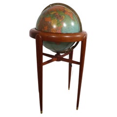
Floor Model Light Up Globe by Replogle Ca. 1950/1960's
By Replogle Globes
Located in New York, NY
Exceptional light up floor model globe, by Replogle Globes Inc. The globe is 16 in. in diameter, it features an interior light, and restrain a solid mahogany frame. This example is i...
Category
Mid-20th Century American Mid-Century Modern New York Maps
Materials
Glass, Mahogany, Paper
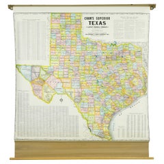
1850-1960 Cram's Superior Latest Federal Census Texas Map
By G. F. Cram Company
Located in New York, NY
The 1850-1960 Cram's Superior Latest Federal Census Texas Map, crafted from pine wood, steel, and canvas, is a valuable historical cartographic piece. Publi...
Category
1910s American Vintage New York Maps
Materials
Canvas
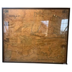
Framed Mid-19th Century Wall Map of Long Island, the Hamptons
Located in Sag Harbor, NY
A Framed museum quality find. This large wall map dates to the mid-1800s. Detailed inset maps of, Sag Harbor, East Hampton, Amagansett, Shelter Island and most villages in Long Island. It also has agriculture stats for 1855. Detailed prints of homes on Scuttle Hole in Bridgehampton as well as several other detailed prints. Lists of businesses, distance tables and railroad schedules and stops. The total amount of detailed information about Suffolk County Long Island is staggering. A unique rare New York map...
Category
Mid-19th Century American Antique New York Maps
Materials
Linen, Paper
$7,100 Sale Price
20% Off
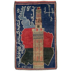
Vintage Afghan Pictorial Map Rug
Located in New York, NY
A vintage Afghan Pictorial map rug from the mid-20th century.
Measures: 3' 0" x 4' 10"
Category
Mid-20th Century Afghan Folk Art New York Maps
Materials
Wool
$660 Sale Price
20% Off
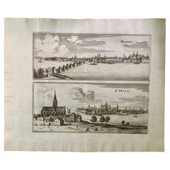
17th Century Topographical Engraving Nantes & St. Malo, France, by Iohan Peeters
Located in New York, NY
The ancient city of Saint Malo in North Western France has long been associated with adventure on the high seas, piracy and exploration. It was the birthplace of several important in...
Category
17th Century Dutch Antique New York Maps
Materials
Paper
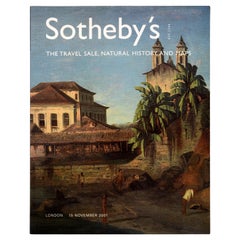
The Travel Sale: Natural History and Maps. November 2001: Sotheby's London
By Sotheby's
Located in valatie, NY
The Travel Sale: Natural History and Maps. November 2001: Sotheby's London. 1st Ed softcover. Lots 1-16; New Zealand 17-22; China Trade and Far East Asia 23-51; India 52-74; Africa 7...
Category
21st Century and Contemporary English New York Maps
Materials
Paper
Pair Antique Italian Maps of the North American Eastern Seaboard
Located in New York, NY
Pair antique Italian maps of the North American Eastern Seaboard. Late 18th early 19th century original Italian documentation of the East Coast of the United States from Passamaquadd...
Category
Late 18th Century Italian Antique New York Maps
Materials
Wood, Paper
Rare and Early Plaster Relief Map of Adirondack Mountains by F J H Merrill
By P.F. Howells, E. W. Merrill
Located in Buffalo, NY
Rare and Early Monumental Plaster Relief Map of Adirondack Mountains by The University of the State of New York, New York State Museum..F J H Merrill director,,,modeled by Howell's ...
Category
1910s American Industrial Vintage New York Maps
Materials
Plaster, Wood
Map of the Republic of Genoa
Located in New York, NY
Framed antique hand-coloured map of the Republic of Genoa including the duchies of Mantua, Modena, and Parma.
Europe, late 18th century.
Dimension: 25...
Category
Late 18th Century European Antique New York Maps
1950's Glass Globe Lamp, Denmark
Located in New York, NY
Danish Glass Globe Lamp, c. 1950's.
Can be lit with inner bulb.
Category
1950s Danish Mid-Century Modern Vintage New York Maps
Materials
Glass, Wood
Floor Model Terrestrial Globe Made in Germany by Dietrich Reimer Kiepert as is
By Heinrich Kiepert, Dietrich Reimers 1
Located in New York, NY
Impressive floor model globe Made in Germany Heinrich Kiepert, Dietrich Reimer c late 19th C / Early 20 C. The large ( 22" Dia. ) globe fits into the reeded oak column base, on a s...
Category
Late 19th Century German Victorian Antique New York Maps
Materials
Metal
Art Deco Cartoon Style Map of Paris possibly by Arthur Zaindenberg circa 1930's
By Arthur Zaidenberg
Located in New York, NY
Art Deco cartoon style map of Paris possibly by Arthur Zaidenberg. The map depicts witty references to Parisians lifestyle, along with drawings of notable landmarks, circa 1930's. T...
Category
1930s American Art Deco Vintage New York Maps
Materials
Paper
17th Century Topographical Map, French Champagne Region, Epernay, Iohan Peeters
Located in New York, NY
Fine topographical 17th century map by Iohan Peeters of the towns of Epernay and Lametz in the Champagne Region of North Eastern France.
Fabulous period engraving for a Wine Cellar,...
Category
17th Century Dutch Antique New York Maps
Materials
Paper
Antique Webber Costello Globe on Metal Tripod Base c 1900 / 1920's
Located in New York, NY
Rare floor model globe made by Weber Costello, circa 1900. The 12" globe rests on a folding metal base. This example is in very good, original condition, showing only light wear, nor...
Category
Early 20th Century American Industrial New York Maps
Materials
Metal
The Hudson, by Wallace Bruce, 1st Ed
Located in valatie, NY
The Hudson by Wallace Bruce. New York: Bryant Literary Union, 1894. 1st Ed hardcover. Illustrated by Alfred Fredericks. Alfred Frederick's photo-engravings ...
Category
1890s American Antique New York Maps
Materials
Paper
17th Century Toulouse, Savve, Sommieres Topographical Map by Iohan Peeters
Located in New York, NY
Fine topographical 17th century map of Toulouse, Savve and Sommieres by Iohan Peeters
Beautiful engraving of the capital of France's Occitanie Region, Toulouse, called La Ville Rose- the Pink City, for the terracotta bricks used in its many buildings, giving the city a distinct apricot-rose hue. An important cultural and educational center, the city's residents included Nobel Prize winners and world renown artists- Henri de Toulouse-Lautrec, Henri Martin, Jean-Auguste-Dominique Ingres, Antonin Mercie, Alexandre Falguiere and more recently Cyril Kongo...
Category
17th Century Dutch Antique New York Maps
Materials
Paper
17th Century Topographical Map, Champagne-Ardenne, Marsal, Maubert Iohan Peeters
Located in New York, NY
Fine topographical 17th century map by Iohan Peeters of Marsal and Maubert Fontaine in the Champagne-Ardennes Region of North Eastern France.
Fabulous period engraving for a Wine Ce...
Category
17th Century Dutch Antique New York Maps
Materials
Paper
Sotheby's The Wardington Library, Important Atlases and Geographies, Part 1 A-K
Located in valatie, NY
Sotheby's: The Wardington Library, Important Atlases and Geographies. Part One: A-K., London, 18 October 2005. 1st Ed hardcover catalog with 244 lots photographed in color and fully ...
Category
Early 2000s English New York Maps
Materials
Paper
1852 Geometrical Constructions Chart by C. W. Knudsen
Located in Garnerville, NY
Twenty two (22) meticulously rendered hand written and drawn geometrical constructions by C. W. Knudsen, circa 1952. The piece is inscribed in red lower left, C. W. Knudsen, August 1...
Category
1850s American Schoolhouse Antique New York Maps
Materials
Glass, Wood, Paper, Parchment Paper
$708 Sale Price
20% Off
Antique Map of Italy by Andriveau-Goujon, 1843
By Andriveau-Goujon
Located in New York, NY
Antique Map of Italy by Andriveau-Goujon, 1843. Map of Italy in two parts by Andriveau-Goujon for the Library of Prince Carini at Palazzo Carini i...
Category
1840s French Antique New York Maps
Materials
Linen, Paper
$3,350 / set
Vintage Framed United States Map
Located in Queens, NY
Vintage aged paper map of the United States mounted on particle board and framed in a simple wooden frame.
Category
20th Century American Mid-Century Modern New York Maps
Materials
Wood, Paper
17th Century Topographical Map of Cote D'azur, Avignon, Frejus by Iohan Peeters
Located in New York, NY
Fine topographical 17th century map by Iohan Peeters of the towns of Avignon and Frejus in the Cote d'Azur-Provence-Alpes Region of Southeastern France.
Beautifully suited decorativ...
Category
17th Century Dutch Antique New York Maps
Materials
Paper
Antique Map of Eastern Hemisphere from the collection of Thierry Despont
Located in New York, NY
Designed by Enrico Bonetti (E. Bonatti) and published by Francesco Vallardi Editore. Based on an earlier map by Evangelista Azzi (Ev. Azzi). Labeled as such at bottom edge of map.
T...
Category
Late 19th Century Italian Antique New York Maps
Materials
Canvas, Wood
Large Framed Map of the Mediterranean
Located in Queens, NY
Large map/chart chart of The Mediterranean and the Grecian Archipelago showing Italy, Sardinia, Corsica, part of France, etc. in a black frame.
Category
20th Century French Mid-Century Modern New York Maps
1918 American Frohse Anatomical Chart, A. J. Nystrom, Max Brodel Illustrator
By A.J. Nystrom & Co, Max Brödel
Located in Buffalo, NY
Antique American Frohse Anatomical pull down chart, by A. J. Nystrom, ,revised and augmented by Max Brodel illustrator... Amazing color, patina, age appropriate wear. dated 1918..
Max (Paul Heinrich) Brödel
1870-1941
Brödel, an illustrator and the first director of the Art as Applied to Medicine program at Johns Hopkins...
Category
1910s American Steampunk Vintage New York Maps
Materials
Wood, Paper
Related Items
The Estate of Jacqueline Kennedy Onassis, Sotheby's Catalogue (Book)
Located in North Yorkshire, GB
This is the hardback Sotheby's sale catalogue which was produced for the sale of the late first ladies possessions in April 1996.
The sale featured, furniture, paintings, jewellery, porcelain, letters, photographs and other Memorabilia from the time that she was first lady and married to President Kennedy. The sale total was in excess of $34 million.
In excellent condition and something that collectors of Kennedy memorabilia...
Category
20th Century New York Maps
Materials
Paper
Duke & Duchess of Windsor Sotheby's, (Book)
Located in North Yorkshire, GB
This is a three volume boxed set of sale catalogues which were produced by Sotheby's in 1999 for the disposal of the effects of the Duke and Duchess of Windsor. It ranges from large scale pieces of furniture from their homes in France to many personal items...
Category
20th Century New York Maps
Materials
Paper
Large Antique Map of the State of Texas, 1861
Located in Langweer, NL
Antique map titled 'Johnson's New Map of the State of Texas' Large map of Texas, shows railroads, wagon roads, the U.S. Mail Route, rivers, ports, ...
Category
Mid-19th Century American Antique New York Maps
Materials
Paper
Sotheby's New York Pre-Columbian Sales Catalog November 22, 1993
By Sotheby's
Located in Stamford, CT
Sotheby's New York Pre-Columbian sales catalogs with lavish color photos. An invaluable reference for the collector, scholar or anyone interested in Pre-Columbian art. These catalogs...
Category
1990s Pre-Columbian New York Maps
Materials
Paper
Replogle Terrestrial Floor Globe
By Replogle Globes
Located in Asbury Park, NJ
This floor globe by Replogle floats within a ring of walnut, supported by four 'turned' chrome stiles, which connect to a base of walnut. The ...
Category
1960s American Mid-Century Modern Vintage New York Maps
1960s Replogle 'Comprehensive' Illuminated Globe on Walnut Base
By Replogle Globes
Located in Brooklyn, NY
1960s Replogle 'Comprehensive' globe composed of paper gores over plastic with a cast aluminum half-meridian all mounted to a walnut base equipped with two upright dividers for paper...
Category
1960s American Mid-Century Modern Vintage New York Maps
Materials
Aluminum
1950s Replogle Mid-Century Modern Illuminated 10" Glass Globe with Atlas
By Replogle Globes
Located in St. Louis, MO
Replogle (Chicago, IL) 10" 'Precision' Globe was manufactured in the early 1950s by and edited by cartographer, Gustav Brueckmann. Composed of paper...
Category
1950s American Mid-Century Modern Vintage New York Maps
Materials
Brass
$775
H 14.75 in W 11.5 in D 10 in
1950s Replogle Glass Illuminated Precision Globe
By Replogle Globes
Located in Brooklyn, NY
This 10" 'Precision' Globe was manufactured in the early 1950s by Replogle (Chicago, IL) and edited by cartographer, Gustav Brueckmann. Composed of p...
Category
1950s American Mid-Century Modern Vintage New York Maps
Materials
Metal, Brass
Vintage Replogle Classical Mahogany Floor World Globe Signed C1940
Located in Big Flats, NY
***Reduced In-House Delivery Rates - Click on “Ask Seller” to Request a Quote***
Vintage Replogle Classical Mahogany Floor World Globe Signed C1940. ...
Category
20th Century New York Maps
Materials
Wood
$1,160 Sale Price
20% Off
H 38 in W 20 in D 20 in
Vintage Replogle World Globe On Stand
By Replogle Globes
Located in San Carlos, CA
For Sale: Vintage 1980s 16" Replogle World Globe on Wooden Stand
Discover a piece of history with this beautifully crafted vintage Replogle globe, perfect for any collector or world...
Category
1980s American Neoclassical Vintage New York Maps
Materials
Wood
Mid Century Modern 1970s Rotating Replogle World Globe with Brass Floor Stand
By Paul McCobb, Replogle Globes
Located in San Jose, CA
Vintage world map Replogle globe with stand in brass, circa 1970's. This piece rotates on a full swing meridian and displays plenty of vintage charm. The perfect accessory piece for ...
Category
1970s American Mid-Century Modern Vintage New York Maps
Materials
Brass
$1,475
H 35 in Dm 14.75 in
Fine Pair of Floor Globes by J & G Cary, Dated 1820 and 1833
By George & John Cary
Located in Lymington, Hampshire
A fine pair of 15 inch floor globes by J & G Cary, dated 1820 and 1833, each set into a mahogany stand with a vase shaped support and three legs centred on a compass, one with a labe...
Category
Early 19th Century English Regency Antique New York Maps
Materials
Mahogany
Previously Available Items
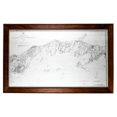
Framed Long Island Sound Map C. 1899
Located in Locust Valley, NY
Map of Long Island Sound with a rustic wood frame and nautical details for Connecticut and Long Island.
Category
Late 19th Century Antique New York Maps
Materials
Paper
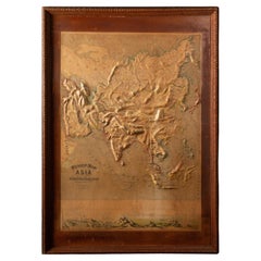
Early 20th C. Relief Maps: Asia Wood and Leather Frames
Located in New York, NY
This early 20th-century set of three relief maps offers a captivating glimpse into the geographical features of Asia. The maps, meticulously crafted, are elevated by their presentat...
Category
Early 20th Century American Victorian New York Maps
Materials
Leather, Wood, Paper
Pan American Airways 1952 World Route Map
By Pan American Airways
Located in New York, NY
World Route Map published in 1952 by Pan American World Airways and printed by Jeppesen and Company, showing the worldwide destinations on six continents ser...
Category
1950s American Mid-Century Modern Vintage New York Maps
Materials
Paper
Early 20th C. Relief Maps: Asia Wood and Leather Frames
Located in New York, NY
This early 20th-century set of three relief maps offers a captivating glimpse into the geographical features of South America, Asia, and Africa. The maps, meticulously crafted, are e...
Category
Early 20th Century American Victorian New York Maps
Materials
Leather, Wood, Paper
Impressive Early 20th C Hand Painted Globe
Located in Hudson, NY
This is a wonderfuly beautiful artistic rendering of a world globe. Dating to the earlier half of the 20th c but summoning an old world view of things. Far more stylistic than factua...
Category
Early 20th Century New York Maps
Materials
Brass
Mid Century Terrestrial Globe on Wooden Stand
Located in New York, NY
Mid Century Terrestrial Globe on Wooden Stand:
Measures: 23" x 23" x 33" H
Category
Mid-20th Century New York Maps
Materials
Wood
17th Century French Champagne Region, Mouzon & St. Menehould Map, Iohan Peeters
Located in New York, NY
Fine 17th Century engraved views of the towns of Mouzon and Sainte-Menehould in the Champagne Region of Northern France. Notably, Dom Perignon, the Benedictine monk associated with the discovery of Champagne, was born in Sainte-Menehould in 1638.
The double map showing finely detailed views of the towns including the grand Gothic Cathedral of Mouzon, fortified walls along the river, the famed so-called Castle Mound of Sainte Menehould with the striking historic town hall and bucolic pasture by the river with prancing horses and grazing cows.
Signed lower right Ioh. Peeters
Size: 15.38 inches by 12.38 inches
Condition: Excellent commensurate with age
European travel and culinary/libation interest.
Other maps of the French region of the same size and by the same engraver are available.
Excellent for Wine Cellar...
Category
17th Century Dutch Antique New York Maps
Materials
Paper
H 12.38 in W 15.38 in D 0 in
Large Antique 1859 Map of North America
Located in Sag Harbor, NY
This Map was made by Augustus Mitchell in 1859 It is in amazing condition for being 163 years old. This price is for the rolled up easy to ship version of this piece. I will be Frami...
Category
Mid-19th Century American Antique New York Maps
Materials
Canvas, Paper
Large Terrestrial and Celestial Globe with Astrological Signs, Circa 1970
Located in Plainview, NY
An exquisite late 20th century vintage large terrestrial and celestial globe with astrological signs displaying magnificent details ma...
Category
Late 20th Century American American Classical New York Maps
Materials
Mahogany, Paper
History of Old Kinderhook by Edward Augustus Collier
Located in valatie, NY
A History of Old Kinderhook by Edward Augustus Collier. G. P. Putnam's and Sons, NY, 1914 (original), reprinted by Higginson Book Co, MA. A reprinted hardcover. Including the Story o...
Category
1990s American New York Maps
Materials
Paper
1970s United Airlines Airport / Travel Agent Thermo-Plastic Sign, 3-Dimensional
By united airlines
Located in Buffalo, NY
1970s United Airlines Airport / Travel Agent Thermo-plastic sign (BLOW MOLD). Amazing 3-dimensional graphics depicting popular tourist travel destinati...
Category
1970s American Mid-Century Modern Vintage New York Maps
Materials
Plastic
H 29 in W 42 in D 2 in
Charles Darwin, Geological Observations on the Volcanic Islands, circa 1891
Located in valatie, NY
Geological Observations on the Volcanic Islands and Parts of South America visited during the Voyage of H.M.S. 'Beagle' by Charles Darwin. Appleton & Co...
Category
1890s English Antique New York Maps
Materials
Paper
H 7.75 in W 5.5 in D 1.75 in
Recently Viewed
View AllMore Ways To Browse
Staffordshire Cottages
Stone Griffin
Striped Chest Of Drawers
Sutherland Drop Leaf Table
Swedish Baroque Chest Of Drawers
Swedish Hanging Cabinet
Swedish Serpentine Commode
Teak Hairpin
Terracotta Horse Head
Thai Goddess
Tiffany Stained Glass Windows
Tiffany Studios Antiques
Tiffany Vase With Sterling Silver
Tiger Bowl
Tole Painting
Toyo Japan Vase
Travertine Elephant
Triangle Dish
