San Francisco Maps
to
5,466
195
6
1
2
3
1
1
1
4
1
1
1
3
3
2
1
1
6
6
6
Item Ships From: San Francisco
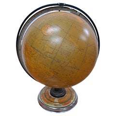
Cram's 16" Deluxe Globe W/Daily Sun Ray and Season Indicator
Located in San Francisco, CA
Cram's 16" Deluxe Globe W/Daily Sun Ray and Season Indicator
1936
Category
1930s Vintage San Francisco Maps
Materials
Metal
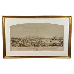
Early San Francisco View by Henry Firks Printed by W.H. Jones in 1849
Located in San Francisco, CA
A tinted lithographic view of San Francisco, made during the gold rush, showing a panoramic view of the bay's waterfront from the south along Montgomery Street to Telegraph Hill. The...
Category
Mid-19th Century American Victorian Antique San Francisco Maps
Materials
Paper
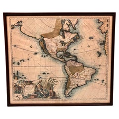
America Septentrionalis by Carroli Allard (1648-1709) Copper Plate Engraving
Located in San Francisco, CA
"Recentissuma Novi Orbis Sive Americae Septentrionale et Meriodionalis"
A hand-colored copper plate engraving of North and South America by Carel Allard depicting recent discoveries...
Category
Late 17th Century Dutch Antique San Francisco Maps
Materials
Paper
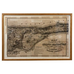
1868 Map of the Upper Part of the Island of Manhattan Above 86th Street
By Wm. Rogers Mfg. Co.
Located in San Francisco, CA
This wonderful piece of New York City history is over 150 years old. It depicts 86th street and above. It was lithographed by WC Rogers and company. It was made to show what was the Battle of Harlem during the Revolutionary war...
Category
1860s American American Colonial Antique San Francisco Maps
Materials
Paper
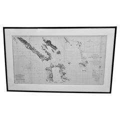
Scarce U.S. Coast Survey Map Depicting Entrance to San Francisco Bay Dated 1856
Located in San Francisco, CA
A fine example of the 1856 U.S. Coast lithographic survey nautical chart of the entrance to San Francisco bay and the city. Published in 1856 by the Office of the Coast Survey the of...
Category
Mid-19th Century American Antique San Francisco Maps
Materials
Paper
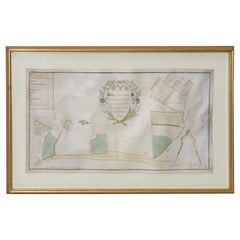
Mid-18th Century Hand Drawn English Farm Map on Vellum, circa 1740s
Located in San Francisco, CA
Mid-18th century hand drawn English farm map on Vellum circa 1740s
Henry Maxted & Isaac Terry, Surveyors.
A Map of a Farm in the Parish of Blean in the County of KENT: Belonging to Mrs Elizabeth Hodgson circa 1743.
A beautiful hand drawn map...
Category
Mid-18th Century English Antique San Francisco Maps
Materials
Lambskin
Related Items
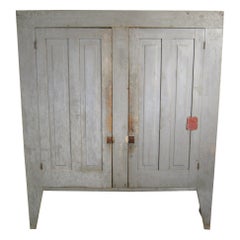
Primitive Cupboard Two-Door Farm House Jelly Rustic 19th Century
Located in Newfoundland, PA
Another wonderful early Rustic two-door original blue/gray cupboard with a great amount of storage space. It has four shelves inside. True antique pieces...
Category
Mid-19th Century American Rustic Antique San Francisco Maps
Materials
Pine
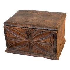
Early 18th Century Italian Carved and Dovetailed Walnut Alms Box
Located in San Francisco, CA
Early 18th century Italian carved and dovetailed walnut alms box, circa 1725
Large dovetails and old handwrought nails give this small scale box a hea...
Category
Early 18th Century Italian Baroque Antique San Francisco Maps
Materials
Iron
Antique American Flag w/ Hand-Written Inscriptions Mourning the Death of FDR
Located in York County, PA
48 STARS ON ANTIQUE AMERICAN FLAG WITH HAND-WRITTEN INSCRIPTIONS AND AN EMBROIDERED DATE OF APRIL 12TH, 1945, MOURNING THE DEATH OF PRESIDENT FRANKLIN DELANO ROOSEVELT:
American national parade flag with 48 stars, printed on cotton, embellished with hand-written inscriptions and an embroidered date to commemorate the death of FDR on April 12th, 1945.
“On this day in 1945, President Franklin D. Roosevelt died of a massive cerebral hemorrhage at his Warm Springs, Georgia, retreat at the age of 63. Roosevelt’s death in the final months of World War II was met with shock and grief throughout the Western world. Many Americans had no inkling of his decline in health. [He] had been president for more than 12 years, longer than any other person. He led the country through some of its greatest domestic and foreign crises to the impending defeat of Nazi Germany and within sight of Japan’s surrender...
Category
1940s American Vintage San Francisco Maps
Materials
Cotton
$4,500
H 19.5 in W 25.5 in D 2.5 in
Large and Extremely Rare Terrestrial Globe by Newton
By Newton Globes - Planer & Newton
Located in Lymington, Hampshire
A large and extremely rare 24-inch terrestrial globe by Newton
Our most magnificent and rare globes were a pair of 24-inch Newton globes.
These too were updated in 1852 (terre...
Category
Mid-19th Century English Antique San Francisco Maps
Materials
Mahogany
1950s Rare Marijuana Ashtray Bowl San Francisco Architect California SF
Located in Hyattsville, MD
Amazing 1950s sculptural ashtray created in the MCM period in San Francisco. Small studio craft, low numbers produced. Signed.
Category
1950s American Mid-Century Modern Vintage San Francisco Maps
Materials
Brass
$1,800
H 3 in W 6.38 in D 5 in
Pair 19th Century Victorian Eastlake Free Mason Throne Chairs w/ Symbolism
By Charles Locke Eastlake
Located in Savannah, GA
Victorian Eastlake large upholstered solid oak throne chairs from Masonic Lodge with lots of detailed carving. The pair consists of one with the plumb bob sy...
Category
1880s American Eastlake Antique San Francisco Maps
Materials
Velvet, Oak
$895 Sale Price / set
68% Off
H 67 in W 30 in D 26 in
Old Map of the Namibia and South Africa Coasts & Inset of Saldanha Bay, ca.1700
Located in Langweer, NL
Antique map titled 'Carte particuliere des Costes de l'Afrique'.
Map of the coasts of Namibia and South Africa. With an inset map of Saldanha Bay.
Artists and Engravers: Publ...
Category
Early 1700s Antique San Francisco Maps
Materials
Paper
$608 Sale Price
20% Off
H 24.81 in W 20.87 in D 0 in
Floor Standing Globe On A Turned Hardwood & Brass Stand Model No 16
By Cram's
Located in Reading, Berkshire
Crams Imperial World Globe
Floor Standing Globe On A Turned Hardwood & Brass Stand Model No 16
Manufactured by George F Cram Co. Indiana, U.S.A
Category
Early 20th Century American Victorian San Francisco Maps
Materials
Brass
$1,744
H 34.26 in W 15.75 in D 14.97 in
Vintage Cram’s Imperial 12 Inch Teaching World Globe 20thC
Located in Big Flats, NY
Vintage Cram’s Imperial 12 Inch Teacher's World Globe 20thC.
Measures - 17"H x 13.25"W x 13.5"D.
A vintage Cram’s Imperial 12-inch world globe from the 20th century. This globe...
Category
20th Century San Francisco Maps
Materials
Paper
$200 Sale Price
20% Off
H 17 in W 13.25 in D 13.5 in
Signed St Andrews Golf Print, Bobby Jones
Located in Oxfordshire, GB
Rare Bobby Jones Signed 1927 Open Golf Championship Picture.
An original 1930 limited edition lithograph titled "Robert Tyre Jones Jr. Winning the British Open Golf Championship". The colour lithograph print is one of 999 prints published, with copyright by Currier & Ives, Inc. It depicts Jones with his Calamity Jane...
Category
1920s American Sporting Art Vintage San Francisco Maps
Materials
Paper
Sun and Moon a Story of Astronomy, Photography and Cartography
Located in New York, NY
A unique pictorial history of astronomical exploration from the earliest Prehistoric observatories to the latest satellite images with 280 spectacular images and an inspiring story i...
Category
21st Century and Contemporary European San Francisco Maps
Materials
Paper
$80 / item
H 2.5 in W 11.13 in D 12.13 in
Thomas Babington Macaulay, The History Of England, 5 Vols., 1849
Located in Bridgeport, CT
London, Longman, Brown, Green and Longmans. Vols 1-V, Third Ed. Brown leather with gilt spines, leather and marbled boards. Marbled end papers, yellow edges. Includes:
Vol. 1, Third...
Category
19th Century English Victorian Antique San Francisco Maps
Materials
Paper
$440 / set
H 8.63 in W 6 in D 1.75 in
Previously Available Items
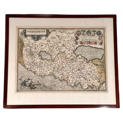
"Terra Sancta" Map of the Holy Land by Abraham Ortelius (1527-1598) Framed
By Abraham Ortelius
Located in San Francisco, CA
Abraham Ortelius (1527-1598) was a cartographer, geographer and map maker from Antwerp in the Spanish Netherlands. He created the first modern atlas, titled in Latin "Theatrum Orbis ...
Category
17th Century Belgian Baroque Antique San Francisco Maps
Materials
Paper
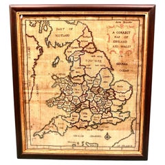
Silk Needlework Map of England and Wales Signed Anna Brewster Dated 1783
Located in San Francisco, CA
A charming silk needlework depiction of England and Wales executed in 1783 by Anna Brewster. This Georgian map sampler is signed and dated in the upper lef...
Category
Late 18th Century English Georgian Antique San Francisco Maps
Materials
Canvas, Silk
H 24.5 in W 21.5 in D 1.5 in
Mid-17th Century Birdseye View of Amsterdam Hand Colored Map, circa 1650
Located in San Francisco, CA
Mid-17th century bird’s-eye view of Amsterdam hand colored map, circa 1650
A fine old map with good color
Amsterdam was the one of the leading...
Category
Mid-17th Century Dutch Antique San Francisco Maps
Materials
Paper
Weber Costello Co. Political Reality Globe on Mahogany Pedestal Stand circa 1940
Located in San Francisco, CA
Weber Costello Co. political reality 16" globe on mahogany pedestal stand, circa 1940
Vintage globe on stand. The globe is in fine vintage ...
Category
Mid-20th Century American Mid-Century Modern San Francisco Maps
Materials
Wood
H 36 in W 17 in L 36 in
Rare Near & Middle East Map by G.W. Bacon & Co. LTD, London, circa 1880
Located in San Francisco, CA
Rare Near & Middle East Map by G.W. Bacon & Co. LTD, London circa 1880
Though the map is in it's original folded condition (see final pic), this wi...
Category
Late 19th Century English Antique San Francisco Maps
Materials
Paper
H 30.75 in W 40.75 in D 0.2 in
World Map by J.H. Colton 1860 Custom Framed with French Mat
Located in San Francisco, CA
A highly decorative colored engraving depicting the world published by J.H. Colton & Co. in 1860, the map beautifully hand colored and rendered. French matted and custom framed.
Category
Mid-19th Century American Antique San Francisco Maps
Bett's Portable Terrestrial Globe, London, circa 1920
Located in San Francisco, CA
Bett's portable terrestrial globe, London, circa 1920. Very fine and strong silk like cotton fabric with exceptionally fine detail and coloration. The sections of the globe are hand-...
Category
1920s English Victorian Vintage San Francisco Maps
Materials
Metal
French Map of the World Dated 1798 by J.A. Dezauche
Located in San Francisco, CA
An impressive large double hemisphere hand-colored copper engraved world map with the title in ribbon form, a large sun with clouds across the top of the map and a decorative adverti...
Category
Mid-18th Century French Louis XVI Antique San Francisco Maps
Rare United States Coastal Survey Office Map
Located in San Francisco, CA
A rare United States coastal survey office map of the entrance to San Francisco Bay, California, dated 1856; lithograph on tissue; the large-scaled map charting...
Category
19th Century American Antique San Francisco Maps
Moll's Famous "Beaver Map"
Located in San Francisco, CA
MOLL, Herman. A New and Exact Map of the Dominions of the King of Great Britain... Containing Newfoundland, New Scotland, New England, New York, New Jersey, Pensilvania,(sic) Maryland, Virginia and Carolina. According to the Newest and most exact observations by Herman Moll Geographer. [London]: T. Bowles, John Bowles, and J. King, 1715.
Engraved map, on two joined sheets, hand-colored in outline, elaborate cartouche in lower center with dedication to the Honourable William Dowglass, five inset maps or scenes added in lower portion, including "A Map of the Improved Part of Carolina", "A Map of the Principal Part of North America", "A View of ye Industry of Beavers in Canada", "A Draught of ye Town and Harbour of Charles-Town", and a map of Louisiana...
Category
18th Century and Earlier English Antique San Francisco Maps
Map of Italy by Charles Francois Delamarche
By Charles Francois Delamarche
Located in San Francisco, CA
An attractive framed engraved map of Italy and surrounding areas by well-known French cartographer C.F. Delamarche, circa 1800.
Category
19th Century French Antique San Francisco Maps
1768 Map of Texas by Josef Antonio de Alzate y Ramirez
Located in San Francisco, CA
Map of Texas titled Nuevo Mapa Geografico de la America Septentrional by Josef Antonio de Alzate y Ramirez (1737-1799.) A corresponding member of the Fren...
Category
18th Century and Earlier Spanish Antique San Francisco Maps
Recently Viewed
View AllMore Ways To Browse
Armoire 6 Door
Arne Vodder Wall
Arne Wahl Iversen Rosewood
Art Deco Bulldog
Art Deco Record Cabinet
Arte Morbelli Italy
Artichoke Vase
Arts And Crafts Fireplace Screens
Arts And Crafts Oak Wardrobe
Asta Stromberg
Austin Art Deco
Baboon Sculpture
Bakelite Cocktail Shaker
Baker Fruitwood
Baker Furniture Dresser Burl
Bandaji Chest
Bar Cabinet Fridge
Bar Cart 30s
