Early 18th Century More Furniture and Collectibles

7
421
to
116
346
72
421
421
421
24
16
6
5
1
1
1
1
5,292
10,572
31,641
14,683
6,978
13,692
6,484
903
643
1,166
1,392
1,101
2,934
2,959
2,513
1,161
811
309
73
43
14
13
141
26
26
26
22
12
11
3
2
2
Period: Early 18th Century
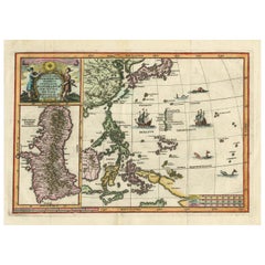
Antique Map of the Philippines and Guam by Scherer, circa 1702
Located in Langweer, NL
Antique map titled 'Nova et Vera Exhibitio Geographica Insularum Marianarum (..)'. Rare and very attractive map of the Mariana Islands, Philippines, Ko...
Category

Antique Early 18th Century More Furniture and Collectibles

Materials

Paper

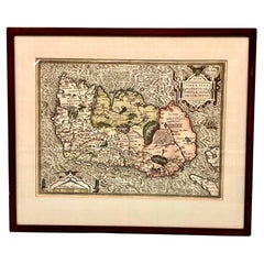
Map of Ireland Titled "Hiberniae Britannicae Insulae Nova Descriptio Irland"
Located in San Francisco, CA
Abraham Ortelius (1527-1598) was a cartographer, geographer and maker from Antwerp in the Spanish Netherlands. He created the first modern atlas titled in Latin Theatrum Orbis Terrar...
Category

Belgian Antique Early 18th Century More Furniture and Collectibles

Materials

Paper

Early 18th Century Russian Icon of St. Michael-Archangel of the Apocalypse
Located in Los Angeles, CA
A traditional Russian icon of St Michael-Archangel of the Apocalypse, with two saints on the borders (St. Nicholas on the left and St. Marina). On top of the icon amid the clouds app...
Category

Russian Antique Early 18th Century More Furniture and Collectibles

Materials

Wood

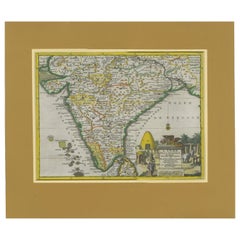
Antique Map of India during the height of the Mughal Imperial Expansion, 1713
Located in Langweer, NL
Antique map titled 'L'Inde de ca le Gange (..)'. Beautiful original antique map embracing most of India, made during the height of the Mughal imperial expansion. The map encompasses ...
Category

Antique Early 18th Century More Furniture and Collectibles

Materials

Paper

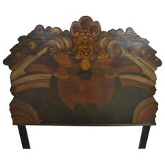
Medieval Style Painted Headboard
Located in Pomona, CA
This is a period headboard with a hand painted design in the medieval style. Shows great age on the reverse. Probably late 17th-early 18th century. Grea...
Category

English Antique Early 18th Century More Furniture and Collectibles

Materials

Wood

18th Century Carved And Painted Wooden Crucifix From France
Located in Haddonfield, NJ
An early 18th Century antique hand carved and polychromed hand painted table crucifix from France with its original patina preserved. This crucifix could possible date back as early ...
Category

French Baroque Antique Early 18th Century More Furniture and Collectibles

Materials

Fruitwood

Original Antique Map of Canaan, Armenia, Syria, Mesopotamia and Arabia, 1709
Located in Langweer, NL
Antique map titled 'Descriptio Paradisi et Terrae Canaan'. Original antique map of Canaan, Armenia, Syria, Mesopotamia and Arabia. It displays the Middle East from the eastern Mediterranean Sea to the Persian Gulf...
Category

Antique Early 18th Century More Furniture and Collectibles

Materials

Paper

Panoramic Antique View of Bandar-Abbas 'Formerly Gamron, Persia' in Iran, 1714
Located in Langweer, NL
Antique print titled 'Gamron'. Panoramic view of the city of Bandar-Abbas (formerly Gamron) in Iran / Persia. This print originates from 'Reizen over Moskovie, door Persie en Indie' ...
Category

Antique Early 18th Century More Furniture and Collectibles

Materials

Paper

Italian 18th Century Gilt Bronze Reliefs Christ and Virgin Mary after Girardon
Located in Milan, IT
Pair of Gilt bronze reliefs of early 18th century, after François Girardon (1628-1715) The original model for these two profiles of the Virgin and Christ dates from 1691. These works...
Category

Italian Louis XIV Antique Early 18th Century More Furniture and Collectibles

Materials

Bronze

IMPORTANT PORTUGUESE ORATORY WITH CALVARY 18th Century
Located in Madrid, ES
IMPORTANT PORTUGUESE ORATORY WITH CALVARY 18th Century Portuguese, from the 18th century in carved Brazilian rosewood. Decoration with interrupted pediments, volutes, floral motifs...
Category

Portuguese Baroque Antique Early 18th Century More Furniture and Collectibles

Materials

Silver

Antique Map of the Straits of Gibraltar by J. Gascoyne, circa 1716
Located in Langweer, NL
Antique map titled 'A Chart of the Straits of Gibraltar'. This chart shows the tides running through the Straits of Gibraltar, between southern Spain and northern Africa. Tide tables...
Category

Antique Early 18th Century More Furniture and Collectibles

Materials

Paper

Spectacular Antique Original Engraving of a Town Plan of Jerusalem, 1708
Located in Langweer, NL
Description: Antique map titled 'Erster Abriss der Stadt Jerusalem wie sie Furnemblich zur Zeit des Hernn Christi beschaffen (..).' Spectacular town plan...
Category

Antique Early 18th Century More Furniture and Collectibles

Materials

Paper

Antique Map of the Holy Land with Picture Frame Border
Located in Langweer, NL
Antique map titled 'Terre Sainte Suivant les Nouvelles Observations (..)'. Original old map of the Holy Land with the picture frame border. The term "Holy Land" usually refers to a t...
Category

Antique Early 18th Century More Furniture and Collectibles

Materials

Paper

A GERMAN ANATOMICAL MODEL OF a PREGNANT WOMAN STEPHEN ZICK
Located in Madrid, ES
A GERMAN ANATOMICAL MODEL OF A PREGNANT WOMAN STEPHEN ZICK The woman with articulated arms, removable torso revealing internal organs, lying on a couch with cushion incised and modelled with simulated lace.On a later wood box. Stephen Zick was one of a dynasty of carvers active from the late 16th to the 18th century in Nuremberg, . Such models, as well as carved skulls, were conceived as teaching tools and were inspired by the drawings of Andrea Vesalius...
Category

Antique Early 18th Century More Furniture and Collectibles

Materials

Wood

Antique Map Eastern Mediterranean by D. Stoopendaal 'circa 1710'
Located in Langweer, NL
Antique map Middle East titled 'De Beschryving van de Reysen Pauli en van de Andere Apostelen'. Antique map of the Eastern Mediterranean with details of the travels by Apostle Paul...
Category

Dutch Antique Early 18th Century More Furniture and Collectibles

Materials

Paper

Old Engraved Map of the Middle East, Arabia and Part of Greece 'Cyprus', 1706
Located in Langweer, NL
Title: Antique map titled 'De Zee en Land-Reyse, van Ioh. Mildenhal en Cartwrigt na Persien en Mogol, opt spoor gevolgd'. Old map of the Middle East, also depicting part of Greece ...
Category

Antique Early 18th Century More Furniture and Collectibles

Materials

Paper

Map of Choromandel & Malabar, Incl Kerala, Tamil Nadu & Part of Sri Lanka, 1726
Located in Langweer, NL
Antique map titled 'Nieuwe kaart van Choromandel ende Malabar.' Original antique map of Southern India documenting the VOC's areas of influence. Included is Kerala, Tamil Nadu...
Category

Antique Early 18th Century More Furniture and Collectibles

Materials

Paper

Ancient World Map of Europe, Asia & Northern Africa with Ancient Names, 1725
Located in Langweer, NL
Antique map titled 'Geografische Kaarte van de Oude Weereld (..).' Original antique map of the ancient world depicting Europe, Asia, and northern Africa with ancient place names....
Category

Antique Early 18th Century More Furniture and Collectibles

Materials

Paper

Original Hand-colored Antique Map of the Southern Part of India
Located in Langweer, NL
Antique map titled 'Orarum Malabariae, Coromandelae &c Tabula Accuratissima - Carte des Cotes de Malabar et de Coromandel'. Beautiful map of the southern part of India. It focuses on...
Category

Antique Early 18th Century More Furniture and Collectibles

Materials

Paper

Antique World Map by P. Schenk '1706'
By Peter Schenk
Located in Langweer, NL
Antique map titled 'Diversa Orbis Terrae. Visu Incedente per Coluros Tropicorum, Ambos Ejus Polos, et Parciularis Sphaerae Zenith, in Planum Orthographica Projectio (..) Plat Ontwerp van verscheyde Aert-klooten (..)'. One of the earliest Dutch World Maps to focus on a more modern cartographic style, based on Carel Allard's map of 1696. This map represented a noteworthy shift from the traditional decorative Dutch 17th century maps where the margins would be full of classical mythological...
Category

Antique Early 18th Century More Furniture and Collectibles

Materials

Paper

Antique Map of the World in 12 Globe Gores by Scherer, 'circa 1702'
Located in Langweer, NL
Antique map titled 'Typus Totius Orbis Terraquei Geographice Delineatus, Et Ad Usum Globo Materiali Superinducendus'. Beautiful example of Scherer's map of the World, configured in 12 globe gores. California is shown as an island. Fascinating Northwest Passage...
Category

Antique Early 18th Century More Furniture and Collectibles

Materials

Paper

Original Antique Sea Chart of the Coastline from England to Gibraltar, ca.1700
Located in Langweer, NL
Antique map titled 'A Chart of the Sea-Coast from England to the Streights.' Original antique map showing the European coastline from the South of England (and North of France) to ...
Category

Antique Early 18th Century More Furniture and Collectibles

Materials

Paper

Antique Map of the Holy Land, Showing the Location of the Various Tribes
Located in Langweer, NL
Antique map titled 'Judaea seu Terra Sancta quae Hebraeorum sive Israelitarum (..)'. Map of The Holy Land, showing the location of the various tribes, in two kingdoms, Judah and Isra...
Category

Antique Early 18th Century More Furniture and Collectibles

Materials

Paper

Decorative Hand-Coloured Antique Map of the Four Irish Provinces, Ireland, c1718
Located in Langweer, NL
Title: Regni Hiberniae Accurata Tabula per Hermanum Moll Decorative map of the four Irish provinces, Ireland, 1718, by Christoph Weigel (with credit to Herman Moll), engraved by Mi...
Category

Antique Early 18th Century More Furniture and Collectibles

Materials

Paper

Early 18th Century Brussel Tapestry, Finely Woven, Red, Blue, Green, Silk & Wool
Located in Port Washington, NY
A handwoven Brussels tapestry of dancing peasants in a field with a boy playing jump rope and another with a bow and arrow. The foreground shows lush trees and scenery. The border c...
Category

Belgian Aubusson Antique Early 18th Century More Furniture and Collectibles

Materials

Wool

Old Original Map of Chormandel & Malabar, India & Ceylon, Now Sri Lanka, 1726
Located in Langweer, NL
Antique map titled 'Nieuwe Kaart van Choromandel ende Malabar'. Antique map depicting the southern part of India and the northern tip of Ceylon, Sri Lanka. This map originates from...
Category

Antique Early 18th Century More Furniture and Collectibles

Materials

Paper

Antique Map of Tartary, Also Showing the Great Wall of China
Located in Langweer, NL
Antique map titled 'Carte de Tartarie'. Detailed map of Tartary, consisting of the Eastern part of Russia, Central Asia, China and Korea, first published by Guillaume De L'Isle in 1706. The map extends from the Peninsula of Korea in the east to the Caspian and Black Seas. The Great Wall of China...
Category

Antique Early 18th Century More Furniture and Collectibles

Materials

Paper

Antique Engraving of Persepolis, a City Sacked by Alexander the Great, 1726
Located in Langweer, NL
Antique print titled 'Ruinen van 't Paleis van Darius, gelegen in 't oude Persepolis, door last van Alexander de Groote verbrandt (..)'. Persepolis was sacked by the troops of Al...
Category

Antique Early 18th Century More Furniture and Collectibles

Materials

Paper

JESUS CHRIST CRUCIFIED Indo-Portuguese sculpture from the 18th Century
Located in Madrid, ES
JESUS CHRIST CRUCIFIED Indo-Portuguese sculpture from the 18th Century in ivor..... The figure is represented in agony, with cendal draped around the waist. Cross in rosewood wood ...
Category

Portuguese Baroque Antique Early 18th Century More Furniture and Collectibles

Materials

Wood

Old Print of Aztec deities Vitzliputsli, Tlaloch or Tescalipuca, Mexico, 1723
Located in Langweer, NL
Antique print titled 'Vitzliputsli (..)'. Old print of the Aztec deities Vitzliputsli, Tlaloch or Tescalipuca. Also depicted are Mexican priests. Originates from 'Ceremonies et coutu...
Category

Antique Early 18th Century More Furniture and Collectibles

Materials

Paper

Antique Map of the British Isles by H. Chatelain, 1719
Located in Langweer, NL
Beautiful hand colored large format map of the British Isles, with large insets of the Eastern and Western Hemispheres and the coats of arms for Engl...
Category

Antique Early 18th Century More Furniture and Collectibles

Materials

Paper

Antique Map of Spain by N. de Fer, circa 1700
Located in Langweer, NL
Antique map of Spain and Portugal with a title cartouche. Nicolas de Fer was the youngest son of the Paris printer and publisher Antoine de Fer. At the ...
Category

Antique Early 18th Century More Furniture and Collectibles

Materials

Paper

Old Antique Map of the Banda Islands (Southeast), Indonesia & Northern Australia
Located in Langweer, NL
Original antique map titled 'Kaart van de Zuyd-Ooster Eylanden van Banda'. Important map of the seas and islands surrounding the Banda Islands, Indonesia, extending south to northern Australia, east to Papua New Guinea and north to Ceram. Published 1724-1726 by Joannes van Braam...
Category

Antique Early 18th Century More Furniture and Collectibles

Materials

Paper

Antique Map of Southeast Asia from Persia to the Timor Island, 1712
Located in Langweer, NL
Antique map titled 'A New Map of the East Indies'. Old map covering all of Southeast Asia from Persia to the Timor Island, inclusive of the modern day nations of India, Ceylon, T...
Category

Antique Early 18th Century More Furniture and Collectibles

Materials

Paper

Early 18th Century Map of Denmark in Old Coloring, Published in 1706
Located in Langweer, NL
Denmark. Schenk (Petrus), Dania Regnum Ducatus Holsatia. et Slesvicum Insulae Danicae et Provinciae Jutia Scania etc. Amsterdam, 1706, engraved reticulated map on thick paper with co...
Category

Antique Early 18th Century More Furniture and Collectibles

Materials

Paper

Antique Chart of the Banda Islands or The Spice Islands, Indonesia, 1726
Located in Langweer, NL
Antique map titled 'Nieuwe Caart der Eylanden van Banda'. Beautiful chart of the Banda Islands including Banda Api, Banda Neira, Banda Besar, Pulau Hatta (Rosengain), Pulau Ai an...
Category

Antique Early 18th Century More Furniture and Collectibles

Materials

Paper

Antique Map of America with California as an Island by Homann '1710'
Located in Langweer, NL
This antique map, titled "Totius Americae Septentrionalis et Meridionalis," represents a significant cartographic piece from 1710 by Johann Baptist Homann. Here's a description of this remarkable map: - **Title**: Totius Americae Septentrionalis et Meridionalis (...) - **Date**: Published in 1710 by Johann Baptist Homann. **Description**: This map is a first edition of Johann Baptiste Homann's map of America, and it is notable for several cartographic features and historical representations: 1. **California as an Island...
Category

Antique Early 18th Century More Furniture and Collectibles

Materials

Paper

Rare Town Plan of Jerusalem, Includes an Extensive Key to Locations etc, 1708
Located in Langweer, NL
Antique map titled 'Eigentliche Vorstellung der Statt Jerusalem und derselben umliegenden Gegenden zu Salomonis auch zu und kurtz nach Christi Zeiten.' Rare town plan...
Category

Antique Early 18th Century More Furniture and Collectibles

Materials

Paper

Antique Map of the Netherlands and Belgium by Homann, circa 1710
Located in Langweer, NL
Antique map titled 'Tabula Generalis Totius Belgii Provinciae XVII. Infer. Germaniae (..)'. Map of the Benelux countries by Johann Baptist Homann. Shows the area between the Seine es...
Category

German Antique Early 18th Century More Furniture and Collectibles

Materials

Paper

Antique Map of the Alsace Region of France by Schenk 'circa 1700'
Located in Langweer, NL
Antique map titled 'Superioris atque Inferioris Alsatiae'. Beautiful map of the Alsace region, from Basel in the south to Philipsburg in the north, centered on Strassburg. Published ...
Category

Antique Early 18th Century More Furniture and Collectibles

Materials

Paper

Antique Map of Greece and Crete, Rhodus and A Part of Asia Minor , ca. 1730
Located in Langweer, NL
Antique engraved map of Greece. Title: "GRÆCIÆ ANTIQUÆ Tabula Nova". Year: c. 1730. Coloured engraved map by G. Delisle of Greece and Part of the Aegean. Condition is good. Sm...
Category

Antique Early 18th Century More Furniture and Collectibles

Materials

Paper

Original Antique Map of England, Showing the Most Memorable Battles
Located in Langweer, NL
Antique map titled 'Carte d'Angleterre ou l'on fait observer les Batailes les plus Memorables de ce Royaume'. Original antique map of England, showing the most memorable battles. Thi...
Category

Antique Early 18th Century More Furniture and Collectibles

Materials

Paper

Antique Map of Ukraine, Bulgaria, Romania, Servia & Surroundings by N. Visscher
Located in Langweer, NL
Antique map titled 'Exactissima Tabula qua tam Danubii Fluvii Pars Inferior, a Belgrado Urbe usq ad ejus ostia, et minores in eum influentes, Fluvii quam Regiones adjacentes, ut Tran...
Category

Antique Early 18th Century More Furniture and Collectibles

Materials

Paper

Antique Double Hemisphere World Map with California as an Island, 1710
Located in Langweer, NL
Description: Antique map titled 'De Werelt Caart'. First state (out of three) antique double hemisphere world map from a Dutch bible by Cornelis D...
Category

Antique Early 18th Century More Furniture and Collectibles

Materials

Paper

Small Old Map Depicting the Banda Islands or the Spice Islands, Indonesia, 1706
Located in Langweer, NL
Antique map titled 'Isole di Banda Nelle Molucche'. Small old map depicting the Banda Islands, Indonesia. Artists and Engravers: Published by V.M. Coronelli in Venice, 1706.
Category

Antique Early 18th Century More Furniture and Collectibles

Materials

Paper

Antique Map of the Eastern Hemisphere by Valk & Chenk '1708'
Located in Langweer, NL
Antique map titled 'Hemispherium Orbis Antiqui, Cumzonis Circulis, Et Sity populorum Diverso'. Decorative example of Andreas Cellarius's map of the Eastern Hemisphere, illustrating with climatic zones ranging from Frigida Borealis to Torrida, with planetary details superimposed. The elaborate border includes fine scrollwork, numerous putti, and additional diagrams showing armillary spheres and climatic zones. Andreas Cellarius was born in 1596 in Neuhausen and educated in Heidelberg. He emigrated to Holland in the early 17th century and 1637 moved to Hoorn, where he became the rector of the Latin School. Cellarius' best known work is his Harmonia Macrocosmica, first issued in 1660 by Jan Jansson, as a supplement to Jansson's Atlas Novus. The work consists of a series of Celestial Charts...
Category

Antique Early 18th Century More Furniture and Collectibles

Materials

Paper

Sea Battle with the English Destroying French Ships in the Nine Year War, c.1700
Located in Langweer, NL
Antique print titled 'Abbildung der See-Schlacht, darinnen die Englisch und Hollandischen Siegreich gegen die Französische Flotta gestochen haben 1692'. Old print depicting the Action at La Hogue, 1692. The Action at La Hogue occurred during the pursuit by the English of the French fleet after the Battle of Barfleur on 19 May Old Style (29 May (New Style)), 1692, during the Nine Years' War. The pursuing English fleet, under the command of Admiral of the Fleet Edward Russell...
Category

Antique Early 18th Century More Furniture and Collectibles

Materials

Paper

Antique Map of Malabar Coast by Valentijn, 1726
Located in Langweer, NL
Untitled sea chart of the coast of Malabar, India. This print originates from 'Oud en Nieuw Oost-Indiën' by F. Valentijn.
Category

Dutch Antique Early 18th Century More Furniture and Collectibles

Materials

Paper

Rare Part of a Poem of the Battle of Ptolemy against Alexander the Great, 1721
Located in Langweer, NL
Antique print titled 'Mr. A. Alewyns dichtkundige uitbreiding over den Veldslag van Ptolomeus tegens Alexander (..)'. Antique print depicting the Battle of Ptolemy against Alexander the Great. This print originates from 't Groot waerelds tafereel, waar in de heilige en waereldsche geschiedenissen en veranderingen zedert de schepping des waerelds'. Artists and Engravers: Published by J...
Category

Antique Early 18th Century More Furniture and Collectibles

Materials

Paper

Large Antique Map of the City of Bremen and Surroundings, Germany
Located in Langweer, NL
Original antique map titled 'Prospect und Grundris der Keiserl Freyen Reichs und Ansee Stadt Bremen (..)'. This is a superb chart of the city of Bremen and the surrounding small vill...
Category

Antique Early 18th Century More Furniture and Collectibles

Materials

Paper

Antique Map of the Region of Venice, Italy by F. De Wit, circa 1700
Located in Langweer, NL
Antique map of the Dominion of Venice, extending from Stato di Milano and Genoa to Istria. Including Lake Garda, Venice and Istria.
Category

Antique Early 18th Century More Furniture and Collectibles

Materials

Paper

Procession of Horsemen and Cardinals During the Entrance of a New Pope, ca.1700
Located in Langweer, NL
Antique print titled 'Bezitneming van St. Jan te Lateranen, met de Plegtelykste Cavalcade'. Procession of horsemen and cardinals during the entrance of a new pope in the Saint John...
Category

Antique Early 18th Century More Furniture and Collectibles

Materials

Paper

Beautiful Original Print of The Creation of the World According to Moses, 1725
Located in Langweer, NL
Antique map, titled: 'De Schepping der Wereldt volgens de Beschryving van Mozes.' Two separate maps on one sheet showing the creation of the world according to Moses. The upper dep...
Category

Antique Early 18th Century More Furniture and Collectibles

Materials

Paper

Antique Map of Portugal by P. Schenk, circa 1700
Located in Langweer, NL
Antique map titled 'Portugalliae et Algarbia'. Striking example of Schenk's rare map of Portugal, with the coats of arms of Portugal, Algarbia and a Spanish sailing vessell in the ca...
Category

Antique Early 18th Century More Furniture and Collectibles

Materials

Paper

Antique Print of London with St. Paul's Cathedral Before the Fire, ca.1725
Located in Langweer, NL
Antique print London titled 'Londres, capitale de l'Angleterre'. Antique print of London with St. Paul's Cathedral (before the fire) in the...
Category

Antique Early 18th Century More Furniture and Collectibles

Materials

Paper

Old Map of the Namibia and South Africa Coasts & Inset of Saldanha Bay, ca.1700
Located in Langweer, NL
Antique map titled 'Carte particuliere des Costes de l'Afrique'. Map of the coasts of Namibia and South Africa. With an inset map of Saldanha Bay. Artists and Engravers: Publ...
Category

Antique Early 18th Century More Furniture and Collectibles

Materials

Paper

Nice Antique Map of Asia Minor, Turkey, circa 1718
Located in Langweer, NL
Antique map titled 'Antiquae Asiae Minoris & C. Tabula' by Philippo Talbor. This rare antique map is published by Edward Wells, circa 1718.
Category

Antique Early 18th Century More Furniture and Collectibles

Materials

Paper

Antique Map of the Region of Paris ‘France’ by H. Heirs, circa 1720
Located in Langweer, NL
Antique map titled 'Agri Parisiensis Tabula particularis, qua maxima Pars Insulae Franciae (..)'. Incredibly detailed map showing everything from tiny villages to forests, farmland, ...
Category

Antique Early 18th Century More Furniture and Collectibles

Materials

Paper

Read More

Pamela Shamshiri Shares the Secrets behind Her First-Ever Book and Its Effortlessly Cool Interiors

The sought-after designer worked with the team at Hoffman Creative to produce a monograph that beautifully showcases some of Studio Shamshiri's most inspiring projects.

Moroccan Artworks and Objects Take Center Stage in an Extraordinary Villa in Tangier

Italian writer and collector Umberto Pasti opens the doors to his remarkable cave of wonders in North Africa.

Montecito Has Drawn Royalty and Celebrities, and These Homes Are Proof of Its Allure

Hollywood A-listers, ex-pat aristocrats and art collectors and style setters of all stripes appreciate the allure of the coastal California hamlet — much on our minds after recent winter floods.

Whaam! Blam! Pow! — a New Book on Pop Art Packs a Punch

Publishing house Assouline and writer Julie Belcove have teamed up to trace the history of the genre, from Roy Lichtenstein, Andy Warhol and Yayoi Kusama to Mickalene Thomas and Jeff Koons.

The Sparkling Legacy of Tiffany & Co. Explained, One Jewel at a Time

A gorgeous new book celebrates — and memorializes — the iconic jeweler’s rich heritage.

What Makes a Gem-Encrusted Chess Set Worth $4 Million?

The world’s most opulent chess set, weighing in at 513 carats, is literally fit for a king and queen.

Tauba Auerbach’s Geometric Pop-Up Book Is Mighty Rare, Thanks to a Hurricane

This sculptural art book has an epic backstory of its own.

Step inside the Storied Mansions of Palm Beach’s Most Effervescent Architect

From Spanish-style courtyards to fanciful fountains, these acclaimed structures abound in surprising and elegant details.

Recently Viewed

View All