Items Similar to Carte de l'Ocean Atlantique - by F. A. de Varnhagen - 1865
Want more images or videos?
Request additional images or videos from the seller
1 of 5
Francisco Adolfo de VarnhagenCarte de l'Ocean Atlantique - by F. A. de Varnhagen - 18651865
1865
$331.87
£247.07
€280
CA$457.26
A$509.16
CHF 269.26
MX$6,196.16
NOK 3,394.03
SEK 3,197.67
DKK 2,131.51
About the Item
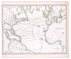
Bermuda Islands is an original black and white print realized in 1865.
Good conditions except for some light folds along the margin.
Original title "Carte de l'Océan Atlantique avec l'indication aproximative des voyages d'Amerígo Vespucci pour acompagner la collection de ses écrits par F. Ad. de Varnhagen - Iles Bermudes".
The artwork is from the book Amerígo Vespucci, Son caractère, ses écrits (même les moins authentiques), sa vie et ses navigations, avec une carte indiquant les routes, by Francisco Adolfo de Varnhagen, Visconde de Porto Seguro; Amerigo Vespucci and published in 1865.
This artwork is shipped from Italy. Under existing legislation, any artwork in Italy created over 70 years ago by an artist who has died requires a licence for export regardless of the work’s market price. The shipping may require additional handling days to require the licence according to the final destination of the artwork.
- Creator:Francisco Adolfo de Varnhagen (1816 - 1878)
- Creation Year:1865
- Dimensions:Height: 16.54 in (42 cm)Width: 13.39 in (34 cm)Depth: 0.04 in (1 mm)
- Medium:
- Period:
- Condition:Insurance may be requested by customers as additional service, contact us for more information.
- Gallery Location:Roma, IT
- Reference Number:Seller: M-1032371stDibs: LU65035005401
About the Seller
4.9
Platinum Seller
Premium sellers with a 4.7+ rating and 24-hour response times
1stDibs seller since 2017
7,646 sales on 1stDibs
Typical response time: 2 hours
- ShippingRetrieving quote...Shipping from: Roma, Italy
- Return Policy
Authenticity Guarantee
In the unlikely event there’s an issue with an item’s authenticity, contact us within 1 year for a full refund. DetailsMoney-Back Guarantee
If your item is not as described, is damaged in transit, or does not arrive, contact us within 7 days for a full refund. Details24-Hour Cancellation
You have a 24-hour grace period in which to reconsider your purchase, with no questions asked.Vetted Professional Sellers
Our world-class sellers must adhere to strict standards for service and quality, maintaining the integrity of our listings.Price-Match Guarantee
If you find that a seller listed the same item for a lower price elsewhere, we’ll match it.Trusted Global Delivery
Our best-in-class carrier network provides specialized shipping options worldwide, including custom delivery.More From This Seller
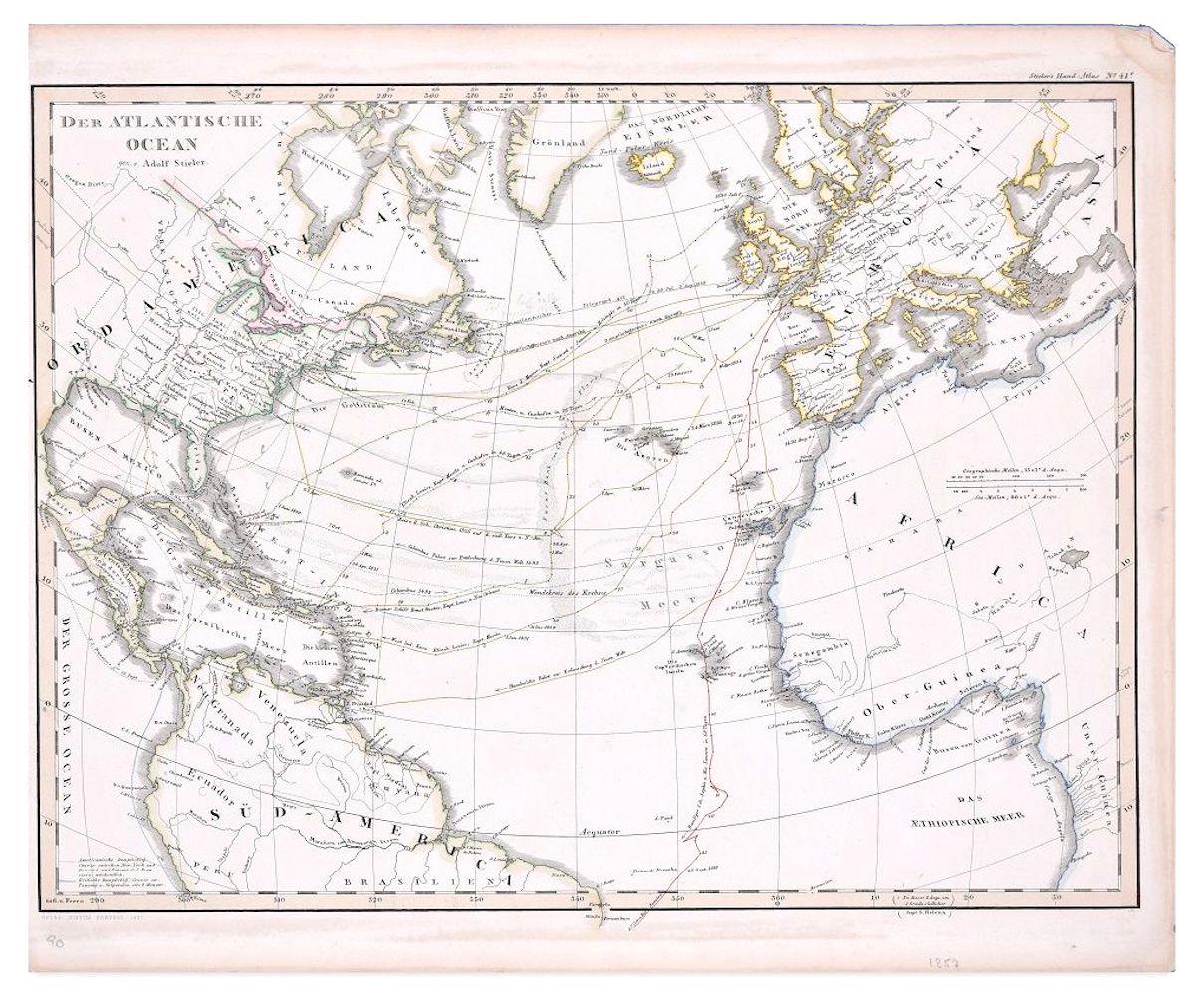
View AllThe Atlantic Ocean - Original Etching by A. Stieler - 1857
Located in Roma, IT
The Atlantic Ocean is an original colored print realized in 1857.
Hand-colored engraving made in Gotha (Germany) by Adolf Stieler.
Good conditions except for some light yellowing t...
Category
1950s Figurative Prints
Materials
Etching
Peche a la Sardine - Etching by Pierre-Émile Berthélemy - 1860s
Located in Roma, IT
Peche a la Sardine is a black and White etching realized by Pierre-Émile Berthélemy in the 1860s.
Titled in the lower.
Image size: 12 x 18, 12 x 18.
Very good impression with wid...
Category
1860s Modern Figurative Prints
Materials
Etching
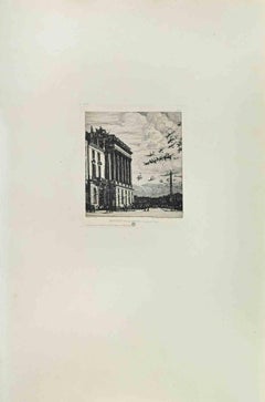
Ministère de la Marine - Etching by Charles Meryon - 1870s
By Charles Meryon
Located in Roma, IT
Ministere de la Marine is an artwork realized by Charles Meryon in the 1870s.
Etching.
Image size: 17x14
Good conditions.
Realized for the "Société des Aquafortistes. Born on th...
Category
1870s Modern Figurative Prints
Materials
Etching
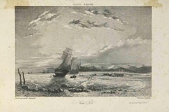
France Maritime - Lithograph by Camille Roqueplan - 19th century
Located in Roma, IT
France Maritime is an original print on paper realized by Camille Roqueplan in the mid-19th Century.
Signed on the plate and titled.
engraving.
Good conditions, with foxing.
Category
19th Century Modern Figurative Prints
Materials
Lithograph
Map of Campaign of 1814 - Etching by Pierre François Tardieu - 1837
Located in Roma, IT
Map of Campaign of 1814 is an Etching realized by Pierre François Tardieu in 1837.
Good conditions.
The artwork is realized in a well-balanced composition. the artwork and belongs ...
Category
1830s Modern Figurative Prints
Materials
Lithograph

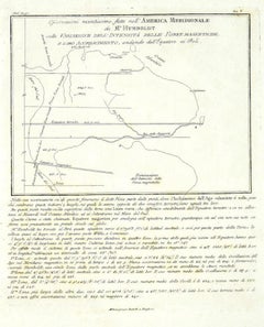
Map of South America - Original Etching - Late 19th Century
Located in Roma, IT
This Map of South America is an etching realized by an anonymous artist.
The state of preservation of the artwork is good with some small diffused stains.
Sheet dimension: 41.5 x 27
The artwork represents the map South America...
Category
Late 19th Century Modern Figurative Prints
Materials
Etching
You May Also Like
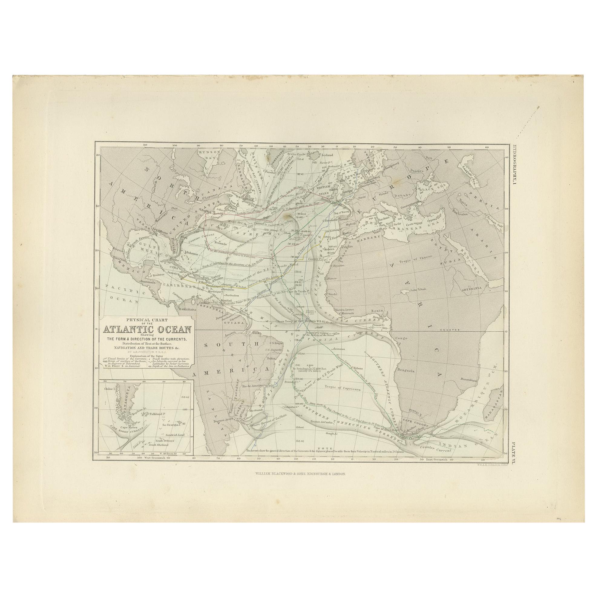
Antique Physical Chart of the Atlantic Ocean by Johnston '1850'
Located in Langweer, NL
Antique map titled 'Physical Chart of the Atlantic Ocean showing the form and direction of the currents'. Original antique chart of the Atlantic Ocean. This map originates from 'The ...
Category
Antique Mid-19th Century Maps
Materials
Paper

$189 Sale Price
20% Off
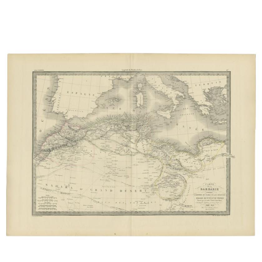
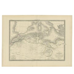
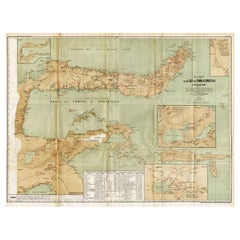
Antique Map of the Barbary Coast by Lapie, 1842
Located in Langweer, NL
Antique map titled 'Carte de la Barbarie contenant l'Empire de Maroc (..)'. Map of the Barbary Coast. This map originates from 'Atlas universel de géographie ancienne et moderne (..)...
Category
Antique 19th Century Maps
Materials
Paper
$231 Sale Price
20% Off
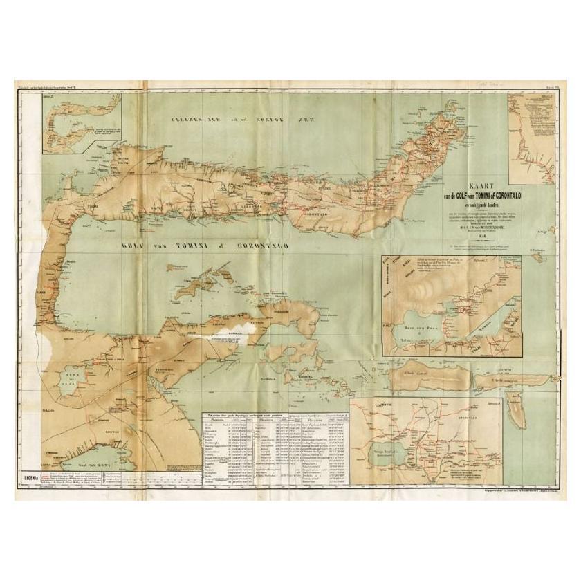
Antique Map of the Gulf of Tomini by Winkler Prins, 1878
Located in Langweer, NL
Antique map titled 'Kaart van de Golf van Tomini of Gorontalo.' (Map of the Gulf of Tomini or Gorontalo.) This map shows the Gulf of Tomini near the Island of Sulawesi, Indonesia. Wi...
Category
Antique 19th Century Maps
Materials
Paper
$175 Sale Price
20% Off
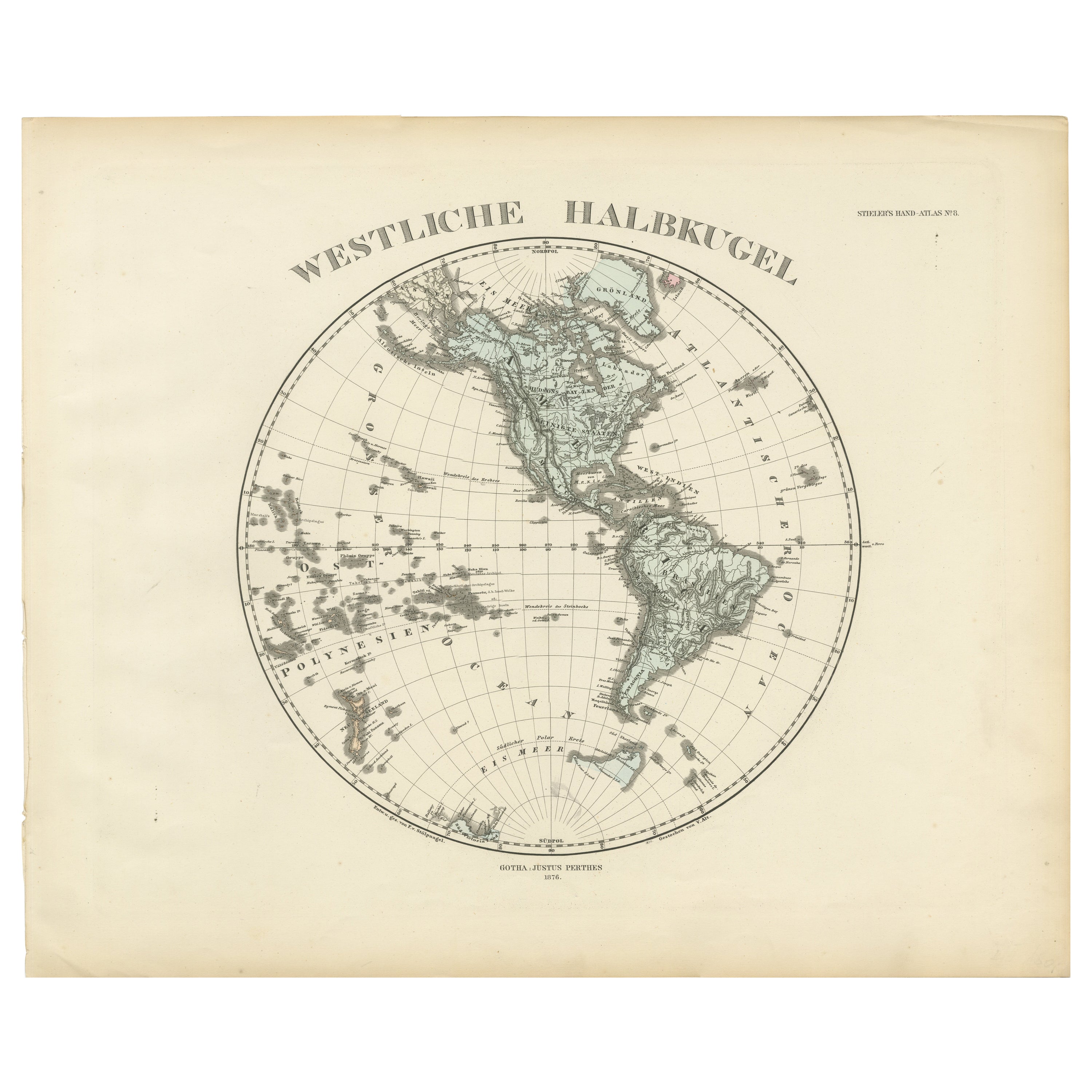
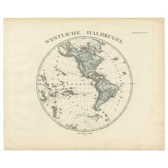
Western Hemisphere - 1876 Edition by Adolf Stieler, Published by Justus Perthes
Located in Langweer, NL
Map titled "Westliche Halbkugel" (Western Hemisphere), is a copperplate engraving from 1876 by Adolf Stieler, a renowned German cartographer. Here's an expanded analysis based on the...
Category
Antique 1870s Maps
Materials
Paper
$227 Sale Price
20% Off
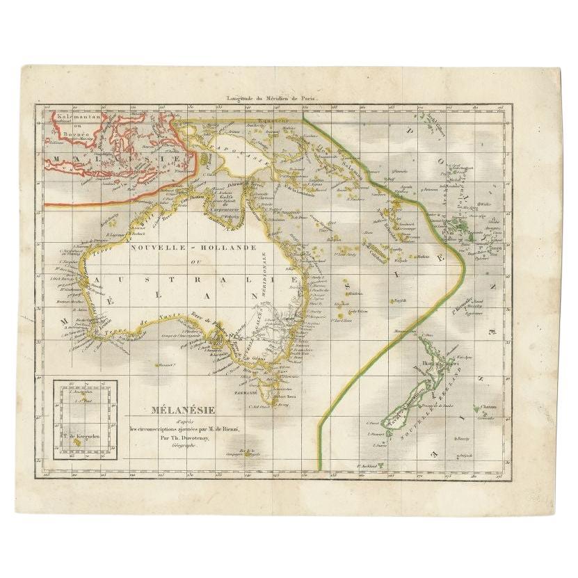
Antique Map of the Pacific Ocean by Rienzi, 1836
Located in Langweer, NL
Antique map titled 'Mélanésie'. Map of the Pacific ocean around Australia, including Java, Timor, the Solomon Islands and New Zealand. This print or...
Category
Antique 19th Century Maps
Materials
Paper

$93 Sale Price
20% Off
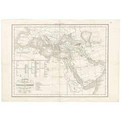
Géographie des Hébreux – Tableau de la Dispersion des Enfants de Noé, 1837
Located in Langweer, NL
Géographie des Hébreux – Tableau de la Dispersion des Enfants de Noé, 1837
This antique map, titled Géographie des Hébreux ou Tableau de la Dispersion des ...
Category
Antique Mid-19th Century French Maps
Materials
Paper
$227 Sale Price
20% Off