Items Similar to "Map and History of Peking" 1936, China Beijing Chromolithograph of City Temples

Want more images or videos?
Request additional images or videos from the seller
1 of 15
Frank Dorn"Map and History of Peking" 1936, China Beijing Chromolithograph of City Temples
$1,800
£1,374.67
€1,574.61
CA$2,567.81
A$2,798.68
CHF 1,457.43
MX$33,768.17
NOK 18,320.45
SEK 17,198.65
DKK 11,760.34
About the Item
A Map and History of Peiping; formerly known as Peking; capital of provinces, princedoms, and kingdoms since 1121 B.C.; in 1264 A.D. the capital of the Mongol Empire of Kublai Khan; made the capital of the Ming Empire and built as it is today by Yung Lo in 1421; continued as the capital of the Chinese Empire through the Ming and Ching Dynasties; and now a city which will live long in the memory of man as one of the greatest the world has ever known. Completed on this fifth day of February in the year of our Lord Nineteen Hundred and Thirty-six.
A viewer can lose themselves exploring the many charming depictions of civilized life in this "chromolithograph" or early color lithograph of Peking, now know as Beijing, China. An excellent specimen of the "Golden Age of Pictorial Cartography" that shows the old city walls and some surrounding lands.
The history, geography, and culture of the city is told through a bustling landscape of scenes featuring the city's inhabitants, historical figures, monuments, and activities. Featured landmarks include: The Old Execution Ground, the Eunuch's Cemetery, the Dog Temple, the Temple of Eighteen Hells, the Spider Pagoda, Black Dragon Pool, Yellow Temple, Alter of Earth, Taoist Temple, Alter of the Moon, The Great Wall, the Summer Palace, Drum Tower, Forbidden City, Legation Quarter, Temple of Heaven, Alter of Agriculture, Lien Hua Painting School, and many others. The city is inhabited by people demonstrating many activates and occupations, such as merchants, rickshaw operators, boxers, porters, soldiers, scholars, clergy, police, bicyclists, farmers, bankers, parents with children, water carriers, diners, warriors, travelers, worshipers, dancers, musicians, horse riders, and golfers, . The city also has many animals such as donkeys, camels, cats, sheep, dogs, elephants, horses, peacocks, doves, dragons, roosters, cattle, deer, lions, and geese. Land features include bright blue rivers and canals, green stands of trees, roads, railways, and bridges.
The outer border of the piece features a pictographic timeline of the city's history, and tells the story of its succession on rulers and political events. The border also illustrates funeral and wedding processions.
This color lithograph on paper is framed in a vintage, wood frame that resembles bamboo. No glass.
- Creator:Frank Dorn (1901 - 1981, American)
- Dimensions:Height: 30 in (76.2 cm)Width: 34 in (86.36 cm)
- Medium:
- Period:
- Condition:
- Gallery Location:Austin, TX
- Reference Number:Seller: BM-233541stDibs: LU1171216693162
About the Seller
4.9
Platinum Seller
Premium sellers with a 4.7+ rating and 24-hour response times
Established in 1964
1stDibs seller since 2019
136 sales on 1stDibs
Typical response time: <1 hour
- ShippingRetrieving quote...Shipping from: Austin, TX
- Return Policy
Authenticity Guarantee
In the unlikely event there’s an issue with an item’s authenticity, contact us within 1 year for a full refund. DetailsMoney-Back Guarantee
If your item is not as described, is damaged in transit, or does not arrive, contact us within 7 days for a full refund. Details24-Hour Cancellation
You have a 24-hour grace period in which to reconsider your purchase, with no questions asked.Vetted Professional Sellers
Our world-class sellers must adhere to strict standards for service and quality, maintaining the integrity of our listings.Price-Match Guarantee
If you find that a seller listed the same item for a lower price elsewhere, we’ll match it.Trusted Global Delivery
Our best-in-class carrier network provides specialized shipping options worldwide, including custom delivery.More From This Seller
View All"Village Hamlet" Color Lithograph on Paper of Coastal Village Town Square Houses
By Heshi Yu
Located in Austin, TX
Color Lithograph on Paper
Image Size: 27 x 22 in.
Frame Size: 29 x 36 in.
Signed in Pencil, Bottom Right
Numbered in Pencil, Bottom Left "77/150"
A cheerful and energetic scene of a...
Category
Mid-20th Century Neo-Expressionist Landscape Prints
Materials
Archival Paper, Lithograph
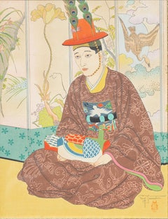
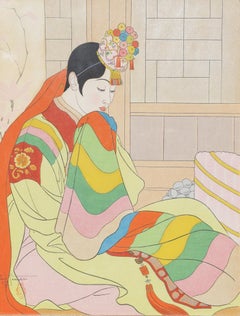
Paul Jacoulet Le Marie Seoul, Corée, Woodblock Print, 1950
By Paul Jacoulet
Located in Austin, TX
Paul Jacoulet ( France, Japan 1902 - 1960 )
Title: La Mariée Seoul, Corée
Medium: Woodblock Print
Size: 15.5 in. x 12 in.
Movemen...
Category
1950s Showa Prints and Multiples
Materials
Color, Lithograph
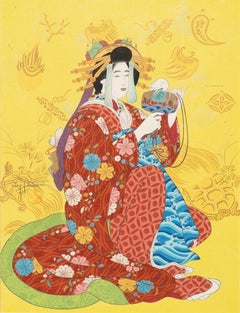
"Daikoku, Dieu de la Richesse" Japanese Style Woodblock Print
By Paul Jacoulet
Located in Austin, TX
A woodblock print of a Japanese geisha in elegant clothing against a yellow decorative background.
By Paul Jacoulet
15.5" x 12" Woodblock print on paper
Framed Size: 22.5" x 18.5"
...
Category
Mid-20th Century Figurative Prints
Materials
Paper, Woodcut
Paul Jacoulet Le Marie Seoul, Coriée, Woodblock Print, 1948
By Paul Jacoulet
Located in Austin, TX
Paul Jacoulet ( France, Japan 1902 - 1960 )
Title: La Mariée Seoul, Corée
Medium: Woodblock Print
Size: 15.5 in. x 12 in.
Movement: Showa
Markings: Si...
Category
1940s Figurative Prints
Materials
Woodcut
"Nobility" 180/300 Signed Color Serigraph of Abstract Horse and Woman with Lute
By Tiefeng Jiang
Located in Austin, TX
Serigraph on paper
Page Size: 12 x 12 in.
Gold Leaf Frame Size: 21 x 21 in.
Hand Signed, bottom right in black marker
Hand Numbered, bottom left in black marker "180/300"
This strik...
Category
1990s Pop Art Animal Prints
Materials
Archival Paper, Screen
"Green Farming" Japanese Landscape Woodblock Print
By Toshi Yoshida 1
Located in Austin, TX
Japanese woodblock print (etching) of a landscape by Toshi Yoshida
11" x 15" - Page Size
17 x 21.25 - Frame Size
Category
20th Century Landscape Prints
Materials
Etching
You May Also Like
China: An Original 18th Century Hand-colored Map by E. Bowen
Located in Alamo, CA
This is an original 18th century hand-colored map entitled "A New & Accurate Map of China, Drawn from Surveys made by the Jesuit Missionaries, by order of the Emperor. The whole bein...
Category
Mid-18th Century Old Masters Landscape Prints
Materials
Engraving

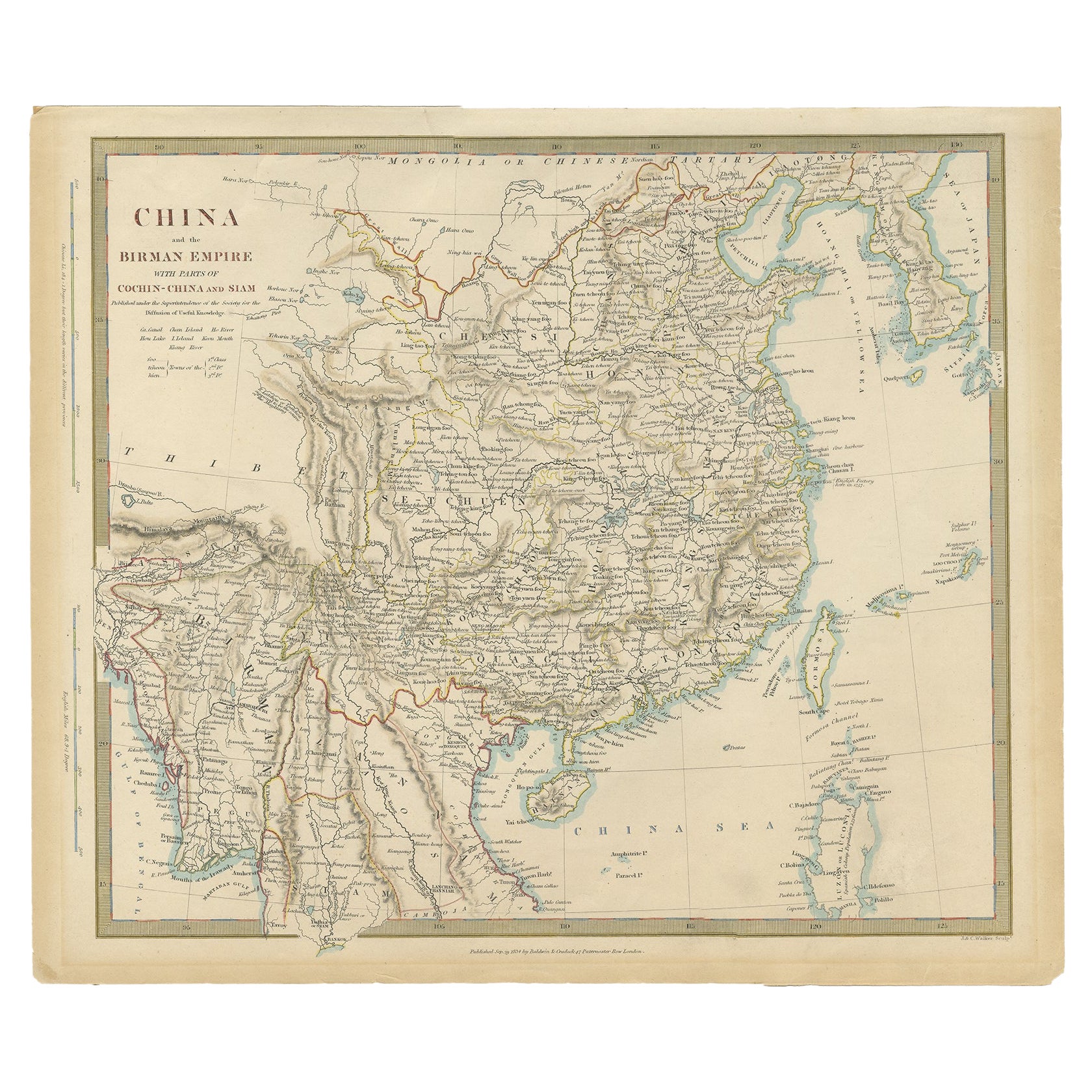
Antique Map of China, Also Depicting Formosa 'Taiwan' and Part of Korea, c.1840
Located in Langweer, NL
Antique map titled 'China'. Old map of China, also depicting Formosa (Taiwan) and part of Korea. Source unknown, to be determined.
Artists and Engravers: Anonymous.
Condition: ...
Category
Antique 19th Century Maps
Materials
Paper

$228 Sale Price
20% Off
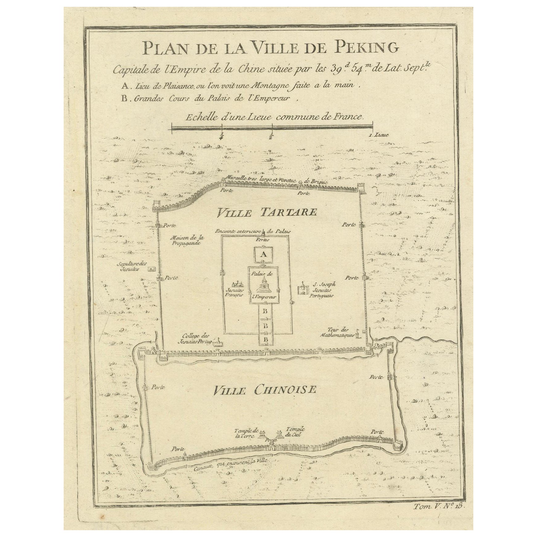
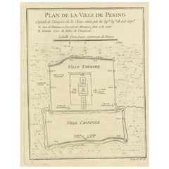
Beijing (Peking) Map with Tartar and Chinese Divisions & Jesuit Missions, 1754
Located in Langweer, NL
An antique map by Jacques Nicolas Bellin titled "Plan de la Ville de Peking Capitale de l'Empire de la Chine," published in Paris in 1754.
This finely engraved plan shows the detailed layout of the city of Peking (now known as Beijing), the capital of China. The map distinctly divides the city into the "Ville Tartare" (Tartar City) and "Ville Chinoise" (Chinese City), indicating the segregated living areas during that period. Notable features on the map include the Emperor's Palace and the French Jesuit and Portuguese Jesuit missions located in the Tartar City, as well as the Temples of the Earth and Sky marked in the Chinese City.
This kind of map is a valuable historical document, offering insight into the urban planning and social geography of Beijing in the mid-18th century. It reflects the European interest in the far reaches of the world during the age of exploration...
Category
Antique 1750s French Prints
Materials
Paper
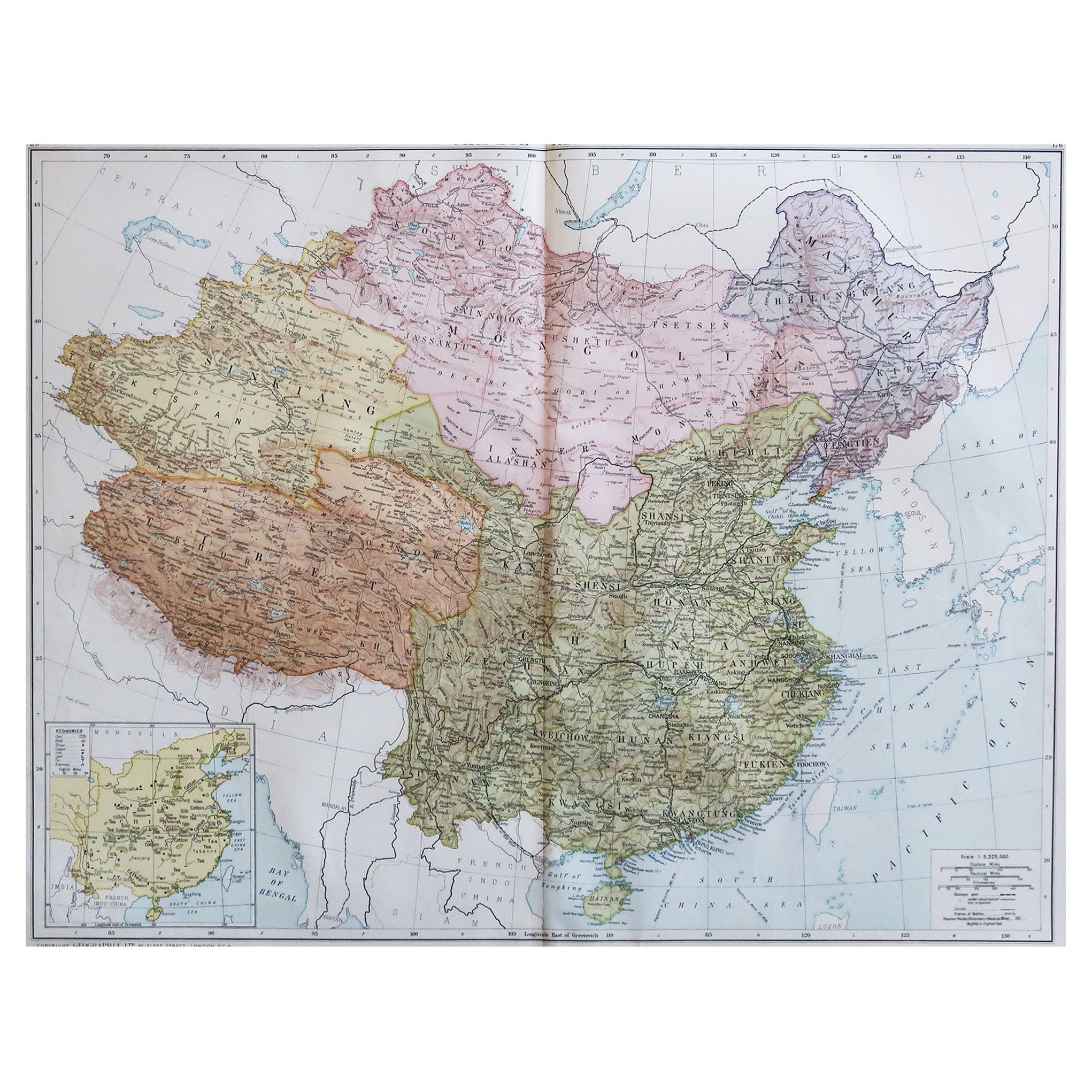
Large Original Vintage Map of China, circa 1920
Located in St Annes, Lancashire
Great map of China.
Original color. Good condition.
Published by Alexander Gross
Unframed.
Category
Vintage 1920s English Edwardian Maps
Materials
Paper

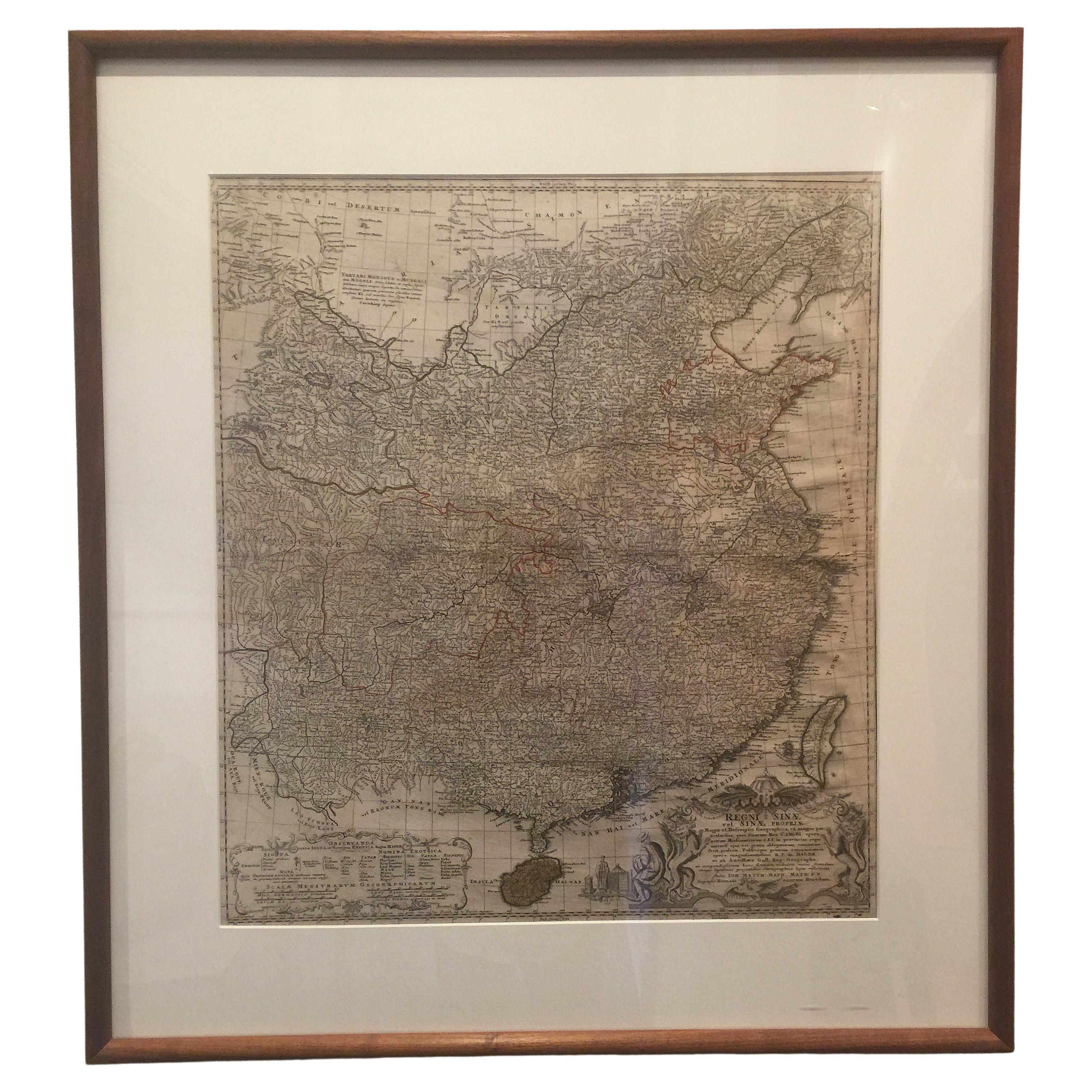
Framed Map of China
Located in Greenwich, CT
Map of China, 19th century. European print map of China
Conservation frame with walnut frame
Overall dimension : 28 1/2" wide 31" high 2" depth with fra...
Category
Antique 19th Century European Qing Prints
Materials
Paper

$3,800
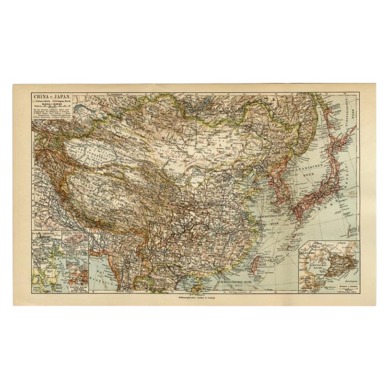
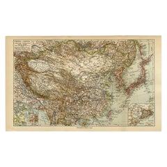
Antique Map of China and Japan by Meyer, 1895
Located in Langweer, NL
Antique map titled 'China und Japan'. Map of China, Mongolia, Taiwan and Japan. With an inset map of Jiaozhou Wan near Qingdao, and another of the region around Hongkong, including Kanton and Macau, with small plans of Hong Kong and Kanton. This map originates from a 1885-1907 edition of a famous German encyclopedia titled 'Meyers grosses Konversations-Lexikon', published in Leipzig and Vienna. Meyers Konversations-Lexikon was a major German encyclopedia that existed in various editions from 1839 until 1984, when it merged with the Brockhaus encyclopedia. Several of the plates were also used in Dutch Encyclopedia's like Winkler Prins...
Category
Antique 19th Century Maps
Materials
Paper
$80 Sale Price
20% Off