Items Similar to Map of Beijing (Peking) with Tartar and Chinese Divisions and Jesuit Missions
Want more images or videos?
Request additional images or videos from the seller
1 of 6
Map of Beijing (Peking) with Tartar and Chinese Divisions and Jesuit Missions
About the Item
An antique map by Jacques Nicolas Bellin titled "Plan de la Ville de Peking Capitale de l'Empire de la Chine," published in Paris in 1754.
This finely engraved plan shows the detailed layout of the city of Peking (now known as Beijing), the capital of China. The map distinctly divides the city into the "Ville Tartare" (Tartar City) and "Ville Chinoise" (Chinese City), indicating the segregated living areas during that period. Notable features on the map include the Emperor's Palace and the French Jesuit and Portuguese Jesuit missions located in the Tartar City, as well as the Temples of the Earth and Sky marked in the Chinese City.
This kind of map is a valuable historical document, offering insight into the urban planning and social geography of Beijing in the mid-18th century. It reflects the European interest in the far reaches of the world during the age of exploration and the importance of Jesuit missions in cultural exchanges between the West and China. The presence of religious missions on the map underscores the role of European powers in the spread of Christianity in China at the time.
- Dimensions:Height: 9.45 in (24 cm)Width: 7.56 in (19.2 cm)Depth: 0 in (0.02 mm)
- Materials and Techniques:Paper,Engraved
- Period:1750-1759
- Date of Manufacture:1754
- Condition:Good. General age-related toning and/or occasional minor defects from handling. Please study scan carefully.
- Seller Location:Langweer, NL
- Reference Number:
About the Seller
5.0
Platinum Seller
These expertly vetted sellers are 1stDibs' most experienced sellers and are rated highest by our customers.
Established in 2009
1stDibs seller since 2017
1,928 sales on 1stDibs
Typical response time: <1 hour
- ShippingRetrieving quote...Ships From: Langweer, Netherlands
- Return PolicyA return for this item may be initiated within 14 days of delivery.
More From This SellerView All
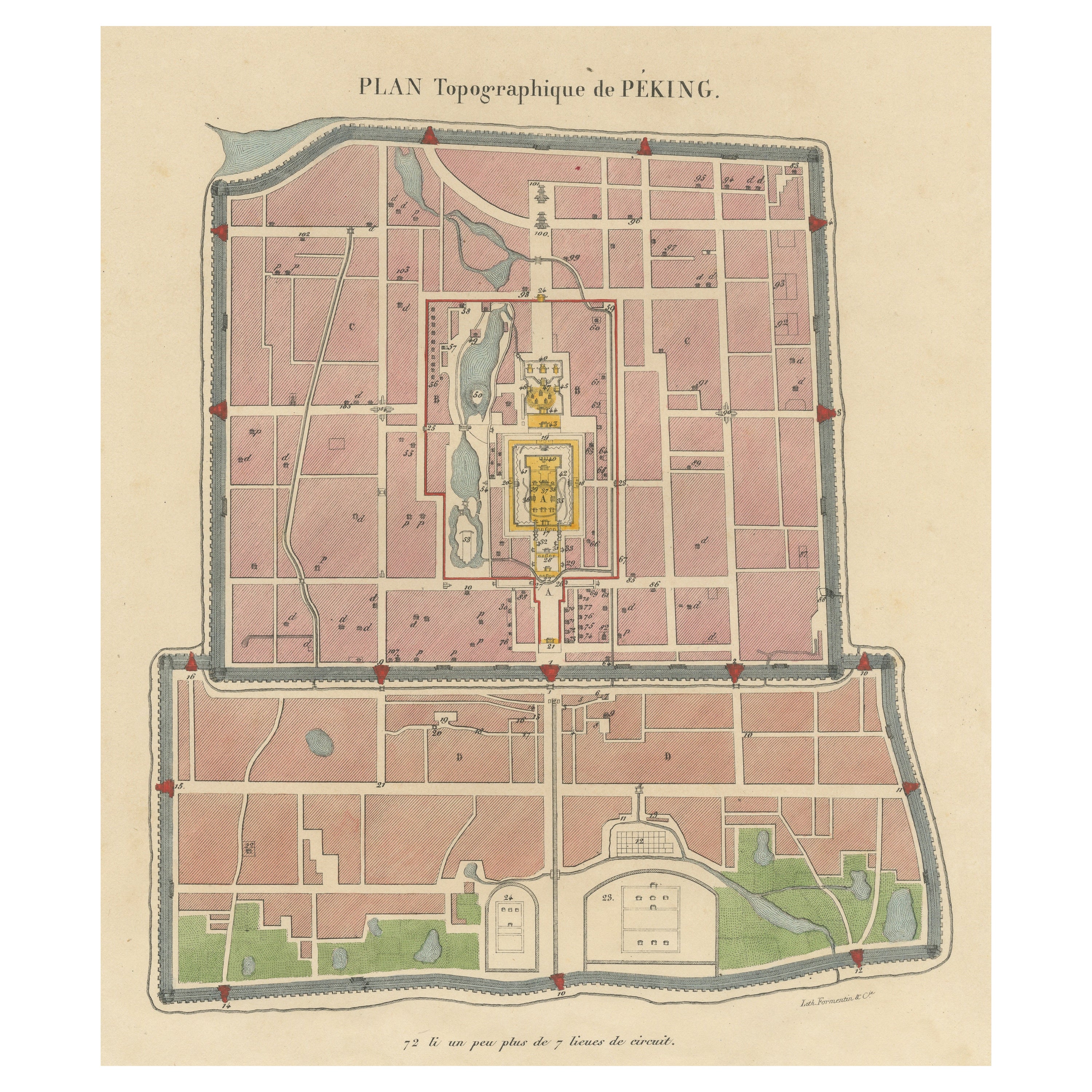
- Original Antique Street Plan of Peking, Beijing, ChinaLocated in Langweer, NLAntique print titled 'Plan topographique de Péking'. Plan of the city of Beijing, Peking, China. Published by Formentin & Cie, circa 1830.Category
Antique Mid-19th Century Prints
MaterialsPaper
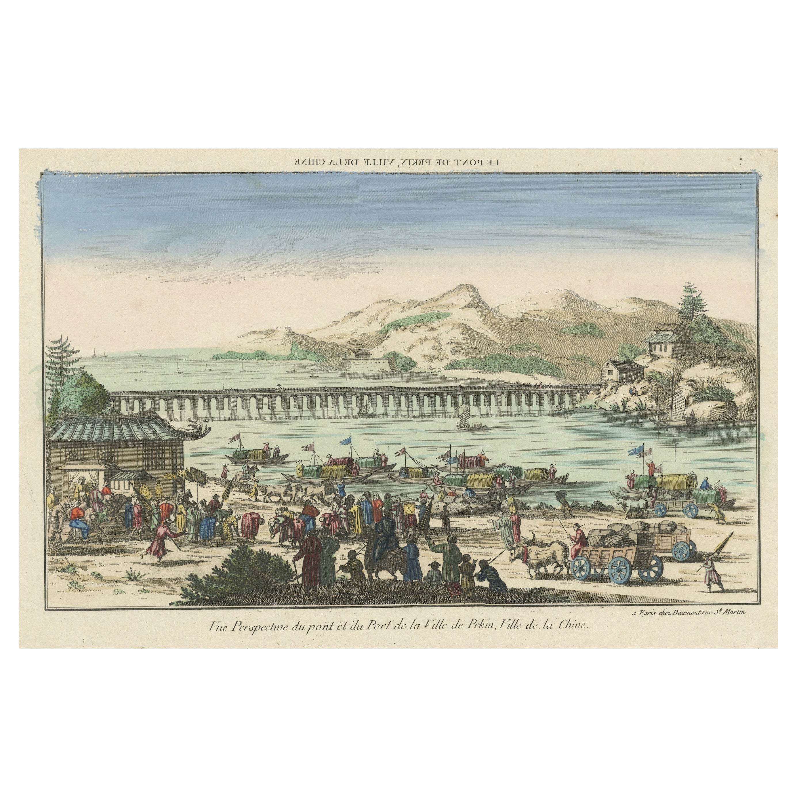
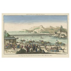
- Rare Early View of the Harbour of Peking or Beijing, Capital of ChinaLocated in Langweer, NLAntique print titled 'Vue Persepective du pont et du Port de la Ville de Pekin, Ville de la Chine'. Rare antique print of a bridge in Peking (Beijing), China. This is an optical prin...Category
Antique Late 18th Century Prints
MaterialsPaper
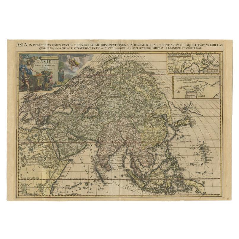
- Important and Scarce Antique Map of Asia from Jesuit Sources, C.1713Located in Langweer, NLAntique map titled 'L'Asie selon les nouvelles observations de Messrs de l'Academie des Sciences etc'. The main focus of this important and scarce map of Asia is the delineation of the northeast part of the continent from Jesuit sources. The northeast coast is severely truncated with the discoveries of Nicolas Witsen shown, and the partial coastlines of Jesso and Compagnies Land are depicted to the north of Japan. Inset in the North Pacific is a map of that same region based on the information from Father Martino Martini. It shows Jesso connected to the mainland with a narrow strait between it and a huge Compagnies Land. An inset below, taken from Father Ferdinand Verbiest, illustrates the road between Peking and Kirin and Nincrita. Father Verbiest's world map of 1674, which he compiled for the Chinese, subsequently led to the Jesuits obtaining a commission to make a comprehensive topographical...Category
Antique 18th Century Maps
MaterialsPaper
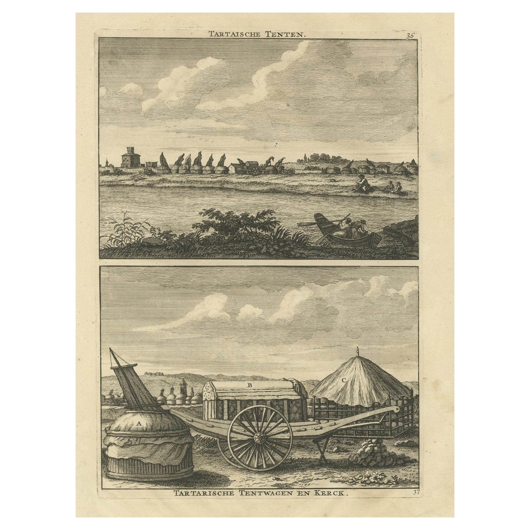
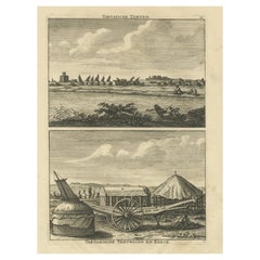
- Antique Print of Tartar Tents, Wagon and a Tartar Church, 1714Located in Langweer, NLAntique print titled 'Tartatsche Tenten - Tartarische Tentwagen en Kerck'. View of Tartar tents and a Tartar church. This print originates from 'Reizen over Moskovie, door Persie en ...Category
Antique 18th Century Prints
MaterialsPaper
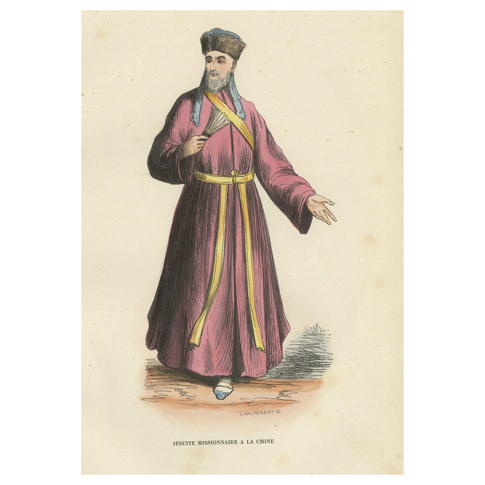
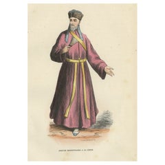
- Antique Print of a Jesuit Missionary in China, 1845Located in Langweer, NLAntique print titled 'Jesuite Missionnaire a la Chine'. Print of a Jesuit Missionary in China. This print originates from 'Histoire et Costumes des Ordres Religieux'. Artists and ...Category
Antique 19th Century Prints
MaterialsPaper
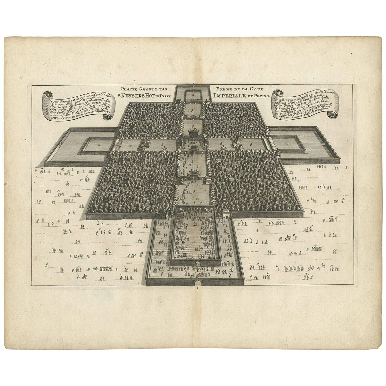
- Rare Antique Map of the Imperial Court in Peking China, 1665Located in Langweer, NLAntique print titled 'Platte Grondt van s Keysers Hof in Pekin. Forme de la Cour Imperiale de Peking'. This print originates from 'Joan Nieuhof, Het Gezands...Category
Antique Mid-17th Century Prints
MaterialsPaper


You May Also Like
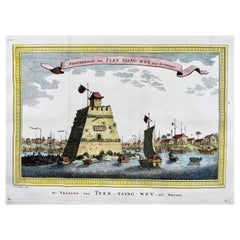
- Prevost; Schley, Fortress on the Beijing River, ChinaBy PrevostLocated in Norwich, GBForteresse de Tyen Tsing Wey, tiree de Nieuhof Published ca 1755. Fine hand colour. Rare original copper plate engraved antique print the Fortress (long ago demolished) guarding the cross roads of the meeting of the major rivers in Beijing (Peking) by Jakob van Schley - after Nieuhoff - in 1755 and published in Antoine François Prevost’s 15 volumes of Histoire Generale des Voyages written by Prevost & other authors between 1746-1789. Several major rivers, including the Yongding, Chaobai, Juma and Wenyu flow through Beijing Municipality. They originate in the highlands of Hebei and Shanxi, cut through the mountains west...Category
Antique 1750s Chinese Georgian Prints
MaterialsPaper
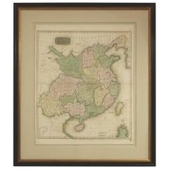
- Framed Early 19th Century Drawn and Engraved Map of ChinaBy John Knighton ThomsonLocated in San Francisco, CAHand drawn and tinted engraved map of China dated 1815 Created for Thomson's New General Atlas Edinburgh Beautifully framed with a linen covered mat.Category
Antique Early 19th Century European Prints
MaterialsPaper
- Original Antique Map of China by Thomas Clerk, 1817Located in St Annes, LancashireGreat map of China Copper-plate engraving Drawn and engraved by Thomas Clerk, Edinburgh. Published by Mackenzie And Dent, 1817 Unframed.Category
Antique 1810s English Maps
MaterialsPaper
- Geometric Map of Florence with Black Lacquered Frame Old Map ReproductionLocated in Scandicci, FlorenceGEOMETRIC PLAN OF THE CITY OF FLORENCE WHICH IS TRUE AS 1:4.500, showing expansions and urban planning changes. The entire print, reproduced on paper, is framed with a "window" struc...Category
21st Century and Contemporary Italian Prints
MaterialsWood, Paper
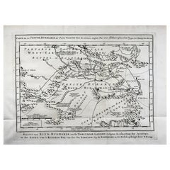
- Schley, Xinjiang Uygur Zizhiqu, Tien Shan, Sinkiang, Map of ChinaBy Jacques-Nicolas BellinLocated in Norwich, GBJ.V. Schley Carte de la petite Bukharie et pays voisins ; Kaart van Klyn-Bukharia, en de nabuurige landen Xinjiang Uygur Zizhiqu (China), Tien Shan, Sinkiang. Relief shown pict...Category
Antique 1740s Dutch Prints
MaterialsPaper
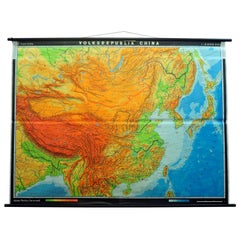
- Vintage Picture Poster Wall Chart Rollable Large Map Peoples Republic of ChinaLocated in Berghuelen, DEA vintage wall chart illustrating a map of people's republic of china. Used as teaching material in German schools. Colorful print on paper reinforce...Category
Late 20th Century German Country Prints
MaterialsCanvas, Wood, Paper