
Want more images or videos?
Request additional images or videos from the seller
1 of 10
Johannes JanssonPERUc. 1635
c. 1635
$600
£455.71
€526.50
CA$840.92
A$941.15
CHF 491.21
MX$11,477.17
NOK 6,286.79
SEK 5,951.25
DKK 3,929.21
Shipping
Retrieving quote...The 1stDibs Promise:
Authenticity Guarantee,
Money-Back Guarantee,
24-Hour Cancellation
About the Item
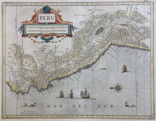
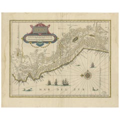
JOHANNES JANSSON (1588 - 1664)
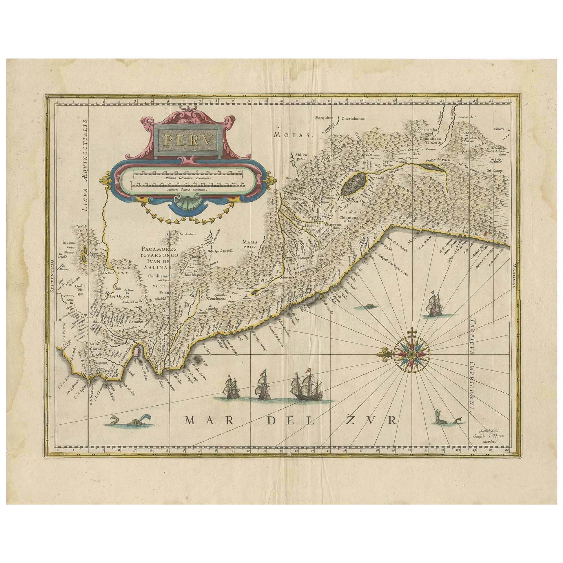
PERU, engraving with early coloring. Platemark 15 1/8 x 19 3/8 inches, sheet 17 x 20 1/2
A nice example of one of the earliest maps of Peru. From the Mercater / Hondius Atlas engraved in the lower left Amstelodami Apud Ioannem Ianffonium (Amsterdam the work of Johannes Jansson). Nice cartouche and with sailing ships and whales at the bottom. In generally good condition, the usual centerfold, some slight tone to the paper. Remains of a vertical fold to the right of the centerfold. French text verso.
Maps, Americana, South America, Gold, Exploration
- Creator:Johannes Jansson (1729 - 1784, Dutch)
- Creation Year:c. 1635
- Dimensions:Height: 15.125 in (38.42 cm)Width: 19.375 in (49.22 cm)
- Medium:
- Movement & Style:
- Period:1630-1639
- Condition:
- Gallery Location:Santa Monica, CA
- Reference Number:1stDibs: LU41138232782
Johannes Jansson
Jan Jansson or Johannes Janssonius (1588-1664) was born in Arnhem, Holland. His father was a printer and bookseller. In 1612 he married a Hondius daughter and became part of the prominent cartographic and publishing family business. He published his first map on his own in 1616. He partnered with his brother-in-law, the famous cartographer Henricus Hondius. They published their Atlas Major in eleven volumes. He also worked on newer editions of earlier Mercator/Hondius atlases. He published Jansson's English Country Maps in 1646. His brother-in-law continued the business following Jansson's death in 1664. Abraham Goos (1590-1643) was a Dutch engraver of maps, sea charts, and globes, based initially in Antwerp and later in Amsterdam. The majority of his work was on maps created by Joannes Jansson, Jocodus Hondius, and John Speed.
About the Seller
5.0
Recognized Seller
These prestigious sellers are industry leaders and represent the highest echelon for item quality and design.
Gold Seller
Premium sellers maintaining a 4.3+ rating and 24-hour response times
Established in 1977
1stDibs seller since 2016
289 sales on 1stDibs
Typical response time: 2 hours
Associations
International Fine Print Dealers Association
- ShippingRetrieving quote...Shipping from: Santa Monica, CA
- Return Policy
Authenticity Guarantee
In the unlikely event there’s an issue with an item’s authenticity, contact us within 1 year for a full refund. DetailsMoney-Back Guarantee
If your item is not as described, is damaged in transit, or does not arrive, contact us within 7 days for a full refund. Details24-Hour Cancellation
You have a 24-hour grace period in which to reconsider your purchase, with no questions asked.Vetted Professional Sellers
Our world-class sellers must adhere to strict standards for service and quality, maintaining the integrity of our listings.Price-Match Guarantee
If you find that a seller listed the same item for a lower price elsewhere, we’ll match it.Trusted Global Delivery
Our best-in-class carrier network provides specialized shipping options worldwide, including custom delivery.More From This Seller
View AllAMERICA
By John Speed
Located in Santa Monica, CA
IMPORTANT AMERICAN MAP - ONE OF THE FIRST TO SHOW CALIFORNIA as an ISLAND
JOHN SPEED (1552-1629)
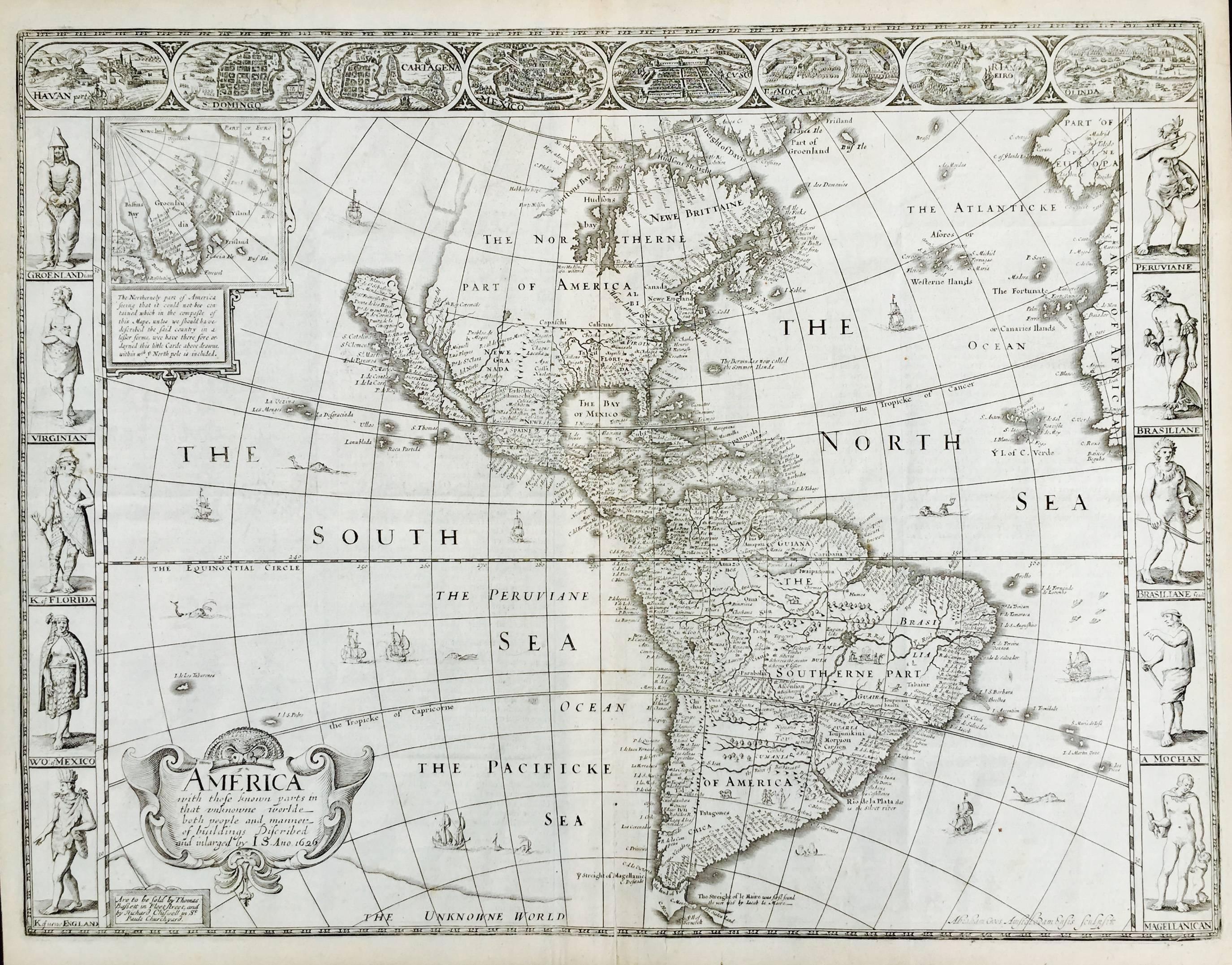
AMERICA - With Those Known Parts In That Unknown Worlde (sic),
1626-(76)
(Burden 217 iv/iv) Engraving, uncolored. Engraved by Abraham Goos and
published by Thomas Basset and Richard Chiswell - 4th state of 4 in 1676
15 1/8 x 20 1/2” From “A Prospect of the Most Famous Parts of the
World”. Generally good condition. A repaired split in lower centerfold. This
is the most common version of this important map...
Category
1620s Old Masters Landscape Prints
Materials
Engraving

$4,000 Sale Price
52% Off
AMERICAE - Sive Novi Orbis, Nova Descriptio
By Abraham Ortelius
Located in Santa Monica, CA
ABRAHAM ORTELIUS (1527 - 1598)
AMERICAE SIVE NOVI ORBIS, NOVA DESCRIPTIO, 1587 (1603) (Van Den Broecke 11, Burden 64; Schwartz & Ehrenberg 69)
Engraving. A very good, well printed...
Category
16th Century Old Masters Landscape Prints
Materials
Engraving

New Map of the Terraqueous Globe - WORLD MAP - CALIFORNIA AS AN ISLAND
By Edward Wells
Located in Santa Monica, CA
EDWARD WELLS (British 1667- 1727)
A NEW MAP of the TERRAQUEOUS GLOBE - according to the latest Discoveries and most general Divisions of it into CONTINENTS and OCEANS, 1700-01 (Shirley 609)
Engraved by Michael Burghers, Oxford. Hand-colored, Platemark 14 1/4 x 20 1/8 inches. Central cartouche flanked by figures representing the continents with dedication to William, Duke of Gloucester...
Category
Early 1700s Old Masters Landscape Prints
Materials
Engraving

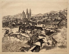
LIGHT AND SHADE TAXCO - J. T. Arms Mexican Masterpiece with Striking Detail
By John Taylor Arms
Located in Santa Monica, CA
JOHN TAYLOR ARMS (1887 – 1953)
LIGHT AND SHADE TAXCO, 1946 (F. 394: (#2 from the Mexican series.)
Etching and aquatint signed and dated in pencil. Image 10 ½ x 13 5/8, sheet 14 1/...
Category
1940s American Realist Landscape Prints
Materials
Etching
WORLD MAP - Planisphaerium Terrestre Sive Terrarum Orbis... 1696
By Carel Allard
Located in Santa Monica, CA
CAREL ALLARD (1648 – 1709)
PLANISPHAERIUM TERRESTRE SIVE TERRARUM ORBIS… 1696 (Shirley 578)
Engraving, 20 ½ x 23 ½”, sheet 21 x 24 1/8". A stunning double hemisphere World Map...
Category
17th Century Old Masters Landscape Prints
Materials
Engraving

16th c. woodcut map - Tabula Asiae Vlll
By Sebastian Münster
Located in Santa Monica, CA
SEBASTIAN MUNSTER (1488-1652)
ASIAE TABVLA Vlll 1540 (45)
Woodcut from Munster's edition of Geographia Universalis, Basel, Henri Petri. 1545 edit...
Category
16th Century Old Masters Landscape Prints
Materials
Woodcut

$950 Sale Price
29% Off
You May Also Like
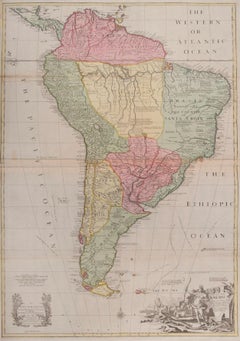
South America
By John Senex
Located in London, GB
South America
SENEX, John.
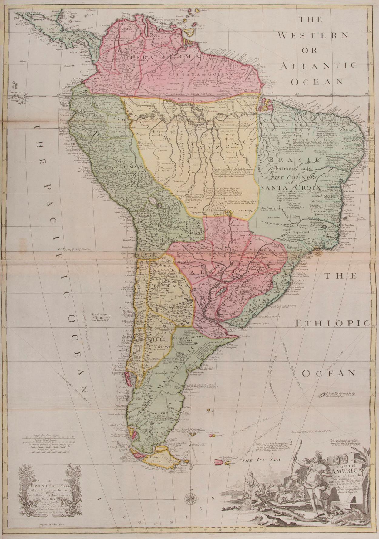
South America Corrected from the Observations Communicated to the Royal Society’s of London & Paris. By John Senex. To Edmund Halley. LLD. Savilian Professor of Geometry in Oxford and Fellow of the Royal Society. This Map corrected from His own Discoveries In gratefull Acknowledgement of his Ready assistance to Encourage this Designe is Humbly Dedicated.
John Senex, at the Globe against St Dunstans Church, Fleetstreet, London 1710 [-1728].
John Senex (1678-1740) was one of the foremost mapmakers in England in the early eighteenth century. He was also a surveyor, globemaker, and geographer. As a young man, he was apprenticed to Robert Clavell, a bookseller. He worked with several mapmakers over the course of his career, including Jeremiah Seller and Charles...
Category
1710s Naturalistic More Art
Materials
Watercolor, Engraving
$4,109
Antique Map of Peru by van der Aa, 'circa 1720'
Located in Langweer, NL
Antique map titled 'Le Perou, Grand Pays de l Amerique Meridionale (..)'. Decorative map of Peru including portions of Ecuador and northern Chile and Boliv...
Category
Antique Early 18th Century Maps
Materials
Paper

$711 Sale Price
20% Off
Antique Map of Peru in South America by Blaeu, circa 1645
Located in Langweer, NL
Antique map titled 'Peru'. Original antique map of Peru. With cartouche, compass rose, ships and two sea-monsters. Published by W. Blaeu, circa 1645.
Category
Antique Mid-17th Century Maps
Materials
Paper
$667 Sale Price
24% Off
The Americas - Vintage Map - 18th century
Located in Roma, IT
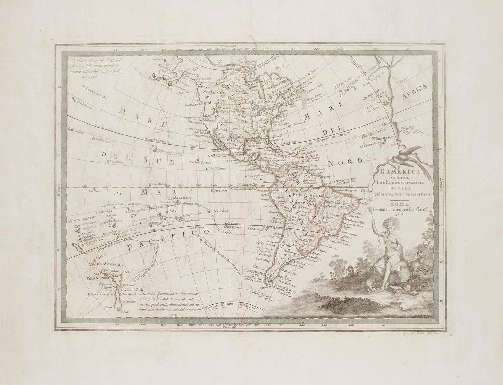
The Americas is a very beautiful vintage map realized in the 18th century by an Italian cartographer.
Very good conditions, on the right side the inscript...
Category
18th Century Figurative Prints
Materials
Paper, Etching

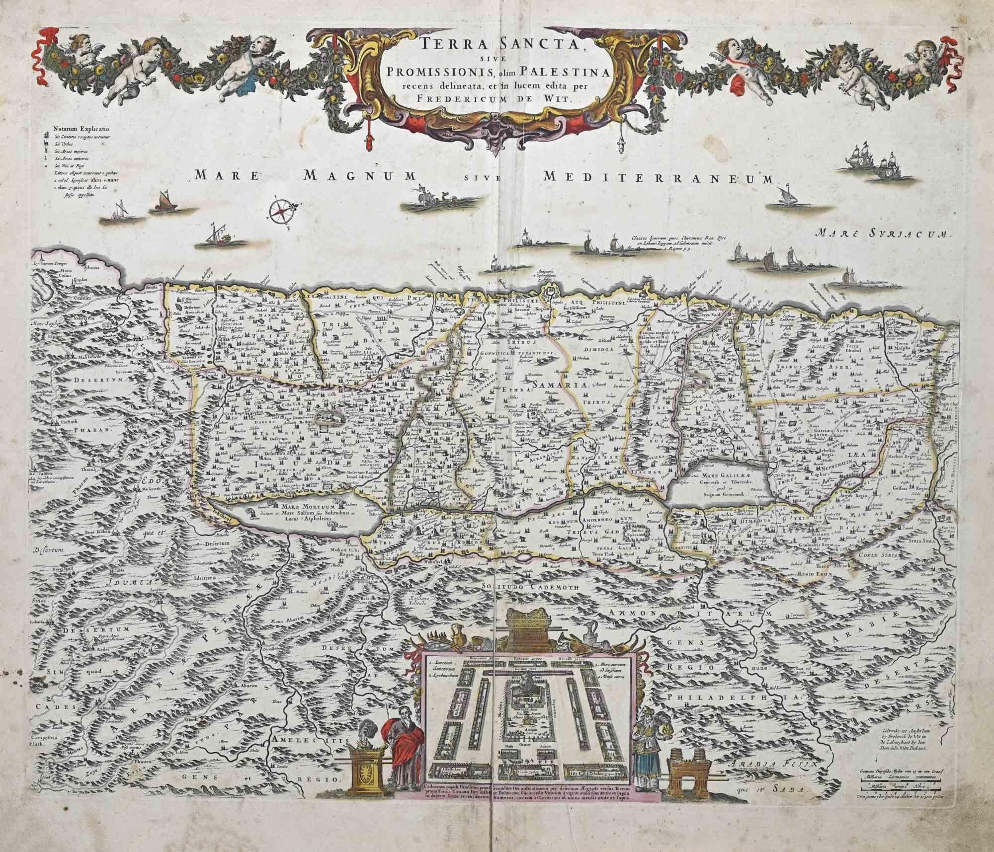
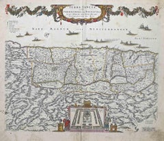
Terra Sancta - Etching by Frederick de Wit - 1680ca
By Frederick de Wit
Located in Roma, IT
This double-page etching with contemporary coloring, entitled Terra Sancta, was realized by the cartographer Frederick de Wit for the famous Atlas published in Amsterdam in ca. 1680....
Category
1680s Modern Figurative Prints
Materials
Etching
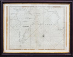
Antique Map of the Southern Oceans, South America and Africa
Located in New York, NY
Antique Map of the South Atlantic, c. 1800s
Engraving
20 x 28 in.
Framed: 25 3/4 x 33 3/4 in.
Category
19th Century Realist Figurative Prints
Materials
Engraving
More Ways To Browse
Antique Sailing Ship
Antique Peru
Peru Gold
Peruvian Gold
Antique Whale Print
Whale Engraving
Diva Vintage
Jean Michel Basquiat Bear
Joseph Wolf
L Lang Painting
New Orleans French Quarter Painting
C S Lewis
Diego Rivera Sketch
Pieta Sculpture
Yayoi Kusama Original
19th Century French Religious Oil Painting
Chinese Ceramic Children
Danish Girl Painting