1850s Landscape Prints
to
6
103
25
1
1
1
Overall Width
to
Overall Height
to
51
3
2
1
16
11
7
7
4
969
2,029
10,093
4,239
111
171
656
508
628
1,263
1,768
1,701
1,038
562
625
105
26
89
33
26
19
16
15
15
14
14
11
9
9
8
8
5
5
5
5
4
4
79
20
20
18
14
5
74
56
43
Period: 1850s
Ancient View of Chapel of Santa Rosalia- Lithograph on Paper - Mid-19th Century
Located in Roma, IT
Chapel of Santa Rosalia is an original modern artwork realized in Italy in the first half of the 19th Century.
Original Colored Lithograph on Ivory Paper.
Inscripted on the lower...
Category
1850s Landscape Prints
Materials
Lithograph
The Bay - Original Lithograph on Paper - Mid-19th Century
Located in Roma, IT
The Bay is an original modern artwork realized in Italy in the first half of the 19th Century.
Original Lithograph on Ivory Paper.
Inscripted on the lower margin in Capital Lette...
Category
1850s Landscape Prints
Materials
Lithograph
Ancient View of Villa Doria, Genova - Lithograph - Mid-19th Century
Located in Roma, IT
Ancient View of Villa Doria is an original modern artwork realized in Italy in the first half of the XIX Century.
Original Lithograph on Ivory Paper.
Inscripted on the lower marg...
Category
1850s Landscape Prints
Materials
Lithograph
Interieur de Geneve [...] - Lithograph by Antonio Fontanesi - 1850s
Located in Roma, IT
This splendid lithograph Interieur de Geneve. Fontaine de l'Hotel De Ville is part of the series of 20 prints dedicated to views of the city of Geneva, engraved by the Italian artist...
Category
1850s Landscape Prints
Materials
Lithograph
Interieur de Geneve. Place de la Grenet - Lithograph by Antonio Fontanesi - 1854
Located in Roma, IT
This splendid lithograph Interieur de Geneve. Place de la Grenette is part of the series of 20 prints dedicated to views of the city of Geneva, engraved by the Italian artist Antonio...
Category
Old Masters 1850s Landscape Prints
Materials
Lithograph
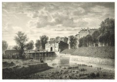
Gene - Original Lithograph - 1950 ca.
Located in Roma, IT
Gene is a beautiful original lithograph realized by Eugène Flandin (1809-1889) in 1850 ca.
Signed on the plate by the artist on the lower left margin, lithographed by Jules Collign...
Category
1850s Landscape Prints
Materials
Lithograph
Le Bout de la Treille - Original Lithograph by Antonio Fontanesi - 1850 ca.
Located in Roma, IT
This splendid lithograph View of Geneve is part of the series of prints dedicated to views of the city of Geneva, engraved by the Italian artist Antonio Fontanesi.
The state of pres...
Category
1850s Landscape Prints
Materials
Lithograph
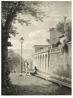
Interieur de Geneve. Un Coin De La Treille - Lithograph by A. Fontanesi
Located in Roma, IT
Image dimensions: 15.3 x 20.8 cm.
This splendid lithograph Interieur de Geneve. Un Coin De La Treille is part of the series of 20 prints dedicated to views of the city of Geneva, en...
Category
1850s Landscape Prints
Materials
Lithograph
'Distribution of Goods to the Gros Ventres' lithograph by John Mix Stanley
Located in Milwaukee, WI
In the mid-nineteenth century, the United States government set out to survey and document its newly acquired lands and territories west of the Mississippi. The goals of these surveys were manifold: to produce topographical maps, to document flora and fauna, and to document natural resources to build the emerging US economy. These surveys, and the images from them, also functioned to build the new sense of American identity with the landscape, condensing vistas into the 'picturesque' tradition of European image making. Thus, the entire span of US territory could be seen as a single, cohesive whole.
This lithograph comes from one of six surveys commissioned by the Army's Topographic Bureau in 1853, which sought to find the best route to construct a transcontinental railroad. The result was a thirteen-volume report including maps, lithographs, and technical data entitled 'Explorations and Surveys to ascertain the most practicable and economical route for a Railroad from the Mississippi river to the Pacific Ocean.' In particular, the print comes from the northern survey, commanded by Isaac Stevens, which explored the regions between the 47th and 49th parallels.
In this image, Stanley documented the encounter with the Gros Ventre people at Milk River. The explorers were invited to the Gros Ventres camp and the two groups exchanged gifts in friendship. The Stevens Party provided "... blankets, shirts, calico, knives, beads, paint, powder, shot, tobacco, hard bread, etc." The image likewise alludes to how, in 1855, Isaac Stevens, concluded a treaty (Stat., L., XI, 657) to provide peace between the United States and the Blackfoot, Flathead and Nez Perce tribes. The Gros Ventres signed the treaty as part of the Blackfoot Confederacy, whose territory near the Three Fork area became a common hunting ground for the Flathead, Nez Perce, Kootenai, and Crow Indians.
5.75 x 8.75 inches, image
6.5 x 9.25 inches, stone
17 x 20 inches, frame
Artist 'Stanley Del.' lower left
Entitled 'Distribution of Goods to the Gros Ventres' lower center margin
Publisher 'Sarony, Major & Knapp. Lith.s 449 Broadway N.Y.' lower right
Inscribed 'U.S.P.R.R. EXP. & SURVEYS — 47th & 49th PARALLELS' upper left
Inscribed 'GENERAL REPORT — PLATE XXI' upper right
Framed to conservation standards using 100 percent rag matting with French accents; glazed with UV5 Plexiglas to inhibit fading; housed in a gold reverse ogee moulding.
Print in overall good condition; some localized foxing and discoloration; minor surface abrasions to frame.
John Mix...
Category
Romantic 1850s Landscape Prints
Materials
Lithograph
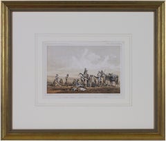
'Camp Red River Hunters' original lithograph by John Mix Stanley
Located in Milwaukee, WI
In the mid-nineteenth century, the United States government set out to survey and document its newly acquired lands and territories west of the Mississippi. The goals of these surveys were manifold: to produce topographical maps, to document flora and fauna, and to document natural resources to build the emerging US economy. These surveys, and the images from them, also functioned to build the new sense of American identity with the landscape, condensing vistas into the 'picturesque' tradition of European image making. Thus, the entire span of US territory could be seen as a single, cohesive whole.
This lithograph comes from one of six surveys commissioned by the Army's Topographic Bureau in 1853, which sought to find the best route to construct a transcontinental railroad. The result was a thirteen-volume report including maps, lithographs, and technical data entitled 'Explorations and Surveys to ascertain the most practicable and economical route for a Railroad from the Mississippi river to the Pacific Ocean.' In particular, the print comes from the northern survey, commanded by Isaac Stevens, which explored the regions between the 47th and 49th parallels.
In this image, Stanley shows an encampment of the people known as the Red River of the North hunters. They were generations of European and mixed-race trappers who lived on the frontier and had Indian wives and mixed-race children. They had come to the area for bison hunting, as the herds were still vast on the prairies. In the image, the figures and their encampment are dwarfed by the vast landscape around them, indicating the sublimity of these new American territories.
5.75 x 8.75 inches, image
6.5 x 9.25 inches, stone
17 x 20 inches, frame
Artist 'Stanley Del.' lower left
Entitled 'Camp Red River Hunters' lower center margin
Publisher 'Sarony, Major & Knapp. Lith.s 449 Broadway N.Y.' lower right
Inscribed 'U.S.P.R.R. EXP. & SURVEYS — 47th & 49th PARALLELS' upper left
Inscribed 'GENERAL REPORT — PLATE XII' upper right
Framed to conservation standards using 100 percent rag matting with French accents; glazed with UV5 Plexiglas to inhibit fading; housed in a gold reverse ogee moulding.
Print in overall good condition; some localized foxing and discoloration; minor surface abrasions to frame.
John Mix Stanley...
Category
Romantic 1850s Landscape Prints
Materials
Lithograph
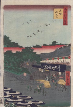
Hiroshige (1797-1858) - Ueno Yamashita
Located in BRUCE, ACT
Artist: Utagawa Hiroshige (Hiroshige Ando 1797-1858)
Title: No.12 Ueno Yamashita
Series: One Hundred Famous Views of Edo (名所江戸百景)
Size: O-ban 大判
Age: 1858
Category
1850s Landscape Prints
Materials
Woodcut
Kensington Gardens (The Small Plate)
Located in New York, NY
Sir Francis Seymour Haden (1818-1910), Kensington Gardens (The Small Plate), drypoint, 1859, signed in pencil lower right. References: Harrington 12...
Category
Realist 1850s Landscape Prints
Materials
Drypoint
'Victor's Camp - Hell Gate Ronde' original John Mix Stanley lithograph
Located in Milwaukee, WI
In the mid-nineteenth century, the United States government set out to survey and document its newly acquired lands and territories west of the Mississippi. The goals of these surveys were manifold: to produce topographical maps, to document flora and fauna, and to document natural resources to build the emerging US economy. These surveys, and the images from them, also functioned to build the new sense of American identity with the landscape, condensing vistas into the 'picturesque' tradition of European image making. Thus, the entire span of US territory could be seen as a single, cohesive whole.
This lithograph comes from one of six surveys commissioned by the Army's Topographic Bureau in 1853, which sought to find the best route to construct a transcontinental railroad. The result was a thirteen-volume report including maps, lithographs, and technical data entitled 'Explorations and Surveys to ascertain the most practicable and economical route for a Railroad from the Mississippi river to the Pacific Ocean.' In particular, the print comes from the northern survey, commanded by Isaac Stevens, which explored the regions between the 47th and 49th parallels.
Stanley shows here the stop the Stanley Party made at the junction of the Bitterroot and Hell Gate, in present day Montana. While there, the Party met with the Flathead Chief by the name Victor, as is shown in the image. The figures and their encampment are dwarfed by the vast landscape around them, indicating the sublimity of these new American territories.
5.75 x 8.75 inches, image
6.5 x 9.25 inches, stone
17 x 20 inches, frame
Artist 'Stanley Del.' lower left
Entitled 'Victor's Camp - Hell Gate Ronde' lower center margin
Publisher 'Sarony, Major & Knapp. Lith.s 449 Broadway N.Y.' lower right
Inscribed 'U.S.P.R.R. EXP. & SURVEYS — 47th & 49th PARALLELS' upper left
Inscribed 'GENERAL REPORT — PLATE XXXI' upper right
Framed to conservation standards using 100 percent rag matting with French accents; glazed with UV5 Plexiglas to inhibit fading; housed in a gold reverse ogee moulding.
Print in overall good condition; some localized foxing and discoloration; minor surface abrasions to frame.
John Mix Stanley...
Category
Romantic 1850s Landscape Prints
Materials
Lithograph
19th century color lithograph portraits ship seascape patriotic flags military
Located in Milwaukee, WI
The present hand-colored lithograph is an excellent example of patriotic mid-nineteenth century American imagery. The print shows the battle and several of the major figures involved in the Battle of Lake Erie: At the center is a view of several frigates on the lake, embroiled in conflict. Above the battle is the quotation: "We have met the enemy and they are ours." Surrounding are laurel-lined roundels with portraits of Oliver Hazard Perry (1785-1819), Stephen Dicateur (1779-1820), Johnston Blakeley (1871-1814), William Bainbridge (1774-1833), David Porter (1780-1843), and James Lawrence (1781-1813) - all of these framed by American flags, banners and cannons. This print shows that the Battle of Lake Erie, part of the War of 1812, still held resonance for American audiences several decades later and was part of the larger narrative of the founding of the country.
9.5 x 13.5 inches, artwork
20 x 23.38 inches, frame
Entitled in the image
Signed in the stone, lower left "Lith. and Pub. by N. Currier"
Inscribed lower right "2 Spruce N.Y." and "No. 1"
Copyrighted lower center "Entered according to Act of Congress in the year 1846 by N. Currier in the Clerk's office of the Southern District of N.Y."
Framed to conservation standards using 100 percent rag matting and housed in a gold gilded moulding.
Nathaniel Currier was a tall introspective man with a melancholy nature. He could captivate people with his piercing stare or charm them with his sparkling blue eyes. Nathaniel was born in Roxbury, Massachusetts on March 27th, 1813, the second of four children. His parents, Nathaniel and Hannah Currier, were distant cousins who lived a humble yet spartan life. When Nathaniel was eight years old, tragedy struck. Nathaniel’s father unexpectedly passed away leaving Nathaniel and his eleven-year-old brother Lorenzo to provide for the family. In addition to their mother, Nathaniel and Lorenzo had to care for six-year-old sister Elizabeth and two-year-old brother Charles. Nathaniel worked a series of odd jobs to support the family, and at fifteen, he started what would become a life-long career when he apprenticed in the Boston lithography shop of William and John Pendleton.
A Bavarian gentleman named Alois Senefelder invented lithography just 30 years prior to young Nat Currier’s apprenticeship. While under the employ of the brothers Pendleton, Nat was taught the art of lithography by the firm’s chief printer, a French national named Dubois, who brought the lithography trade to America.
Lithography involves grinding a piece of limestone flat and smooth then drawing in mirror image on the stone with a special grease pencil. After the image is completed, the stone is etched with a solution of aqua fortis leaving the greased areas in slight relief. Water is then used to wet the stone and greased-ink is rolled onto the raised areas. Since grease and water do not mix, the greased-ink is repelled by the moisture on the stone and clings to the original grease pencil lines. The stone is then placed in a press and used as a printing block to impart black on white images to paper.
In 1833, now twenty-years old and an accomplished lithographer, Nat Currier left Boston and moved to Philadelphia to do contract work for M.E.D. Brown, a noted engraver and printer. With the promise of good money, Currier hired on to help Brown prepare lithographic stones of scientific images for the American Journal of Sciences and Arts. When Nat completed the contract work in 1834, he traveled to New York City to work once again for his mentor John Pendleton, who was now operating his own shop located at 137 Broadway. Soon after the reunion, Pendleton expressed an interest in returning to Boston and offered to sell his print shop to Currier. Young Nat did not have the financial resources to buy the shop, but being the resourceful type he found another local printer by the name of Stodart. Together they bought Pendleton’s business.
The firm ‘Currier & Stodart’ specialized in "job" printing. They produced many different types of printed items, most notably music manuscripts for local publishers. By 1835, Stodart was frustrated that the business was not making enough money and he ended the partnership, taking his investment with him. With little more than some lithographic stones, and a talent for his trade, twenty-two year old Nat Currier set up shop in a temporary office at 1 Wall Street in New York City. He named his new enterprise ‘N. Currier, Lithographer’
Nathaniel continued as a job printer and duplicated everything from music sheets to architectural plans. He experimented with portraits, disaster scenes and memorial prints, and any thing that he could sell to the public from tables in front of his shop. During 1835 he produced a disaster print Ruins of the Planter's Hotel, New Orleans, which fell at two O’clock on the Morning of the 15th of May 1835, burying 50 persons, 40 of whom Escaped with their Lives. The public had a thirst for newsworthy events, and newspapers of the day did not include pictures. By producing this print, Nat gave the public a new way to “see” the news. The print sold reasonably well, an important fact that was not lost on Currier.
Nat met and married Eliza Farnsworth in 1840. He also produced a print that same year titled Awful Conflagration of the Steamboat Lexington in Long Island Sound on Monday Evening, January 18, 1840, by which melancholy occurrence over One Hundred Persons Perished. This print sold out very quickly, and Currier was approached by an enterprising publication who contracted him to print a single sheet addition of their paper, the New York Sun. This single page paper is presumed to be the first illustrated newspaper ever published.
The success of the Lexington print launched his career nationally and put him in a position to finally lift his family up. In 1841, Nat and Eliza had their first child, a son they named Edward West Currier. That same year Nat hired his twenty-one year old brother Charles and taught him the lithography trade, he also hired his artistically inclined brother Lorenzo to travel out west and make sketches of the new frontier as material for future prints. Charles worked for the firm on and off over the years, and invented a new type of lithographic crayon which he patented and named the Crayola. Lorenzo continued selling sketches to Nat for the next few years.
In 1843, Nat and Eliza had a daughter, Eliza West Currier, but tragedy struck in early 1847 when their young daughter died from a prolonged illness. Nat and Eliza were grief stricken, and Eliza, driven by despair, gave up on life and passed away just four months after her daughter’s death.
The subject of Nat Currier’s artwork changed following the death of his wife and daughter, and he produced many memorial prints and sentimental prints during the late 1840s. The memorial prints generally depicted grief stricken families posed by gravestones (the stones were left blank so the purchasers could fill in the names of the dearly departed). The sentimental prints usually depicted idealized portraits of women and children, titled with popular Christian names of the day.
Late in 1847, Nat Currier married Lura Ormsbee, a friend of the family. Lura was a self-sufficient woman, and she immediately set out to help Nat raise six-year-old Edward and get their house in order. In 1849, Lura delivered a son, Walter Black Currier, but fate dealt them a blow when young Walter died one year later. While Nat and Lura were grieving the loss of their new son, word came from San Francisco that Nat’s brother Lorenzo had also passed away from a brief illness. Nat sank deeper into his natural quiet melancholy. Friends stopped by to console the couple, and Lura began to set an extra place at their table for these unexpected guests. She continued this tradition throughout their lives.
In 1852, Charles introduced a friend, James Merritt Ives, to Nat and suggested he hire him as a bookkeeper. Jim Ives was a native New Yorker born in 1824 and raised on the grounds of Bellevue Hospital where his father was employed as superintendent. Jim was a self-trained artist and professional bookkeeper. He was also a plump and jovial man, presenting the exact opposite image of his new boss.
Jim Ives met Charles Currier through Caroline Clark, the object of Jim’s affection. Caroline’s sister Elizabeth was married to Charles, and Caroline was a close friend of the Currier family. Jim eventually proposed marriage to Caroline and solicited an introduction to Nat Currier, through Charles, in hopes of securing a more stable income to support his future wife.
Ives quickly set out to improve and modernize his new employer’s bookkeeping methods. He reorganized the firm’s sizable inventory, and used his artistic skills to streamline the firm’s production methods. By 1857, Nathaniel had become so dependent on Jims’ skills and initiative that he offered him a full partnership in the firm and appointed him general manager. The two men chose the name ‘Currier & Ives’ for the new partnership, and became close friends.
Currier & Ives produced their prints in a building at 33 Spruce Street where they occupied the third, fourth and fifth floors. The third floor was devoted to the hand operated printing presses that were built by Nat's cousin, Cyrus Currier, at his shop Cyrus Currier & Sons in Newark, NJ. The fourth floor found the artists, lithographers and the stone grinders at work. The fifth floor housed the coloring department, and was one of the earliest production lines in the country. The colorists were generally immigrant girls, mostly German, who came to America with some formal artistic training. Each colorist was responsible for adding a single color to a print. As a colorist finished applying their color, the print was passed down the line to the next colorist to add their color. The colorists worked from a master print displayed above their table, which showed where the proper colors were to be placed. At the end of the table was a touch up artist who checked the prints for quality, touching-in areas that may have been missed as it passed down the line. During the Civil War, demand for prints became so great that coloring stencils were developed to speed up production.
Although most Currier & Ives prints were colored in house, some were sent out to contract artists. The rate Currier & Ives paid these artists for coloring work was one dollar per one hundred small folios (a penny a print) and one dollar per one dozen large folios. Currier & Ives also offered uncolored prints to dealers, with instructions (included on the price list) on how to 'prepare the prints for coloring.' In addition, schools could order uncolored prints from the firm’s catalogue to use in their painting classes.
Nathaniel Currier and James Merritt Ives attracted a wide circle of friends during their years in business. Some of their more famous acquaintances included Horace Greeley, Phineas T. Barnum, and the outspoken abolitionists Rev. Henry Ward, and John Greenleaf Whittier (the latter being a cousin of Mr. Currier).
Nat Currier and Jim Ives described their business as "Publishers of Cheap and Popular Pictures" and produced many categories of prints. These included Disaster Scenes, Sentimental Images, Sports, Humor, Hunting Scenes, Politics, Religion, City and Rural Scenes, Trains, Ships, Fire Fighters, Famous Race Horses, Historical Portraits, and just about any other topic that satisfied the general public's taste. In all, the firm produced in excess of 7500 different titles, totaling over one million prints produced from 1835 to 1907.
Nat Currier retired in 1880, and signed over his share of the firm to his son Edward. Nat died eight years later at his summer home 'Lion’s Gate' in Amesbury, Massachusetts. Jim Ives remained active in the firm until his death in 1895, when his share of the firm passed to his eldest son, Chauncey.
In 1902, faced will failing health from the ravages of Tuberculosis, Edward Currier sold his share of the firm to Chauncey Ives...
Category
Victorian 1850s Landscape Prints
Materials
Watercolor, Lithograph
'Maple River' original color lithograph by John Mix Stanley
Located in Milwaukee, WI
In the mid-nineteenth century, the United States government set out to survey and document its newly acquired lands and territories west of the Mississippi. The goals of these surveys were manifold: to produce topographical maps, to document flora and fauna, and to document natural resources to build the emerging US economy. These surveys, and the images from them, also functioned to build the new sense of American identity with the landscape, condensing vistas into the 'picturesque' tradition of European image making. Thus, the entire span of US territory could be seen as a single, cohesive whole.
This lithograph comes from one of six surveys commissioned by the Army's Topographic Bureau in 1853, which sought to find the best route to construct a transcontinental railroad. The result was a thirteen-volume report including maps, lithographs, and technical data entitled 'Explorations and Surveys to ascertain the most practicable and economical route for a Railroad from the Mississippi river to the Pacific Ocean.' Along with the image, Stanley also noted in the report of the Maple River: "It would be an excellent plan for an emigrant travelling through the country, before reaching one of these rivers on which he expects to camp, to catch a few frogs, for the purpose of fishing in these streams, which abound pike, picarel, and large catfish. Frogs are by far the best bait that can be used." This note from the artist perhaps describes some of the actions of the figures in the camp in the foreground of the image.
5.75 x 8.75 inches, image
6.5 x 9.25 inches, stone
13.25 x 16.25 inches, frame
Artist 'Stanley Del.' lower left
Entitled 'Maple River' lower center margin
Publisher 'Sarony, Major & Knapp. Lith.s 449 Broadway N.Y.' lower right
Inscribed 'U.S.P.R.R. EXP. & SURVEYS — 47th & 49th PARALLELS' upper left
Inscribed 'GENERAL REPORT — PLATE VIII' upper right
Framed to conservation standards using 100 percent rag matting and Museum Glass to inhibit fading; housed in a brass-surface aluminium moulding.
John Mix...
Category
Romantic 1850s Landscape Prints
Materials
Lithograph
'Lieutenant Crovers Despatch – Return of Governor Stevens to Fort Benton'
Located in Milwaukee, WI
In the mid-nineteenth century, the United States government set out to survey and document its newly acquired lands and territories west of the Mississippi. The goals of these surveys were manifold: to produce topographical maps, to document flora and fauna, and to document natural resources to build the emerging US economy. These surveys, and the images from them, also functioned to build the new sense of American identity with the landscape, condensing vistas into the 'picturesque' tradition of European image making. Thus, the entire span of US territory could be seen as a single, cohesive whole.
This lithograph comes from one of six surveys commissioned by the Army's Topographic Bureau in 1853, which sought to find the best route to construct a transcontinental railroad. The result was a thirteen-volume report including maps, lithographs, and technical data entitled 'Explorations and Surveys to ascertain the most practicable and economical route for a Railroad from the Mississippi river to the Pacific Ocean.' In particular, the print comes from the northern survey, commanded by Isaac Stevens, which explored the regions between the 47th and 49th parallels.
5.75 x 8.75 inches, image
6.5 x 9.25 inches, stone
17 x 20 inches, frame
Artist 'Stanley Del.' lower left
Entitled 'Lieutenant Crovers Despatch – Return of Governor Stevens to Fort Benton' lower center margin
Publisher 'Sarony, Major & Knapp. Lith.s 449 Broadway N.Y.' lower right
Inscribed 'U.S.P.R.R. EXP. & SURVEYS — 47th & 49th PARALLELS' upper left
Inscribed 'GENERAL REPORT — PLATE XXXVII' upper right
Framed to conservation standards using 100 percent rag matting with French accents; glazed with UV5 Plexiglas to inhibit fading; housed in a gold reverse ogee moulding.
Print in overall good condition; some localized foxing and discoloration; minor surface abrasions to frame.
John Mix Stanley...
Category
Romantic 1850s Landscape Prints
Materials
Lithograph
'Kettle Falls, Columbia River' original color lithograph by John Mix Stanley
Located in Milwaukee, WI
In the mid-nineteenth century, the United States government set out to survey and document its newly acquired lands and territories west of the Mississippi. The goals of these surveys were manifold: to produce topographical maps, to document flora and fauna, and to document natural resources to build the emerging US economy. These surveys, and the images from them, also functioned to build the new sense of American identity with the landscape, condensing vistas into the 'picturesque' tradition of European image making. Thus, the entire span of US territory could be seen as a single, cohesive whole.
This lithograph comes from one of six surveys commissioned by the Army's Topographic Bureau in 1853, which sought to find the best route to construct a transcontinental railroad. The result was a thirteen-volume report including maps, lithographs, and technical data entitled 'Explorations and Surveys to ascertain the most practicable and economical route for a Railroad from the Mississippi river to the Pacific Ocean.'
When it came to depicting the Columbia River, as seen in the present print, Stanley chose to depict the river's characteristic rock formations and choppy waters. The figures in the image give the viewer a sense of the vase scale of the imposing landscape. Other explorers that reached the site years before the Pacific Railroad Survey, such as Lewis and Clark, observed this scene with wonder and awe – and it is clear Stanley felt the same way.
5.75 x 8.75 inches, image
6.5 x 9.25 inches, stone
13.25 x 16.25 inches, frame
Artist 'Stanley Del.' lower left
Entitled 'Kettle Falls, Columbia River' lower center margin
Publisher 'Sarony, Major & Knapp. Lith.s 449 Broadway N.Y.' lower right
Inscribed 'U.S.P.R.R. EXP. & SURVEYS — 47th & 49th PARALLELS' upper left
Inscribed 'GENERAL REPORT — PLATE XLVII' upper right
Framed to conservation standards using 100 percent rag matting and Museum Glass to inhibit fading; housed in a brass-surface aluminium moulding.
Print in overall good condition; wrinkles in upper margin and upper right corner; frame in excellent condition.
John Mix Stanley...
Category
Romantic 1850s Landscape Prints
Materials
Lithograph
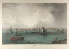
Boston
Located in Missouri, MO
John William Hill (1812-1879)
"Boston" 1857
Hand-Colored Engraving
Site Size: 29 x 41 inches
Framed Size: 39 x 52 inches
Born in London, England, John William Hill came to America with his family at age 7. His father, John Hill, was a well-known landscape painter, engraver, and aquatintist. John William had a career of two phases, a city topographer-engraver and then, the leading pre-Rafaelite school painter in this country. Employed by the New York Geological Survey and then by Smith Brothers...
Category
Pre-Raphaelite 1850s Landscape Prints
Materials
Engraving, Aquatint