John Mix Stanley Art

1814-1872

John Mix Stanley was an artist-explorer, an American painter of landscapes, and Native American portraits and tribal life. Born in the Finger Lakes region of New York, he started painting signs and portraits as a young man, but in 1842 he traveled to the American West to paint Native American life. In 1846, he exhibited a gallery of 85 of his paintings in Cincinnati and Louisville. During the Mexican-American War, he joined Colonel Stephen Watts Kearney's expedition to California and painted accounts of the campaign, as well as aspects of the Oregon territory. Stanley continued to travel and paint in the West, and mounted a major exhibit of more than 150 works at the Smithsonian Institution in 1852. Although he had some Congressional interest in purchasing the collection, he was unsuccessful in completing a sale, and never recovered his expenses for a decade of intensive work and travel. In 1854, he exhibited a 42-scene panorama of western scenes in Washington, DC, Baltimore, New York and London, but it has been lost. More than 200 of his paintings, maps and other work being held at the Smithsonian were lost in an 1865 fire. The irreparable loss of most of his works cast an eclipse over Stanley's reputation in American art history for some time, but today a few of his surviving works are held by national and numerous regional museums.

to
2
5
Overall Width
to
Overall Height
to
7
4
1
1
1
1
1
7

Use search to find more

7
12,000
2,897
2,541
1,646

Use search to find more

Artist: John Mix Stanley
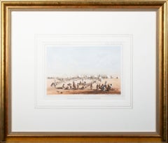
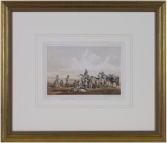
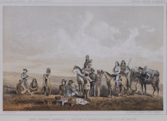
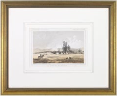
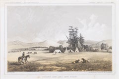
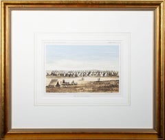
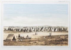
'Camp Red River Hunters' original lithograph by John Mix Stanley

'Camp Red River Hunters' original lithograph by John Mix Stanley

By John Mix Stanley

Located in Milwaukee, WI

In the mid-nineteenth century, the United States government set out to survey and document its newly acquired lands and territories west of the Mississippi. The goals of these surveys were manifold: to produce topographical maps, to document flora and fauna, and to document natural resources to build the emerging US economy. These surveys, and the images from them, also functioned to build the new sense of American identity with the landscape, condensing vistas into the 'picturesque' tradition of European image making. Thus, the entire span of US territory could be seen as a single, cohesive whole. This lithograph comes from one of six surveys commissioned by the Army's Topographic Bureau in 1853, which sought to find the best route to construct a transcontinental railroad. The result was a thirteen-volume report including maps, lithographs, and technical data entitled 'Explorations and Surveys to ascertain the most practicable and economical route for a Railroad from the Mississippi river to the Pacific Ocean.' In particular, the print comes from the northern survey, commanded by Isaac Stevens, which explored the regions between the 47th and 49th parallels. In this image, Stanley shows an encampment of the people known as the Red River of the North hunters. They were generations of European and mixed-race trappers who lived on the frontier and had Indian wives and mixed-race children. They had come to the area for bison hunting, as the herds were still vast on the prairies. In the image, the figures and their encampment are dwarfed by the vast landscape around them, indicating the sublimity of these new American territories. 5.75 x 8.75 inches, image 6.5 x 9.25 inches, stone 17 x 20 inches, frame Artist 'Stanley Del.' lower left Entitled 'Camp Red River Hunters' lower center margin Publisher 'Sarony, Major & Knapp. Lith.s 449 Broadway N.Y.' lower right Inscribed 'U.S.P.R.R. EXP. & SURVEYS — 47th & 49th PARALLELS' upper left Inscribed 'GENERAL REPORT — PLATE XII' upper right Framed to conservation standards using 100 percent rag matting with French accents; glazed with UV5 Plexiglas to inhibit fading; housed in a gold reverse ogee moulding. Print in overall good condition; some localized foxing and discoloration; minor surface abrasions to frame. John Mix Stanley...

Category

1850s Romantic John Mix Stanley Art

Materials

Lithograph
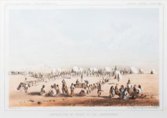
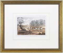
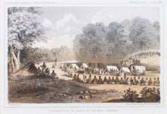
'Distribution of Goods to the Assiniboines' original John Mix Stanley lithograph

'Distribution of Goods to the Assiniboines' original John Mix Stanley lithograph

By John Mix Stanley

Located in Milwaukee, WI

In the mid-nineteenth century, the United States government set out to survey and document its newly acquired lands and territories west of the Mississippi. The goals of these surveys were manifold: to produce topographical maps, to document flora and fauna, and to document natural resources to build the emerging US economy. These surveys, and the images from them, also functioned to build the new sense of American identity with the landscape, condensing vistas into the 'picturesque' tradition of European image making. Thus, the entire span of US territory could be seen as a single, cohesive whole. This lithograph comes from one of six surveys commissioned by the Army's Topographic Bureau in 1853, which sought to find the best route to construct a transcontinental railroad. The result was a thirteen-volume report including maps, lithographs, and technical data entitled 'Explorations and Surveys to ascertain the most practicable and economical route for a Railroad from the Mississippi river to the Pacific Ocean.' When it came to depicting the Assiniboine people, as seen in the present print, Stanley chose to juxtapose their encampment, marked by tipis in the distance, with the encampment of the Isaac Stevens survey party. In the foreground, commemorating this moment, Isaac Stevens can be seen presenting trade goods, which are known to include thirty two dressed skins and two robes. The survey leader Isaac Stevens noted being grateful for the generosity of the Assiniboine, commenting: "I felt very grateful indeed to those Indians, for their kindness to my men, their proffer of kind feeling and hospitality to myself and the survey." This description and this image, however, are arguably depicted through rose-colored glasses: to the Assiniboine people, this meeting may well have included stressful diplomatic relationships and have indicated a threat to the sovereignty over the territories agreed to be theirs by the 1851 Treaty of Fort Laramie. 5.75 x 8.75 inches, image 6.5 x 9.25 inches, stone 17 x 19.75 inches, frame Artist 'Stanley Del.' lower left Entitled 'Distribution of Goods to the Assiniboines' lower center margin Publisher 'Sarony, Major & Knapp. Lith.s 449 Broadway N.Y.' lower right Inscribed 'U.S.P.R.R. EXP. & SURVEYS — 47th & 49th PARALLELS' upper left Inscribed 'GENERAL REPORT — PLATE XIV' upper right Framed to conservation standards using 100 percent rag matting with French accents; glazed with UV5 Plexiglas to inhibit fading; housed in a gold reverse ogee moulding. Print in overall good condition; some localized foxing and discoloration; frame in excellent condition. John Mix Stanley...

Category

1850s Romantic John Mix Stanley Art

Materials

Lithograph
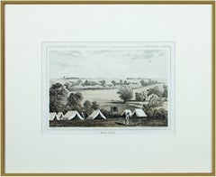
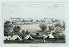
'Maple River' original color lithograph by John Mix Stanley
'Maple River' original color lithograph by John Mix Stanley
By John Mix Stanley

Located in Milwaukee, WI

In the mid-nineteenth century, the United States government set out to survey and document its newly acquired lands and territories west of the Mississippi. The goals of these surveys were manifold: to produce topographical maps, to document flora and fauna, and to document natural resources to build the emerging US economy. These surveys, and the images from them, also functioned to build the new sense of American identity with the landscape, condensing vistas into the 'picturesque' tradition of European image making. Thus, the entire span of US territory could be seen as a single, cohesive whole. This lithograph comes from one of six surveys commissioned by the Army's Topographic Bureau in 1853, which sought to find the best route to construct a transcontinental railroad. The result was a thirteen-volume report including maps, lithographs, and technical data entitled 'Explorations and Surveys to ascertain the most practicable and economical route for a Railroad from the Mississippi river to the Pacific Ocean.' Along with the image, Stanley also noted in the report of the Maple River: "It would be an excellent plan for an emigrant travelling through the country, before reaching one of these rivers on which he expects to camp, to catch a few frogs, for the purpose of fishing in these streams, which abound pike, picarel, and large catfish. Frogs are by far the best bait that can be used." This note from the artist perhaps describes some of the actions of the figures in the camp in the foreground of the image. 5.75 x 8.75 inches, image 6.5 x 9.25 inches, stone 13.25 x 16.25 inches, frame Artist 'Stanley Del.' lower left Entitled 'Maple River' lower center margin Publisher 'Sarony, Major & Knapp. Lith.s 449 Broadway N.Y.' lower right Inscribed 'U.S.P.R.R. EXP. & SURVEYS — 47th & 49th PARALLELS' upper left Inscribed 'GENERAL REPORT — PLATE VIII' upper right Framed to conservation standards using 100 percent rag matting and Museum Glass to inhibit fading; housed in a brass-surface aluminium moulding. John Mix...

Category

1850s Romantic John Mix Stanley Art

Materials

Lithograph
'Lieutenant Crovers Despatch – Return of Governor Stevens to Fort Benton'

'Lieutenant Crovers Despatch – Return of Governor Stevens to Fort Benton'

By John Mix Stanley

Located in Milwaukee, WI

In the mid-nineteenth century, the United States government set out to survey and document its newly acquired lands and territories west of the Mississippi. The goals of these surveys were manifold: to produce topographical maps, to document flora and fauna, and to document natural resources to build the emerging US economy. These surveys, and the images from them, also functioned to build the new sense of American identity with the landscape, condensing vistas into the 'picturesque' tradition of European image making. Thus, the entire span of US territory could be seen as a single, cohesive whole. This lithograph comes from one of six surveys commissioned by the Army's Topographic Bureau in 1853, which sought to find the best route to construct a transcontinental railroad. The result was a thirteen-volume report including maps, lithographs, and technical data entitled 'Explorations and Surveys to ascertain the most practicable and economical route for a Railroad from the Mississippi river to the Pacific Ocean.' In particular, the print comes from the northern survey, commanded by Isaac Stevens, which explored the regions between the 47th and 49th parallels. 5.75 x 8.75 inches, image 6.5 x 9.25 inches, stone 17 x 20 inches, frame Artist 'Stanley Del.' lower left Entitled 'Lieutenant Crovers Despatch – Return of Governor Stevens to Fort Benton' lower center margin Publisher 'Sarony, Major & Knapp. Lith.s 449 Broadway N.Y.' lower right Inscribed 'U.S.P.R.R. EXP. & SURVEYS — 47th & 49th PARALLELS' upper left Inscribed 'GENERAL REPORT — PLATE XXXVII' upper right Framed to conservation standards using 100 percent rag matting with French accents; glazed with UV5 Plexiglas to inhibit fading; housed in a gold reverse ogee moulding. Print in overall good condition; some localized foxing and discoloration; minor surface abrasions to frame. John Mix Stanley...
Category

1850s Romantic John Mix Stanley Art

Materials

Lithograph
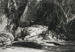
'Distribution of Goods to the Gros Ventres' lithograph by John Mix Stanley
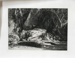

'Distribution of Goods to the Gros Ventres' lithograph by John Mix Stanley

By John Mix Stanley

Located in Milwaukee, WI

In the mid-nineteenth century, the United States government set out to survey and document its newly acquired lands and territories west of the Mississippi. The goals of these surveys were manifold: to produce topographical maps, to document flora and fauna, and to document natural resources to build the emerging US economy. These surveys, and the images from them, also functioned to build the new sense of American identity with the landscape, condensing vistas into the 'picturesque' tradition of European image making. Thus, the entire span of US territory could be seen as a single, cohesive whole. This lithograph comes from one of six surveys commissioned by the Army's Topographic Bureau in 1853, which sought to find the best route to construct a transcontinental railroad. The result was a thirteen-volume report including maps, lithographs, and technical data entitled 'Explorations and Surveys to ascertain the most practicable and economical route for a Railroad from the Mississippi river to the Pacific Ocean.' In particular, the print comes from the northern survey, commanded by Isaac Stevens, which explored the regions between the 47th and 49th parallels. In this image, Stanley documented the encounter with the Gros Ventre people at Milk River. The explorers were invited to the Gros Ventres camp and the two groups exchanged gifts in friendship. The Stevens Party provided "... blankets, shirts, calico, knives, beads, paint, powder, shot, tobacco, hard bread, etc." The image likewise alludes to how, in 1855, Isaac Stevens, concluded a treaty (Stat., L., XI, 657) to provide peace between the United States and the Blackfoot, Flathead and Nez Perce tribes. The Gros Ventres signed the treaty as part of the Blackfoot Confederacy, whose territory near the Three Fork area became a common hunting ground for the Flathead, Nez Perce, Kootenai, and Crow Indians. 5.75 x 8.75 inches, image 6.5 x 9.25 inches, stone 17 x 20 inches, frame Artist 'Stanley Del.' lower left Entitled 'Distribution of Goods to the Gros Ventres' lower center margin Publisher 'Sarony, Major & Knapp. Lith.s 449 Broadway N.Y.' lower right Inscribed 'U.S.P.R.R. EXP. & SURVEYS — 47th & 49th PARALLELS' upper left Inscribed 'GENERAL REPORT — PLATE XXI' upper right Framed to conservation standards using 100 percent rag matting with French accents; glazed with UV5 Plexiglas to inhibit fading; housed in a gold reverse ogee moulding. Print in overall good condition; some localized foxing and discoloration; minor surface abrasions to frame. John Mix...

Category

1850s Romantic John Mix Stanley Art

Materials

Lithograph

'Victor's Camp - Hell Gate Ronde' original John Mix Stanley lithograph

'Victor's Camp - Hell Gate Ronde' original John Mix Stanley lithograph

By John Mix Stanley

Located in Milwaukee, WI

In the mid-nineteenth century, the United States government set out to survey and document its newly acquired lands and territories west of the Mississippi. The goals of these surveys were manifold: to produce topographical maps, to document flora and fauna, and to document natural resources to build the emerging US economy. These surveys, and the images from them, also functioned to build the new sense of American identity with the landscape, condensing vistas into the 'picturesque' tradition of European image making. Thus, the entire span of US territory could be seen as a single, cohesive whole. This lithograph comes from one of six surveys commissioned by the Army's Topographic Bureau in 1853, which sought to find the best route to construct a transcontinental railroad. The result was a thirteen-volume report including maps, lithographs, and technical data entitled 'Explorations and Surveys to ascertain the most practicable and economical route for a Railroad from the Mississippi river to the Pacific Ocean.' In particular, the print comes from the northern survey, commanded by Isaac Stevens, which explored the regions between the 47th and 49th parallels. Stanley shows here the stop the Stanley Party made at the junction of the Bitterroot and Hell Gate, in present day Montana. While there, the Party met with the Flathead Chief by the name Victor, as is shown in the image. The figures and their encampment are dwarfed by the vast landscape around them, indicating the sublimity of these new American territories. 5.75 x 8.75 inches, image 6.5 x 9.25 inches, stone 17 x 20 inches, frame Artist 'Stanley Del.' lower left Entitled 'Victor's Camp - Hell Gate Ronde' lower center margin Publisher 'Sarony, Major & Knapp. Lith.s 449 Broadway N.Y.' lower right Inscribed 'U.S.P.R.R. EXP. & SURVEYS — 47th & 49th PARALLELS' upper left Inscribed 'GENERAL REPORT — PLATE XXXI' upper right Framed to conservation standards using 100 percent rag matting with French accents; glazed with UV5 Plexiglas to inhibit fading; housed in a gold reverse ogee moulding. Print in overall good condition; some localized foxing and discoloration; minor surface abrasions to frame. John Mix Stanley...

Category

1850s Romantic John Mix Stanley Art

Materials

Lithograph

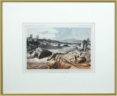
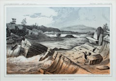
'Kettle Falls, Columbia River' original color lithograph by John Mix Stanley

'Kettle Falls, Columbia River' original color lithograph by John Mix Stanley

By John Mix Stanley

Located in Milwaukee, WI

In the mid-nineteenth century, the United States government set out to survey and document its newly acquired lands and territories west of the Mississippi. The goals of these surveys were manifold: to produce topographical maps, to document flora and fauna, and to document natural resources to build the emerging US economy. These surveys, and the images from them, also functioned to build the new sense of American identity with the landscape, condensing vistas into the 'picturesque' tradition of European image making. Thus, the entire span of US territory could be seen as a single, cohesive whole. This lithograph comes from one of six surveys commissioned by the Army's Topographic Bureau in 1853, which sought to find the best route to construct a transcontinental railroad. The result was a thirteen-volume report including maps, lithographs, and technical data entitled 'Explorations and Surveys to ascertain the most practicable and economical route for a Railroad from the Mississippi river to the Pacific Ocean.' When it came to depicting the Columbia River, as seen in the present print, Stanley chose to depict the river's characteristic rock formations and choppy waters. The figures in the image give the viewer a sense of the vase scale of the imposing landscape. Other explorers that reached the site years before the Pacific Railroad Survey, such as Lewis and Clark, observed this scene with wonder and awe – and it is clear Stanley felt the same way. 5.75 x 8.75 inches, image 6.5 x 9.25 inches, stone 13.25 x 16.25 inches, frame Artist 'Stanley Del.' lower left Entitled 'Kettle Falls, Columbia River' lower center margin Publisher 'Sarony, Major & Knapp. Lith.s 449 Broadway N.Y.' lower right Inscribed 'U.S.P.R.R. EXP. & SURVEYS — 47th & 49th PARALLELS' upper left Inscribed 'GENERAL REPORT — PLATE XLVII' upper right Framed to conservation standards using 100 percent rag matting and Museum Glass to inhibit fading; housed in a brass-surface aluminium moulding. Print in overall good condition; wrinkles in upper margin and upper right corner; frame in excellent condition. John Mix Stanley...

Category

1850s Romantic John Mix Stanley Art

Materials

Lithograph

Related Items
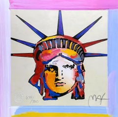
Liberty Head X, Peter Max

Peter MaxLiberty Head X, Peter Max, 2003

$1,008Sale Price|20% Off

H 7 in W 6.87 in

Liberty Head X, Peter Max

By Peter Max

Located in Fairfield, CT

Artist: Peter Max (1937) Title: Liberty Head X Year: 2004 Edition: 679/700, plus proofs Medium: Lithograph on Lustro Saxony paper Size: 7 x 6.87 inches Condition: Excellent Inscripti...

Category

Early 2000s Pop Art John Mix Stanley Art

Materials

Lithograph

Umbrella Man at Sunrise, Peter Max

Peter MaxUmbrella Man at Sunrise, Peter Max, 2001

$1,104Sale Price|20% Off

H 9 in W 11 in

Umbrella Man at Sunrise, Peter Max

By Peter Max

Located in Fairfield, CT

Artist: Peter Max (1937) Title: Umbrella Man at Sunrise Year: 2001 Edition: 303/500, plus proofs Medium: Lithograph on Lustro Saxony paper Size: 9 x 11 inches Condition: Excellent In...

Category

Early 2000s Pop Art John Mix Stanley Art

Materials

Lithograph

Chagall, Die Zauberflöte (Mourlot CS. 38), The Metropolitan Opera (after)

Chagall, Die Zauberflöte (Mourlot CS. 38), The Metropolitan Opera (after)

By Marc Chagall

Located in Fairfield, CT

Title: Die Zauberflöte (Mourlot CS. 38), The Metropolitan Opera Year: 1973 Medium: Lithograph on wove paper Size: 39.5 x 25.75 inches Notes: From the opening of Mozart's 'The Magic F...

Category

1970s Expressionist John Mix Stanley Art

Materials

Lithograph

PAYSAGE D’ ITALIE
PAYSAGE D’ ITALIE

PAYSAGE D’ ITALIE

By Jean-Baptiste-Camille Corot

Located in Santa Monica, CA

JEAN-BAPTISTE CAMILLE COROT (1876 - 1875) PAYSAGE D’ ITALIE 1866 (Melot 7 iii/iii) Etching, plate 6 ¼ x 9 inches, Third state after the removal of the text but before the random scr...

Category

1860s Romantic John Mix Stanley Art

Materials

Etching

Sailboat with Sun & Moon, Peter Max

Peter MaxSailboat with Sun & Moon, Peter Max, 2003

$571Sale Price|20% Off

H 3.5 in W 3 in

Sailboat with Sun & Moon, Peter Max

By Peter Max

Located in Fairfield, CT

Artist: Peter Max (1937) Title: Sailboat with Sun & Moon Year: 2003 Edition: 455/500, plus proofs Medium: Lithograph on Lustro Saxony paper Size: 3.5 x 3 inches Condition: Excell...

Category

Early 2000s Pop Art John Mix Stanley Art

Materials

Lithograph

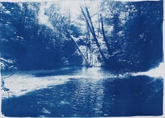
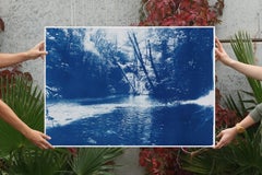
Romantic Landscape of Scandinavian Enchanted Forest, Large Lake Print Cyanotype

Romantic Landscape of Scandinavian Enchanted Forest, Large Lake Print Cyanotype

By Kind of Cyan

Located in Barcelona, ES

This is an exclusive handprinted limited edition cyanotype. Lovely scene of a hidden pond in a Scandinavian forest. Details: + Title: Scandinavian Enchanted Forest + Year: 2026 + ...

Category

2010s Romantic John Mix Stanley Art

Materials

Photographic Film, Emulsion, Watercolor, Monotype, Photogram

Sailboat IV, Peter Max

Peter MaxSailboat IV, Peter Max, 2000

$381Sale Price|20% Off

H 2.75 in W 3.125 in

Sailboat IV, Peter Max

By Peter Max

Located in Fairfield, CT

Artist: Peter Max (1937) Title: Sailboat IV Year: 2000 Edition: 500/500, plus proofs Medium: Lithograph on Lustro Saxony paper Size: 2.75 x 3.125 inches Condition: Excellent Inscript...

Category

Early 2000s Pop Art John Mix Stanley Art

Materials

Lithograph

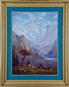
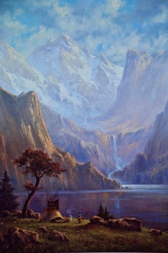
Native American Camp by a Lake & Waterfall, Limited Edition Signed Hartwig Print

Native American Camp by a Lake & Waterfall, Limited Edition Signed Hartwig Print

By Heine Hartwig

Located in Alamo, CA

Limited edition Heine Hartwig print from a painting by the same artist, signed & numbered in gold in the lower right, 722/800. This beautiful, colorful a...

Category

Late 20th Century Romantic John Mix Stanley Art

Materials

Other Medium

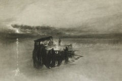
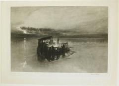
Timber Raft on the Rhine

Timber Raft on the Rhine

By Sir Frank Short

Located in Plano, TX

Timber Raft on the Rhine (after the watercolor by J.M.W. Turner in the National Gallery). 1898. Mezzotint. Hardie 66. 8 1/4 x 11 11/16 (sheet 10 5/16 x 13 1/2). Edition 100. A rich, ...

Category

1890s Romantic John Mix Stanley Art

Materials

Mezzotint

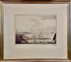
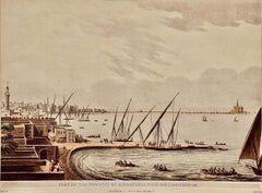
Alexandria, Egypt & Lighthouse: A Hand-colored Aquatint & Engraving by L. Mayer

Alexandria, Egypt & Lighthouse: A Hand-colored Aquatint & Engraving by L. Mayer

By Luigi Mayer

Located in Alamo, CA

This is a hand-colored aquatint and engraving entitled "Part of the New City of Alexandria, with the Light House", published in London by R. Bowyer from 1802-1805. The print was crea...

Category

Early 19th Century Romantic John Mix Stanley Art

Materials

Engraving, Aquatint

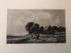
Cottage and Harvesters

Cottage and Harvesters

By Sir Frank Short

Located in Plano, TX

Cottage and Harvesters (after a watercolor by Peter De Wint, 1784-1849). 1907. Mezzotint. Hardie 88. 6 5/8 x 10 11/16 (sheet 14 x 19 1/4). Edition 100. Housed in a 16 x 20 mat. A ver...

Category

Early 1900s Romantic John Mix Stanley Art

Materials

Mezzotint

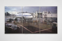
Untitled (Airport Paris)

Untitled (Airport Paris)

By Peter Fischli & David Weiss

Located in New York, NY

Peter Fischli / David Weiss Untitled (Airport Paris) 2008 Offset lithograph on three sheets Each sheet: 51 1/4 x 32 5/8 inches; 130 x 83 cm Edition of 100 Signed and numbered in ink ...

Category

Early 2000s Contemporary John Mix Stanley Art

Materials

Lithograph

The Tennis Court - Mandela, South African President, Signed, Robben Island, sport

The Tennis Court - Mandela, South African President, Signed, Robben Island, sport

By Nelson Mandela

Located in Knowle Lane, Cranleigh

Nelson Mandela, The Tennis Court, Signed Limited Edition Lithograph Many people are unaware that Nelson Mandela turned his hand to art in his 80's as a way of leaving a legacy for hi...

Category

Early 2000s Contemporary John Mix Stanley Art

Materials

Lithograph

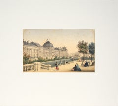
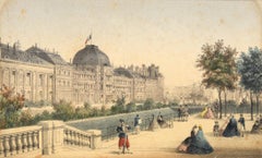
Les Tuileries, Paris - Hand Colored Lithograph 1845-1860

Les Tuileries, Paris - Hand Colored Lithograph 1845-1860

Located in Soquel, CA

Les Tuileries, Paris - Hand Colored Lithograph Delicate hand-colored lithograph of Tuileries Palace in Paris, France printed by Rose-Joseph Lemercier (French, 1803 - 1887). Published, Paris 1843 to 1867 by Hautecoeur Freres (Eugène and Alfred Hautecoeur (French). After Charles Riviere...

Category

Mid-19th Century Romantic John Mix Stanley Art

Materials

Paper, Ink, Watercolor

A Yorkshire Dell or The Heron’s Pool.

Sir Frank ShortA Yorkshire Dell or The Heron’s Pool., 1905

$1,000Sale Price|20% Off

H 20 in W 14 in D 0.5 in

A Yorkshire Dell or The Heron’s Pool.

By Sir Frank Short

Located in Plano, TX

A Yorkshire Dell or The Heron’s Pool. (after J.M.W. Turner, R.A., 1775-1851.) Soft-ground etching and mezzotint. Hardie 85. mezzotint over etching on India paper printed on chine-co...

Category

Early 20th Century Romantic John Mix Stanley Art

Materials

Mezzotint, Etching

John Mix Stanley art for sale on 1stDibs.

Find a wide variety of authentic John Mix Stanley art available for sale on 1stDibs. You can also browse by medium to find art by John Mix Stanley in lithograph and more. Not every interior allows for large John Mix Stanley art, so small editions measuring 17 inches across are available. Customers who are interested in this artist might also find the work of Nathaniel Currier, Eugene Delacroix, and Sunol Alvar. John Mix Stanley art prices can differ depending upon medium, time period and other attributes. On 1stDibs, the price for these items starts at $950 and tops out at $1,150, while the average work can sell for $1,150.

Artists Similar to John Mix Stanley