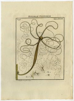
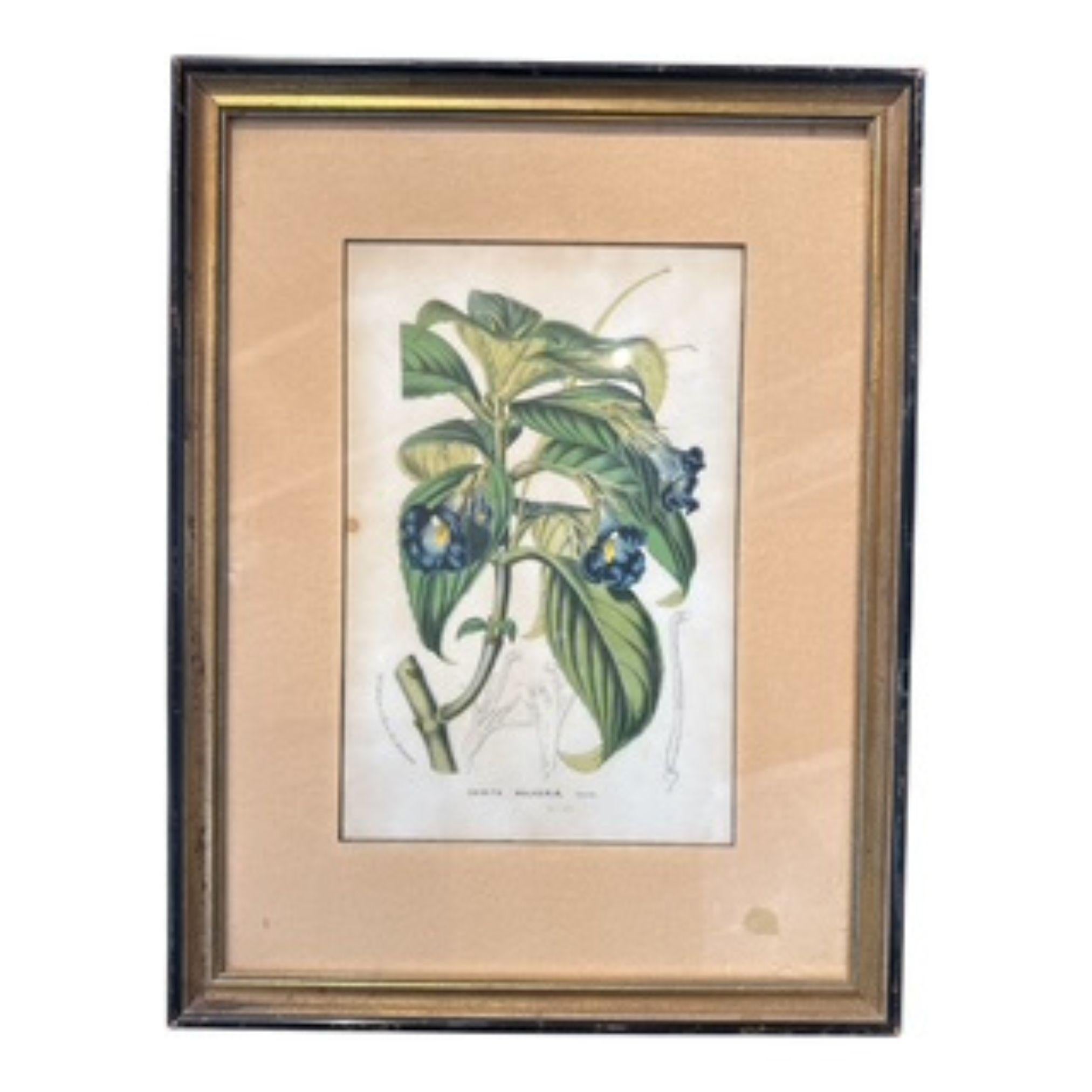
Historiae Polyporum. Tab. LXXXIV-LXXXVII.


1 of 4
August Johann Rösel von RosenhofHistoriae Polyporum. Tab. LXXXIV-LXXXVII.1765
1765
$165.51List Price
About the Item
- Creator:August Johann Rösel von Rosenhof (1705 - 1759, German)
- Creation Year:1765
- Dimensions:Height: 10.83 in (27.5 cm)Width: 8.47 in (21.5 cm)
- Medium:
- Period:1760-1769
- Condition:Some faint soiling and/or staining in the margin edges. Image faintly browned. Faint offsetting of the opposite text page. General age-related toning and occasional minor defects from handling.
- Gallery Location:Zeeland, NL
- Reference Number:Seller: 650651stDibs: LU59232988021
Authenticity Guarantee
In the unlikely event there’s an issue with an item’s authenticity, contact us within 1 year for a full refund. DetailsMoney-Back Guarantee
If your item is not as described, is damaged in transit, or does not arrive, contact us within 7 days for a full refund. Details24-Hour Cancellation
You have a 24-hour grace period in which to reconsider your purchase, with no questions asked.Vetted Professional Sellers
Our world-class sellers must adhere to strict standards for service and quality, maintaining the integrity of our listings.Price-Match Guarantee
If you find that a seller listed the same item for a lower price elsewhere, we’ll match it.Trusted Global Delivery
Our best-in-class carrier network provides specialized shipping options worldwide, including custom delivery.You May Also Like
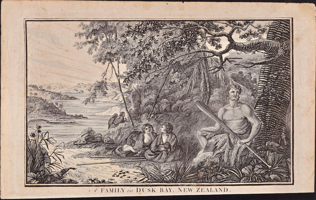
Family in Dusky Bay, New Zealand: Original 18th C. Engraving from Captain Cook
By William Hodges
Located in Alamo, CA
"A Family in Dusk Bay, New Zealand" is an original 18th century engraving from a drawing by William Hodges (1744-1797), who was the artist who accompanies Captain Cook on his second ...
Category
1780s Landscape Prints
Materials
Engraving

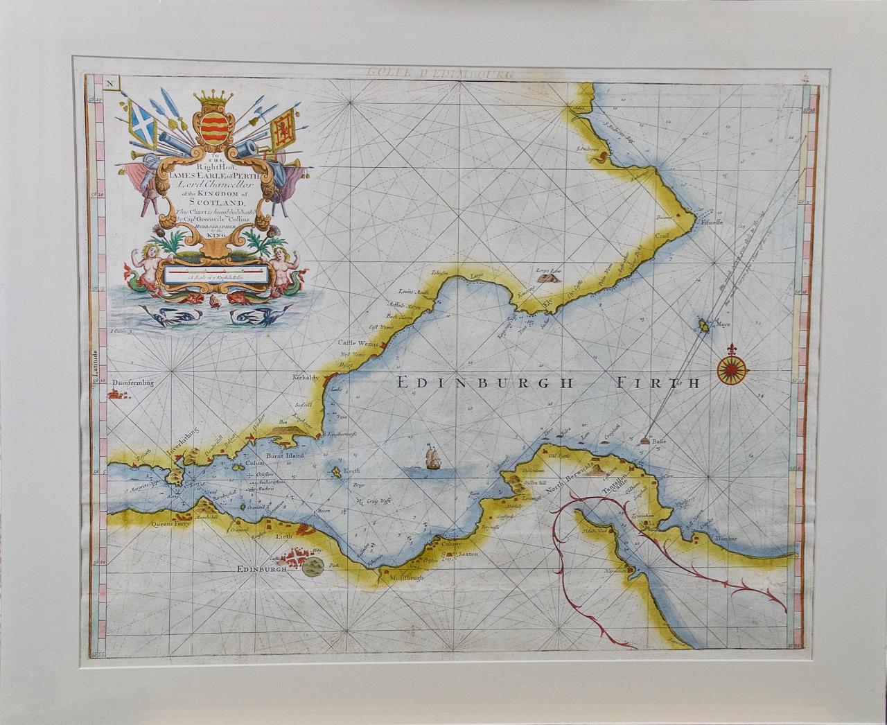
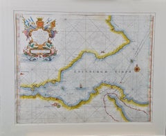
Edinburgh, Scotland: An Original 17th C. Hand-Colored Engraved Sea Chart
By Captain Greenvile Collins
Located in Alamo, CA
This hand-colored sea chart is entitled "Edinburgh Firth" from "Great Britain's Coasting Pilot. Being a New and Exact Survey of the Sea-Coast of England" by Captain Greenville Collin...
Category
Late 17th Century Landscape Prints
Materials
Engraving
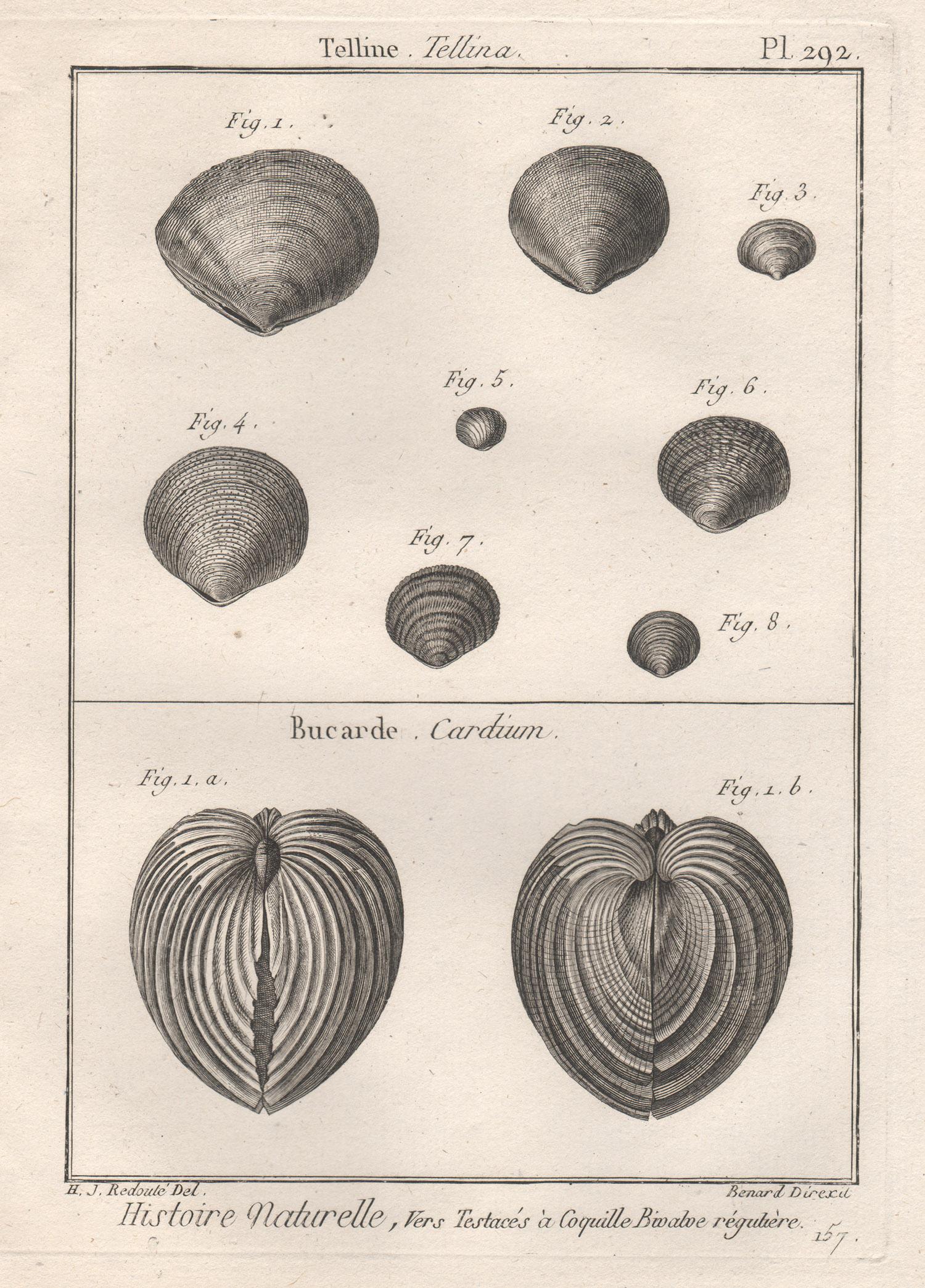
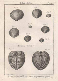
Shells, French 18th century natural history marine sea shell engraving
Located in Melbourne, Victoria
18th century natural history engraving depicting shells by Robert Benard after Henry Joseph Redoute.
Henry Redoute was the bro...
Category
Late 18th Century Victorian More Prints
Materials
Engraving
Persia, Armenia & Adjacent Regions: A Hand-colored 17th Century Map by De Wit
By Frederick de Wit
Located in Alamo, CA
This colorful and detailed 17th century copperplate map by Frederick De Wit was published in Amsterdam between 1666 and 1690. It depicts the Caspian Se...
Category
Late 17th Century Old Masters More Prints
Materials
Engraving

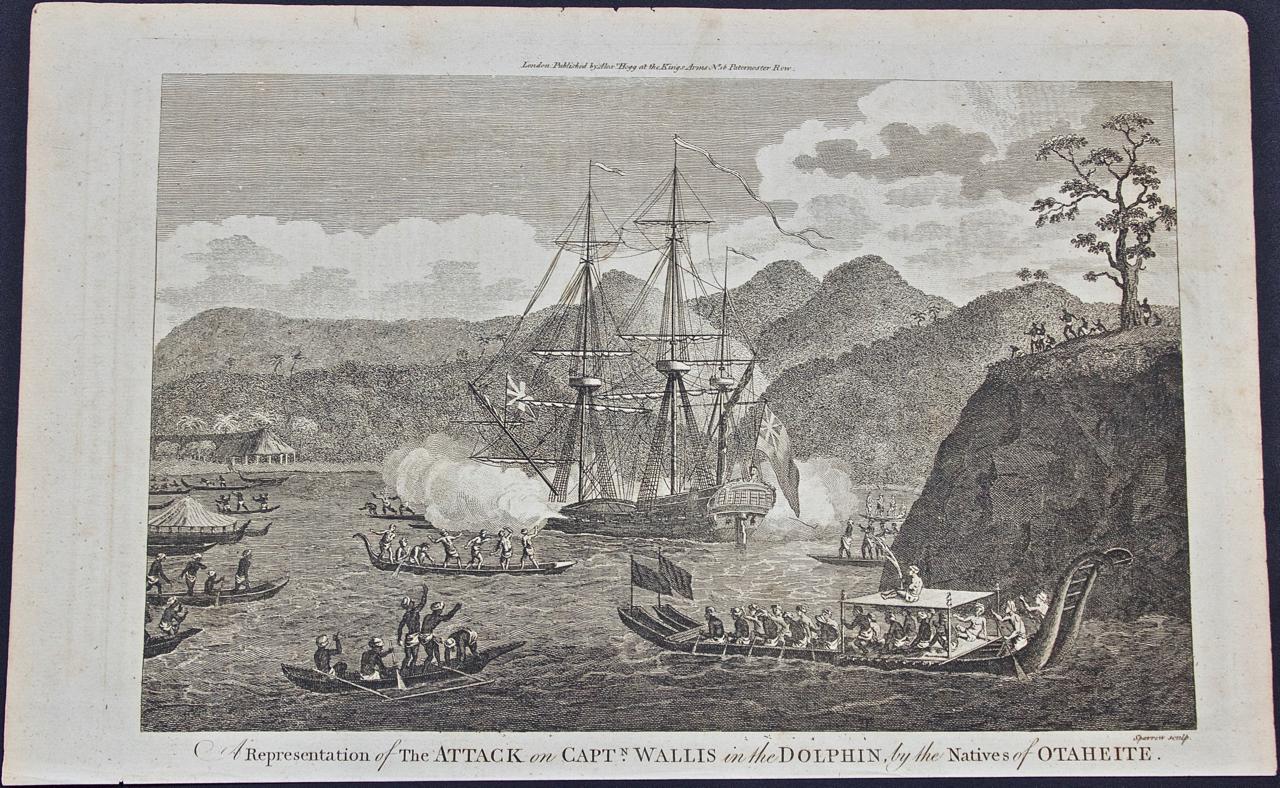
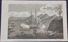
Attack on Captain Wallis When He Discovered Tahiti: Original 18th C. Engraving
Located in Alamo, CA
"A Representation of the Attack on Captain Wallis in the Dolphin by the Natives of Otaheite (Tahiti)" is an engraving created by the artist Sparrow based on an engraving in John Hawk...
Category
1780s Landscape Prints
Materials
Engraving
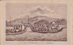
The Fleet of Tahiti displayed for Captain Cook: An Original 18th C. Engraving
By William Hodges
Located in Alamo, CA
"The Fleet of Otaheite, Assembled at Oparee" is an original 18th century engraving from a drawing by William Hodges (1744-1797), who was the artist who accompanies Captain Cook on hi...
Category
1780s Landscape Prints
Materials
Engraving
Recently Viewed
View AllMore Ways To Browse
Vintage Little Bo Peep
Vintage Madeira Linens
Warhol Chicken Noodle
Yusaku Kamekura
Zell Am See Vintage Poster
Akira Yamaguchi
Amado Gonzalez
Andre Hemer
Beatrice Mallet
Cake Risograph
Charles Fazzino We Are The World
Courchevel Vintage Poster
Ed Ruscha Sin With Olive
Ewan David Eason
Gustav Klutsis
Ivan Navarro
James Bond Movie Posters
John Lennon On Sale