Items Similar to Spectra of the Sun, Stars, Gases & c. Antique Astronomy science print

Want more images or videos?
Request additional images or videos from the seller
1 of 3
Spectra of the Sun, Stars, Gases & c. Antique Astronomy science print1890
1890
$120
£91.14
€104.83
CA$167.66
A$186.96
CHF 97.55
MX$2,294.12
NOK 1,241.65
SEK 1,176.44
DKK 782.39
Shipping
Retrieving quote...The 1stDibs Promise:
Authenticity Guarantee,
Money-Back Guarantee,
24-Hour Cancellation
About the Item
Colour lithograph, 1890. 285mm by 210mm (sheet). From W Peck's 'A Handbook and Atlas of Astronomy', 1890. Sir William Peck FRSE FRAS (1862 – 1925) was a Scottish astronomer and scientific instrument maker.
- Creation Year:1890
- Dimensions:Height: 11.23 in (28.5 cm)Width: 8.27 in (21 cm)
- Medium:
- Movement & Style:
- After:William Peck (British)
- Period:
- Condition:Faint marks in the margins.
- Gallery Location:Melbourne, AU
- Reference Number:1stDibs: LU1244213118342
About the Seller
5.0
Platinum Seller
Premium sellers with a 4.7+ rating and 24-hour response times
Established in 2005
1stDibs seller since 2019
585 sales on 1stDibs
Typical response time: 1 hour
- ShippingRetrieving quote...Shipping from: Melbourne, Australia
- Return Policy
Authenticity Guarantee
In the unlikely event there’s an issue with an item’s authenticity, contact us within 1 year for a full refund. DetailsMoney-Back Guarantee
If your item is not as described, is damaged in transit, or does not arrive, contact us within 7 days for a full refund. Details24-Hour Cancellation
You have a 24-hour grace period in which to reconsider your purchase, with no questions asked.Vetted Professional Sellers
Our world-class sellers must adhere to strict standards for service and quality, maintaining the integrity of our listings.Price-Match Guarantee
If you find that a seller listed the same item for a lower price elsewhere, we’ll match it.Trusted Global Delivery
Our best-in-class carrier network provides specialized shipping options worldwide, including custom delivery.More From This Seller
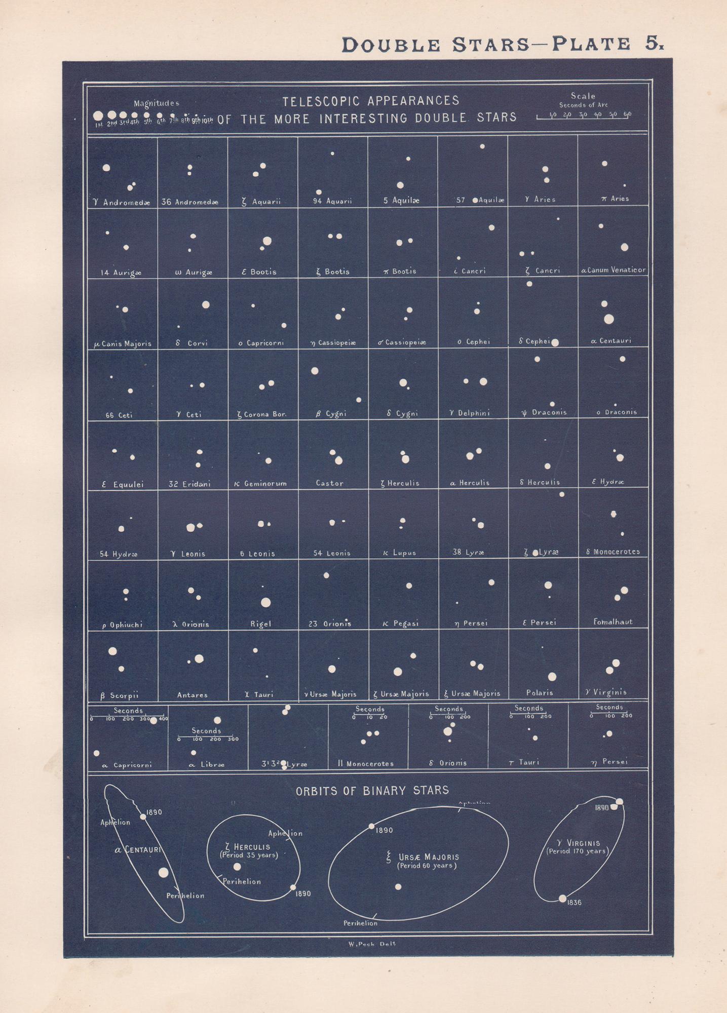
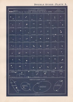
View AllDouble Stars. Antique Astronomy science print
Located in Melbourne, Victoria
Colour lithograph, 1890. 285mm by 210mm (sheet). From W Peck's 'A Handbook and Atlas of Astronomy', 1890. Sir William Peck FRSE FRAS (1862 – 1925) was a Scottish astronomer and scien...
Category
Late 19th Century Victorian More Prints
Materials
Lithograph
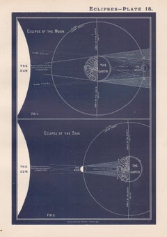
Eclipses. Antique Astronomy science print
Located in Melbourne, Victoria
Colour lithograph, 1890. 285mm by 210mm (sheet). From W Peck's 'A Handbook and Atlas of Astronomy', 1890. Sir William Peck FRSE FRAS (1862 – 1925) was a Scottish astronomer and scien...
Category
Late 19th Century Victorian More Prints
Materials
Lithograph
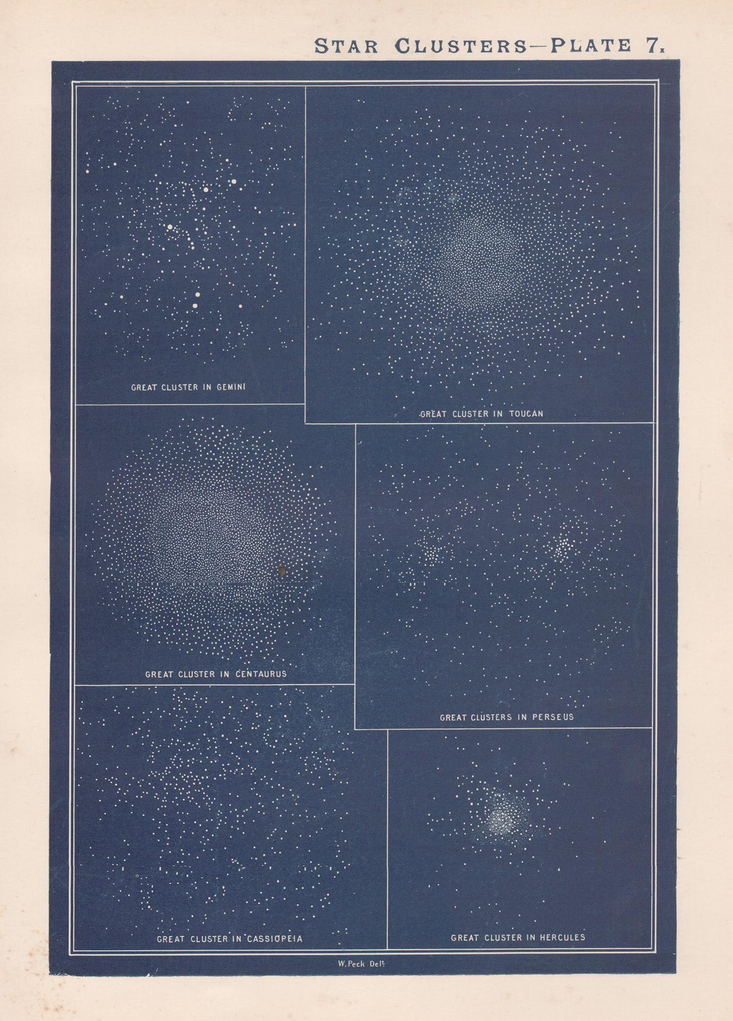
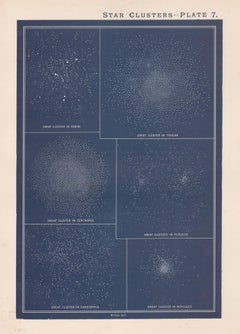
Star Clusters. Antique Astronomy print
Located in Melbourne, Victoria
Colour lithograph, 1890. 285mm by 210mm (sheet). From W Peck's 'A Handbook and Atlas of Astronomy', 1890. Sir William Peck FRSE FRAS (1862 – 1925) was a Scottish astronomer and scien...
Category
Late 19th Century Victorian More Prints
Materials
Lithograph
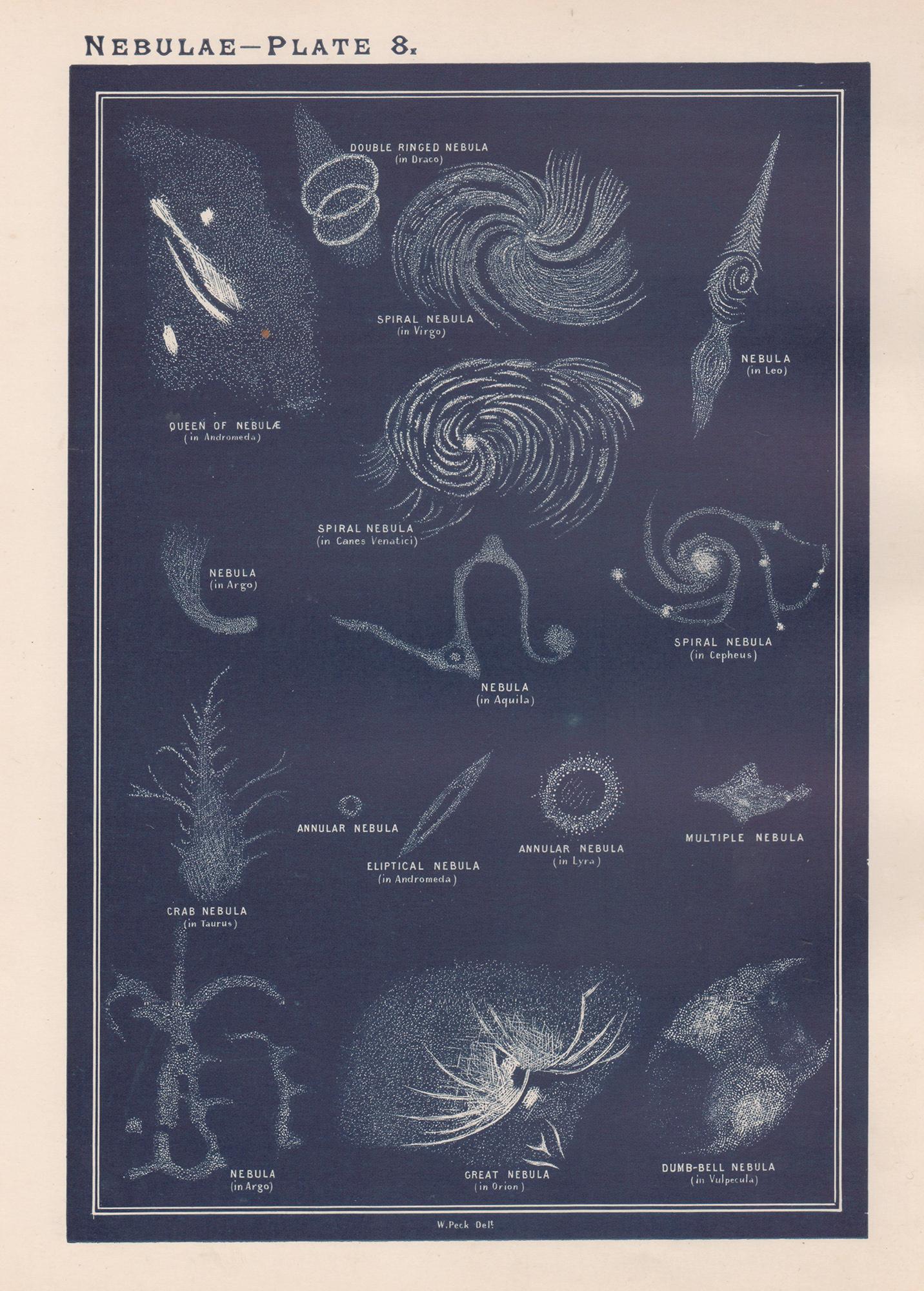
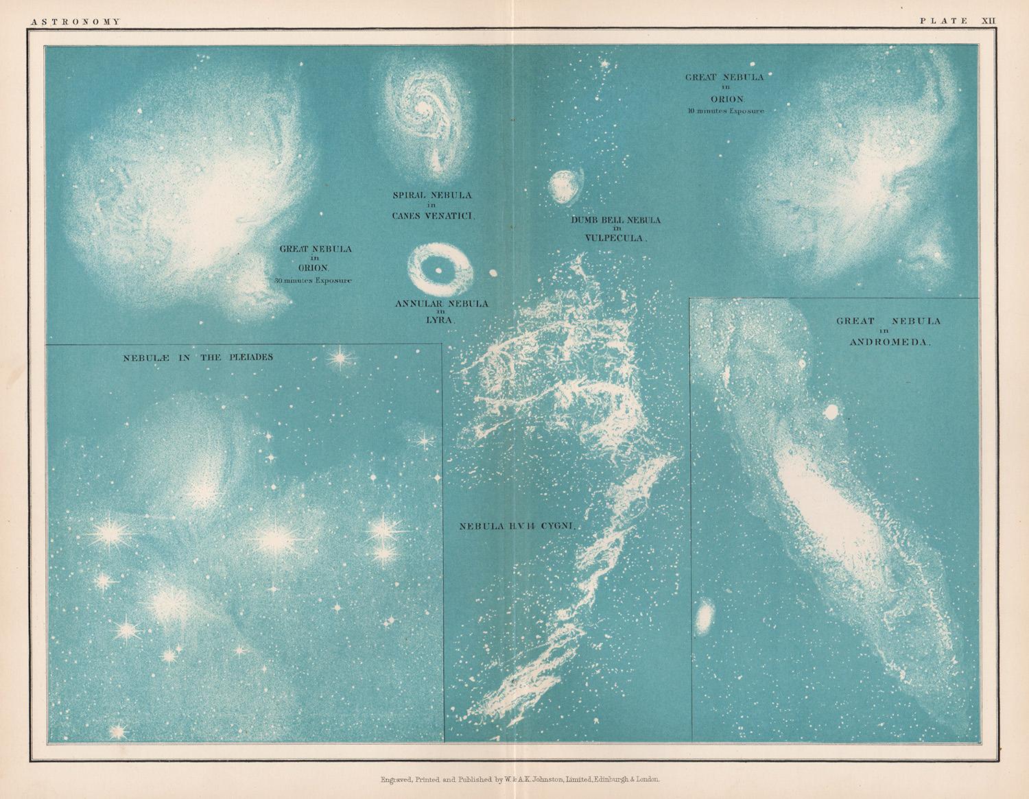
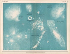
Nebulae. Antique Astronomy print
Located in Melbourne, Victoria
Colour lithograph, 1890. 285mm by 210mm (sheet). From W Peck's 'A Handbook and Atlas of Astronomy', 1890. Sir William Peck FRSE FRAS (1862 – 1925) was a Scottish astronomer and scien...
Category
Late 19th Century Victorian More Prints
Materials
Lithograph

Nebulae, antique astronomy science diagram illustration print
Located in Melbourne, Victoria
Nebulae.
Antique lithograph by W & AK Johnston, famous Scottish cartographers.
Central vertical fold as issued. From Thomas Heath's 'The Twentieth Centur...
Category
Early 20th Century Victorian More Prints
Materials
Lithograph
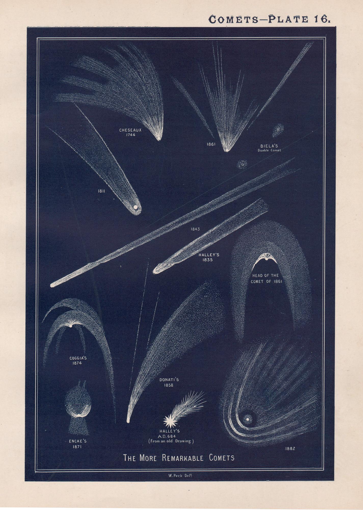
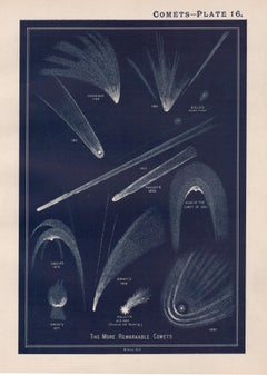
Comets. Antique Astronomy print
Located in Melbourne, Victoria
Colour lithograph, 1890. 285mm by 210mm (sheet). From W Peck's 'A Handbook and Atlas of Astronomy', 1890. Sir William Peck FRSE FRAS (1862 – 1925) was a Scottish astronomer and scien...
Category
Late 19th Century Victorian More Prints
Materials
Lithograph
You May Also Like
Antique Print of the World's Time Zones by Johnson, 1872
Located in Langweer, NL
Antique print titled 'A Diagram exhibiting the difference of time between the places shown & Washington'. Original print of the World's time zones. This map originates from 'Johnson'...
Category
Antique Late 19th Century Prints
Materials
Paper
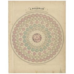
$285 Sale Price
20% Off
Original Antique Astronomy Print. C.1900
Located in St Annes, Lancashire
Great image of the solar system
Unframed.
Chromo-lithograph
Published, C.1900
The measurement is the paper size of the print
Free shipping.
Category
Antique Early 1900s English Folk Art Prints
Materials
Paper
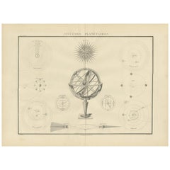
Antique Chart of Celestial and Scientific Models by Lapie, 1842
Located in Langweer, NL
Antique print titled 'Systèmes Planétaires'. Chart of various celestial and scientific models. Includes an armillary sphere and various models of the universe, the season, eclipses, a Copernican, Tycho...
Category
Antique Mid-19th Century French Prints
Materials
Paper
$714 Sale Price
25% Off
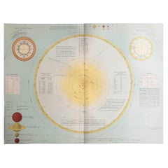
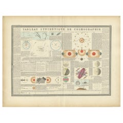
Antique Print of the Planetary Systems of the World by Levasseur, '1875'
Located in Langweer, NL
Antique print titled 'Tableau Synthétique de Cosmographie'. Large print depicting the planetary systems of the world. This map originates from 'Atlas de Géographie Moderne Physique e...
Category
Antique Late 19th Century Prints
Materials
Paper
$476 Sale Price
20% Off
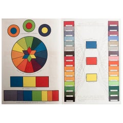
Original Antique Print of A Colour Chart . C.1900
Located in St Annes, Lancashire
Great image of a colour chart
Unframed.
Chromo-lithograph
Published, C.1900
The measurement is the paper size of the print
Free shipping.
Category
Antique Early 1900s English Folk Art Prints
Materials
Paper
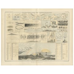
Cartography Print 1852 – Educational Diagram of Mountains, Winds, and Reefs
Located in Langweer, NL
Cartographic Masterpiece 1852 – Illustrated Guide to Map Symbols and Climate
Description:
This original 1852 plate titled "Illustrations of Chartography Plate I" offers a fascinating and visually rich introduction to 19th-century mapping techniques. Published in A School Atlas of Physical Geography by the eminent Scottish cartographer Alexander Keith Johnston, the plate served as an educational tool designed to teach the principles of cartography, climatology, geology, and meteorology.
The detailed engravings include symbolic representations used on maps, such as forms of mountains, volcanoes, reef systems, and rainfall diagrams, along with charts of wind directions, cloud formations, and the system of contouring. Particularly notable is the lower section titled "Climatography," which combines scientific elements into a picturesque landscape featuring a rainbow, tornado, sea spray, and a mountain chain—all stylized to represent the natural forces shaping Earth’s surface.
Johnston was a leading cartographer of the Victorian period, and this atlas was used widely in schools and scientific circles for its clarity and innovative visual methods. The plate was engraved and printed by W. & A.K. Johnston, his family firm, which gained a global reputation for excellence in educational publishing.
This chart is not only historically significant but also aesthetically appealing, making it an ideal piece for collectors of antique scientific prints...
Category
Antique Mid-19th Century Prints
Materials
Paper