Items Similar to Nebulae, antique astronomy science diagram illustration print
Want more images or videos?
Request additional images or videos from the seller
1 of 3
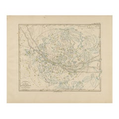
Nebulae, antique astronomy science diagram illustration print1901
1901
$150
£113.35
€130.89
CA$209.60
A$232.57
CHF 121.83
MX$2,851.95
NOK 1,549.58
SEK 1,462.74
DKK 976.14
Shipping
Retrieving quote...The 1stDibs Promise:
Authenticity Guarantee,
Money-Back Guarantee,
24-Hour Cancellation
About the Item
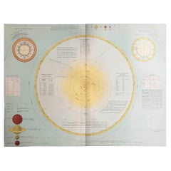
Nebulae.
Antique lithograph by W & AK Johnston, famous Scottish cartographers.
Central vertical fold as issued. From Thomas Heath's 'The Twentieth Century Atlas of Popular Astronomy', 1901.
240mm by 370mm (sheet)
Alexander Keith Johnston FRSE FRGS FGS FEGS LLD (1804 – 1871) was a Scottish geographer and cartographer. In 1826, he joined his brother William in a printing and engraving business, forming the well-known cartographical firm of W. and A. K. Johnston.
- Creation Year:1901
- Dimensions:Height: 9.45 in (24 cm)Width: 14.57 in (37 cm)
- Medium:
- Movement & Style:
- After:Alexander Keith Johnston (1804 - 1871, British)
- Period:
- Condition:Central vertical fold as issued.
- Gallery Location:Melbourne, AU
- Reference Number:1stDibs: LU1244210940982
About the Seller
5.0
Platinum Seller
Premium sellers with a 4.7+ rating and 24-hour response times
Established in 2005
1stDibs seller since 2019
585 sales on 1stDibs
Typical response time: 1 hour
- ShippingRetrieving quote...Shipping from: Melbourne, Australia
- Return Policy
Authenticity Guarantee
In the unlikely event there’s an issue with an item’s authenticity, contact us within 1 year for a full refund. DetailsMoney-Back Guarantee
If your item is not as described, is damaged in transit, or does not arrive, contact us within 7 days for a full refund. Details24-Hour Cancellation
You have a 24-hour grace period in which to reconsider your purchase, with no questions asked.Vetted Professional Sellers
Our world-class sellers must adhere to strict standards for service and quality, maintaining the integrity of our listings.Price-Match Guarantee
If you find that a seller listed the same item for a lower price elsewhere, we’ll match it.Trusted Global Delivery
Our best-in-class carrier network provides specialized shipping options worldwide, including custom delivery.More From This Seller
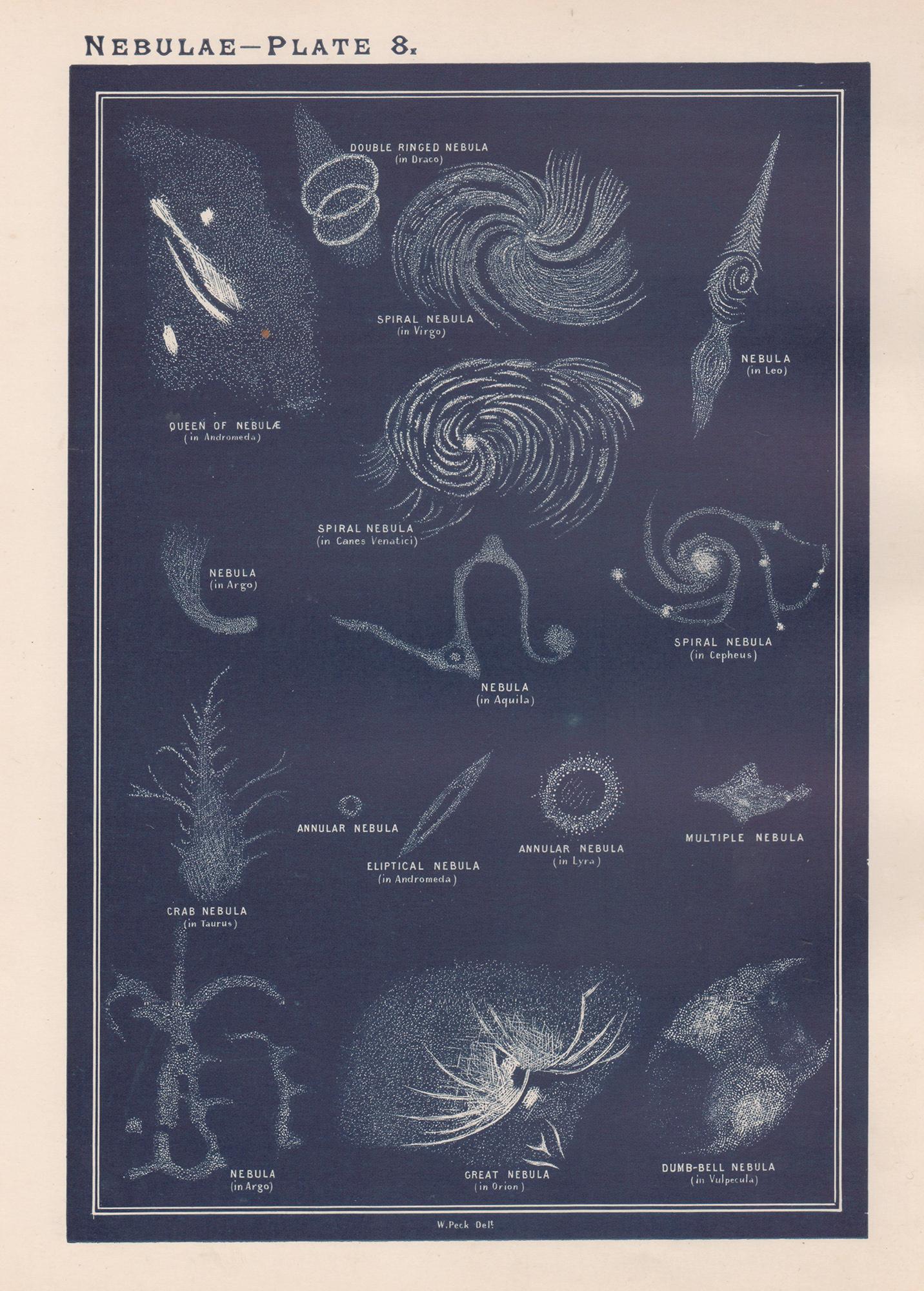
View AllNebulae. Antique Astronomy print
Located in Melbourne, Victoria
Colour lithograph, 1890. 285mm by 210mm (sheet). From W Peck's 'A Handbook and Atlas of Astronomy', 1890. Sir William Peck FRSE FRAS (1862 – 1925) was a Scottish astronomer and scien...
Category
Late 19th Century Victorian More Prints
Materials
Lithograph

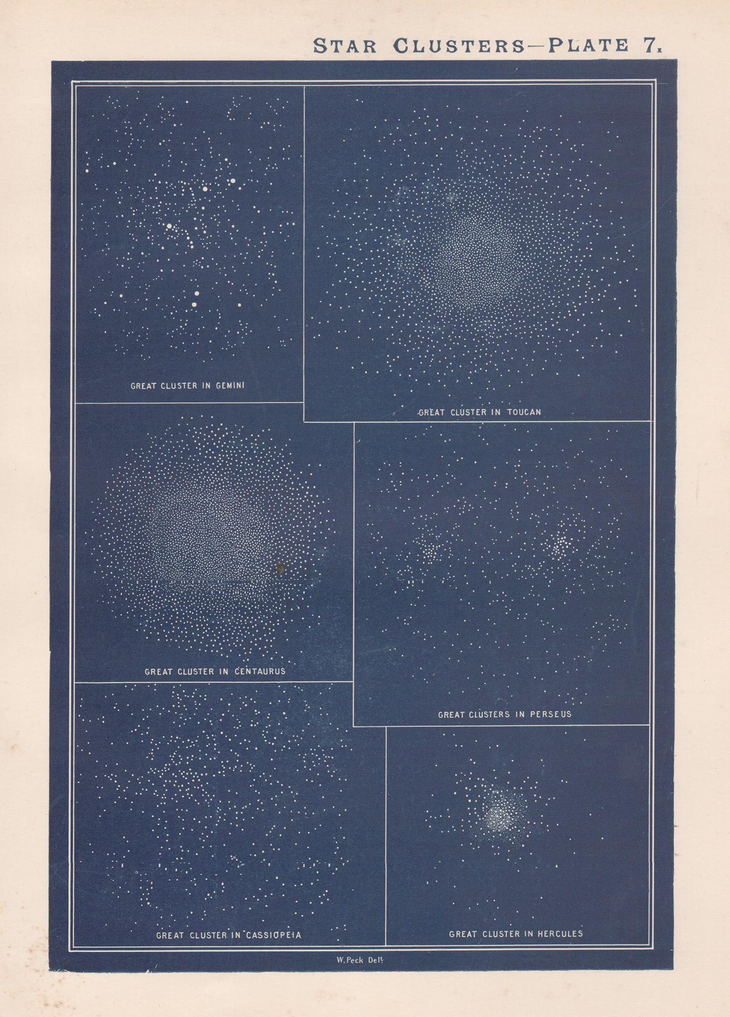
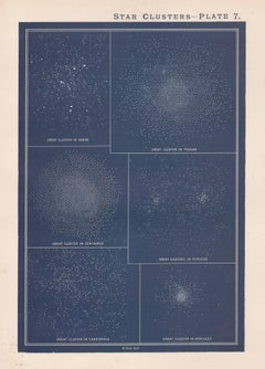
Star Clusters. Antique Astronomy print
Located in Melbourne, Victoria
Colour lithograph, 1890. 285mm by 210mm (sheet). From W Peck's 'A Handbook and Atlas of Astronomy', 1890. Sir William Peck FRSE FRAS (1862 – 1925) was a Scottish astronomer and scien...
Category
Late 19th Century Victorian More Prints
Materials
Lithograph
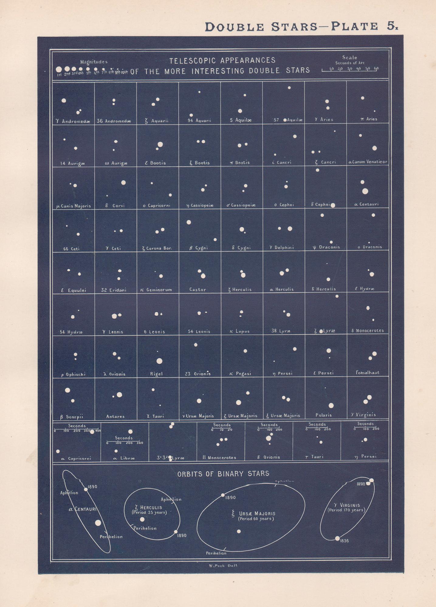
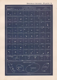
Double Stars. Antique Astronomy science print
Located in Melbourne, Victoria
Colour lithograph, 1890. 285mm by 210mm (sheet). From W Peck's 'A Handbook and Atlas of Astronomy', 1890. Sir William Peck FRSE FRAS (1862 – 1925) was a Scottish astronomer and scien...
Category
Late 19th Century Victorian More Prints
Materials
Lithograph
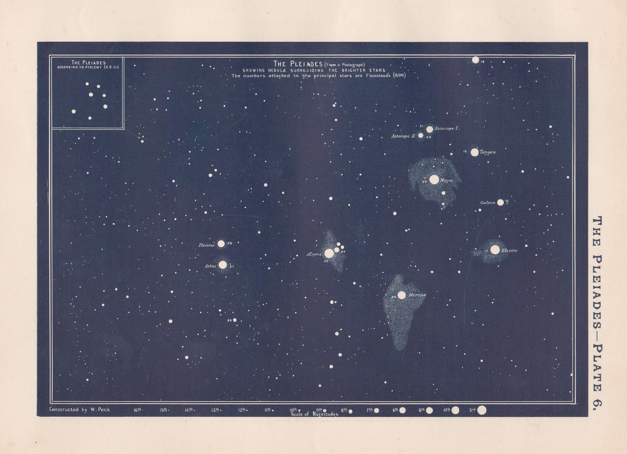
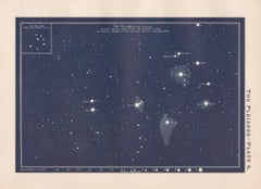
The Pleiades. Antique Astronomy celestial print
Located in Melbourne, Victoria
Colour lithograph, 1890. 210mm by 285mm (sheet). From W Peck's 'A Handbook and Atlas of Astronomy', 1890. Sir William Peck FRSE FRAS (1862 – 1925) was a Scottish astronomer and scien...
Category
Late 19th Century Victorian More Prints
Materials
Lithograph
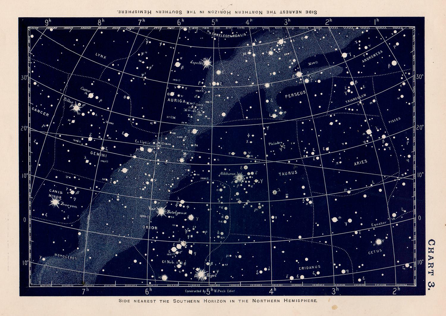
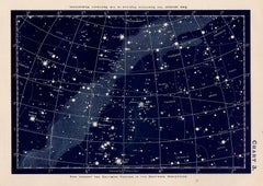
Star Chart. Antique Astronomy celestial print
Located in Melbourne, Victoria
Colour lithograph, 1890. 210mm by 285mm (sheet). From W Peck's 'A Handbook and Atlas of Astronomy', 1890. Sir William Peck FRSE FRAS (1862 – 1925) was a Scottish astronomer and scien...
Category
Late 19th Century Victorian More Prints
Materials
Lithograph
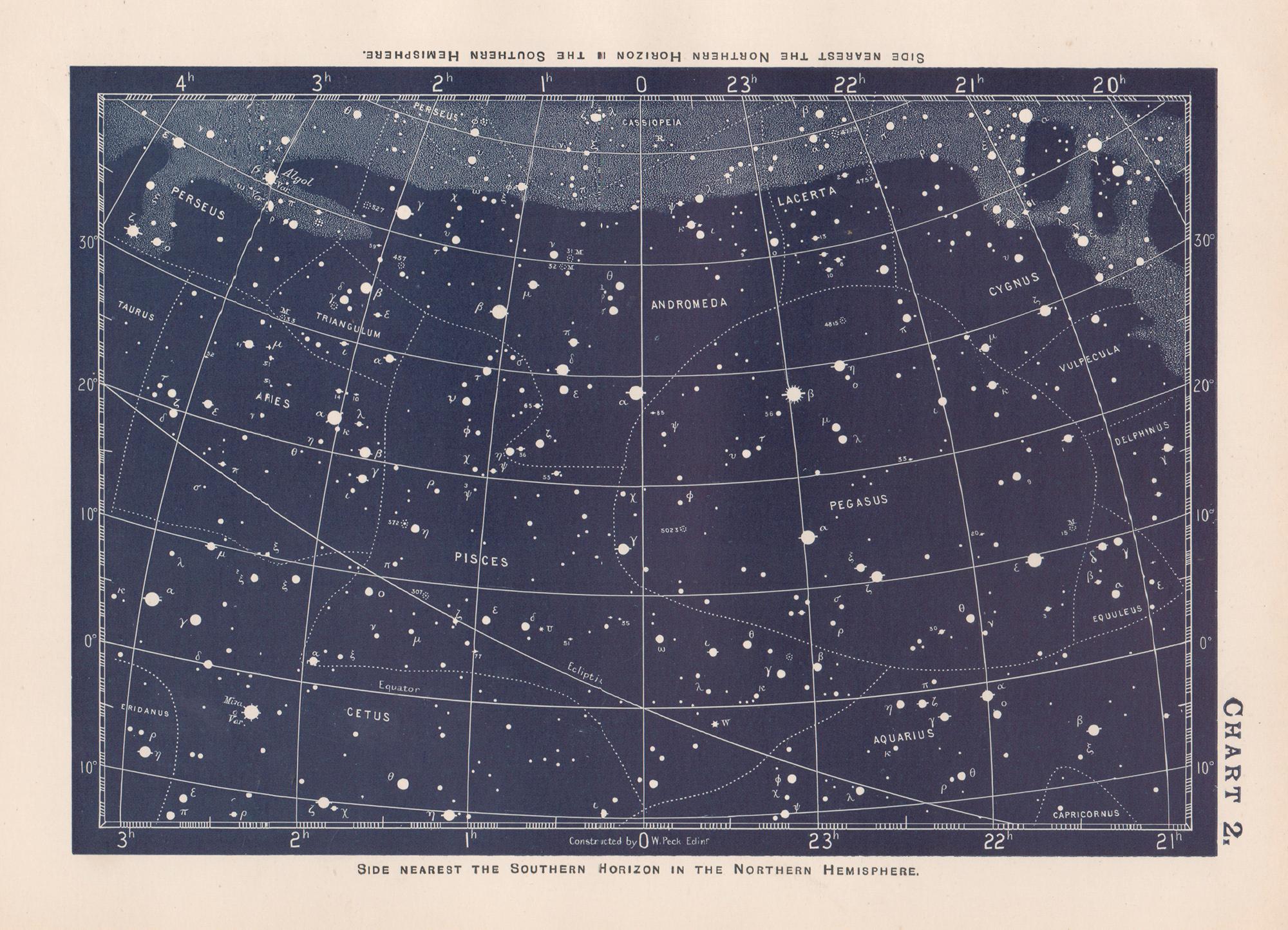
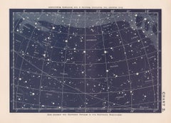
Star Chart. Antique Astronomy celestial print
Located in Melbourne, Victoria
Colour lithograph, 1890. 210mm by 285mm (sheet). From W Peck's 'A Handbook and Atlas of Astronomy', 1890. Sir William Peck FRSE FRAS (1862 – 1925) was a Scottish astronomer and scien...
Category
Late 19th Century Victorian More Prints
Materials
Lithograph
You May Also Like
Northern Hemisphere Star Map – Constellations & Astronomical Chart, c.1858
Located in Langweer, NL
Northern Hemisphere Star Map – Constellations & Astronomical Chart c.1858
This attractive antique print shows the northern starry sky titled “Der nördliche gestirnte Himmel”, meanin...
Category
Antique Mid-19th Century German Maps
Materials
Paper
Original Antique Astronomy Print. C.1900
Located in St Annes, Lancashire
Great image of the solar system
Unframed.
Chromo-lithograph
Published, C.1900
The measurement is the paper size of the print
Free shipping.
Category
Antique Early 1900s English Folk Art Prints
Materials
Paper
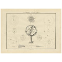
Antique Chart of Celestial and Scientific Models by Lapie, 1842
Located in Langweer, NL
Antique print titled 'Systèmes Planétaires'. Chart of various celestial and scientific models. Includes an armillary sphere and various models of the universe, the season, eclipses, a Copernican, Tycho...
Category
Antique Mid-19th Century French Prints
Materials
Paper
$715 Sale Price
25% Off
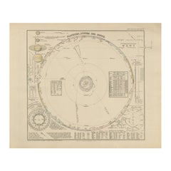
Solar System Map – Planetary Orbits and Data Chart, Published in 1857
Located in Langweer, NL
Solar System Map – Planetary Orbits and Data Chart 1857
This antique print shows a detailed diagram of the solar system titled “Planeten-System der Sonne” meaning “Planetary System ...
Category
Antique Mid-19th Century German Maps
Materials
Paper
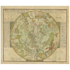
Antique Chart of the Passage of Comets in the Southern Sky, circa 1740
Located in Langweer, NL
Antique map titled 'Motus Comtarum in Hemispaerio Australi (..)'. This uncommon chart depicts the passage of comets in the southern sky between the years 1530-1704. Centered on the ecliptic poles and shows the constellation figures based on classical mythology, without showing the stars. The paths of dozens of comets are illustrated, eincluding those sighted by Tycho Brahe...
Category
Antique Mid-18th Century Maps
Materials
Paper
$2,235 Sale Price
25% Off
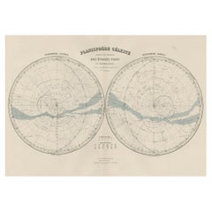
Antique Map of the Night Skies of the Northern and Southern Hemispheres, 1880
Located in Langweer, NL
Antique world map titled 'Planisphère en Céleste'.
This map depicts the night skies of both the northern and southern hemispheres. This map originates from 'Géographie Universell...
Category
Antique 1880s Maps
Materials
Paper
$276 Sale Price
20% Off
More Ways To Browse
Victorian Antique Illustrations
Vintage Austria Ski Poster
Used Church Organ
Lucas Van Leyden
Keith Haring Deck
Shepard Fairey Letterpress
John Lennon Lyrics
Keith Haring Skate
Soviet Poster 1920
Vintage Cross Country Skis
Vladimir Lenin
Drolatiques De Pantagruel
Matador Sculpture
Picasso Matador
Sci Fi Retro Space Art
Francis Xavier
Rubber Stamp Portfolio
Russian Ballet Poster