Items Similar to Map of Edgartown, Martha's Vineyard

Want more images or videos?
Request additional images or videos from the seller
1 of 3
UnknownMap of Edgartown, Martha's Vineyardca. 1938
ca. 1938
$225
£170.86
€197.50
CA$316.22
A$352.11
CHF 186.20
MX$4,284.92
NOK 2,347.12
SEK 2,211.33
DKK 1,474.03
About the Item
Original map of Edgartown, Martha's Vineyard with recent hand-coloring, 1938. Light toning to edges; has original holes punched in left edge. From "Massachusetts City and Town Maps" by the Massachusetts Geodetic Survey.

About the Seller
4.9
Recognized Seller
These prestigious sellers are industry leaders and represent the highest echelon for item quality and design.
Established in 1972
1stDibs seller since 2016
187 sales on 1stDibs
Typical response time: <1 hour
Associations
International Fine Print Dealers Association
- ShippingRetrieving quote...Shipping from: New York, NY
- Return Policy
Authenticity Guarantee
In the unlikely event there’s an issue with an item��’s authenticity, contact us within 1 year for a full refund. DetailsMoney-Back Guarantee
If your item is not as described, is damaged in transit, or does not arrive, contact us within 7 days for a full refund. Details24-Hour Cancellation
You have a 24-hour grace period in which to reconsider your purchase, with no questions asked.Vetted Professional Sellers
Our world-class sellers must adhere to strict standards for service and quality, maintaining the integrity of our listings.Price-Match Guarantee
If you find that a seller listed the same item for a lower price elsewhere, we’ll match it.Trusted Global Delivery
Our best-in-class carrier network provides specialized shipping options worldwide, including custom delivery.More From This Seller
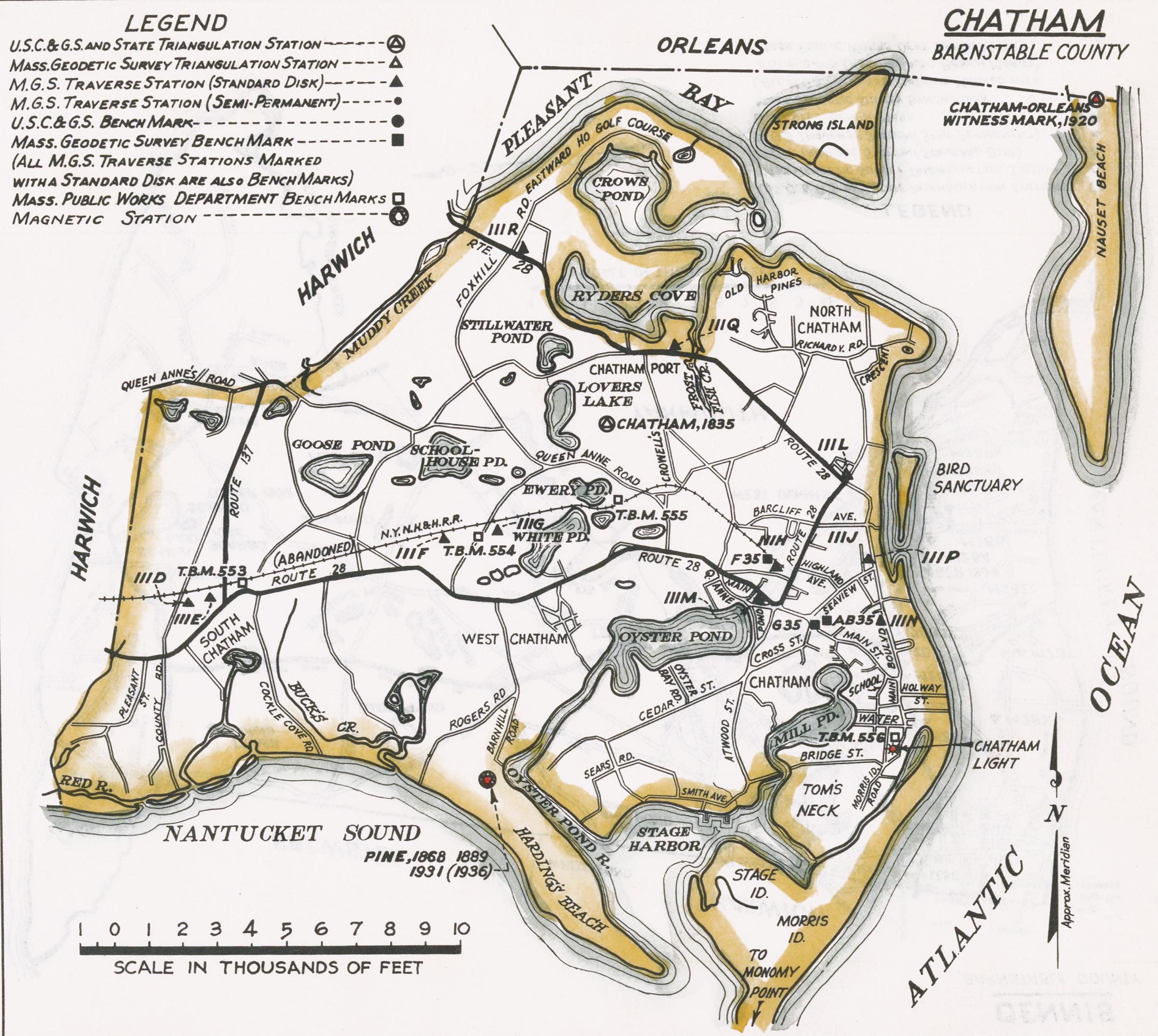
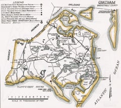
View AllMap of Chatham, Cape Cod
Located in New York, NY
Original map of Chatham, Cape Cod, with recent hand-coloring, 1938. Light toning to edges; has original holes punched in left edge. From "Massachusetts Cit...
Category
1930s Prints and Multiples
Materials
Paper
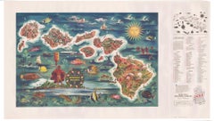
The Dole Map of the Hawaiian Islands.
Located in New York, NY
Original color lithograph. Honolulu. Hawaiian Pineapple Company, 1950.
Category
1950s Prints and Multiples
Materials
Paper
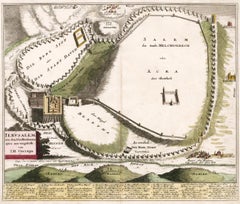
Map of Biblical Jerusalem
Located in New York, NY
Original copper engraving hand-colored at the time of publication. Nuremberg, 1720.
Category
1720s Prints and Multiples
Materials
Paper
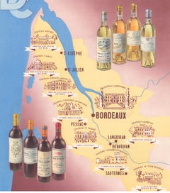
Wine Map of Bordeaux
Located in New York, NY
Original color lithograph for Établissements D. Cordier S.A. Draeger, Imp., circa 1938.
Category
1930s Prints and Multiples
Materials
Paper
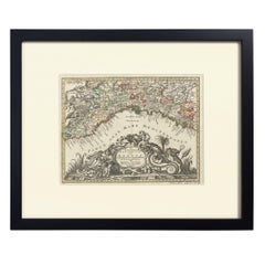
Hand-Colored Map of Genoa, circa 1744
By Matthew Seutter
Located in New York, NY
Seutter, Matthew.
Genova [Genoa].
From Atlas minor praecipua Terrarum Imperia...
Augsburg, circa 1744.
Original engraving with old hand-coloring.
Image size: 7 5/8 x 10 inches.
Materials
Paper
Two-Part Large Hand-Colored Map of Europe from 1798
By Thomas Kitchin
Located in New York, NY
Map of Europe printed on two separate sheets from A New Universal Atlas by Thomas Kitchin. Published in London by Laurie & Whittle, 1798. Original engravings hand-colored at publicat...
Category
1790s More Art
Materials
Paper

$1,700 Sale Price
33% Off
You May Also Like
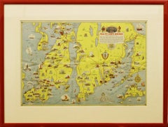
"Rhode Island Map, 1933"
Located in Bristol, CT
Classic c1933 colour (12 fold) red framed map of Rhode Island designed by H.W. Hetherington from Narragansett Bay to Buzzard's Bay
Map Sz: 17 3/8"...
Category
1930s Prints and Multiples
Materials
Lithograph
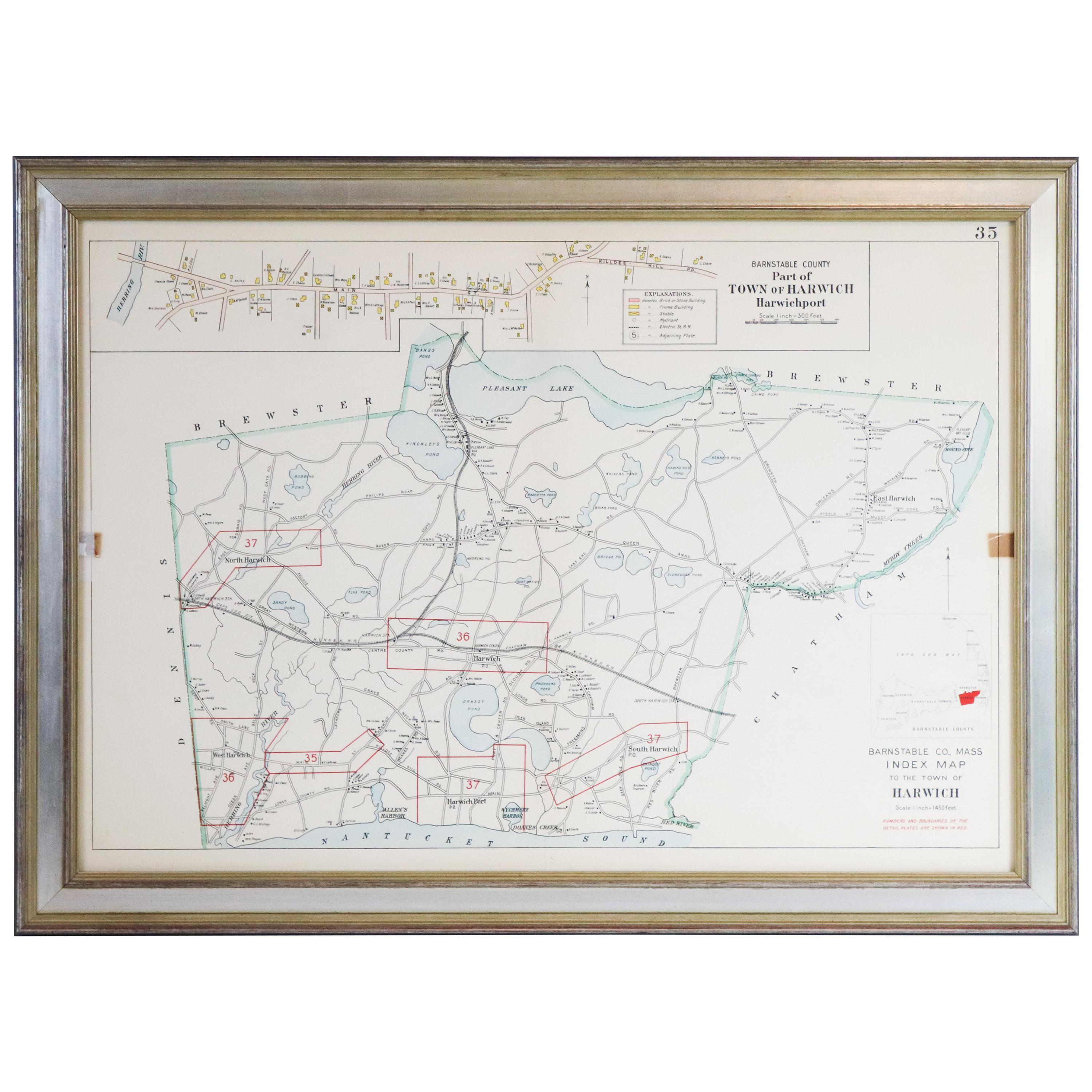
Map of Harwich, Massachusetts
Located in Norwell, MA
Turn of the century map of Harwich, Massachusetts. Plate from a Cape Cod County Map book showing the Barnstable county town of Harwich including Allens Harbor, Pleasant Lake, Harwich...
Category
20th Century Maps

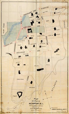
Plan of a Part of Newport, R. I. Showing Changes... O. H. P, Belmont, Esq.
Located in New York, NY
PLAN OF A PART OF NEWPORT, R.I. SHOWING CHANGES IN HIGHWAYS ASKED FOR BY O.H.P. BELMONT, ESQ.
The original ink and watercolor plan on paper from 1907. The plan is extremely large; if fully assembled it would measure no less than 11.5 feet in height and 6.5 feet in breadth. Segmented and backed on modern linen in four sections – each section is 70 x 39 inches. This grand oversized folding map can be folded down to four sections each 17.5 x 11 inches and stored in a modern made leather and marble paper case 18 x 11.75 x 3 inches.
Text continues, "Prepared for Charles Warren Lippitt at the office of J. P. Cotton, C.E. Newport, R.I. Oct. 28, 1907." A fine manuscript plan of the Bellevue neighborhood of Newport, depicting the street layout and the detailed footprints of the area’s many mansions.
The plan was produced at the behest of Charles Warren Lippett (1846-1924), who served as governor of Rhode Island from 1895-1897. The Lippett “Breakwater” mansion is also shown on this plan, situated at the southernmost tip of the peninsula. Though the circumstances are unclear, Lippitt seems to have requested the plan be drawn out of some concern for road construction proposed by Oliver Hazard Perry...
Category
Early 20th Century Naturalistic More Art
Materials
Ink, Watercolor
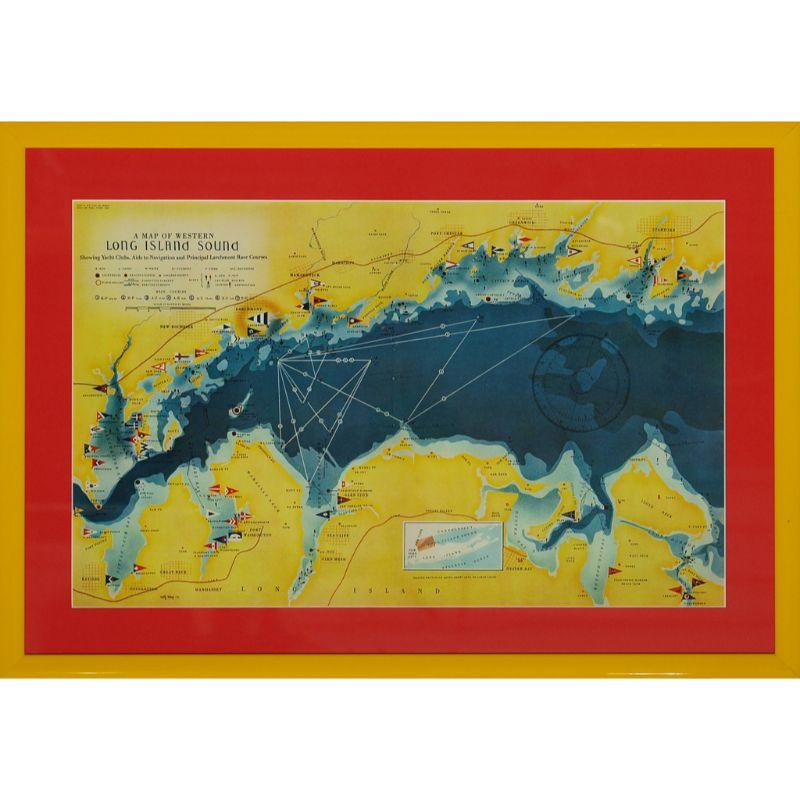
A Map Of Western Long Island Sound Showing Yacht Clubs, Aids To Navigation...
Located in Bristol, CT
Classic color map/ nautical chart (by Nolf Klep '39) of the North Shore of Long Island Sound
for members of the Larchmont Yacht Club (see verso)
Map Sz: 13 ...
Category
1930s More Prints
Materials
Paper

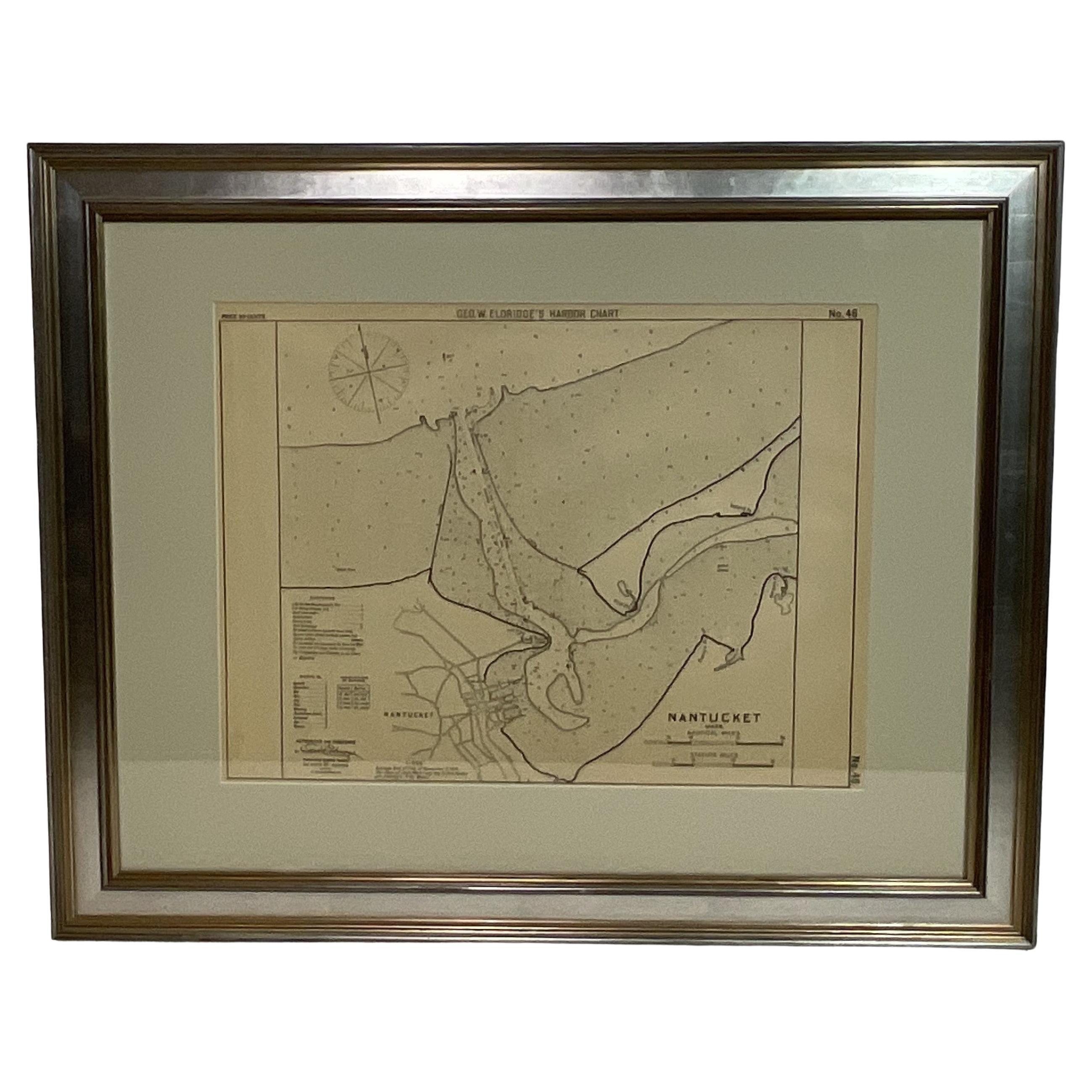
1907 Chart of Nantucket Harbor by George Eldridge
Located in Norwell, MA
Chart of Nantucket Harbor from 1907 by cartographer George W. Eldridge. The chart shows the channel passing by the jetty into the harbor, by Brant Point to Steamboat Wharf. Also show...
Category
Antique Early 1900s North American Maps
Materials
Paper

1873 Martha's Vineyard and Nantucket Chart
Located in Norwell, MA
Original chart of Nantucket and Martha's Vineyard by George Eldridge, Cartographer, 125 State Street, Boston. Dated 1873. Mounted to canvas. Also showing the coast of Cape Cod includ...
Category
Antique 1870s North American Maps
Materials
Paper

More Ways To Browse
Hole Punch
Thomas Hart Benton Original
Antique Prints New Orleans
Original Vintage Twa Posters
Picasso Dove Of Peace
Picasso Imaginaire 1969
Poster Vintage Suisse
Raimondi Giuseppe
Romare Bearden Collage Prints
Shepard Fairey 2000
Tanna Kasimir Hoernes
Tiffany Etching
Turkey Poster
Vintage Sunflower Prints
Vintage Vinyl Record Covers
Antoine Henry
Christo Fabric
Clown Vintage Poster