Didier Robert de Vaugondy Prints
French, 1723-1786
Didier Robert de Vaugondy (1723-1786) was the son of Gilles Robert de Vaugondy, who was a prominent French cartographer, printmaker and publisher. The two worked together in the family business, they publishing atlases. The best know publication was the Atlas Universel (1757). Didier followed his father as the royal cartographer/hydrographer to King Louis XV of France. He held a similar position in the court of the Duke of Lorraine and King of Poland. He later became the royal censor for information published in French geography texts, sea charts and publication describing travel and exploration.to
1
1
Height
to
Width
to
1
1
1
1
1
1
1
2
110
104
93
80
Creator: Didier Robert de Vaugondy
California, Alaska and Mexico: 18th Century Hand-Colored Map by de Vaugondy
By Didier Robert de Vaugondy
Located in Alamo, CA
This is an 18th century hand-colored map of the western portions of North America entitled "Carte de la Californie et des Pays Nord-Ouest separés de l'Asie par le détroit d'Anian, ex...
Category
1770s French Antique Didier Robert de Vaugondy Prints
Materials
Paper
Related Items
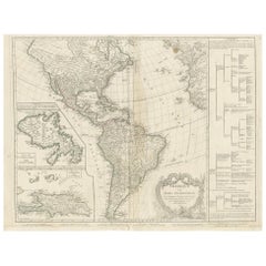
Antique Map of the Americas and West Indies by Robert de Vaugondy, 1778
Located in Langweer, NL
Antique Map of the Americas and West Indies by Robert de Vaugondy, 1778
This detailed antique map titled "Amérique ou Indes Occidentales" was published in 1778 by the renowned Frenc...
Category
Late 18th Century French Antique Didier Robert de Vaugondy Prints
Materials
Paper
$1,351 Sale Price
25% Off
H 20.87 in W 27.56 in D 0.02 in
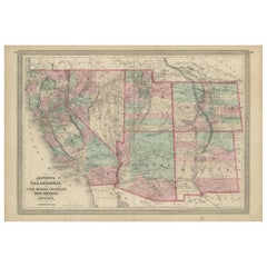
Antique Map of California, Utah, Nevada, Colorado, New Mexico & Arizona '1872'
Located in Langweer, NL
Antique map titled 'Johnson's California (..)'. Original map of California, Utah, Nevada, Colorado, New Mexico and Arizona. This map originates from ...
Category
Late 19th Century Antique Didier Robert de Vaugondy Prints
Materials
Paper
$240 Sale Price
20% Off
H 18.12 in W 26.38 in D 0.02 in
Antique Map of New England and Part of Canada by Vaugondy 'circa 1755'
Located in Langweer, NL
Antique map titled 'Partie de l'Amérique septent qui comprend la nouvelle France ou le Canada'. Decorative and highly detailed map of New England an...
Category
Mid-18th Century Antique Didier Robert de Vaugondy Prints
Materials
Paper
$1,576 Sale Price
24% Off
H 20.08 in W 25.99 in D 0.02 in
Texas California Mexico Map – Antique Tallis Map with Gold Region, c.1850
Located in Langweer, NL
Texas California Mexico Map – Antique Tallis Map with Gold Region, c.1850
This highly decorative and historically rich map titled 'Mexico, California and Texas' was published around...
Category
Mid-19th Century Antique Didier Robert de Vaugondy Prints
Materials
Paper
$804
H 10.44 in W 13.78 in D 0.02 in
Antique Map of Mexico and Central America by Johnson '1872'
Located in Langweer, NL
Antique map titled 'Johnson's Mexico (..)'. Two maps one one sheet showing Mexico and Central America, with inset maps of Tehuantepec and Panama. This map originates from 'Johnson's ...
Category
Late 19th Century Antique Didier Robert de Vaugondy Prints
Materials
Paper
$288 Sale Price
20% Off
H 26.38 in W 18.12 in D 0.02 in
Antique Albertus Seba Pair 18th Century Hand-Colored Engravings Butterfly
By Albertus Seba 1
Located in Washington, DC
Rare pair of original hand-colored prints from Sir Albertus Seba's cabinet of natural curiosities. Prints come from published volumes in Amste...
Category
Mid-18th Century Dutch Antique Didier Robert de Vaugondy Prints
Materials
Paper
$700 / set
H 26 in W 12.5 in D 0.3 in
18th Century Antique Engraving of the Southern Hemisphere by G. de L'Isle
By Guillaume De L'Isle
Located in Langweer, NL
Antique map titled 'Hemisphere Meridional pour voir plus distinctement Les Terres Australes'. Hemispherical map of the southern hemisphere centered on ...
Category
Late 18th Century Antique Didier Robert de Vaugondy Prints
Materials
Paper
$955 Sale Price
20% Off
H 21.58 in W 29.93 in D 0.02 in
Rare Hand-Colored Antique Map of Tartary, China and Korea, ca.1741
Located in Langweer, NL
Antique map titled 'A General Map of Eastern and Western Tatary, commonly call'd Tartary; drawn from the Particular Maps of the Jesuit Missionaries'.
Rare antique map of Tartary, C...
Category
1740s Antique Didier Robert de Vaugondy Prints
Materials
Paper
$2,642 Sale Price
20% Off
H 16.15 in W 21.66 in D 0 in
Antique Map of Mexico by Johnston, '1909'
Located in Langweer, NL
Antique map titled 'Mexico'. Original antique map of Mexico. This map originates from the ‘Royal Atlas of Modern Geography’. Published by W. & A....
Category
Early 20th Century Didier Robert de Vaugondy Prints
Materials
Paper
Antique 18th Century Map of the Province of Pensilvania 'Pennsylvania State'
Located in Philadelphia, PA
A fine antique of the colony of Pennsylvania.
Noted at the top of the sheet as a 'Map of the province of Pensilvania'.
This undated and anonymous map is thought to be from the Gentleman's Magazine, London, circa 1775, although the general appearance could date it to the 1760's.
The southern boundary reflects the Mason-Dixon survey (1768), the western boundary is placed just west of Pittsburgh, and the northern boundary is not marked.
The map has a number of reference points that likely refer to companion text and appear to be connected to boundaries. The western and southern boundaries are marked Q, R, S, for example. A diagonal line runs from the Susquehanna R to the Lake Erie P. A broken line marked by many letters A, B, N, O, etc., appears in the east.
There are no latitude or longitude markings, blank verso.
Framed in a shaped contemporary gilt wooden frame and matted under a cream colored matte.
Bearing an old Graham Arader Gallery...
Category
18th Century British American Colonial Antique Didier Robert de Vaugondy Prints
Materials
Paper
$1,250
H 10.25 in W 13.25 in D 0.5 in
Orignal Hand-Colored Antique Map of Chili by W. Blaeu, 1658
By Willem Blaeu
Located in Langweer, NL
Very decorative antique map of Chili published by W. Blaeu, 1658. This map depicts Chile from Copiapo southward to the island of Chiloé with ships and sea monsters adorning the sea. ...
Category
Mid-17th Century Antique Didier Robert de Vaugondy Prints
Materials
Paper
$895 Sale Price
20% Off
H 21.86 in W 25.99 in D 0.02 in
Antique Map of the Indonesian and Philippine Archipelagos by R. de Vaugondy
Located in Langweer, NL
Striking and highly detailed map of the region from Sumatra and Malaca and Southern China to the Philipines, New Guinea and Northern Australia, centered on Borneo. Includes a large i...
Category
Mid-18th Century Antique Didier Robert de Vaugondy Prints
Materials
Paper
$1,119 Sale Price
20% Off
H 19.49 in W 25.12 in D 0.02 in
Didier Robert De Vaugondy prints for sale on 1stDibs.
Didier Robert de Vaugondy prints are available for sale on 1stDibs. These distinctive items are frequently made of paper and are designed with extraordinary care. There are many options to choose from in our collection of Didier Robert de Vaugondy prints, although gray editions of this piece are particularly popular. Prices for Didier Robert de Vaugondy prints can differ depending upon size, time period and other attributes — on 1stDibs, these items begin at $875 and can go as high as $875, while a piece like these, on average, fetch $875.


