Guillaume De L'Isle Maps
to
2
2
2
2
2
2
2
2
2
104
63
28
24
Creator: Guillaume De L'Isle
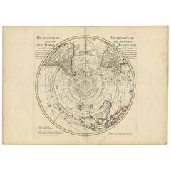
18th Century Antique Engraving of the Southern Hemisphere by G. de L'Isle
By Guillaume De L'Isle
Located in Langweer, NL
Antique map titled 'Hemisphere Meridional pour voir plus distinctement Les Terres Australes'. Hemispherical map of the southern hemisphere centered on ...
Category
Late 18th Century Antique Guillaume De L'Isle Maps
Materials
Paper
$955 Sale Price
20% Off
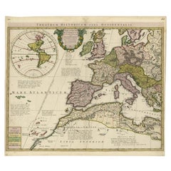
Finely Engraved Antique Map of Europe with inset of America, c.1745
By Guillaume De L'Isle
Located in Langweer, NL
Antique map titled 'Theatrum Historicum pars Occidentalis.' Finely engraved historical map with a profusion of details. It shows western Europe and the northern Mediterranean basin a...
Category
18th Century Antique Guillaume De L'Isle Maps
Materials
Paper
$1,393 Sale Price
20% Off
Related Items
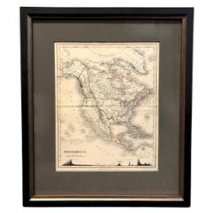
1846 "North America" Map, Engraved by I. Dower
Located in Colorado Springs, CO
Presented is an original 1846 map of “North America.” The map was drawn and engraved by I. Dower and published in London by Orr & Company. The map depicts North America, to include G...
Category
1840s English Victorian Antique Guillaume De L'Isle Maps
Materials
Paper
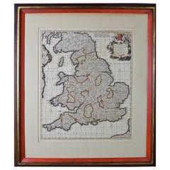
Large 17th Century Hand Colored Map of England and the British Isles by de Wit
By Frederick de Wit
Located in Alamo, CA
A large hand colored 17th century map of England and the British Isles by Frederick de Wit entitled "Accuratissima Angliæ Regni et Walliæ Principatus", published in Amsterdam in 1680. It is a highly detailed map of England, Scotland, the Scottish Isles...
Category
Late 17th Century Dutch Antique Guillaume De L'Isle Maps
Materials
Paper
$1,175
H 35 in W 30.5 in D 2 in
Antique Tibet Po Cha Mug Silver Finely Engraved Jade White Coral
Located in Palermo, Sicily
Antique Tibet Po Cha Religious Mug Silver finely engraved White Jade Coral , refined object of great class and history, in excellent condition.
Category
1880s Tibetan Tibetan Antique Guillaume De L'Isle Maps
Materials
Jade, Silver
$1,441 Sale Price
20% Off
H 3.94 in Dm 3.94 in
1876 "Gettysburg, The Repulse of Longstreet's Assault." Engraving
Located in Colorado Springs, CO
Presented here is an 1876 engraving of John B. Bachelder and James Walker’s Gettysburg. The Repulse of Longstreet’s Assault. The engraved scene depicts the decisive battle on the final day of the Battle of Gettysburg. Researched by the photographer and topographer John B. Bachelder and painted by James Walker, the original painting was created in 1870. This detailed engraving was done by H. B. Hall Jr. and published by James Drummond Ball.
Otherwise called Pickett’s Charge, the battle occurred on July 3, 1863. Pickett’s corp commander, Lieutenant General James Longstreet was placed in charge of the attack despite his hesitations. Longstreet’s central role led to the title of the work, Repulse of Longstreet’s Assault. In an attempt to gain control of an important supply route, nine Confederate brigades charged across three-quarters of a mile of open ground against cannon fire to take Cemetery Ridge from the defending Union Army. Despite their overwhelming numbers, the Confederate forces were repelled with considerable casualties marking not only a decisive victory for the Union, but also the beginning of the slow defeat of Lee’s Army. The furthest the charging forces advanced before being repulsed would forever be known as the “High Water Mark of the Confederacy.” The Confederate army never recovered from the losses at Gettysburg and it effectively ended Lee’s campaign into Pennsylvania.
The engraving gives the perspective from the Union rear, one that encompasses most of the battlefield, from Big Round Top on the left to the northern reaches of Cemetery Ridge on the right. The Confederate lines at Seminary Ridge are in the far distance, partially obscured by bursting shells. The image centers on the main Confederate assault, in the vicinity of what today are known as "The Copse" and "The Bloody Angle." The composition has elemen...
Category
1870s American Antique Guillaume De L'Isle Maps
Materials
Paper
$8,500
H 26.75 in W 47.5 in D 1.5 in
Large and Impressive German Antique Finely Engraved Judaica Pewter Seder Plate
Located in London, GB
The fine German antique pewter plate depicts a family scene, as the group sits at the table during the Passover Seder. Around the rim of the plate...
Category
19th Century Antique Guillaume De L'Isle Maps
Materials
Pewter
$4,431
H 0.99 in Dm 14.38 in
Antique Albertus Seba Pair 18th Century Hand-Colored Engravings Butterfly
By Albertus Seba 1
Located in Washington, DC
Rare pair of original hand-colored prints from Sir Albertus Seba's cabinet of natural curiosities. Prints come from published volumes in Amste...
Category
Mid-18th Century Dutch Antique Guillaume De L'Isle Maps
Materials
Paper
$700 / set
H 26 in W 12.5 in D 0.3 in
Vintage Reproduction 17th Century Map of Europe, American, Cartography, Blaeuw
Located in Hele, Devon, GB
This is a vintage reproduction map of Europe. An American, paper stock cartography print in frame after the work by Blaeuw, dating to the late 20t...
Category
Late 20th Century Central American Mid-Century Modern Guillaume De L'Isle Maps
Materials
Glass, Wood, Paper
$1,265
H 30.32 in W 38.39 in D 1.38 in
19th Century Framed Engravings From The New Book Of Martyrs by Henry Southwell
Located in Lowestoft, GB
A collection of 11 framed and glazed engravings taken from the New Book Of Martyrs By Henry Southwell
The 11 engravings show authentic and genuine historical account of the many dre...
Category
19th Century English Antique Guillaume De L'Isle Maps
Materials
Glass, Pine, Paper
$962 / set
H 14.77 in W 10.24 in D 0.6 in
Hand-Colored 18th Century Homann Map of the Danube, Italy, Greece, Croatia
By Johann Baptist Homann
Located in Alamo, CA
"Fluviorum in Europa principis Danubii" is a hand colored map of the region about the Danube river created by Johann Baptist Homann (1663-1724) in his 'Atlas Novus Terrarum', publish...
Category
Early 18th Century German Antique Guillaume De L'Isle Maps
Materials
Paper
$875
H 20 in W 23.88 in D 0.07 in
The Kingdom of Naples and Southern Italy: A Hand-Colored 18th Century Homann Map
By Johann Baptist Homann
Located in Alamo, CA
"Novissima & exactissimus Totius Regni Neapolis Tabula Presentis Belli Satui Accommo Data" is a hand colored map of southern Italy and the ancient Kingdom of Naples created by Johann...
Category
Early 18th Century German Antique Guillaume De L'Isle Maps
Materials
Paper
$1,175
H 20 in W 23.88 in D 0.07 in
Original Antique Map of the American State of Colorado, 1903
Located in St Annes, Lancashire
Antique map of Colorado
Published By A & C Black. 1903
Original colour
Good condition
Unframed.
Free shipping
Category
Early 1900s English Antique Guillaume De L'Isle Maps
Materials
Paper
Original Antique Map of Europe, Arrowsmith, 1820
Located in St Annes, Lancashire
Great map of Europe
Drawn under the direction of Arrowsmith.
Copper-plate engraving.
Published by Longman, Hurst, Rees, Orme and Brown, 1820
...
Category
1820s English Antique Guillaume De L'Isle Maps
Materials
Paper
Guillaume De L'isle maps for sale on 1stDibs.
Guillaume De L'Isle maps are available for sale on 1stDibs. These distinctive items are frequently made of paper and are designed with extraordinary care. There are many options to choose from in our collection of Guillaume De L'Isle maps, although beige editions of this piece are particularly popular. If you’re looking for additional options, many customers also consider maps by Jacques-Nicolas Bellin, F. Valentijn, and Nicolas Sanson. Prices for Guillaume De L'Isle maps can differ depending upon size, time period and other attributes — on 1stDibs, these items begin at $500 and can go as high as $1,563, while a piece like these, on average, fetch $1,032.


