Homann Heirs Collectibles and Curiosities
to
10
10
10
10
10
1
1
10
10
10
12
104
101
74
71
Creator: Homann Heirs
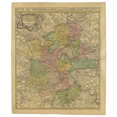
Antique Map of the Region of Paris by Homann Heirs, c.1720
By Homann Heirs
Located in Langweer, NL
Antique map titled 'Agri Parisiensis Tabula particularis, qua maxima Pars Insulae Franciae (..).' Incredibly detailed map showing everything from tiny villages to forests, farmland, ...
Category
18th Century Antique Homann Heirs Collectibles and Curiosities
Materials
Paper
$191 Sale Price
20% Off
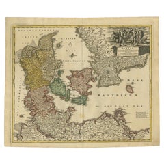
Antique Map of Denmark with the Danish Royal Crest, c.1730
By Homann Heirs
Located in Langweer, NL
Antique map titled 'Regni Daniae in quo sunt Ducatus Holsatia and Slesuicum Insulae Danicae Jutia, Scania Blekingia (..).' Map of Denmark and islands, part of Sweden and Germany, dra...
Category
18th Century Antique Homann Heirs Collectibles and Curiosities
Materials
Paper
$431 Sale Price
20% Off
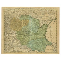
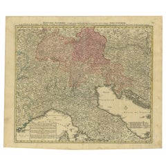
Antique Map of the Danube River by Homann, c.1720
By Homann Heirs
Located in Langweer, NL
Antique map titled 'Danubii Fluminis (..)'. Regional map of the Donau river, Shows the Danube river from Belgrade in Serbia, along the border between Roma...
Category
18th Century Antique Homann Heirs Collectibles and Curiosities
Materials
Paper
$886 Sale Price
20% Off
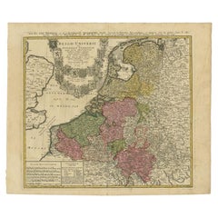
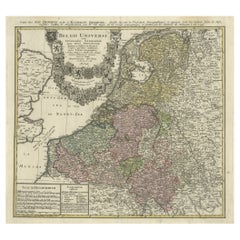
Antique Map of the Seventeen Provinces of Netherlands, Belgium, Luxembourg, 1748
By Homann Heirs
Located in Langweer, NL
Antique map titled 'Belgii Universi seu Inferioris Germaniae quam XVII Provinciae (..)'.
Map of the Seventeen Provinces after Tobias Meier, published by Homann's Heirs in 1748. The...
Category
18th Century Antique Homann Heirs Collectibles and Curiosities
Materials
Paper
$440 Sale Price
20% Off
Antique Map of the Seventeen Provinces by Homann Heirs, 1748
By Homann Heirs
Located in Langweer, NL
Antique map titled 'Belgii Universi seu Inferioris Germaniae quam XVII Provinciae (..)'. Map of the Seventeen Provinces after Tobias Meier, published by Homann's Heirs in 1748. The S...
Category
18th Century Antique Homann Heirs Collectibles and Curiosities
Materials
Paper
$527 Sale Price
20% Off
Antique Map of the Danube River and Surroundings by Homann Heirs, c.1730
By Homann Heirs
Located in Langweer, NL
Antique map titled 'Danubii Fluminus (a fontibus prope Doneschingam usq Posonium urbem defignati) Pars Superior, in qua Suevia, Bavaria, Asutria, Stiria, Carinthia, Carniola, Tyrolis...
Category
18th Century Antique Homann Heirs Collectibles and Curiosities
Materials
Paper
$402 Sale Price
20% Off
Antique Map of the Waldeck Region of Germany by Homann Heirs, circa 1733
By Homann Heirs
Located in Langweer, NL
Antique map titled 'Waldecciae ac finitimorum Dominiorum (.)'. Map of the Waldeck region of Germany. With decorative cartouche depicting people mining, fishing and deer hunting with ...
Category
18th Century Antique Homann Heirs Collectibles and Curiosities
Materials
Paper
$316 Sale Price
20% Off
Antique Map of Vlaams-Brabant by Homann Heirs, c.1720
By Homann Heirs
Located in Langweer, NL
Antique map titled 'Ducatus Brabantiae Nova Tabula in qua (..).' Fully engraved copper plate map filled with details. Covers Flanders centered roughly on Ascot and delineating the wa...
Category
18th Century Antique Homann Heirs Collectibles and Curiosities
Materials
Paper
$402 Sale Price
20% Off
Antique Map of the Region of Orleans by Homann Heirs, c.1760
By Homann Heirs
Located in Langweer, NL
Antique map titled 'Novissima Totius Aureliani Generalitatis (..) - Nouvelle Carte du Gouvernement General et Militaire d'Orleans (..).' Detailed map by Rizzi Zononi covering the vic...
Category
18th Century Antique Homann Heirs Collectibles and Curiosities
Materials
Paper
$215 Sale Price
20% Off
Antique Map Normandy 'France' by Homann Heirs, Published in c.1740
By Homann Heirs
Located in Langweer, NL
Antique map France titled 'Normannia Galliae celebris Provincia in terras suas Ballisiatus (..)'.
Decorative regional map of Normandy, France, circa ...
Category
Mid-18th Century German Antique Homann Heirs Collectibles and Curiosities
Materials
Paper
$766 Sale Price
5% Off
Related Items
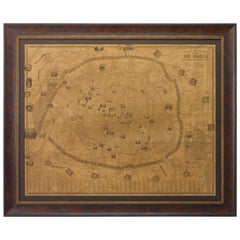
Plan of Paris, France, by A. Vuillemin, Antique Map, 1845
Located in Colorado Springs, CO
This large and detailed plan of Paris was published by Alexandre Vuillemin in 1845. The map conveys a wonderful amount of information and is decorated throughout with pictorial vigne...
Category
1840s American Antique Homann Heirs Collectibles and Curiosities
Materials
Paper
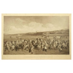
Antique Golf Print, Royal North Devon Golf Club, Photogravure of Westward Ho
Located in Oxfordshire, GB
Royal North Devon Golf Club 1893 by Mayall & Co. Ltd.
A great image of the members of the 'Royal North Devon Golf Club, Westward Ho!' from 1893. The figures are all photographs superimposed onto a painted background of the course. In the margin is printed 'Permanent Autotype, Produced by Mayall & Co. Ltd. 73 Piccadilly'. The image appears very much photographic but is more of a photomechanical print rather than a photograph.
John Jabez Edwin Paisley Mayall (1813-1901) was an English photographer who in 1860 took the first carte-de-visite photographs of Queen Victoria.
Taken from Royal North Devon:-
Royal North Devon at Westward Ho! Can rightly claim to be the cradle of English Golf. Founded in 1864, it is the oldest golf course in the country and is regarded as the St Andrews of the South. The golf course is as tough as any of the UK's more famous links layouts and has recently been placed in Golf World 's 'Top 100 Courses in the World' that a golfer 'must play'.
Not only is Royal North Devon a great course, it is also a place of huge historical importance. Inside the warmly welcoming clubhouse, the golf museum, honours boards and the clubs top competition trophies are worth a visit on their own and help to tell the story of the game and this remarkable club's unique place in it.
Above all, this is great, natural golf that is largely unchanged from 100 years ago when Harold Hilton et al pronounced Westward Ho! As England's No 1 competition golf course. RND is pure, raw exhilaration and ultimately the experience of playing a fast running links in a stiff breeze still tests the very best in the game.
Many of the great players of the last 100 years were regular competitors at RND but the greatest of them all is without doubt John Henry Taylor...
Category
1890s British Sporting Art Antique Homann Heirs Collectibles and Curiosities
Materials
Paper
$2,615
H 20 in W 34.25 in D 0.1 in
Original Antique Map of Ancient Greece, Achaia, Corinth, 1786
Located in St Annes, Lancashire
Great map of Ancient Greece. Showing the region of Thessaly, including Mount Olympus
Drawn by J.D. Barbie Du Bocage
Copper plate engraving by P.F Tardieu
Original hand color...
Category
1780s French Other Antique Homann Heirs Collectibles and Curiosities
Materials
Paper
French 18th Century Map of Paris by Turgot
By Michel Etienne Turgot
Located in Los Angeles, CA
Complete Paris map set of etchings by Turgot. This printing is from the 1960s and have warm natural color to the paper. Frame each individually to your liking. The overall dimension ...
Category
1960s French French Provincial Vintage Homann Heirs Collectibles and Curiosities
Materials
Paper
New Map of North America from the Latest Discoveries, 1763
Located in Philadelphia, PA
A fine antique 18th century map of the North American seaboard.
Entitled "A New Map of North America from the Latest Discoveries 1763".
By the Cartographer/Engraver - John Spil...
Category
Mid-18th Century English Georgian Antique Homann Heirs Collectibles and Curiosities
Materials
Paper
Original Antique Map of Ancient Greece- Boeotia, Thebes, 1787
Located in St Annes, Lancashire
Great map of Ancient Greece. Showing the region of Boeotia, including Thebes
Drawn by J.D. Barbie Du Bocage
Copper plate engraving by P.F T...
Category
1780s French Other Antique Homann Heirs Collectibles and Curiosities
Materials
Paper
Original Antique Map of The United States of America by Dower, circa 1835
Located in St Annes, Lancashire
Nice map of the USA
Drawn and engraved by J.Dower
Published by Orr & Smith. C.1835
Unframed.
Free shipping
Category
1830s English Antique Homann Heirs Collectibles and Curiosities
Materials
Paper
$60
H 12.25 in W 9.25 in D 0.07 in
Original Antique Map of The London Underground. 1911
Located in St Annes, Lancashire
Superb map of The London Underground
Published by Ward Lock, 1911
Folding map. Printed on paper
Unframed.
Good condition/ Minor repair to an edge tear on right edge ( shown in ...
Category
1910s English Vintage Homann Heirs Collectibles and Curiosities
Materials
Canvas, Paper
Original Antique Map of The Philippines. C.1900
Located in St Annes, Lancashire
Fabulous map of The Philippines
Original color.
Engraved and printed by the George F. Cram Company, Indianapolis.
Published, C.1900.
Unframed.
Free shipping.
Category
1890s American Antique Homann Heirs Collectibles and Curiosities
Materials
Paper
Hand-Colored 18th Century Homann Map of the Danube, Italy, Greece, Croatia
By Johann Baptist Homann
Located in Alamo, CA
"Fluviorum in Europa principis Danubii" is a hand colored map of the region about the Danube river created by Johann Baptist Homann (1663-1724) in his 'Atlas Novus Terrarum', publish...
Category
Early 18th Century German Antique Homann Heirs Collectibles and Curiosities
Materials
Paper
$875
H 20 in W 23.88 in D 0.07 in
Original Antique Map of Spain and Portugal, circa 1790
Located in St Annes, Lancashire
Super map of Spain and Portugal
Copper plate engraving by A. Bell
Published, circa 1790.
Unframed.
Category
1790s English Other Antique Homann Heirs Collectibles and Curiosities
Materials
Paper
Antique Map of Principality of Monaco
By Antonio Vallardi Editore
Located in Alessandria, Piemonte
ST/619 - "Old Geographical Atlas of Italy - Topographic map of ex-Principality of Monaco" -
ediz Vallardi - Milano -
A somewhat special edition ---
Category
Late 19th Century Italian Other Antique Homann Heirs Collectibles and Curiosities
Materials
Paper
Previously Available Items
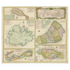
Stunning Map of Caribbean Islands, Incl Jamaica, Bermuda, Barbados and St. Kitts
By Homann Heirs
Located in Langweer, NL
Original antique map titled 'Dominia Anglorum in praecipuis Insulis Americae (..) - Die Englische Colonie-Laender auf den Insuln von America'. Large sheet with five maps describing the islands of St...
Category
Mid-18th Century Antique Homann Heirs Collectibles and Curiosities
Materials
Paper
H 19.89 in W 23.23 in D 0.02 in
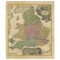
Antique Map of England and Wales Showing the Anglo-Saxon Kingdoms, C.1720
By Homann Heirs
Located in Langweer, NL
Antique map titled 'Magnae Britanniae pars Meridionalis in qua Regnum Angliae (..).' Detailed map of England and Wales by J. B. Homann, ca. 1720, based on Visscher's map of 1695, del...
Category
18th Century Antique Homann Heirs Collectibles and Curiosities
Materials
Paper
H 25.08 in W 21.07 in D 0 in
Antique Map of the Strait of Gibraltar by Homann Heirs, circa 1730
By Homann Heirs
Located in Langweer, NL
Highly decorative antique map of the Strait of Gibraltar by Homann Heirs. This map was a collaborative effort between Jean de Petit (royal engineer and architect) and Johann Friedric...
Category
Mid-18th Century Antique Homann Heirs Collectibles and Curiosities
Homann Heirs collectibles and curiosities for sale on 1stDibs.
Homann Heirs collectibles and curiosities are available for sale on 1stDibs. These distinctive items are frequently made of paper and are designed with extraordinary care. There are many options to choose from in our collection of Homann Heirs collectibles and curiosities, although beige editions of this piece are particularly popular. If you’re looking for additional options, many customers also consider collectibles and curiosities by Johann Baptist Homann, Villeroy & Boch, and Steiff. Prices for Homann Heirs collectibles and curiosities can differ depending upon size, time period and other attributes — on 1stDibs, these items begin at $216 and can go as high as $865, while a piece like these, on average, fetch $459.
Creators Similar to Homann Heirs
WMF Württembergische Metallwarenfabrik
