Thomas Jefferys Maps
to
1
1
1
1
1
1
1
1
1
1
2
104
63
28
24
Creator: Thomas Jefferys
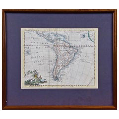
South America: Hand-colored 18th Century Framed Map by Thomas Jefferys
By Thomas Jefferys
Located in Alamo, CA
This detailed hand-colored map of South America by Thomas Jefferys was published in London in 1750. The map shows countries, early colonial possessions, towns, rivers, mountains, and...
Category
Mid-18th Century English Antique Thomas Jefferys Maps
Materials
Paper
Related Items
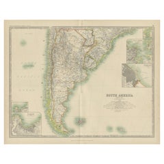
Antique Map of South America by Johnston '1909'
Located in Langweer, NL
Antique map titled 'South America, Southern Sheet'. Depicting Chile, Argentina, Brazil, Patagonia, the Falkland Island and more. With inset maps of Valparaiso, Rio de Janeiro and Bue...
Category
Early 20th Century Thomas Jefferys Maps
Materials
Paper
$240 Sale Price
20% Off
H 19.49 in W 24.41 in D 0.02 in
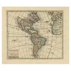
Antique Hand-Coloured Map of North and South America, ca.1765
Located in Langweer, NL
Description: Antique map titled 'Nieuwe Kaart van Amerika.' Attractive map of North and South America, the western part of Africa and south west Europe. Source unknown, to be determi...
Category
1760s Antique Thomas Jefferys Maps
Materials
Paper
$1,200 Sale Price
20% Off
H 15.75 in W 20.2 in D 0 in
Interesting Original Antique Map of South America, 1822
Located in Langweer, NL
Antique map titled 'South America'.
Map of South America with attractive topography, surrounded on three sides by text on the history, geography, and economy of the continent. Sh...
Category
19th Century Antique Thomas Jefferys Maps
Materials
Paper
Antique Map of South America by J. Cook, 1775
Located in Langweer, NL
Antique map titled 'Kaart van het Zuidlyk Eind van Amerika'. Map of the sourthern part of South America, focusing on Cook's tracks around the Cape Horn and T...
Category
Mid-18th Century Antique Thomas Jefferys Maps
Materials
Paper
Antique Albertus Seba Pair 18th Century Hand-Colored Engravings Butterfly
By Albertus Seba 1
Located in Washington, DC
Rare pair of original hand-colored prints from Sir Albertus Seba's cabinet of natural curiosities. Prints come from published volumes in Amste...
Category
Mid-18th Century Dutch Antique Thomas Jefferys Maps
Materials
Paper
$700 / set
H 26 in W 12.5 in D 0.3 in
Scarce Antique Map of South America
Located in Langweer, NL
Antique map titled 'Carte de l'Amérique Méridionale'. Scarce map of South America, published in Paris in 1821. The map shows the continent in the ...
Category
Early 19th Century Antique Thomas Jefferys Maps
Materials
Paper
Antique Map of South America by De la Harpe '1780'
Located in Langweer, NL
Antique map titled 'Carte de l'Amerique Méridionale'. Original antique map of South America. Note the 'Laguna de Xarayes' is illustrated as the source of the Paraguay river. The laguna is now known as Pantanal, world's largest tropical wetland area. This map orginates from 'Abrégé de l'histoire générale des Voyages' by J.F. de la Harpe.
Category
Late 18th Century Antique Thomas Jefferys Maps
Materials
Paper
$480 Sale Price
20% Off
H 19.69 in W 13.98 in D 0.02 in
Antique Map of Scandinavia by T. Jefferys, circa 1750
Located in Langweer, NL
Antique map titled 'Sweden, Denmark, Norway & Finland'. An original mid-18th century copper engraved antique map of Scandinavia by Thomas Jefferys....
Category
Mid-18th Century Antique Thomas Jefferys Maps
Materials
Paper
$182 Sale Price
20% Off
H 8.19 in W 10.08 in D 0.02 in
Original Antique Hand-colored World Map with or without Frame, '1696'
Located in Langweer, NL
Antique world map titled 'Mappe-Monde dressee sur les Observations de Mrs. de l'Academie Royale des Sciences (..)'. Beautiful original antique world map...
Category
Late 17th Century Antique Thomas Jefferys Maps
Materials
Paper
$4,323 Sale Price
20% Off
H 28.75 in W 33.67 in D 1.58 in
Original Antique Map of South East Asia by Thomas Clerk, 1817
Located in St Annes, Lancashire
Great map of South East Asia
Copper-plate engraving
Drawn and engraved by Thomas Clerk, Edinburgh.
Published by Mackenzie And Dent, 1817
Unframed.
Category
1810s English Antique Thomas Jefferys Maps
Materials
Paper
Original Antique Map of South America. C.1780
Located in St Annes, Lancashire
Great map of South America
Copper-plate engraving
Published C.1780
Two small worm holes to left side of map
Unframed.
Category
Early 1800s English Georgian Antique Thomas Jefferys Maps
Materials
Paper
Antique Map of South America by W. G. Blackie, 1859
Located in Langweer, NL
Antique map titled 'South America'. Original antique map of South America. This map originates from ‘The Imperial Atlas of Modern Geography’. Published by W. G. Blackie, 1859.
Category
Mid-19th Century Antique Thomas Jefferys Maps
Materials
Paper
$240 Sale Price
20% Off
H 21.26 in W 14.57 in D 0.02 in
Thomas Jefferys maps for sale on 1stDibs.
Thomas Jefferys maps are available for sale on 1stDibs. These distinctive items are frequently made of paper and are designed with extraordinary care. There are many options to choose from in our collection of Thomas Jefferys maps, although black editions of this piece are particularly popular. If you’re looking for additional options, many customers also consider maps by John Cary, John Speed, and John Ogilby. Prices for Thomas Jefferys maps can differ depending upon size, time period and other attributes — on 1stDibs, these items begin at $575 and can go as high as $575, while a piece like these, on average, fetch $575.


