Shackladys Antiques Maps
to
4
4
4
1
3
3
4
4
4
4
4
4
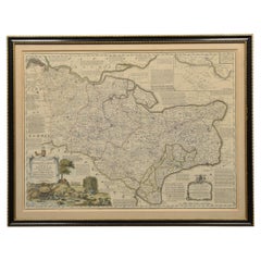
Map of Essex by Emanuel Bowen
Located in Cheshire, GB
Map of part of Essex and part of Kent, hand-coloured. Encased in an ebonized and gilded frame.
Dimensions
Height 25.5 Inches
Length 32.5 Inches
width 1 Inches.
Category
Antique Late 19th Century British Maps
Materials
Paper
$977 Sale Price
50% Off
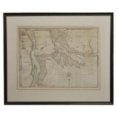
Chart of the Harbour of Liverpool
Located in Cheshire, GB
PL Burdett A Chart of the Harbour of Liverpool hand coloured. Encased in an ebonised frame.
Dimensions
Height 23.5 Inches
Width 28 Inches
Depth 1 Inches
Category
Early 20th Century British Maps
Materials
Paper
$624 Sale Price
20% Off
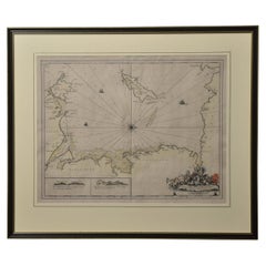
Northwest Coast and Isle of Man Map
Located in Cheshire, GB
Greenville Collins Northwest Coast and Isle of Man. hand coloured chart, encased in an ebonised frame.
Dimensions
Height 26.5 Inches
Width 30 Inches
Depth 1 Inches
Category
Early 20th Century British Maps
Materials
Paper
$515 Sale Price
20% Off
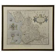
Map of Lancashire
Located in Cheshire, GB
Saxton Map of Lancashire hand coloured. Encased in an ebonised frame.
Dimensions
Height 21 Inches
Width 24 Inches
Depth 1 Inches
Category
Early 20th Century British Maps
Materials
Paper
$754 Sale Price
20% Off
Related Items
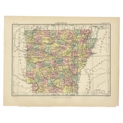
Antique Map of Arkansas
Located in Langweer, NL
Antique map titled 'Arkansas'. Original antique map of Arkansas, United States. This print originates from 'Encyclopaedia Britannica', Ninth Edition. P...
Category
Antique Late 19th Century Maps
Materials
Paper
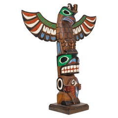
Northwest Coast Totem by Marlin Alphonse
By Native American Art
Located in Coeur d'Alene, ID
Colorful Alaskan three figure winged totem. Carved and painted by Marlin Alphonse. Noted on back "purchased by Brad and Hazel Ritter on board Royal Princes, Sitka, Alaska 1986. His name heavily carved on back.
PERIOD: 1986
ORIGIN: Alaska
SIZE: 13"H x 12"W x 3 1/2"D
Family Owned & Operated
Cisco’s Gallery deals in the rare, exceptional, and one-of-a-kind pieces that define the history of America and the Old West. Our pieces range from American Indian to Cowboy Western and include original items of everyday life, commerce, art, and warfare that tamed America’s frontier. Our 14,000 square foot gallery opened in 1996 in beautiful Coeur d’Alene, Idaho.
Personal Service
Cisco’s operates on old fashioned values – honesty and integrity, and all of our items are backed by our money back guarantee. We appreciate the opportunity to earn your business. Whether you desire assistance with a jewelry purchase, choosing a gift, identification, or even selling – we hope to be your trusted source.
Native American carvings & totems native American Indian native American totem poles n.
Category
Vintage 1980s American Native American Native American Objects
Materials
Cedar
Antique Map of Principality of Monaco
By Antonio Vallardi Editore
Located in Alessandria, Piemonte
ST/619 - "Old Geographical Atlas of Italy - Topographic map of ex-Principality of Monaco" -
ediz Vallardi - Milano -
A somewhat special edition ---
Category
Antique Late 19th Century Italian Other Prints
Materials
Paper
Antique Map of Venezuela by Montanus, 1671
By Arnoldus Montanus
Located in Langweer, NL
Antique map titled 'Venezuela cum parte Australi Novae Andalusiae'. The map extends from Coquibocoa to the Orinoque River, centered on Bariquicemento and Cape de Curiacao. Large cart...
Category
Antique Mid-17th Century English Maps
Materials
Paper
Excellent Antique Map of America with Unusual Northwest Coast of America, c.1754
Located in Langweer, NL
Description: Antique map titled 'Nieuwe Kaart Van het Westelykste Deel Der Weereld, dienende tot aanwyzing an de Scheepstogten der Nederlanderne Naar West Indie.' Excellent map of America, featuring an unusual northwest coast of America, which includes Martin d'Aguilar's strait which provides for a Northwest Passage via the Great Lakes. The rest of the NW coast...
Category
Antique 1750s Maps
Materials
Paper
$543 Sale Price
20% Off
H 13.98 in W 15.75 in D 0 in
Antique Map of North Carolina, with inset map of the western part
Located in Langweer, NL
Antique map titled 'North Carolina'. Original antique map of North Carolina, United States. With inset map of the western part of North Carolina....
Category
Antique Late 19th Century Maps
Materials
Paper
$274 Sale Price
20% Off
H 8.27 in W 10.63 in D 0.02 in
Antique Chart of the Passage of Comets in the Southern Sky, circa 1740
Located in Langweer, NL
Antique map titled 'Motus Comtarum in Hemispaerio Australi (..)'. This uncommon chart depicts the passage of comets in the southern sky between the years 1530-1704. Centered on the ecliptic poles and shows the constellation figures based on classical mythology, without showing the stars. The paths of dozens of comets are illustrated, eincluding those sighted by Tycho Brahe...
Category
Antique Mid-18th Century Maps
Materials
Paper
$2,214 Sale Price
25% Off
H 20.87 in W 24.69 in D 0.02 in
Antique Map of the Eastern United States with Inset Map of Texas
Located in Langweer, NL
Antique map titled 'Verein-Staaten von Nord-America mit Ausnahme Florida's und der Westlichen Territorien'. This map extends as far west as Louisiana and only includes the northern p...
Category
Antique Mid-19th Century Maps
Materials
Paper
$510 Sale Price
20% Off
H 14.65 in W 17.84 in D 0.02 in
Antique Map of the British Isles by H. Chatelain, 1719
By Henri-Abraham Chatelain
Located in Langweer, NL
Beautiful hand colored large format map of the British Isles, with large insets of the Eastern and Western Hemispheres and the coats of arms for Engl...
Category
Antique Early 18th Century Maps
Materials
Paper
$708 Sale Price
20% Off
H 20.08 in W 25.2 in D 0.02 in
Map of Italy and Neighboring Regions by Delamarche – Antique Map, c.1800
Located in Langweer, NL
Antique Map of Italy and Surrounding Regions by Delamarche, circa 1800
This elegant and detailed antique map titled Carte Générale de l’Italie was drawn and engraved by the French g...
Category
Antique Early 1800s French Maps
Materials
Paper
$671
H 22.45 in W 31.7 in D 0.01 in
Antique Map of the Northwestern Coast of Spain
Located in Langweer, NL
Antique map titled 'Gallaecia Regnum'. Original old map of the northwestern coast of Spain, extending from the Asturias de Oviedo region and Aviles in the Northeast to Bayona and the...
Category
Antique Mid-17th Century Maps
Materials
Paper
Antique Map of the Coast of France Between Brest and Bayonne
Located in Langweer, NL
Antique map titled 'Carte des Costes de France depuis Brest jusquá Bayone'. Original old map of the coast of France between Brest and Bayonne. This map originates from 'Le Petit Atla...
Category
Antique Mid-18th Century Maps
Materials
Paper
$302 Sale Price
20% Off
H 18.31 in W 12.6 in D 0.02 in
