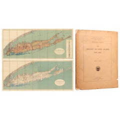
Set of a Book and Two Maps of Long Island, '1914'
View Similar Items


Want more images or videos?
Request additional images or videos from the seller
1 of 5
Set of a Book and Two Maps of Long Island, '1914'
Price:$660
$842.09List Price
About the Item
- Dimensions:Height: 25.4 in (64.5 cm)Width: 61.62 in (156.5 cm)Depth: 0.02 in (0.5 mm)
- Sold As:Set of 3
- Materials and Techniques:
- Period:
- Date of Manufacture:1914
- Condition:Both maps are on two joined sheets, as issued, and lithographed by Julius Bien. Quarto, 231 pages with paper wrappers. The maps are clean and colorful with faint toning, minor color offsetting, and several small splits at the fold junctions. Text and.
- Seller Location:Langweer, NL
- Reference Number:Seller: BG-124681stDibs: LU3054319881292
About the Seller
5.0
Recognized Seller
These prestigious sellers are industry leaders and represent the highest echelon for item quality and design.
Platinum Seller
Premium sellers with a 4.7+ rating and 24-hour response times
Established in 2009
1stDibs seller since 2017
2,531 sales on 1stDibs
Authenticity Guarantee
In the unlikely event there’s an issue with an item’s authenticity, contact us within 1 year for a full refund. DetailsMoney-Back Guarantee
If your item is not as described, is damaged in transit, or does not arrive, contact us within 7 days for a full refund. Details24-Hour Cancellation
You have a 24-hour grace period in which to reconsider your purchase, with no questions asked.Vetted Professional Sellers
Our world-class sellers must adhere to strict standards for service and quality, maintaining the integrity of our listings.Price-Match Guarantee
If you find that a seller listed the same item for a lower price elsewhere, we’ll match it.Trusted Global Delivery
Our best-in-class carrier network provides specialized shipping options worldwide, including custom delivery.More From This Seller
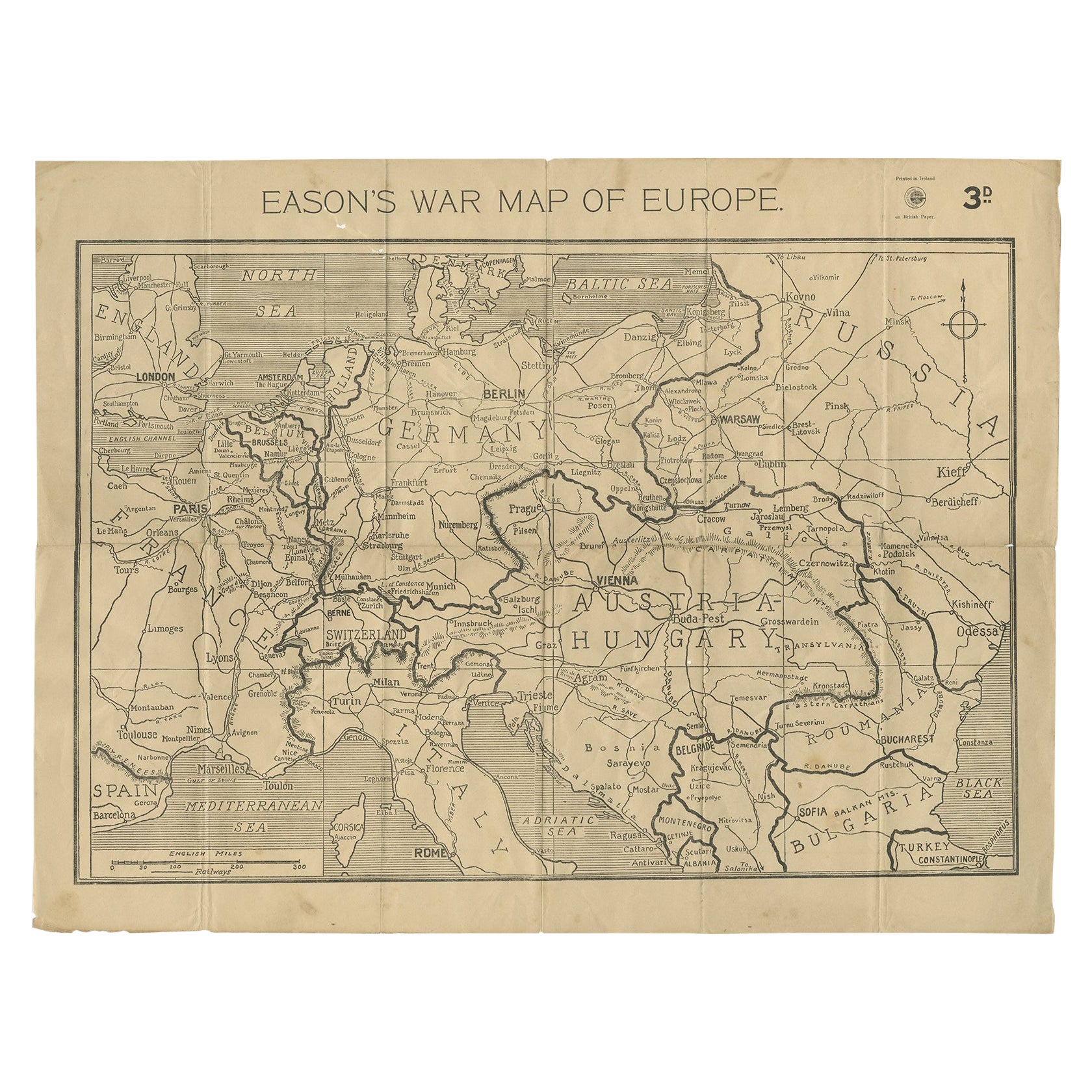
View AllEason's War Map of Europe, circa 1914
Located in Langweer, NL
Antique map titled 'Eason's War Map of Europe'. Printed in Ireland. Source unknown, to be determined.
Artists and Engravers: Anonymous.
Condition: Good, ...
Category
20th Century Maps
Materials
Paper

$519 Sale Price
20% Off
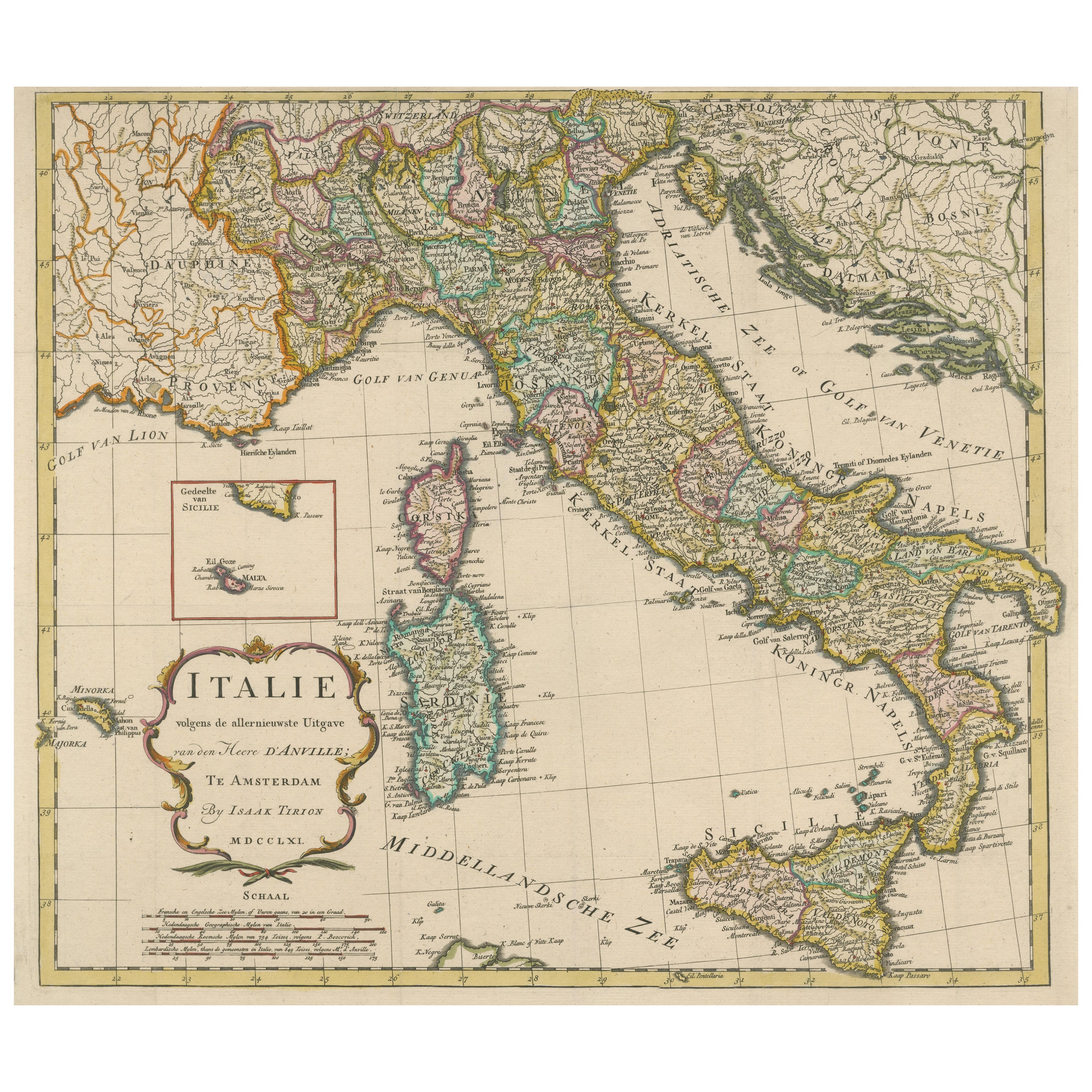
Detailed Antique Map of Italy and surrounding Islands
Located in Langweer, NL
Antique map titled 'Italie volgens de allernieuwste Uitgave van den Heere d'Anville'. Very detailed antique map, based on D'Anville's important map of It...
Category
Antique Mid-18th Century Maps
Materials
Paper
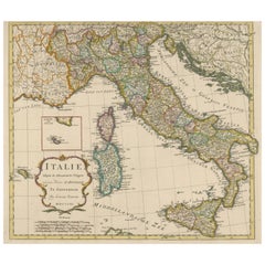
$585 Sale Price
20% Off
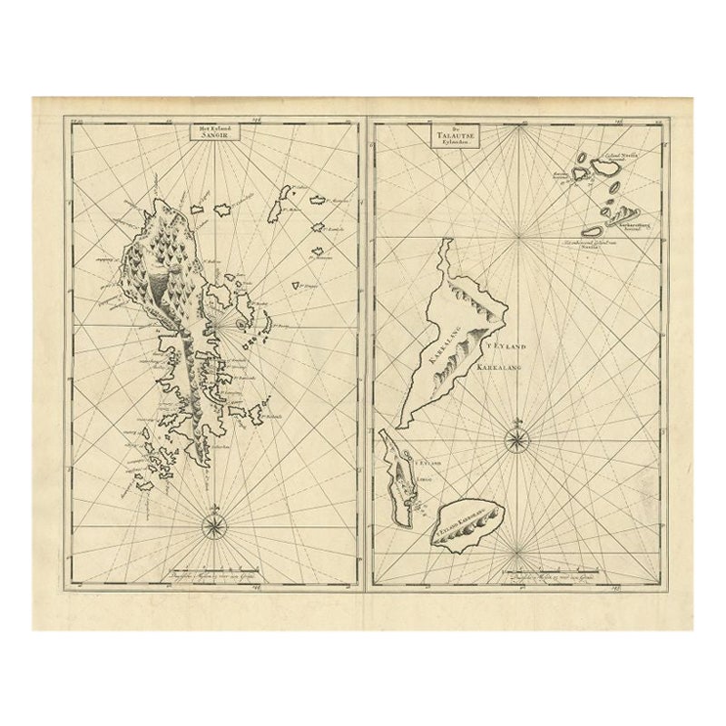
Antique Map of Sangir Island and the Talaud Islands by Valentijn, 1726
Located in Langweer, NL
Antique map titled 'Het Eyland Sangir & De Talautse Eylanden'. Two maps on one sheet. To the left, a map of Sangir Island, Indonesia. To the right, a map of the Talaud Islands, Indon...
Category
Antique 18th Century Maps
Materials
Paper
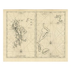
$491 Sale Price
20% Off
Antique Map of Japan, the Kurile Islands and Liu Kiu Islands, 1886
Located in Langweer, NL
The map is an exquisite piece, showcasing Japan's vibrant geography. Engraved by J. Bartholomew and published by George Philip & Son in London & Liverpool, it presents a detailed and...
Category
Antique Late 19th Century Maps
Materials
Paper
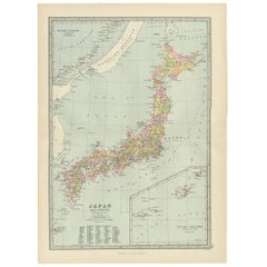
$113 Sale Price
20% Off
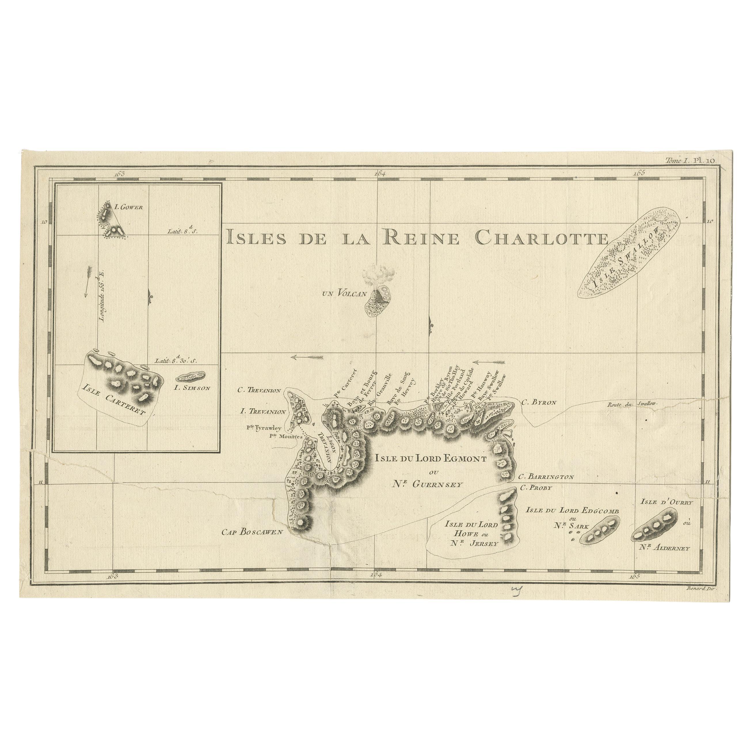
Antique Map of the Santa Cruz Islands with Inset of Carteret and Gower Islands
Located in Langweer, NL
Antique map titled 'Isles de la Reine Charlotte (..)'. A detailed chart of the Santa Cruz islands, to the north of the New Hebrides, with Carteret's track in "Swallow"; including an ...
Category
Antique Late 18th Century Maps
Materials
Paper
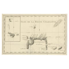
$283 Sale Price
20% Off
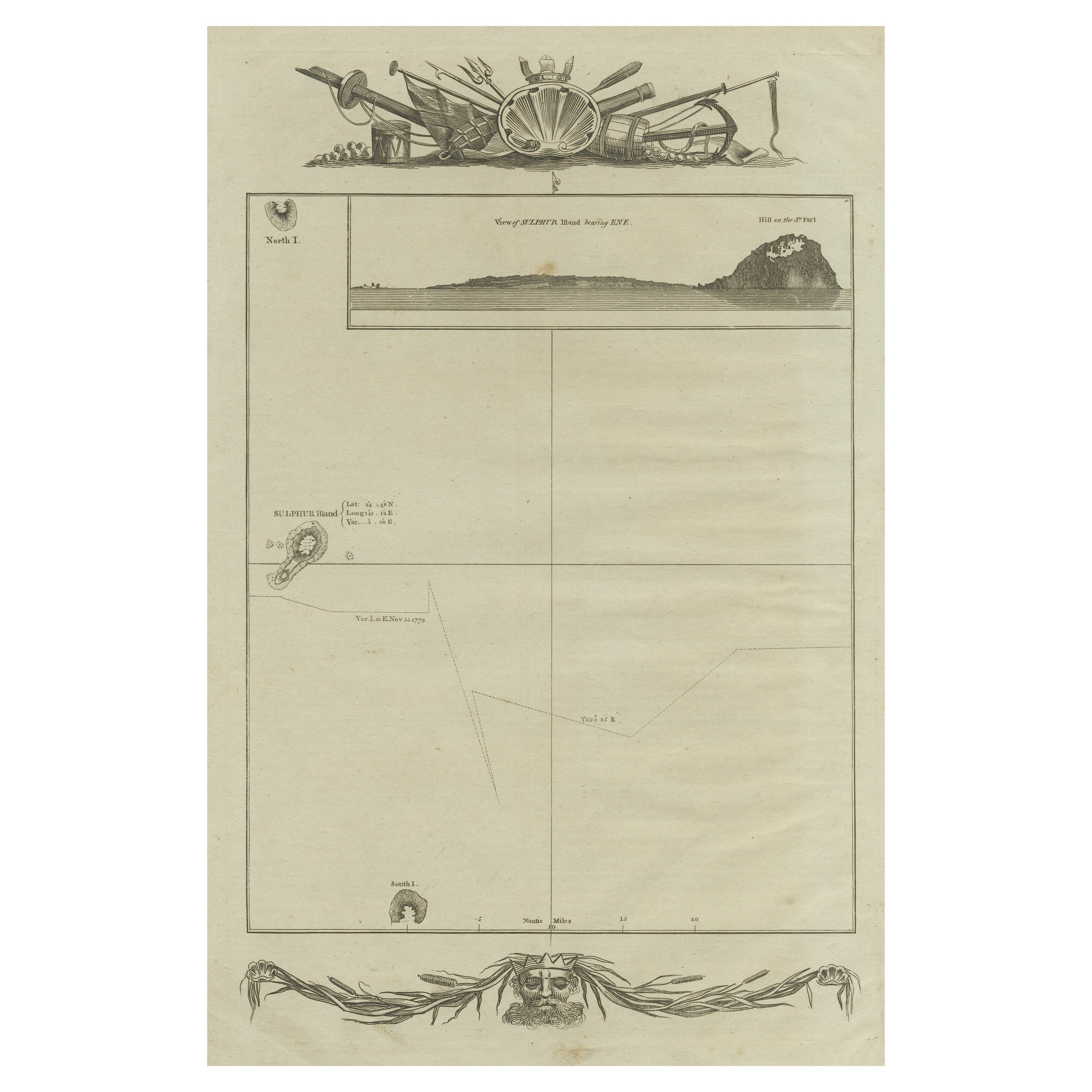
Antique Map of the Islands of Iwo Jima and Sulfur
Located in Langweer, NL
Untitled Antique Map of the islands of Iwo Jima and Sulfur, with a view of Sulphur with the hill. This map originates from 'A new, authentic, and complete collection of voyages round...
Category
Antique Late 18th Century Maps
Materials
Paper
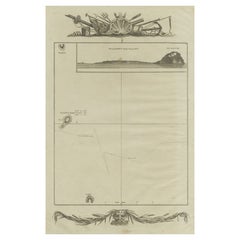
$245 Sale Price
20% Off
You May Also Like
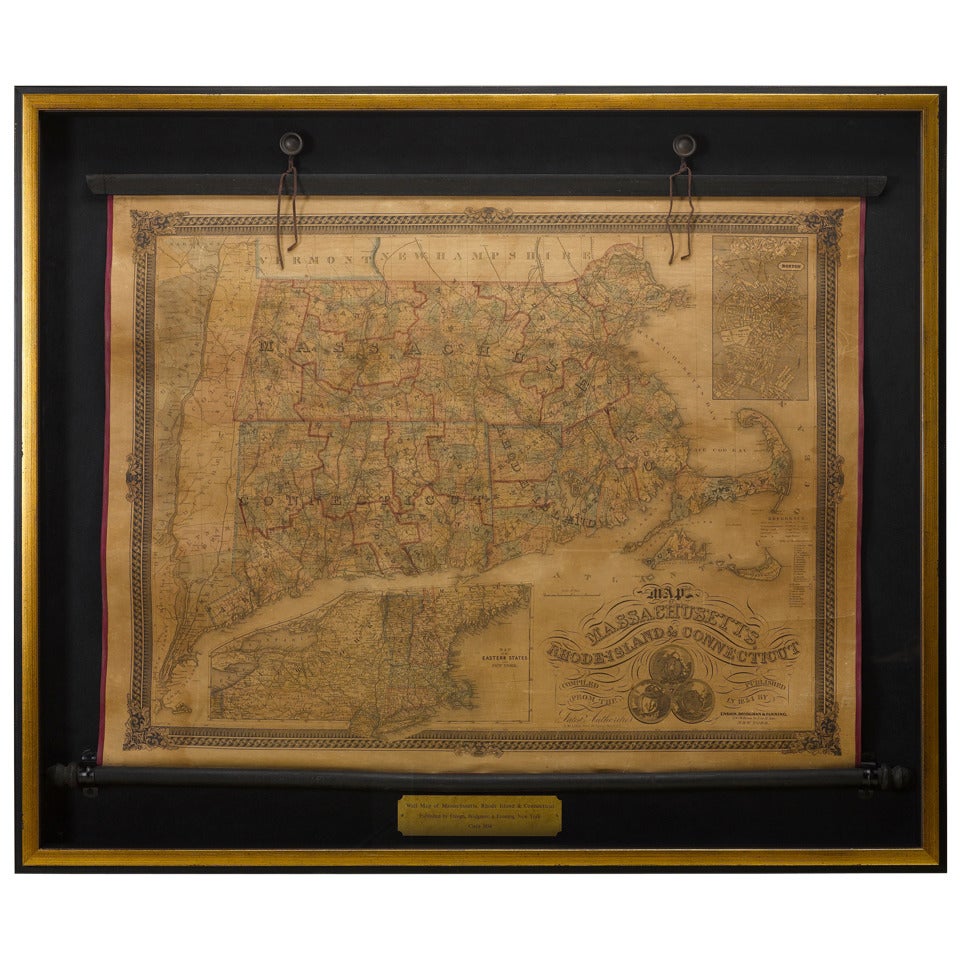
1854 Map of Massachusetts, Connecticut and Rhode Island, Antique Wall Map
Located in Colorado Springs, CO
This striking wall map was published in 1854 by Ensign, Bridgman & Fanning and has both full original hand-coloring and original hardware. This impression is both informative and highly decorative.
The states are divided into counties, outlined in red, green, and black, and subdivided into towns. Roads, canals, and railroad lines are prominently depicted, although they are not all labeled. The mapmakers also marked lighthouses, banks, churches, and prominent buildings, with a key at right. The map is an informative and comprehensive overview of the infrastructural development of New England prior to the Civil War. Physical geographies depicted include elevation, conveyed with hachure marks, rivers and lakes. The impression features an inset map of Boston...
Category
Antique 19th Century American Maps
Materials
Paper

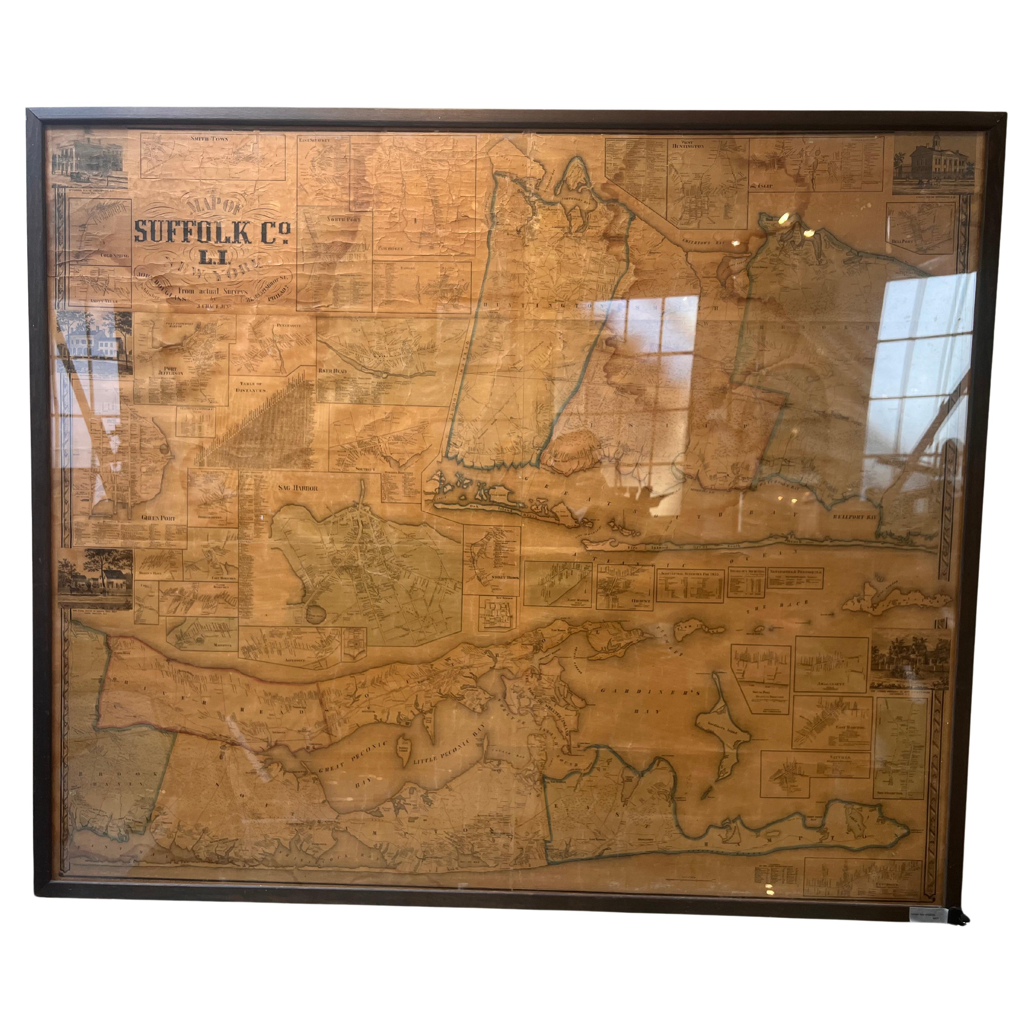
Framed Mid-19th Century Wall Map of Long Island, the Hamptons
Located in Sag Harbor, NY
A Framed museum quality find. This large wall map dates to the mid-1800s. Detailed inset maps of, Sag Harbor, East Hampton, Amagansett, Shelter Island and most villages in Long Island. It also has agriculture stats for 1855. Detailed prints of homes on Scuttle Hole in Bridgehampton as well as several other detailed prints. Lists of businesses, distance tables and railroad schedules and stops. The total amount of detailed information about Suffolk County Long Island is staggering. A unique rare New York map...
Category
Antique Mid-19th Century American Maps
Materials
Linen, Paper

$7,100 Sale Price
20% Off
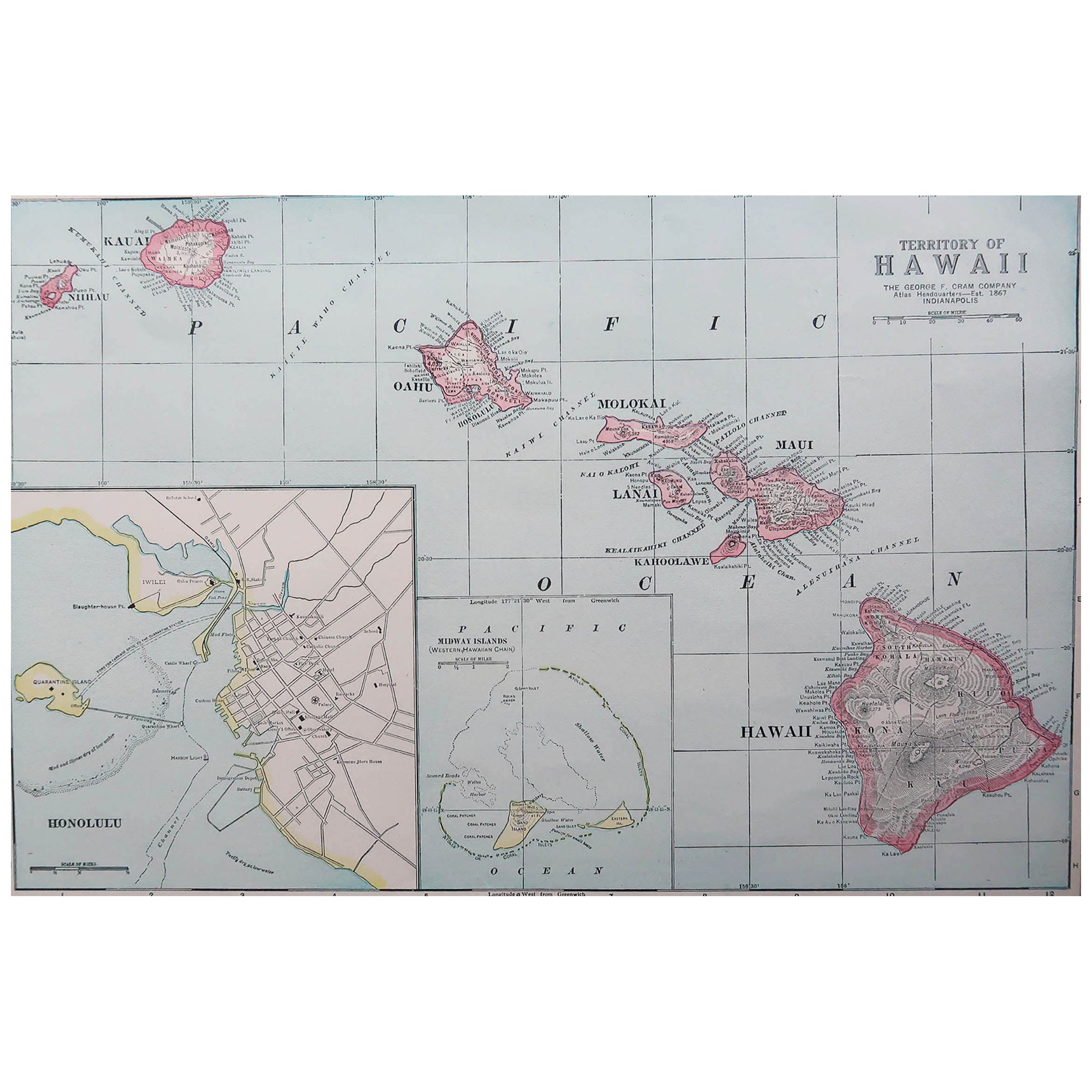
Original Antique Map of Hawaii And Adjacent Islands. C.1900
Located in St Annes, Lancashire
Fabulous map of Hawaii. With a vignette of Honolulu
Original color.
Engraved and printed by the George F. Cram Company, Indianapolis.
Published, C.1900.
Unframed.
Free shipping.
Category
Antique 1890s American Maps
Materials
Paper

Chagall: Love and the Stage 1914-1922 Hardcover Book
By (after) Marc Chagall
Located in North Hollywood, CA
Chagall: Love and the Stage 1914-1922. large hardcover 1st edition 1998, out of print.
Marc Chagall, Royal Academy of Arts (Great Britain).
Merrell Holberton, 1998 - Art - 104 pages....
Category
Late 20th Century British Expressionist Books
Materials
Paper

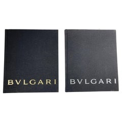
Set of Two Bvlgari Brand Book Catalogue Jewellery and Watches 2013
By Bulgari
Located in North Hollywood, CA
Set of two Bvlgari catalogues, jewelry and watches. Collection of 2013. Hardcover black cloth catalogues of one of the most famous Luxury Jewellery maker in the world. Sotirio Bulgar...
Category
2010s Italian Expressionist Books
Materials
Paper
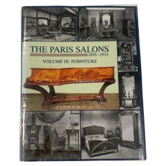
“The Paris Salons”, 1895-1914 Furniture ‘Book’
Located in Montelabbate, PU
This is the third in a multi-volume collection providing a visual catalogue record of the decorative arts of the Paris Salons. Included in this volume are reproductions of the catalogue illustrations of furniture at the Exposition Universelle of 1900, the annual Salons du Mobilier, and the celebrated 1903 and 1904 expositions of the Ecole de Nancy in the French capital. This chronological record clearly shows the revolution in furniture design that transpired in France at the turn of the century. The illustrations trace precisely the emergence of the art nouveau style in the 1890s, its high point between the 1900 Exposition Universelle and the 1903 Salons, its demise between 1905-1909, the return to period revivalism and the transitional art nouveau - art deco style of 1910-1912 with the proto - art deco style of the immediate pre-war years (1911-1914). Many examples of non-art nouveau works from the period are also included. Hundreds of these contemporary illustrations...
Category
Early 20th Century Books
Materials
Paper
Recently Viewed
View AllMore Ways To Browse
Antique Geological Maps
Antique Furniture Staten Island
Antique Magic Collectibles
Meader Furniture
Smith Brothers Furniture
Viking Antiques
Antique Leather Journal
Rothschild Books
Italian Leather Bound Book
Tooled Leather Mexican
Leather Books Spanish
Punch Books
Vintage Autograph Book
F Scott Fitzgerald
Vintage Police Collectibles
Ernest Hemingway Furniture
Versailles Book
Book Press Iron