Items Similar to 1685 Alain Manesson Mallet Map of Hokkaido (Lesso) in Northern Japan

Want more images or videos?
Request additional images or videos from the seller
1 of 10
1685 Alain Manesson Mallet Map of Hokkaido (Lesso) in Northern Japan
$551.62
£410.35
€460
CA$755.36
A$839.86
CHF 438.53
MX$10,223.11
NOK 5,595.41
SEK 5,242.64
DKK 3,501.73
Shipping
Retrieving quote...The 1stDibs Promise:
Authenticity Guarantee,
Money-Back Guarantee,
24-Hour Cancellation
About the Item
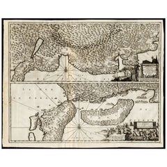
Title: 1685 Alain Manesson Mallet Map of Hokkaido, Iesso, and Company’s Land
Description: This engraved seventeenth-century map, titled Terre de Iesso, was published in 1685 as part of Alain Manesson Mallet’s Description de l’Univers. Printed in Paris and Frankfurt by Zunner, this map presents a European interpretation of northern Japan, particularly Hokkaido, referred to as Iesso, along with the speculative lands of Company’s Land and Terre des États.
During the Edo period under the Tokugawa Shogunate, Japan was largely closed to foreign trade and exploration, making European knowledge of its geography limited. As a result, maps such as this one included speculative elements, including the presence of mythical lands like Company’s Land, which was believed to have been sighted by European navigators but was later proven nonexistent. The map also includes Terre de la Compagnie and Terre des États, which frequently appeared on seventeenth-century European maps following the accounts of Maarten Gerritsz Vries, a Dutch explorer who sailed near Japan in 1643.
The map features a decorative style, with detailed illustrations of sailing ships in the Ocean Oriental, or Pacific Ocean. The Strait of Sungar, today known as the Tsugaru Strait, separates Iesso from the southern part of Japan, labeled Partie du Japon. Other notable coastal features include Cap Nabo ou Goree, an early name for a promontory in northern Japan.
This map reflects the speculative nature of early European cartography, as mapmakers combined limited firsthand knowledge with secondhand reports from sailors and traders. The depiction of Company’s Land persisted in maps well into the eighteenth century before it was conclusively disproven. The engraving is finely detailed, and the addition of sailing ships and stylized topography enhances its visual appeal.
Mallet’s Description de l’Univers was an important geographical work that provided contemporary European readers with knowledge of the known world. His maps, though small in size, were carefully engraved and often beautifully hand-colored, making them highly desirable among collectors of early cartography.
Cartographer and Source:
Alain Manesson Mallet, who lived from sixteen thirty to seventeen hundred six, was a French military engineer, cartographer, and cosmographer. He served under King Louis the Fourteenth and published Description de l’Univers in sixteen eighty three to sixteen eighty five. His work contained a combination of geographical maps, views, and descriptions of different regions around the world. Mallet’s maps are known for their artistic engraving, compact format, and imaginative interpretations of distant lands.
Condition Report:
The paper is well-preserved, with a fine laid texture characteristic of seventeenth-century printing. The engraving remains sharp, with clear lettering and precise details of ships, coastlines, and mountainous terrain.
There is light age-toning, particularly along the edges, which is expected for a map of this period. The original hand-coloring remains vibrant, with carefully applied shading distinguishing different territories. Some minor text bleed-through is visible from the reverse side, typical of books and atlases of this era, but it does not detract from the clarity of the map. The margins are intact, and there are no major tears, stains, or repairs, making this a fine and collectible example of early European cartography of Japan.
Framing Recommendations:
To properly preserve and display this antique map, museum-quality archival materials are recommended.
For matting and backing, use acid-free, museum-grade board to protect the paper from further aging. A double mat with a neutral outer mat and a warm beige or soft gold inner accent will highlight the delicate hand-coloring.
A dark walnut, black, or gilded wooden frame will complement the map’s historical style. An antique-style frame with subtle detailing would further enhance its seventeenth-century aesthetic.
To protect the map, UV-resistant museum glass or acrylic is recommended to prevent fading while maintaining clarity. Anti-reflective glass will allow for clear viewing of the engraving’s intricate details.
For mounting, avoid adhesives. Instead, use archival-quality corner mounts or Japanese paper hinges to secure the map without causing damage.
The framed map should be displayed in a stable environment, away from direct sunlight, humidity, and extreme temperature changes. An ideal setting would be in a study, library, or gallery, where its historical and artistic significance can be fully appreciated.
This sixteen eighty five Mallet map of Hokkaido, Iesso, and Company’s Land is a rare and historically significant artifact. It captures European exploration, early misconceptions about Japan, and the artistic cartography of the seventeenth century. It is a valuable addition to collections focused on antique maps, Japanese history, and early European voyages to Asia.
- Dimensions:Height: 8.12 in (20.6 cm)Width: 5.44 in (13.8 cm)Depth: 0.01 in (0.2 mm)
- Materials and Techniques:Paper,Engraved
- Period:1680-1689
- Date of Manufacture:1685
- Condition:The paper is well-preserved, with a fine laid texture characteristic of seventeenth-century printing. The engraving remains sharp, with clear lettering and precise details of ships, coastlines, and mountainous terrain.
- Seller Location:Langweer, NL
- Reference Number:Seller: BGSH-0031stDibs: LU3054343931672
About the Seller
5.0
Recognized Seller
These prestigious sellers are industry leaders and represent the highest echelon for item quality and design.
Platinum Seller
Premium sellers with a 4.7+ rating and 24-hour response times
Established in 2009
1stDibs seller since 2017
2,510 sales on 1stDibs
Typical response time: <1 hour
- ShippingRetrieving quote...Shipping from: Langweer, Netherlands
- Return Policy
Authenticity Guarantee
In the unlikely event there’s an issue with an item’s authenticity, contact us within 1 year for a full refund. DetailsMoney-Back Guarantee
If your item is not as described, is damaged in transit, or does not arrive, contact us within 7 days for a full refund. Details24-Hour Cancellation
You have a 24-hour grace period in which to reconsider your purchase, with no questions asked.Vetted Professional Sellers
Our world-class sellers must adhere to strict standards for service and quality, maintaining the integrity of our listings.Price-Match Guarantee
If you find that a seller listed the same item for a lower price elsewhere, we’ll match it.Trusted Global Delivery
Our best-in-class carrier network provides specialized shipping options worldwide, including custom delivery.More From This Seller
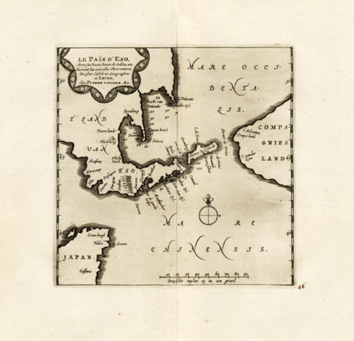
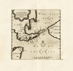
View AllExtremely Rare Map of The land of Eso or Hokkaido in Japan, 1725
Located in Langweer, NL
Plate 46: 'Le Pais d' Eso.' (The land of Eso / Hokkaido in Japan.) Extremely rare in this edition.
This plate originates from the very scarse: 'La Galerie Agreable du Monde (..). T...
Category
Antique 18th Century Maps
Materials
Paper
$695 Sale Price
20% Off
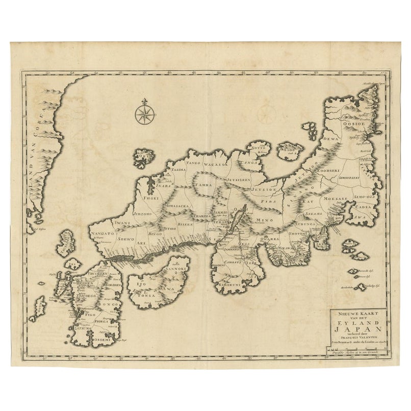
Rare Antique Map of Japan with Place Names Given in Dutch Nomenclature, 1726
Located in Langweer, NL
Antique map titled 'Nieuwe Kaart van het Eyland Japan'.
Rare map of Japan, it shows each of the Japanese provinces, with place names along the route from Nagasaki to Edo. The place...
Category
Antique 18th Century Maps
Materials
Paper
$2,158 Sale Price
20% Off
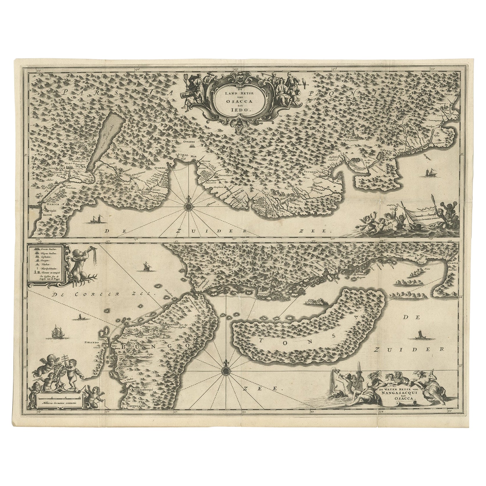
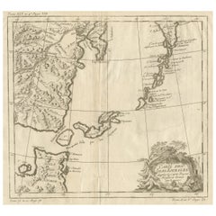
Map of Japanese Coast from Osaka to Tokyo & the Kyushu and Shikoku Islands, 1669
Located in Langweer, NL
Antique map titled 'De Land Reyse van Osacca to Iedo. De Water eyse van Nangasacqui tot Osacca.'
Two maps on one sheet. The top map shows the Japanese coast from Osaka to Tokyo (Jedo). The lower map shows the strait between mainland Japan and the two large islands...
Category
Antique 1660s Maps
Materials
Paper
$1,391 Sale Price
20% Off
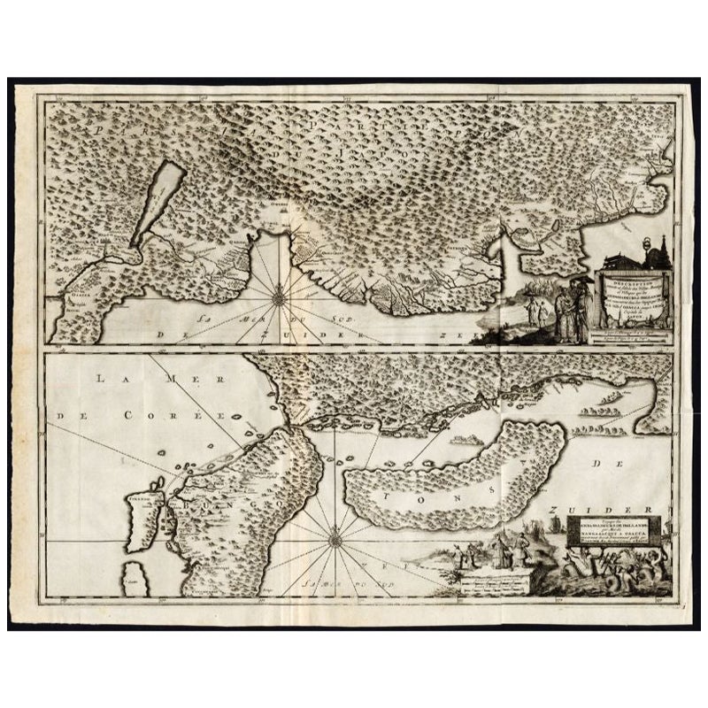
Antique Map of the Region of Osaka and Hirado Island in Japan, 1725
By Pieter Van Der Aa
Located in Langweer, NL
Antique map titled 'Description exacte et fidele des villes, bourgs et villages qui les Ambassadeurs de Hollande ont rencontrez dans leur voyage par terre de la ville Osacca jusqu'a ...
Category
Antique 18th Century Maps
Materials
Paper
$1,271 Sale Price
20% Off
Antique Map of Japan and Korea by Sanson, 'c.1690'
Located in Langweer, NL
Antique map titled 'Les Iles du Iapon (..)'. Original antique map, with beautiful (later) hand coloring, of Japan and the Island of Corey (Korea). Uncommon edition, with '234' at top...
Category
Antique Late 17th Century Maps
Materials
Paper

$959 Sale Price
20% Off
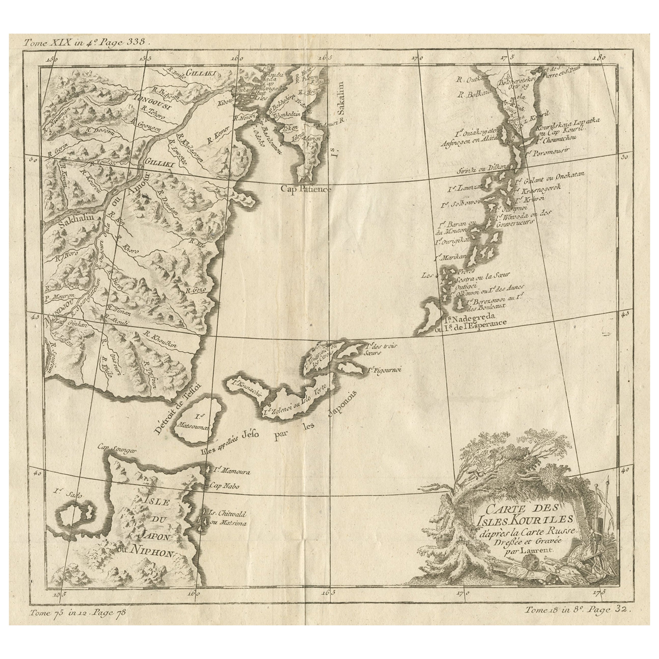
Old Map of The Kurile Islands, from Hokkaido, Japan to Kamchatka, Russia, c.1750
Located in Langweer, NL
Antique map titled 'Carte des Iles Kouriles'. Original antique map of the Kuril Islands.
The Kuril Islands or Kurile Islands are a volcanic archipelago that stretches approximate...
Category
Antique 1750s Maps
Materials
Paper
$316 Sale Price
20% Off
Free Shipping
You May Also Like
1627 Hendrik Hondius Map Entitled "Vltoniae Orientalis Pars, " Ric.a009
Located in Norton, MA
1627 Hendrik Hondius map entitled
"Vltoniae orientalis pars,"
Ric.a009
Title:
Vltoniae orientalis : pars
Title (alt.) :
Ultoniae orientalis pars
Creator:
Mercator, Gerh...
Category
Antique 17th Century Dutch Maps
Materials
Paper

1633 Map "La Souverainete De Sedan Et De Raucourt, Et La Prevoste Ric0011
Located in Norton, MA
1653 map entitled
"La Souverainete de Sedan et de Raucourt, et la Prevoste de Doncheri,"
Ric0011
Description:
Lovely map centered on Sedan and Doncheri and the Meuze River fr...
Category
Antique 17th Century Dutch Maps
Materials
Paper

Antique French Map of Asia Including China Indoneseia India, 1783
Located in Amsterdam, Noord Holland
Very nice map of Asia. 1783 Dedie au Roy.
Additional information:
Country of Manufacturing: Europe
Period: 18th century Qing (1661 - 1912)
Condition: Overall Condition B (Good Used)...
Category
Antique 18th Century European Maps
Materials
Paper

$648 Sale Price
20% Off
1714 Henri Chatelain "Nouvelle Carte Des Etatas Du Grand.Duc De Mos Moscovie Eur
Located in Norton, MA
A 1714 Henri Chatelain map, entitled
"Nouvelle Carte Des Etatas Du Grand Duc De Moscovie En Europe,"
Ricb001
Henri Abraham Chatelain (1684-1743) was a Huguenot pastor of Parisi...
Category
Antique Early 18th Century Dutch Maps
Materials
Paper

The Normandy Region of France: A 17th C. Hand-colored Map by Sanson and Jaillot
By Nicolas Sanson
Located in Alamo, CA
This large hand-colored map entitled "Le Duché et Gouvernement de Normandie divisée en Haute et Basse Normandie en divers Pays; et par evêchez, avec le Gouvernement General du Havre ...
Category
Antique 1690s French Maps
Materials
Paper

1657 Janssonius Map of Vermandois and Cappelle, Ric. A-004
Located in Norton, MA
1657 Janssonius map of
Vermandois and Cappelle
Ric.a004
Description: Antique map of France titled 'Descriptio Veromanduorum - Gouvernement de la Cappelle'. Two detailed maps o...
Category
Antique 17th Century Unknown Maps
Materials
Paper

More Ways To Browse
Japan Antiques Collectables
Dutch Military
Japanese Compact
Stained Glass Dutch
Dutch Sailing Ship
Live Edge Black Walnut
Antique Wooden Mallets
Vintage Scandanavian Chairs
19th Century Red Glass
Antique French Console Table Tables
Silver Bowl Large
Antique French Silk
Down Couch
Used Lighter Art
Blue Edge Glass
Mahogany 1950s Furniture
Solid Mahogany Table
Dessert Glasses