Items Similar to 1714 Henri Chatelain "Nouvelle Carte Des Etatas Du Grand.Duc De Mos Moscovie Eur

Want more images or videos?
Request additional images or videos from the seller
1 of 9
1714 Henri Chatelain "Nouvelle Carte Des Etatas Du Grand.Duc De Mos Moscovie Eur
About the Item
A 1714 Henri Chatelain map, entitled
"Nouvelle Carte Des Etatas Du Grand Duc De Moscovie En Europe,"
Ricb001
Henri Abraham Chatelain (1684-1743) was a Huguenot pastor of Parisian origins. Chatelain proved a successful businessman, creating lucrative networks in London, The Hague, and then Amsterdam. He is most well known for the Atlas Historique, published in seven volumes between 1705 and 1720. This encyclopedic work was devoted to the history and genealogy of the continents, discussing such topics as geography, cosmography, topography, heraldry, and ethnography. Published thanks to a partnership between Henri, his father, Zacharie, and his younger brother, also Zacharie, the text was contributed to by Nicolas Gueudeville, a French geographer. The maps were by Henri, largely after the work of Guillaume Delisle, and they offered the general reader a window into the emerging world of the eighteenth century.
Dimension: Paper Size: 18" W x 14" H (46 cm W x 36cm H)
Date: 18th Century
Condition: Good Condition with age, please see photos.
- Dimensions:Height: 14.18 in (36 cm)Width: 18.12 in (46 cm)Depth: 0.4 in (1 cm)
- Materials and Techniques:
- Place of Origin:
- Period:
- Date of Manufacture:1714
- Condition:
- Seller Location:Norton, MA
- Reference Number:1stDibs: LU5848230191662
About the Seller
5.0
Platinum Seller
These expertly vetted sellers are 1stDibs' most experienced sellers and are rated highest by our customers.
Established in 2000
1stDibs seller since 2021
85 sales on 1stDibs
Typical response time: <1 hour
- ShippingRetrieving quote...Ships From: Norton, MA
- Return PolicyA return for this item may be initiated within 3 days of delivery.
More From This SellerView All
- 1860 Large Map "Carte De La Siberie Russie D'asie, " Ric.R0001Located in Norton, MALarge 1860 map "Carte De La Siberie Russie D'Asie," R-0001 " Authentic" - 1860 map "Carte De La Siberie Russie D'Asie," Dimension: Paper: 68 cm W x 51 cm H ; Sight: 51cm W x 4...Category
Antique 19th Century Unknown Maps
MaterialsPaper
- 1630 Pierre Petit map "Description du Gouvernement de la Capelle" Ric0010Located in Norton, MA1630 Pierre Petit map entitled "Description du Gouvernement de la Capelle," Ric0010 Pierre Petit was the son of a minor provincial official in Montluçon. The town, in the Auver...Category
Antique 17th Century Dutch Maps
MaterialsPaper
- 1656 "La Souverainete de Sedan et de Raucourt, et la Prevoste de Doncheri Ric004Located in Norton, MA1656 map entitled "La Souverainete de Sedan et de Raucourt, et la Prevoste de Doncheri," Hand Colored Ric0004. Description: Lovely map centered on Sedan and Doncheri an...Category
Antique 17th Century Dutch Maps
MaterialsPaper
- 1839 Map of Karte Des "Russischen Reiches in Europa Und Asien" Ric.R0013Located in Norton, MA1839 map of Karte Des "Russischen Reiches in Europa and Asien" Ric.r013 Map of the European and Asian parts of Russian Empire. Karte der Russischen Reiches in Europa und Asien...Category
Antique 19th Century Unknown Maps
MaterialsPaper
- 1633 Map "La Souverainete De Sedan Et De Raucourt, Et La Prevoste Ric0011Located in Norton, MA1653 map entitled "La Souverainete de Sedan et de Raucourt, et la Prevoste de Doncheri," Ric0011 Description: Lovely map centered on Sedan and Doncheri and the Meuze River fr...Category
Antique 17th Century Dutch Maps
MaterialsPaper
- 1640 Joan Bleau Map Entitled"Diocecese de rheims et le pais de rethel, " Eic.a011Located in Norton, MA1640 Joan Bleau map entitled "Diocecese de rheims et le pais de rethel," Ric.a011 OAN BLAEU Diocecese de Rheims, et le pais de Rethel. Handcolored engraving, c.1640. ...Category
Antique 17th Century Dutch Maps
MaterialsPaper


You May Also Like
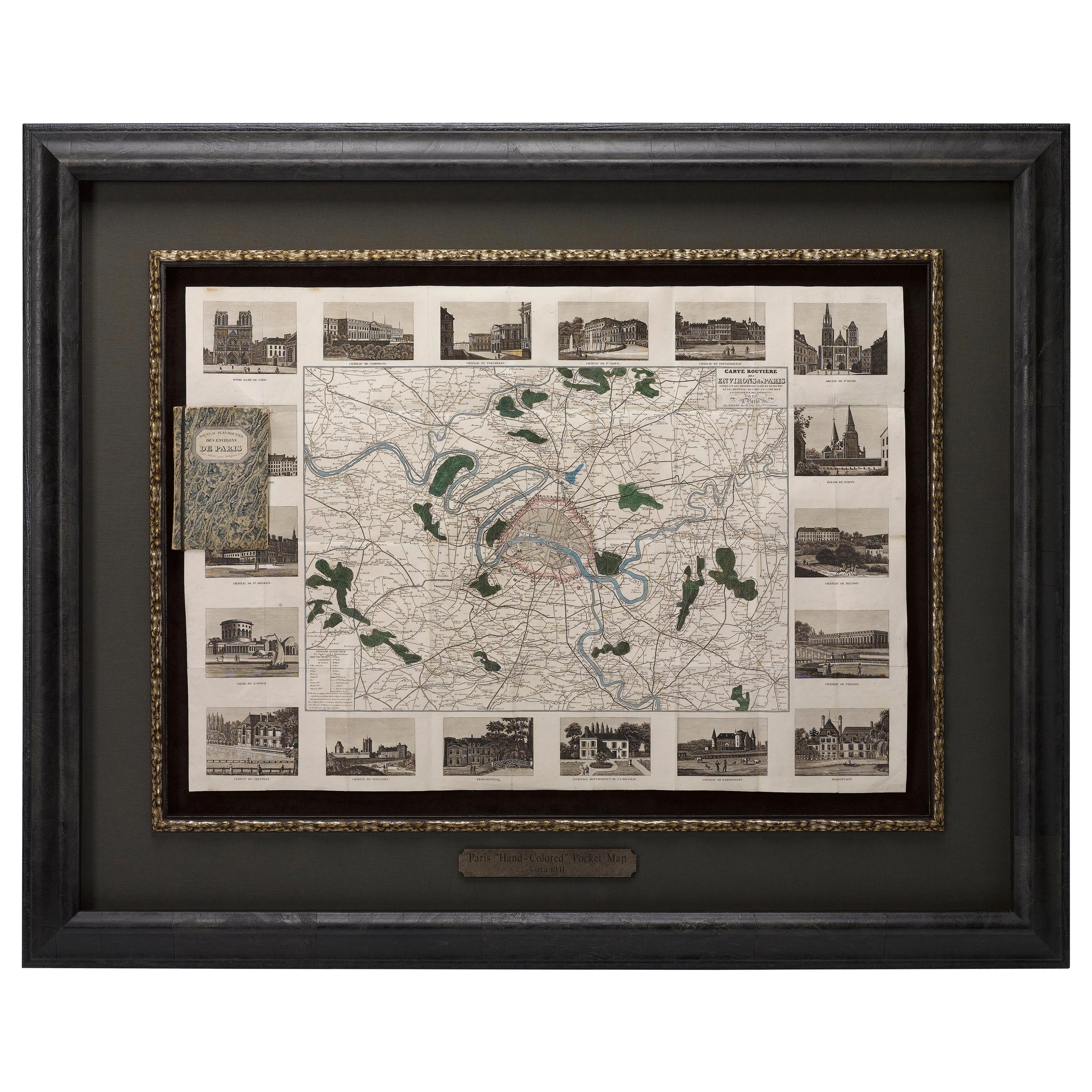
- Antique Map of Paris, "Carte Routiere des Environs de Paris" 1841Located in Colorado Springs, COThis beautiful hand-colored road map of Paris was published in 1841. The map shows Paris and the surrounding area in a folding pocket map. Organized and detailed for travelers, this ...Category
Antique 1840s French Maps
MaterialsPaper
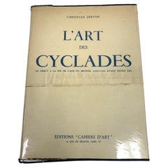
- L'Art Des Cyclades. Du Debut a La Fin De L'age Du Bronze HB BookBy Christian ZervosLocated in Bridgeport, CTL' Art des Cyclandes du Debut a La Fin de L' Age du Bronze, 2500 - 1100 Avant Notre Ere, hardbound book with dust jacket covered with Bodart cover. Published by Editions Cahiers D' ...Category
20th Century French Classical Greek Books
MaterialsPaper
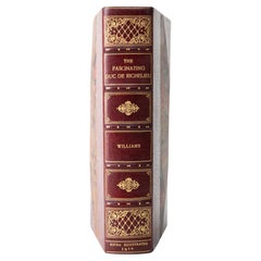
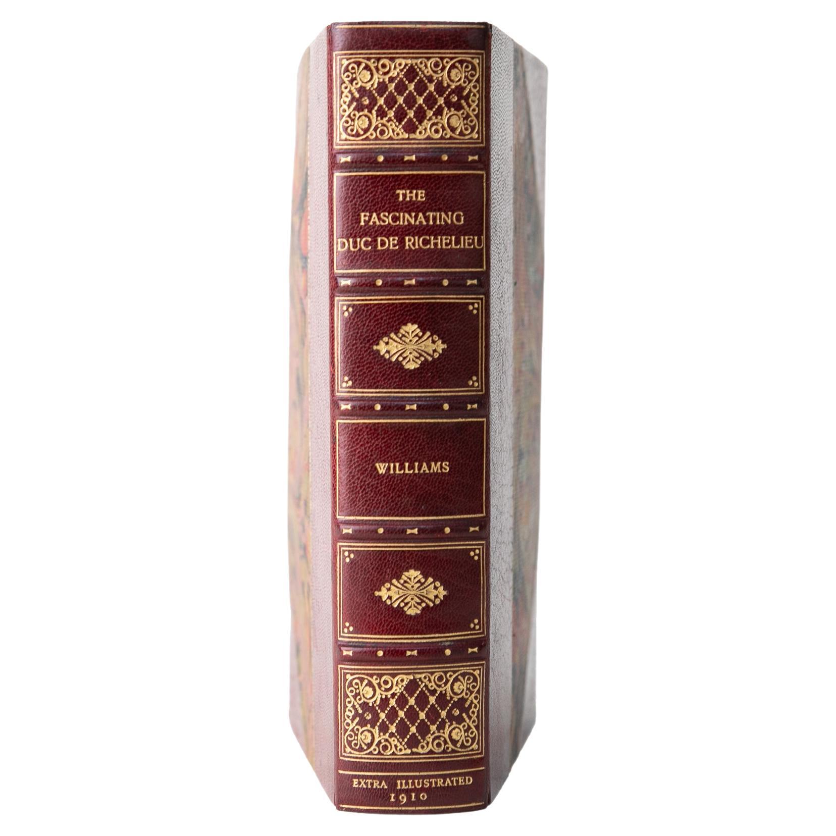
- 1 Volume. H. Noel Williams, The Fascinating Duc de Richelieu.Located in New York, NY1 Volume. H. Noel Williams, The Fascinating Duc de Richelieu. First Edition. Bound by Bayntun in 3/4 wine morocco and marbled boards bordered in gilt-tooling with a gilt-tooled raise...Category
Early 20th Century English Books
MaterialsLeather
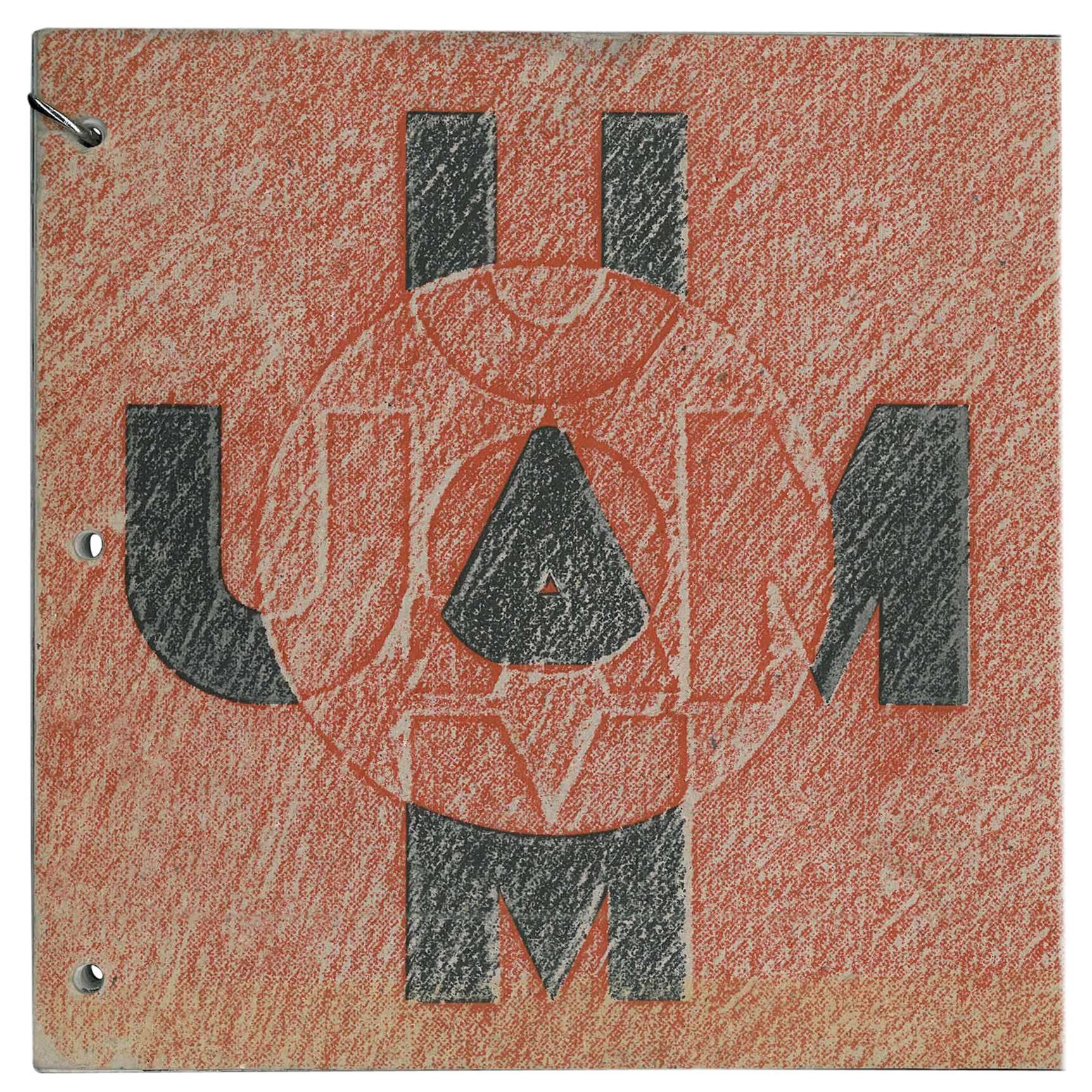
- UAM Union des Artistes Modernes Petits Meubles de Grands Noms (Book)Located in North Yorkshire, GBThis is a very scarce and beautiful catalogue of an exhibition which took place in October and November 1994 at Galerie de Vos. The UAM (The French Union of Modern Artists) was a movement made up of French Decorative Artists which flourished in the 1930s, 1940s and 1950s. The members were some of the great names of the 20th century's designers and decorators and included - Rose Adler, Pierre Chareau, Eileen Gray, Rene Herbst, Francis Jourdain, Le Corbusier & Jenneret, Robert Mallet-Stevens, Gustave...Category
20th Century Books
MaterialsPaper
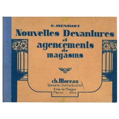
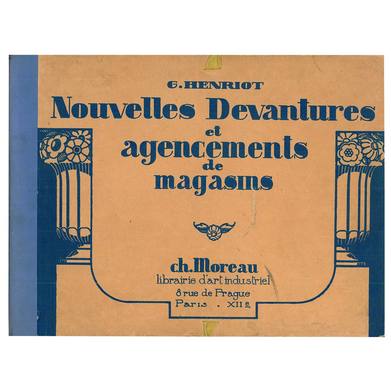
- Nouvelles Devantures et Agencements de Magasins (Book)Located in North Yorkshire, GBDesigns for Shop Windows An hardcovered ribbon tied portfolio with 60 photogravure reproductions showing examples of New Shop fronts and Shop fittings in the Art Deco style by some ...Category
Mid-20th Century Books
MaterialsPaper
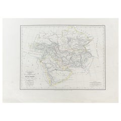
- Antique Carte de De la Perse Saudie Arabia UAE Turkey Qatar Bahrein, 1836Located in Amsterdam, Noord HollandAntique Carte de De la Perse Saudie Arabia UAE Turkey Qatar Bahrein, 1836 Very nice map of Middle East. Additional information: Material: Paper Typ...Category
Antique 18th Century European Maps
MaterialsPaper