Items Similar to 1656 "La Souverainete de Sedan et de Raucourt, et la Prevoste de Doncheri Ric004
Want more images or videos?
Request additional images or videos from the seller
1 of 14
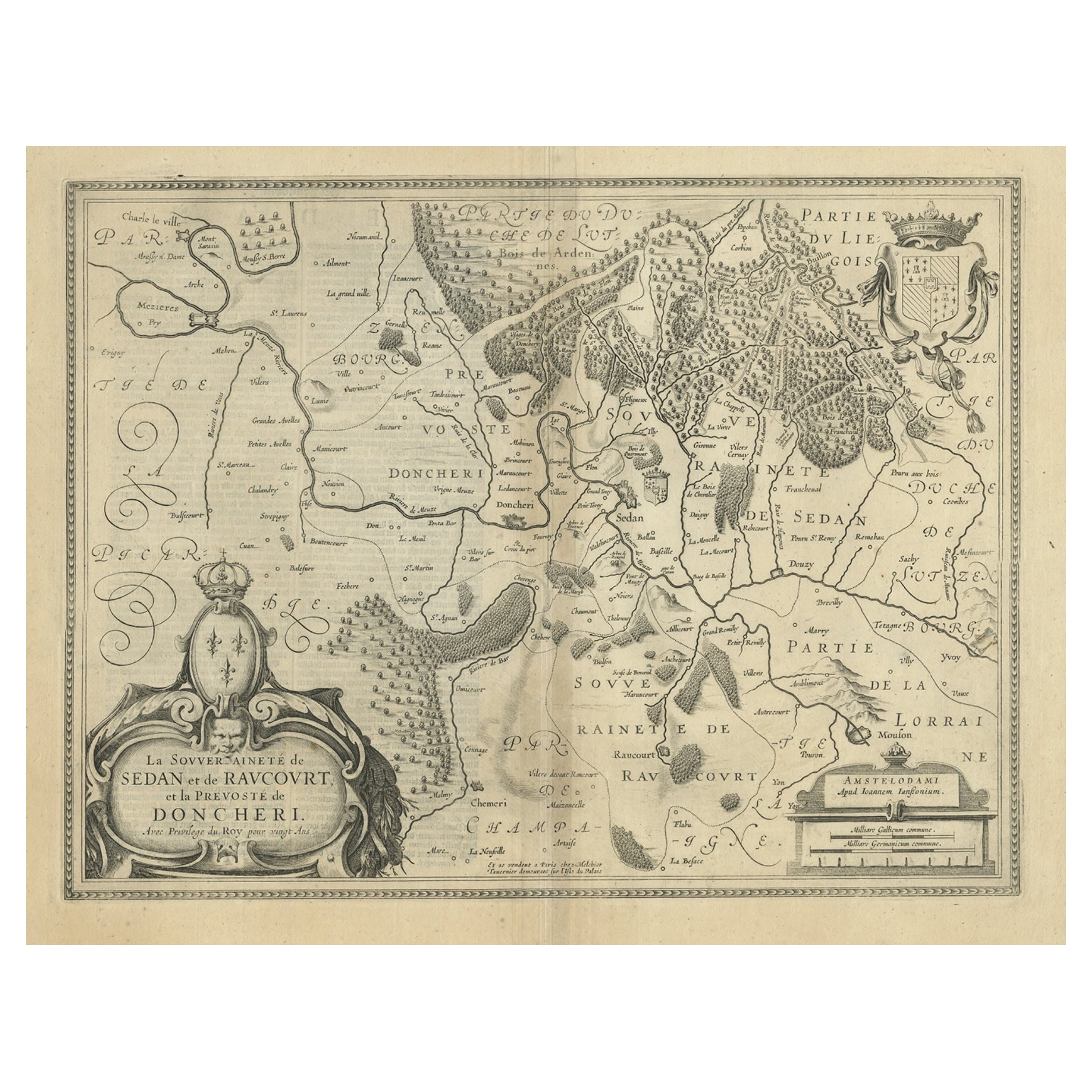
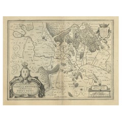
1656 "La Souverainete de Sedan et de Raucourt, et la Prevoste de Doncheri Ric004
About the Item
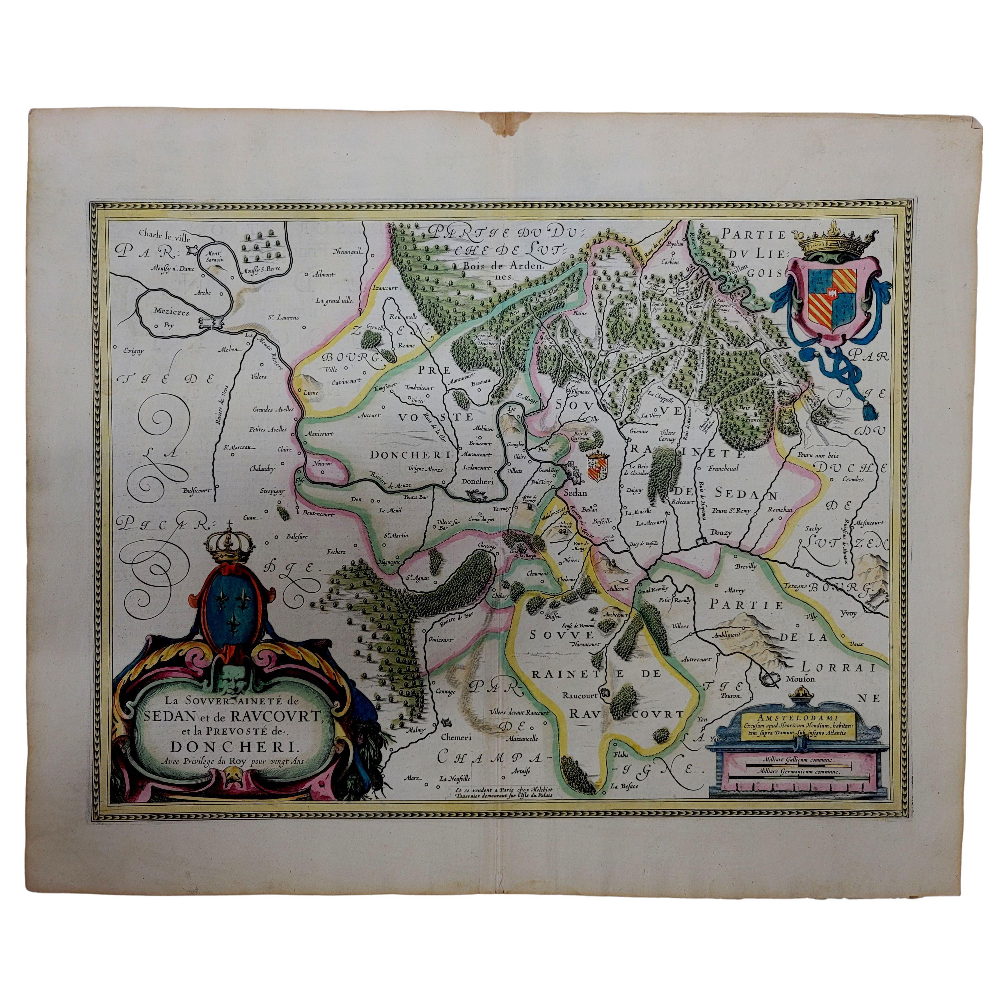
1656 map entitled
"La Souverainete de Sedan et de Raucourt, et la Prevoste de Doncheri,"
Hand Colored
Ric0004.
Description:
Lovely map centered on Sedan and Doncheri and the Meuze River from Charleville and Mezieres to Mosuon and Yvoy. The fortified cities are well depicted. Richly embellished with a large title cartouche with the royal arms, a scale cartouche and coat of arms. Latin text on verso.
Artists and Engravers:
Antique map of France titled 'La Souveraineté de Sedan et de Raucourt, et la prevosté de Doncheri'. Lovely map centered on Sedan and Doncheri and the Meuze River from Charleville and Mezieres to Mosuon and Yvoy. This map originates from 'Atlas Novus, Sive Theatrum Orbis Orbis Terrarum: In quo Galliae, Helvetiae (..)' by J. Janssonius (1656-1657).
Dimension: Paper: 23.3" W x 20.3" H (59 cm W x 51.7 cm H) ; Sight: 19.7" x 15.7" H (50 cm W x 39.8 cm H)
Condition: Good Condition with aged toning, please see photos.
- Dimensions:Height: 20.36 in (51.7 cm)Width: 23.23 in (59 cm)Depth: 0.4 in (1 cm)
- Materials and Techniques:
- Place of Origin:
- Period:
- Date of Manufacture:1656
- Condition:
- Seller Location:Norton, MA
- Reference Number:1stDibs: LU5848230191542
About the Seller
5.0
Platinum Seller
These expertly vetted sellers are 1stDibs' most experienced sellers and are rated highest by our customers.
Established in 2000
1stDibs seller since 2021
85 sales on 1stDibs
Typical response time: <1 hour
- ShippingRetrieving quote...Ships From: Norton, MA
- Return PolicyA return for this item may be initiated within 3 days of delivery.
More From This SellerView All
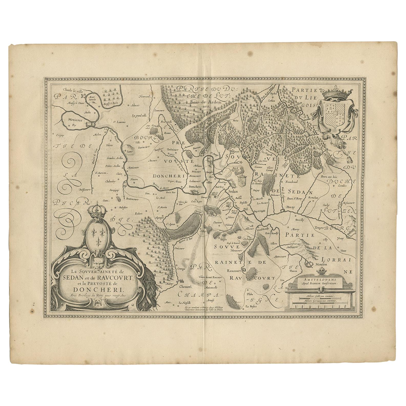
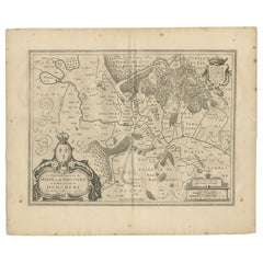
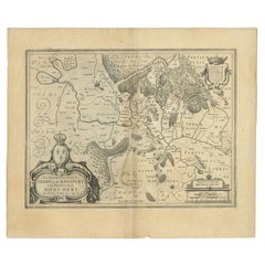
- 1633 Map "La Souverainete De Sedan Et De Raucourt, Et La Prevoste Ric0011Located in Norton, MA1653 map entitled "La Souverainete de Sedan et de Raucourt, et la Prevoste de Doncheri," Ric0011 Description: Lovely map centered on Sedan and Doncheri and the Meuze River fr...Category
Antique 17th Century Dutch Maps
MaterialsPaper
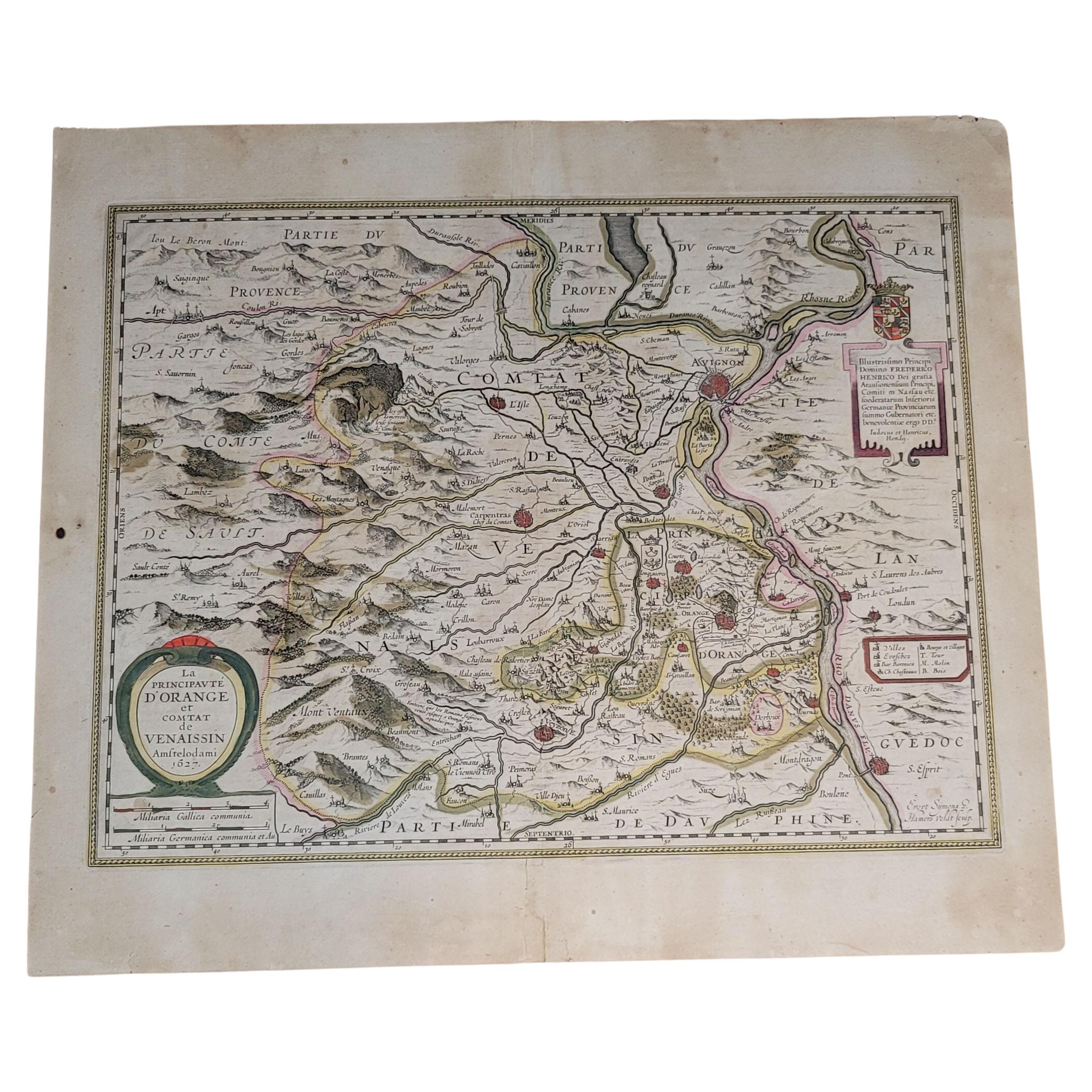
- 1627 Hondius Map "La Principaute d'Orange et Comtat de Ve", Ric.0003Located in Norton, MA1627 Hondius map entitled "La Principaute d'Orange et Comtat de Venaissin," Original Hand-Colored Description: From Johannes Janssonius's Atlantis Maioris Appendix of 1630. ...Category
Antique 17th Century Unknown Maps
MaterialsPaper
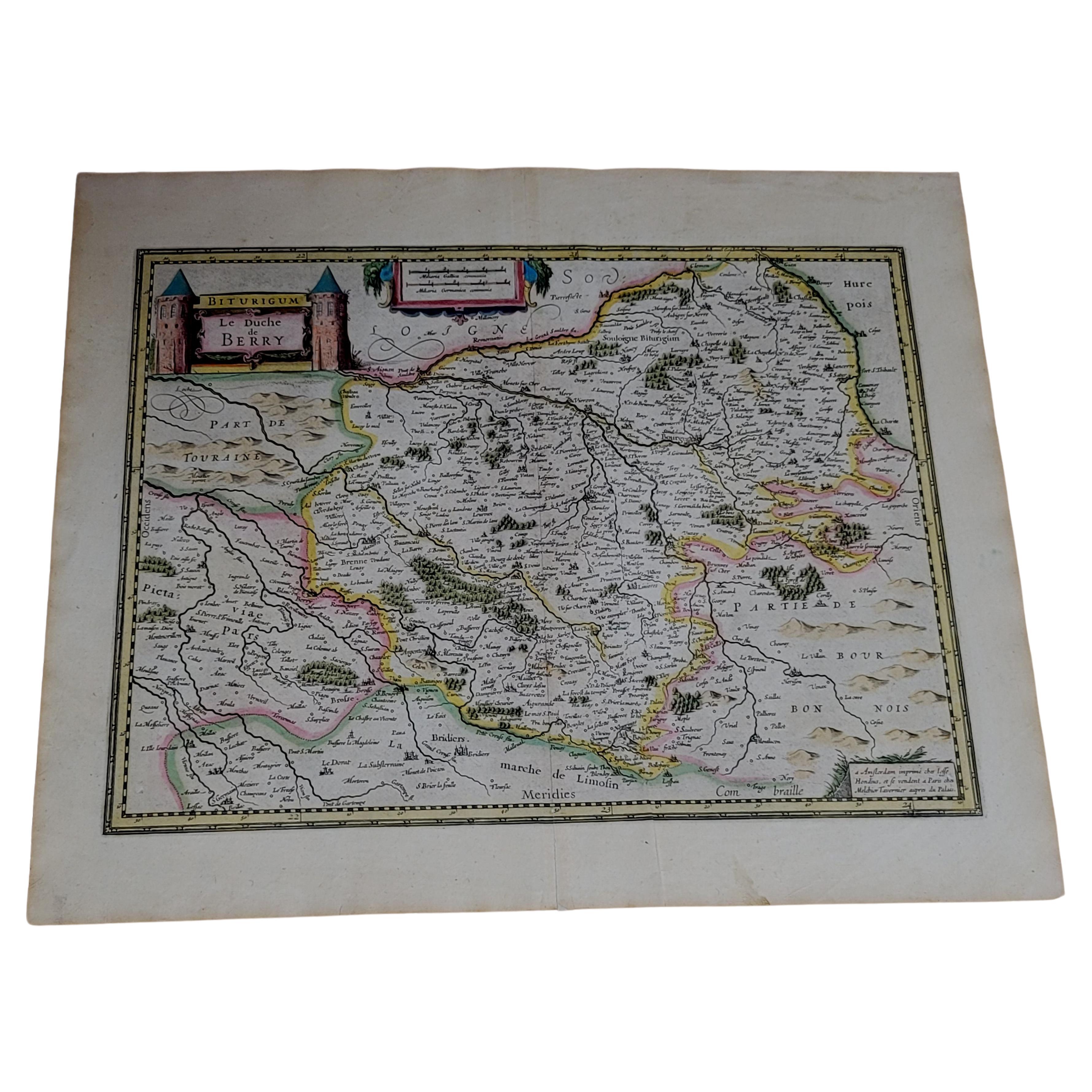
- 1633 Map, Entitled "La Douche De Berry, " Ric.0005Located in Norton, MA1633 map, entitled "La douche de Berry," Hand Colored Ric.0005 Description: 1633 map, entitled "La douche de Berry," Dimension: Paper: 23.3" W x 20.3" H (59 cm W x 51.7 c...Category
Antique 17th Century Unknown Maps
MaterialsPaper
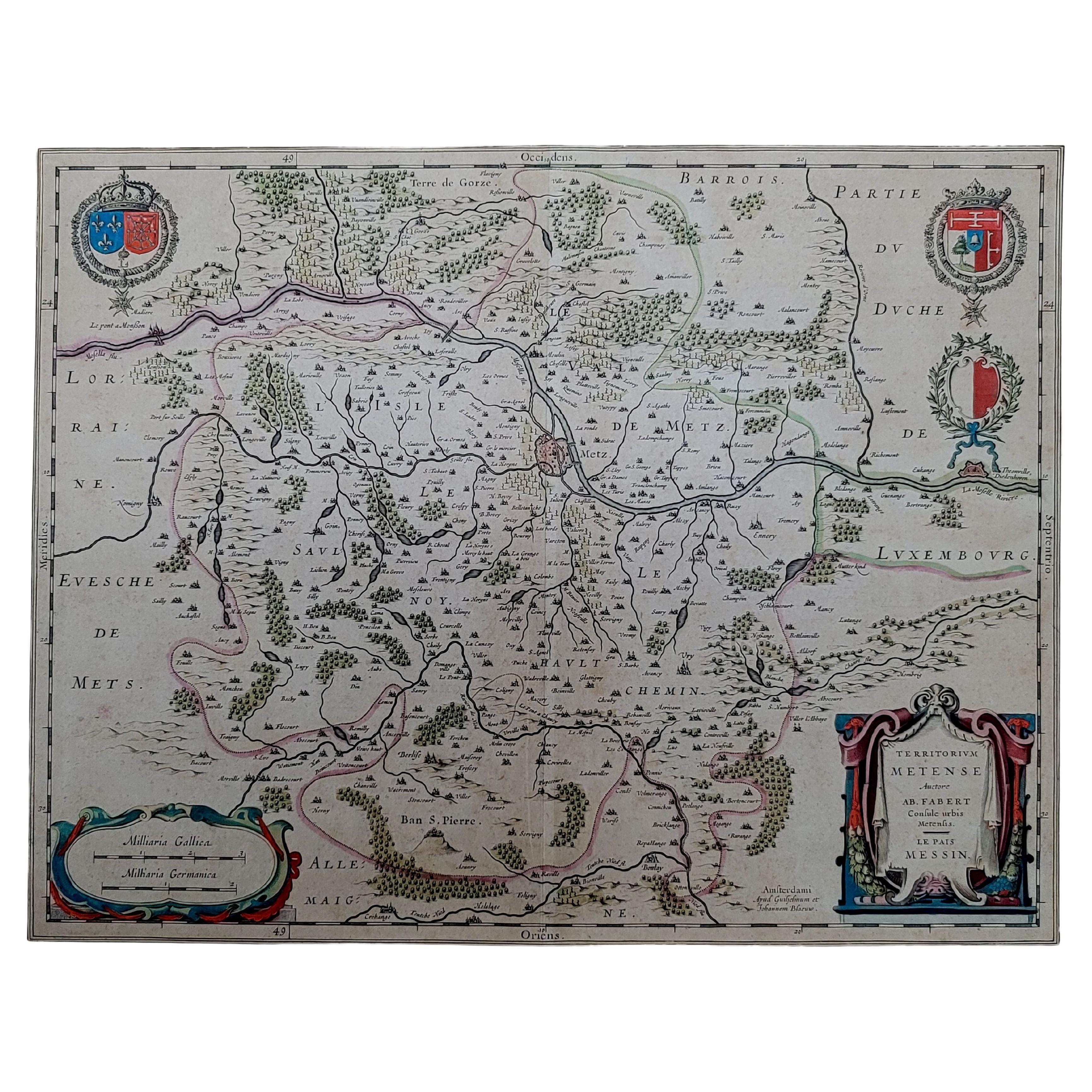
- 1656 Jansson Map Metz Region of France Entitled "Territorium Metense" Ric0014Located in Norton, MA1656 Jansson map Metz Region of France entitled "Territorium Metense." Ric0014 " Authentic" - Map of the historical region surrounding Metz, in Lorraine, France. Oriented with ...Category
Antique 17th Century Dutch Maps
MaterialsPaper
- 1657 Janssonius Map of Vermandois and Cappelle, Ric. A-004Located in Norton, MA1657 Janssonius map of Vermandois and Cappelle Ric.a004 Description: Antique map of France titled 'Descriptio Veromanduorum - Gouvernement de la Cappelle'. Two detailed maps o...Category
Antique 17th Century Unknown Maps
MaterialsPaper
- Antique German Bisque Doll 971 A 2 M Armand Marseille, Ric#004Located in Norton, MABeautiful Armand Marseille 14" bent knee baby in her factory original clothing and mohair wig. Her bisque socket head is good with no evidence of mish...Category
Vintage 1910s German Toys and Dolls
MaterialsComposition


You May Also Like
- Antique Map of the Region of Sedan and Doncheri by Janssonius, 1657By Johannes JanssoniusLocated in Langweer, NLAntique map of France titled 'La Souveraineté de Sedan et de Raucourt, et la prevosté de Doncheri'. Lovely map centered on Sedan and Doncheri and the Meuze River from Charleville and...Category
Antique Mid-17th Century Maps
MaterialsPaper
- Lovely Antique Map Centered on Sedan and Doncheri and the Meuze River, ca.1650Located in Langweer, NLOriginal antique map with title: 'La Souveraineté de Sedan et de Raucourt, et la prevosté de Doncheri', is an antique map centered on Sedan and Doncheri, along with the Meuze River ...Category
Antique 1650s Maps
MaterialsPaper
- Antique Map of the Region of Sedan and Doncheri in France by Janssonius, c.1650By Johannes JanssoniusLocated in Langweer, NLAntique map of France titled 'La Souveraineté de Sedan et de Raucourt, et la prevosté de Doncheri'. Lovely map centered on Sedan and Doncheri and the Meuze River from Charleville and...Category
Antique 17th Century Maps
MaterialsPaper
- Antique Print of La Turbie or Route de la Corniche et Monaco, c.1865Located in Langweer, NLAntique print titled 'La Turbie, Route de la Corniche et Monaco'. View of the commune of La Turbie, France. This print originates from 'Nice Et Savoie, Sites Pittoreques, Monuments, ...Category
Antique 19th Century Prints
MaterialsPaper
- La Belle et la Bête Un Choix de Jeunes Artistes Americains Art Gallery BookLocated in North Hollywood, CALa belle et la be^te: Un choix de jeunes artistes americains : Beauty ad the Beast, a choice of young American artist. Doug Aitken : 6 octobre-19 nove...Category
20th Century French Folk Art Books
MaterialsPaper
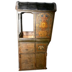
- French Château de Chasse, Sedan Chair, Original Unrestored, circa 1740Located in Chillerton, Isle of WightFrench Château de Chasse, Sedan Chair, Original Unrestored Circa 1740 Very Rare, this piece was discovered neglected in cellar of a Château in the West of France, it was used by the...Category
Antique Mid-18th Century French Provincial Historical Memorabilia
MaterialsPaint

Recently Viewed
View AllMore Ways To Browse
Antique Furniture La
Antique Painted Cartouche
Antique Royal Coat Of Arms
Large Map Of The Netherlands
Sedan Antique
Antique Style Atlas
Nautical Map
Nautical Maps
Antique Ship Decor
Pacific Map
Coastal Maps
Antique Sea Chart
Mexico Antique Map
Antique Roman Map
Antique Maps Mexico
Antique Sea Charts
Amsterdam Coat Of Arms
Antique Texas Collectables