Items Similar to 1700 Guillaume Delisle Map: Western Mediterranean & Moorish North Africa


Want more images or videos?
Request additional images or videos from the seller
1 of 7
1700 Guillaume Delisle Map: Western Mediterranean & Moorish North Africa
$860.10
$1,075.1220% Off
£644.70
£805.8720% Off
€728
€91020% Off
CA$1,181.63
CA$1,477.0320% Off
A$1,319.18
A$1,648.9720% Off
CHF 691.23
CHF 864.0420% Off
MX$16,148.01
MX$20,185.0120% Off
NOK 8,778.61
NOK 10,973.2620% Off
SEK 8,277.11
SEK 10,346.3920% Off
DKK 5,541.80
DKK 6,927.2520% Off
Shipping
Retrieving quote...The 1stDibs Promise:
Authenticity Guarantee,
Money-Back Guarantee,
24-Hour Cancellation
About the Item
1700 Guillaume Delisle Map: Western Mediterranean & Moorish North Africa
This hand-colored map from 1700 by Guillaume Delisle, titled "In Notitiam Ecclesiasticam Africae Tabula Geographica," offers a detailed look at the regions under Moorish control during the later medieval period.
It encompasses the northern African coast from Morocco to Libya, the Iberian Peninsula, and the western Mediterranean, including notable islands such as Sardinia, Corsica, Malta, the Balearics, and Sicily, where a smoking Mount Etna is depicted.
The map is embellished with three decorative cartouches, adding artistic flair to the detailed geographical renderings.
Engraved by Jean Baptiste Liebaux, the map measures 25.2 inches wide by 19.1 inches high.
It features a sharp impression with contemporary outline color, later enhanced cartouches, and is printed on a bright sheet with a Society of Jesus watermark.
The condition is very good, with an archivally repaired centerfold separation at the bottom and light toning along the edges.
Keywords:
- Guillaume Delisle map
- Western Mediterranean historical map
- Northern Africa map
- Moors medieval control
- Iberian Peninsula
- 18th-century maps
- Sicily and Mount Etna
- Sardinia, Corsica, Malta, Balearic Islands
- Historical cartography
- Decorative cartouches
These keywords will attract collectors interested in historical maps of the Mediterranean and North Africa, as well as those focused on Moorish influence and medieval geography.
- Dimensions:Height: 19.1 in (48.52 cm)Width: 25.2 in (64.01 cm)Depth: 0.02 in (0.51 mm)
- Materials and Techniques:Paper,Engraved
- Period:1700-1709
- Date of Manufacture:1700
- Condition:Repaired: An archivally repaired centerfold separation at the bottom. The condition is very good, with an archivally repaired centerfold separation at the bottom and light toning along the edges.
- Seller Location:Langweer, NL
- Reference Number:Seller: BG-138531stDibs: LU3054341277372
About the Seller
5.0
Recognized Seller
These prestigious sellers are industry leaders and represent the highest echelon for item quality and design.
Platinum Seller
Premium sellers with a 4.7+ rating and 24-hour response times
Established in 2009
1stDibs seller since 2017
2,511 sales on 1stDibs
Typical response time: <1 hour
- ShippingRetrieving quote...Shipping from: Langweer, Netherlands
- Return Policy
Authenticity Guarantee
In the unlikely event there’s an issue with an item’s authenticity, contact us within 1 year for a full refund. DetailsMoney-Back Guarantee
If your item is not as described, is damaged in transit, or does not arrive, contact us within 7 days for a full refund. Details24-Hour Cancellation
You have a 24-hour grace period in which to reconsider your purchase, with no questions asked.Vetted Professional Sellers
Our world-class sellers must adhere to strict standards for service and quality, maintaining the integrity of our listings.Price-Match Guarantee
If you find that a seller listed the same item for a lower price elsewhere, we’ll match it.Trusted Global Delivery
Our best-in-class carrier network provides specialized shipping options worldwide, including custom delivery.More From This Seller
View AllAntique Map of the Northern Coast of Africa and Southern Europe, circa 1745
By Covens & Mortier
Located in Langweer, NL
Antique map titled 'In Notitiam Ecclesiasticam Africae Tabula Geographica'. Very decorative hand-colored map of the northern coast of Africa, Spain, Italy and the Mediterranean with the islands of Sardinia, Corsica, Majorca, Minorca etc. Sicily features a smoking Mount Aetna. Embellished with three architectural cartouches...
Category
Antique Mid-18th Century Maps
Materials
Paper

$302 Sale Price
67% Off
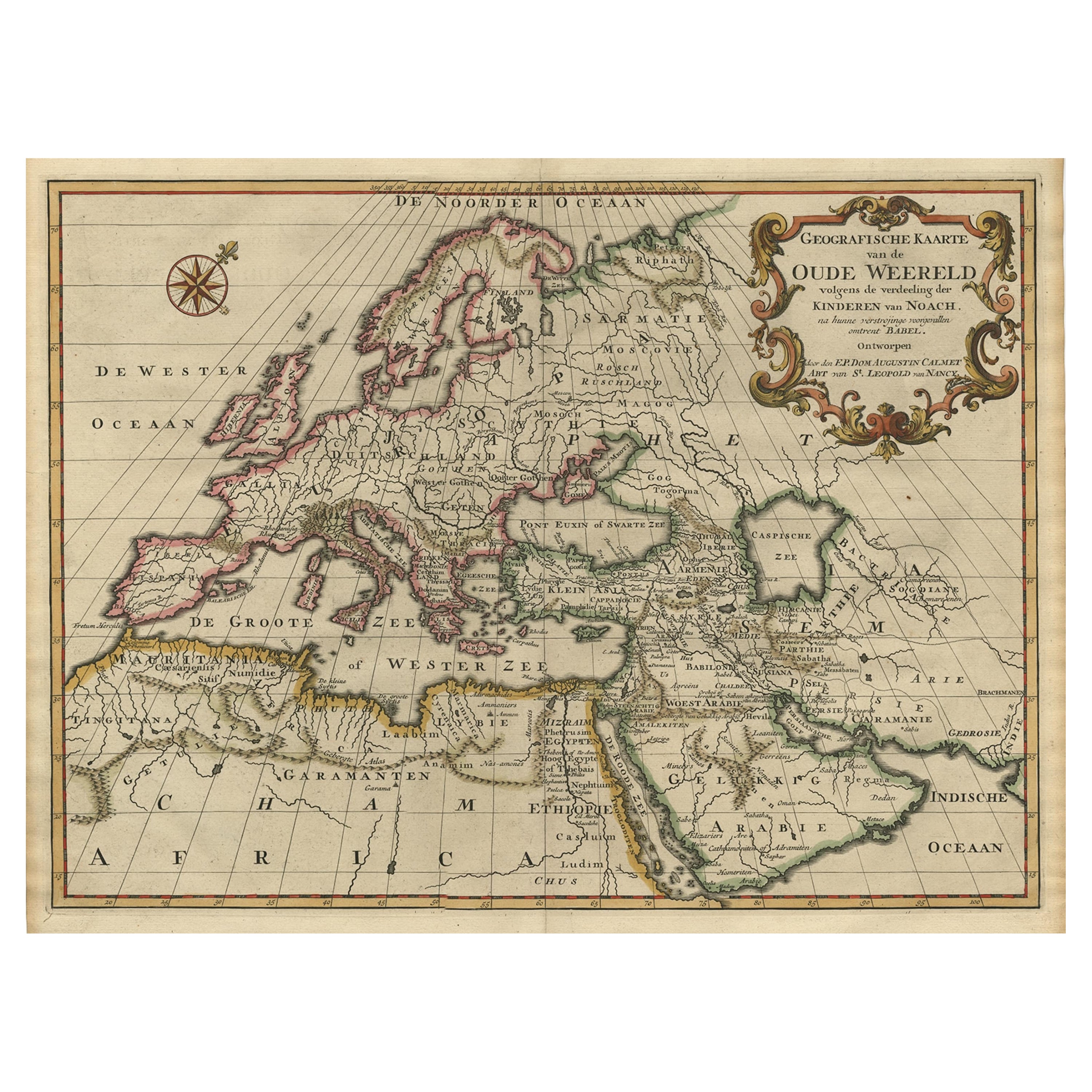
Ancient World Map of Europe, Asia & Northern Africa with Ancient Names, 1725
Located in Langweer, NL
Antique map titled 'Geografische Kaarte van de Oude Weereld (..).'
Original antique map of the ancient world depicting Europe, Asia, and northern Africa with ancient place names....
Category
Antique 1720s Maps
Materials
Paper
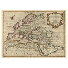
$1,108 Sale Price
24% Off
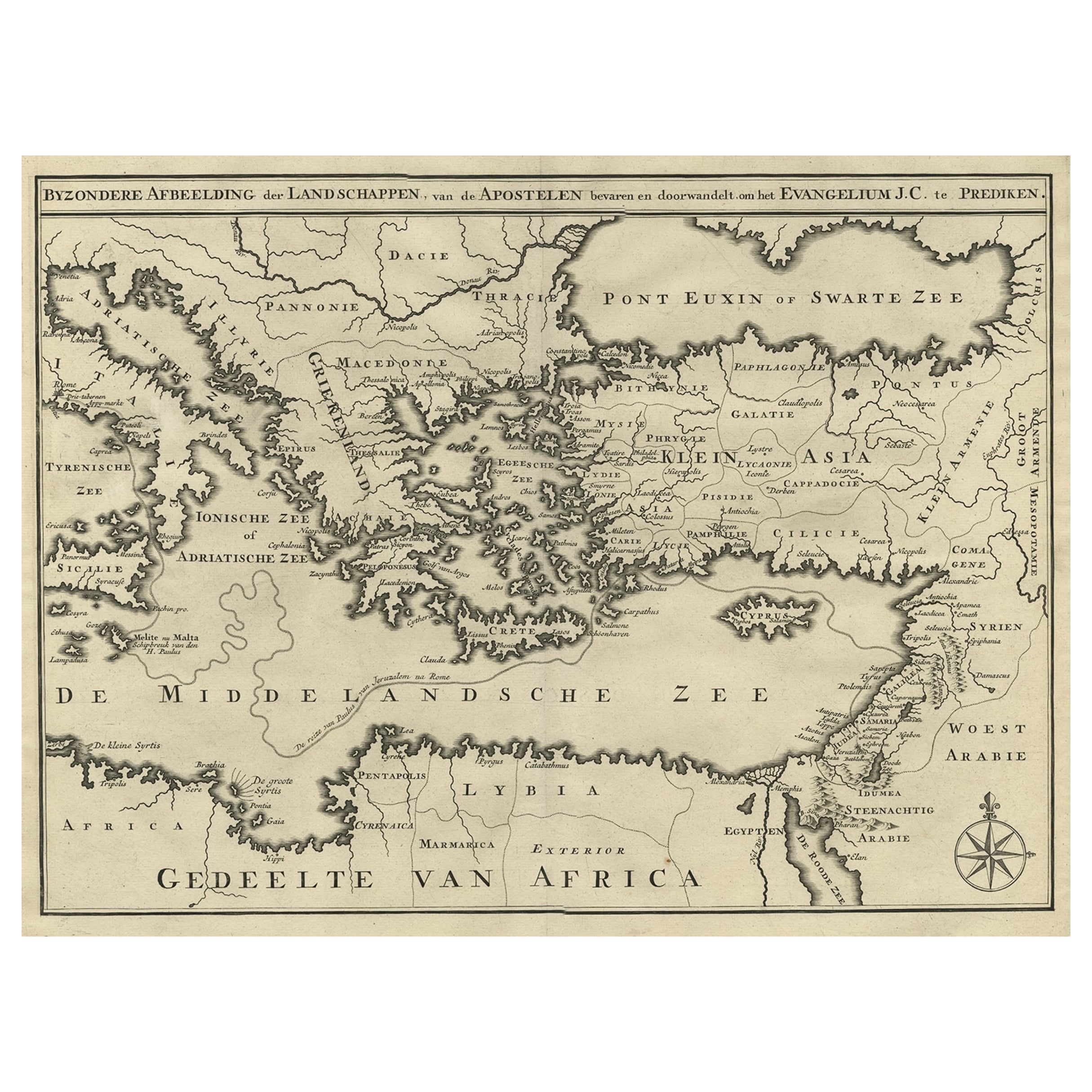
Scarce Map of the Mediterranean and Parts of Europe, Africa & Middle East, 1725
Located in Langweer, NL
Antique map titled: Byzondere afbeelding der landschappen, van de Apostelen bevaren en doorwandelt, om het Evangelium J.C. te prediken.
Scarce map of the Mediterranean and contigu...
Category
Antique 1720s Maps
Materials
Paper
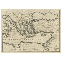
$359 Sale Price
20% Off
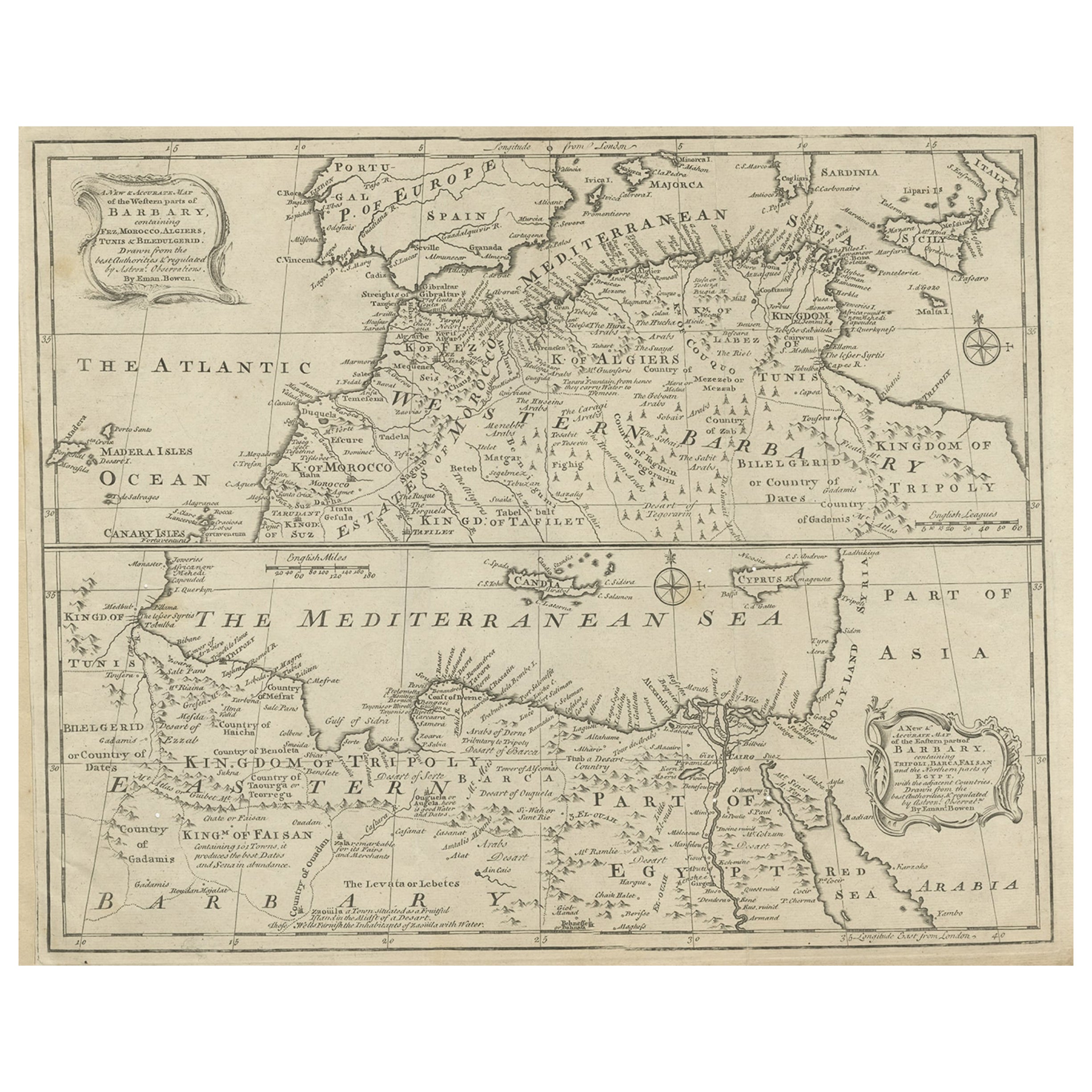
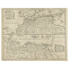
Antique Map of Western and Eastern Barbary in Africa, c.1744
Located in Langweer, NL
Antique map titled 'A New & Accurate Map of the Western Parts of Barbary' and 'A New & Accurate Map of the Eastern Parts of Barbary'. Decorative maps of North Africa and the Southern...
Category
Antique 18th Century Maps
Materials
Paper
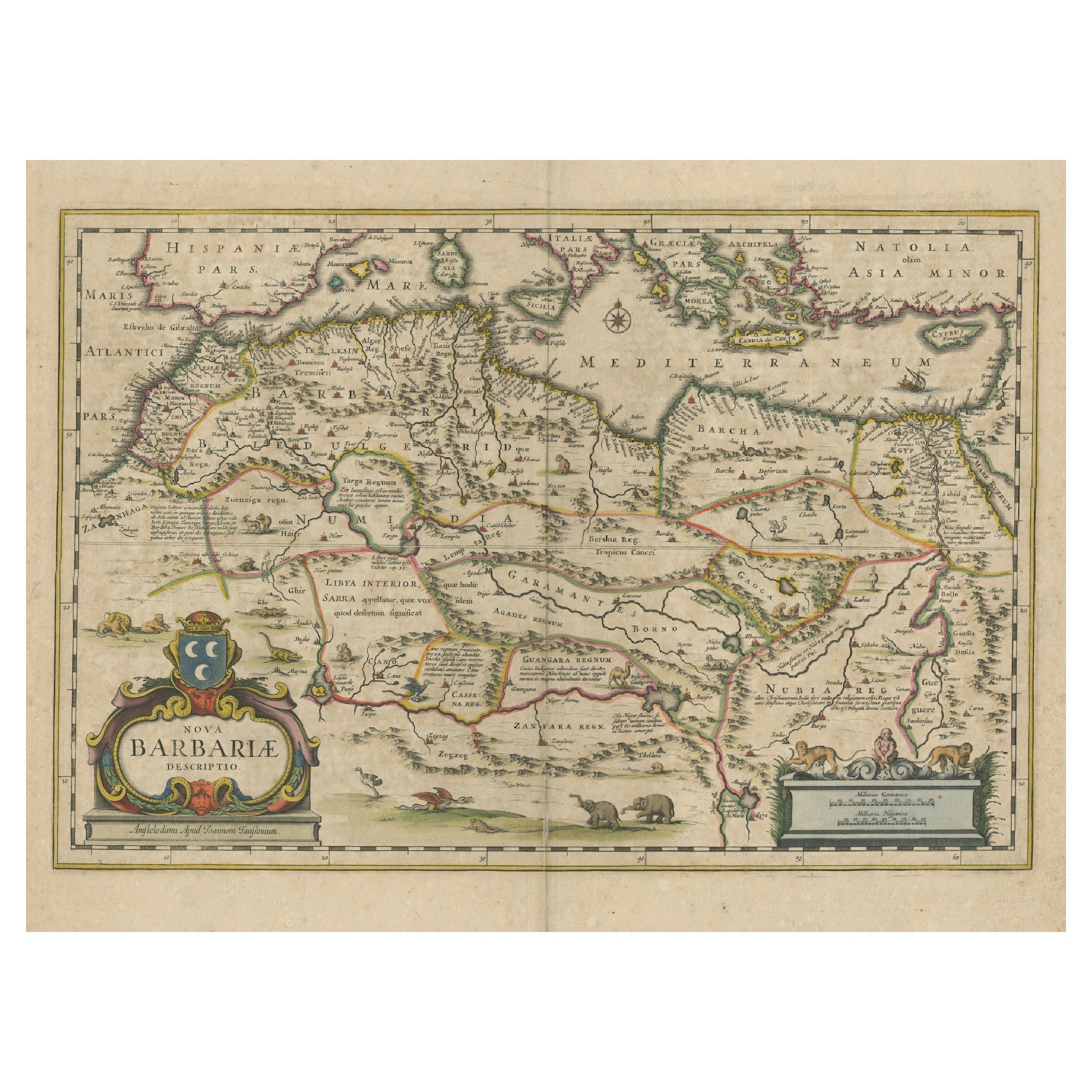
1640 Map of North Africa Nova Barbariae Descriptio or The Barbarian Coast
Located in Langweer, NL
1640 Antique Map of North Africa 'Nova Barbariae Descriptio' by Johannes Janssonius
This antique map titled Nova Barbariae Descriptio*, published by Johannes Janssonius around 1640,...
Category
Antique 1640s Maps
Materials
Paper
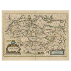
$453 Sale Price
20% Off
Antique Map Eastern Mediterranean by D. Stoopendaal 'circa 1710'
Located in Langweer, NL
Antique map Middle East titled 'De Beschryving van de Reysen Pauli en van de Andere Apostelen'. Antique map of the Eastern Mediterranean with details of the travels by Apostle Paul...
Category
Antique Early 18th Century Dutch Maps
Materials
Paper

$330 Sale Price
20% Off
You May Also Like
"Nova Barbariae Descriptio", a 17th Century Hand-Colored Map of North Africa
By Johannes Janssonius
Located in Alamo, CA
This original attractive 17th century hand-colored map of North Africa entitled "Nova Barbariae Descriptio" by Johannes Janssonius was published in Paris in 1635. It includes the Med...
Category
Antique Mid-17th Century Dutch Maps
Materials
Paper

"Africa Vetus": a 17th Century Hand-Colored Map by Sanson
By Nicolas Sanson
Located in Alamo, CA
This original hand-colored copperplate engraved map of Africa entitled "Africa Vetus, Nicolai Sanson Christianiss Galliar Regis Geographi" was originally created by Nicholas Sanson d...
Category
Antique Late 17th Century French Maps
Materials
Paper

Africa: A Large 17th Century Hand-Colored Map by Sanson and Jaillot
By Nicolas Sanson
Located in Alamo, CA
This large original hand-colored copperplate engraved map of Africa entitled "L'Afrique divisee suivant l'estendue de ses principales parties ou sont distingues les uns des autres, L...
Category
Antique 1690s French Maps
Materials
Paper

Southern Greece: A Large 17th C. Hand-colored Map by Sanson and Jaillot
By Nicolas Sanson
Located in Alamo, CA
This large original hand-colored copperplate engraved map of southern Greece and the Pelopponese Peninsula entitled "La Moree Et Les Isles De Zante, Cefalonie, Ste. Marie, Cerigo & C...
Category
Antique 1690s French Maps
Materials
Paper

1718 Ides & Witsen Map "Route D'amsterdam a Moscow Et De La Ispahan Et Gamron
Located in Norton, MA
1718 Ides & Witsen map, entitled
"Route D'Amsterdam A Moscow Et De La Ispahan Et Gamron,"
Ric.b005
Subject: Eastern Europe and Central Asia
Period: 1718 (published)
Publicati...
Category
Antique Early 18th Century Dutch Maps
Materials
Paper

1633 Map "La Souverainete De Sedan Et De Raucourt, Et La Prevoste Ric0011
Located in Norton, MA
1653 map entitled
"La Souverainete de Sedan et de Raucourt, et la Prevoste de Doncheri,"
Ric0011
Description:
Lovely map centered on Sedan and Doncheri and the Meuze River fr...
Category
Antique 17th Century Dutch Maps
Materials
Paper

More Ways To Browse
Mediterranean Antique
Antique Maltese
Antique Maltese Furniture
18th Century Maltese Furniture
Coffee Table Black Italian Modern
Christofle America
Iranian Silk Rug Carpet
Poul Moller
Tables With Inlaid Wood
World War Table
Antonio Jacobsen
Ariston Chairs
Coffee Tables Europe
Marble Top Dining Tables
Nordiska Argentina
Pink And Black Rug
Black Wooden Chair
Orrefors Embassy