Items Similar to 1773 John Blair Map of the Ancient Holy Land: Tribes, Journeys, and Empires


Want more images or videos?
Request additional images or videos from the seller
1 of 12
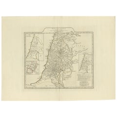
1773 John Blair Map of the Ancient Holy Land: Tribes, Journeys, and Empires
$982.48
£731.39
€820
CA$1,345.75
A$1,496.77
CHF 781.56
MX$18,214.06
NOK 9,981.78
SEK 9,361.15
DKK 6,242.37
Shipping
Retrieving quote...The 1stDibs Promise:
Authenticity Guarantee,
Money-Back Guarantee,
24-Hour Cancellation
About the Item
Title: 1773 John Blair Map of the Ancient Holy Land: Tribes, Journeys, and Empires
This exceptional map by John Blair, published in London in 1773, offers a richly detailed view of the Ancient Holy Land, partitioned into the territories of the 12 Tribes of Israel. The map extends beyond the Promised Land to include Cyprus, the Red Sea, Egypt, Mesopotamia, Assyria, and parts of the Arabian Peninsula, reflecting the region's historical and cultural significance.
A notable feature is its depiction of the journeys of the Israelites and routes associated with ancient trade and exploration. The map further illustrates the Davidic and Solomonic Empires, offering insights into Israel's golden age during the 11th to 9th centuries BCE. The map is meticulously detailed, including cities, mountains, deserts, rivers, and bays. Additionally, it traces maritime routes, such as those of the Apostle Paul, bridging the biblical and historical narratives of the region.
The beautifully engraved cartouche, featuring flora and symbols of the Holy Land, adds artistic elegance to this cartographic masterpiece. Blair’s map is an invaluable resource for understanding the geography of biblical events and the broader historical context of the Middle East, combining theological, historical, and archaeological insights.
This map appeals to collectors of Judaica, antique maps, and those with an interest in biblical history, serving as both a decorative piece and a scholarly reference.
Condition Report:
The map is in excellent condition for its age, with crisp engraving and minimal toning. Margins are intact, and no repairs or significant blemishes are noted.
Framing and Matting Tips:
Use a neutral archival mat and a dark wooden or gold antique-style frame to emphasize the map’s historic character. Consider UV-protective glass to preserve its crisp detail. For an enhanced display, pair the map with a descriptive plaque or accompanying text to highlight its historical and biblical significance. Displaying it in a well-lit area with an appropriate backdrop can further enhance its visual and educational appeal.
- Dimensions:Height: 18.51 in (47 cm)Width: 23.35 in (59.3 cm)Depth: 0.01 in (0.2 mm)
- Materials and Techniques:Paper,Engraved
- Place of Origin:
- Period:1770-1779
- Date of Manufacture:1773
- Condition:The map is in excellent condition for its age, with crisp engraving and minimal toning. Centerfold as Issued. Margins are intact, and no repairs or significant blemishes are noted.
- Seller Location:Langweer, NL
- Reference Number:Seller: BG-14043-61stDibs: LU3054343437732
About the Seller
5.0
Recognized Seller
These prestigious sellers are industry leaders and represent the highest echelon for item quality and design.
Platinum Seller
Premium sellers with a 4.7+ rating and 24-hour response times
Established in 2009
1stDibs seller since 2017
2,510 sales on 1stDibs
Typical response time: <1 hour
- ShippingRetrieving quote...Shipping from: Langweer, Netherlands
- Return Policy
Authenticity Guarantee
In the unlikely event there’s an issue with an item’s authenticity, contact us within 1 year for a full refund. DetailsMoney-Back Guarantee
If your item is not as described, is damaged in transit, or does not arrive, contact us within 7 days for a full refund. Details24-Hour Cancellation
You have a 24-hour grace period in which to reconsider your purchase, with no questions asked.Vetted Professional Sellers
Our world-class sellers must adhere to strict standards for service and quality, maintaining the integrity of our listings.Price-Match Guarantee
If you find that a seller listed the same item for a lower price elsewhere, we’ll match it.Trusted Global Delivery
Our best-in-class carrier network provides specialized shipping options worldwide, including custom delivery.More From This Seller
View AllAntique Map of the Holy Land Described in the Old and New Testament, ca.1660
Located in Langweer, NL
Antique map titled 'Geographiae Sacrae ex Veteri et Novo Testamento Desumptae Tabula Prima quae Totius Orbis Partes Continet.'
Map of the lands described in the Old and New Testame...
Category
Antique 1660s Maps
Materials
Paper

$814 Sale Price
20% Off
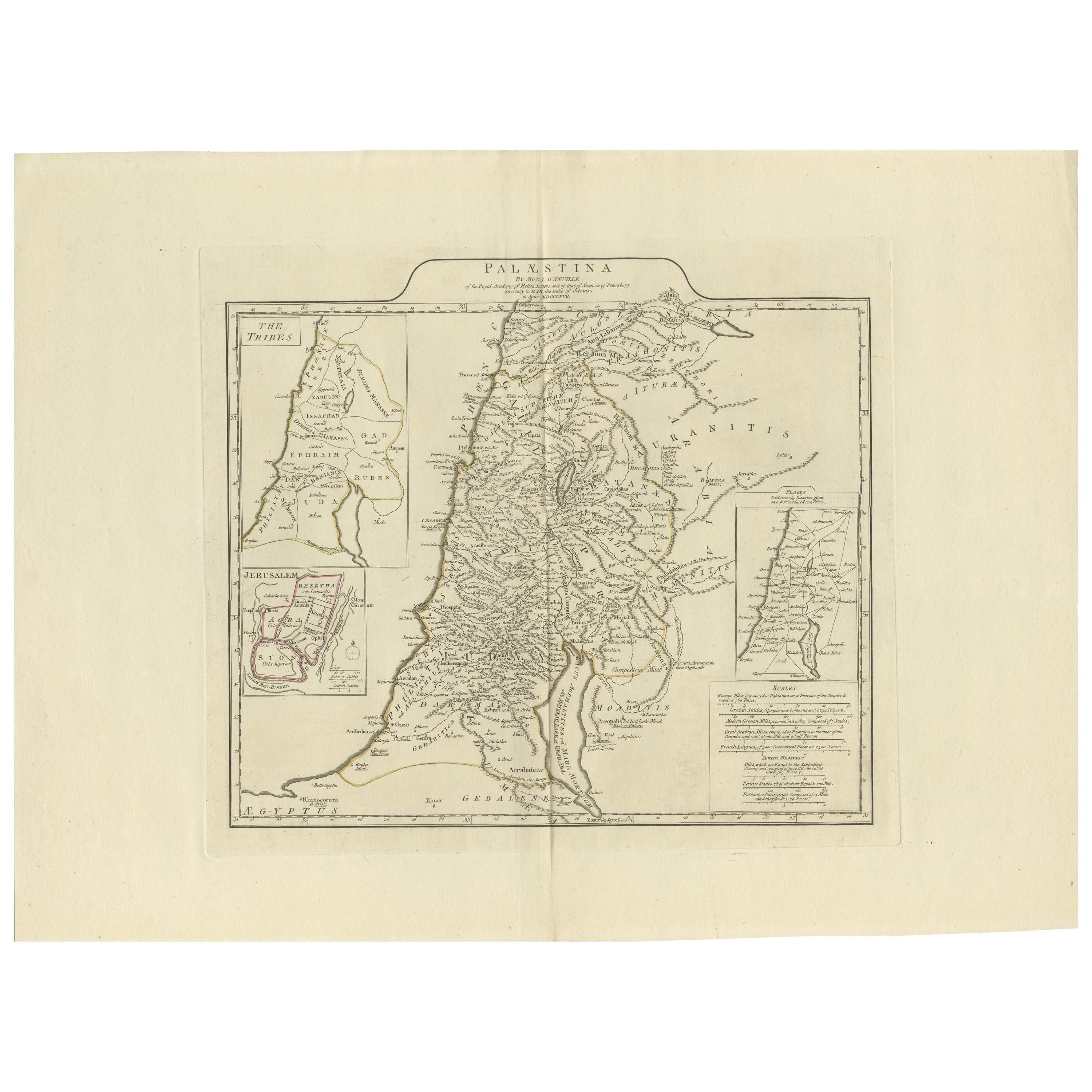
1767 D’Anville Map of the Holy Land: Ancient Divisions and Biblical Geography
Located in Langweer, NL
Ancient Map of Palestine or the Holy Land by D'Anville (1767)
This detailed map, created by the renowned French cartographer Jean Baptiste Bourguignon d'Anville in 1767, depicts the...
Category
Antique 1670s Maps
Materials
Paper
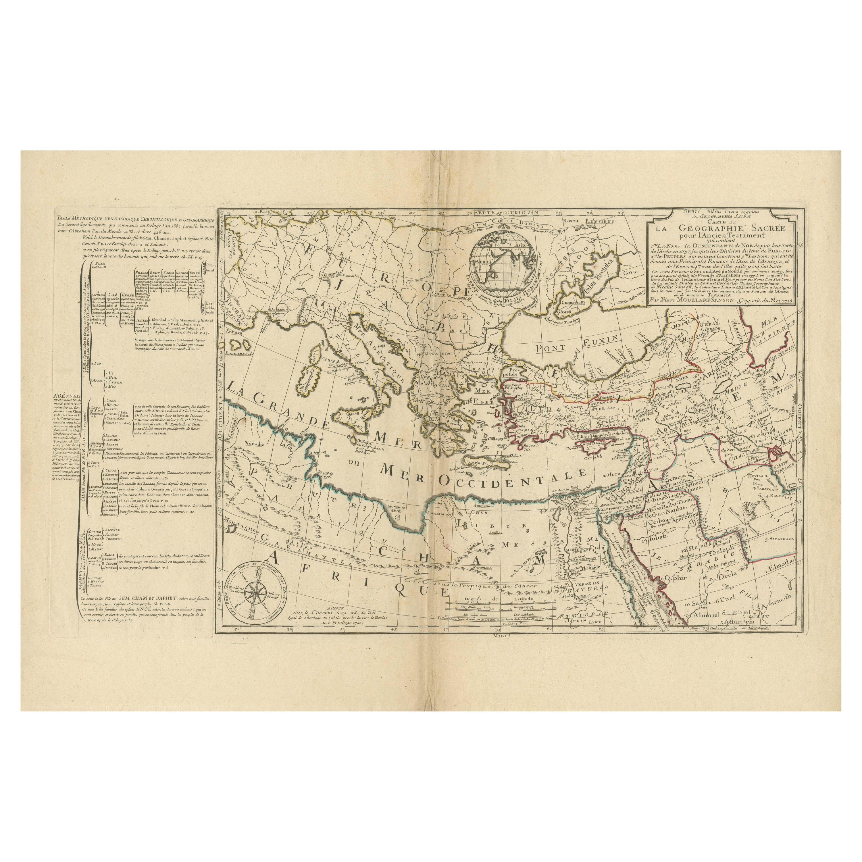
Moullart-Sanson Map of the Holy Land and Sacred Geography of the Old Testament
Located in Langweer, NL
"1716 Moullart-Sanson Map of the Holy Land and Sacred Geography of the Old Testament"
This engraved map, created by Pierre Moullart-Sanson and reissued by Robert de Vaugondy in 1740...
Category
Antique 1710s Maps
Materials
Paper
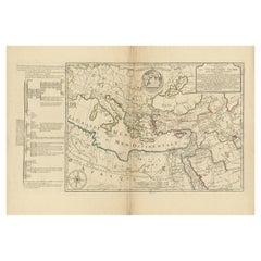
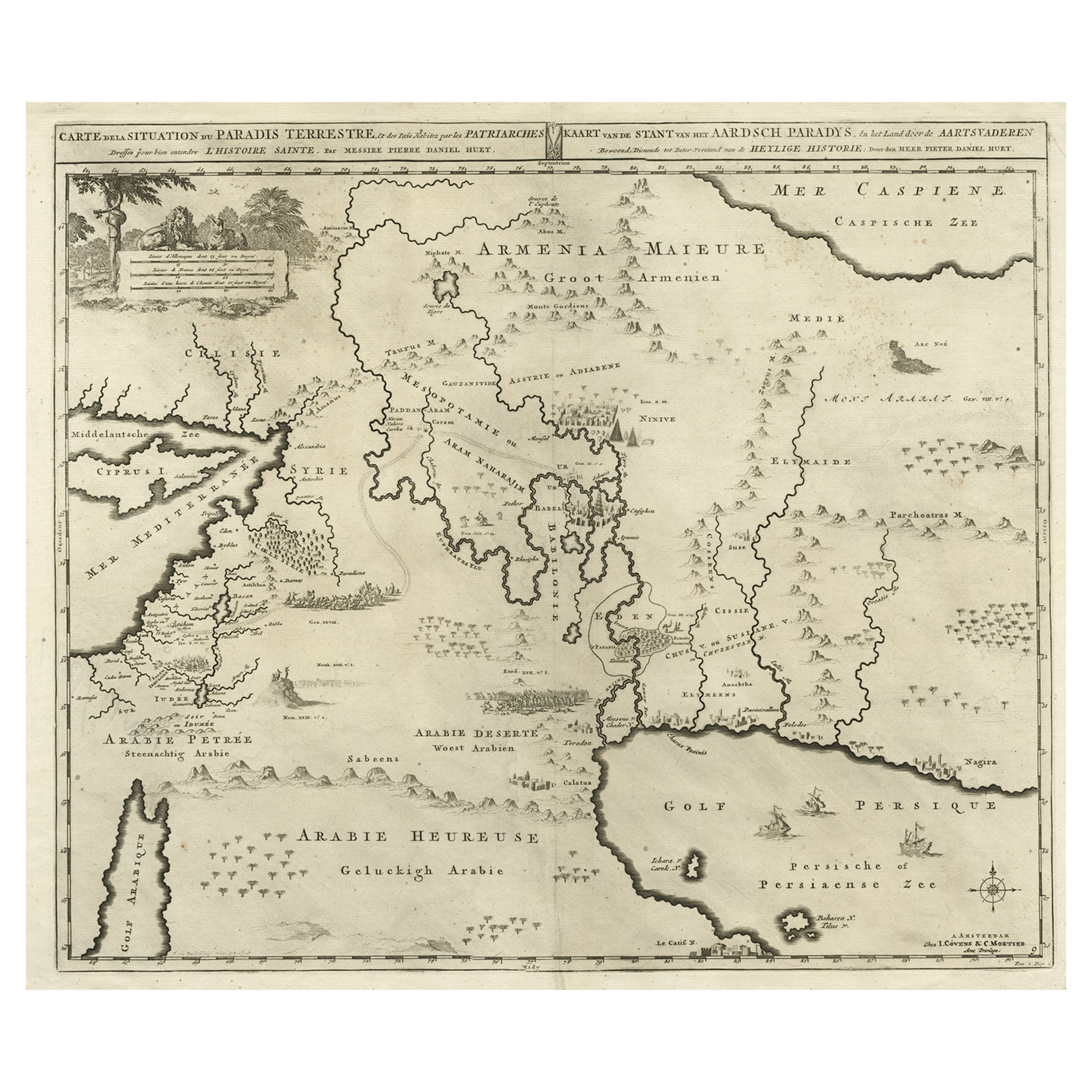
Biblical Map of the Region from the Mediterranean through the Persian Gulf, 1720
Located in Langweer, NL
Antique map titled 'Carte de la Situation du Paradis Terrestre, Et des Pais Habitez par les Patriarches Dressee pour bien entendre l'Histoire Sainte, Par Messire Pierre Daniel Huet.'
This interesting map covers the region from the Mediterranean through the Persian Gulf. Detail is omitted in favor of Biblical depictions including the Sermon on the Mount...
Category
Antique 1720s Maps
Materials
Paper
$460 Sale Price
20% Off
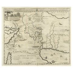
Antique Bible Map of the Middle East by A. Schut, 1743
Located in Langweer, NL
Antique map titled 'De Gelegentheyt van 't Paradys en 't Landt Canaan'. Dutch Bible map covering the region between the Mediterranean and the Persian Gulf, ...
Category
Antique Mid-18th Century Maps
Materials
Paper

$527 Sale Price
20% Off
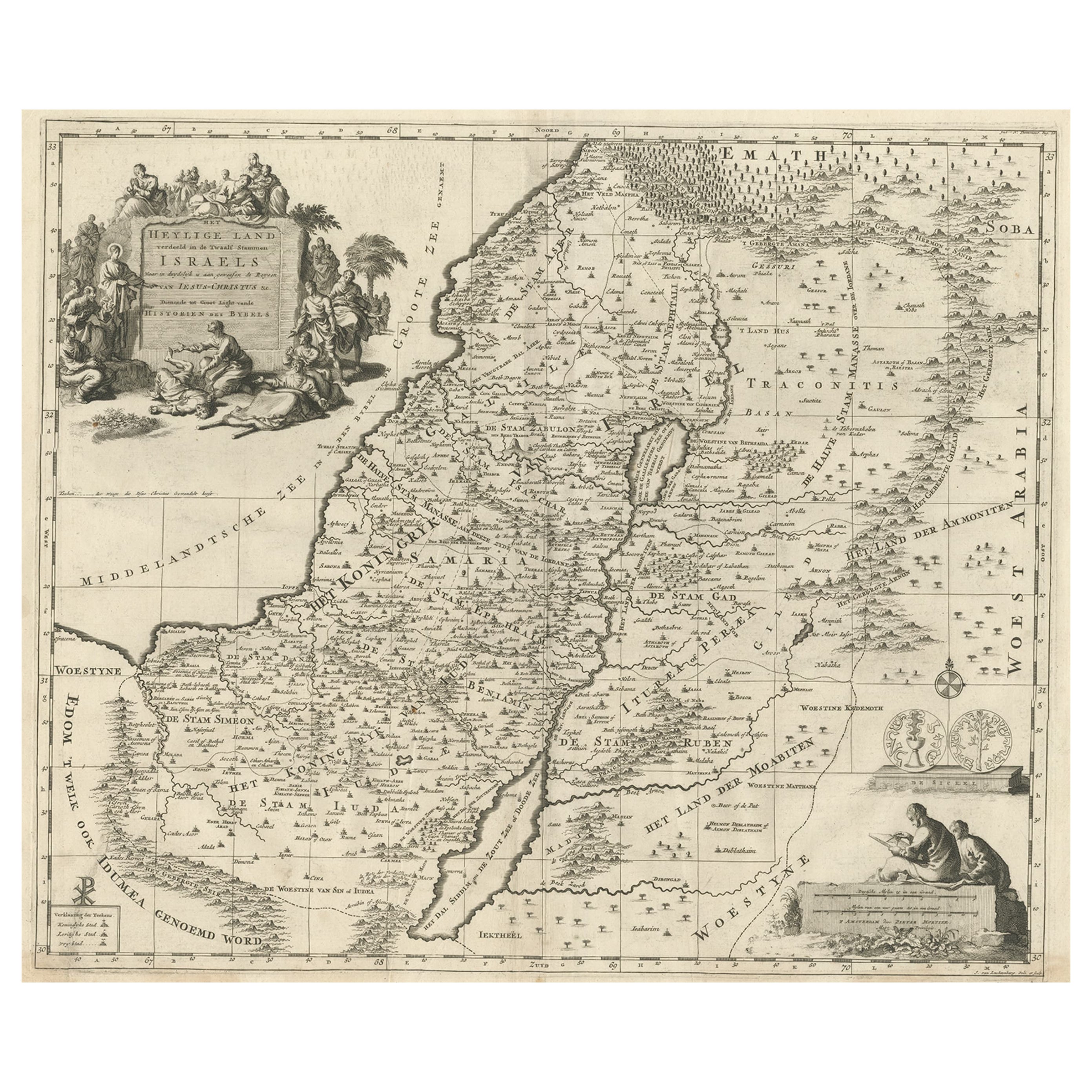
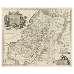
Map of the Holy Land Divided into 12 Tribes, the Travels of Jesus Christ, 1700
Located in Langweer, NL
Antique map titled 'Het Heylige Land verdeeld in de Twaalf Stammen Israels (..)'.
Decorative and detailed map of the Holy Land divided into 12 Tribes, sh...
Category
Antique Early 1700s Maps
Materials
Paper
$469 Sale Price
20% Off
You May Also Like
Map of the Holy Land "Carte de la Syrie et de l'Egypte" by Pierre M. Lapie
By Pierre M. Lapie
Located in Alamo, CA
An early 19th century map of ancient Syria and Egypt entitled "Carte de la Syrie et de l'Egypte anciennes/dressée par M. Lapie, Colonel d'Etat Major, et...
Category
Antique Early 19th Century French Maps
Materials
Paper

1718 Ides & Witsen Map "Route D'amsterdam a Moscow Et De La Ispahan Et Gamron
Located in Norton, MA
1718 Ides & Witsen map, entitled
"Route D'Amsterdam A Moscow Et De La Ispahan Et Gamron,"
Ric.b005
Subject: Eastern Europe and Central Asia
Period: 1718 (published)
Publicati...
Category
Antique Early 18th Century Dutch Maps
Materials
Paper

Antique French Map of Asia Including China Indoneseia India, 1783
Located in Amsterdam, Noord Holland
Very nice map of Asia. 1783 Dedie au Roy.
Additional information:
Country of Manufacturing: Europe
Period: 18th century Qing (1661 - 1912)
Condition: Overall Condition B (Good Used)...
Category
Antique 18th Century European Maps
Materials
Paper

$648 Sale Price
20% Off
Map Holy Land La Terre Sainte Engraved van Loon Published N de Fer 1703 French
Located in BUNGAY, SUFFOLK
La Terre Sainte, The Holy Land, Tiree Des Memoires De M.De.La Rue. Par N. de Fer. Geographe de Sa Majeste Catoliq et de Monseigneur le Dauphin. Avec Privil du Roi 1703
Detailed map of the Holy Land from Nicholas de Fer's L'Atlas Curieux ou le Monde. East is oriented at the top.
MAKER Nicolas de Fer 1646-1720
The French cartographer and engraver, Nicolas de Fer, was a master at creating maps that were works of art. The maps that he published were printed during the Baroque period when the decorative arts were characterized by ornate detail. De Fer’s detailed maps and atlases were valued more for their decorative content than their geographical accuracy.
Nicolas de Fer was born in 1646. His father, Antoine de Fer, owned a mapmaking firm. At the age of twelve, Nicolas was apprenticed to a Parisian engraver named Louis Spirinx. The family business was starting to decline when his father died in 1673. Nicolas de Fer’s mother, Genevieve, took over the business after the death of her husband. In 1687 the business was passed on to Nicolas and the profits increased after he took over the firm. Nicolas de Fer was a prolific cartographer who produced atlases and hundreds of single maps. He eventually became the official geographer to King Louis XIV of France and King Philip V...
Category
Antique Early 1700s French Louis XIV Maps
Materials
Paper

West Coast of Africa, Guinea & Sierra Leone: An 18th Century Map by Bellin
By Jacques-Nicolas Bellin
Located in Alamo, CA
Jacques Bellin's copper-plate map entitled "Partie de la Coste de Guinee Dupuis la Riviere de Sierra Leona Jusquau Cap das Palmas", depicting the coast of Guinea and Sierra Leone in ...
Category
Antique Mid-18th Century French Maps
Materials
Paper

Antique 1803 Italian Map of Asia Including China Indoneseia India
Located in Amsterdam, Noord Holland
Antique 1803 Italian Map of Asia Including China Indoneseia India
Very nice map of Asia. 1803.
Additional information:
Type: Map
Country of Manufacturing: Europe
Period: 19th centu...
Category
Antique 19th Century European Maps
Materials
Paper

$584 Sale Price
20% Off
More Ways To Browse
Antique Partition
Antique Egyptian Glass
Egyptian Cartouche
Apostle Paul
Blairs Used Furniture
12 Apostles
Arabia Plaque
Carlo Scarpa 1934 Chairs
Christofle Marly
1900 Antique Chairs
Glass Table Italian Round
Alvar Aalto Poster
Geometric Metal Table
Post Modern High Chairs
Vintage Vine Rug
Cancel An Order
Antique Framing Square
Silver Metal Chair