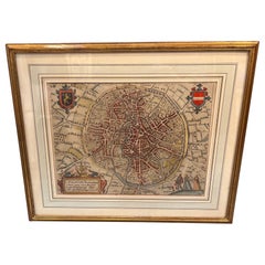
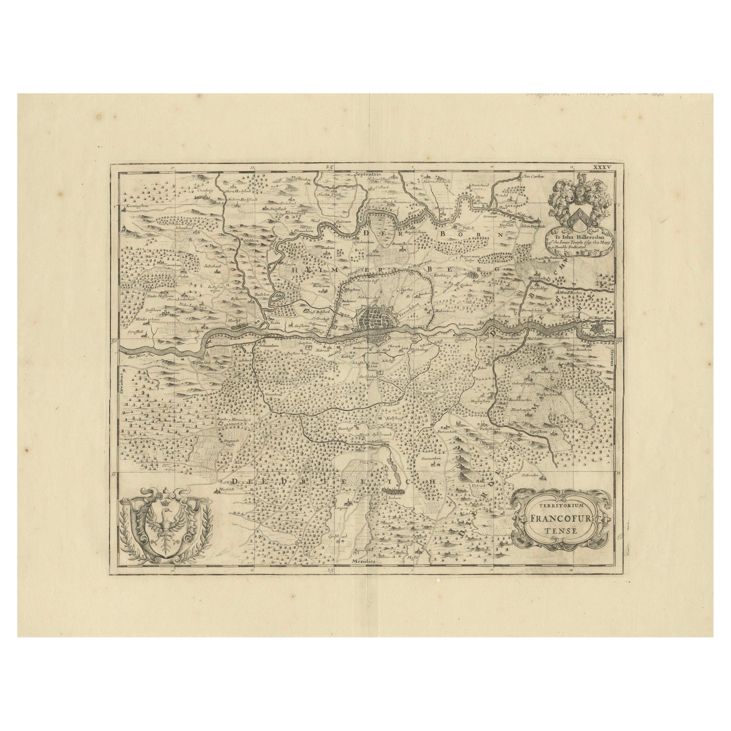
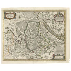
17th Century Framed Map of Bruges in Belgium, 1652
View Similar Items


Want more images or videos?
Request additional images or videos from the seller
1 of 8
17th Century Framed Map of Bruges in Belgium, 1652
$750List Price
About the Item
- Dimensions:Height: 14.5 in (36.83 cm)Width: 17.5 in (44.45 cm)Depth: 0.5 in (1.27 cm)
- Materials and Techniques:
- Period:1650-1659
- Date of Manufacture:1652
- Condition:Wear consistent with age and use. No rips or tears to the map, the giltwood frame with slight expected wear.
- Seller Location:Lambertville, NJ
- Reference Number:Seller: 10111stDibs: LU1308245802302
About the Seller
4.9
Platinum Seller
Premium sellers with a 4.7+ rating and 24-hour response times
Established in 1985
1stDibs seller since 2015
1,054 sales on 1stDibs
Authenticity Guarantee
In the unlikely event there’s an issue with an item’s authenticity, contact us within 1 year for a full refund. DetailsMoney-Back Guarantee
If your item is not as described, is damaged in transit, or does not arrive, contact us within 7 days for a full refund. Details24-Hour Cancellation
You have a 24-hour grace period in which to reconsider your purchase, with no questions asked.Vetted Professional Sellers
Our world-class sellers must adhere to strict standards for service and quality, maintaining the integrity of our listings.Price-Match Guarantee
If you find that a seller listed the same item for a lower price elsewhere, we’ll match it.Trusted Global Delivery
Our best-in-class carrier network provides specialized shipping options worldwide, including custom delivery.More From This Seller
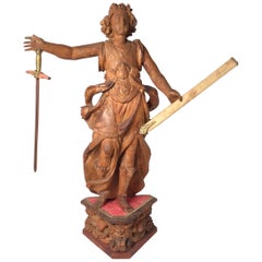
View AllExceptional 17th Century Carved Wooden Statue of Saint Micheal
Located in Lambertville, NJ
Exceptional 17th century carved wooden statue of Saint Micheal, European probably from a church or rectory. Naturally patinated and ori...
Category
Antique 17th Century European Baroque Sculptures and Carvings
Materials
Hardwood
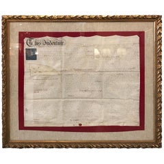
Early 19th Century Original Framed Land Indenture, England, 1810
Located in Lambertville, NJ
A large hand written land indenture document England, 1810, framed. The beautifully hand written document mounted on board with a red velvet border and ...
Category
Antique 1810s English Regency Maps
Materials
Glass, Giltwood, Parchment Paper
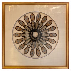
19th Century Chinese Framed Needlework in Silk
Located in Lambertville, NJ
A framed silk needlework consisting of hand made pieces of 19th century Chinese clothing in a fine custom frame and matt.
Category
Antique 1880s Chinese Textiles
Materials
Silk, Glass, Giltwood
Pair of Early 20th Century Framed Prints
Located in Lambertville, NJ
A pair of 1910 framed prints of Asian porcelain in giltwood frames. Beautifully matted in French matts.
Category
Vintage 1910s European Prints
Materials
Glass, Giltwood, Paper
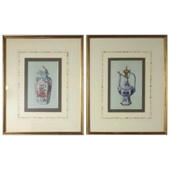
$895 / set
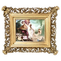
19th Century Painting on Porcelain in Gilt Frame
Located in Lambertville, NJ
A painting on porcelain of a nobleman and nude woman with cupids, elaborately painted and highly detailed. The original gilt wood frame with reti...
Category
Antique 1880s Austrian Paintings
Materials
Porcelain, Giltwood
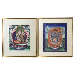
Pair of Burmese Early 20th Century Giltwood Framed Paintings
Located in Lambertville, NJ
A pair of vibrantly colored Burmese water color paintings of Deities. The early 20th century paintings in mid 20th century professionally framed giltwood frames.
Category
Early 20th Century Asian Paintings
Materials
Glass, Giltwood, Paper
You May Also Like
17th Century Hand Colored Map of the Liege Region in Belgium by Visscher
By Nicolaes Visscher II
Located in Alamo, CA
An original 17th century map entitled "Leodiensis Episcopatus in omnes Subjacentes Provincias distincté divisusVisscher, Leodiensis Episcopatus" by Nicolaes Visscher II, published in Amsterdam in 1688. The map is centered on Liege, Belgium, includes the area between Antwerp, Turnhout, Roermond, Cologne, Trier and Dinant.
This attractive map is presented in a cream-colored mat measuring 30" wide x 27.5" high. There is a central fold, as issued. There is minimal spotting in the upper margin and a tiny spot in the right lower margin, which are under the mat. The map is otherwise in excellent condition.
The Visscher family were one of the great cartographic families of the 17th century. Begun by Claes Jansz Visscher...
Category
Antique Late 17th Century Dutch Maps
Materials
Paper

Framed 17th Century Map of Cumberland, England by John Speed, 1610
By John Speed
Located in Middleburg, VA
A fascinating and richly detailed antique map of Cumberland County in northwest England, drawn and published by the celebrated English cartographer John Spe...
Category
Antique Early 17th Century English British Colonial Maps
Materials
Copper, Gold Leaf

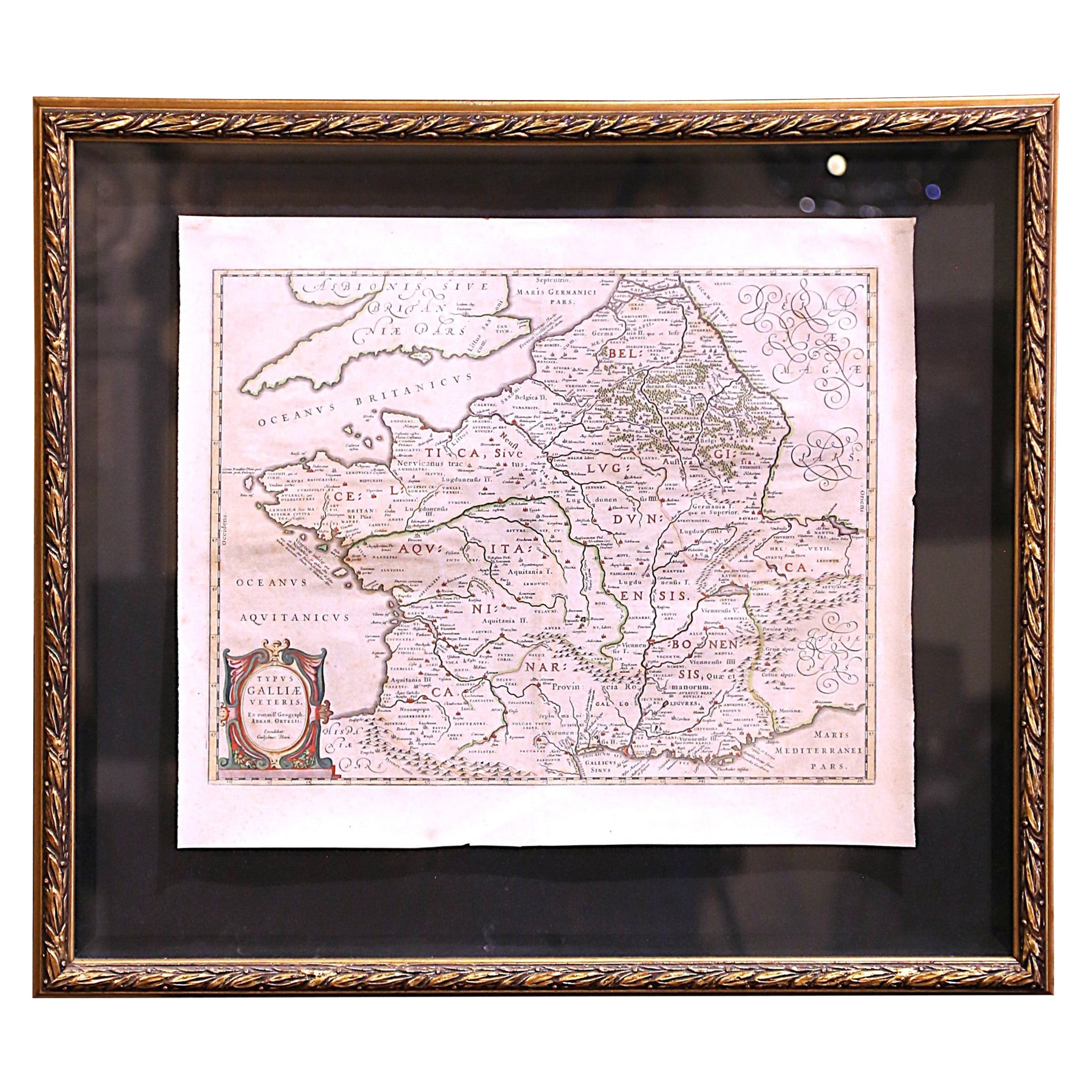
17th Century Framed Map of Ancient France Titled "Typus Galliae Veteris"
Located in Dallas, TX
Decorate an office or a library with this elegant historic map. Crafted in the Netherlands circa 1630, this beautifully framed antique map with pr...
Category
Antique 17th Century Dutch Baroque Maps
Materials
Glass, Giltwood, Paper

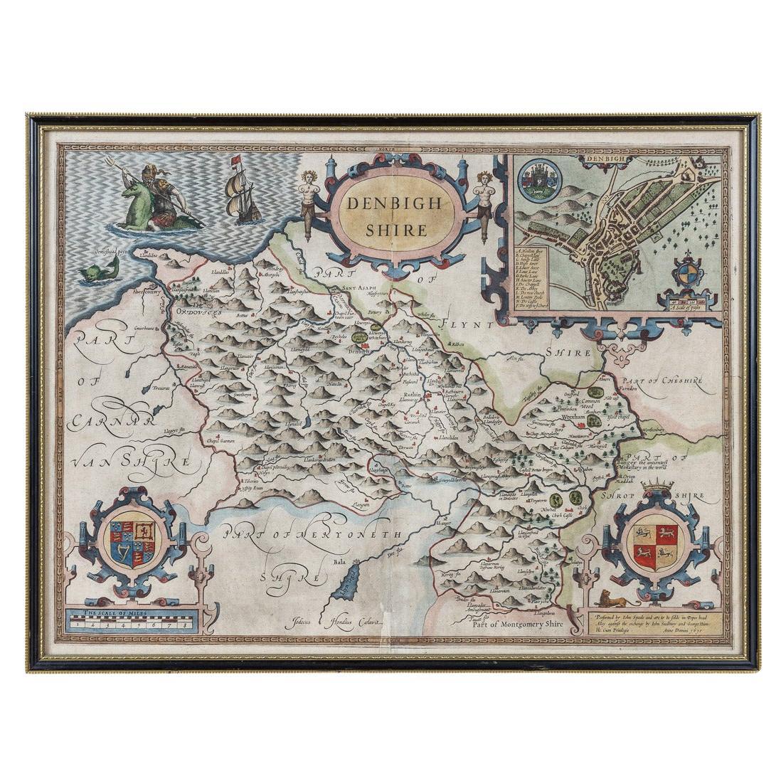
17th Century John Speed Map of Denbighshire, c.1610
By John Speed
Located in Royal Tunbridge Wells, Kent
Antique early 17th century British very rare and original John Speed, hand coloured map of Denbighshire, dated 1610, by John Sunbury and George Humble. John...
Category
Antique 17th Century British Maps
Materials
Wood, Paper

17th Century Nicolas Visscher Map of Southeastern Europe
Located in Hamilton, Ontario
A beautiful, highly detailed map of southeastern Europe by Nicolas Visscher. Includes regions of Northern Italy (showing the cities Bologna, Padua, and Venice), Bohemia, Austria (sho...
Category
Antique 17th Century Dutch Maps
Materials
Paper

$1,350 Sale Price
38% Off
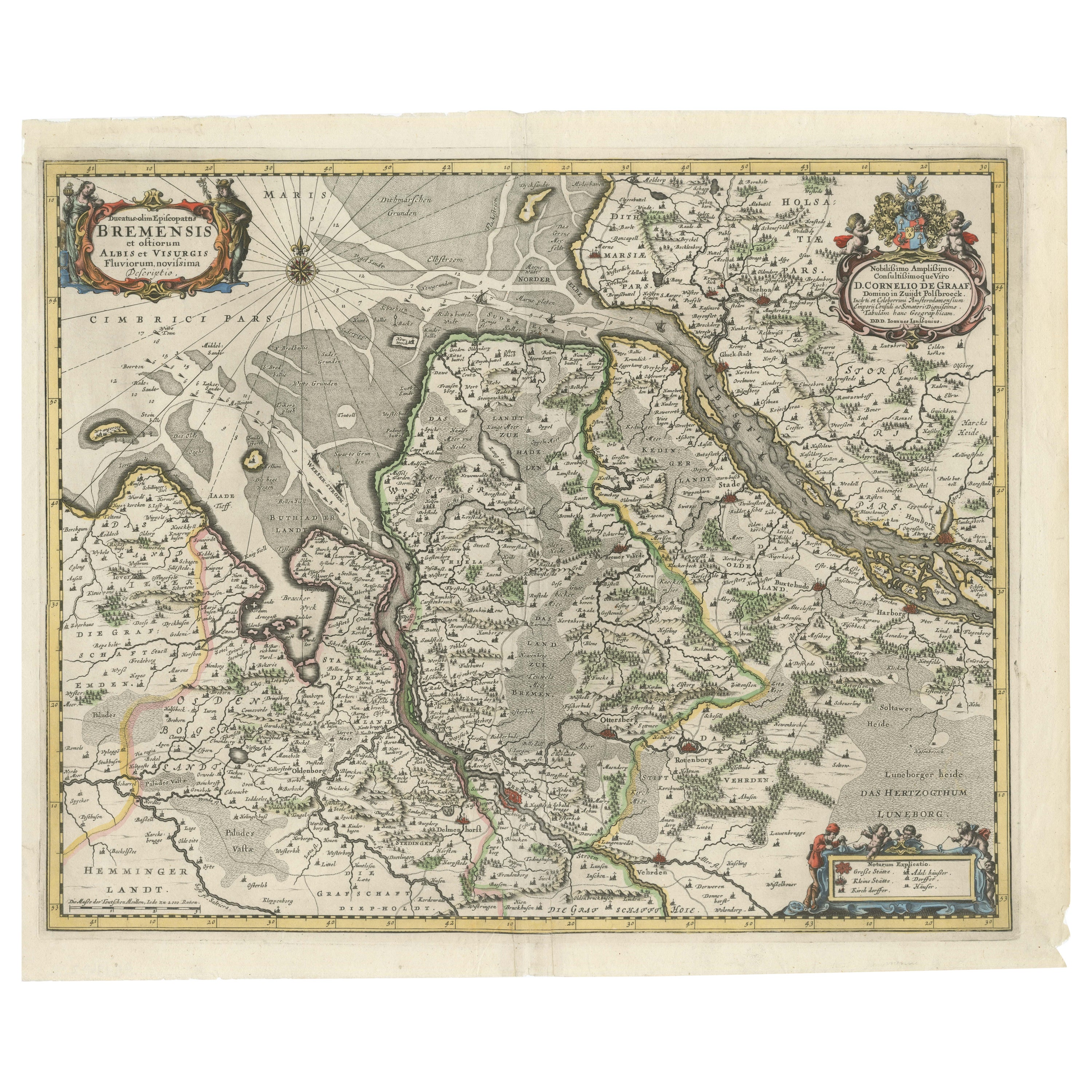
Johannes Janssonius' 17th-Century Map of the Duchy of Bremen in Germany
Located in Langweer, NL
The map titled "Ducatus olim Episcopatus Bremensis et ostiorum Albis et Visurgis Fluviorum novissima Descriptio" by Johannes Janssonius provides a rich historical and geographical il...
Category
Antique 1650s Maps
Materials
Paper
$726 Sale Price
20% Off
Recently Viewed
View AllMore Ways To Browse
Wood Minimalist Chair
Antique Imperial Furniture
Gold Modern Coffee Table
Large Side Tables
18th Century Gilded Furniture
Japanese Silver Ceramics
One Of A Kind Chair
Used Oak Dining Room Chairs
17th Century Plate
Childrens Vintage Poster
Chinese Ship
Nursery Art
Vintage Travel Poster Mid Century
Desk Key
Woven Silk Art
Carved Cabriole Table
Dark Antique Table
White Wooden Table