Giltwood Maps
4
to
4
4
4
4
1
1
1
4
8,808
5,351
87
32
31
2
2
2
2
2
Material: Giltwood
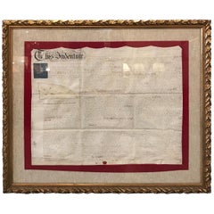
Early 19th Century Original Framed Land Indenture, England, 1810
Located in Lambertville, NJ
A large hand written land indenture document England, 1810, framed. The beautifully hand written document mounted on board with a red velvet border and ...
Category
1810s English Regency Antique Giltwood Maps
Materials
Giltwood, Parchment Paper, Glass
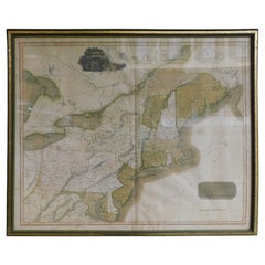
English Engraved Hand Colored Map of the North Eastern United States, circa 1817
Located in Hollywood, SC
English copper engraved hand colored map of the North Eastern United States matted under glass in a gilt frame, Early 19th Century. Drawn and Engraved for Thomson's New General Atlas...
Category
1810s English George III Antique Giltwood Maps
Materials
Glass, Giltwood, Paint, Paper
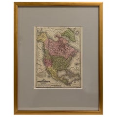
Framed 1839 Hand Colored Map of the United States
Located in Stamford, CT
Framed hand colored map of the United States of America from 1839. Newly framed in a giltwood frame.
Category
1830s American American Classical Antique Giltwood Maps
Materials
Giltwood, Paper, Glass
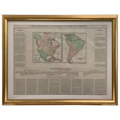
Framed 1820s Hand Colored Map of the United States
Located in Stamford, CT
Framed 1820s hand colored map photos of North America and South America. As found framed in giltwood frame.
Category
1820s American Spanish Colonial Antique Giltwood Maps
Materials
Giltwood, Paper, Glass
Related Items
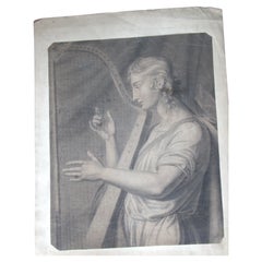
Harpist, 18th Century Drawing
Located in Perth, GB
18th.entury unframed pencil drawing of an Harpist.
Category
Mid-18th Century Antique Giltwood Maps
Materials
Paper
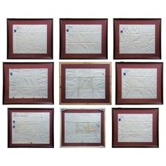
'7'19th Century British Real Estate Land Indentures Lease Documents 1867 Framed
Located in Dayton, OH
(7) 19th century British real estate land indentures lease documents 1867 framed
1860s European land indentures. Each is neatly framed with mat allowin...
Category
1860s Victorian Antique Giltwood Maps
Materials
Paper
H 30.5 in W 35 in D 1 in
Original Antique Map of The United States of America, circa 1890
Located in St Annes, Lancashire
Great map of the USA
By The Stanford's Geographical Establishment
Original colour
Unframed.
Category
1890s English Victorian Antique Giltwood Maps
Materials
Paper
Cased Ship Model of the United States Frigate "Essex" 1799
Located in Bridgeport, CT
Finely made three masted ship model (1/8” inch =1 ‘ Scale) with carved wood details and painted with string details. Includes Masthead Sculpture, two Anchor...
Category
20th Century American Classical Giltwood Maps
Materials
Wood
Antique Hand Colored Framed Map of Europe
Located in West Palm Beach, FL
Antique reproduction copied from an edition dated 1595 by Ortelius.
Category
Late 19th Century Antique Giltwood Maps
Antique Map of The United States of North America, 1882
Located in Langweer, NL
This is a historical map titled "The United States of North America, Central Part" from the 1882 Blackie Atlas. It depicts the continental United States with a high level of detail, ...
Category
1880s Antique Giltwood Maps
Materials
Paper
Original Antique Hand-colored Map of the United States, circa 1845
Located in Langweer, NL
Antique map titled 'United States'. Old map of the United States, includes the last part of the North West Territory (present day Wisconsin and part of Minnesota). It also marks Ft. Crawford at the confluence of the Mississippi River and the Ouisconsin River (present day Wisconsin River). Published by Orr & Company; Amen Corner...
Category
Mid-19th Century Antique Giltwood Maps
Materials
Paper
Vanity Fair Framed Signed Print from Gaekwar Baroda, circa 1901
Located in London, GB
Vanity fair framed signedpPrint from Gaekwar Baroda circa 1901
We share what we love, and we love this pine framed original Vanity fair signed print from...
Category
Early 20th Century British Victorian Giltwood Maps
Materials
Paper
Early 19th Century French Mahogany Miniature Escritoire
Located in Bedfordshire, GB
A very attractive and most unusual early 19th century
French mahogany miniature escritoire having hinged top
over one frieze drawer raised on original brass ball feet
(This most unusual piece was almost certainly made originally
as a travelling salesman...
Category
Early 19th Century French Regency Antique Giltwood Maps
Materials
Mahogany
Large Original Antique Map of the United States of America. 1891
Located in St Annes, Lancashire
Fabulous map of The United States
Original color
By Rand, McNally & Co.
Dated 1891
Unframed
Free shipping.
Category
1890s American Antique Giltwood Maps
Materials
Paper
No Reserve
H 20.5 in W 13.5 in D 0.07 in
Early 19th Century Marionette Puppets
Located in London, GB
Early 19th Century Marionette Puppets
A rare untouched example of two hand crafted early 19th century marionette puppets, likely to be French in...
Category
1820s French Antique Giltwood Maps
Materials
Fabric, Pine, Paper
Mahogany Staircase Section Architectural Model, Late 19th/Early 20th C England.
Located in Knivsta, SE
Mahogany Staircase Section Architectural Model, Late 19th/Early 20th C England. Possibly for Educational Purposes or Architectural Competitions.
A ...
Category
Late 19th Century English Antique Giltwood Maps
Materials
Mahogany
Free Shipping
H 13 in W 12.21 in D 15.75 in
Previously Available Items
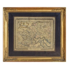
French Needlepoint Map, Europe Centrale 1838, in Period Giltwood Frame
Located in Atlanta, GA
delightful needlepoint of Central Europe in 1838, the message "Offert mon pere' PC" stitched at the bottom, the map surrounded by laurel leaves, in period Louis Philippe giltwood frame.
Category
1830s French Louis Philippe Antique Giltwood Maps
Materials
Yarn, Giltwood
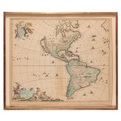
Antique Framed Hand Colored Map of the Americas by Frederick De Wit, circa 1675
Located in Morristown, NJ
Frederick De Wit (Dutch, 1629-1706), "Novissima et Accuratissima totius Americae Descriptio", hand-colored map engraving of North and South America with California depicted as an island, decorated with images of Native Americans and indigenous flora and fauna, framed under glass, 19.5"h x 23"l (sheet), 22.5"h x 1.75"d x 26"w (frame), From the collection of an NY corporation.
A fine example of De Wit’s map of the Americas, first published ca. 1675. This map is fascinating. It was the first Dutch map to include all five Great Lakes; Lac Superieur (Lake Superior), Lac des Puans (Lake Michigan), Mare Dulce (Lake Huron...
Category
1670s Dutch Baroque Antique Giltwood Maps
Materials
Glass, Wood, Giltwood, Paint, Paper
H 22.5 in W 26 in D 1.75 in
English Map of West Indies with a Gilt Wood Frame Under Glass, Late 19th Cent
Located in Hollywood, SC
English hand colored accurate map of the West Indies with a foliage gilt wood and gesso frame under glass, Late 19th century. Long West from London.
Category
Late 19th Century English Victorian Antique Giltwood Maps
Materials
Gesso, Glass, Giltwood, Paint, Paper
H 13.75 in W 16.75 in D 0.75 in
Framed Britannia Map Hand Tinted and Colored, Signed Matthaus Seutter, C. 1725
Located in Hollywood, SC
Framed and Matted Britannia Map hand tinted and colored with gilt frame.
Signed Matthaus Seutter, 1725
Seutter was one of the most important and prolific German map publishers of t...
Category
1720s German George II Antique Giltwood Maps
Materials
Glass, Giltwood, Paper
H 33 in W 28.75 in D 1.25 in
French Vintage Map of Paris 1940s in Giltwood Frame
Located in Dallas, TX
Collectible extra large framed map of Paris.
Nice giltwood frame.
Map reflects age.
Measure: 42 inches wide x 41 inches height.
Category
Mid-20th Century French Giltwood Maps
Materials
Paper, Giltwood
Recently Viewed
View AllMore Ways To Browse
Antique Sailing Maps
Antique Sailing Map
West Coat Of Arms
Bay Area Antique Furniture
Greek Asia Minor
Hemisphere World Map
Antique Maps Canada
Antique Map Canada
Canada Antique Map
Speed Map
Charing Cross
Malaysian Antique
Blaeu World Map
West Indies Map
Map Of Brazil
Map Huge
Antique Portuguese Plates
Antique Maps Of Canada
