Items Similar to 1802 Map of Australasia and the South Pacific - European Exploration Routes


Want more images or videos?
Request additional images or videos from the seller
1 of 8
1802 Map of Australasia and the South Pacific - European Exploration Routes
$1,725.33
$2,156.6620% Off
£1,284.39
£1,605.4920% Off
€1,440
€1,80020% Off
CA$2,363.27
CA$2,954.0820% Off
A$2,628.47
A$3,285.5920% Off
CHF 1,372.50
CHF 1,715.6320% Off
MX$31,985.66
MX$39,982.0820% Off
NOK 17,528.97
NOK 21,911.2220% Off
SEK 16,439.09
SEK 20,548.8620% Off
DKK 10,962.22
DKK 13,702.7720% Off
Shipping
Retrieving quote...The 1stDibs Promise:
Authenticity Guarantee,
Money-Back Guarantee,
24-Hour Cancellation
About the Item
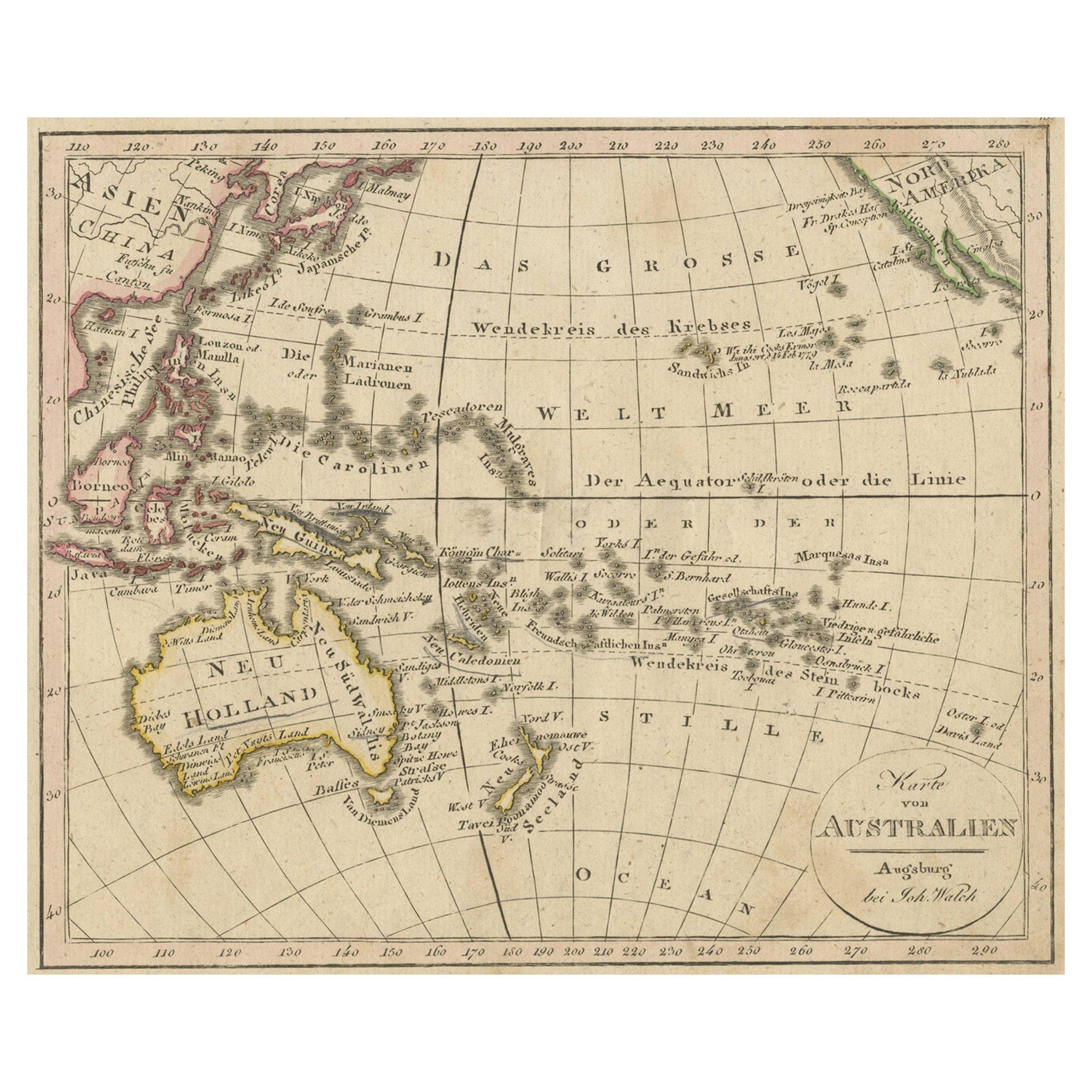
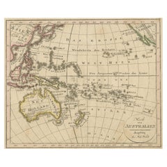
1802 Johann Walch Map of Australasia and the South Pacific - European Exploration Routes
This 1802 map by Johann Walch provides a highly detailed view of Australasia and the South Pacific, capturing the region’s exploration history by Europeans. Spanning from Sumatra to Pitcairn Island, the map highlights place names in Australia, New Zealand, and numerous Pacific islands. The Australian continent's recognizable outline pre-dates Matthew Flinders' full circumnavigation. The routes of explorers like Tasman, Cook, Bougainville, and others are clearly marked, reflecting Europe's fascination with the Pacific during the 18th century. It also details early Dutch encounters, with references to notable explorers such as Janszoon, Hartog, and Carstensz.
The simple oval cartouche in the top right and a scale in the lower right frame the map, while the lower left contains a note explaining how Cook's voyages and other circumnavigations are depicted, emphasizing the contemporary interest in maritime exploration.
The map includes the routes of several important European explorers of the Pacific and Australasia:
1. Abel Tasman (1642-1643) - His voyage around the south of Australia, including the discovery of Tasmania (which he named Van Diemen's Land), New Zealand, Tonga, and Fiji. Tasman was the first European to sight many of these places.
2. James Cook (1768-1779) - All three of Cook's significant voyages are marked:
- The first voyage (1768-1771) took him to Tahiti to observe the Transit of Venus, and he extensively charted New Zealand and the eastern coast of Australia.
- The second voyage (1772-1775) aimed to find the hypothetical southern continent. Cook disproved its existence by crossing the Antarctic Circle multiple times.
- The third voyage (1776-1780) sought the Northwest Passage, leading him to the North Pacific before he was killed in Hawaii in 1779.
3. George Bass (1799) - Bass was a Royal Navy surgeon who, along with Matthew Flinders, surveyed parts of the Australian coast. He confirmed the existence of the Bass Strait, separating Tasmania from mainland Australia.
4. Thomas Gilbert and William Marshall (1789) - The map shows the route of Captains Gilbert and Marshall during their voyage from Australia to China. They were part of the First Fleet, and their voyage led to several geographic names being assigned to islands and atolls.
5. Louis Antoine de Bougainville (1766-1769) - Bougainville was the first Frenchman to circumnavigate the globe. His route through the Pacific is shown, reflecting France's increasing interest in the region.
6. John Byron, Samuel Wallis, and Philip Carteret (1764-1768) - These British explorers' routes are also depicted. They contributed significantly to British exploration of the Pacific prior to Cook’s voyages, with Wallis being the first European to reach Tahiti.
Additionally, the map references earlier Dutch East India Company (VOC) voyages:
- Willem Janszoon (1605-1606) - His voyage on the Duyfken along the eastern shore of the Gulf of Carpentaria, marking the first recorded European contact with Australia.
- Dirk Hartog (1616) - Commanded the Eendracht, the second recorded European ship to contact Australia, leading to the famous pewter plate left at Dirk Hartog Island.
- Jacob d’Edel and Frederik de Houtman (1619) - Sighted parts of the western coast of Australia, naming stretches of land and islands, such as Edels Land and the Houtman Abrolhos.
- Jan Carstensz (1623) - Sailed with the Arnhem, after which Arnhem Land is named, exploring northern Australia.
The routes marked on the map illustrate Europe’s gradual understanding of the Pacific, with a focus on Australia's coasts and the numerous islands in the South Pacific, as mapped by explorers from multiple nations over nearly two centuries.
This map is a fine example of German cartographic publishing from Augsburg, demonstrating the enthusiasm for new geographical discoveries and European naval achievements in the Pacific during the late 18th and early 19th centuries.
The map is in very good condition, with only minor wear. The hand-coloring is vivid and well-preserved. Margins are intact, with slight toning and minimal foxing typical for its age. There are a few light folds from storage but no significant tears or damage.
- Dimensions:Height: 22.25 in (56.5 cm)Width: 27.17 in (69 cm)Depth: 0.01 in (0.2 mm)
- Materials and Techniques:Paper,Engraved
- Period:
- Date of Manufacture:1802
- Condition:The map is in very good condition, with only minor wear. The hand-coloring is vivid and well-preserved. Margins are intact, with slight toning and minimal foxing typical for its age. There are a few light folds from storage but no significant tears.
- Seller Location:Langweer, NL
- Reference Number:Seller: BHZ106461stDibs: LU3054342589652
About the Seller
5.0
Recognized Seller
These prestigious sellers are industry leaders and represent the highest echelon for item quality and design.
Platinum Seller
Premium sellers with a 4.7+ rating and 24-hour response times
Established in 2009
1stDibs seller since 2017
2,510 sales on 1stDibs
Typical response time: <1 hour
- ShippingRetrieving quote...Shipping from: Langweer, Netherlands
- Return Policy
Authenticity Guarantee
In the unlikely event there’s an issue with an item’s authenticity, contact us within 1 year for a full refund. DetailsMoney-Back Guarantee
If your item is not as described, is damaged in transit, or does not arrive, contact us within 7 days for a full refund. Details24-Hour Cancellation
You have a 24-hour grace period in which to reconsider your purchase, with no questions asked.Vetted Professional Sellers
Our world-class sellers must adhere to strict standards for service and quality, maintaining the integrity of our listings.Price-Match Guarantee
If you find that a seller listed the same item for a lower price elsewhere, we’ll match it.Trusted Global Delivery
Our best-in-class carrier network provides specialized shipping options worldwide, including custom delivery.More From This Seller
View AllAntique Map of Oceania and the Pacific Ocean, Australia and New Zealand, 1826
Located in Langweer, NL
Antique map of Australia titled 'Karte von Australien'. Old map of Australia and New Zealand. Published in Walch's 'Neuester Schul-Atlas'.
Artists and Engravers: Johann, or Johan...
Category
Antique 19th Century Maps
Materials
Paper
$153 Sale Price
20% Off
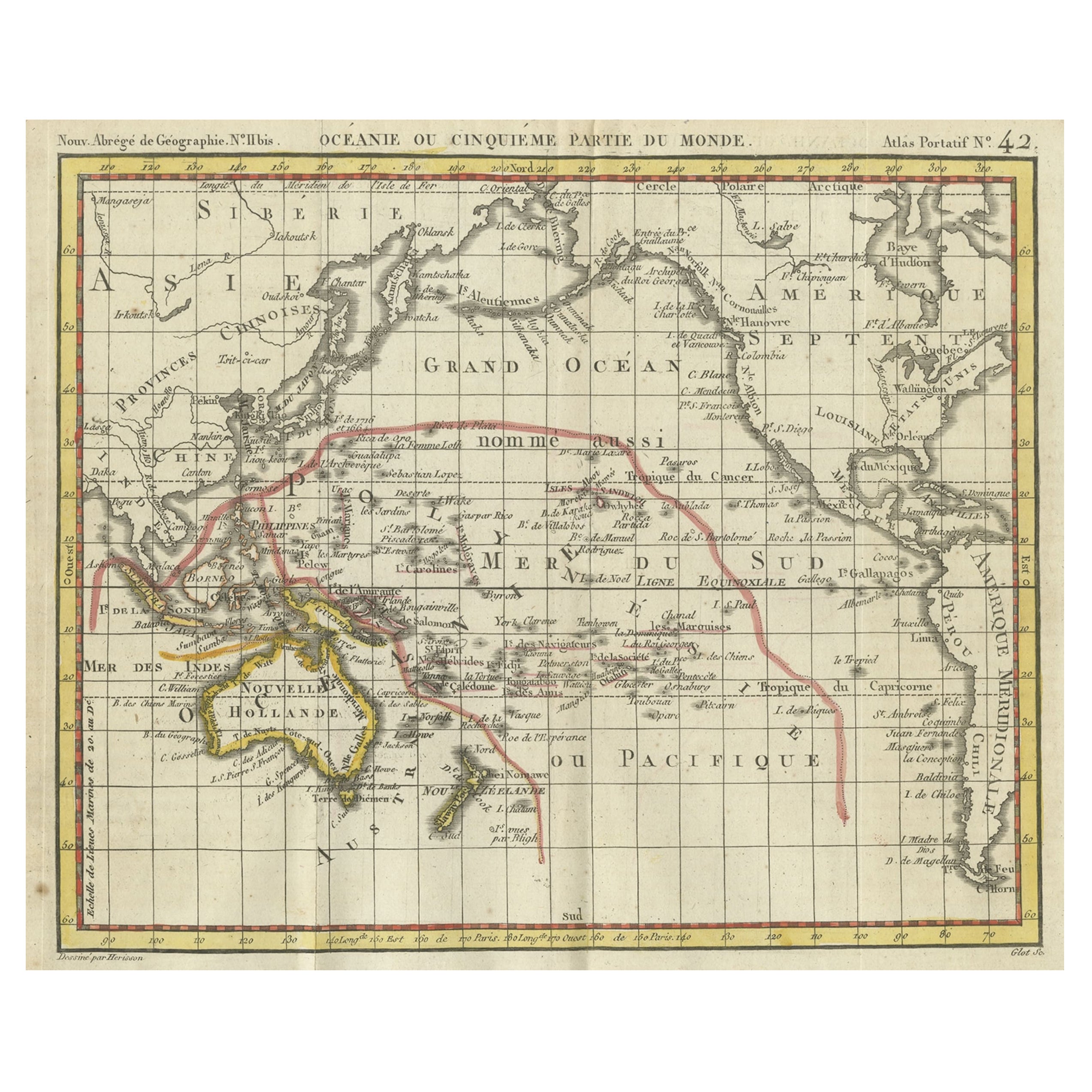
Original Antique Map of Oceania, the 5th Continent, 1816
Located in Langweer, NL
Antique map titled ‘Océanie ou cinquième partie du monde‘.
This is an original antique map of Oceania, the 5th continent, by Herisson taken from atlas "Nouv. Abrége de Géographie...
Category
Antique 1810s Maps
Materials
Paper
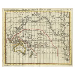
$268 Sale Price
20% Off
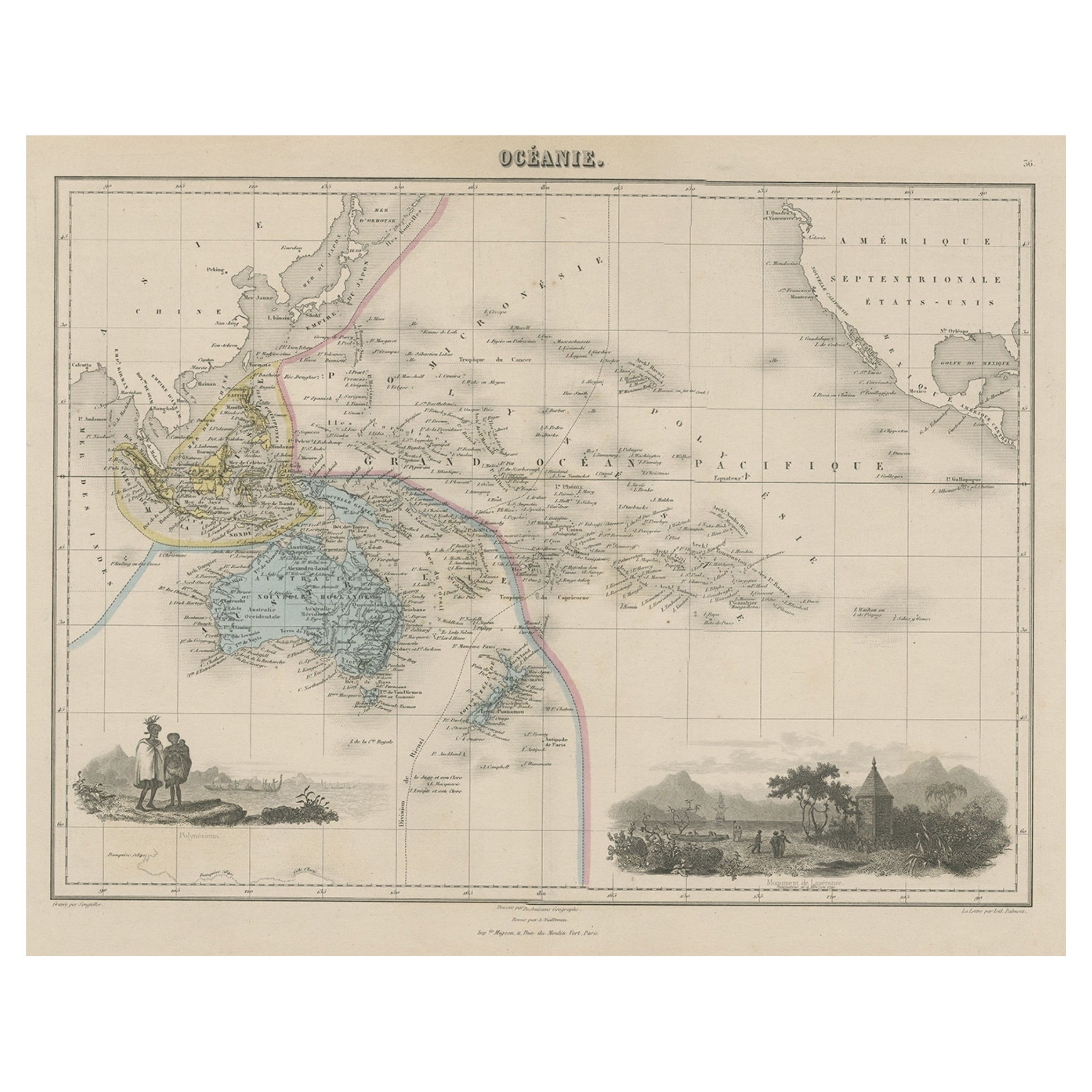
Old Map of the Oceans Around Australia, Indonesia and New Zealand, 1880
Located in Langweer, NL
Antique map titled 'Océanie'.
Old map of the oceans around Australia, Indonesia and New Zealand. With vignettes of people from Polynesia and the old monument Laparouse. This map ...
Category
Antique 1880s Maps
Materials
Paper
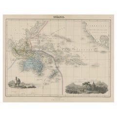
$210 Sale Price
20% Off
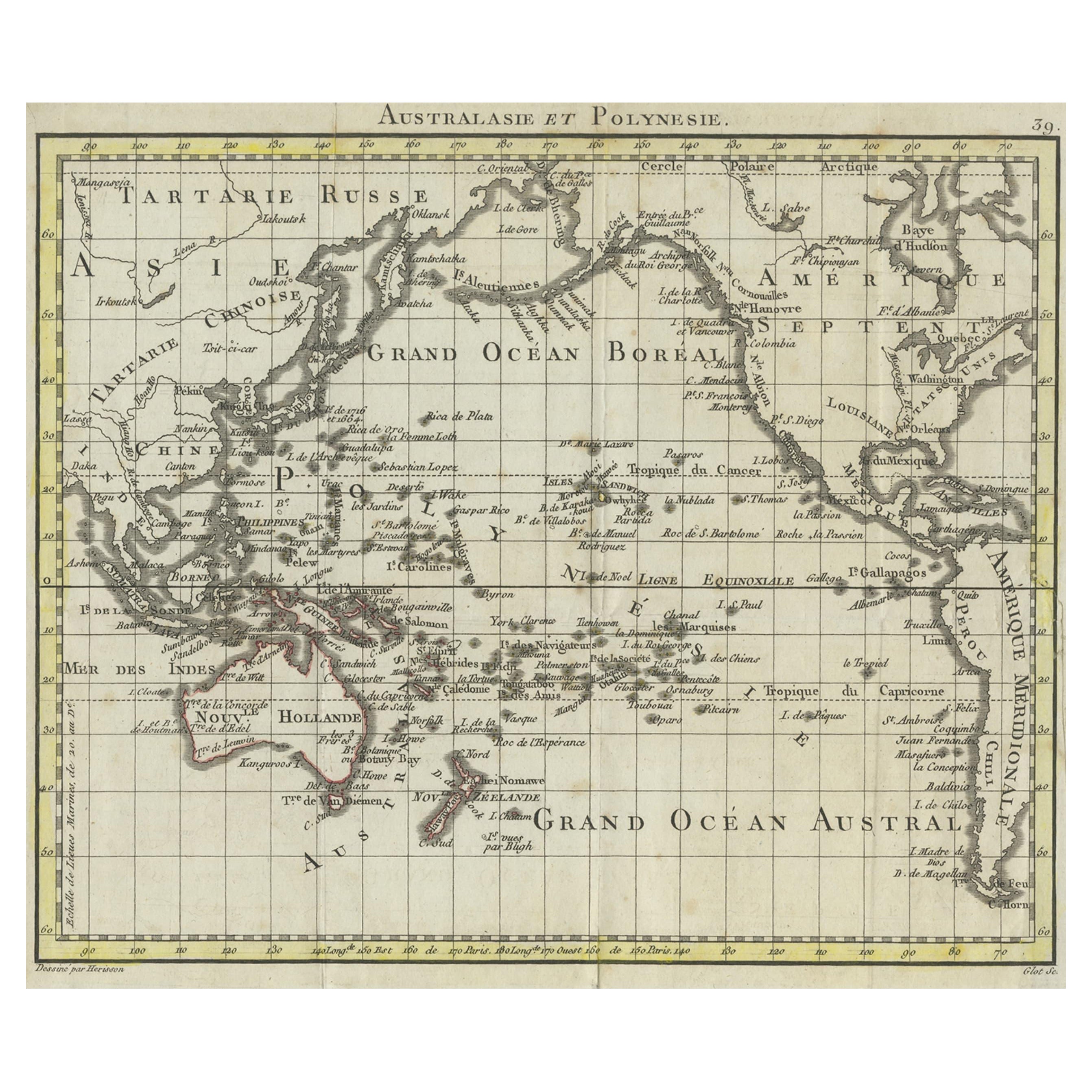
Antique French Map of the Pacific Ocean with Australia and Polynesia, 1806
Located in Langweer, NL
Antique map titled 'Australasie et Polynesie'. Old map of Oceania and the Pacific Ocean. Originates from 'Atlas Portatif contenant la Géographie Universelle Ancienne et Moderne' by H...
Category
Antique 19th Century Maps
Materials
Paper
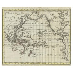
$115 Sale Price
20% Off
Antique Map of Oceania by Balbi '1847'
Located in Langweer, NL
Antique map titled 'Océanie'. Original antique map of Oceania. This map originates from 'Abrégé de Géographie (..)' by Adrien Balbi. Published 1847.
Category
Antique Mid-19th Century Maps
Materials
Paper

$143 Sale Price
20% Off
Antique Map of Australasia, New Zealand, Polynesia & the Pacific Ocean, 1840
Located in Langweer, NL
Antique map titled 'The Pacific Ocean'.
This map depicts Australasia, New Zealand, Polynesia and islands in the Pacific Ocean including the Sandwich Islands.
Artists and Engravers: Published by the Society for the Diffusion of Useful Knowledge, 1840. Engraved by J. & C. Walker.
Condition:
Good, general age-related toning. Few tiny tears...
Category
Antique 1840s Maps
Materials
Abalone, Paper

$210 Sale Price
20% Off
You May Also Like
Large Original Antique Map of Australia by Sidney Hall, 1847
Located in St Annes, Lancashire
Great map of Australia
Drawn and engraved by Sidney Hall
Steel engraving
Original colour outline
Published by A & C Black. 1847
Unframed
Free shipping.
Category
Antique 1840s Scottish Maps
Materials
Paper

Original Antique Map of Australia by Dower, circa 1835
Located in St Annes, Lancashire
Nice map of Australia
Drawn and engraved by J.Dower
Published by Orr & Smith. C.1835
Unframed.
Free shipping
Category
Antique 1830s English Maps
Materials
Paper

Large Original Antique Map of The Pacific Ocean, Fullarton, C.1870
Located in St Annes, Lancashire
Great map of The Pacific Ocean
From the celebrated Royal Illustrated Atlas
Lithograph by Swanston. Original color.
Published by Fullarton,...
Category
Antique 1870s Scottish Maps
Materials
Paper

Antique 1803 Italian Map of Asia Including China Indoneseia India
Located in Amsterdam, Noord Holland
Antique 1803 Italian Map of Asia Including China Indoneseia India
Very nice map of Asia. 1803.
Additional information:
Type: Map
Country of Manufacturing: Europe
Period: 19th centu...
Category
Antique 19th Century European Maps
Materials
Paper

$584 Sale Price
20% Off
Ancient Map of Oceania - Original Etching - 19th century
Located in Roma, IT
This Map of Oceania is an etching realized in the 19th century.
The state of preservation of the artwork is good. At the top of the paper, the inscription “Longitudine del Meridiano...
Category
19th Century More Prints
Materials
Etching

Original Antique Map of The World by Thomas Clerk, 1817
Located in St Annes, Lancashire
Great map of The Eastern and Western Hemispheres
On 2 sheets
Copper-plate engraving
Drawn and engraved by Thomas Clerk, Edinburgh.
Published by Mackenzie And Dent, 1817
...
Category
Antique 1810s English Maps
Materials
Paper

More Ways To Browse
Pacific Northwest Furniture
Voc Antique
Gilbert And George
Pewter Plate
Engraved Pewter
British Royal Navy
Map Storage
Paper Globe Light
Hawaiian Antique
Antique Pewter Plates
Antique Transits
18th Century Naval
Antique Hawaiian Furniture
British East India Company
Antique Pewter Frames
Hawaiian Collectibles
Voc Plate
Antique Pewter Collectables