Items Similar to 1856 France and Switzerland Map with Mountain Profiles


Video Loading
Want more images or videos?
Request additional images or videos from the seller
1 of 11
1856 France and Switzerland Map with Mountain Profiles
$459.66
£346.22
€390
CA$633.89
A$712.15
CHF 372.10
MX$8,692.15
NOK 4,724.59
SEK 4,447.21
DKK 2,968.53
About the Item
1856 Map of France and Switzerland with Paris Inset by Stülpnagel
This finely detailed antique map of France and Switzerland was published in 1856 by the esteemed German cartographer Freiherr von Stülpnagel and printed by Justus Perthes in Gotha. The map, titled “Frankreich und die Schweiz,” is a superb example of mid-19th-century European cartography, combining scientific accuracy with elegant design.
The map depicts France in its entirety, from the English Channel (“Der Canal oder La Manche”) in the north to the Mediterranean coastline in the south, and from the Bay of Biscay in the west to the alpine regions of Switzerland and western Italy in the east. Each French department is clearly delineated with hand-colored borders, and major cities, rivers, and mountain ranges are carefully labeled. The Swiss cantons are also defined, and the rugged terrain of the Alps is rendered with considerable topographical detail.
A notable feature of the map is the inset at the lower left, titled “Umgebungen von Paris,” which offers an enlarged view of the Paris region and its surrounding communes. This inset provides valuable insight into the infrastructure and geography around the French capital during the mid-1800s. At the bottom of the sheet is a cross-sectional elevation profile showing the mountainous regions of southern France, offering a rare visual representation of elevation within a political map.
This map reflects the precision and clarity for which Stülpnagel and the Justus Perthes publishing house were known. It serves not only as a geographic reference but also as a historical document, capturing France and Switzerland in the period just prior to the major territorial and political shifts of the late 19th century.
Condition report:
Very good condition overall. Strong plate mark and rich, original hand-coloring. Light age-related toning and minor foxing in the margins. No tears or repairs. Please examine the image carefully for condition details.
Framing tips:
This map would look exceptional in a classic black or gold frame with a wide ivory or cream-colored mat. For a more modern interior, a slim walnut frame could provide a balanced contrast to the antique tones.
Technique: Engraving with original hand-coloring
Maker: Freiherr F. von Stülpnagel, published by Justus Perthes, Gotha, 1856
- Dimensions:Height: 14.77 in (37.5 cm)Width: 17.88 in (45.4 cm)Depth: 0.01 in (0.2 mm)
- Materials and Techniques:Paper,Engraved
- Place of Origin:
- Period:
- Date of Manufacture:1857
- Condition:Very good condition overall. Strong plate mark and rich, original hand-coloring. Light age-related toning and minor foxing in the margins. No tears or repairs. Please examine the image carefully for condition details.
- Seller Location:Langweer, NL
- Reference Number:Seller: BG-05552-141stDibs: LU3054346102682
About the Seller
5.0
Recognized Seller
These prestigious sellers are industry leaders and represent the highest echelon for item quality and design.
Platinum Seller
Premium sellers with a 4.7+ rating and 24-hour response times
Established in 2009
1stDibs seller since 2017
2,533 sales on 1stDibs
Typical response time: <1 hour
- ShippingRetrieving quote...Shipping from: Langweer, Netherlands
- Return Policy
Authenticity Guarantee
In the unlikely event there’s an issue with an item’s authenticity, contact us within 1 year for a full refund. DetailsMoney-Back Guarantee
If your item is not as described, is damaged in transit, or does not arrive, contact us within 7 days for a full refund. Details24-Hour Cancellation
You have a 24-hour grace period in which to reconsider your purchase, with no questions asked.Vetted Professional Sellers
Our world-class sellers must adhere to strict standards for service and quality, maintaining the integrity of our listings.Price-Match Guarantee
If you find that a seller listed the same item for a lower price elsewhere, we’ll match it.Trusted Global Delivery
Our best-in-class carrier network provides specialized shipping options worldwide, including custom delivery.More From This Seller
View AllAntique Map of France, 1903, with Inset of Paris and Corsica
Located in Langweer, NL
Title: Antique Map of France, 1903, with Inset of Paris and Corsica
Description:
This antique map, titled "France," was engraved and published in 1903 by the renowned W. & A.K. John...
Category
Early 20th Century Maps
Materials
Paper

Antique Map of France by Balbi '1847'
Located in Langweer, NL
Antique map titled 'France'. Original antique map of France. This map originates from 'Abrégé de Géographie (..)' by Adrien Balbi. Published 1847.
Category
Antique Mid-19th Century Maps
Materials
Paper

$117 Sale Price
20% Off
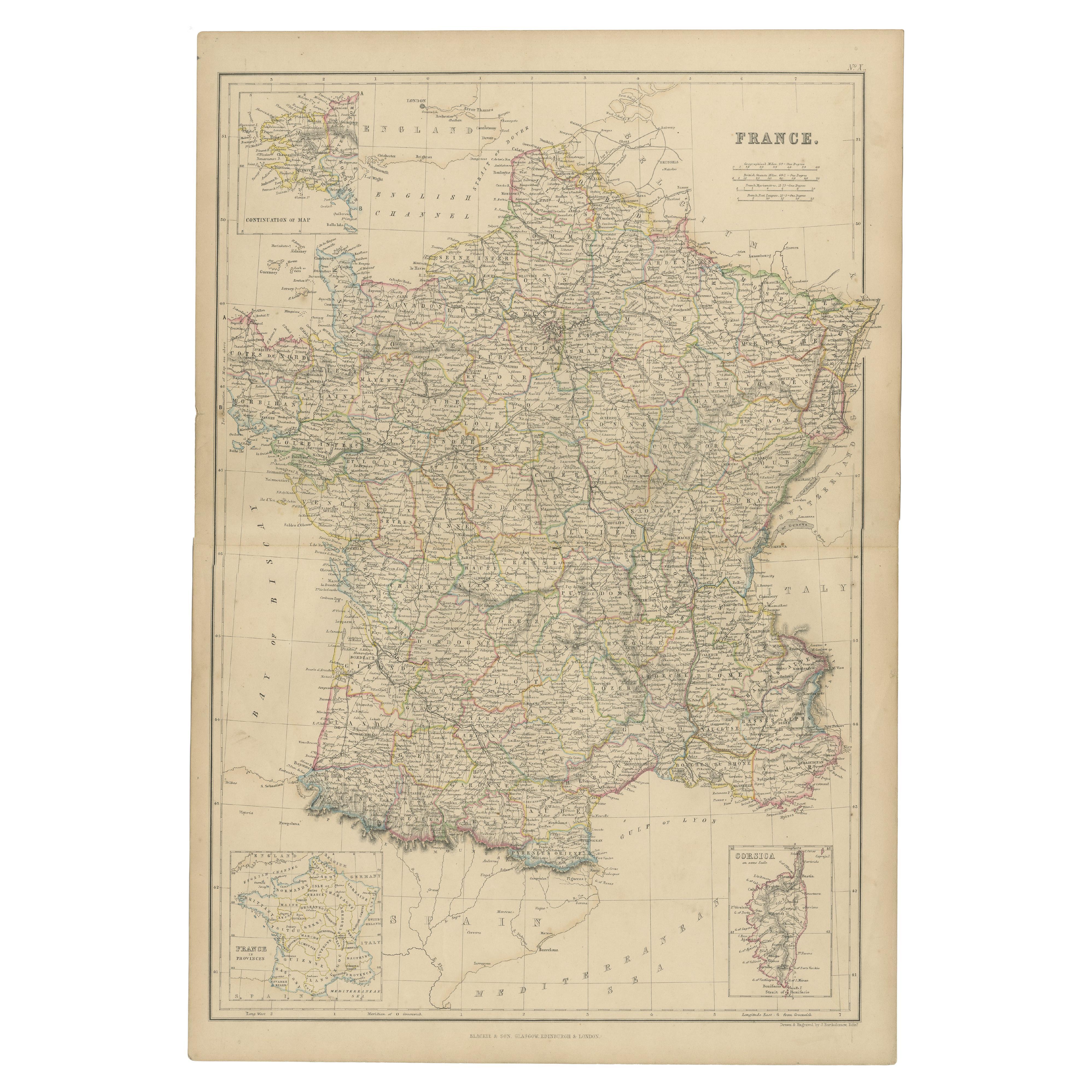
1859 Classic Map of France: Blackie's Imperial Geographic Masterpiece
Located in Langweer, NL
The "Antique Map of France" from 'The Imperial Atlas of Modern Geography', published in 1859 by W. G. Blackie, is a historically valuable cartographic work that offers a comprehensiv...
Category
Antique Mid-19th Century Maps
Materials
Paper

$220 Sale Price
25% Off
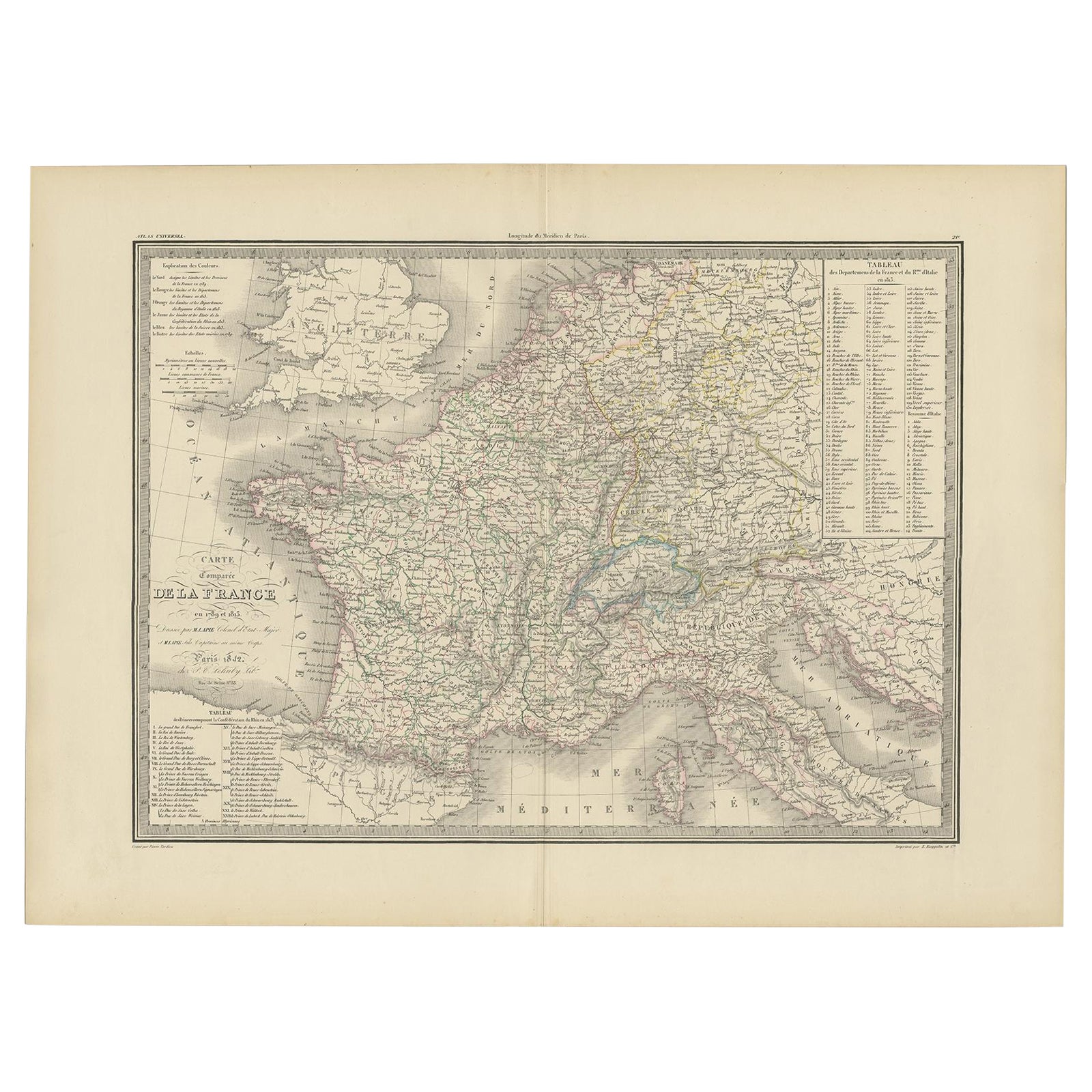
Antique Map of France with Surrounding Countries, 1842
Located in Langweer, NL
Antique map titled 'Carte comparée de la France en 1789 et 1813'. Map of France. This map originates from 'Atlas universel de géographie ancienne et moderne (..)' by Pierre M. Lapie ...
Category
Antique 19th Century Maps
Materials
Paper
$282 Sale Price
20% Off
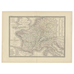
Antique Map of France by Lapie, 1842
Located in Langweer, NL
Antique map titled 'Carte des Gaules'. Map of France. This map originates from 'Atlas universel de géographie ancienne et moderne (..)' by Pierre M. Lapie and Alexandre E. Lapie. Pie...
Category
Antique Mid-19th Century Maps
Materials
Paper

$471 Sale Price
20% Off
Antique Map of France by A & C. Black, 1870
Located in Langweer, NL
Antique map titled 'France'. Original antique map of France with inset map of France as divided into provinces, before the revolution of 1789 and map of Corsica...
Category
Antique Late 19th Century Maps
Materials
Paper

$259 Sale Price
20% Off
You May Also Like
France, Northern Part. Century Atlas antique map
Located in Melbourne, Victoria
'The Century Atlas. France, Northern Part.'
Original antique map, 1903.
Inset maps of 'France in Provinces' and 'Paris and Vicinity'.
Central fold as issued. Map name and number pr...
Category
Early 20th Century Victorian More Prints
Materials
Lithograph

Large 19th Century Map of France
Located in Pease pottage, West Sussex
Large 19th Century Map of France.
Remarkable condition, with a pleasing age worn patina.
Recently framed.
France Circa 1874.
Category
Antique Late 19th Century French Maps
Materials
Linen, Paper

Map of France - Etching - 1820
Located in Roma, IT
Map of France is an Original Etching realized by an unknown artist of 19th century in 1820.
Very good condition on two sheets of white paper joined at t...
Category
1820s Modern Figurative Prints
Materials
Etching

Hautes Alpes, France. Antique map of a French department, 1856
By Victor Levasseur
Located in Melbourne, Victoria
'Dept. des Hautes Alpes', steel engraving with original outline hand-colouring., 1856, from Levasseur's 'Atlas National Illustre'.
This area of France i...
Category
19th Century Naturalistic Landscape Prints
Materials
Engraving

Antique Map of France
Located in Dallas, TX
Nice antique map of France in wood frame. This would make a great gift for a collector. A wonderful accessory!
Category
Early 20th Century Decorative Art
Materials
Glass, Wood, Paper

$1,760
Pyrenees Orientales, France. Antique map of a French department, 1856
By Victor Levasseur
Located in Melbourne, Victoria
'Dept. des Pyrenees Orientales', steel engraving with original outline hand-colouring., 1856, from Levasseur's 'Atlas National Illustre'.
This area is well-known wine producing reg...
Category
19th Century Naturalistic Landscape Prints
Materials
Engraving
