Items Similar to 1858 Map of Hungary, Galicia & the Balkans – Justus Perthes Engraving

Want more images or videos?
Request additional images or videos from the seller
1 of 11
1858 Map of Hungary, Galicia & the Balkans – Justus Perthes Engraving
$425.18
£320.10
€360
CA$585.71
A$655.96
CHF 342.27
MX$8,012.30
NOK 4,354.68
SEK 4,104.80
DKK 2,740.37
About the Item
1858 Map of Hungary, Galicia & the Balkans – Justus Perthes Engraving
Antique map titled "Galizien, Ungarn, Slavonien und Croatien, Siebenbürgen und Dalmatien," published by Justus Perthes in Gotha in 1858. This highly detailed copperplate engraving presents a wide view of the eastern territories of the Austrian Empire, including Hungary, Galicia (now partly in Poland and Ukraine), Transylvania, Croatia, Slavonia, Dalmatia, and Bosnia.
Drawn with cartographic precision, the map captures the ethnic and political complexity of the region just before the Austro-Hungarian Compromise of 1867. Major cities such as Pesth (Budapest), Lemberg (Lviv), Belgrade, Sarajevo, and Cluj (Klausenburg) are clearly labeled, along with an intricate web of rivers, trade routes, and mountainous terrain.
Provincial boundaries are delicately hand-colored, and a detailed legend at lower right explains the symbols for towns, fortresses, and administrative borders. The Adriatic coast from Trieste to Montenegro is included, as well as parts of Moldavia, Wallachia, and the Carpathians, making this map particularly valuable for those interested in the shifting borders and national identities of Central and Eastern Europe.
This map serves as an important visual document of the Habsburg Empire's southeastern frontier during a period of political tension and regional nationalism. A valuable piece for collectors of Central European or Balkan cartography.
Condition report:
Very good condition. Minor age-related toning in margins. Hand-coloring is vivid and intact. No tears or repairs noted. Please study the image for details.
Framing suggestions:
Frame with dark walnut or black wood for a classic, scholarly appearance. Use a soft cream or ivory mat with a possible burgundy or gold inner accent to echo the provincial colors. Ideal for office or study display.
Technique: Copperplate engraving with original hand-coloring
Maker: Justus Perthes, Gotha, 1858
- Dimensions:Height: 14.77 in (37.5 cm)Width: 17.88 in (45.4 cm)Depth: 0.01 in (0.2 mm)
- Materials and Techniques:Paper,Engraved
- Place of Origin:
- Period:
- Date of Manufacture:1858
- Condition:Very good condition. Minor toning to outer margins. Hand-coloring remains vivid. No tears, foxing, or repairs.
- Seller Location:Langweer, NL
- Reference Number:Seller: BG-05552-391stDibs: LU3054346118562
About the Seller
5.0
Recognized Seller
These prestigious sellers are industry leaders and represent the highest echelon for item quality and design.
Platinum Seller
Premium sellers with a 4.7+ rating and 24-hour response times
Established in 2009
1stDibs seller since 2017
2,533 sales on 1stDibs
Typical response time: <1 hour
- ShippingRetrieving quote...Shipping from: Langweer, Netherlands
- Return Policy
Authenticity Guarantee
In the unlikely event there’s an issue with an item’s authenticity, contact us within 1 year for a full refund. DetailsMoney-Back Guarantee
If your item is not as described, is damaged in transit, or does not arrive, contact us within 7 days for a full refund. Details24-Hour Cancellation
You have a 24-hour grace period in which to reconsider your purchase, with no questions asked.Vetted Professional Sellers
Our world-class sellers must adhere to strict standards for service and quality, maintaining the integrity of our listings.Price-Match Guarantee
If you find that a seller listed the same item for a lower price elsewhere, we’ll match it.Trusted Global Delivery
Our best-in-class carrier network provides specialized shipping options worldwide, including custom delivery.More From This Seller
View AllMap of Iran, Arabia, Asia Minor & Caucasus by Perthes, 1858
Located in Langweer, NL
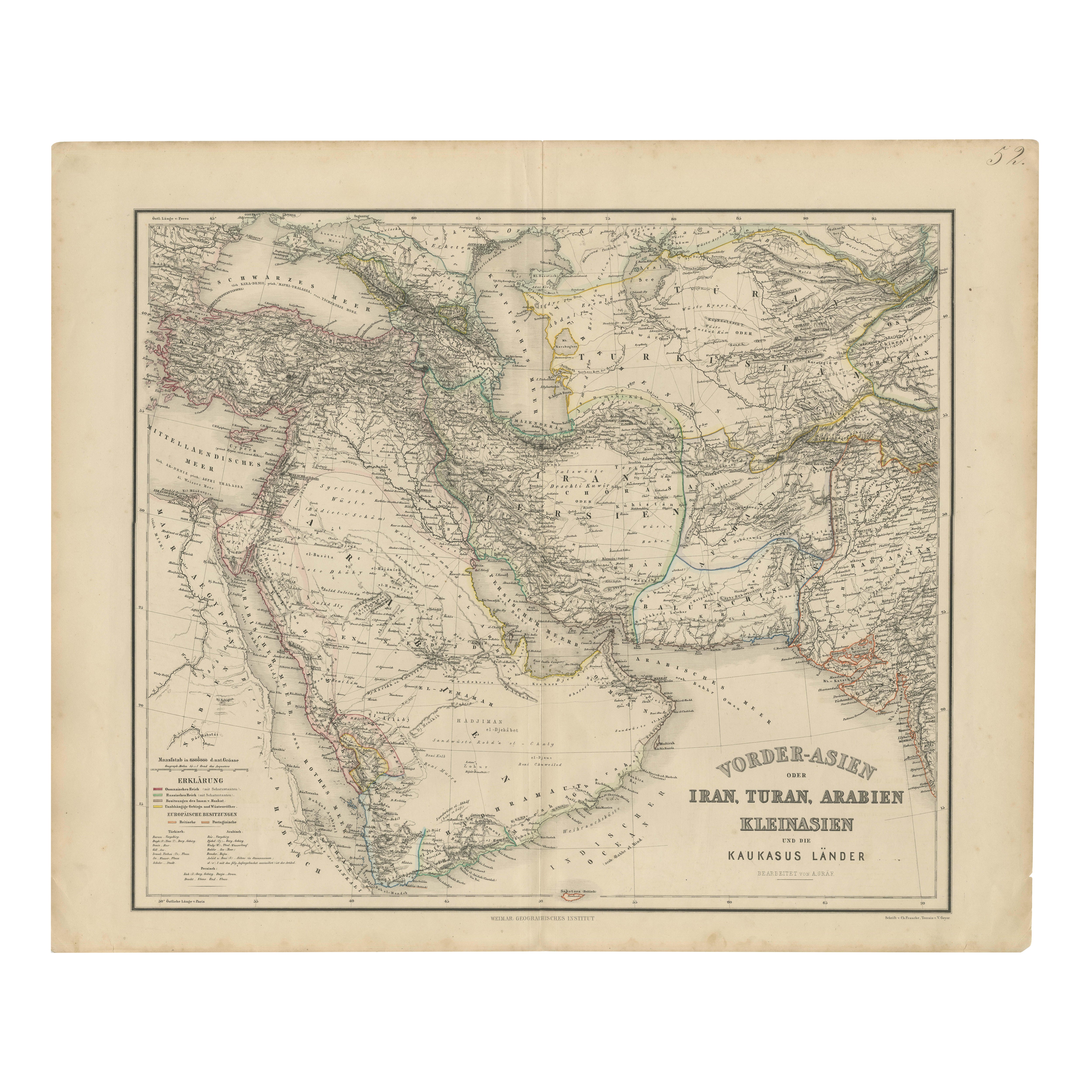
Map of Iran, Arabia, Asia Minor & Caucasus by Perthes, 1858
This is a detailed engraved map titled Vorder-Asien oder Iran, Turan, Arabien, Kleinasien und die Kaukasus Länder, publis...
Category
Antique Mid-19th Century German Maps
Materials
Paper

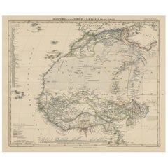
Antique Map of West and Central Africa – Stieler Atlas, Justus Perthes 1857
Located in Langweer, NL
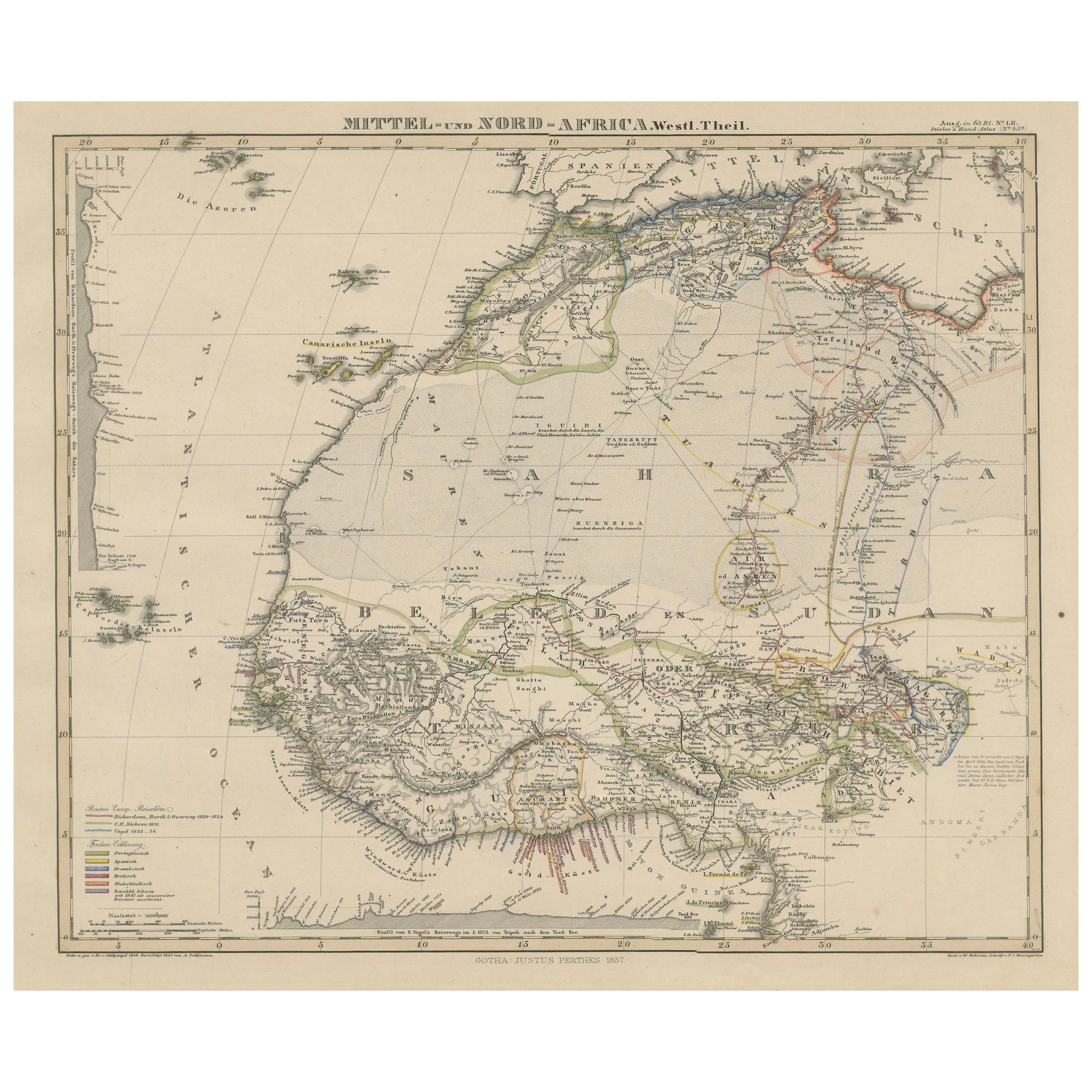
Antique Map of West and Central Africa – Stieler Atlas, Justus Perthes 1857
This finely engraved map titled "Mittel- und Nord-Africa. Westl. Theil." was published in 1857 by Justus ...
Category
Antique Mid-19th Century German Maps
Materials
Paper
European Turkey Map – Detailed Balkan Ottoman Provinces 1858
Located in Langweer, NL
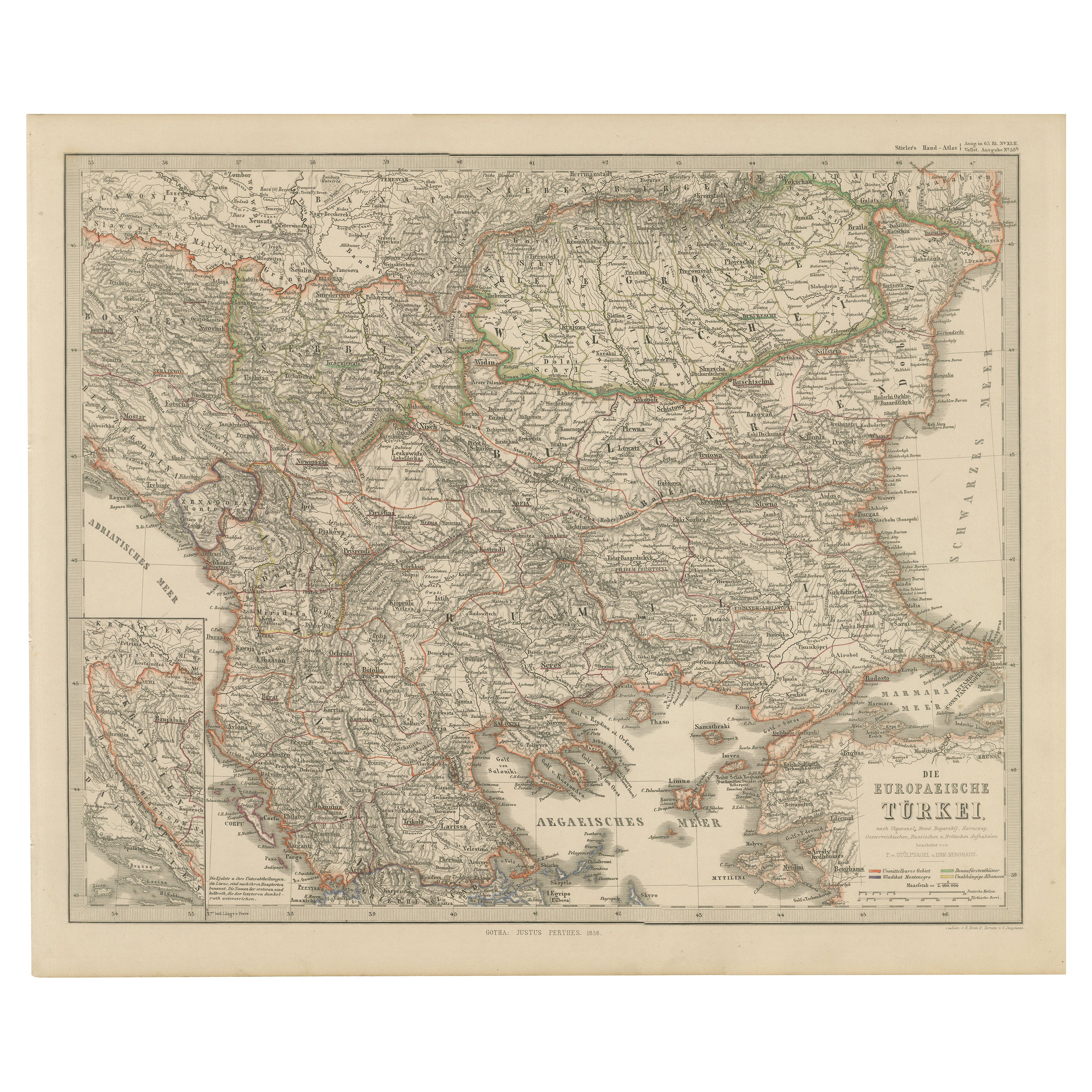
European Turkey and Greece Map – Balkans and Ionian Islands 1857
This detailed antique print shows “Die Europäische Türkei, Griechenland und die Ionische...
Category
Antique Mid-19th Century German Maps
Materials
Paper

Antique Map of the Middle East by Perthes, 1848
Located in Langweer, NL
Antique map titled 'Terra inter Euphratem et Indum Antiqua'. Old map of the Middle East originating from 'Orbis Terrarum Antiquus in usum Schola...
Category
Antique 19th Century Maps
Materials
Paper

$93 Sale Price
20% Off
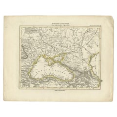
Antique Map of the Black Sea by Perthes, 1848
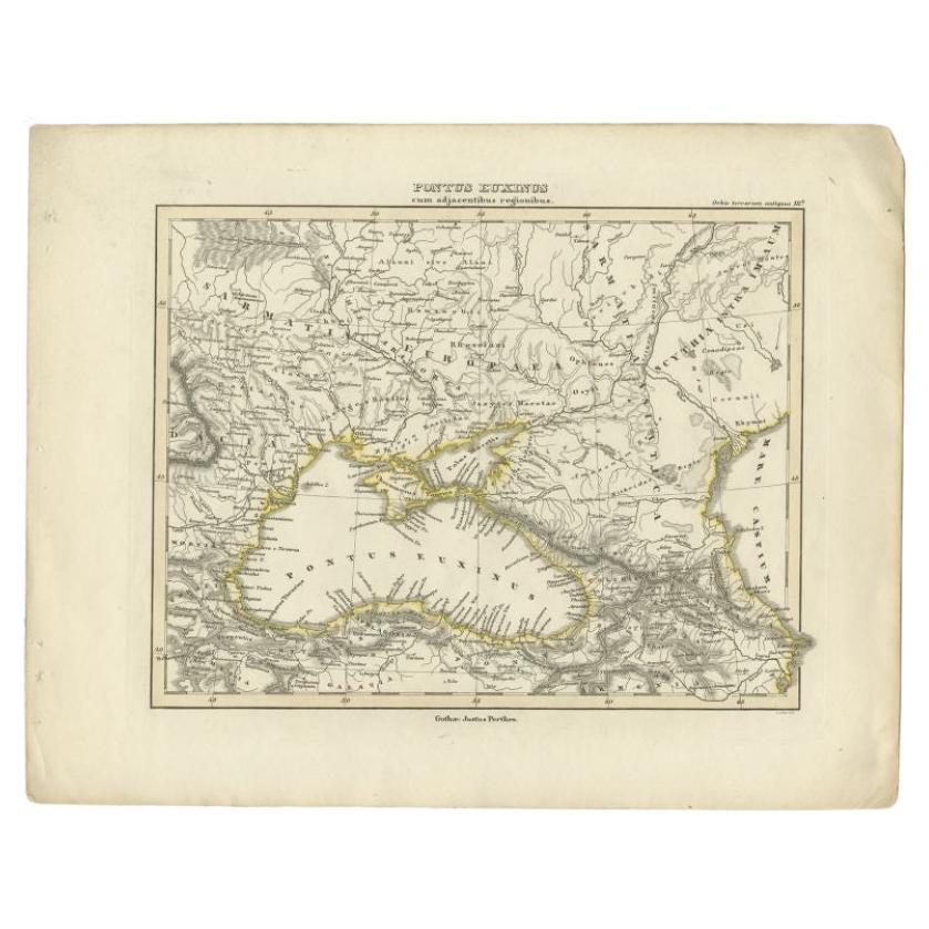
Located in Langweer, NL
Antique map titled 'Pontus Euxinus'. Old map of the Black Sea and surroundings originating from 'Orbis Terrarum Antiquus in usum Scholarum'. Artists and Engravers: Published by Justu...
Category
Antique 19th Century Maps
Materials
Paper
$93 Sale Price
20% Off
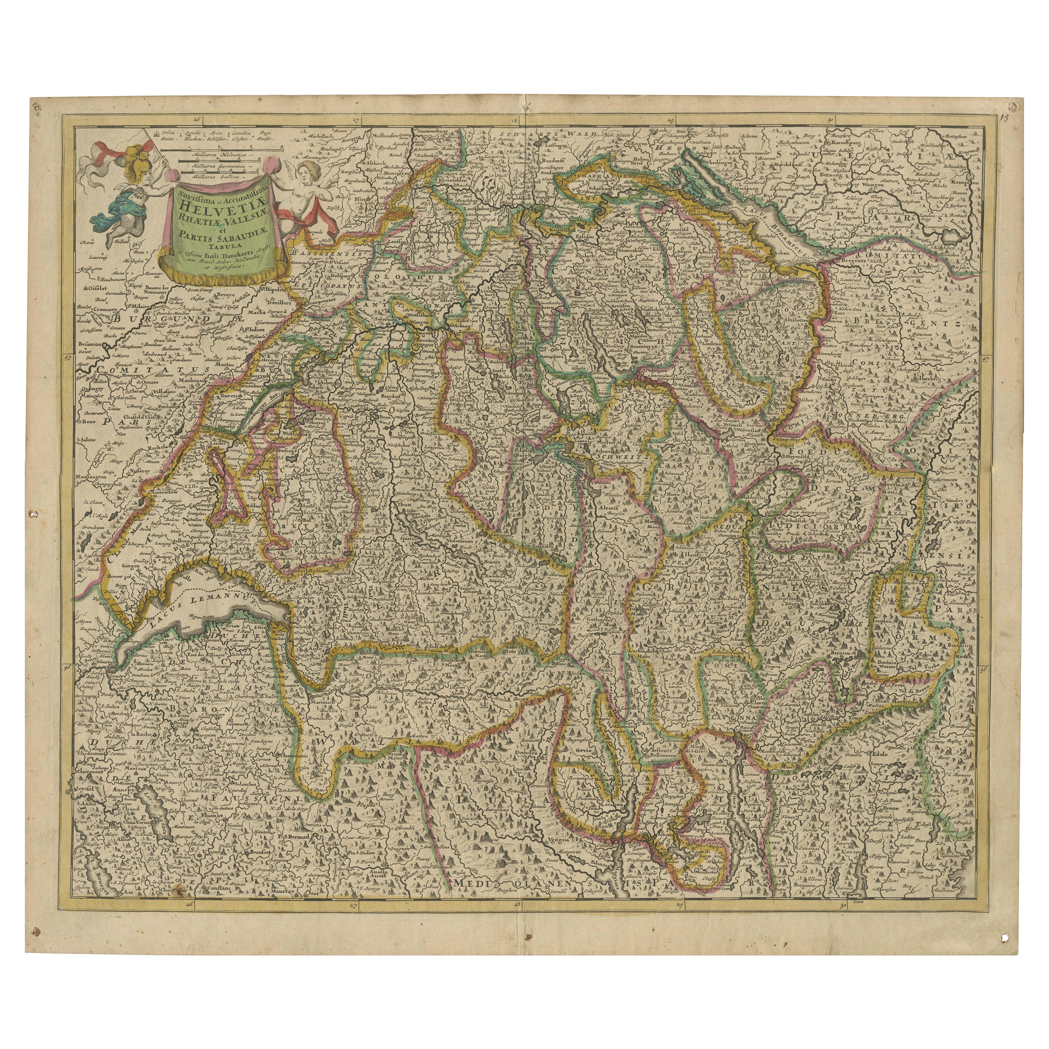
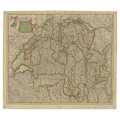
Map of Switzerland by Justus Danckerts, Hand-Colored Engraving ca. 1690
Located in Langweer, NL
Map of Switzerland by Justus Danckerts, Hand-Colored Engraving ca. 1690
This detailed and attractively hand-colored antique map titled *Helvetiae Rhaetiae et Valesiae, nec non parti...
Category
Antique Late 17th Century Maps
Materials
Paper
You May Also Like
18th Century Map of the Southern Balkans by Giovanni Maria Cassini
By Giovanni Maria Cassini
Located in Hamilton, Ontario
18th century map by Italian engraver Giovanni Maria Cassini (Italy 1745-1824).
Map of the Southern Balkans: Rome. Hand colored and copper engraved print done in the year 1788. It in...
Category
Antique 18th Century Italian Maps
Materials
Paper

$795 Sale Price
36% Off
1858 Colton's Map of New York, Ric.B011
Located in Norton, MA
An 1858 Colton's map of New York
Ric.b011
Colton’s New York, 1858 - A large original color engraved and very detailed map of the state of New York,...
Category
Antique 19th Century Unknown Maps
Materials
Paper

Original Antique Map of Hungary, Arrowsmith, 1820
Located in St Annes, Lancashire
Great map of Hungary
Drawn under the direction of Arrowsmith.
Copper-plate engraving.
Published by Longman, Hurst, Rees, Orme and Brown, 1820
Unframed.
Category
Antique 1820s English Maps
Materials
Paper

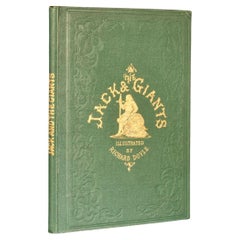
1858 The Story of Jack and the Giants
By Richard Doyle
Located in Bath, GB
An exciting retelling of Jack the Giant Killer, beautifully illustrated throughout by Richard Doyle, a smart copy.
A vivid retelling of 'The Story of Ja...
Category
Antique 1850s British Books
Materials
Paper
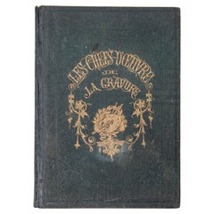
"The Masterpieces of Engraving"
By Eugene Maxime Vallée
Located in Alessandria, Piemonte
O/7821 - interesting French book that I saved from ruin: they are usually dismembered to make prints to sell individually. This one is intact, with its 24 printed plates. Nice to ...
Category
Antique Mid-19th Century French Other Books
Materials
Paper
$614 Sale Price
20% Off
Engraving Depicting 16th Century Map of Terra Sancta
Located in Buchanan, MI
Abraham Ortelius (Flemish, 1527-1598) Terra Sancta.
Engraving depicting 16th century map of Terra Sancta. Site 15" x 19.5.
Category
Antique 18th Century and Earlier Maps
Materials
Paper
