Items Similar to 1882 Map of Argentina, La Plata, Chile, Paraguay, Uruguay, and Patagonia


Want more images or videos?
Request additional images or videos from the seller
1 of 7
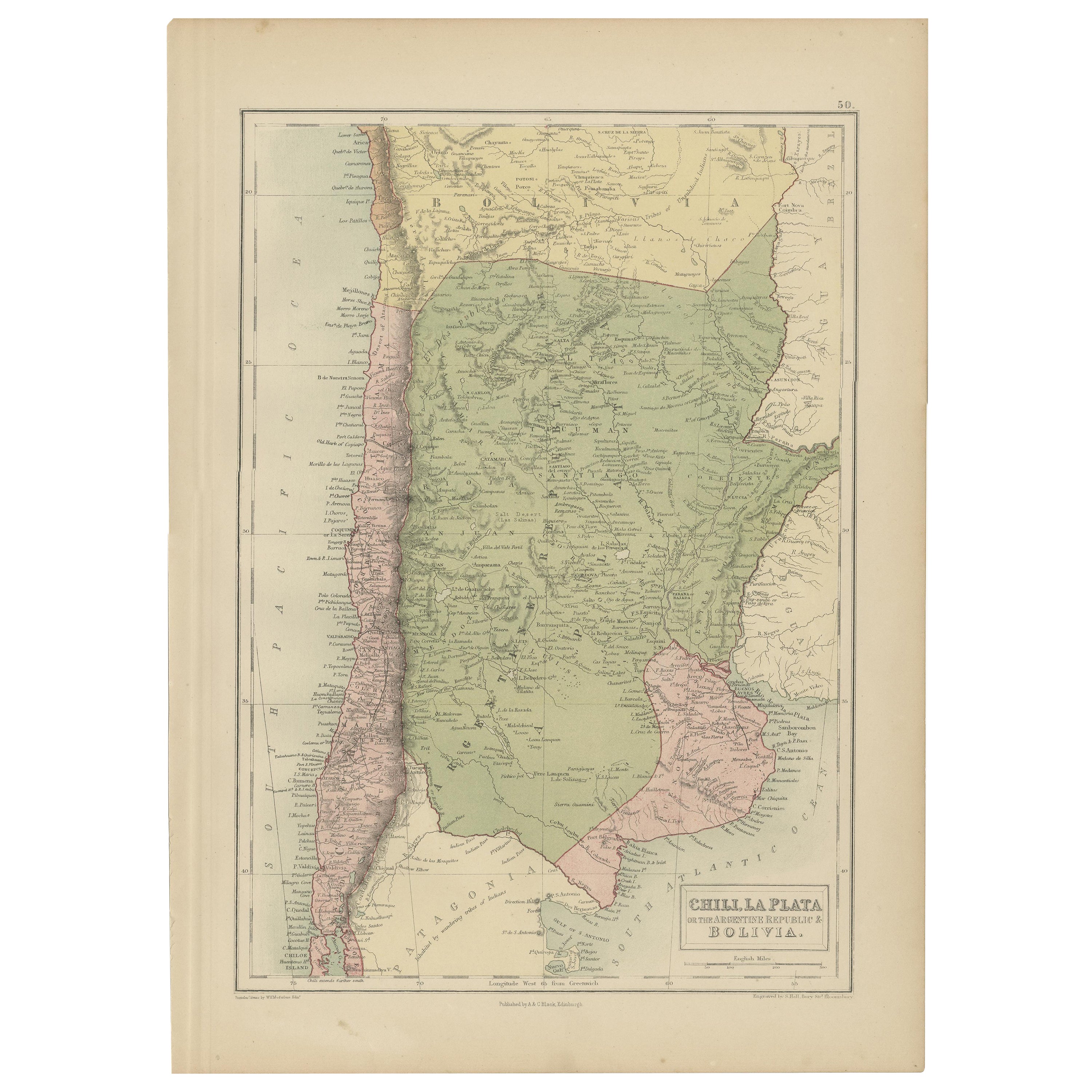
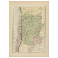
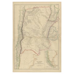
1882 Map of Argentina, La Plata, Chile, Paraguay, Uruguay, and Patagonia
$299.79
£223.02
€250
CA$410.52
A$456.44
CHF 238.33
MX$5,556.04
NOK 3,040.99
SEK 2,849.26
DKK 1,903.11
Shipping
Retrieving quote...The 1stDibs Promise:
Authenticity Guarantee,
Money-Back Guarantee,
24-Hour Cancellation
About the Item
This 1882 map, published as part of the 'Comprehensive Atlas and Geography of the World' by Blackie and Son, provides an intricate depiction of Argentina, La Plata, Chile, Paraguay, Uruguay, and the southern region of Patagonia. This detailed cartographic work captures the geography, political boundaries, and natural features of the region during the late 19th century, showcasing the breadth of knowledge and cartographic skill of the era.
The map highlights the dramatic topography of the Andes Mountains, stretching along Chile's western edge, contrasting with the expansive plains and lowlands of Argentina and the La Plata region. Rivers such as the Paraná, Uruguay, and the Río de la Plata are prominently featured, underscoring their importance as lifelines for commerce and transportation. Key cities, towns, and settlements are carefully marked, offering insight into population centers during this period.
Regional boundaries are clearly delineated with subtle color variations, distinguishing the territories of Argentina, Chile, Uruguay, and Paraguay, as well as the less-settled areas of Patagonia. The map also includes an inset focused on the southern extremities of South America, detailing the rugged coastline, islands, and waterways of Patagonia and Tierra del Fuego.
This map reflects the geopolitical and geographical understanding of South America in 1882, providing valuable historical context for the region's development. With its detailed craftsmanship and aesthetic appeal, this map serves as both an educational resource and a decorative piece for historians, cartographers, and collectors interested in 19th-century South American geography.
Condition Report for the 1882 Map:
- Paper condition: The map is printed on aged paper with natural toning typical of its age. There are no visible tears, creases, or major folds.
- Coloring: The original colors are intact, with soft, muted tones characteristic of 19th-century cartography. The colors appear stable, with no significant fading or discoloration.
- Printing quality: The engraving details are crisp and clear, with text, borders, and topographical features remaining legible and sharp.
- Margin integrity: The margins are clean and wide.
- Damage or repairs: There is no major damage or prior repairs.
Tips for Framing and Matting:
- Frame style: Use a classic frame with a traditional design, such as antique gold, walnut, or dark wood, to complement the historical nature of the map.
- Frame depth: Ensure the frame has enough depth to accommodate UV-protective glass and acid-free matting.
- Matting colors: Choose a double mat:
- Inner mat: Light cream or off-white to match the paper's aged tone.
- Outer mat: Muted colors like sage green, beige, or soft gold to highlight the map’s subtle coloring without overwhelming it.
- Matting material: Use archival-quality, acid-free mat board to prevent further aging or discoloration.
- Glass: Install UV-protective, anti-reflective glass to safeguard the map from light damage while ensuring a clear view.
Proper framing and matting will preserve the map’s condition and enhance its presentation, making it a stunning display piece.
- Dimensions:Height: 22.45 in (57 cm)Width: 14.97 in (38 cm)Depth: 0 in (0.02 mm)
- Materials and Techniques:
- Period:
- Date of Manufacture:1882
- Condition:Good condition, folding line in the middle. The outer borders are slightly discolored due to age, but not the image. This map is ideal for framing. Study the image carefully.
- Seller Location:Langweer, NL
- Reference Number:Seller: BG-13601-2-721stDibs: LU3054343552492
About the Seller
5.0
Recognized Seller
These prestigious sellers are industry leaders and represent the highest echelon for item quality and design.
Platinum Seller
Premium sellers with a 4.7+ rating and 24-hour response times
Established in 2009
1stDibs seller since 2017
2,510 sales on 1stDibs
Typical response time: <1 hour
- ShippingRetrieving quote...Shipping from: Langweer, Netherlands
- Return Policy
Authenticity Guarantee
In the unlikely event there’s an issue with an item’s authenticity, contact us within 1 year for a full refund. DetailsMoney-Back Guarantee
If your item is not as described, is damaged in transit, or does not arrive, contact us within 7 days for a full refund. Details24-Hour Cancellation
You have a 24-hour grace period in which to reconsider your purchase, with no questions asked.Vetted Professional Sellers
Our world-class sellers must adhere to strict standards for service and quality, maintaining the integrity of our listings.Price-Match Guarantee
If you find that a seller listed the same item for a lower price elsewhere, we’ll match it.Trusted Global Delivery
Our best-in-class carrier network provides specialized shipping options worldwide, including custom delivery.More From This Seller
View AllAntique Map of Chile, La Plata and Part of Bolivia by A & C. Black, 1870
Located in Langweer, NL
Antique map titled 'Chili, La Plata & Bolivia'. Original antique map of Chile, La Plata and Part of Bolivia. This map originates from ‘Black's General Atlas o...
Category
Antique Late 19th Century Maps
Materials
Paper
$146 Sale Price
30% Off
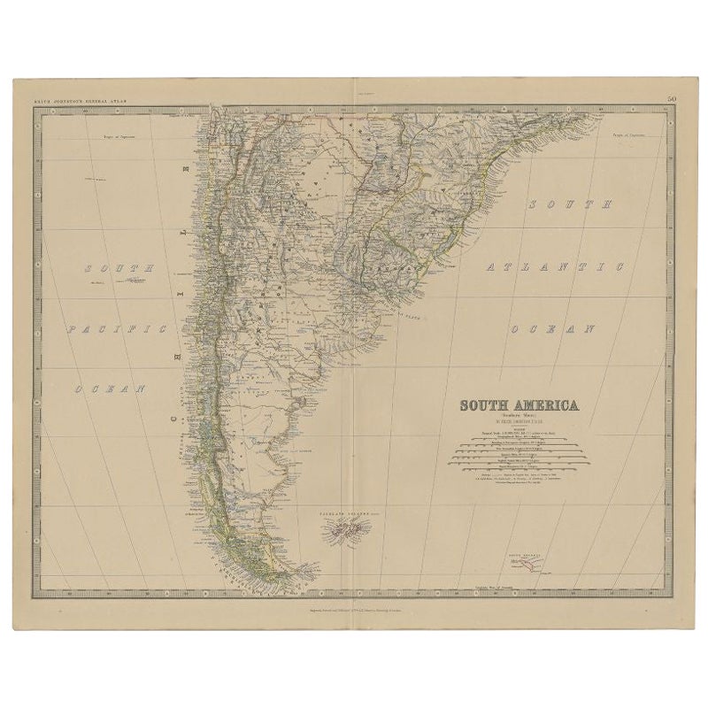
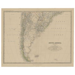
Antique Map of South America, Southern Part, 1882
Located in Langweer, NL
Antique map titled 'South America'. Old map of South America. This map originates from 'The Royal Atlas of Modern Geography, Exhibiting, in a Series of Entirely Original and Authenti...
Category
Antique 19th Century Maps
Materials
Paper
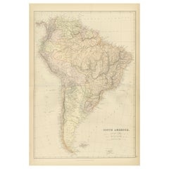
1882 Detailed Map of South America showing Political and Geographical Features
Located in Langweer, NL
This 1882 map of South America, published by Blackie and Son as part of the 'Comprehensive Atlas and Geography of the World,' showcases the continent in remarkable detail. It provide...
Category
Antique 1880s Maps
Materials
Paper
Original Antique Map of Peru in South America, 1875
Located in Langweer, NL
Antique map titled 'Carte générale du Pérou'. Large map of Peru. This map originates from 'Atlas de Géographie Moderne Physique et Politique' by A. Levasse...
Category
Antique Late 19th Century Maps
Materials
Paper

$335 Sale Price
20% Off
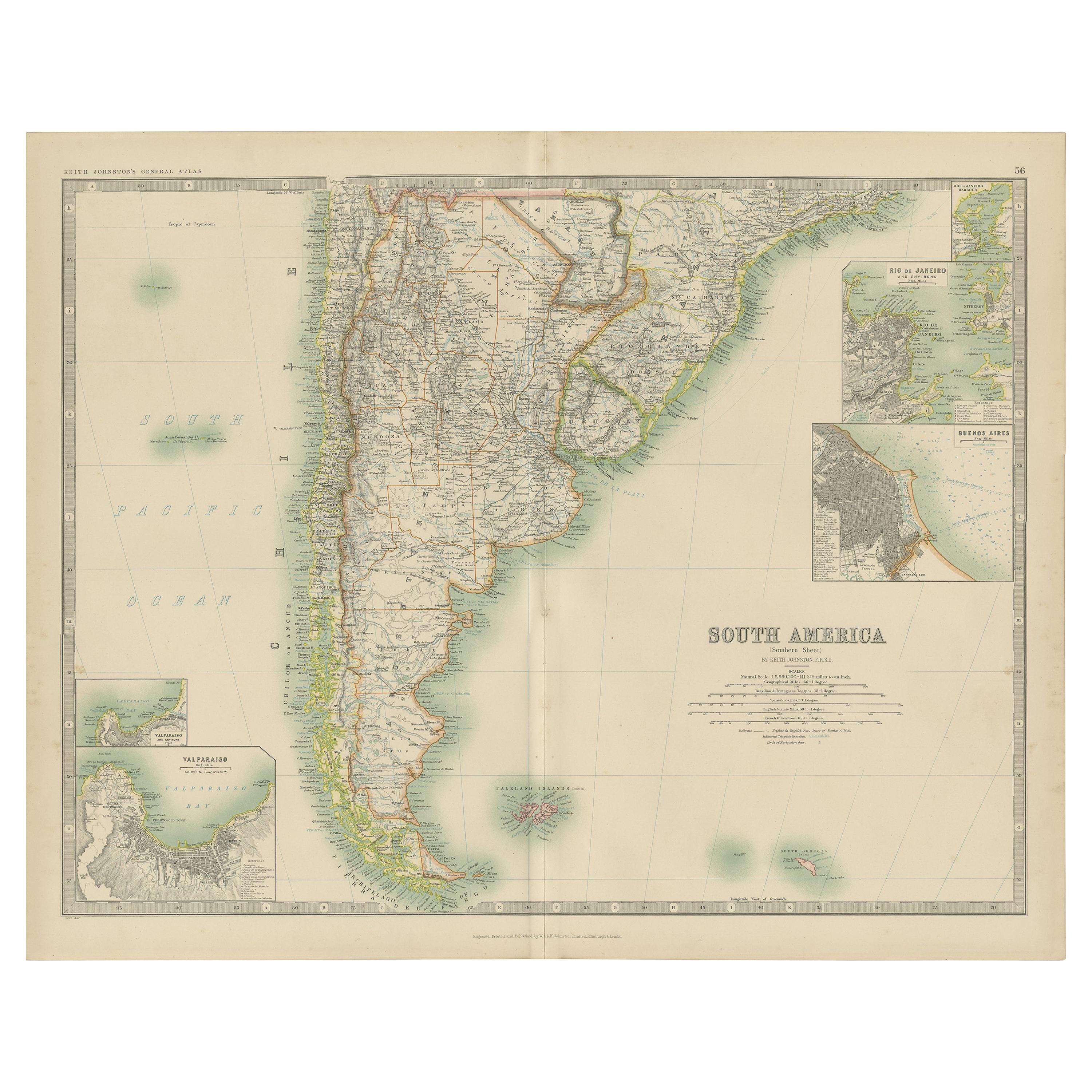
Antique Map of South America by Johnston '1909'
Located in Langweer, NL
Antique map titled 'South America, Southern Sheet'. Depicting Chile, Argentina, Brazil, Patagonia, the Falkland Island and more. With inset maps of Valparaiso, Rio de Janeiro and Bue...
Category
Early 20th Century Maps
Materials
Paper
$239 Sale Price
20% Off
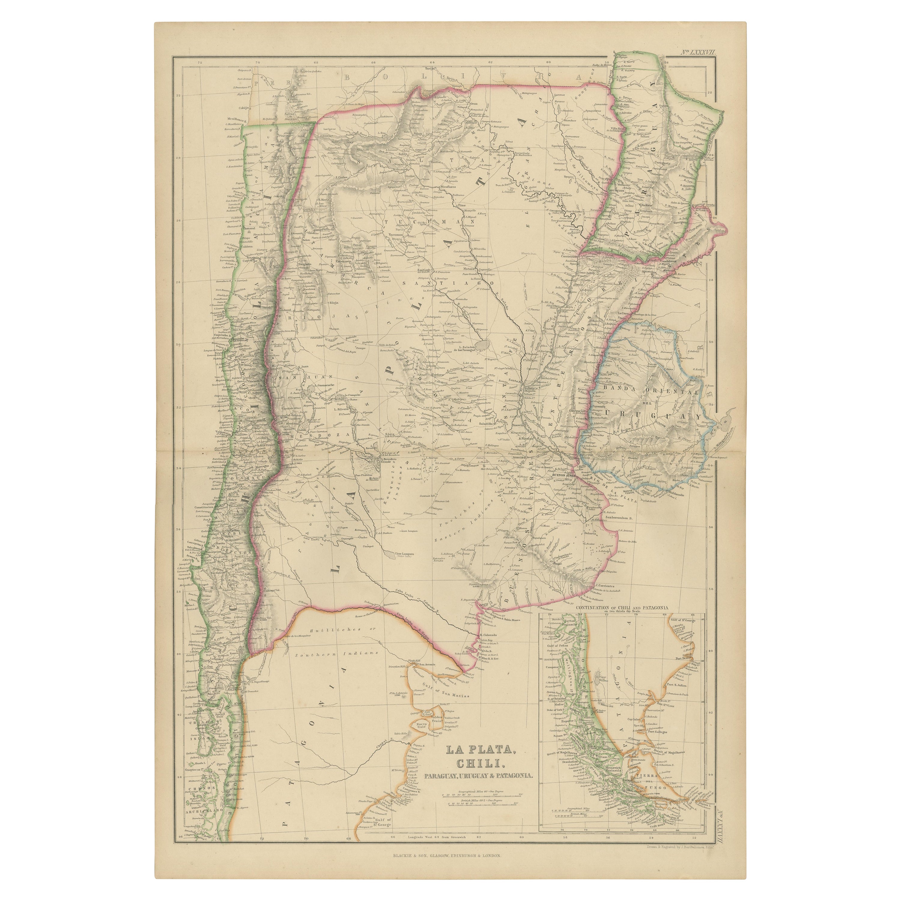
Antique Map of La Plata, Chili, by W. G. Blackie, 1859
Located in Langweer, NL
Antique map titled 'La Plata, Chili, Paraguay, Uruguay and Patagonia'.
Original antique map of La Plata, Chili, Paraguay, Uruguay and Patagonia with inset m...
Category
Antique Mid-19th Century Maps
Materials
Paper
$239 Sale Price
20% Off
You May Also Like
Original Antique Decorative Map of South America-West Coast, Fullarton, C.1870
Located in St Annes, Lancashire
Great map of Chili, Peru and part of Bolivia
Wonderful figural border
From the celebrated Royal Illustrated Atlas
Lithograph. Original color.
Published by Fullarton, Edi...
Category
Antique 1870s Scottish Maps
Materials
Paper

South America, North-West Part. Century Atlas antique vintage map
Located in Melbourne, Victoria
'The Century Atlas. South America, North-West Part'
Original antique map, 1903.
Central fold as issued. Map name and number printed on the reverse corners.
Sheet 40cm by 29.5cm.
Category
Early 20th Century Victorian More Prints
Materials
Lithograph

South America, Eastern Part. Century Atlas antique vintage map
Located in Melbourne, Victoria
'The Century Atlas. South America. Eastern Part'
Original antique map, 1903.
Inset map 'Rio de Janeiro and Vicinity'.
Central fold as issued. Map name and number printed on the rev...
Category
Early 20th Century Victorian More Prints
Materials
Lithograph

Antique Lithography Map, South America, English, Framed, Cartography, Victorian
Located in Hele, Devon, GB
This is an antique lithography map of South America. An English, framed atlas engraving of cartographic interest by John Rapkin , dating to the early Victorian period and later, circ...
Category
Antique Mid-19th Century British Early Victorian Maps
Materials
Wood

Antique Map of South America in Roma Frame
Located in Malibu, CA
Antique map of South America. Displayed in a new Roma frame with museum quality matting. Custom frame in platinum. No print date, but cert...
Category
Antique Late 19th Century Victorian Prints
Materials
Hardwood, Paper

$262 Sale Price
30% Off
Charte von Sud-America (Map of South America) - Etching with Hand-Drawn Outlines
Located in Soquel, CA
Map of south America, engraved by Franz Pluth (Czech, 1800-1871), from the book "Neueste Länder - und Völkerkunde, ein geographisches Lesebuch für alle Stände" by Linder, F. L. (Prag...
Category
1820s Other Art Style More Prints
Materials
Paper, Printer's Ink, Etching

More Ways To Browse
Antique Argentina
Argentine Antique Furniture
Chile Antique Prints
Post Modern High Chairs
Vintage Vine Rug
Silver Metal Chair
Swedish Kilim
Vintage Scandanavian Chairs
Vintage Tropical Furniture
19th Century Red Glass
Antique French Console Table Tables
French 50s
Rusted Metal Art
Silver Bowl Large
Antique French Silk
Down Couch
Cobalt Blue Glass
Used Lighter Art