Items Similar to 18th Century Antique Conrad Lotter Septentrionalis Meridionalis American Maps


Want more images or videos?
Request additional images or videos from the seller
1 of 13
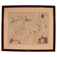
18th Century Antique Conrad Lotter Septentrionalis Meridionalis American Maps
$2,400
$3,00020% Off
£1,854.42
£2,318.0220% Off
€2,143.88
€2,679.8520% Off
CA$3,391.37
CA$4,239.2220% Off
A$3,803.65
A$4,754.5620% Off
CHF 1,991.91
CHF 2,489.8920% Off
MX$46,218.07
MX$57,772.5920% Off
NOK 25,293.96
NOK 31,617.4520% Off
SEK 23,980.46
SEK 29,975.5720% Off
DKK 16,002.94
DKK 20,003.6820% Off
About the Item
Pair of rare hand colored maps from the 1770's, depicting "America Septentrionalis" (North America), engraved by Georg Friedrich Lotter and America Meridionalis (South America), engraved by Gustav Conrad Lotter. Silver painted wood frame.
Georg Friedrich Lotter (1744-1801) and Gustav Conrad Lotter (1746-1776) were brothers to Matthaus Albrecht Lotter (1741-1810) and all German engravers / mapmakers and sons of Tobias Conrad Lotter (1717-1777) who had inherited the business from Matthaus Seutter. T.C. Lotter and his sons succeeded in building on the success and professional reputation of Seutter's work, becoming one of the most prominent mid-18th century map publishers working in the German school. After T.C.'s death the firm began to decline. It was passed on to the next generation of Lotters, Gabriel (1776-1857) and Georg Friedrich (1787-1864), but faded out of business in the early 19th century. (Source: Geographicaus)
Dimensions:
25" x 1.25" x 20" / Sans Frame - 23.25" x 18.5" (Width x Depth x Height)
- Dimensions:Height: 20 in (50.8 cm)Width: 1.25 in (3.18 cm)Depth: 25 in (63.5 cm)
- Materials and Techniques:Paper,Engraved
- Period:
- Date of Manufacture:18th Century
- Condition:Wear consistent with age and use. some foxing/discoloration; creases; couple of cracks to frames.
- Seller Location:Dayton, OH
- Reference Number:Seller: 419201stDibs: LU5343240614802

About the Seller
5.0
Platinum Seller
Premium sellers with a 4.7+ rating and 24-hour response times
Established in 2010
1stDibs seller since 2020
1,597 sales on 1stDibs
Typical response time: <1 hour
- ShippingRetrieving quote...Shipping from: Dayton, OH
- Return Policy
Authenticity Guarantee
In the unlikely event there’s an issue with an item’s authenticity, contact us within 1 year for a full refund. DetailsMoney-Back Guarantee
If your item is not as described, is damaged in transit, or does not arrive, contact us within 7 days for a full refund. Details24-Hour Cancellation
You have a 24-hour grace period in which to reconsider your purchase, with no questions asked.Vetted Professional Sellers
Our world-class sellers must adhere to strict standards for service and quality, maintaining the integrity of our listings.Price-Match Guarantee
If you find that a seller listed the same item for a lower price elsewhere, we’ll match it.Trusted Global Delivery
Our best-in-class carrier network provides specialized shipping options worldwide, including custom delivery.More From This Seller
View AllAntique Colored Belgium Map Flandria Gallica Flanders Henricus Hondius
Located in Dayton, OH
Antique hand colored map of Flanders, Belgium, engraved by Henricus Hondius.
Sans frame - 21.25” x 18”.
Category
Antique 19th Century Renaissance Maps
Materials
Paper

$280 Sale Price
20% Off
Vincenzo Coronelli's Colored Map of the New World Western Hemisphere Framed 47"
By Vincenzo Coronelli
Located in Dayton, OH
A Framed Reproduction of Coronelli's Map of the New World, Attributed to Trevor James Company. The map shows the Western Hemisphere including the discoveries made by Abel Tasman in A...
Category
20th Century Maps
Materials
Paper

$1,080 Sale Price
20% Off
Antique 1844 J Calvin Smith JH Colton Midwest United States Survey Map 27"
By J.H. Colton
Located in Dayton, OH
Antique framed black and white map of seven Midwestern American states. Guide Through Ohio, Michigan, Indiana, Illinois, Missouri, Wisco...
Category
Antique 1840s Maps
Materials
Paper

$940 Sale Price
20% Off
Vintage Oversized New York City Lower Manhattan 1840s Map Print
Located in Dayton, OH
Vintage late 20th century reproduction print of New York City featuring lower Manhattan in 1840.
Category
Late 20th Century Victorian Maps
Materials
Paper

$800 Sale Price
20% Off
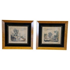
2 Antique English Colonial Birdseye Maple Colored Etching Prints 9"
Located in Dayton, OH
Two antique colored etchings / prints featuring birds eye maple frame and reverse painted glass borders. One scene features four children playing war with a blue coated general lead...
Category
Early 20th Century British Colonial Prints
Materials
Paper
$140 Sale Price / set
20% Off
20th Century Large Vintage Oval Wall Map of the World Globe Conference Table 13'
Located in Dayton, OH
Monumental oval classroom map of the world / wall globe from the second half of the 20th century. A two piece sculpture design made with heavy wood and metal trim paneling. Can be ...
Category
20th Century Maps
Materials
Metal

$2,400 Sale Price
20% Off
You May Also Like
Vintage Reproduction 17th Century Map of Europe, American, Cartography, Blaeuw
Located in Hele, Devon, GB
This is a vintage reproduction map of Europe. An American, paper stock cartography print in frame after the work by Blaeuw, dating to the late 20t...
Category
Late 20th Century Central American Mid-Century Modern Maps
Materials
Glass, Wood, Paper

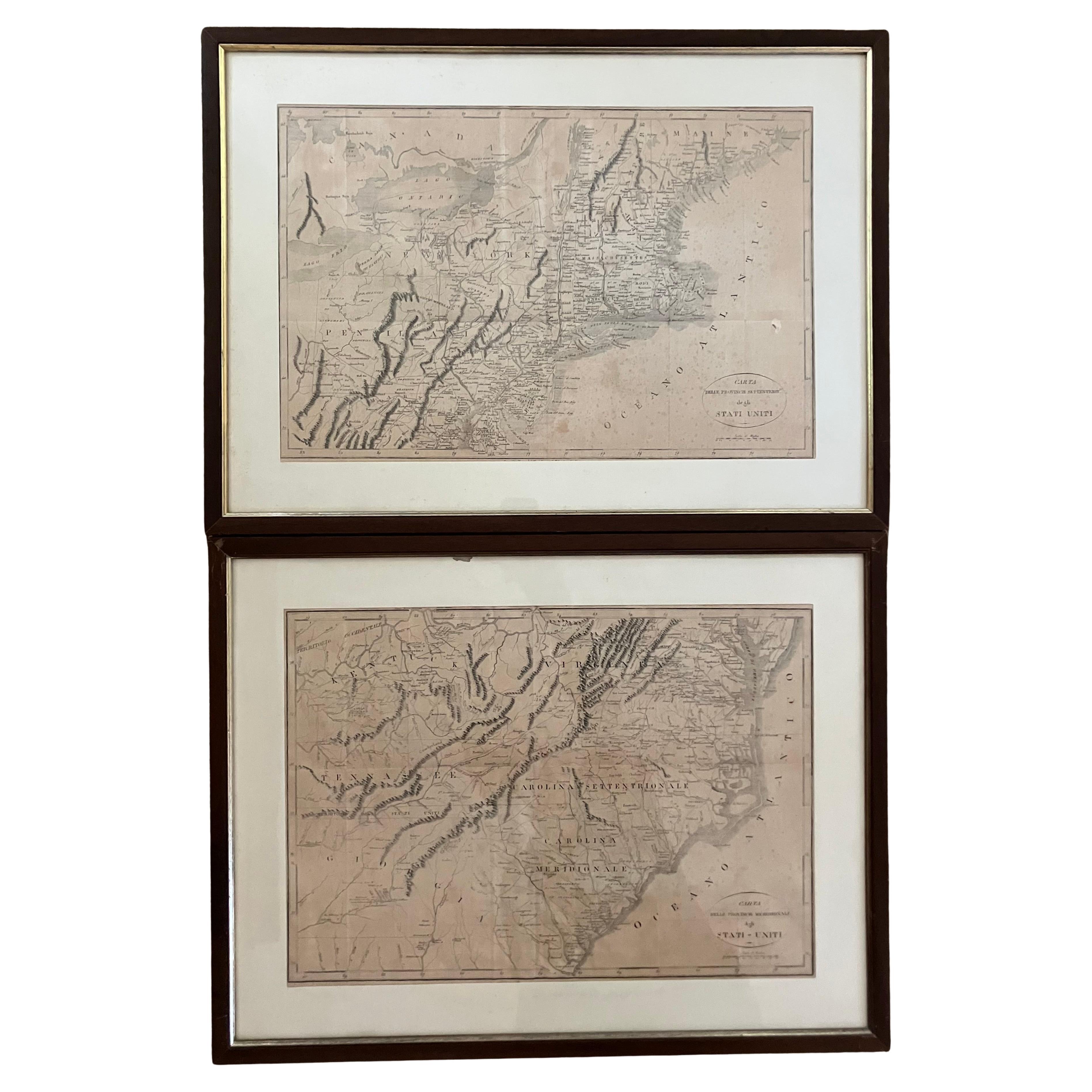
Pair Antique Italian Maps of the North American Eastern Seaboard
Located in New York, NY
Pair antique Italian maps of the North American Eastern Seaboard. Late 18th early 19th century original Italian documentation of the East Coast of the United States from Passamaquadd...
Category
Antique Late 18th Century Italian Maps
Materials
Wood, Paper

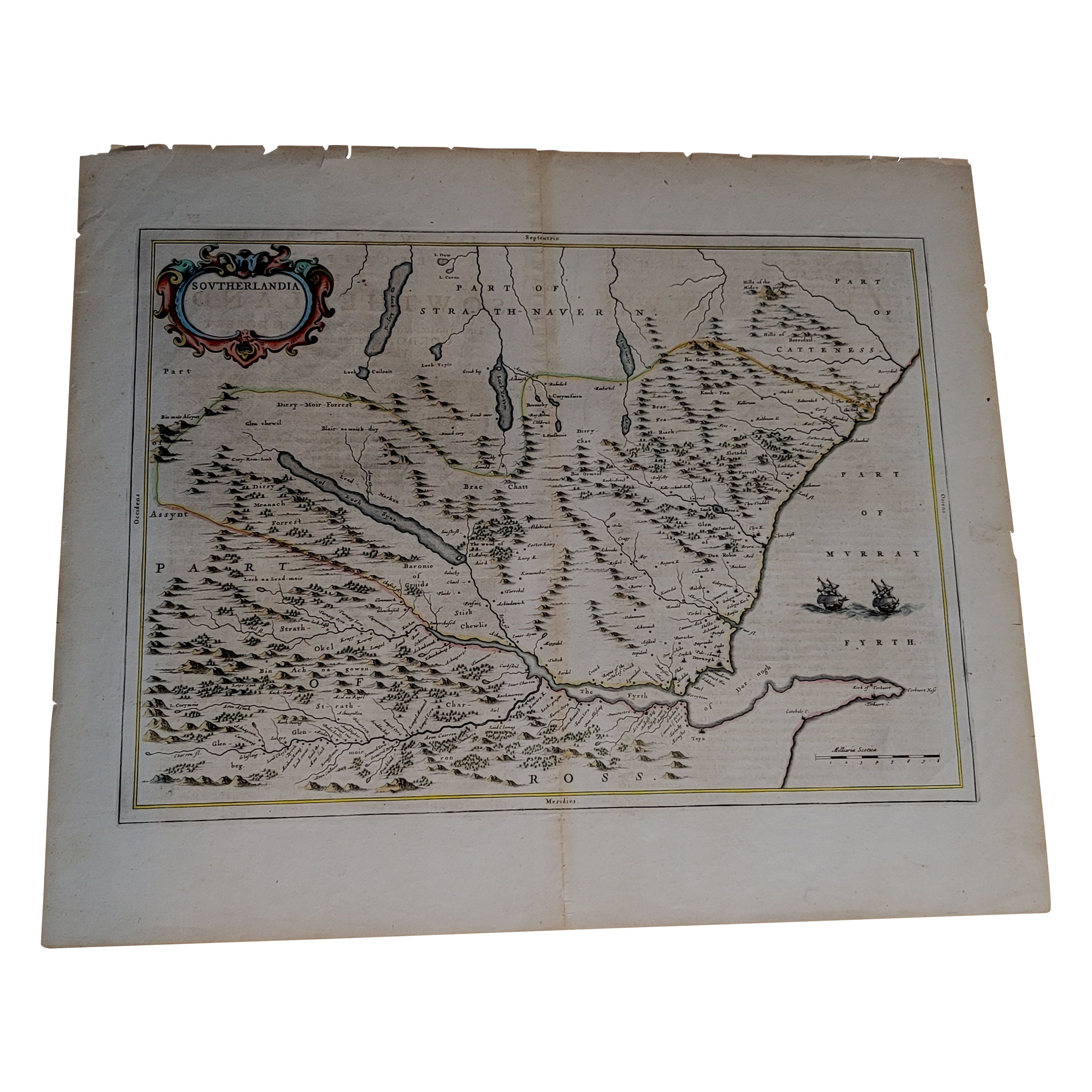
1654 Joan Blaeu Map the Sutherland, Scotland, Entitled "Southerlandia, "Ric0007
Located in Norton, MA
1654 Joan Blaeu map of the
Sutherland, Scotland, entitled
"Southerlandia,"
Hand Colored
Ric0007
Description:
Lovely map centered on Sedan and D...
Category
Antique 17th Century Dutch Maps
Materials
Paper

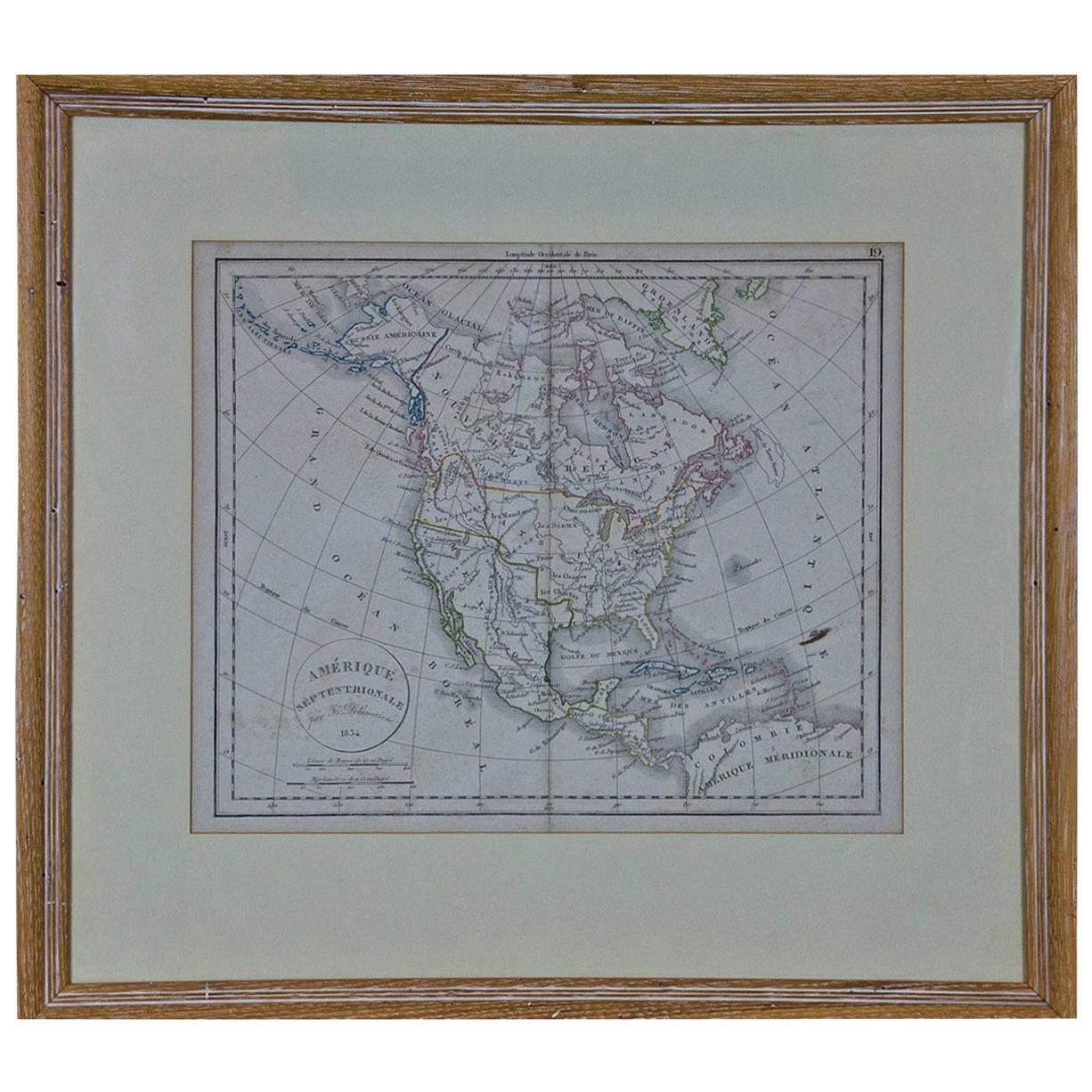
America "Amérique Septentrionale": A 19th Century French Map by Delamarche
By Maison Delamarche 1
Located in Alamo, CA
This framed mid 19th century map of North America entitled "Amérique Septentrionale" by Felix Delamarche was published in Paris in 1854 by Quay de l'Horloge du Palais, avec les Carte...
Category
Antique Mid-19th Century American Other Maps
Materials
Paper

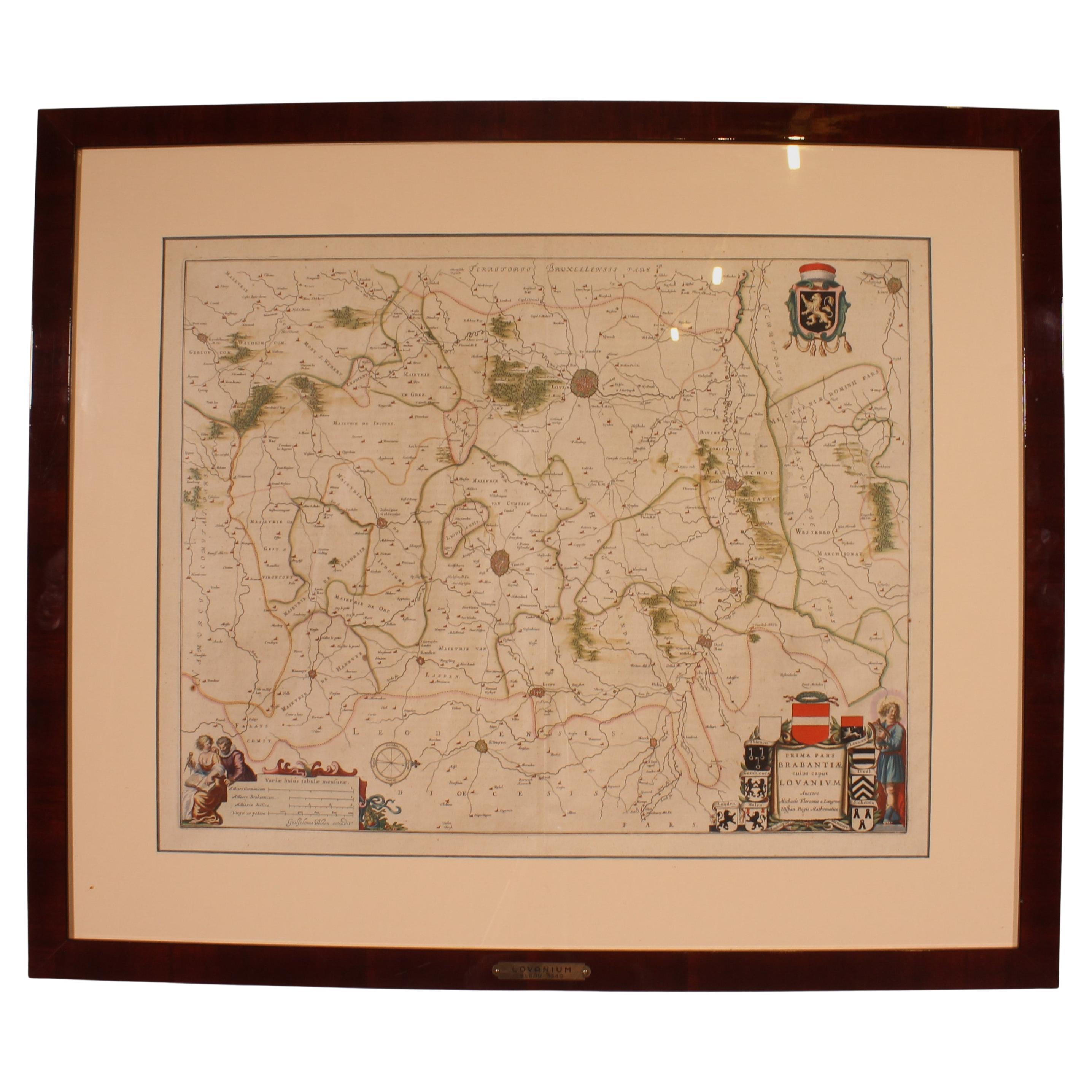
Antique Map Of Lovanium By Bleau Circa 1640
Located in Brussels, Brussels
map of the brabent of leuven (Belgium) circa 1640 by Bléau. Bléau was well known for antique atlas that he draw during the 17 century
beautiful map, double page folded in the middle,...
Category
Antique 17th Century French Renaissance Prints
Materials
Paper
Antique Map of Asia 'in Frame, circa 1739'
Located in Langweer, NL
Antique map titled 'Asia Dividida em suas Regioens & Principaes Estados'. Rare and uncommon map of Asia. Signed '1739'. Source unknown, to be determined.
...
Category
Antique Mid-18th Century Maps
Materials
Paper

$605 Sale Price
35% Off
More Ways To Browse
Antique American 18th Century Furniture
18th Century American Antiques
Antique German 18th Century
18th Century American Silver
18th Century Painted American Furniture
Tobias Antique
Silver 1776
Silver Over Copper
Vintage Barware Glasses
Coffee Table Black Italian Modern
Christofle America
Iranian Silk Rug Carpet
Poul Moller
Tables With Inlaid Wood
World War Table
Antonio Jacobsen
Ariston Chairs
Coffee Tables Europe