Items Similar to Ancient Cartography of the Indian Subcontinent, Published in 1880

Want more images or videos?
Request additional images or videos from the seller
1 of 7
Ancient Cartography of the Indian Subcontinent, Published in 1880
$354.65
$443.3120% Off
£263.97
£329.9620% Off
€296
€37020% Off
CA$485.78
CA$607.2320% Off
A$540.30
A$675.3720% Off
CHF 282.13
CHF 352.6620% Off
MX$6,574.83
MX$8,218.5420% Off
NOK 3,603.18
NOK 4,503.9720% Off
SEK 3,379.15
SEK 4,223.9320% Off
DKK 2,253.34
DKK 2,816.6820% Off
Shipping
Retrieving quote...The 1stDibs Promise:
Authenticity Guarantee,
Money-Back Guarantee,
24-Hour Cancellation
About the Item
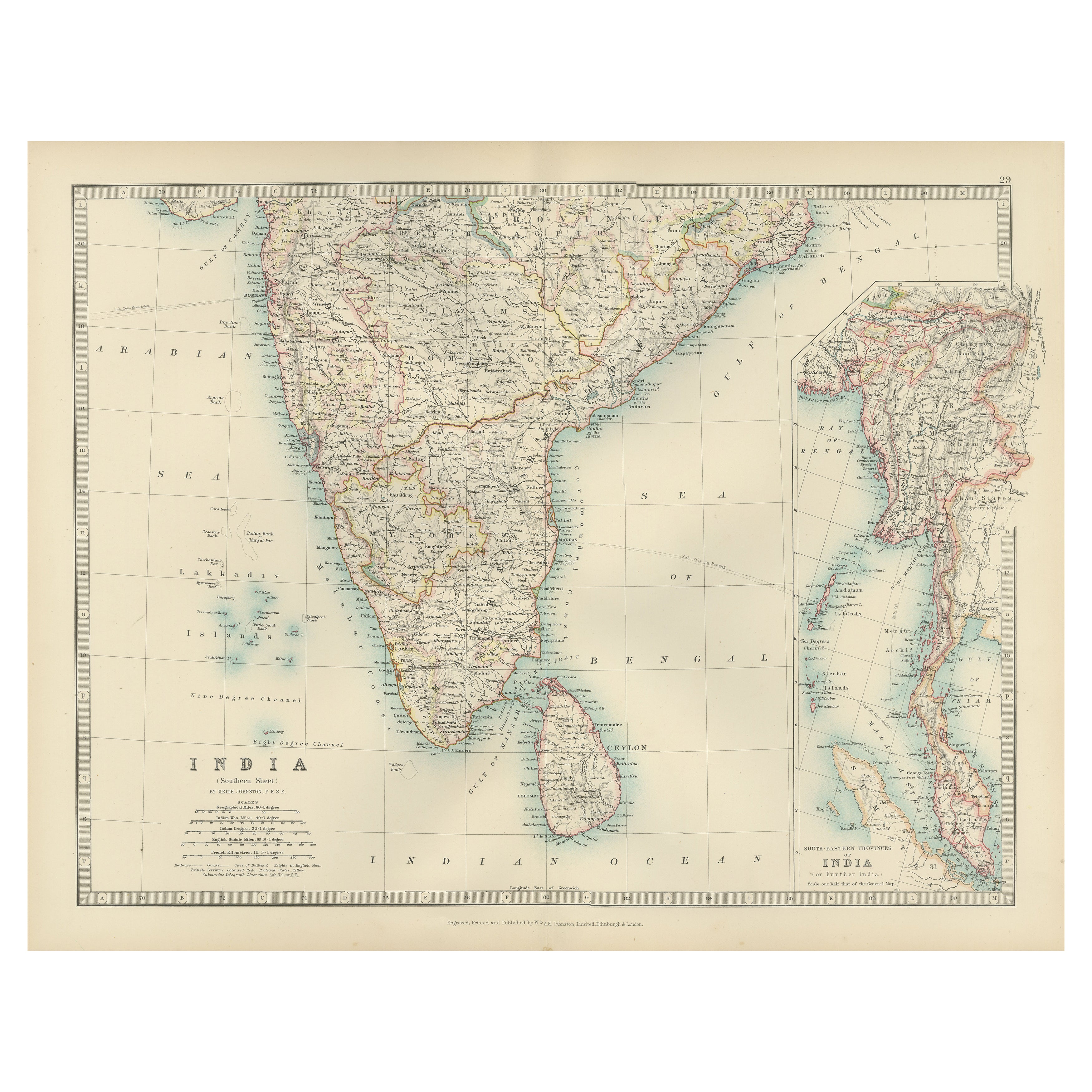
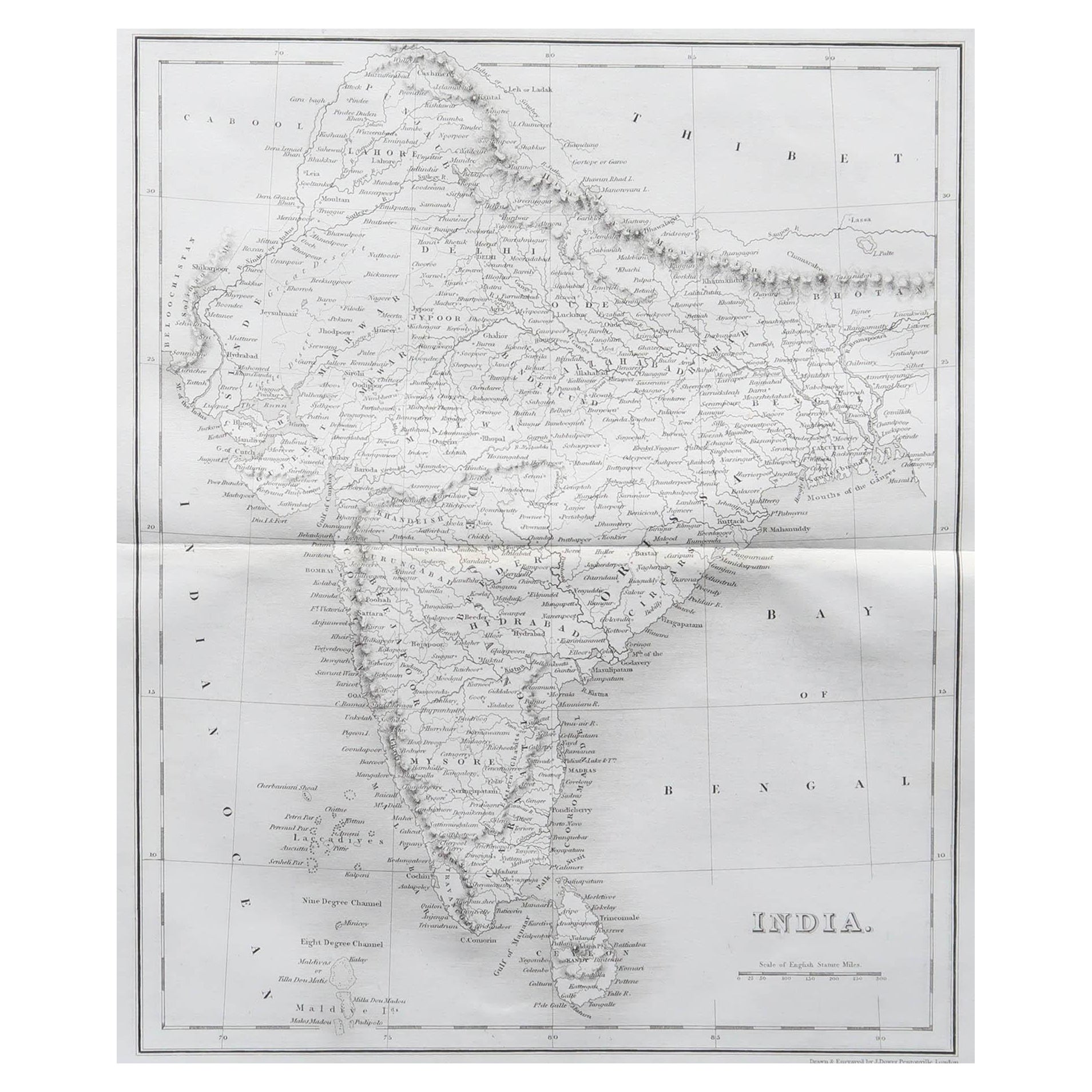
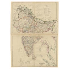
This map is titled "INDIA," and it provides a detailed view of the Indian subcontinent with various inset maps that offer additional historical and geographical context.
The main map displays the Indian subcontinent with regions labeled in Latin, indicative of the territories as known in ancient and classical times. The map features:
1. **Geographical Features**: The Himalayas, the extensive river systems including the Ganges and Indus, and the outline of the subcontinent with its peninsular south.
2. **Political Divisions**: It might show ancient political divisions such as the Maurya and Gupta empires or regions under control of various dynasties and states before European colonization.
3. **Inset Maps**: These provide close-ups of significant regions or areas with historical importance, such as the Ganges river valley or trade routes.
4. **Historical Routes**: The map could include ancient trade routes like the Silk Road and maritime paths used by traders to reach Southeast Asia, the Middle East, and East Africa.
5. **Latin Labels**: Following the convention of the time it was created, the map uses Latin for place names, which aligns with its educational and scholarly purposes.
6. **Topographical Details**: Mountain ranges, plateaus, and coastal lines are depicted, showing the diverse topography of India.
This map is from the "Spruner-Menke Atlas Antiquus". The time period the map represents could span from the ancient Vedic period through successive empires like the Mauryan and Gupta empires up to the medieval period, reflecting the knowledge of India available to European scholars in the 19th century. This map would be of particular interest to historians of ancient India and those studying the historical geography of the subcontinent.
- Dimensions:Height: 15.56 in (39.5 cm)Width: 18.51 in (47 cm)Depth: 0 in (0.02 mm)
- Materials and Techniques:
- Period:
- Date of Manufacture:1880
- Condition:Good, given age. General age-related toning, especially around the edges. Vertical folding line as issued. Please study scan carefully.
- Seller Location:Langweer, NL
- Reference Number:Seller: BG-13686-2-181stDibs: LU3054338541582
About the Seller
5.0
Recognized Seller
These prestigious sellers are industry leaders and represent the highest echelon for item quality and design.
Platinum Seller
Premium sellers with a 4.7+ rating and 24-hour response times
Established in 2009
1stDibs seller since 2017
2,502 sales on 1stDibs
Typical response time: <1 hour
- ShippingRetrieving quote...Shipping from: Langweer, Netherlands
- Return Policy
Authenticity Guarantee
In the unlikely event there’s an issue with an item’s authenticity, contact us within 1 year for a full refund. DetailsMoney-Back Guarantee
If your item is not as described, is damaged in transit, or does not arrive, contact us within 7 days for a full refund. Details24-Hour Cancellation
You have a 24-hour grace period in which to reconsider your purchase, with no questions asked.Vetted Professional Sellers
Our world-class sellers must adhere to strict standards for service and quality, maintaining the integrity of our listings.Price-Match Guarantee
If you find that a seller listed the same item for a lower price elsewhere, we’ll match it.Trusted Global Delivery
Our best-in-class carrier network provides specialized shipping options worldwide, including custom delivery.More From This Seller
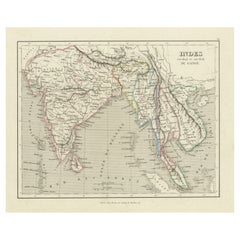
View AllAntique Map of India to Southeast Asia
Located in Langweer, NL
Antique map titled 'Indes en-decà et au-delà du Gange'. Original old map of India to Southeast Asia, showing India, Nepal, Bhutan, Sri Lanka (Ceylon), Myanmar (Birma), part of Indone...
Category
Antique Mid-19th Century Maps
Materials
Paper
$182 Sale Price
20% Off
Antique Map of Southern India and South Eastern Provinces, 1903
Located in Langweer, NL
Title: Antique Map of Southern India and South Eastern Provinces, 1903, with Intricate Detail
Description:
This antique map, titled "India (Southern Sheet) and the South Eastern Pro...
Category
Early 20th Century Maps
Materials
Paper
Antique Map of Asia with Intricate Provincial Boundaries, Published in 1903
Located in Langweer, NL
Title: Antique Map of Asia, 1903, with Intricate Provincial Boundaries and Coastal Features
Description:
This antique map, titled "Asia," was engraved and published in 1903 by the r...
Category
Early 20th Century Maps
Materials
Paper
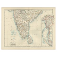
Vintage Cartographic Collection Set of India Explored - W. G. Blackie's 1859
Located in Langweer, NL
Antique map titled 'India'. Original antique map of India with inset maps of Pegu, the Tenasserim Provinces, straits settlements. This map originate...
Category
Antique Mid-19th Century Maps
Materials
Paper
$383 Sale Price / set
20% Off
Cartographic Elegance: The British Raj's India, 1882 Atlas by Blackie and Son
Located in Langweer, NL
These two maps are part of an 1882 atlas published by Blackie and Son, a notable publishing company in the 19th century known for their educational books and detailed atlases. The ma...
Category
Antique 1880s Maps
Materials
Paper

$421 Sale Price / set
20% Off
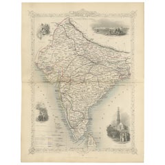
Mid-19th Century Decorative Map of India with Cultural and Natural Vignettes
Located in Langweer, NL
The Tallis maps, including the one of India, are known for their detailed and ornamental style. They were produced during the mid-19th century, a time when cartographic publishing became as much an art form as a means of geographic representation.
John Tallis & Company, founded by John Tallis, was known for creating maps with elaborate borders and vignettes surrounding the map itself. These maps often included illustrations that depicted scenes representative of the region's culture, significant local wildlife, architectural landmarks, and portraits of indigenous peoples...
Category
Antique 1850s Maps
Materials
Paper
$297 Sale Price
20% Off
You May Also Like
Original Antique Map of India by Dower, circa 1835
Located in St Annes, Lancashire
Nice map of India
Drawn and engraved by J.Dower
Published by Orr & Smith. C.1835
Unframed.
Free shipping
Category
Antique 1830s English Maps
Materials
Paper

India (Southern Sheet), English antique map by Alexander Keith Johnston, 1901
Located in Melbourne, Victoria
'India (Southern Sheet)', antique lithographic map by Keith Johnston.
Inset maps of 'Bombay Island & Town', 'Madras & Environs', and 'South-Eastern Provinces of India'.
Central vertical fold as issued.
495mm by 625mm (sheet)
Alexander Keith...
Category
Early 20th Century Victorian More Prints
Materials
Lithograph

Antique 1803 Italian Map of Asia Including China Indoneseia India
Located in Amsterdam, Noord Holland
Antique 1803 Italian Map of Asia Including China Indoneseia India
Very nice map of Asia. 1803.
Additional information:
Type: Map
Country of Manufacturing: Europe
Period: 19th centu...
Category
Antique 19th Century European Maps
Materials
Paper

$584 Sale Price
20% Off
Large Original Vintage Map of India, circa 1920
Located in St Annes, Lancashire
Great map of India
Original color.
Good condition / repair to some minor damage just above Sri Lanka. Shown in the last image.
Published by Alexander Gross
Unframed.
Category
Vintage 1920s English Maps
Materials
Paper

Railway Map of India.
Located in London, GB
THUILLIER, Colonel Henry Ravenshaw.
Railway Map of India. Railways Brought up to October 1895. Scale 1 Inch = 48 miles or 1:3,041,280.
[Calcutta], Published under the direction of Colonel H. Thuillier, R.E., Surveyor General of India, October 1890.
A comprehensive railway map of British India, including the subcontinent and Burma, also displaying the main road networks, navigable canals, steamship routes, and telegraph connections across the peninsular. This publication by the Survey of India Office includes a useful ‘References’ key giving information on the differing gauges in use across the region, and a colour code highlighting the lands under direct British administration in pink, ‘Tributary States’ in yellow and ‘Independent & Foreign Possessions’ in Green. A notice records the price for colour as ‘Five Rupees’, as against ‘Four Rupees’ without.
Prepared under the direction of Colonel Henry Ravenshaw Thuillier, who as his father before him, served as Surveyor General of India from 1887 to 1895. Here Baluchistan is shown as an enclave of the British Raj. This strategically important territory lies in modern-day Pakistan, and is situated around the natural fort town of Quetta located high in the Chiltan mountains. It came under direct British rule in 1876, securing the vital Bolan Pass though which British troops under the command of General Michael Biddulph passed during the Second Anglo-Afghan War...
Category
1890s Other Art Style More Art
Materials
Lithograph
Map Of India - Original Lithograph - 19th Century
Located in Roma, IT
Map of India is an original lithograph artwork realized by an Anonymous engraver of the 19th Century.
Printed in the series of "France Pittoresque".
Titled "France Pittoresque".
...
Category
19th Century Modern Figurative Prints
Materials
Lithograph

More Ways To Browse
Antique South Indian Furniture
Silk Map
Vintage Wood Table With Glass Top
19th Century Square Table
Galle Chairs
Large Chinese Rug
1940s Vintage French Art Deco
20th Century Spanish Table
Antonio Bellini
Retro Fiberglass Furniture
Shipping Crate
Antique Oushak Carpets
Blue Coffee Tables
German Bauhaus Posters
1945 Chair Juhl
Antique Three Leg Table
Folke Arstrom
Silver Over Copper