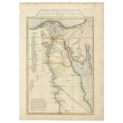
Ancient Egypt Map – Ægyptus Antiqua by D’Anville, Paris circa 1765
View Similar Items


Video Loading
Want more images or videos?
Request additional images or videos from the seller
1 of 12
Ancient Egypt Map – Ægyptus Antiqua by D’Anville, Paris circa 1765
Price:$518.90
$625.03List Price
About the Item
- Dimensions:Height: 22.01 in (55.9 cm)Width: 15.99 in (40.6 cm)Depth: 0.01 in (0.2 mm)
- Materials and Techniques:Paper,Engraved
- Period:
- Date of Manufacture:circa 1765
- Condition:Good condition with wide margins and original outline color. Some minor age toning around the edges, and a small number in manuscript ink at upper right. No significant tears or repairs. Paper is strong and well-preserved.
- Seller Location:Langweer, NL
- Reference Number:Seller: BG-12763-51stDibs: LU3054345439552
About the Seller
5.0
Recognized Seller
These prestigious sellers are industry leaders and represent the highest echelon for item quality and design.
Platinum Seller
Premium sellers with a 4.7+ rating and 24-hour response times
Established in 2009
1stDibs seller since 2017
2,513 sales on 1stDibs
Authenticity Guarantee
In the unlikely event there’s an issue with an item’s authenticity, contact us within 1 year for a full refund. DetailsMoney-Back Guarantee
If your item is not as described, is damaged in transit, or does not arrive, contact us within 7 days for a full refund. Details24-Hour Cancellation
You have a 24-hour grace period in which to reconsider your purchase, with no questions asked.Vetted Professional Sellers
Our world-class sellers must adhere to strict standards for service and quality, maintaining the integrity of our listings.Price-Match Guarantee
If you find that a seller listed the same item for a lower price elsewhere, we’ll match it.Trusted Global Delivery
Our best-in-class carrier network provides specialized shipping options worldwide, including custom delivery.More From This Seller
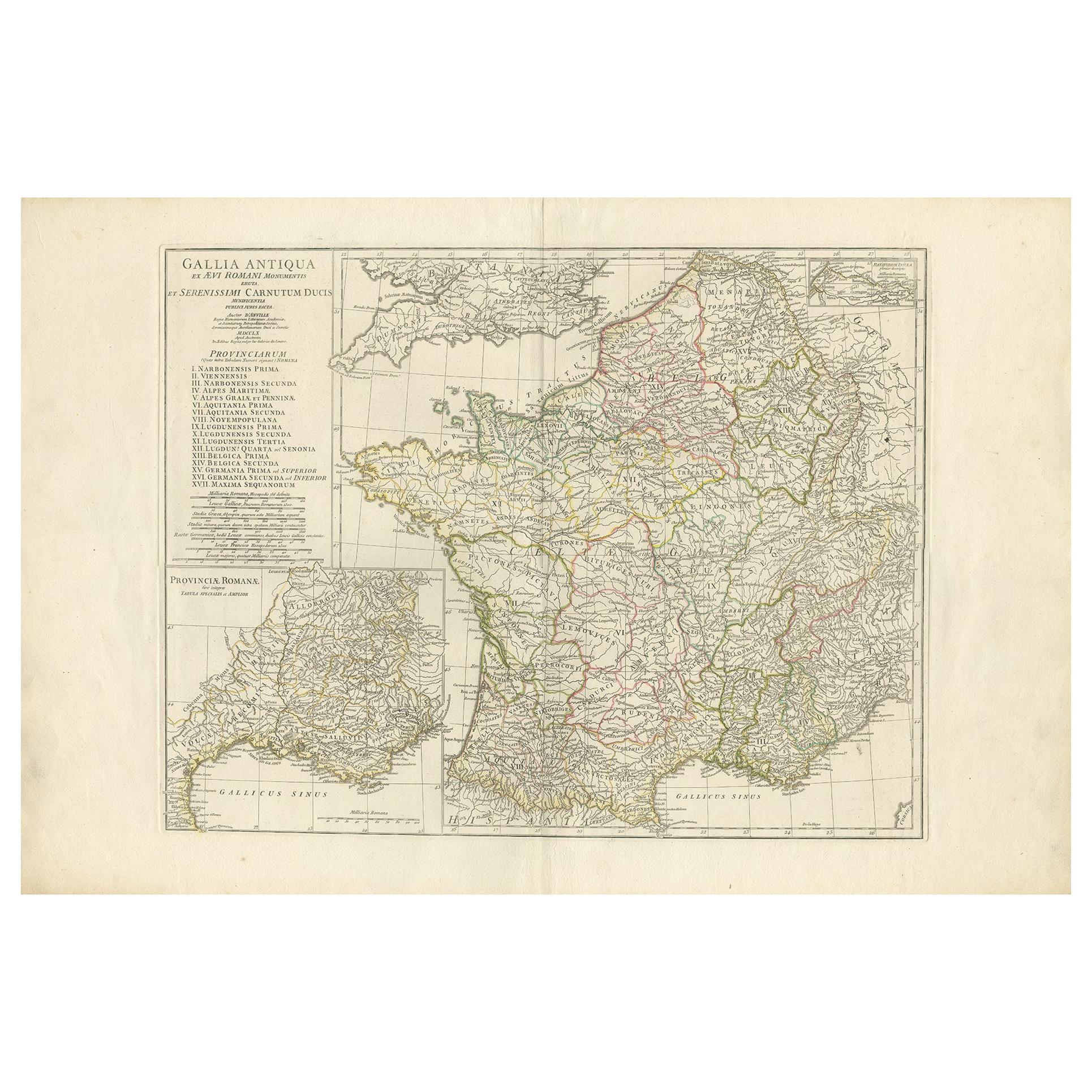
View AllAntique Map of France in Ancient Roman Times by d'Anville, c.1795
Located in Langweer, NL
Antique map titled 'Gallia Antiqua ex Aevi Romani Monumentis (..)'. Original, large, map of France in ancient Roman times. Bottom left, a large inset shows Gallia's southern most Rom...
Category
Antique Late 18th Century French Maps
Materials
Paper

$661 Sale Price
30% Off
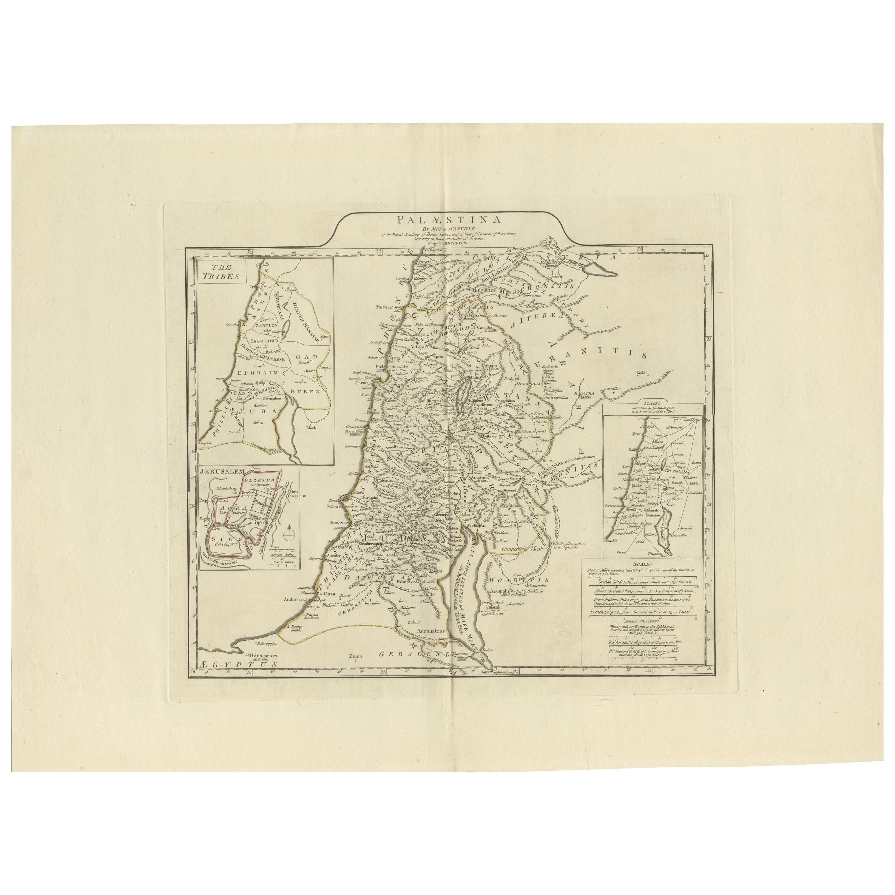
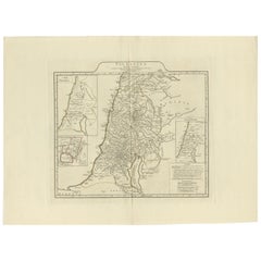
1767 D’Anville Map of the Holy Land: Ancient Divisions and Biblical Geography
Located in Langweer, NL
Ancient Map of Palestine or the Holy Land by D'Anville (1767)
This detailed map, created by the renowned French cartographer Jean Baptiste Bourguignon d'Anville in 1767, depicts the...
Category
Antique 1670s Maps
Materials
Paper
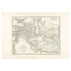
Empire of the Parthians: Historical Cartographic Masterpiece by d'Anville, 1819
Located in Langweer, NL
Description:
Ancient map of the Parthian Empire (19th century), original engraving extracted from the atlas of the history of the emperors from 1819, based on the history of the Rom...
Category
Antique 1810s Maps
Materials
Paper
$93 Sale Price
20% Off
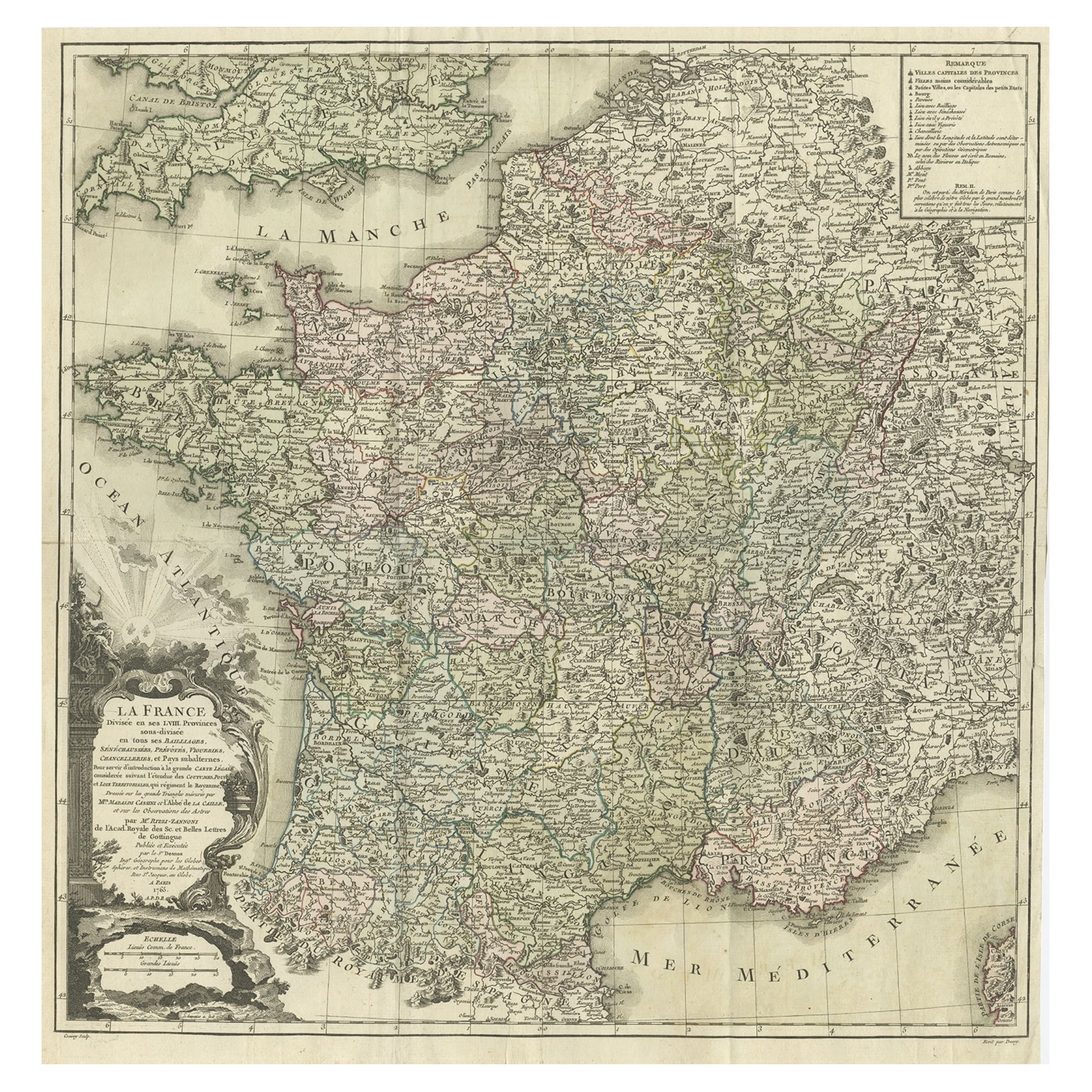
Antique Map of ancient France by Zannoni, 1765
Located in Langweer, NL
Antique map France titled 'Galliae Veteris (..)'. Beautiful old map of France. This map originates from 'Atlas Historique de la France Ancienne et Moderne' ...
Category
Antique 18th Century Maps
Materials
Paper

$302 Sale Price
20% Off
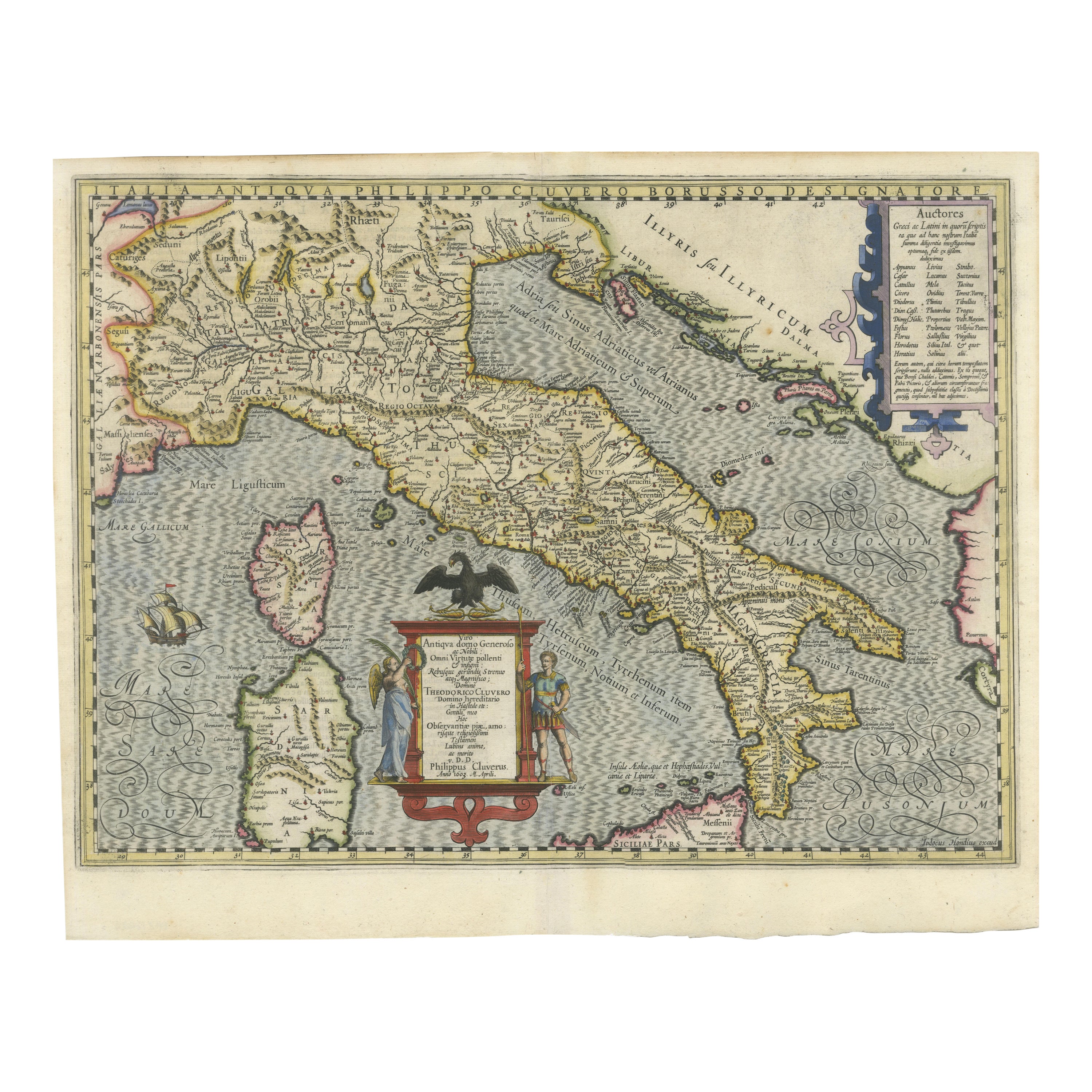
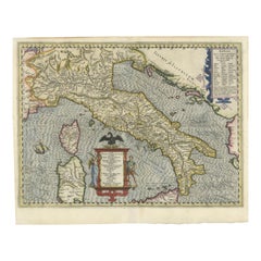
Italia Antiqua Philippo Cluvero – 1603 Hondius Map of Ancient Italy, Handcolored
Located in Langweer, NL
Italia Antiqua Philippo Cluvero – 1603 Hondius Map of Ancient Italy with Hand Color
This stunning early 17th-century map, *Italia Antiqua Philippo Cluvero Borusso Designatore*, wa...
Category
Antique Early 1600s Maps
Materials
Paper
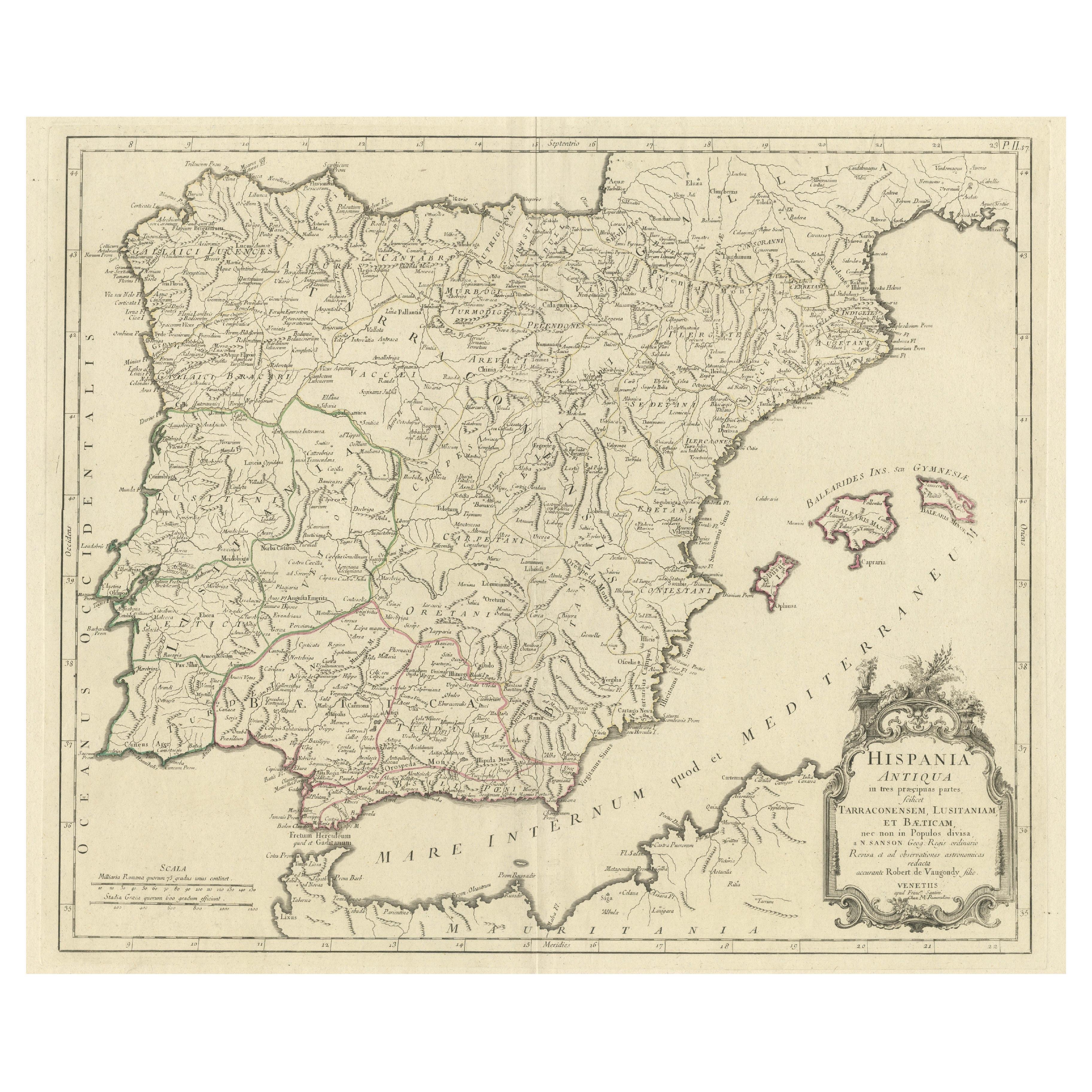
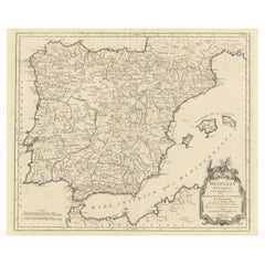
Old Map of Ancient Spain and Portugal – Hispania Antiqua Featuring Roman Cities
Located in Langweer, NL
Title: "Hispania Antiqua in Tres Praecipuas Partes Divisa: Tarraconensem, Lusitaniam, et Bæticam" by Robert de Vaugondy, 18th Century
Description:
This beautifully detailed map titl...
Category
Antique Late 18th Century Maps
Materials
Paper
$623 Sale Price
20% Off
You May Also Like
Large Original Vintage Map of Egypt, circa 1920
Located in St Annes, Lancashire
Great map of Egypt
Unframed
Original color
By John Bartholomew and Co. Edinburgh Geographical Institute
Published, circa 1920
Free shipping.
Category
Vintage 1920s British Maps
Materials
Paper

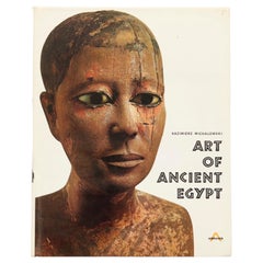
Art of Ancient Egypt by Kazimierz Michalowski
Located in Bradenton, FL
Art of Ancient Egypt by Kazimierz Michalowski. Hardcover book with dustjacket. Published by Harry N. Abrams Inc., of New York. Printed in France, bound in the Netherlands. 904 illust...
Category
Late 20th Century French Egyptian Books
Materials
Paper
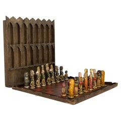
French Chess Theme of Ancient Egypt Plaster & Wood Restored, circa 1920
Located in Labrit, Landes
French chess game in the thematic of Ancient Egypt. The chess pieces are in painted and waxed plaster, the board is in wood and the is also a display shel...
Category
Vintage 1920s French Egyptian Revival Games
Materials
Plaster, Wood
$4,158 Sale Price
26% Off
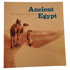
The American Discovery of Ancient Egypt 1995
Located in North Hollywood, CA
The American Discovery of Ancient Egypt 1995.
Essays, edited by Nancy Thomas.
A survey of the achievements of American Egyptology featuring such enterpris...
Category
Late 20th Century Egyptian Moorish Books
Materials
Paper
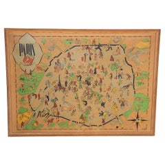
Art Deco Cartoon Style Map of Paris possibly by Arthur Zaindenberg circa 1930's
By Arthur Zaidenberg
Located in New York, NY
Art Deco cartoon style map of Paris possibly by Arthur Zaidenberg. The map depicts witty references to Parisians lifestyle, along with drawings of notable landmarks, circa 1930's. T...
Category
Vintage 1930s American Art Deco Maps
Materials
Paper
French 18th Century Map of Paris by Turgot
By Michel Etienne Turgot
Located in Los Angeles, CA
Complete Paris map set of etchings by Turgot. This printing is from the 1960s and have warm natural color to the paper. Frame each individually to your liking. The overall dimension ...
Category
Vintage 1960s French French Provincial Maps
Materials
Paper
$4,500 / set
Recently Viewed
View AllMore Ways To Browse
Ancient Egyptians Gold
Manuscripts
Antique Manuscript
Antique Ivory Collectables
Gold Paris Charm
Arabia Set
Ancient Egyptian Table
Antique Egyptian Glass
Antique Table Mats
Egypt Gold Charm
Memphis Antique Furniture
Thebes Table
Styles Of Antique Desks
Black And White Coffee Table
Curved Velvet Couch
Velvet Curved Sofa
Wood Round Coffee Tables
Antique Paper Flowers