Items Similar to Antique Map of Bavaria with many details, Germany


Want more images or videos?
Request additional images or videos from the seller
1 of 9
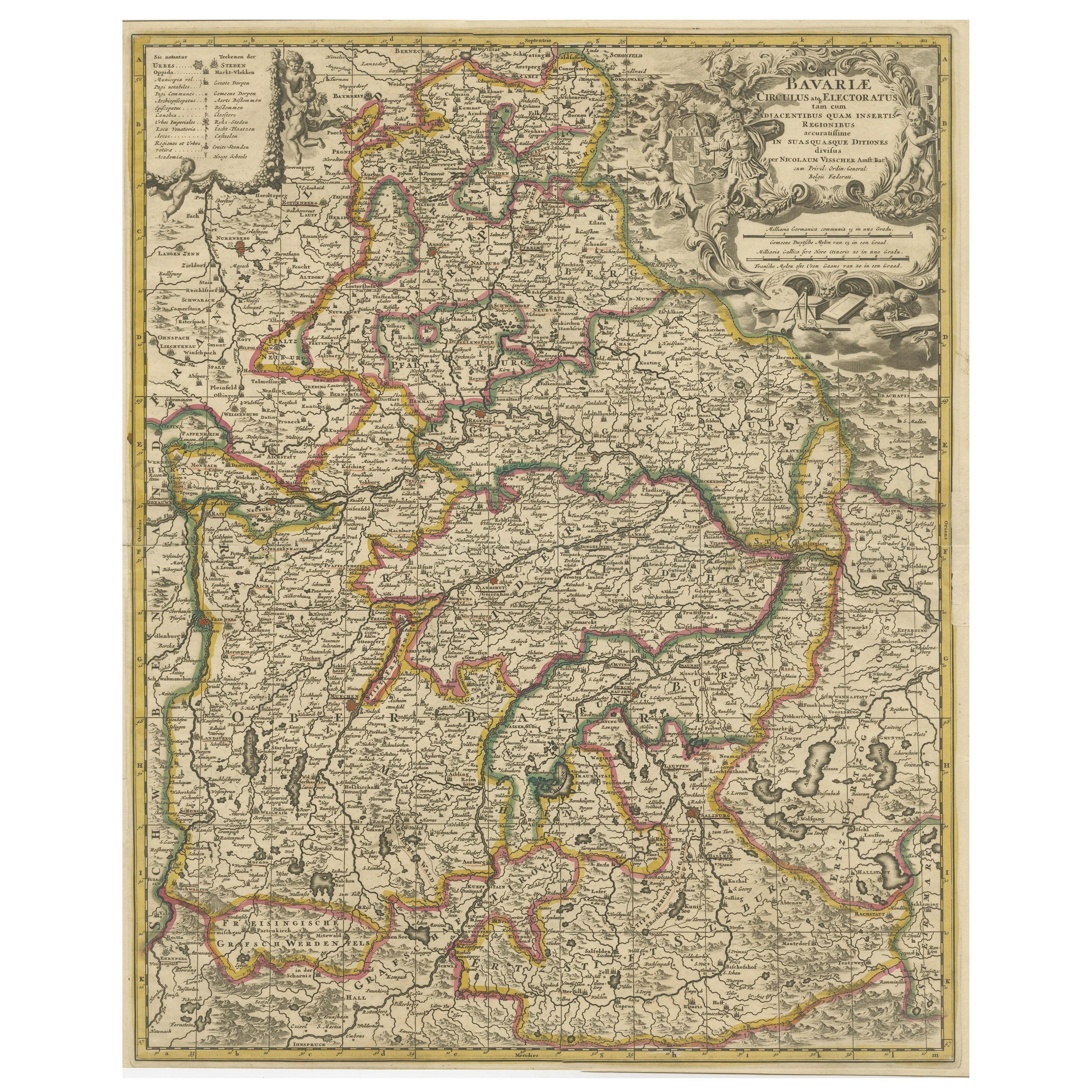
Antique Map of Bavaria with many details, Germany
$623.81
$779.7620% Off
£467.58
£584.4820% Off
€528
€66020% Off
CA$857
CA$1,071.2620% Off
A$956.77
A$1,195.9620% Off
CHF 501.33
CHF 626.6620% Off
MX$11,711.74
MX$14,639.6820% Off
NOK 6,366.90
NOK 7,958.6320% Off
SEK 6,003.18
SEK 7,503.9820% Off
DKK 4,019.33
DKK 5,024.1620% Off
Shipping
Retrieving quote...The 1stDibs Promise:
Authenticity Guarantee,
Money-Back Guarantee,
24-Hour Cancellation
About the Item
Antique map titled 'Bavariae Circulus atq Electoratus tam cum Adiacentibus quam insertis Regionibus (..)'. Dutch map of Bavaria, showing the many cities, towns, and other features of this historically-significant part of Germany. The map stretches south to Innsbruck and north to Amberg. Also shown are Munich, Salzburg, Augsburg, and Regensburg. Many rivers, mountains, and forests are all shown. Published by N. Visscher.
The Visscher family were art and map dealers in Amsterdam during the 17th century. Funded by C. J. Visscher (1587-1652), the business was continued by his son and grandson both named Nicolas. Nicolas Visscher I was born 1618 in Wenns, Austria. He died 1679 in Linz. After the death of Nicolas II, his widow passed the business to Pieter Schenk.
- Dimensions:Height: 25.36 in (64.4 cm)Width: 20.79 in (52.8 cm)Depth: 0.02 in (0.5 mm)
- Materials and Techniques:
- Period:Late 17th Century
- Date of Manufacture:circa 1698
- Condition:Minor fading. Please study image carefully.
- Seller Location:Langweer, NL
- Reference Number:Seller: BG-091631stDibs: LU305439932341
About the Seller
5.0
Recognized Seller
These prestigious sellers are industry leaders and represent the highest echelon for item quality and design.
Platinum Seller
Premium sellers with a 4.7+ rating and 24-hour response times
Established in 2009
1stDibs seller since 2017
2,511 sales on 1stDibs
Typical response time: <1 hour
- ShippingRetrieving quote...Shipping from: Langweer, Netherlands
- Return Policy
Authenticity Guarantee
In the unlikely event there’s an issue with an item’s authenticity, contact us within 1 year for a full refund. DetailsMoney-Back Guarantee
If your item is not as described, is damaged in transit, or does not arrive, contact us within 7 days for a full refund. Details24-Hour Cancellation
You have a 24-hour grace period in which to reconsider your purchase, with no questions asked.Vetted Professional Sellers
Our world-class sellers must adhere to strict standards for service and quality, maintaining the integrity of our listings.Price-Match Guarantee
If you find that a seller listed the same item for a lower price elsewhere, we’ll match it.Trusted Global Delivery
Our best-in-class carrier network provides specialized shipping options worldwide, including custom delivery.More From This Seller
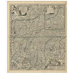
View AllAntique Map of Upper Bavaria, Germany, circa 1690
Located in Langweer, NL
Antique map titled 'Bavariae pars superior cum insertis et adjacentibus regionibus non solum in ejusdem ditiones generales (..). Original antique map of upper Bavaria from Regensburg...
Category
Antique Late 17th Century Dutch Maps
Materials
Paper
$656 Sale Price
20% Off
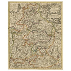
Antique Map of Bavaria, Bayern, with original Hand Coloring
Located in Langweer, NL
Antique map titled 'Bavariae Circulus atq Electoratus tam cum Adiacentibus quam insertis Regionibus'. Original old map of Bavaria, Bayern, Germany. The map stretches south to Innsbru...
Category
Antique Late 17th Century Maps
Materials
Paper
$444 Sale Price
20% Off
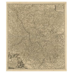
Antique Map of the Niederrhein region, Germany
Located in Langweer, NL
Antique map titled 'Circulus Electorum Rheni sive Rhenanus Inferior (..)'. Original antique map of the Niederrhein region, Germany. By F. de Wit, circa 1690.
Frederick de Wit (1629-...
Category
Antique Late 17th Century Maps
Materials
Paper
$425 Sale Price
20% Off
Antique Map of Germany During the Mid-18th Century, Published in 1747
Located in Langweer, NL
Antique map Germany titled 'A New & Accurate Map of Germany'. It covers Germany during the mid-18th century, which included all of modern day Germany, Austria, Switzerland, Czech Rep...
Category
Antique 18th Century Maps
Materials
Paper

$198 Sale Price
20% Off
Antique Map of present-day North-Rhine Westphalia, Germany
Located in Langweer, NL
Antique map titled 'Nova et Accurata Ducatus Cliviae et Comitatus Marchiae (..)'. Detailed regional map of Germany showing the region bounded by the Maas River in the west and to par...
Category
Antique Mid-18th Century Maps
Materials
Paper

$500 Sale Price
20% Off
Antique Map of the Nassau Region in Western Germany
Located in Langweer, NL
Antique map titled 'Nassovia Principatus (..)'. Detailed map of the Nassau region in western Germany between Koblenz, Hadamar, Giessen, Frankfurt and Mainz. The map is filled with in...
Category
Antique Early 18th Century Maps
Materials
Paper

$623 Sale Price
20% Off
You May Also Like
17th Century Hand-Colored Map of a Region in West Germany by Janssonius
By Johannes Janssonius
Located in Alamo, CA
This attractive highly detailed 17th century original hand-colored map is entitled "Archiepiscopatus Maghdeburgensis et Anhaltinus Ducatus cum terris adjacentibus". It was published ...
Category
Antique Mid-17th Century Dutch Maps
Materials
Paper

Original Antique Map of Switzerland, Engraved By Barlow, Dated 1807
Located in St Annes, Lancashire
Great map of Switzerland
Copper-plate engraving by Barlow
Published by Brightly & Kinnersly, Bungay, Suffolk.
Dated 1807
Unframed.
Category
Antique Early 1800s English Maps
Materials
Paper

Prussia, Poland, N. Germany, Etc: A Hand-colored 17th Century Map by Janssonius
By Johannes Janssonius
Located in Alamo, CA
This is an attractive hand-colored copperplate engraved 17th century map of Prussia entitled "Prussia Accurate Descripta a Gasparo Henneberg Erlichensi", published in Amsterdam by Joannes Janssonius in 1664. This very detailed map from the golden age of Dutch cartography includes present-day Poland, Latvia, Lithuania, Estonia and portions of Germany. This highly detailed map is embellished by three ornate pink, red, mint green and gold...
Category
Antique Mid-17th Century Dutch Maps
Materials
Paper

18th Century Hand-Colored Homann Map of Germany, Including Frankfurt and Berlin
By Johann Baptist Homann
Located in Alamo, CA
An 18th century hand-colored map entitled "Tabula Marchionatus Brandenburgici et Ducatus Pomeraniae quae sunt Pars Septentrionalis Circuli Saxoniae Superioris" by Johann Baptist Homa...
Category
Antique Early 18th Century German Maps
Materials
Paper

1853 Map of "Russia in Europe Including Poland" Ric.r016
Located in Norton, MA
Description
Russia in Europe incl. Poland by J Wyld c.1853
Hand coloured steel engraving
Dimension: Paper: 25 cm W x 33 cm H ; Sight: 22 cm W x 28 cm H
Condition: Good ...
Category
Antique 19th Century Unknown Maps
Materials
Paper

1752 Vaugoundy Map of Flanders : Belgium, France, and the Netherlands, Ric.a002
Located in Norton, MA
Large Vaugoundy Map of Flanders:
Belgium, France, and the Netherlands
Colored -1752
Ric.a002
Description: This is a 1752 Didier Robert de Vaugondy map of Flanders. The map de...
Category
Antique 17th Century Unknown Maps
Materials
Paper

More Ways To Browse
Bavaria Antique
Carved Cabriole Table
Dark Antique Table
Antique Wall Table
1960 Chair Wood Danish
Unusual Dining Table
Antique Dutch Plates
Mdf Table
Showcase Coffee Table
Space Age Orange
Vallauris France
Silver Ladle
Scalloped Table
Brazil Wood Chairs
Vintage Art Deco Side Tables
Window Display
1960s Cushion Chair
Green Brown Oriental Rug