Items Similar to Antique Map of Denmark and German Empire Regions, 1903, Intricate and Colorful

Want more images or videos?
Request additional images or videos from the seller
1 of 10
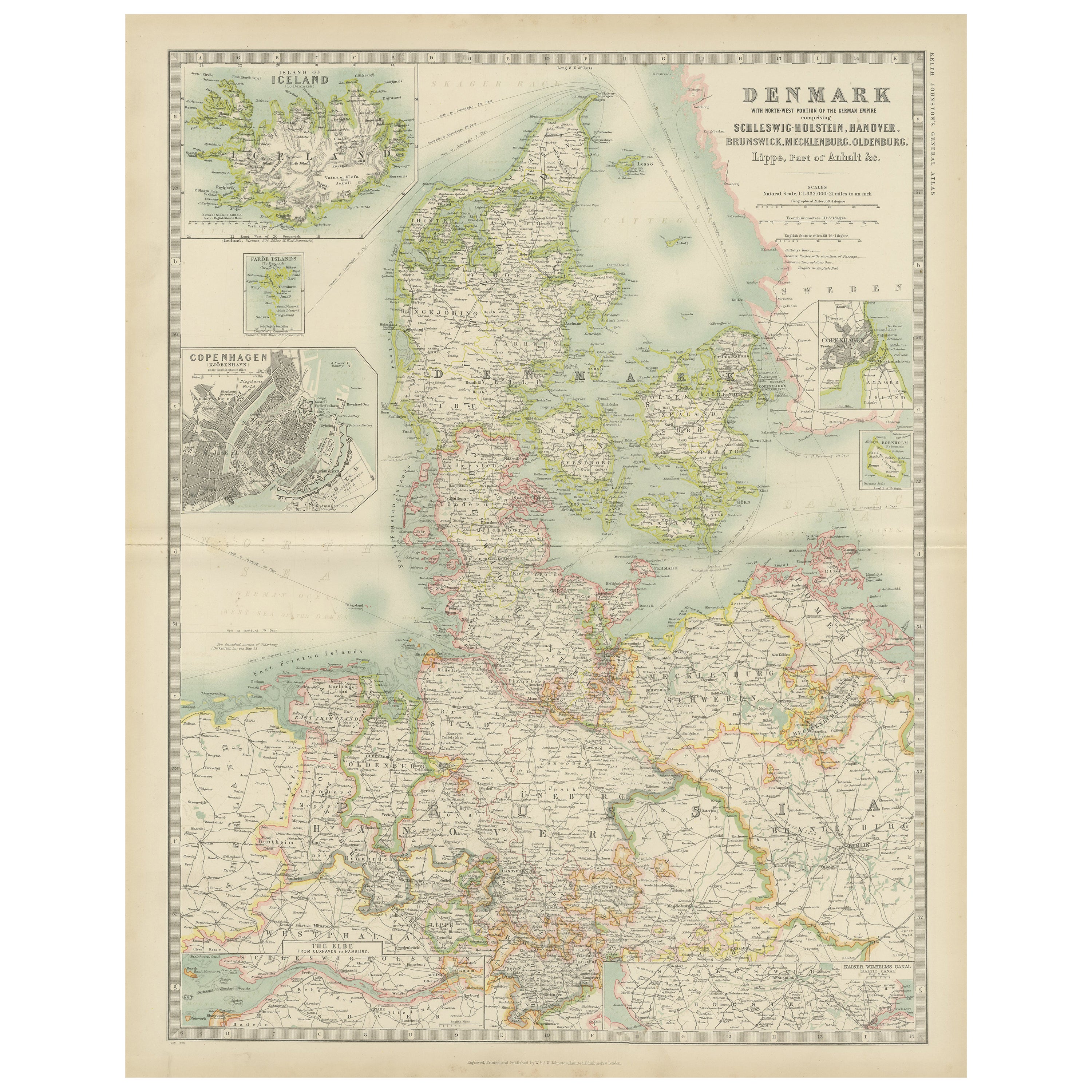
Antique Map of Denmark and German Empire Regions, 1903, Intricate and Colorful
$216.18
£159.21
€180
CA$294.09
A$326.80
CHF 171.25
MX$4,007.64
NOK 2,184.16
SEK 2,054.78
DKK 1,370.31
Shipping
Retrieving quote...The 1stDibs Promise:
Authenticity Guarantee,
Money-Back Guarantee,
24-Hour Cancellation
About the Item
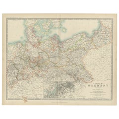
Title: Antique Map of Denmark and German Empire Regions, 1903, Intricate and Colorful
Description:
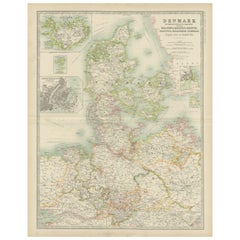
This antique map, titled "Denmark with North West Portions of the German Empire," was engraved and published in 1903 by the distinguished cartographers W. & A.K. Johnston in Edinburgh and London. It presents a beautifully detailed view of Denmark, along with northern Germany including Schleswig-Holstein, Hanover, Brunswick, Mecklenburg, Oldenburg, Anhalt, and Lippe, offering a fascinating snapshot of this region at the turn of the 20th century.
The map is elegantly hand-colored in soft pastel shades to demarcate regional and national boundaries, creating a visually harmonious and informative composition. Denmark’s iconic peninsulas, islands, and fjords are clearly depicted, as are the railway lines, rivers, and major cities that defined the region’s economic and social landscape during this era. Inset maps of the Faroe Islands and Iceland add an extra dimension to this comprehensive portrayal.
Particularly striking is the clear delineation of the shifting political boundaries in northern Germany—a region undergoing significant transitions at the time. The map’s intricate linework and precise typography demonstrate the exceptional quality of Johnston’s craftsmanship and the depth of information included.
For collectors and lovers of history, this map is more than a decorative artifact. It represents a moment in time when Europe’s political and geographic landscape was dynamic and interconnected, capturing the essence of a region known for its maritime culture, trade networks, and complex relationships between neighboring states.
Condition report:
This map is in very good antique condition, showing only slight toning and minor foxing typical for its age. The colors remain vibrant and the paper stable and clear.
Framing tips:
A classic wooden frame in walnut or oak will enhance the map’s warm pastel tones and historical charm. Pair it with a cream or light tan matting to highlight the delicate engraving and create a refined, elegant focal point in any home or office.
- Dimensions:Height: 18.59 in (47.2 cm)Width: 14.49 in (36.8 cm)Depth: 0.01 in (0.2 mm)
- Materials and Techniques:
- Period:
- Date of Manufacture:1903
- Condition:This map is in very good antique condition, showing only slight toning and minor foxing typical for its age. The colors remain vibrant and the paper stable and clear. Folding line as issued.
- Seller Location:Langweer, NL
- Reference Number:Seller: BG-13577-151stDibs: LU3054345242412
About the Seller
5.0
Recognized Seller
These prestigious sellers are industry leaders and represent the highest echelon for item quality and design.
Platinum Seller
Premium sellers with a 4.7+ rating and 24-hour response times
Established in 2009
1stDibs seller since 2017
2,494 sales on 1stDibs
Typical response time: 1 hour
- ShippingRetrieving quote...Shipping from: Langweer, Netherlands
- Return Policy
Authenticity Guarantee
In the unlikely event there’s an issue with an item’s authenticity, contact us within 1 year for a full refund. DetailsMoney-Back Guarantee
If your item is not as described, is damaged in transit, or does not arrive, contact us within 7 days for a full refund. Details24-Hour Cancellation
You have a 24-hour grace period in which to reconsider your purchase, with no questions asked.Vetted Professional Sellers
Our world-class sellers must adhere to strict standards for service and quality, maintaining the integrity of our listings.Price-Match Guarantee
If you find that a seller listed the same item for a lower price elsewhere, we’ll match it.Trusted Global Delivery
Our best-in-class carrier network provides specialized shipping options worldwide, including custom delivery.More From This Seller
View AllAntique Map of Denmark by Johnston '1909'
Located in Langweer, NL
Antique map titled 'Denmark'. Original antique map of Denmark. With inset maps of Iceland, Faroe Island, and Copenhagen. This map originates from the ‘Royal Atlas of Modern Geography...
Category
Early 20th Century Maps
Materials
Paper
$240 Sale Price
20% Off
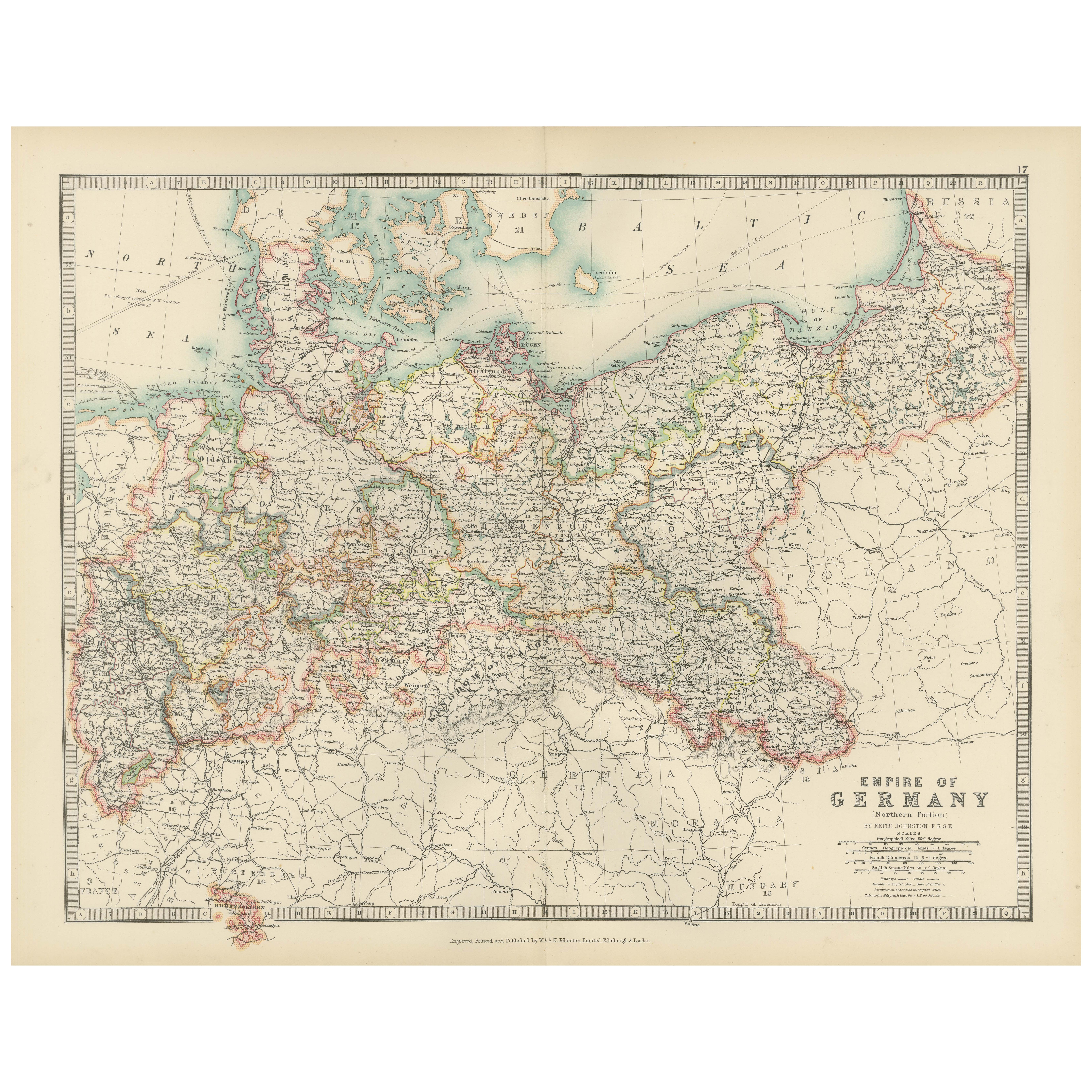
Antique Map of the German Empire, 1903, Northern Portion with Coastal and Inland
Located in Langweer, NL
Title: Antique Map of the German Empire, 1903, Northern Portion with Coastal and Inland Detail
Description:
This antique map, titled "Empire of Germany (Northern Portion)," was engr...
Category
Early 20th Century Maps
Materials
Paper

Antique Map of Denmark with Inset Maps of Iceland, Copenhagen and the Elbe, 1882
Located in Langweer, NL
Antique map titled 'Denmark with North-West portion of the German Empire comprising Schleswic-Holstein, Hanover, Brunswick, Meckleburg, Oldenburg, Anhalt, Lippe & c'. Old map of Denm...
Category
Antique 19th Century Maps
Materials
Paper
$230 Sale Price
20% Off
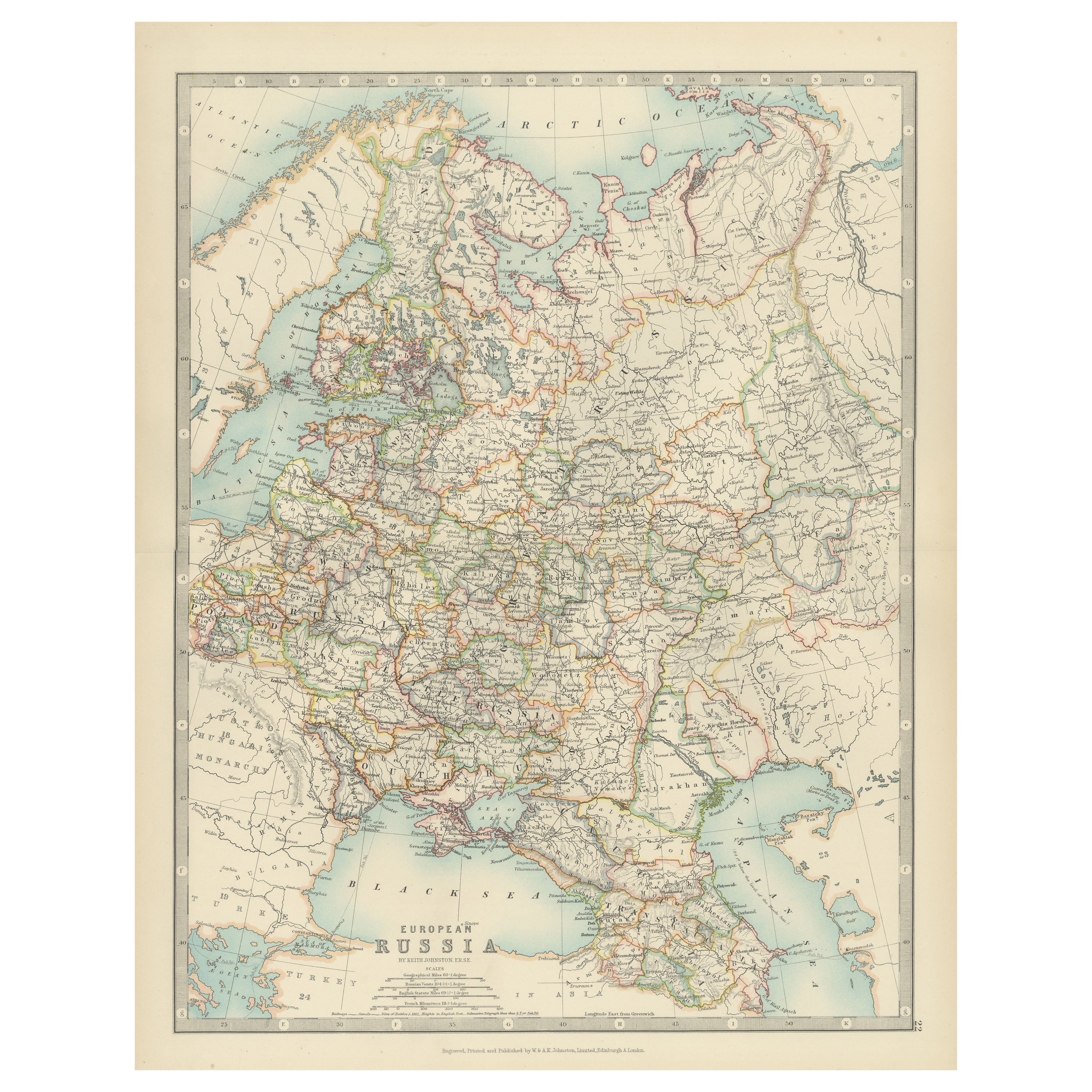
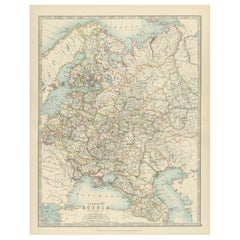
Antique Map of European Russia, 1903, with Colorful Provincial Boundaries
Located in Langweer, NL
Title: Antique Map of European Russia, 1903, with Colorful Provincial Boundaries
Description:
This antique map, titled "European Russia," was engraved and published in 1903 by W. & ...
Category
Early 20th Century Maps
Materials
Paper
Antique Map of Europe, 1903, with Intricate Political Boundaries and Rich Detail
Located in Langweer, NL
Title: Antique Map of Europe, 1903, with Intricate Political Boundaries and Rich Detail
Description:
This antique map, titled "Europe," is a finely engraved and beautifully colored ...
Category
Early 20th Century Maps
Materials
Paper

Antique Map of the German Empire by Johnston, '1909'
Located in Langweer, NL
Antique map titled 'Empire of Germany'. Original antique map of the German Empire. With inset maps of Berlin and Potsdam. This map originates from the ‘R...
Category
Early 20th Century Maps
Materials
Paper
$240 Sale Price
20% Off
You May Also Like
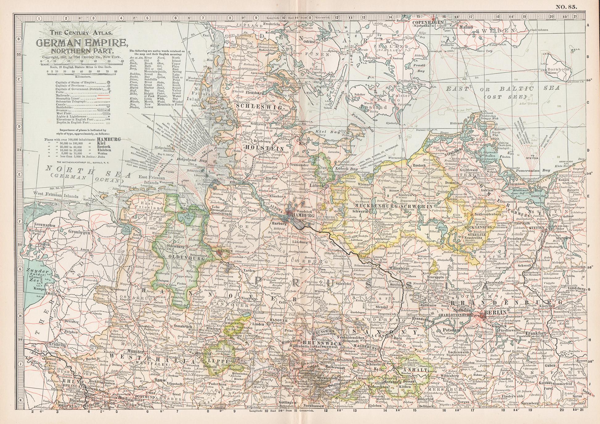
German Empire, Northern Part. Century Atlas antique vintage map
Located in Melbourne, Victoria
'The Century Atlas. German Empire, Northern Part.'
Original antique map, 1903.
Central fold as issued. Map name and number printed on the reverse corne...
Category
Early 20th Century Victorian More Prints
Materials
Lithograph

Denmark. Century Atlas antique vintage map
Located in Melbourne, Victoria
'The Century Atlas. Denmark'
Original antique map, 1903.
Inset maps of 'Faroe Islands', 'Iceland' and 'Copenhagen'.
Central fold as issued. Map name and number printed on the reve...
Category
Early 20th Century Victorian More Prints
Materials
Lithograph

German Empire, Southwestern Part. Century Atlas antique vintage map
Located in Melbourne, Victoria
'The Century Atlas. German Empire, Southwestern Part'
Original antique map, 1903.
Central fold as issued. Map name and number printed on the reverse co...
Category
Early 20th Century Victorian More Prints
Materials
Lithograph

Russia in Europe with Poland and Finland. Century Atlas antique vintage map
Located in Melbourne, Victoria
'The Century Atlas. Russia in Europe with Poland and Finland'
Original antique map, 1903.
Central fold as issued. Map name and number printed on the reverse corners.
Sheet 40cm by ...
Category
Early 20th Century Victorian More Prints
Materials
Lithograph

Large Original Vintage Map of Sweden and Norway circa 1920
Located in St Annes, Lancashire
Great map of Sweden and Norway
Original color. Good condition
Published by Alexander Gross
Unframed.
Category
Vintage 1920s English Victorian Maps
Materials
Paper

Russia, Western and Southern Part. Century Atlas antique vintage map
Located in Melbourne, Victoria
'The Century Atlas. Russia, Western and Southern Part'
Original antique map, 1903.
Inset map tilted 'St Petersburg and Environs'.
Central fold as issued. Map name and number printe...
Category
Early 20th Century Victorian More Prints
Materials
Lithograph

More Ways To Browse
German Empire Furniture
German Empire
Railway Map
Antique Oak Island
Hanover Furniture
Iceland Antique
Icelandic Antique
Antique Furniture Brunswick
Schleswig Holstein
Faroe Islands
Solid Mahogany Table
Dessert Glasses
Geometric Glass Table
Mid Century Pin
6x10 Rug
Studded Furniture
Styles Of Antique Desks
Black And White Coffee Table