Items Similar to Antique Map of the Eastern Part of Brazil by A. Van Krevelt, 1772


Want more images or videos?
Request additional images or videos from the seller
1 of 5
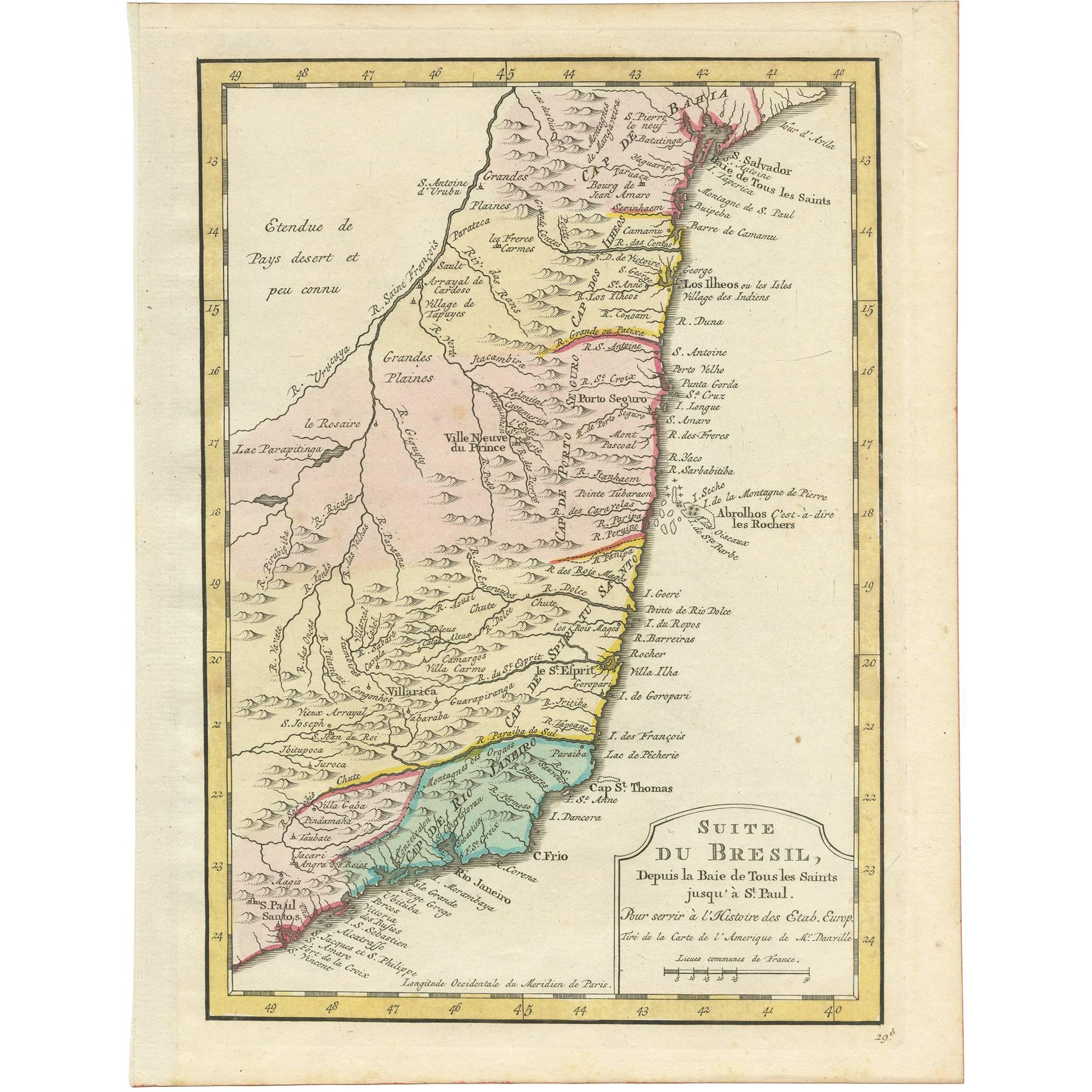
Antique Map of the Eastern Part of Brazil by A. Van Krevelt, 1772
$311.79
$389.7320% Off
£231.94
£289.9220% Off
€260
€32520% Off
CA$426.94
CA$533.6820% Off
A$474.70
A$593.3820% Off
CHF 247.86
CHF 309.8320% Off
MX$5,778.28
MX$7,222.8520% Off
NOK 3,162.63
NOK 3,953.2820% Off
SEK 2,963.23
SEK 3,704.0420% Off
DKK 1,979.24
DKK 2,474.0520% Off
Shipping
Retrieving quote...The 1stDibs Promise:
Authenticity Guarantee,
Money-Back Guarantee,
24-Hour Cancellation
About the Item
Rare edition of this accurate map of eastern part of Brazil. This map originates from 'Atlas Portatif pour servir a l'intelligence de l'Histoire Philosophique et Politique des etablissements et du commerce des Europe'ens dans les deux Indes'. Engraved by A. van Krevelt in 1772. Prepared by Jean Baptiste Bourguignon d'Anville (1697-1782).
- Dimensions:Height: 10.32 in (26.2 cm)Width: 15.08 in (38.3 cm)Depth: 0.02 in (0.5 mm)
- Materials and Techniques:
- Period:
- Date of Manufacture:1772
- Condition:Please study image carefully.
- Seller Location:Langweer, NL
- Reference Number:Seller: BG-034671stDibs: LU305439548313
About the Seller
5.0
Recognized Seller
These prestigious sellers are industry leaders and represent the highest echelon for item quality and design.
Platinum Seller
Premium sellers with a 4.7+ rating and 24-hour response times
Established in 2009
1stDibs seller since 2017
2,511 sales on 1stDibs
Typical response time: <1 hour
- ShippingRetrieving quote...Shipping from: Langweer, Netherlands
- Return Policy
Authenticity Guarantee
In the unlikely event there’s an issue with an item’s authenticity, contact us within 1 year for a full refund. DetailsMoney-Back Guarantee
If your item is not as described, is damaged in transit, or does not arrive, contact us within 7 days for a full refund. Details24-Hour Cancellation
You have a 24-hour grace period in which to reconsider your purchase, with no questions asked.Vetted Professional Sellers
Our world-class sellers must adhere to strict standards for service and quality, maintaining the integrity of our listings.Price-Match Guarantee
If you find that a seller listed the same item for a lower price elsewhere, we’ll match it.Trusted Global Delivery
Our best-in-class carrier network provides specialized shipping options worldwide, including custom delivery.More From This Seller
View AllAntique Map of South America by Tirion, c.1765
By Thomas Kitchin
Located in Langweer, NL
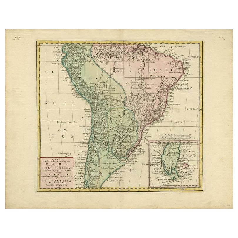
Antique map titled 'Kaart van het Onderkoningschap van Peru zig uitstrekkende: over Chile, Paraguay en andere Spaansche Landen als ook van Brazil en verdere Bezittingen van Portugal ...
Category
Antique 18th Century Maps
Materials
Paper

$333 Sale Price
20% Off
Antique Map of South America by Keizer & de Lat, 1788
Located in Langweer, NL
Antique map titled 'Kaartje van het Zuider-Deel van America'. Uncommon original antique map of South America. This map originates from 'Nieuwe Natuur- Geschied- en Handelkundige Zak-...
Category
Antique Late 18th Century Maps
Materials
Paper

$383 Sale Price
20% Off
Antique Map of the Northern Part of South America by Delamarche, 1806
Located in Langweer, NL
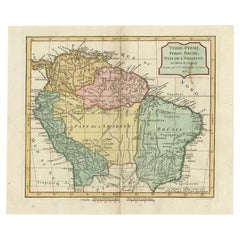
Antique map titled 'Terre-Ferme, Perou, Bresil, Pays de L'Amazone.' This map shows the northern part of South America with Peru, Brazil, Guyana etc. By Robert de Vaugondy, revised an...
Category
Antique 19th Century Maps
Materials
Paper
$167 Sale Price
20% Off
Antique Map of the Brazilian Coast by A. Van Krevelt
Located in Langweer, NL
Uncommon edition of this accurate map of part of Brazil, from San Salvador till Rio de Janeiro and S.Paulo. In lower right engraved "29b." Originates from 'Atlas Portatif pour servir...
Category
Antique Late 18th Century Brazilian Maps
Materials
Paper
$231 Sale Price
22% Off
Antique Map of Northern Brazil by Bonne, c.1780
Located in Langweer, NL
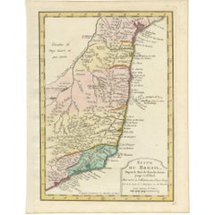
Antique map titled 'Carte de la Partie Septentrionale du Bresil.' Detailed map of the northern portion of Brazil from Bahia to French Guiana, showing the eastern Amazon interior rivers, Mission Territories, Goyza and the coastal regions, including coastal currents. Source unknown, to be determined. Artists and Engravers: Rigobert Bonne (1727-1795 ) was one of the most important cartographers of the late 18th century. In 1773 he succeeded Jacques Bellin as Royal Cartographer to France in the office of the Hydrographer at the Depôt de la Marine. Working in his official capacity Bonne compiled some of the most detailed and accurate maps of the period. Bonne's work represents an important step in the evolution of the cartographic ideology away from the decorative work of the 17th and early 18th century towards a more detail oriented and practical aesthetic. With regard to the rendering of terrain Bonne maps...
Category
Antique 18th Century Maps
Materials
Paper

$119 Sale Price
20% Off
Antique Map of South America by J. Cook, 1775
Located in Langweer, NL
Antique map titled 'Kaart van het Zuidlyk Eind van Amerika'. Map of the sourthern part of South America, focusing on Cook's tracks around the Cape Horn and T...
Category
Antique Mid-18th Century Maps
Materials
Paper

$815 Sale Price
20% Off
You May Also Like
Original Antique Map of South America. C.1780
Located in St Annes, Lancashire
Great map of South America
Copper-plate engraving
Published C.1780
Two small worm holes to left side of map
Unframed.
Category
Antique Early 1800s English Georgian Maps
Materials
Paper

West Coast of Africa, Guinea & Sierra Leone: An 18th Century Map by Bellin
By Jacques-Nicolas Bellin
Located in Alamo, CA
Jacques Bellin's copper-plate map entitled "Partie de la Coste de Guinee Dupuis la Riviere de Sierra Leona Jusquau Cap das Palmas", depicting the coast of Guinea and Sierra Leone in ...
Category
Antique Mid-18th Century French Maps
Materials
Paper

South America, Eastern Part. Century Atlas antique vintage map
Located in Melbourne, Victoria
'The Century Atlas. South America. Eastern Part'
Original antique map, 1903.
Inset map 'Rio de Janeiro and Vicinity'.
Central fold as issued. Map name and number printed on the rev...
Category
Early 20th Century Victorian More Prints
Materials
Lithograph

North & South America: A 17th Century Hand-colored Map by Jansson & Goos
By Johannes Janssonius
Located in Alamo, CA
A 17th century hand-colored map of North & South America entitled "Americae Descriptio" by the cartographer Johannes Jansson, published in Jansson's Atlas Minor in Amsterdam in 1628....
Category
Antique 1620s Dutch Maps
Materials
Paper

Carte du Bresil, antique 1860s engraved map of Brazil
Located in Melbourne, Victoria
'Carte du Bresil'
Engraving with original outline colouring, circa 1860, by Alexandre Vuillemin, published in Paris.
31cm by 41cm (sheet)
21.5cm by 31.5cm (image)
Category
Late 19th Century Victorian More Prints
Materials
Lithograph

Original Antique Map of Spain and Portugal, circa 1790
Located in St Annes, Lancashire
Super map of Spain and Portugal
Copper plate engraving by A. Bell
Published, circa 1790.
Unframed.
Category
Antique 1790s English Other Maps
Materials
Paper

More Ways To Browse
Eastern European Antiques
Japanese Silver Ceramics
One Of A Kind Chair
Used Oak Dining Room Chairs
Childrens Vintage Poster
Vintage Travel Poster Mid Century
Desk Key
Carved Cabriole Table
Dark Antique Table
White Wooden Table
Antique Wall Table
1960 Chair Wood Danish
Unusual Dining Table
Antique Dutch Plates
Mdf Table
Showcase Coffee Table
Space Age Orange
Vallauris France