Items Similar to Antique Map of Europe, 1903, with Intricate Political Boundaries and Rich Detail


Want more images or videos?
Request additional images or videos from the seller
1 of 10
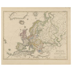
Antique Map of Europe, 1903, with Intricate Political Boundaries and Rich Detail
$330.01
£248.57
€280
CA$455.10
A$511.29
CHF 267.15
MX$6,240.52
NOK 3,392.01
SEK 3,192.87
DKK 2,131.25
About the Item
Title: Antique Map of Europe, 1903, with Intricate Political Boundaries and Rich Detail
Description:
This antique map, titled "Europe," is a finely engraved and beautifully colored cartographic masterpiece published in 1903 by the renowned firm W. & A.K. Johnston in Edinburgh and London. It offers a captivating snapshot of the political and geographic landscape of Europe at the dawn of the 20th century, a period marked by shifting alliances and imperial ambitions.
The map meticulously details the entire European continent, extending from the icy waters of the Arctic to the sun-drenched shores of the Mediterranean and the Black Sea. With an intricate web of borders, it illustrates the complex political arrangements of the era, including the Austro-Hungarian Empire, the Ottoman Empire, and the Russian Empire—all of which would soon undergo profound transformations. Major cities, mountain ranges, rivers, and railway lines are all clearly marked, reflecting the interconnectedness and dynamism of Europe during this period of modernization and industrial expansion.
This map’s delicate pastel hues—soft greens, blues, and pinks—combined with precise typography and fine engraving, create a visually appealing work of art. It is a testament to the exceptional skill of the Johnston family of cartographers, who were celebrated for their accuracy and aesthetic sensibility.
For collectors and lovers of history, this map is more than just a geographic tool. It is a glimpse into a world poised on the brink of dramatic political upheaval, capturing the last years of Europe’s old empires and the dawn of the modern era. Whether displayed in a home, library, or office, it brings a sense of timeless elegance and historical curiosity to any space.
Condition report:
This map is in very good antique condition. Minor foxing and light toning around the edges, consistent with its age, do not detract from its beauty. The colors remain fresh and the paper stable. Folding line as issued.
Framing tips:
Choose a classic dark wood frame, such as walnut or mahogany, to complement the warm pastel tones. A cream or light tan mat will accentuate the map’s fine details and soft coloring, creating a refined presentation perfect for any room.
- Dimensions:Height: 14.49 in (36.8 cm)Width: 18.9 in (48 cm)Depth: 0.01 in (0.2 mm)
- Materials and Techniques:
- Period:
- Date of Manufacture:1903
- Condition:This map is in very good antique condition. Minor foxing and light toning around the edges, consistent with its age, do not detract from its beauty. The colors remain fresh and the paper stable. Folding line as issued.
- Seller Location:Langweer, NL
- Reference Number:Seller: BG-13577-31stDibs: LU3054345240912
About the Seller
5.0
Recognized Seller
These prestigious sellers are industry leaders and represent the highest echelon for item quality and design.
Platinum Seller
Premium sellers with a 4.7+ rating and 24-hour response times
Established in 2009
1stDibs seller since 2017
2,534 sales on 1stDibs
Typical response time: <1 hour
- ShippingRetrieving quote...Shipping from: Langweer, Netherlands
- Return Policy
Authenticity Guarantee
In the unlikely event there’s an issue with an item’s authenticity, contact us within 1 year for a full refund. DetailsMoney-Back Guarantee
If your item is not as described, is damaged in transit, or does not arrive, contact us within 7 days for a full refund. Details24-Hour Cancellation
You have a 24-hour grace period in which to reconsider your purchase, with no questions asked.Vetted Professional Sellers
Our world-class sellers must adhere to strict standards for service and quality, maintaining the integrity of our listings.Price-Match Guarantee
If you find that a seller listed the same item for a lower price elsewhere, we’ll match it.Trusted Global Delivery
Our best-in-class carrier network provides specialized shipping options worldwide, including custom delivery.More From This Seller
View AllAntique Map of the European Continent, 1882
Located in Langweer, NL
Antique map titled 'Europe'. Old map of the European continent. This map originates from 'The Royal Atlas of Modern Geography, Exhibiting, in a Series of ...
Category
Antique 19th Century Maps
Materials
Paper

$127 Sale Price
20% Off
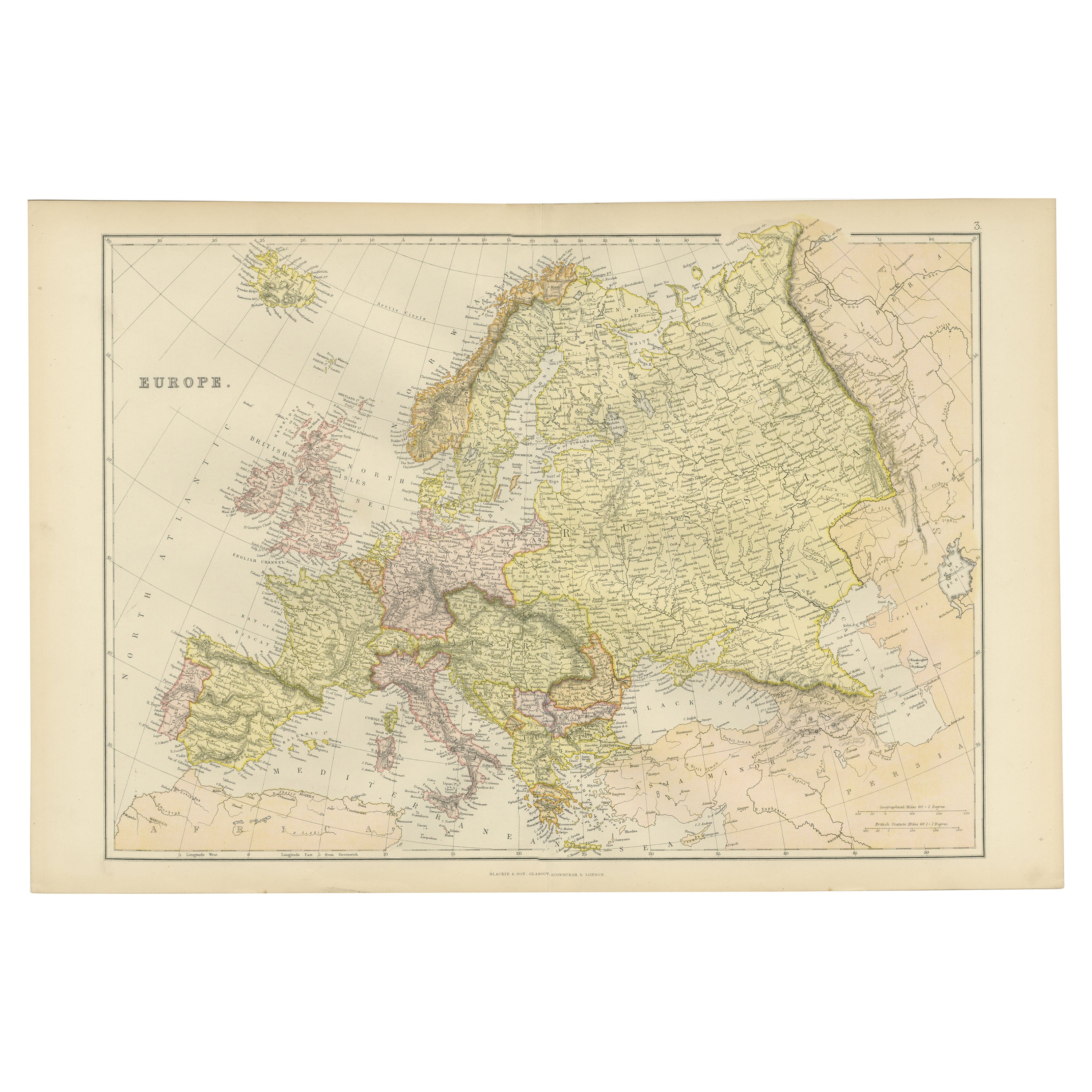
Colorful Detailed Antique Map of Europe, Published in 1882
Located in Langweer, NL
"The Antique Map of Europe from 'The Comprehensive Atlas and Geography of the World,' published in 1882 by Blackie & Son, is a testament to meticulous cartography and scholarly preci...
Category
Antique 1880s Maps
Materials
Paper
$179 Sale Price
20% Off
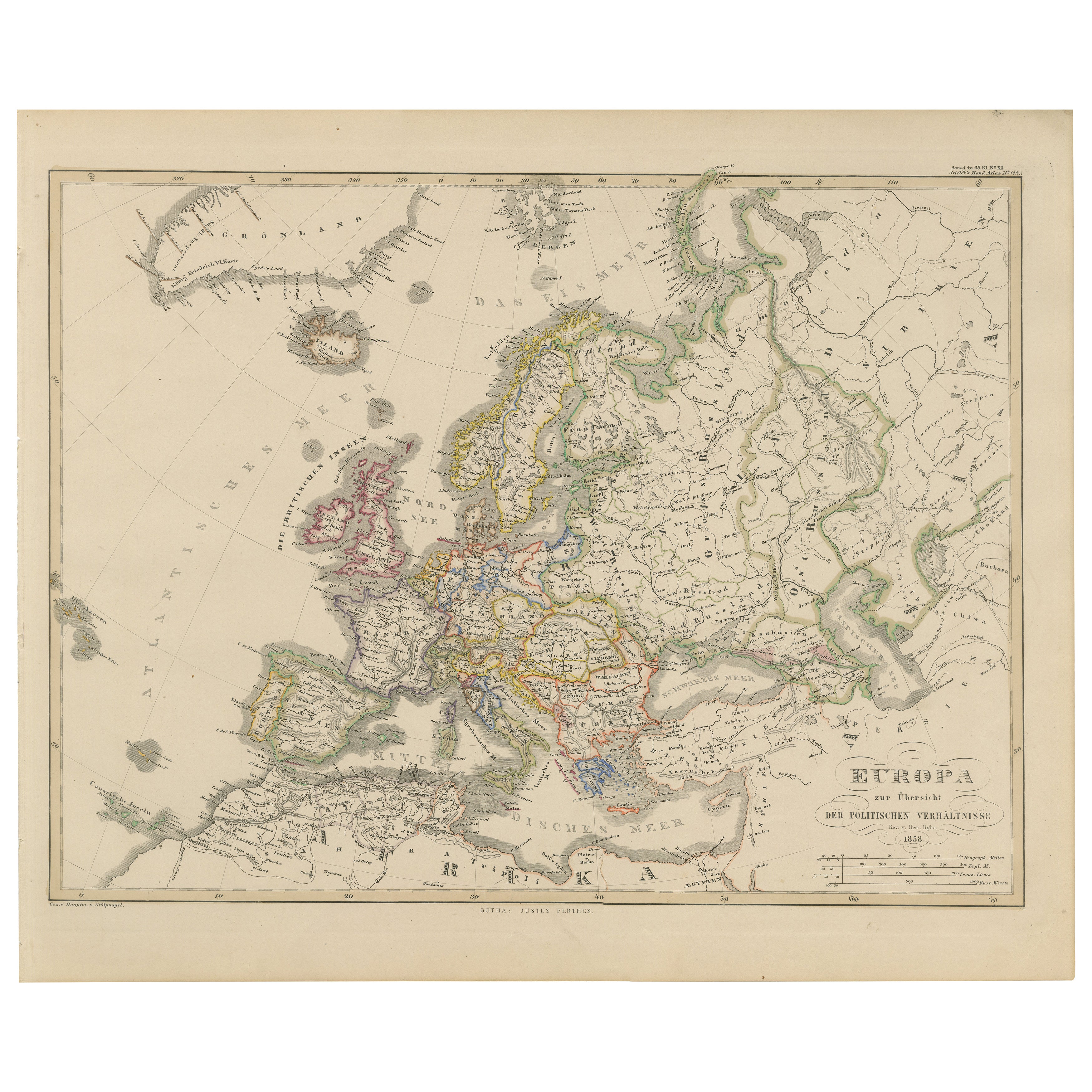
Europe Map – Political Divisions and Borders, Published in 1858
Located in Langweer, NL
Europe Map – Political Divisions and Borders 1858
This fine antique print shows Europe with its political divisions titled “Europa zur Übersicht der politischen Verhältnisse” meanin...
Category
Antique Mid-19th Century German Maps
Materials
Paper
Antique Map of the Europe Continent, 1880
Located in Langweer, NL
Antique map titled 'Europe'. Old map of the European continent. This map originates from 'Géographie Universelle Atlas-Migeon' by J. Migeon.
Artists an...
Category
Antique 19th Century Maps
Materials
Paper

$169 Sale Price
20% Off
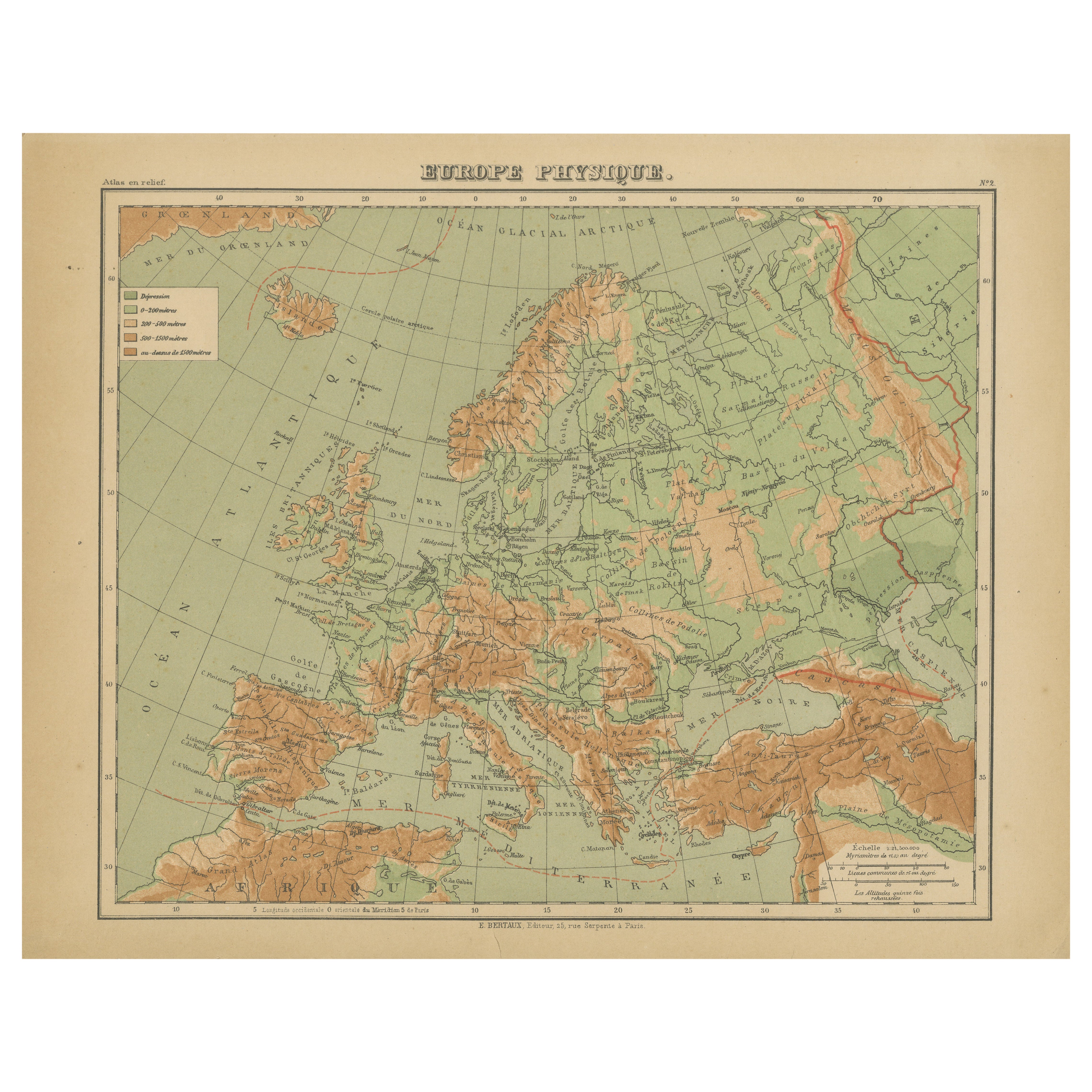
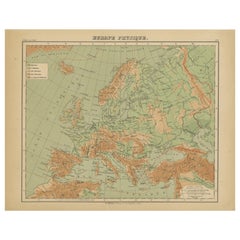
Relief Atlas Map of Europe by Hachette – Antique French Map c.1883
Located in Langweer, NL
Antique Map of Europe – Physical Relief Map by Hachette, circa 1883
Description:
This antique map titled “Europe Physique” was published by Hachette in Paris around 1883 and origina...
Category
Antique Late 19th Century French Maps
Materials
Paper
Antique Map of Europe by W. G. Blackie, 1859
Located in Langweer, NL
Antique map titled 'Europe'. Original antique map of Europe. This map originates from ‘The Imperial Atlas of Modern Geography’. Published by W. G. Blackie, 1859.
Category
Antique Mid-19th Century Maps
Materials
Paper

$235 Sale Price
20% Off
You May Also Like
Large Original Antique Map of Europe by Sidney Hall, 1847
Located in St Annes, Lancashire
Great map of Europe
Drawn and engraved by Sidney Hall
Steel engraving
Original colour outline
Published by A & C Black. 1847
Unframed
Free shipping.
Category
Antique 1840s Scottish Maps
Materials
Paper

Russia in Europe with Poland and Finland. Century Atlas antique vintage map
Located in Melbourne, Victoria
'The Century Atlas. Russia in Europe with Poland and Finland'
Original antique map, 1903.
Central fold as issued. Map name and number printed on the reverse corners.
Sheet 40cm by ...
Category
Early 20th Century Victorian More Prints
Materials
Lithograph

Original Antique Map of Europe, Arrowsmith, 1820
Located in St Annes, Lancashire
Great map of Europe
Drawn under the direction of Arrowsmith.
Copper-plate engraving.
Published by Longman, Hurst, Rees, Orme and Brown, 1820
...
Category
Antique 1820s English Maps
Materials
Paper

Russia, Western and Southern Part. Century Atlas antique vintage map
Located in Melbourne, Victoria
'The Century Atlas. Russia, Western and Southern Part'
Original antique map, 1903.
Inset map tilted 'St Petersburg and Environs'.
Central fold as issued. Map name and number printe...
Category
Early 20th Century Victorian More Prints
Materials
Lithograph

France, Northern Part. Century Atlas antique map
Located in Melbourne, Victoria
'The Century Atlas. France, Northern Part.'
Original antique map, 1903.
Inset maps of 'France in Provinces' and 'Paris and Vicinity'.
Central fold as issued. Map name and number pr...
Category
Early 20th Century Victorian More Prints
Materials
Lithograph

Map of Europe, 1844
Located in Houston, TX
Over 150 year old engraved map of Europe by Olney from 1844. Original hand color. Shows Northern Europe, Prussia and Germany.
Original antique map o...
Category
1840s More Prints
Materials
Ink, Watercolor, Handmade Paper

More Ways To Browse
Empire Library
Antique Engraving Tools
Library Ottoman
Railway Map
Antique Industrial Tools
Dark Web
Imperial Mahogany
Arctic Fox
Antique Mahogany Ottoman
Solid Mahogany Table
Dessert Glasses
Geometric Glass Table
Mid Century Pin
6x10 Rug
Studded Furniture
Styles Of Antique Desks
Black And White Coffee Table
Metal Relief