Items Similar to Antique Map of the Expedition of Govert Knol by Valentijn, 1726
Want more images or videos?
Request additional images or videos from the seller
1 of 5
Antique Map of the Expedition of Govert Knol by Valentijn, 1726
$103.48
$129.3620% Off
£76.69
£95.8620% Off
€86.40
€10820% Off
CA$141.28
CA$176.6020% Off
A$157.16
A$196.4620% Off
CHF 82.39
CHF 102.9820% Off
MX$1,920.51
MX$2,400.6320% Off
NOK 1,049.10
NOK 1,311.3820% Off
SEK 987.58
SEK 1,234.4820% Off
DKK 657.84
DKK 822.3020% Off
Shipping
Retrieving quote...The 1stDibs Promise:
Authenticity Guarantee,
Money-Back Guarantee,
24-Hour Cancellation
About the Item
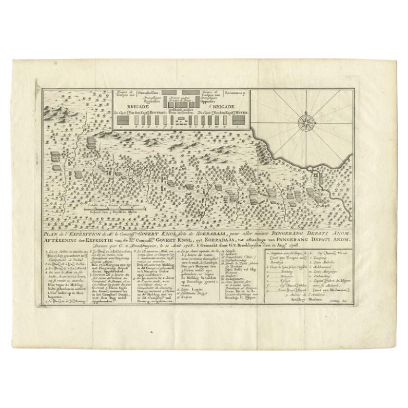
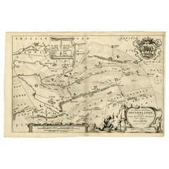
Antique map titled 'Aftekening der Expeditie van de Hr. Commissaris Govert Cnoll uyt Soerabaja, tot afhalinge van Pangerang Adepati Anom'. Map showing the expedition of Commissioner Govert Knol from Surabaya to Pangerang, Indonesia. This print originates from 'Oud en Nieuw Oost-Indiën' by F. Valentijn.
Artists and Engravers: François Valentijn (1666-1727), a missionary, worked at Amboina from 1684 to 1694 and 1705 to 1713 and travelled extensively in the VOC's lands.
Condition: Good, given age. Three tiny holes and paper erosion right top corner, due to worm holes, reinforced using contemporary paper backed with acid free archival tape. General age-related toning and/or occasional minor defects from handling. Please study image carefully.
Date: 1726
Overall size: 33.8 x 20.8 cm.
Image size: 30 x 18.4 cm.
We sell original antique maps to collectors, historians, educators and interior decorators all over the world. Our collection includes a wide range of authentic antique maps from the 16th to the 20th centuries. Buying and collecting antique maps is a tradition that goes back hundreds of years. Antique maps have proved a richly rewarding investment over the past decade, thanks to a growing appreciation of their unique historical appeal. Today the decorative qualities of antique maps are widely recognized by interior designers who appreciate their beauty and design flexibility. Depending on the individual map, presentation, and context, a rare or antique map can be modern, traditional, abstract, figurative, serious or whimsical. We offer a wide range of authentic antique maps for any budget
- Dimensions:Height: 8.19 in (20.8 cm)Width: 13.31 in (33.8 cm)Depth: 0 in (0.01 mm)
- Materials and Techniques:
- Period:
- Date of Manufacture:1726
- Condition:
- Seller Location:Langweer, NL
- Reference Number:Seller: PCT-511691stDibs: LU3054327793772
About the Seller
5.0
Recognized Seller
These prestigious sellers are industry leaders and represent the highest echelon for item quality and design.
Platinum Seller
Premium sellers with a 4.7+ rating and 24-hour response times
Established in 2009
1stDibs seller since 2017
2,502 sales on 1stDibs
Typical response time: <1 hour
- ShippingRetrieving quote...Shipping from: Langweer, Netherlands
- Return Policy
Authenticity Guarantee
In the unlikely event there’s an issue with an item’s authenticity, contact us within 1 year for a full refund. DetailsMoney-Back Guarantee
If your item is not as described, is damaged in transit, or does not arrive, contact us within 7 days for a full refund. Details24-Hour Cancellation
You have a 24-hour grace period in which to reconsider your purchase, with no questions asked.Vetted Professional Sellers
Our world-class sellers must adhere to strict standards for service and quality, maintaining the integrity of our listings.Price-Match Guarantee
If you find that a seller listed the same item for a lower price elsewhere, we’ll match it.Trusted Global Delivery
Our best-in-class carrier network provides specialized shipping options worldwide, including custom delivery.More From This Seller
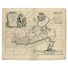
View AllAntique Map of the Expedition of Govert Knol by Van Schley, 1765
By Jakob van der Schley
Located in Langweer, NL
Antique map titled 'Plan de l' expédition de Mr. le Commiss. re Govert Knol, forti de Soerabaja, pour aller recévoir Pangerang Depati Anom. / Aftékening der Expeditie van de H. r Commiss. is Govert Knol , uyt Soerabaya , tot afhaalinge van Pangerang Depati Anom'. Map showing the expedition...
Category
Antique 18th Century Maps
Materials
Paper
$114 Sale Price
20% Off
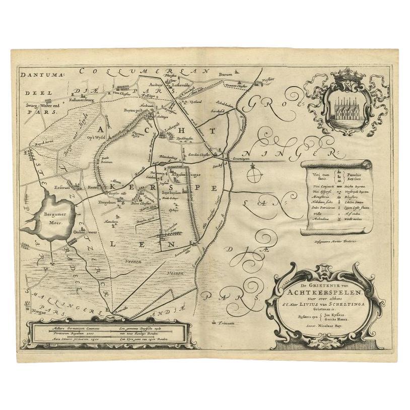
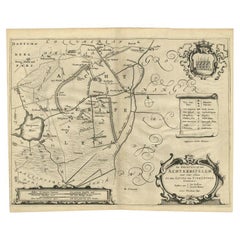
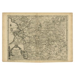
Antique Map of the Region of Achtkarspelen by Schotanus, 1664
Located in Langweer, NL
Antique map titled 'De Grietenije van Achtkerspelen (..)'. Map of the Grietenij of Achtkarspelen, Friesland, The Netherlands. Multiple cartouches, key and coat of arms. Originates fr...
Category
Antique 17th Century Maps
Materials
Paper
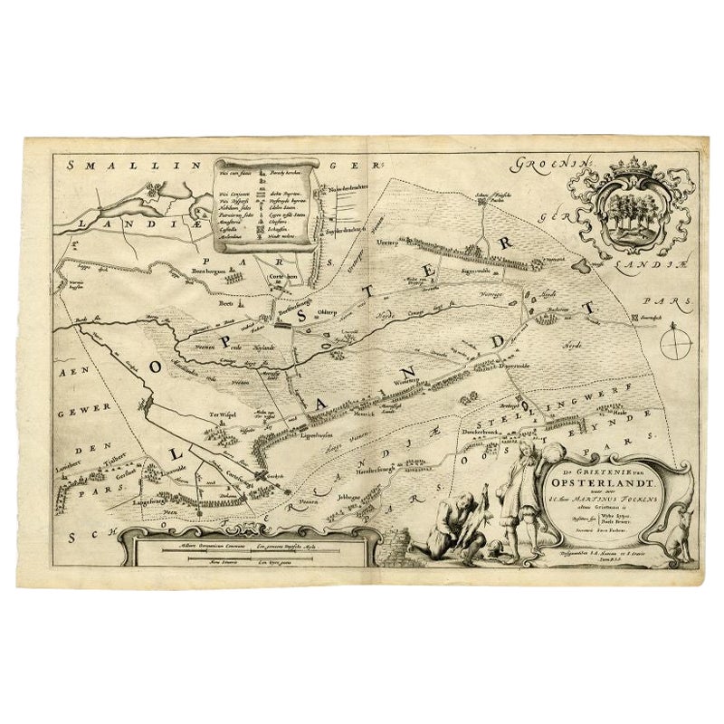
Antique Map of the Region of Opsterland by Schotanus, 1664
By B. Schotanus
Located in Langweer, NL
Antique map titled 'De Grietenie van Opsterlandt : waer over d'e. heer Martinus Fockens altans grietman is, bysitters syn Wybe Sytjes, Boele Broers, secretaris Saco Fockens.' Detaile...
Category
Antique 17th Century Maps
Materials
Paper
$258 Sale Price
20% Off
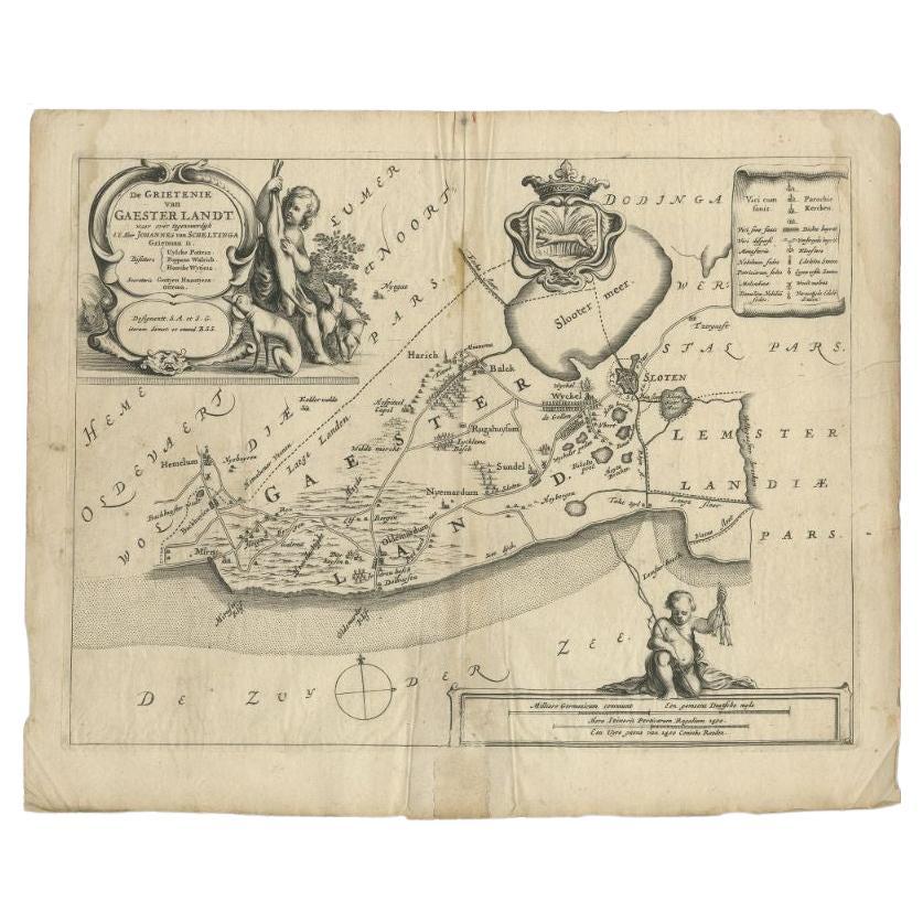
Antique Map of the Region of Gaasterland, Friesland, The Netherlands, 1664
Located in Langweer, NL
Antique map titled 'De Grietenie van Gaesterlandt (..)'. Map of the region of Gaasterland in Friesland, the Netherlands. This region includes the villages of Balk, Sloten, Wyckel and...
Category
Antique 17th Century Maps
Materials
Paper
$114 Sale Price
20% Off
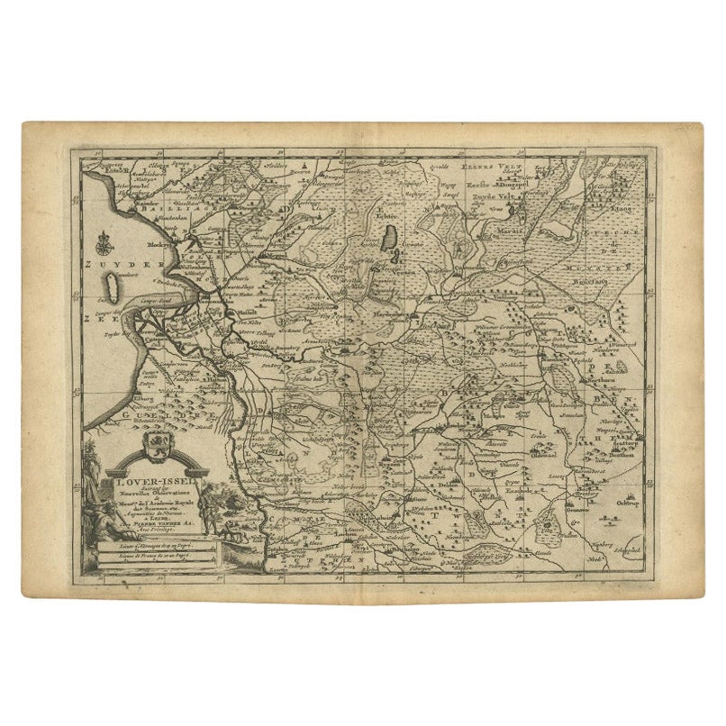
Antique Map of Overijssel by Van der Aa, c.1715
Located in Langweer, NL
Antique map titled 'L'Over-Issel'. This map depicts the Dutch province Overijssel. This map originates from 'Nouvel Atlas, très exact et fort commode pour toutes sortes de personnes,...
Category
Antique 18th Century Maps
Materials
Paper
$182 Sale Price
20% Off
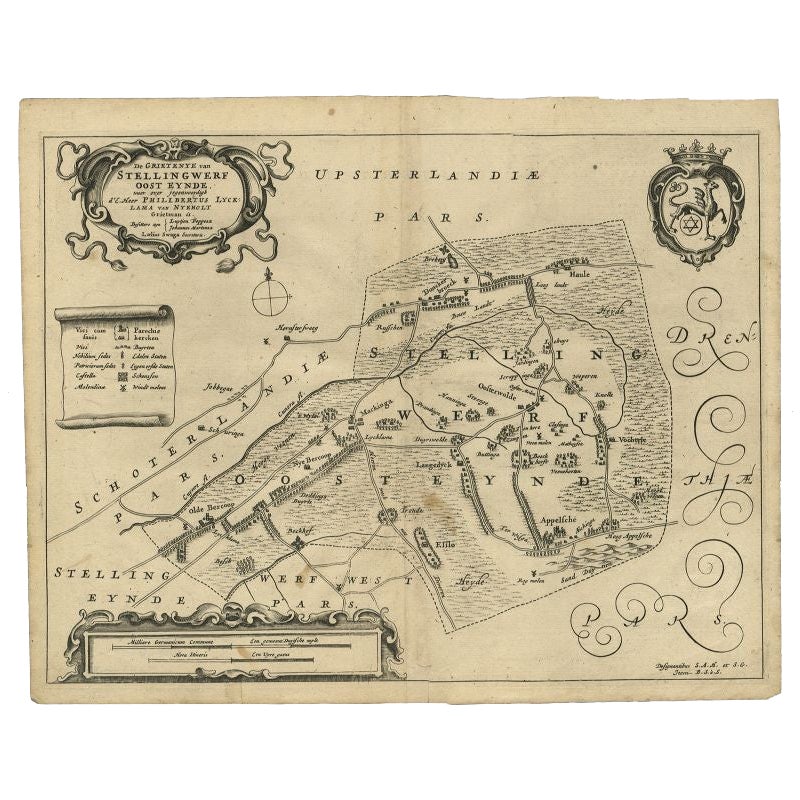
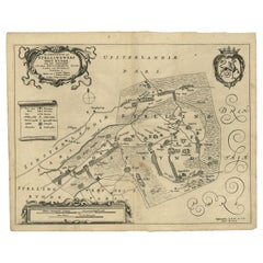
Antique Map of the Region of Ooststellingwerf by Schotanus, 1664
By B. Schotanus
Located in Langweer, NL
Antique map titled 'De Grietenije van Stellingwerf oost eynde (..).' Map of the Grietenij of Ooststellingwerf, Friesland, The Netherlands. Multiple cartouches, key and coat of arms. ...
Category
Antique 17th Century Maps
Materials
Paper
You May Also Like
1627 Hendrik Hondius Map Entitled "Vltoniae Orientalis Pars, " Ric.a009
Located in Norton, MA
1627 Hendrik Hondius map entitled
"Vltoniae orientalis pars,"
Ric.a009
Title:
Vltoniae orientalis : pars
Title (alt.) :
Ultoniae orientalis pars
Creator:
Mercator, Gerh...
Category
Antique 17th Century Dutch Maps
Materials
Paper

1646 Jansson Map Entitled "Procinvia Connactiae, " Ric.a006
Located in Norton, MA
1646 Jansson map entitled
"Procinvia connactiae,"
Ric.a006
Description: The PROVINCE of CONNAVGT 490 x 380From vol 4 of Jansson's Atlas Novus 1646, published in Amsterdam with...
Category
Antique 17th Century Unknown Maps
Materials
Paper

1640 Willem Blaeu Map Entitled "Contado di molise et principato vltra, " Ric.a003
By Willem Blaeu
Located in Norton, MA
1640 Willem Blaeu map entitled
"Contado di molise et principato vltra,"
Colored
Ric. a003
Measures: 38 x 49.6 cm and wide margins
DBLAEU.
Cou...
Category
Antique 17th Century Dutch Maps
Materials
Paper

1635 Willem Blaeu Map of Northern France"Comitatvs Bellovacvm" Ric.a08
Located in Norton, MA
1635 Willem Blaeu map of northern France, entitled.
"Comitatvs Bellovacvm Vernacule Beavvais,"
Colored
Ric.a008
“COMITATVS BELLOVACVM…” Amsterdam: W...
Category
Antique 17th Century Unknown Maps
Materials
Paper

1643 Willem&Joan Blaeu Map NW Flanders "Flandriae Teutonicae Pars Prientalior
Located in Norton, MA
1643 Willem and Joan Blaeu map of northwest Flanders, entitled
"Flandriae Teutonicae Pars Prientalior,"
Ric0012
" Authentic" - Map of the northwest Fl...
Category
Antique 17th Century Dutch Maps
Materials
Paper

1657 Janssonius Map of Vermandois and Cappelle, Ric. A-004
Located in Norton, MA
1657 Janssonius map of
Vermandois and Cappelle
Ric.a004
Description: Antique map of France titled 'Descriptio Veromanduorum - Gouvernement de la Cappelle'. Two detailed maps o...
Category
Antique 17th Century Unknown Maps
Materials
Paper

More Ways To Browse
Expedition Furniture
French School Map
Nova Scotia Antique Furniture
Richard Wentworth
Antique Mace
Map Of Madagascar
Map Of Normandy
Bali Map
Croatia Map
Gibraltar Antique Map
Albania Antique Map
Antique Furniture Kingston
Antique Louisiana Map
Armenia Map
L Tardieu
Chinese Wall Pocket
18th Century Nautical Engraving
Antique Map Burgundy