Items Similar to Antique Map of Flintshire in Wales, United Kingdom, c.1850
Want more images or videos?
Request additional images or videos from the seller
1 of 5
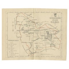
Antique Map of Flintshire in Wales, United Kingdom, c.1850
$132.32
$165.4020% Off
£99.18
£123.9820% Off
€112
€14020% Off
CA$181.79
CA$227.2420% Off
A$202.95
A$253.6920% Off
CHF 106.34
CHF 132.9320% Off
MX$2,484.31
MX$3,105.3920% Off
NOK 1,350.56
NOK 1,688.1920% Off
SEK 1,273.40
SEK 1,591.7520% Off
DKK 852.58
DKK 1,065.7320% Off
About the Item
Antique map titled 'Flintshire'. Antique map of Flintshire with a inlay plan of Flintshire town. Flintshire is a principal area of Wales, known as a county, United Kingdom. Drawn and engraved for Lewis 'Topographical Dictionary'.
Artists and Engravers: Engraved by J. & C. Walker.
Condition: Very good, general age-related toning. Please study image carefully.
Date: c.1850
Overall size: 32 x 24.5 cm.
Image size: 23 x 17.5 cm.
We sell original antique maps to collectors, historians, educators and interior decorators all over the world. Our collection includes a wide range of authentic antique maps from the 16th to the 20th centuries. Buying and collecting antique maps is a tradition that goes back hundreds of years. Antique maps have proved a richly rewarding investment over the past decade, thanks to a growing appreciation of their unique historical appeal. Today the decorative qualities of antique maps are widely recognized by interior designers who appreciate their beauty and design flexibility. Depending on the individual map, presentation, and context, a rare or antique map can be modern, traditional, abstract, figurative, serious or whimsical. We offer a wide range of authentic antique maps for any budget.
- Dimensions:Height: 9.65 in (24.5 cm)Width: 12.6 in (32 cm)Depth: 0 in (0.01 mm)
- Materials and Techniques:
- Period:
- Date of Manufacture:circa 1850
- Condition:
- Seller Location:Langweer, NL
- Reference Number:Seller: BG-095201stDibs: LU3054326190642
About the Seller
5.0
Recognized Seller
These prestigious sellers are industry leaders and represent the highest echelon for item quality and design.
Platinum Seller
Premium sellers with a 4.7+ rating and 24-hour response times
Established in 2009
1stDibs seller since 2017
2,513 sales on 1stDibs
Typical response time: <1 hour
- ShippingRetrieving quote...Shipping from: Langweer, Netherlands
- Return Policy
Authenticity Guarantee
In the unlikely event there’s an issue with an item’s authenticity, contact us within 1 year for a full refund. DetailsMoney-Back Guarantee
If your item is not as described, is damaged in transit, or does not arrive, contact us within 7 days for a full refund. Details24-Hour Cancellation
You have a 24-hour grace period in which to reconsider your purchase, with no questions asked.Vetted Professional Sellers
Our world-class sellers must adhere to strict standards for service and quality, maintaining the integrity of our listings.Price-Match Guarantee
If you find that a seller listed the same item for a lower price elsewhere, we’ll match it.Trusted Global Delivery
Our best-in-class carrier network provides specialized shipping options worldwide, including custom delivery.More From This Seller
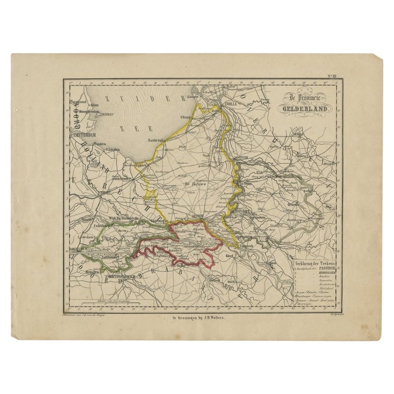
View AllAntique Map of Gelderland, Largest Province of The Netherlands, c.1870
Located in Langweer, NL
Antique map titled 'De Provincie Gelderland'.
Map of the province of Gelderland, the Netherlands. This map originates from 'F. C. Brugsma's Atlas van het Koninkrijk der Nederland...
Category
Antique 19th Century Maps
Materials
Paper
$103 Sale Price
20% Off
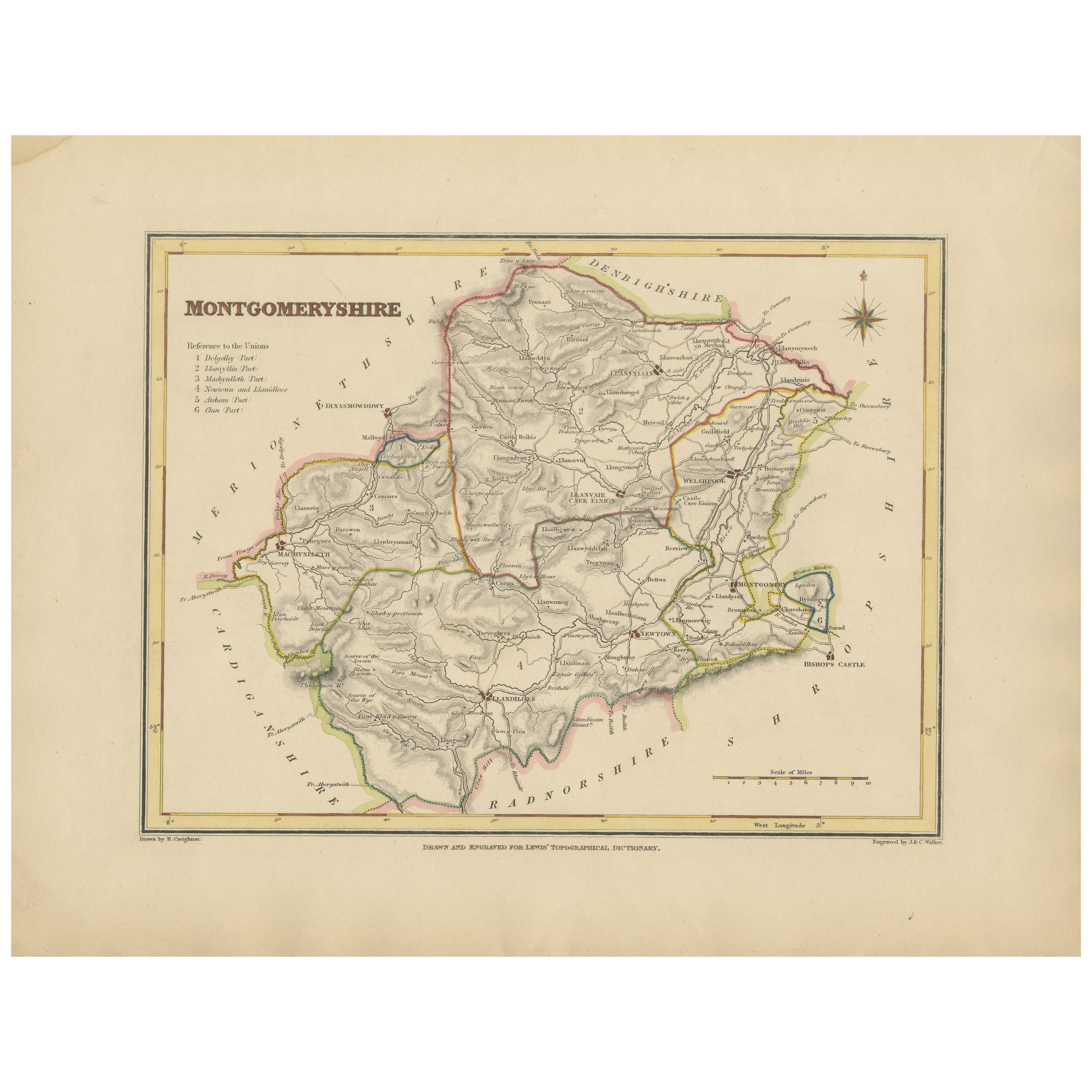
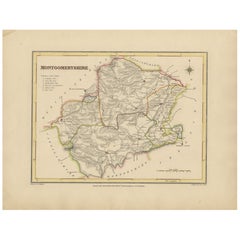
Old Map of Montgomeryshire by 1844 – Welshpool Llanidloes Newtown Machynlleth
Located in Langweer, NL
Title: Old Map of Montgomeryshire by Samuel Lewis 1844 – Welshpool Llanidloes Newtown Machynlleth
Description: This 1844 map of Montgomeryshire was engraved for Samuel Lewis’ Topographical Dictionary of Wales. It highlights principal towns such as Welshpool, Llanidloes, Newtown, and Machynlleth, with rivers, roads, and hill shading showing the region's terrain. The hand-colored borders mark the administrative divisions, and a decorative compass rose and union reference chart are included.
Condition:
The map is in good condition with light age toning and wide clean margins. The engraving is clear and the original hand coloring remains vibrant. No tears or major imperfections are present.
Framing suggestions:
An acid-free mat in ivory or soft beige will complement the aged paper tone. A dark wood, black, or antique gold frame will suit the historic style. UV-protective glass is recommended to preserve the colors. A beautiful display piece for those with ties to mid-Wales or an interest in antique cartography.
Keywords:
Montgomeryshire map 1844 Samuel Lewis antique...
Category
Antique 1840s Maps
Materials
Paper
$226 Sale Price
20% Off
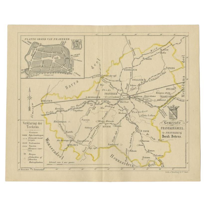
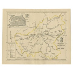
Antique Map of the Franekeradeel Township by Behrns, 1861
Located in Langweer, NL
Antique map titled 'Gemeente Franekeradeel'. Old map depicting the Franekeradeel township including cities and villages like Franeker, Midlum, Hitsum, Schalsum, Dongjum, Peins and Ac...
Category
Antique 19th Century Maps
Materials
Paper
$84 Sale Price
20% Off
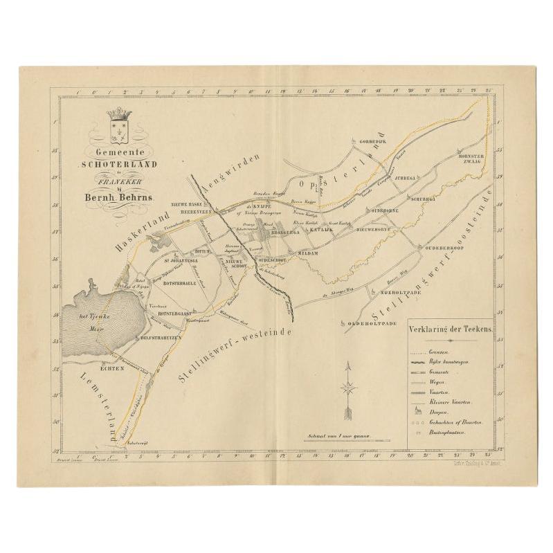
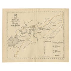
Antique Map of the Schoterland Township in Friesland, the Netherlands, 1861
Located in Langweer, NL
Antique map titled 'Gemeente Schoterland'. Old map depicting the Schoterland township including cities and villages like Rotsterhaule, Delfstrahuizen, Nieuweschoot, Mildam, Katlijk, ...
Category
Antique 19th Century Maps
Materials
Paper
$189 Sale Price
20% Off
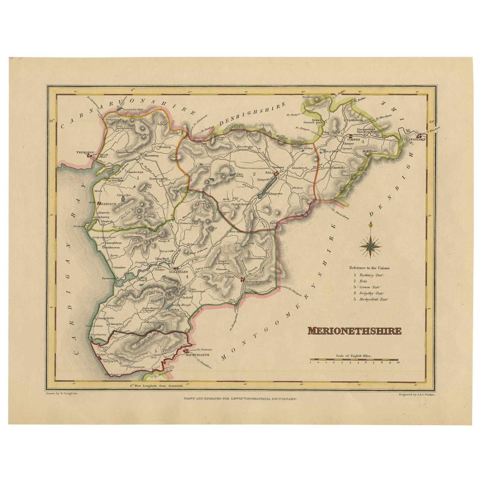
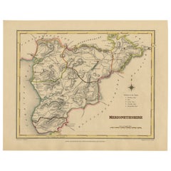
Old Map of Merionethshire by Lewis, 1844: Barmouth, Bala, Harlech, Dolgelley
Located in Langweer, NL
Old Map of Merionethshire by Samuel Lewis 1844 – Barmouth Bala Harlech Dolgelley
Description: This finely engraved hand-colored map of Merionethshire was published in 1844 for Samu...
Category
Antique 1840s Maps
Materials
Paper
$226 Sale Price
20% Off
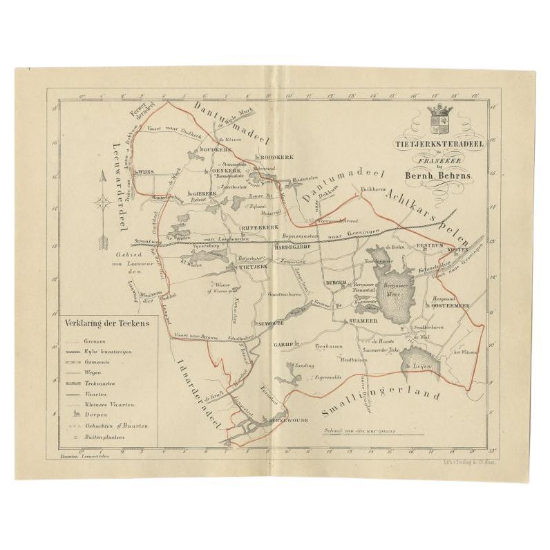
Antique Map of the Frisian Tietjerksteradeel Township in the Netherlands, 1861
Located in Langweer, NL
Antique map titled 'Gemeente Tietjerksteradeel'. Old map depicting the Tietjerksteradeel township including cities and villages like Wijns, Oenkerk, Rijperkerk, Hardegarijp, Tietjerk...
Category
Antique 19th Century Maps
Materials
Paper
$132 Sale Price
20% Off
You May Also Like
Original Antique English County Map - Monmouthshire. J & C Walker. 1851
Located in St Annes, Lancashire
Great map of Monmouthshire
Original colour
By J & C Walker
Published by Longman, Rees, Orme, Brown & Co. 1851
Unframed.
Category
Antique 1850s English Other Maps
Materials
Paper

Original Antique English County Map, Buckinghamshire, J & C Walker, 1851
Located in St Annes, Lancashire
Great map of Buckinghamshire
Original colour
By J & C Walker
Published by Longman, Rees, Orme, Brown & Co. 1851
Unframed.
Category
Antique 1850s English Other Maps
Materials
Paper

Original Antique English County Map, Nottinghamshire, J & C Walker, 1851
Located in St Annes, Lancashire
Great map of Nottinghamshire
Original colour
By J & C Walker
Published by Longman, Rees, Orme, Brown & Co. 1851
Unframed.
Category
Antique 1850s English Other Maps
Materials
Paper

Original Antique English County Map, Herefordshire, J & C Walker, 1851
Located in St Annes, Lancashire
Great map of Herefordshire
Original colour
By J & C Walker
Published by Longman, Rees, Orme, Brown & Co. 1851
Unframed.
Category
Antique 1850s English Other Maps
Materials
Paper

Original Antique English County Map, Derbyshire, J & C Walker, 1851
Located in St Annes, Lancashire
Great map of Derbyshire
Original colour
By J & C Walker
Published by Longman, Rees, Orme, Brown & Co. 1851
Unframed.
Category
Antique 1850s English Other Maps
Materials
Paper

Original Antique English County Map, Rutland, J & C Walker, 1851
Located in St Annes, Lancashire
Great map of Rutland
Original colour
By J & C Walker
Published by Longman, Rees, Orme, Brown & Co. 1851
Unframed.
Category
Antique 1850s English Other Maps
Materials
Paper

More Ways To Browse
Wales And Wales Furniture
J C Walker Map
Antique Railroad Collectibles
Blaeu World Map
Roman Empire Map
Antique Map Of Middle East
Caribbean Map
Antique Map Of Egypt
Antique Map Ortelius
Antique Farm Antiques Collectibles
Antique Galleon
Biblical Maps
Medieval Capital
Civil War Map
Map Of Singapore
Migeon Migeon
Scottish Coat Of Arms
Antique Maps Of Canada