Items Similar to Antique Map of France, 1903, with Inset of Paris and Corsica

Want more images or videos?
Request additional images or videos from the seller
1 of 10
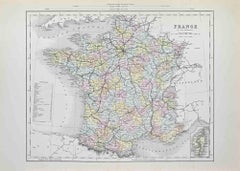
Antique Map of France, 1903, with Inset of Paris and Corsica
$372.31
£274.20
€310
CA$506.49
A$562.83
CHF 294.93
MX$6,902.05
NOK 3,761.62
SEK 3,538.79
DKK 2,359.98
Shipping
Retrieving quote...The 1stDibs Promise:
Authenticity Guarantee,
Money-Back Guarantee,
24-Hour Cancellation
About the Item
Title: Antique Map of France, 1903, with Inset of Paris and Corsica
Description:
This antique map, titled "France," was engraved and published in 1903 by the renowned W. & A.K. Johnston firm in Edinburgh and London. It offers a comprehensive and meticulously detailed view of France at the turn of the 20th century, capturing both its diverse geography and its political organization.
The map features an intricate network of departments, with boundaries delicately shaded in pastel greens, pinks, yellows, and blues, making each region stand out with subtle elegance. Cities, towns, rivers, and mountain ranges are finely rendered, showcasing the exceptional craftsmanship and precision that Johnston maps are known for.
A standout feature of this map is its inset detailing the "Environs of Paris," providing an in-depth view of the French capital and its surrounding area. Another inset focuses on the island of Corsica, ensuring no part of the French Republic is left undocumented. The clear, crisp typography and fine linework highlight the map’s quality, while the soft color palette adds a refined aesthetic that complements both modern and traditional interiors.
For collectors and enthusiasts, this map offers more than geographic data—it’s a snapshot of France at a time when the country was a leading European power with a rich cultural and political heritage. It also reflects a period of modernization, with railways connecting even the remotest parts of the nation.
Condition report:
The map is in very good antique condition, with minimal foxing and light edge toning typical for its age. The colors remain vibrant and the paper is stable and well-preserved.
Framing tips:
A dark wooden frame, such as walnut or mahogany, will add warmth and sophistication to this map. Use a cream or off-white matting to highlight the soft pastel colors and intricate detail, making this a refined and elegant focal point in any room or office.
- Dimensions:Height: 14.49 in (36.8 cm)Width: 18.9 in (48 cm)Depth: 0.01 in (0.2 mm)
- Materials and Techniques:
- Period:
- Date of Manufacture:1903
- Condition:The map is in very good antique condition, with minor age-related foxing and slight edge toning typical for its vintage. The colors remain vibrant and the paper is stable and well-preserved. Folding line as issued.
- Seller Location:Langweer, NL
- Reference Number:Seller: BG-13577-91stDibs: LU3054345241512
About the Seller
5.0
Recognized Seller
These prestigious sellers are industry leaders and represent the highest echelon for item quality and design.
Platinum Seller
Premium sellers with a 4.7+ rating and 24-hour response times
Established in 2009
1stDibs seller since 2017
2,494 sales on 1stDibs
Typical response time: 1 hour
- ShippingRetrieving quote...Shipping from: Langweer, Netherlands
- Return Policy
Authenticity Guarantee
In the unlikely event there’s an issue with an item’s authenticity, contact us within 1 year for a full refund. DetailsMoney-Back Guarantee
If your item is not as described, is damaged in transit, or does not arrive, contact us within 7 days for a full refund. Details24-Hour Cancellation
You have a 24-hour grace period in which to reconsider your purchase, with no questions asked.Vetted Professional Sellers
Our world-class sellers must adhere to strict standards for service and quality, maintaining the integrity of our listings.Price-Match Guarantee
If you find that a seller listed the same item for a lower price elsewhere, we’ll match it.Trusted Global Delivery
Our best-in-class carrier network provides specialized shipping options worldwide, including custom delivery.More From This Seller
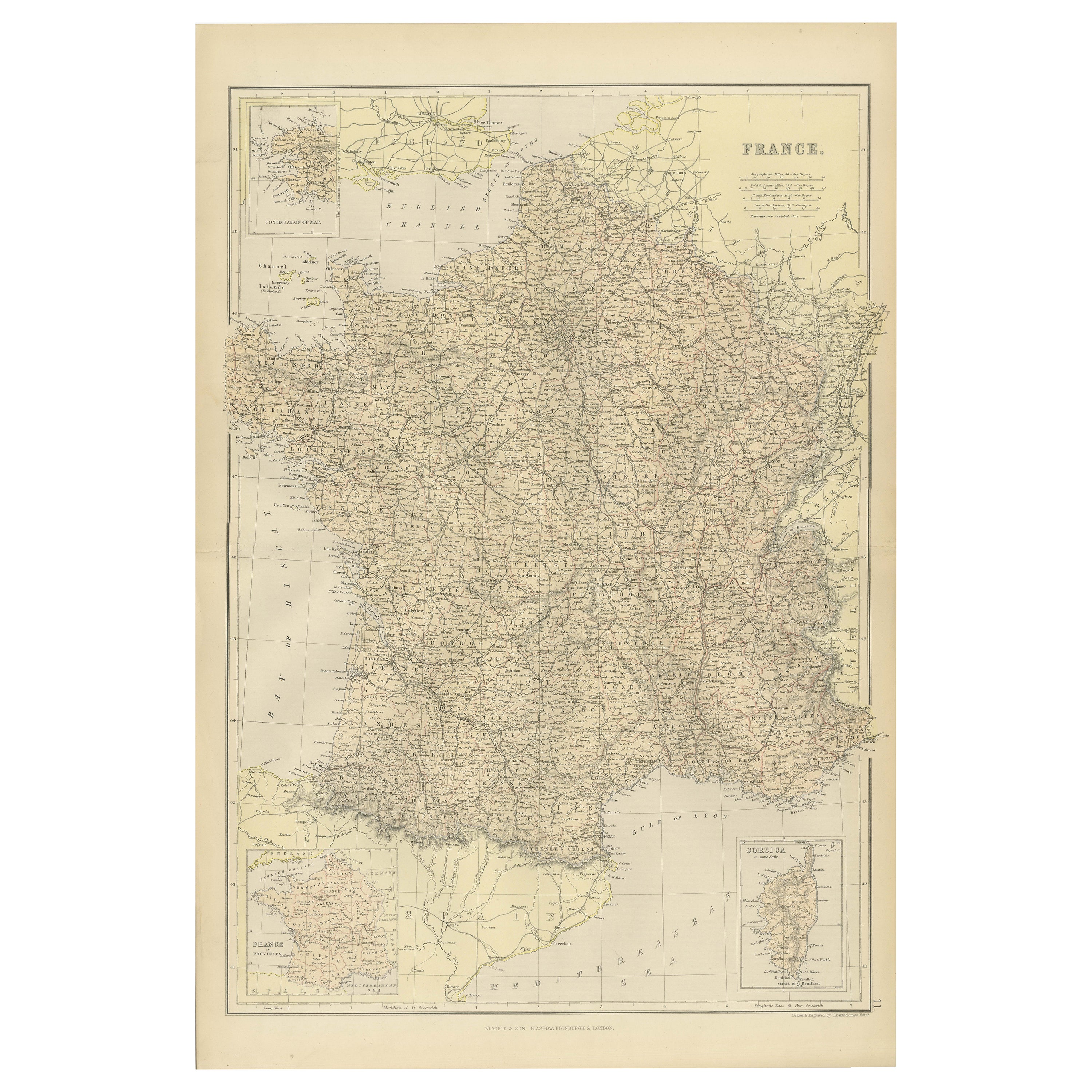
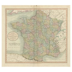
View AllAntique Map of France by A & C. Black, 1870
Located in Langweer, NL
Antique map titled 'France'. Original antique map of France with inset map of France as divided into provinces, before the revolution of 1789 and map of Corsica...
Category
Antique Late 19th Century Maps
Materials
Paper

$264 Sale Price
20% Off
1882 Map of France Highlighting Political Boundaries, Cities, Insets of Corsica
Located in Langweer, NL
This 1882 map of France, published by Blackie and Son as part of the 'Comprehensive Atlas and Geography of the World,' offers a detailed depiction of the country during the late 19th...
Category
Antique 1880s Maps
Materials
Paper

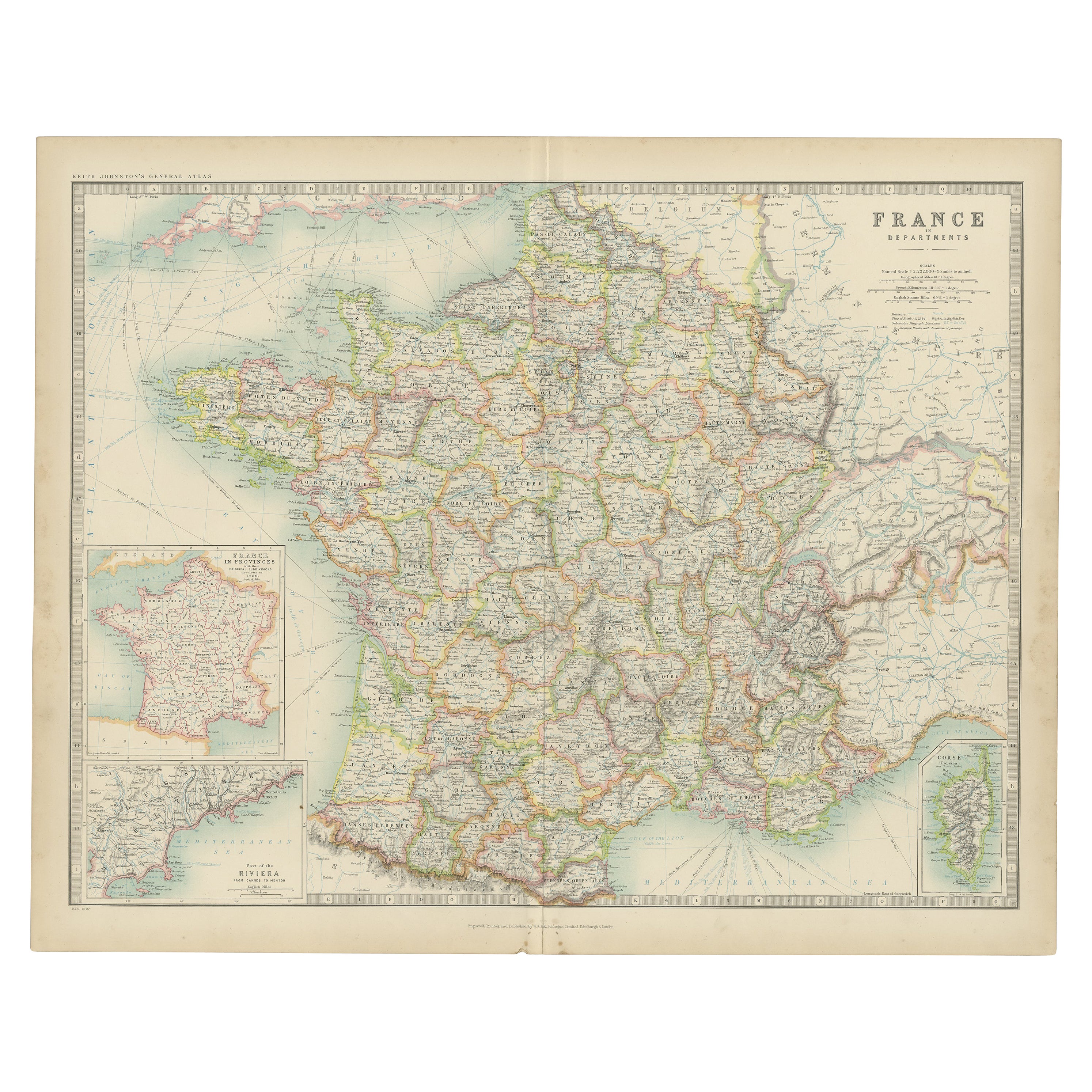
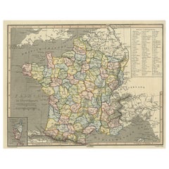
Antique Map of France by Johnston (1909)
Located in Langweer, NL
Antique map titled 'France'. Original antique map of France. With inset maps of France in provinces, part of the Riviera and Corsica. This map or...
Category
Early 20th Century Maps
Materials
Paper

$240 Sale Price
20% Off
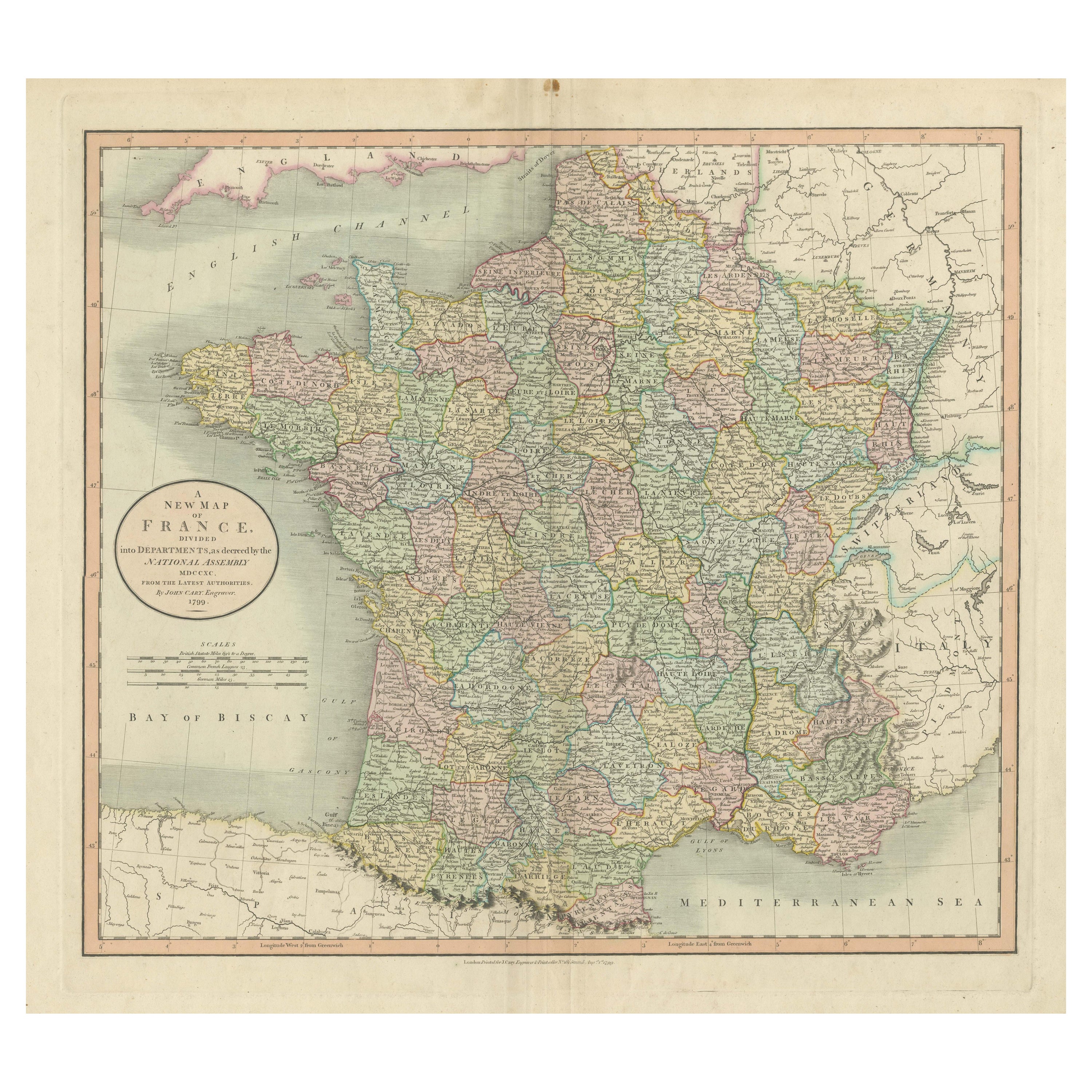
Antique Map of France Divided into Departments, with Original Hand Coloring
Located in Langweer, NL
Antique map titled 'A New Map of France (..)'. Original old map of France, divided into departments. With original/contemporary hand coloring. Published by John Cary, 1799. John Cary was an important and prolific London map seller...
Category
Antique Late 18th Century Maps
Materials
Paper
$422 Sale Price
20% Off
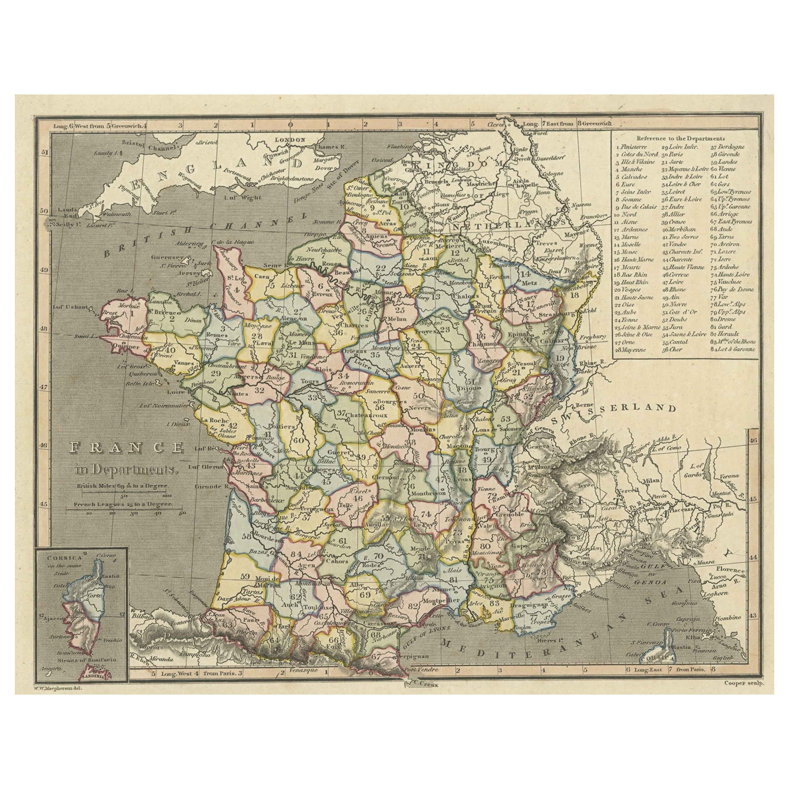
Antique Map of France with Inset Map of the Island of Corsica, 1820
Located in Langweer, NL
Antique map titled 'France in Departments'. Old map of France, with small inset map of the island of Corsica. Includes a table with reference to the departments.
Artists and Engr...
Category
Antique 19th Century Maps
Materials
Paper
$249 Sale Price
20% Off
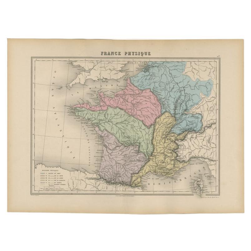
Antique Map of France by Migeon, 1880
Located in Langweer, NL
Antique map titled 'France Physique'. Old map of France. This map originates from 'Géographie Universelle Atlas-Migeon' by J. Migeon.
Artists and Engravers: Published by J. Migeon...
Category
Antique 19th Century Maps
Materials
Paper

$124 Sale Price
20% Off
You May Also Like
France, Northern Part. Century Atlas antique map
Located in Melbourne, Victoria
'The Century Atlas. France, Northern Part.'
Original antique map, 1903.
Inset maps of 'France in Provinces' and 'Paris and Vicinity'.
Central fold as issued. Map name and number pr...
Category
Early 20th Century Victorian More Prints
Materials
Lithograph

Large 19th Century Map of France
Located in Pease pottage, West Sussex
Large 19th Century Map of France.
Remarkable condition, with a pleasing age worn patina.
Recently framed.
France Circa 1874.
Category
Antique Late 19th Century French Maps
Materials
Linen, Paper

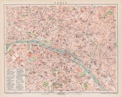
Paris, France. Antique Map City Plan Chromolithograph, circa 1895
Located in Melbourne, Victoria
'Paris'
Colour lithograph. 1895.
250mm by 305mm (sheet).
Late 19th century German lithograph plan of Paris, France.
Central vertical fold. Printed street index on the reverse o...
Category
Late 19th Century Victorian More Prints
Materials
Lithograph
France in Departments - Lithograph - 1872
Located in Roma, IT
France in Departments is a map realized by an artist of the 19th century.
Lithograph, printed in 1872 by Milliam Mackenzie, London.
Category
1870s Modern Figurative Prints
Materials
Lithograph
France in Departments - Lithograph - 1872
Located in Roma, IT
France in Departments is an artwork realized by an artist of the 19th century.
Lithograph, printed in 1872 by Milliam Mackenzie, London.
Good condition.
Category
1870s Modern Figurative Prints
Materials
Lithograph

Antique Map of France
Located in Dallas, TX
Nice antique map of France in wood frame. This would make a great gift for a collector. A wonderful accessory!
Category
Early 20th Century Decorative Art
Materials
Glass, Wood, Paper

$1,760
More Ways To Browse
Railway Map
French Matting
Solid Mahogany Table
Dessert Glasses
Geometric Glass Table
Mid Century Pin
6x10 Rug
Studded Furniture
Styles Of Antique Desks
Black And White Coffee Table
Metal Relief
Curved Velvet Couch
Velvet Curved Sofa
Wood Round Coffee Tables
Antique Paper Flowers
Oak Brutalist
Used College Furniture
Wood Minimalist Chair