Items Similar to Antique Map of Kalmykia – Vandermaelen Lithograph of Central Asia, 1827


Want more images or videos?
Request additional images or videos from the seller
1 of 10
Antique Map of Kalmykia – Vandermaelen Lithograph of Central Asia, 1827
$428.15
£318.59
€360
CA$588.26
A$656.55
CHF 345.42
MX$7,975.21
NOK 4,378.98
SEK 4,098.17
DKK 2,740.54
About the Item
Antique Map of Kalmykia – Vandermaelen Lithograph of Central Asia, 1827
This rare antique map titled “Partie de la Kalmoukie” (No. 56) is an original 1827 lithograph by Belgian cartographer Philippe Marie Vandermaelen. Published as part of his monumental Atlas Universel, this sheet presents a stark and evocative portrayal of a remote region of Central Asia, including parts of present-day western China (Xinjiang), near the Taklamakan Desert and Lop Nor basin.
The map focuses on the arid expanses historically associated with the Kalmyk and Uyghur regions, featuring locations such as the cities of Khotan (Kotân), Yarkand (Yarkend), and the lake of Lop Nor, clearly marked as "Lop." Also indicated are several mountain ranges, desert tracts labeled "Désert Sablonneux" (Sandy Desert), and notable rivers including the Yarkand River. The map annotates locations with sparse settlement names like Sertene, Cas. Nog., and regions like “Province de Fo-Ym,” “Kharie,” and “Oukie,” reflecting a European interpretation of the ethnic and geographic divisions of the time.
This print stands out for its minimalist style, characteristic of Vandermaelen’s work, which prioritizes accuracy and topographical clarity. The terrain is rendered in shaded relief to indicate elevation, and the few named settlements and rivers reflect the limited Western knowledge of the region in the early 19th century. This map forms part of Vandermaelen's innovative vision: mapping the entire world at the same scale (1:1,641,836) and printing it via lithography—a cutting-edge method at the time.
Philippe Vandermaelen was a self-taught mapmaker and the founder of the Établissement Géographique in Brussels, one of the earliest and most significant geographic institutes in Europe. His Atlas Universel was the first to attempt a systematic representation of the world at a consistent scale, allowing all sheets to be joined into a giant three-dimensional globe.
Condition: Good condition overall. Crisp impression with original centerfold. Light, even toning with minimal spotting. Strong paper with no tears, repairs, or foxing, except for both bottom corners.
Framing tips: This map’s subdued elegance is well-suited to minimalist or vintage-style frames in matte black, warm oak, or brushed bronze. Use a pale ivory or sand-colored mat to echo the desert tones and enhance the map’s visual depth.
Technique: Lithograph
Maker: Philippe Marie Vandermaelen, Brussels, 1827
- Dimensions:Height: 18.51 in (47 cm)Width: 20.28 in (51.5 cm)Depth: 0.01 in (0.2 mm)
- Materials and Techniques:Paper,Engraved
- Place of Origin:
- Period:
- Date of Manufacture:1827
- Condition:Condition: Good condition overall. Crisp impression with original centerfold. Light, even toning with minimal spotting. Strong paper with no tears, repairs, or foxing, except for both bottom corners.
- Seller Location:Langweer, NL
- Reference Number:Seller: BG-13457-41stDibs: LU3054346159112
About the Seller
5.0
Recognized Seller
These prestigious sellers are industry leaders and represent the highest echelon for item quality and design.
Platinum Seller
Premium sellers with a 4.7+ rating and 24-hour response times
Established in 2009
1stDibs seller since 2017
2,565 sales on 1stDibs
Typical response time: <1 hour
- ShippingRetrieving quote...Shipping from: Langweer, Netherlands
- Return Policy
Authenticity Guarantee
In the unlikely event there’s an issue with an item’s authenticity, contact us within 1 year for a full refund. DetailsMoney-Back Guarantee
If your item is not as described, is damaged in transit, or does not arrive, contact us within 7 days for a full refund. Details24-Hour Cancellation
You have a 24-hour grace period in which to reconsider your purchase, with no questions asked.Vetted Professional Sellers
Our world-class sellers must adhere to strict standards for service and quality, maintaining the integrity of our listings.Price-Match Guarantee
If you find that a seller listed the same item for a lower price elsewhere, we’ll match it.Trusted Global Delivery
Our best-in-class carrier network provides specialized shipping options worldwide, including custom delivery.More From This Seller
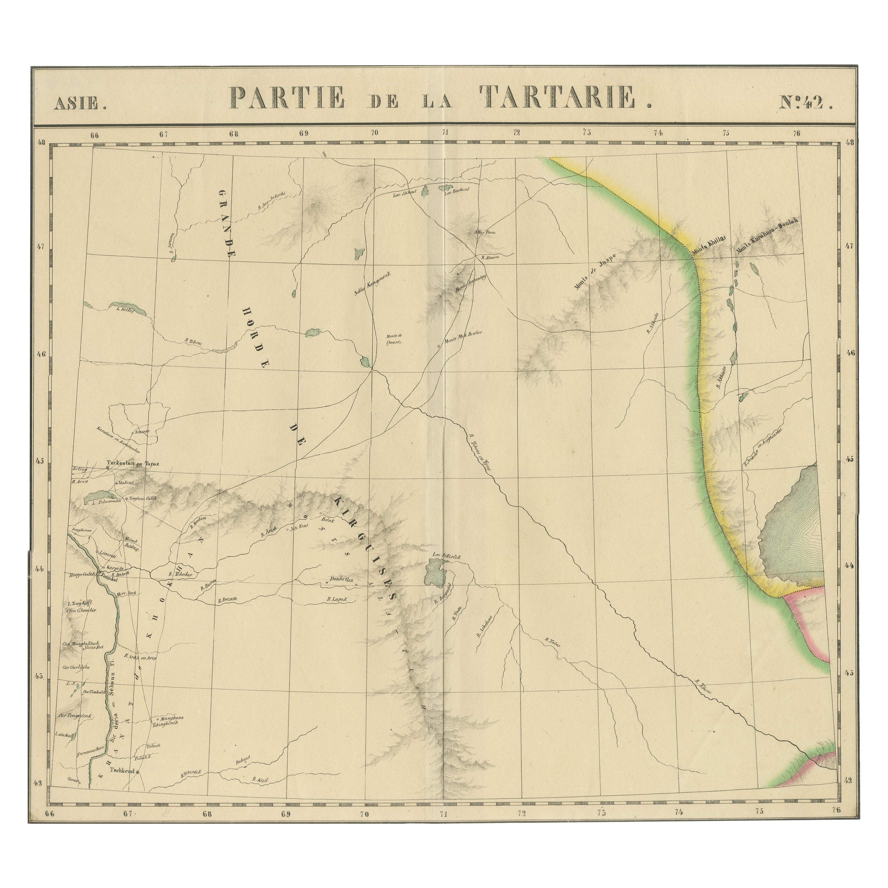
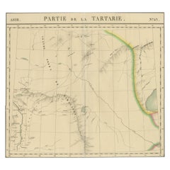
View AllAntique Map of Tartary – Hand-Colored Lithograph of Central Asia, 1827
Located in Langweer, NL
Antique Map of Tartary – Hand-Colored Lithograph of Central Asia, 1827
This original antique map, titled "Partie de la Tartarie" (No. 42), is an exceptional example of early 19th-ce...
Category
Antique Early 19th Century Belgian Maps
Materials
Paper
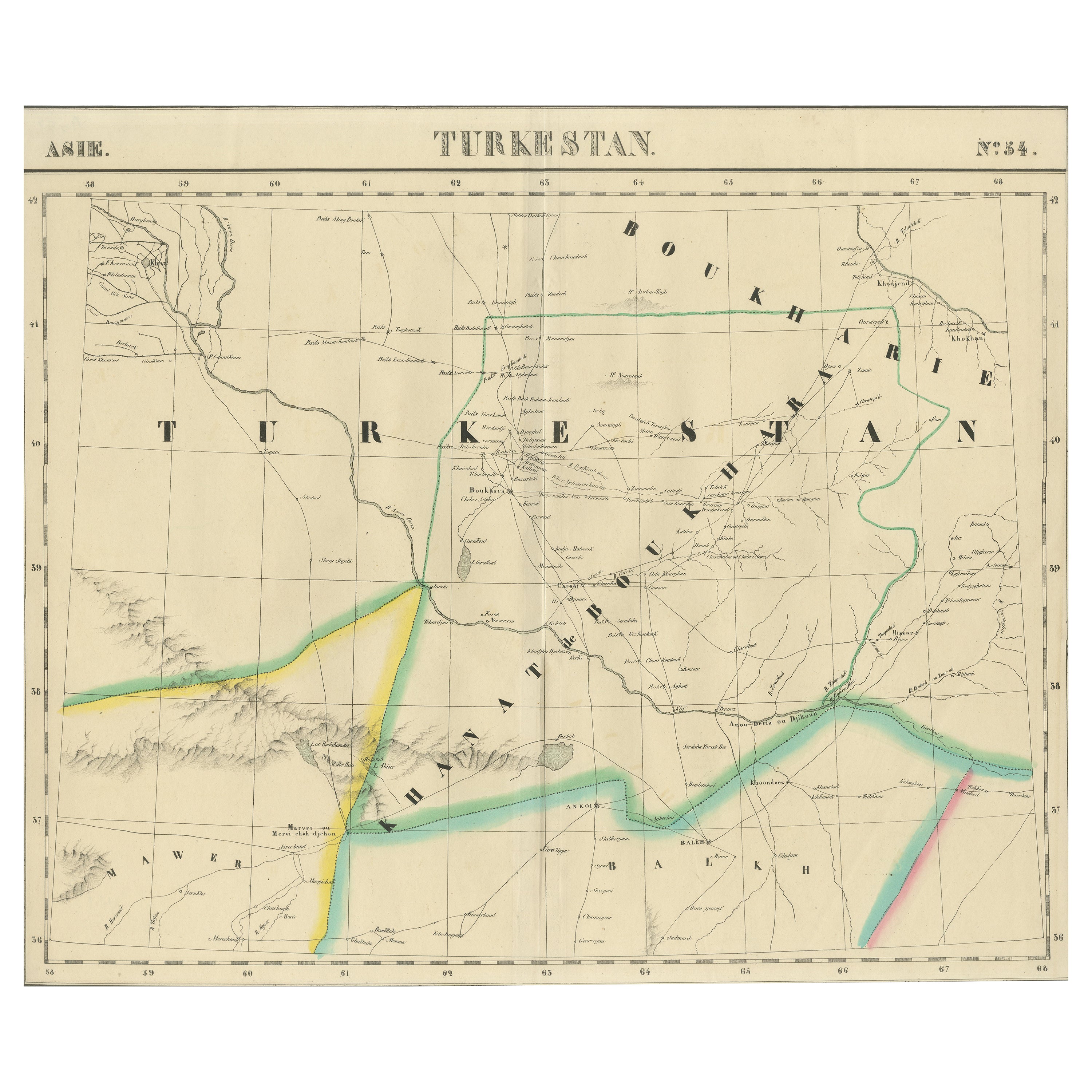
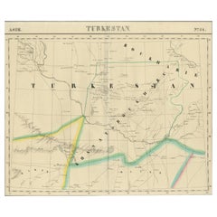
Antique Map of Turkestan – Vandermaelen Lithograph of Central Asia, 1827
Located in Langweer, NL
Antique Map of Turkestan – Vandermaelen Lithograph of Central Asia, 1827
This finely detailed antique map titled “Turkestan” (No. 34) is an original lithograph from the groundbreaki...
Category
Antique Early 19th Century Belgian Maps
Materials
Paper
Antique Map of Tartary and Northeast Asia by Bellin, circa 1750
By Jacques-Nicolas Bellin
Located in Langweer, NL
Antique map titled 'Carte de la Tartarie Occidentale'. Map of Tartary and northeast Asia, from Lake Baykal, Partie du Siberia in the north, Pays des Kalkas at the center, as well as ...
Category
Antique Mid-18th Century European Maps
Materials
Paper

$133 Sale Price
20% Off
Antique Map of Tartary and Northeast Asia, c.1750
Located in Langweer, NL
Antique map titled 'Carte de la tartarie occidentale'. An interesting map of Tartary and northeast Asia, from Lake Baykal, Partie du Siberia in the north, Pays des Kalkas at the cent...
Category
Antique 18th Century Maps
Materials
Paper

$123 Sale Price
20% Off
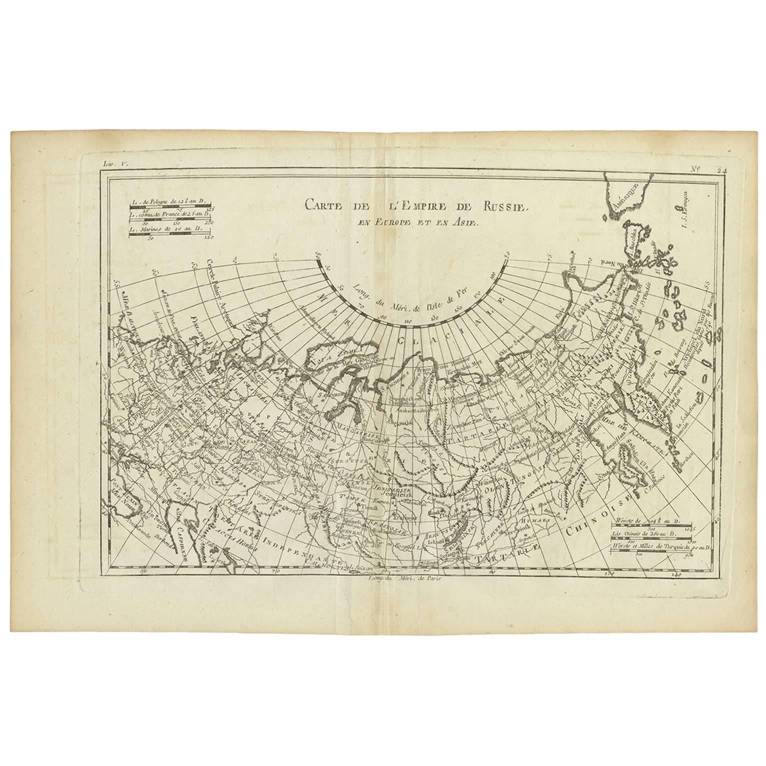
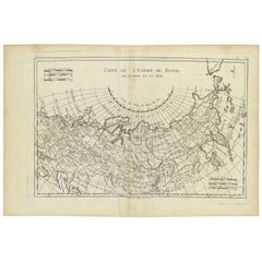
Antique Map of the Russian Empire by R. Bonne, 1780
Located in Langweer, NL
Antique map titled 'Carte de l'Empire de Russie.' Drawn by R. Bonne for G. Raynal’s Atlas de Toutes les Parties Connues du Globe Terrestre, Dressé pour l'Histoire Philosophique et Po...
Category
Antique Late 18th Century French Maps
Materials
Paper
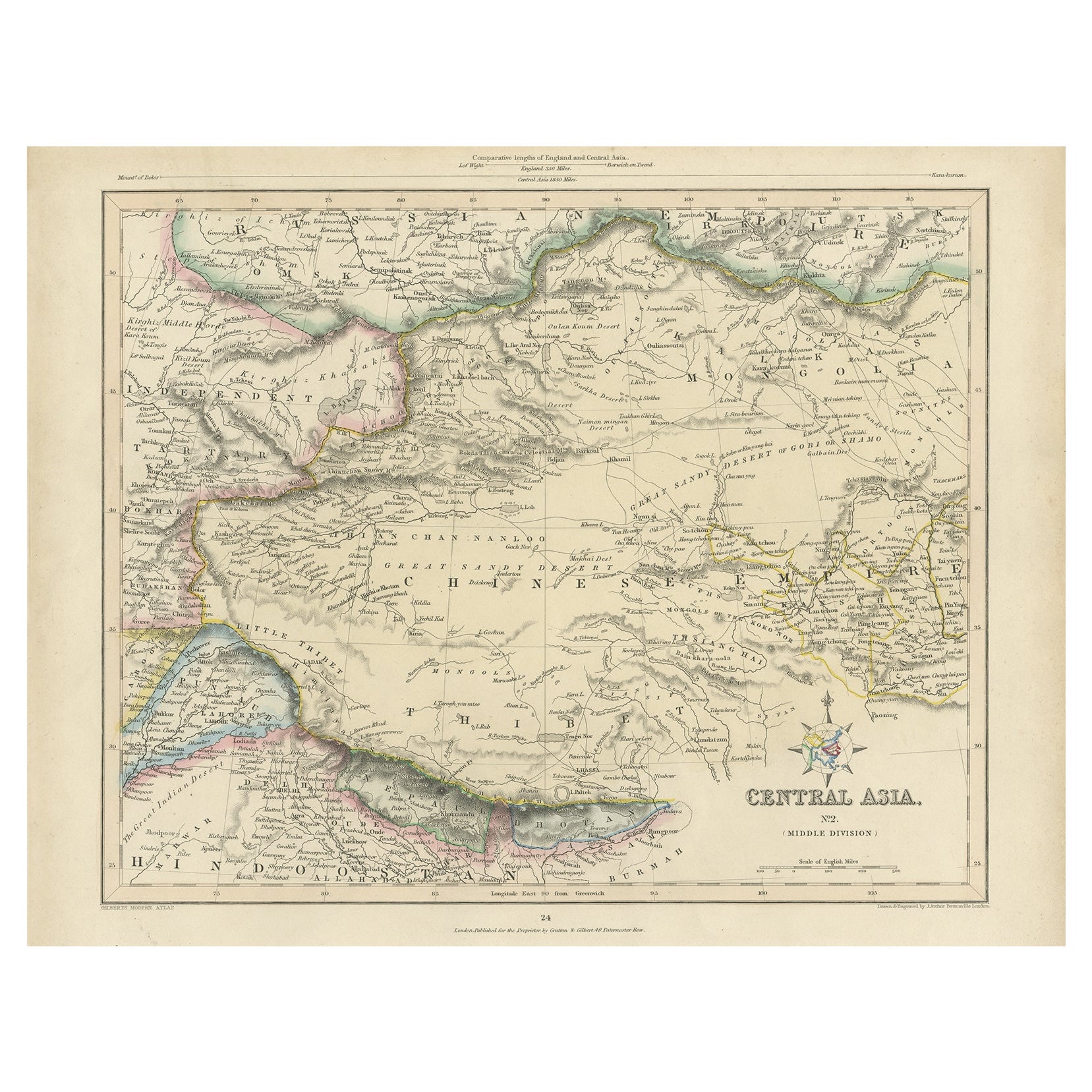
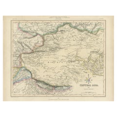
Antique Map of Central Asia, Finely Engraved, 1841
Located in Langweer, NL
Antique map titled 'Central Asia, Middle Division'. A finely engraved and attractive mid 19th Century map of Central Asia which was drawn and engraved by Joshua Archer and published ...
Category
Antique 19th Century Maps
Materials
Paper
$228 Sale Price
20% Off
You May Also Like
Original Antique Map of China, Arrowsmith, 1820
Located in St Annes, Lancashire
Great map of China
Drawn under the direction of Arrowsmith
Copper-plate engraving
Published by Longman, Hurst, Rees, Orme and Brown, 1820
Unfr...
Category
Antique 1820s English Maps
Materials
Paper

1860 Large Map "Carte De La Siberie Russie D'asie, " Ric.R0001
Located in Norton, MA
Large 1860 map "Carte De La Siberie Russie D'Asie," R-0001
" Authentic" - 1860 map "Carte De La Siberie Russie D'Asie,"
Dimension: Paper: 68 cm W x 51 cm H ; Sight: 51cm W x 4...
Category
Antique 19th Century Unknown Maps
Materials
Paper

Large Original Antique Map of Afghanistan. Edward Weller, 1861
Located in St Annes, Lancashire
Great map of Afghanistan
Lithograph engraving by Edward Weller
Original colour
Published, 1861
Unframed
Good condition
Category
Antique 1860s English Victorian Maps
Materials
Paper

Large Original Antique Map of Morocco. Edward Weller, 1861
Located in St Annes, Lancashire
Great map of Morocco
Lithograph engraving by Edward Weller
Original colour
Published, 1861
Unframed
Good condition.
Category
Antique 1860s English Victorian Maps
Materials
Paper

Map of Russia - Original Etching - Late 19th Century
Located in Roma, IT
This Map of Russia is an etching realized by an anonymous artist.
The state of preservation of the artwork is good with some small diffused stains.
Sheet dimension:27.5 x 44
At t...
Category
Late 19th Century Modern Figurative Prints
Materials
Etching
Map of Campaign of 1814 - Etching by Pierre François Tardieu - 1837
Located in Roma, IT
Map of Campaign of 1814 is an Etching realized by Pierre François Tardieu in 1837.
Good conditions.
The artwork is realized in a well-balanced composition. the artwork and belongs ...
Category
1830s Modern Figurative Prints
Materials
Lithograph
