Items Similar to Antique Map of Menaldumadeel, Township in Friesland, The Netherlands, 1868

Want more images or videos?
Request additional images or videos from the seller
1 of 5
Antique Map of Menaldumadeel, Township in Friesland, The Netherlands, 1868
$117.86
$147.3220% Off
£87.34
£109.1720% Off
€98.40
€12320% Off
CA$160.90
CA$201.1220% Off
A$178.99
A$223.7420% Off
CHF 93.83
CHF 117.2920% Off
MX$2,187.24
MX$2,734.0620% Off
NOK 1,194.81
NOK 1,493.5120% Off
SEK 1,124.75
SEK 1,405.9320% Off
DKK 749.21
DKK 936.5120% Off
Shipping
Retrieving quote...The 1stDibs Promise:
Authenticity Guarantee,
Money-Back Guarantee,
24-Hour Cancellation
About the Item
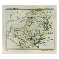
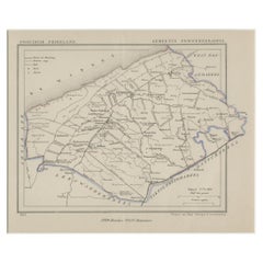
Antique map titled 'Provincie Friesland - Gemeente Menaldumadeel'.
Map of the township of Menaldumadeel including Menaldum, Deinum, Boxum and many other villages. This map originates from 'Gemeente-Atlas van Nederland' by J. Kuyper. Published by H. Suringar.
Condition: Fine; occasional foxing as visible on the scans; sheet irregularly cut, not affecting image. Please study image carefully.
Date: 1868
Overall size: 24 x 19 cm.
Image size: 19.5 x 16.5 cm.
- Dimensions:Height: 9.45 in (24 cm)Width: 7.49 in (19 cm)Depth: 0 in (0.01 mm)
- Materials and Techniques:
- Period:
- Date of Manufacture:1868
- Condition:Condition: Fine; occasional foxing as visible on the scans; sheet irregularly cut, not affecting image. Please study image carefully.
- Seller Location:Langweer, NL
- Reference Number:Seller: PCT-158921stDibs: LU3054326360872
About the Seller
5.0
Recognized Seller
These prestigious sellers are industry leaders and represent the highest echelon for item quality and design.
Platinum Seller
Premium sellers with a 4.7+ rating and 24-hour response times
Established in 2009
1stDibs seller since 2017
2,494 sales on 1stDibs
Typical response time: 1 hour
- ShippingRetrieving quote...Shipping from: Langweer, Netherlands
- Return Policy
Authenticity Guarantee
In the unlikely event there’s an issue with an item’s authenticity, contact us within 1 year for a full refund. DetailsMoney-Back Guarantee
If your item is not as described, is damaged in transit, or does not arrive, contact us within 7 days for a full refund. Details24-Hour Cancellation
You have a 24-hour grace period in which to reconsider your purchase, with no questions asked.Vetted Professional Sellers
Our world-class sellers must adhere to strict standards for service and quality, maintaining the integrity of our listings.Price-Match Guarantee
If you find that a seller listed the same item for a lower price elsewhere, we’ll match it.Trusted Global Delivery
Our best-in-class carrier network provides specialized shipping options worldwide, including custom delivery.More From This Seller
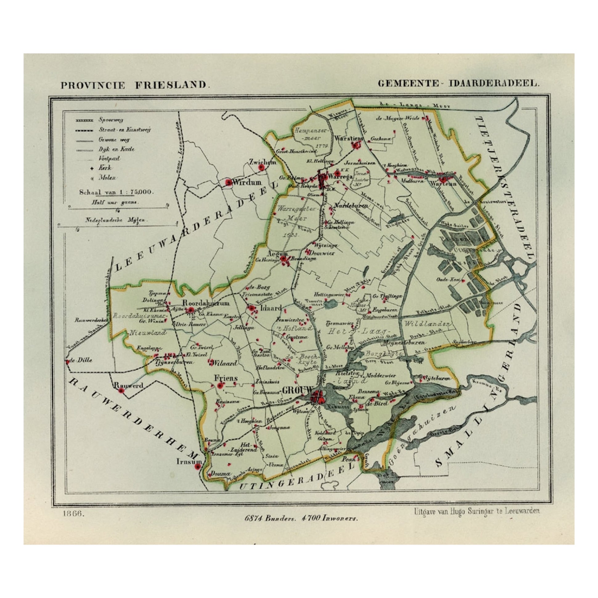
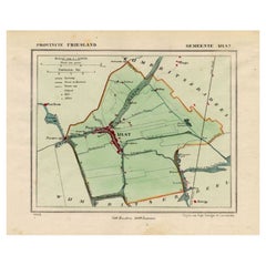
View AllAntique Map of Idaarderadeel, Township In Frieslands, The Netherlands, 1868
Located in Langweer, NL
Antique map titled 'Provincie Friesland - Gemeente Idaarderadeel'.
Map of the township of Idaarderadeel including Grou, Idaard, Warrega and many other villages. This map originat...
Category
Antique 19th Century Maps
Materials
Paper
$134 Sale Price
20% Off
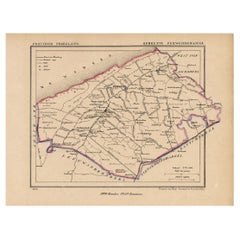
Antique Map of Kollumerland, a Township in Friesland, The Netherlands, 1868
Located in Langweer, NL
Antique map titled 'Provincie Friesland - Gemeente Kollumerland en Nieuw-Kruisland'.
Map of the township of Kollumerland including Kollum, Westergeest, Burum and many other villa...
Category
Antique 19th Century Maps
Materials
Paper
$124 Sale Price
20% Off
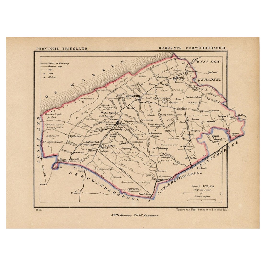
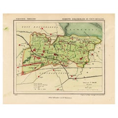
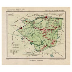
Antique Map of the County Ferwerderadeel, Friesland, The Netherlands, 1868
Located in Langweer, NL
Antique map titled 'Provincie Friesland - Gemeente Ferwerderadeel'. Map of the township of Ferwerderadeel including Ferwerd, Blija and many other villages. This map originates from '...
Category
Antique 19th Century Maps
Materials
Paper
$153 Sale Price
20% Off
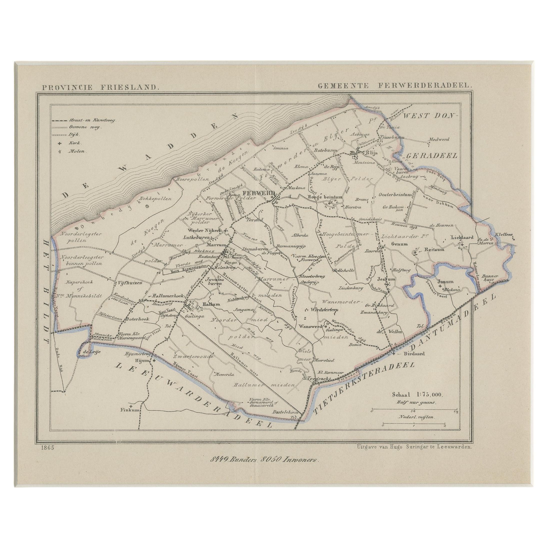
Antique Map of Ferwerderadeel, a County in Friesland, The Netherlands, 1868
Located in Langweer, NL
Antique map titled 'Provincie Friesland - Gemeente Ferwerderadeel'. Map of the township of Ferwerderadeel including Ferwerd, Blija and many other villages. This map originates from '...
Category
Antique 19th Century Maps
Materials
Paper
$172 Sale Price
20% Off
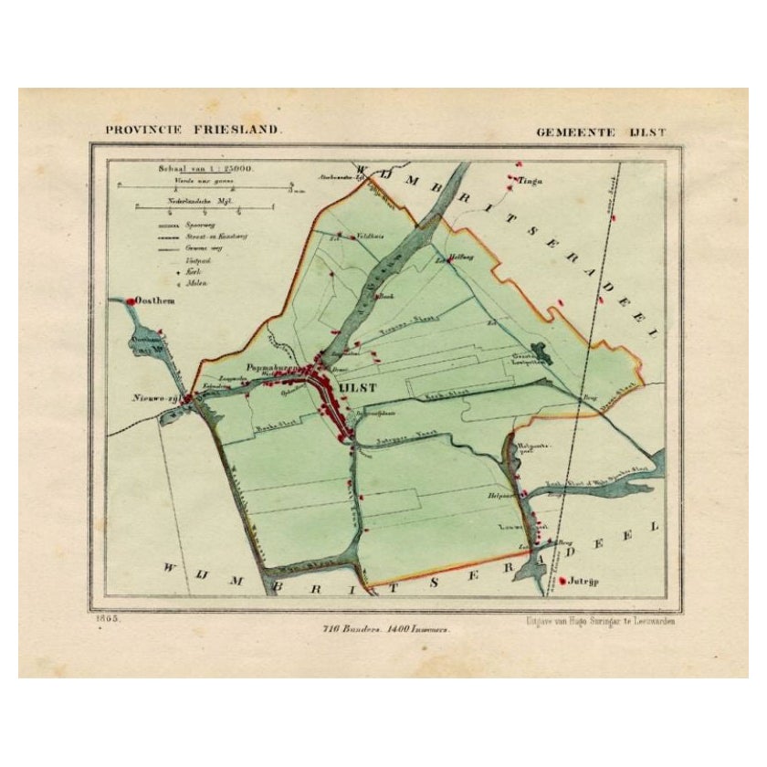
Antique Map of Ijlst , Friesland in the Netherlands, 1865
Located in Langweer, NL
Friesland: Gemeente IjJlst. These scarse detailed maps of Dutch Towns originate from the 'Gemeente-atlas' of Jacob Kuyper. This atlas of all towns in the Netherlands was published fr...
Category
Antique 19th Century Maps
Materials
Paper
$182 Sale Price
20% Off
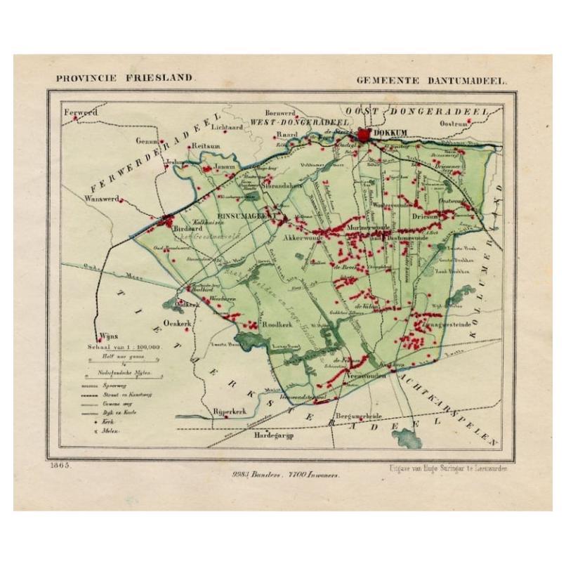
Antique Map of Dantumadeel, Friesland, The Netherlands, 1868
Located in Langweer, NL
Antique map titled 'Provincie Friesland - Gemeente Dantumadeel'. Map of the township of Dantumadeel including Birdaard, Rinsumageest, Veenwouden and many other villages. This map ori...
Category
Antique 19th Century Maps
Materials
Paper
$103 Sale Price
20% Off
You May Also Like
Original Antique English County Map, Huntingdonshire, J & C Walker, 1851
Located in St Annes, Lancashire
Great map of Huntingdonshire
Original colour
By J & C Walker
Published by Longman, Rees, Orme, Brown & Co. 1851
Unframed.
Category
Antique 1850s English Other Maps
Materials
Paper

Original Antique English County Map, Cambridgeshire, J & C Walker, 1851
Located in St Annes, Lancashire
Great map of Cambridgeshire
Original colour
By J & C Walker
Published by Longman, Rees, Orme, Brown & Co. 1851
Unframed.
Category
Antique 1850s English Other Maps
Materials
Paper

Original Antique English County Map, Nottinghamshire, J & C Walker, 1851
Located in St Annes, Lancashire
Great map of Nottinghamshire
Original colour
By J & C Walker
Published by Longman, Rees, Orme, Brown & Co. 1851
Unframed.
Category
Antique 1850s English Other Maps
Materials
Paper

Original Antique English County Map, Buckinghamshire, J & C Walker, 1851
Located in St Annes, Lancashire
Great map of Buckinghamshire
Original colour
By J & C Walker
Published by Longman, Rees, Orme, Brown & Co. 1851
Unframed.
Category
Antique 1850s English Other Maps
Materials
Paper

Original Antique English County Map, Warwickshire, J & C Walker, 1851
Located in St Annes, Lancashire
Great map of Warwickshire
Original colour
By J & C Walker
Published by Longman, Rees, Orme, Brown & Co. 1851
Unframed.
Category
Antique 1850s English Other Maps
Materials
Paper

Original Antique English County Map, Leicestershire, J & C Walker, 1851
Located in St Annes, Lancashire
Great map of Leicestershire
Original colour
By J & C Walker
Published by Longman, Rees, Orme, Brown & Co. 1851
Unframed.
Category
Antique 1850s English Other Maps
Materials
Paper

More Ways To Browse
1868 Furniture
Caribbean Colonial Furniture
Antique Maps West Indies
California Island Map
Pirate Antique
Map Of Holy Land
Antique Blackwood Furniture
Antique Macedonia
Antique Maps Of New York City
Victorian Compass
Antique Maps Caribbean Islands
Hungary Map
Cartographer Tool
Goa Furniture
George Fleet
Sri Lanka Map
Philippines Map
Antique Map Ceylon